Take a Walk
A Quest into the Wild
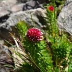
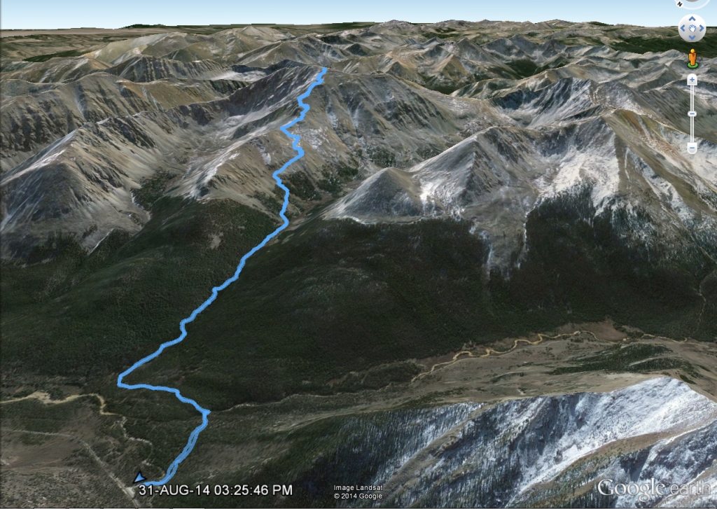
McCullough Gulch Trail: Breckenridge CO
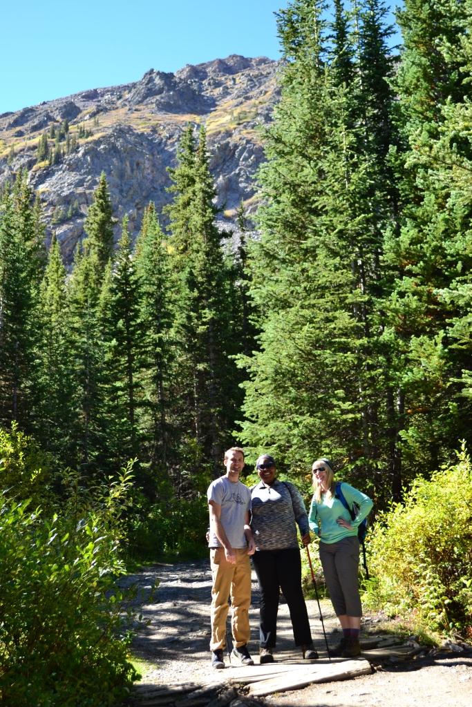
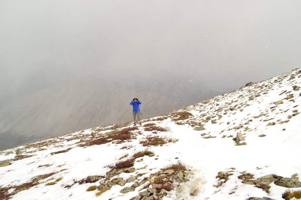
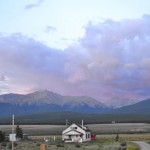
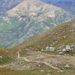
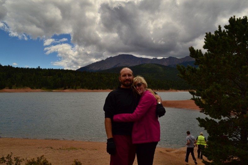
A few weeks ago (Sept. 12) with New Jersey and Texas friends alongside our usual gear in the truck, we made our way back to Breckenridge, a quaint but beloved town nestled in the Tenmile Range. Breckenridge is home to worldclass skiing, amazing hikes, and of course the famed 14er Quandary Peak of which we tackled earlier this summer. In addition to getting some fun mountain biking in, we opted to take a hike and enjoy the bluebird day and perfect temperatures which are common for September in the mountains. Instead of joining the crowds of people heading up to tag the summit of Quandary, we kept driving on McCullough Gulch Rd past the Quandary Trailhead for another 3 miles until we reached the entry point for McCullough Gulch.
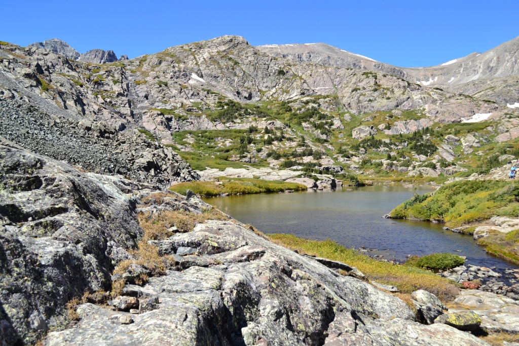
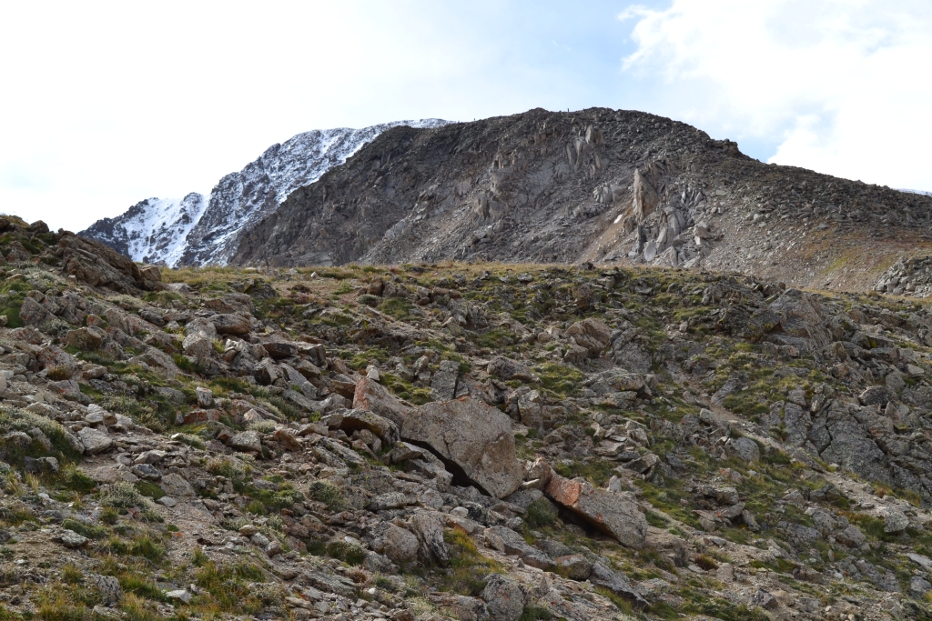
McCullough Gulch is located on the northern side of Quandary Peak. The McCullough drainage system offers access to several glacial lakes and spectacular waterfalls. The standard route which leads to the White Falls and the first lake, Upper Blue Reservoir is approximately 2.8 miles RT. While the trail boasts amazing sites in such a short distance, it should be noted that the trail gains over 800 feet in elevation to reach the lake and begins at an elevation of about 11,100 ft. This can result in a moderately tough climb if not properly acclimated.
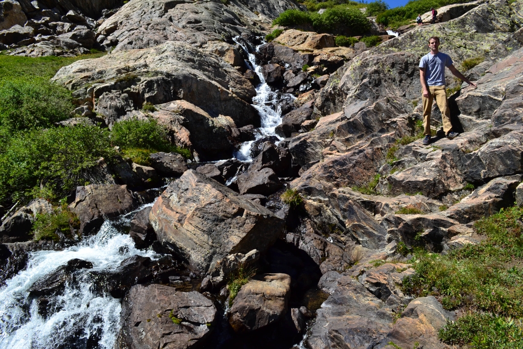
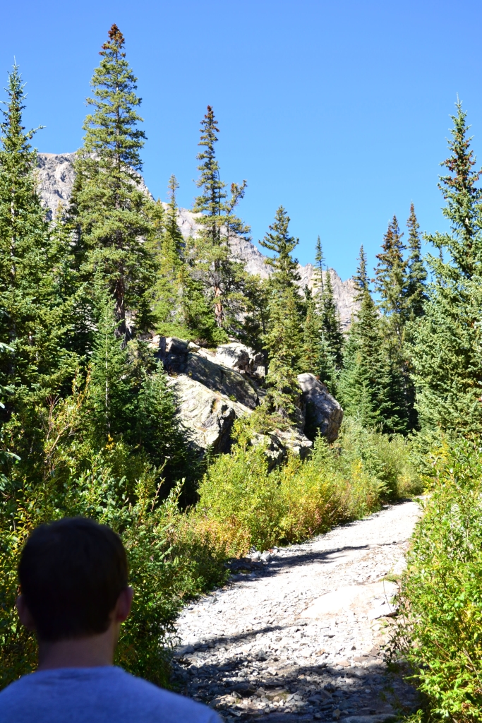
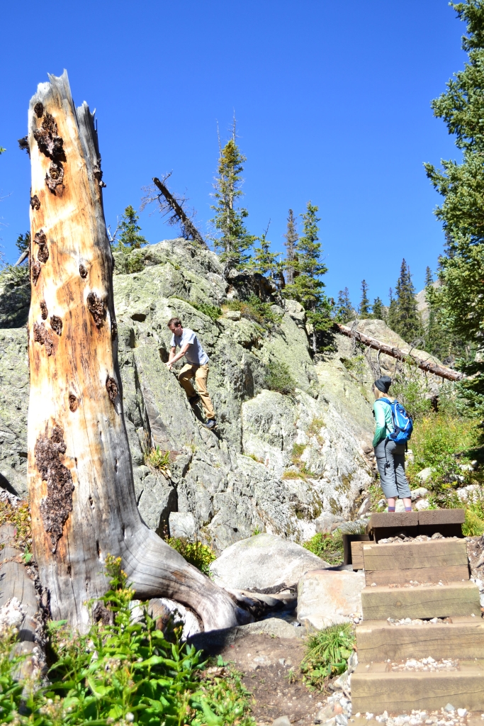
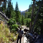
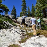
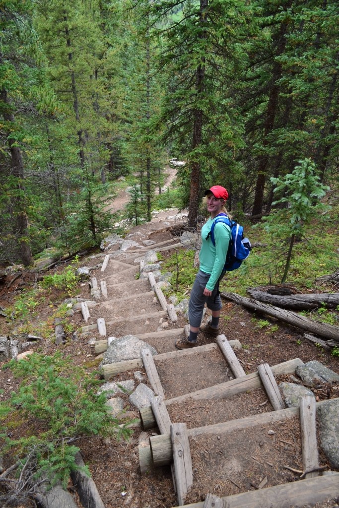
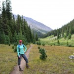
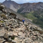
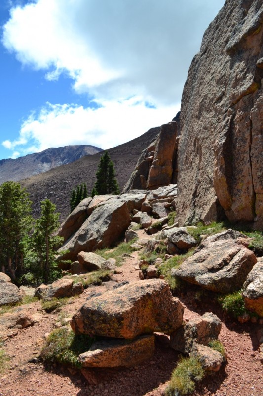
The road leading up to the TH was quite rough. While it is possible for a 2WD car to get up there, it may not be a pleasant experience. There was at least one spot where we were very thankful to have high clearance. The road dead ends at a locked gate. Parking is available alongside the dirt road leading up to this gate. The first 0.5 mile of the trail follows an old mining road and immediately begins to gain elevation. Seen below are photos of the crew getting started and our first waterfall crossing.
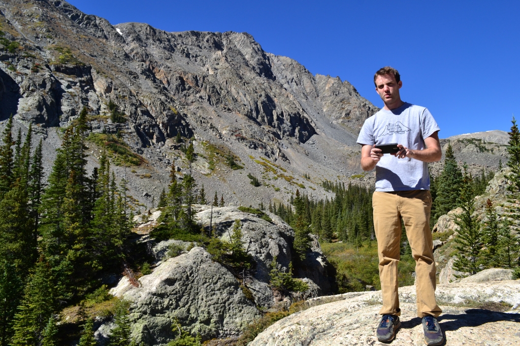
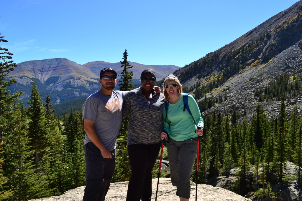
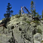
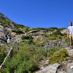
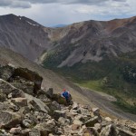
We passed an old mining/construction site and building before reaching a rocky outcrop that provided us with the first views of the beautiful Gulch and surrounding mountains. After this point, the trail splits off to a rugged path that quickly gains elevation. Seen below are photos of us braving the edge of a drop off for some cool pictures.
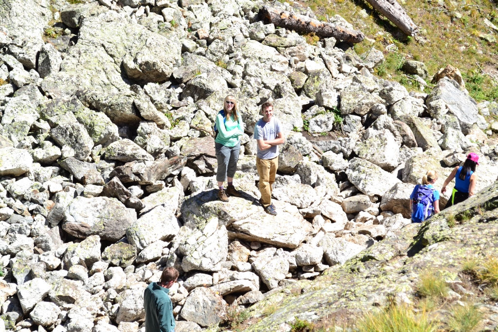
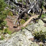
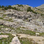
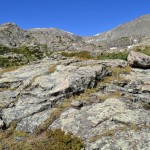
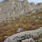
We continued up the rocky path weaving in and out of forests, dodging roots, and maneuvering around rocks until we reached a large talus field at about a mile into the hike. With careful footing, this portion was quite easy. A large stable slab of rock to the left of the trail provided a little light scramble for us along the way. Seen below are photos of the talus field and fun.
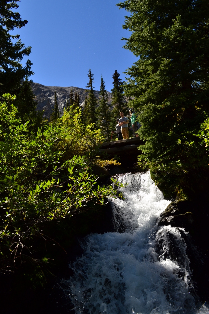
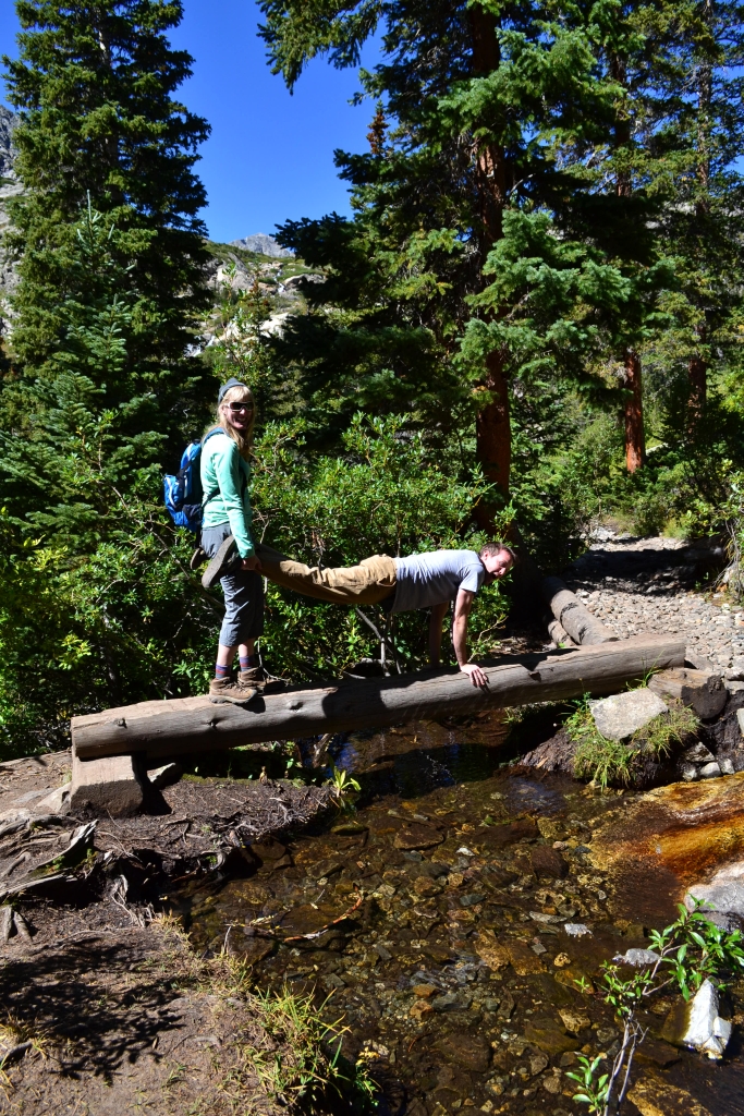
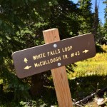
After just a few minutes of hiking past the talus field we reached a point in which the trail splits. A sign directs traffic one direction to the “White Falls Loop”. We weren’t sure what this meant at the time and opted to continue on the McCullough Gulch Trail. We later learned this was simply a social loop that leads to nice views of the falls and returns to the main trail after an additional mile. There is a short stream crossing around this area, but a nice wooden plank provides an easy crossing. Of course, in our book the easy way is the boring way…
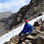
We then continued on the trail up a very steep section through dense forest before it finally opened up at the dramatic upper valley. A trail to the left leads directly to the waterfall. Staying straight on the original trail leads to the north shore of the first glacial lake. An additional bit of elevation gain is necessary to reach the lake, and it cannot be seen from the waterfall. There are additional access points to the lake in this area, and members of our group all chose to explore the area in his or her own unique way. Some of us hiked the normal route to the lake, others decided to climb up and over the waterfall.
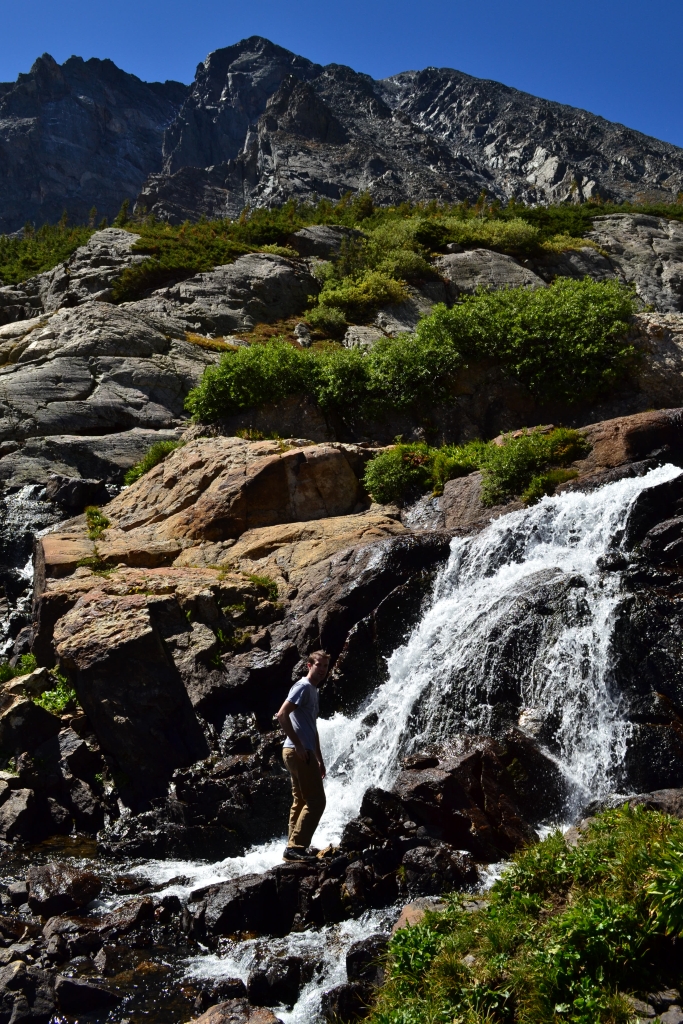
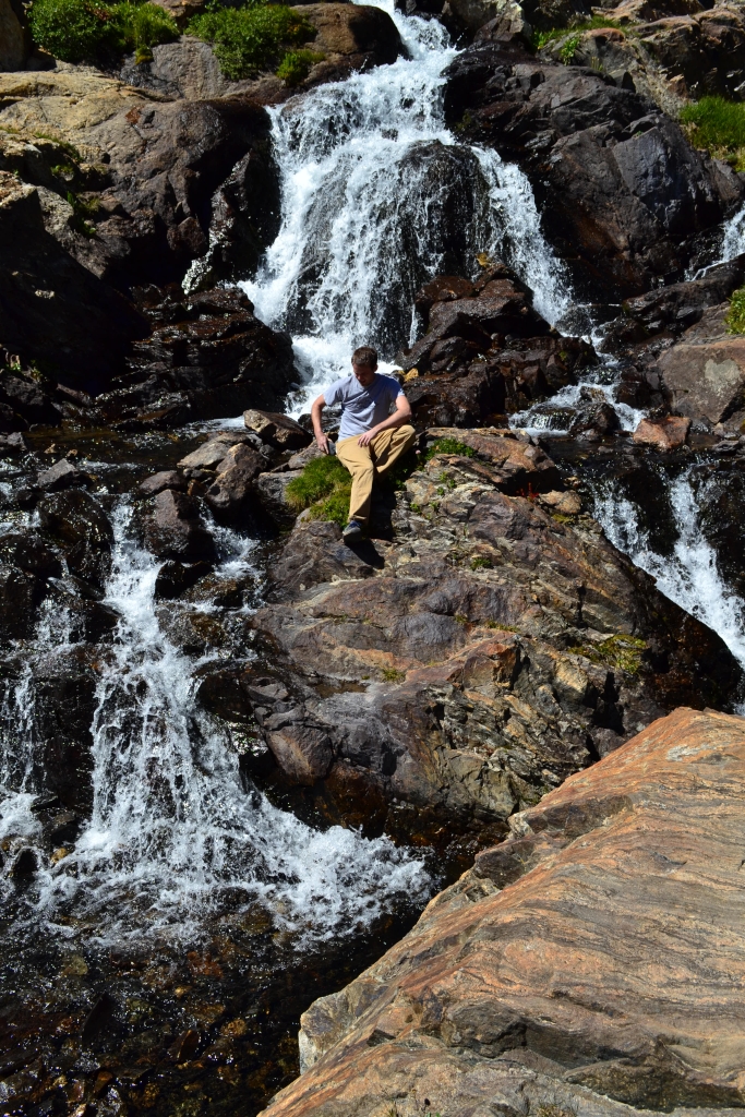
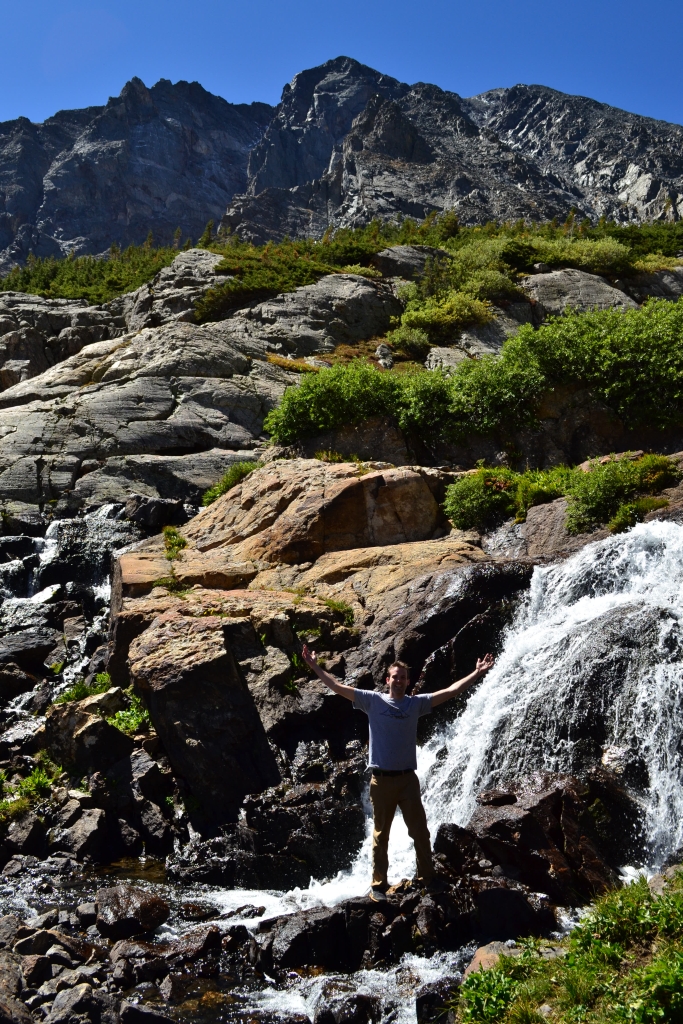
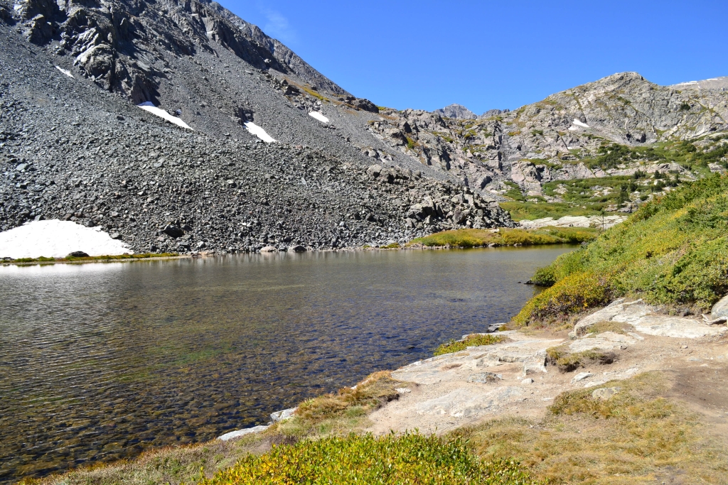
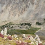
The glacial lake we were greeted with on the other side of the Falls was unique from most alpine lakes we have hiked to. It was extremely shallow, allowing for full views of its rocky bottom from several feet above the surface on the north shore. There were several hiking parties at the lake enjoying lunch. We paused for a few moments admiring the lake. Alas,Oktoberfest was calling our name, and we were ready to head back to town to partake. Seen below are photos of the lake and upper valley.

We returned the way we came, and the hike was almost uneventful. Unfortunately, Monique had a fight with the trail and the trail won leaving her with a cut and large swelled shin as a souvenir of her time in the Colorado backcountry. Thankfully, the pain wasn’t too intense, and we were all able to make it back to the car okay. Overall the hike was quite beautiful, displaying most of the natural landmarks Colorado has to offer within a 3 mile span. Plus, it’s only about 9 miles to the turn off for McCullough Gulch Rd from Main St. in Breckenridge making the TH fairly accessible if you have a decent vehicle. We’ll leave you with this photograph from the Upper Valley and a gallery of our hiking crew playing in the Valley.


La Plata Peak: Sawatch Range
Distance: 9.38 miles (out and back) Elevation Gain: 4,314 ft. (total) 4,114 ft (net)
Max Elevation: 14,209 ft. Min. Elevation: 10,095 ft.
Winter is coming.
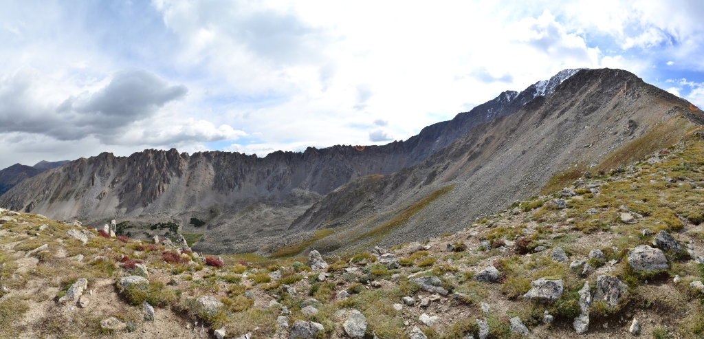
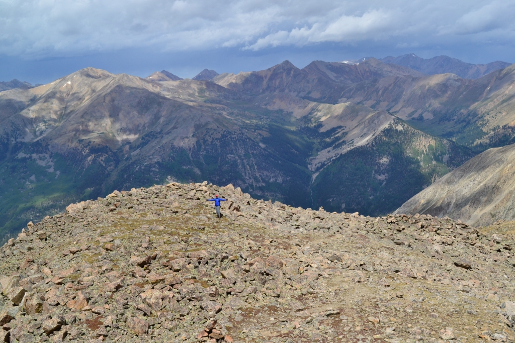
And unlike Game of Thrones, it is actually approaching rather quickly, more so, in fact, than we would like. Having an extra day off this past Labor Day weekend, we planned one of our final summer ascents of a 14er. We chose La Plata Peak located in the Sawatch Range about 20 miles southwest of Leadville, Colorado, as our 7th distinct peak this summer (not that we are peak bagging or anything…). We had the opportunity to explore some of the area earlier this summer when we summitted Mount Elbert. In stark contrast to the Front Range, the Sawatch offers a little more seclusion and a glimpse into a rugged side of the Colorado backcountry. La Plata Peak means “the silver” Peak in Spanish, called such due to the copious amounts of silver deposits strewn throughout the area. In fact, visible from the trail is a residual rust hue carved into the sections of mountain, evidence of plenty of mining activity in the area.
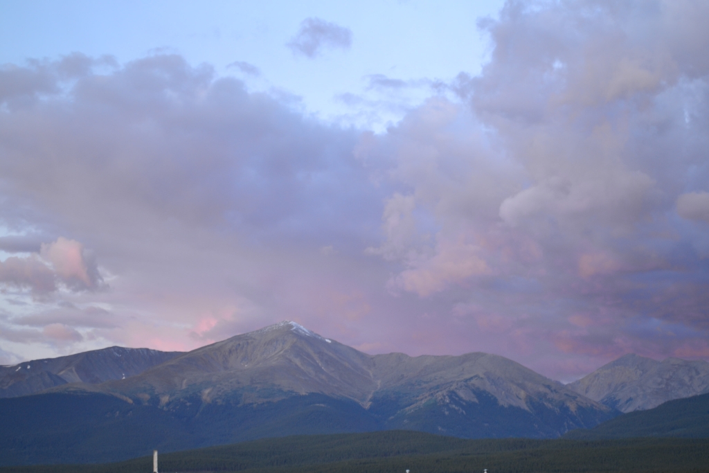
Once again, we set our alarms for 4:00 am on a weekend morning, and sleepily rolled out of a nice slumber to climb another mountain. La Plata Peak is 14,336 ft. tall and the 5th tallest peak in Colorado. There are three distinct routes used to obtain her summit: the southwest ridge which is shorter and starts a little higher in elevation, the northwest ridge of which the trailhead begins right off of Hwy 82, and the infamous Ellingwood Ridge which we will discuss in detail later. We chose the standard northwest ridge due to the length and elevation gain (about 9.5 miles and 4,400 ft.) and amazing views of Ellingwood Ridge. Below is the sunrise behind Mt. Elbert as we drove to the La Plata Trailhead.
We arrived at the TH at about 7:20 in the morning but made an error in locating the trailhead. We mistakenly kept driving on the 4WD road past the TH. The rough road wasted about 30 min of our time, and we didn’t get on the trail until about 7:50 in the morning which is a bit of a late start for us. For those of you who venture here, park at the small lot located just off of Hwy 82. Walk down the 4WD road (South Fork Lake Creek Rd.) and cross the bridge traveling for about 0.25 miles. As the road slowly gains elevation, look to the left and the La plata Peak TH can be found. Unlike many of the Front Range 14ers the sign is not clearly labeled. Follow it into the woods to begin your adventure.
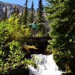
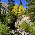
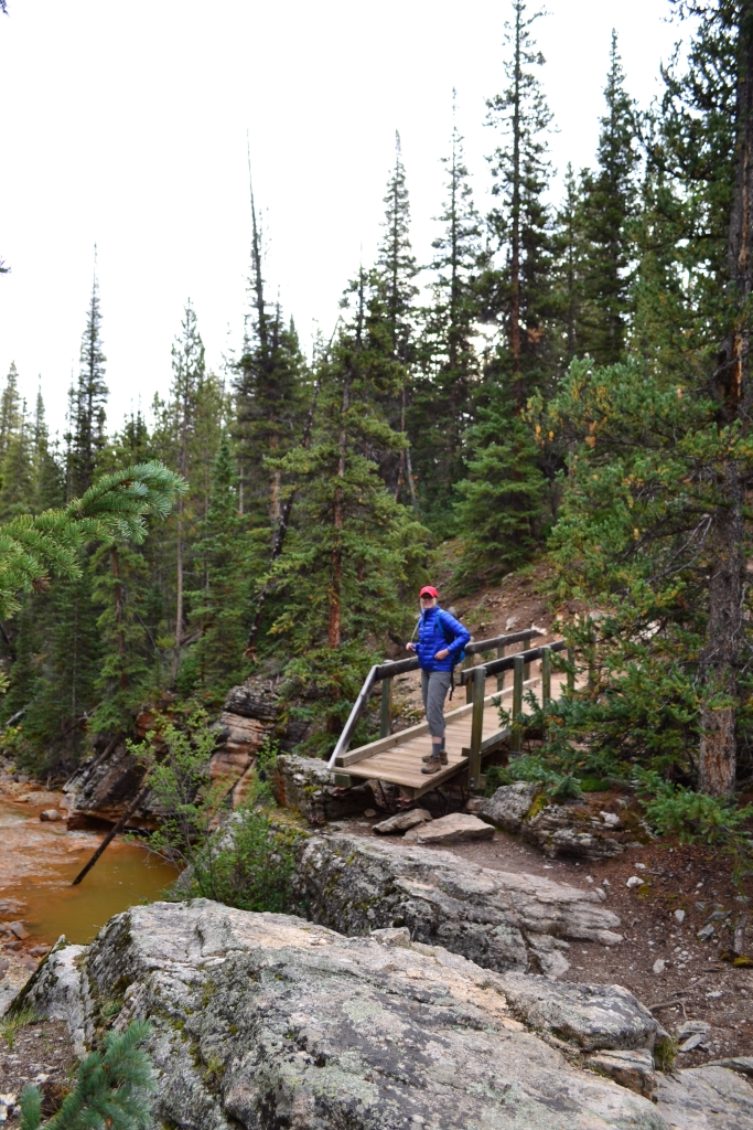
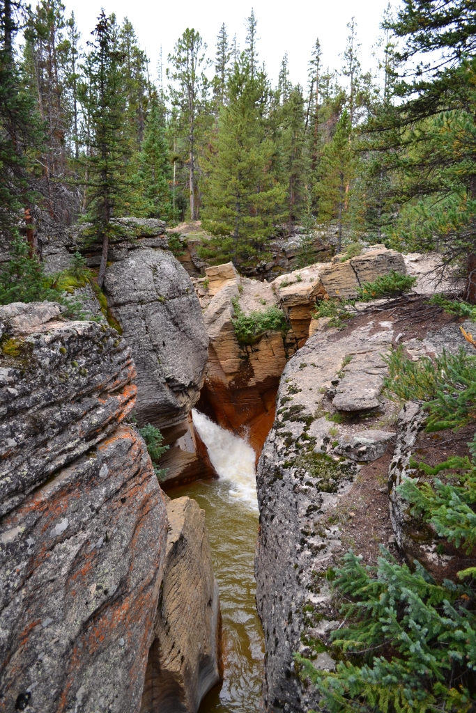
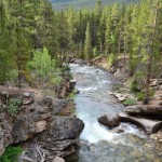
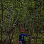
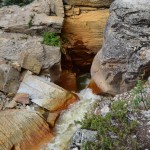
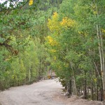
The trail pleasantly led us through a dense forest full of many aspen trees, some of which were already beginning to change colors. We lost a little elevation here. In fact, a pair of hikers that we ran into were concerned this was not the right trail because we were not yet gaining elevation. During this lovely hike through the woods, there were two river/stream crossings. The first had no bridge, and we had to carefully balance across a few tree logs thrown across it. The second was a metal/wood foot bridge that crossed the powerful South Fork Lake Creek. There was quite some distance between the bridge and the raging waters below us. To our right, we were greeted with a powerful waterfall and smooth canyon rock wall, carved out after many years by the water that rushed over it. Seen below are photos of the creek crossings and waterfall.

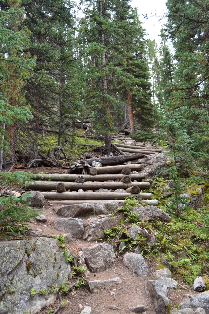
After the bridge crossing, the trail splits. Take the trail to the right. The left is incorrect and leads to an abandoned mine or so we read. After this point, the trail picks up elevation. We soon reached the “stairs”. To prevent erosion through these very steep sections, trail workers and volunteers have built stone and log steps. These steps really got our heart rates up and provided a great warm-up for the rest of the climb.
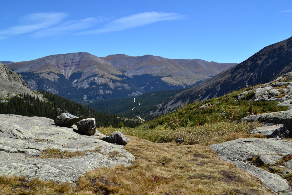
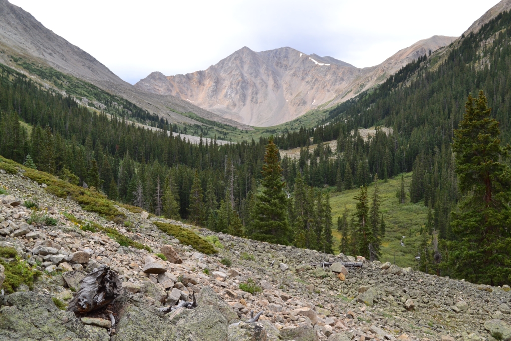
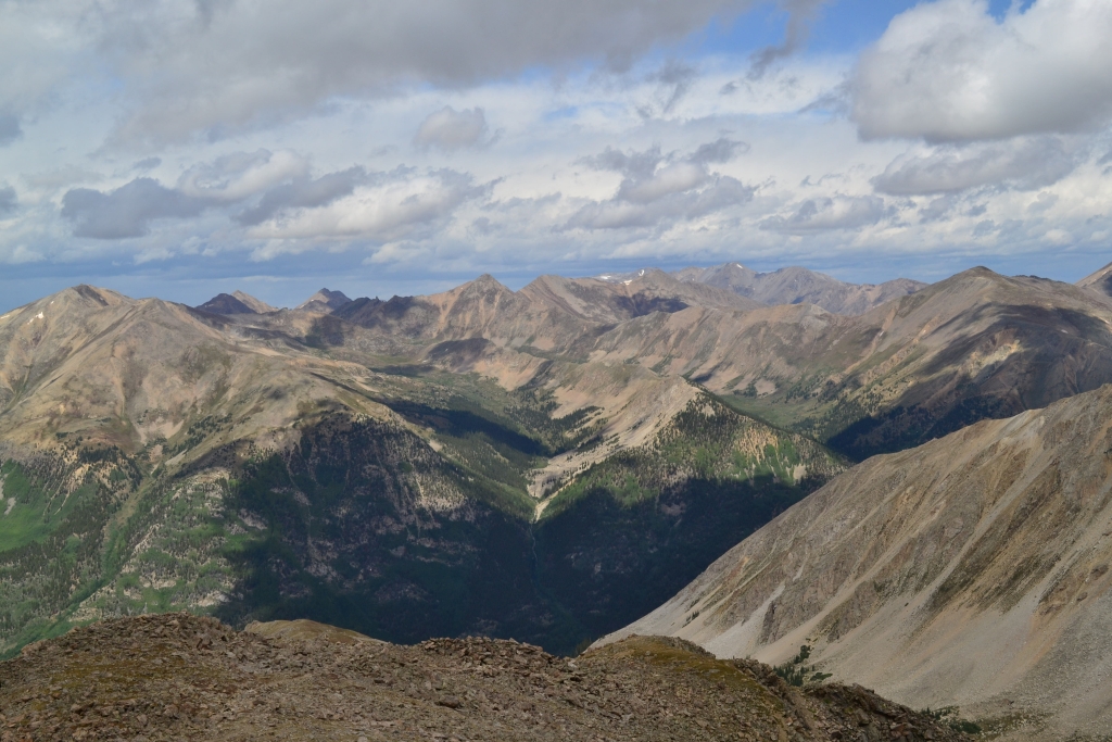
We continued to travel up La Plata Gulch for about a mile alternating between these steep steps and long steep switchbacks, enjoying the sounds of the rushing waterfall to our right. After one mile, we reached a clearing and flat trail. It was beautiful through the sections of the trail and a nice reprieve from the steps in the forests. However, we could now see our goal, and it seemed impossibly far away. Seen below is the beauty we encountered in the gulch.
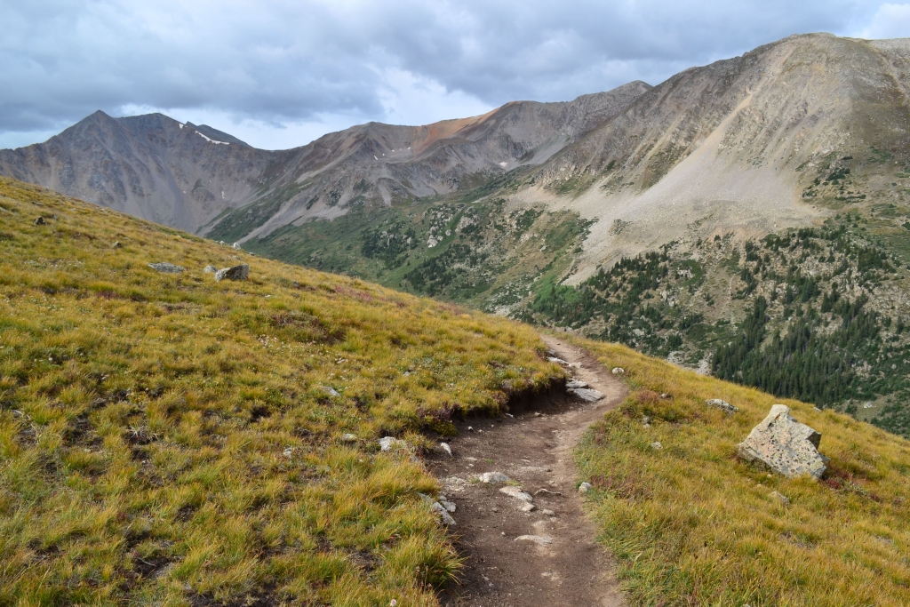
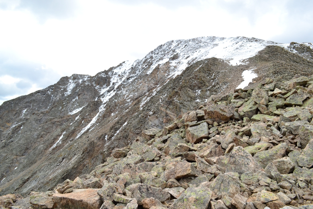
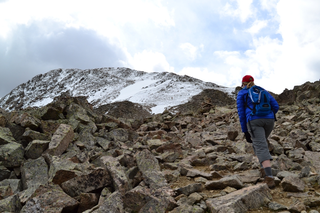
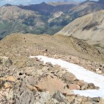
We continued through this brief section and then began to slowly gain elevation again. As we approached 11,100 feet, the trail led us away from the gulch and up 1000 feet on very short, steep switchbacks. This portion of the trail was long and not our favorite. The switchbacks were so short that our distance gained seemed minimal. Finally, the switchbacks eased up on steepness (at about 11,800 ft), and we began a long steady traverse on the hillside. Seen below are photos as we exit the gully and approach the ridgeline. Notice the first glimpse of snow-covered La Plata can now be seen in the bottom left picture.

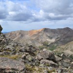
Eventually, we were at the start of the Northwest Ridge (about 12,800 feet). It was here that we were greeted with our first views of Ellingwood Ridge. This amazing ridge is another third way up to the summit of La Plata. It is a long class 3/4 ridgeline climb that gains just under 6,000 feet in elevation. Route finding, good fitness, and some comfort with moderate climbing and exposure are all a must if you want to tackle the ridge. We hope to try this next summer season. We have heard a perfect bluebird day is what is necessary to make an enjoyable trip across Ellingwood Ridge. On this hike, we were content to admire her majesty from the relative safety and comfort of the northridge. Seen below are photos of Ellingwood ridge and our ridge traverse.
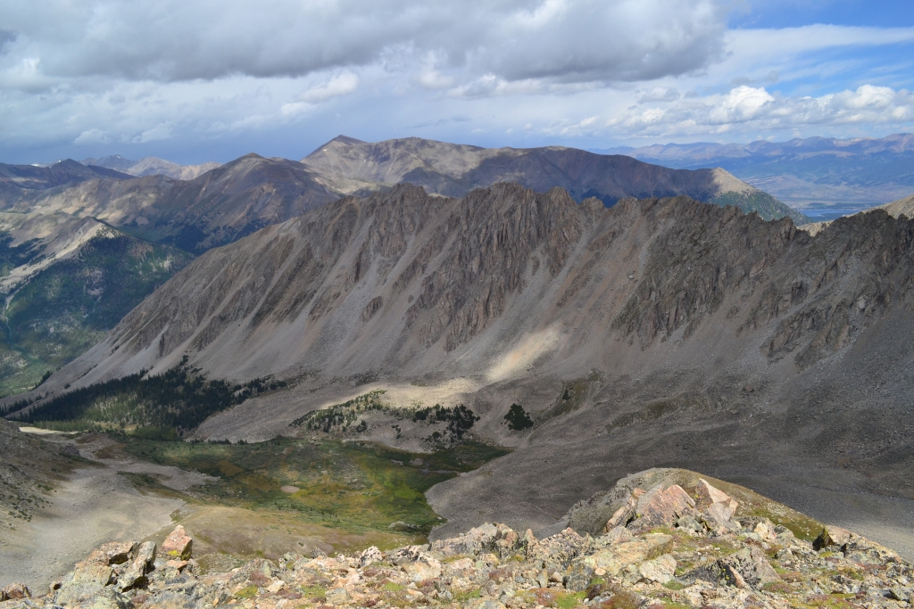
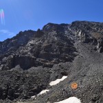
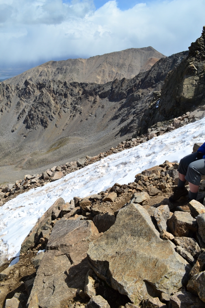
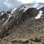
As we began the traverse across the ridgeline, we were greeted with tremendous wind. It must have been gusting close to 50-55 mph (the wind certainly impeded walking and almost knocked us over a few times), though we had no way to get an accurate reading other than estimating based on how much our bodies were being pushing around. We continued to trudge across the ridge, and began some class 2 work in spots to avoid wind exposure on the main trail. Large talus litter the last 1.25 miles of the trail and make route finding somewhat interesting. We circumvented the large buttress in front of us and continued up. Finally, we reached a moderately flat section at roughly 13,600 feet. We could now see the summits of La Plata and East La Plata Peaks. At this point, there was snow on the trail. We were a little surprised to encounter this much snow at the end of August. Once again, we skirted the true trail to avoid some of the slippery snow. We favored the rock hopping over punching in the icy snow.
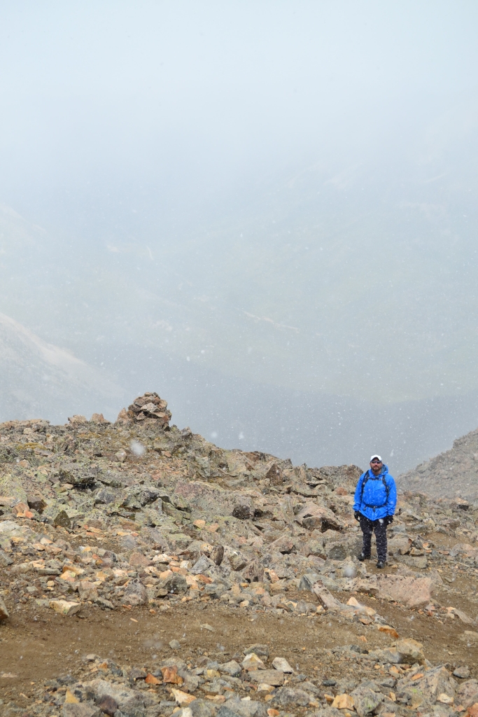
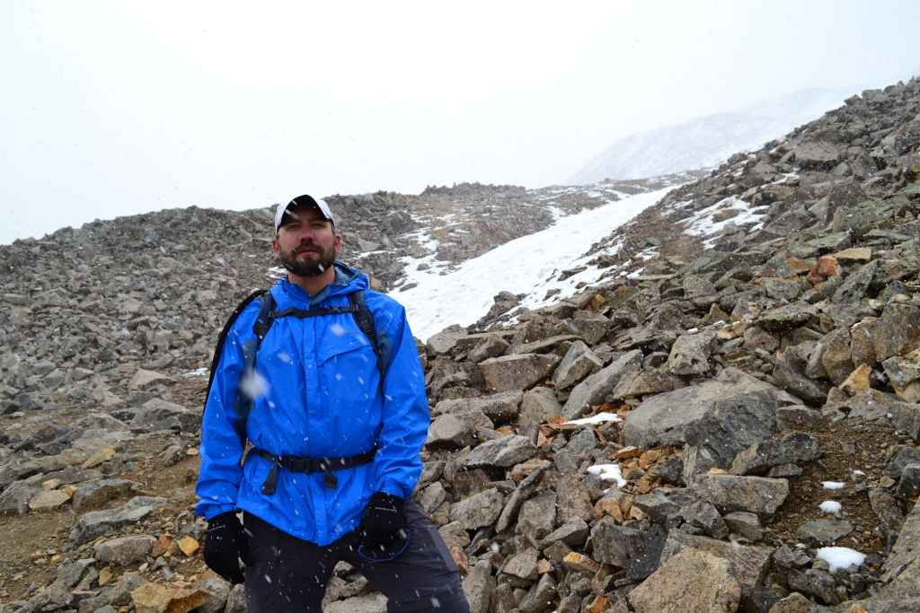
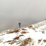
From here on up, the wind got worse and a thick cloud came over the mountain. It thankfully didn’t look like a thunderstorm cloud, but it turned out to be a snow/sleet cloud. Conditions rapidly began to deteriorate. We pressed on for a while until 14,206 ft. We were just below the true summit, but visibility was fading and the wind, sleet, and snow were leading to what we thought would soon be a white out. Instead of fighting to tag the summit registry, we turned around and headed back down. The next 600 feet down were highly uncomfortable. We had cool weather clothes, but not winter weather clothes. This is another example of how unpredictable weather can be at 14,000 feet. The reports had called for no precipitation but here it was August, and we were in a snowstorm. At times, we had to huddle behind cairns to keep from blowing over. Below are some images and a video which includes some footage of the snowstorm.

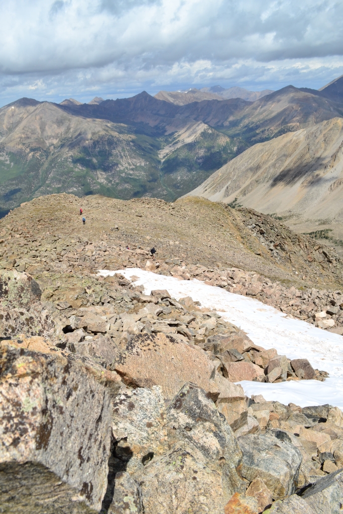
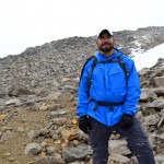
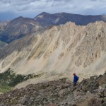
Interestingly, right at about 13,500 ft. the spot at which the first snowfield appeared everything cleared up. We could still see the storm a few hundred feet above us, but conditions were now nice enough that we could sit back and finally eat something and relax a minute. We chatted with another hiker coming down the mountain behind us, a cool guy from Seattle. He was prepping to climb Kilimanjaro next month. We are jealous. The storm above us seemed to be moving away, and for a few minutes we considered trudging back up to sign the summit registry. But another system appeared to be in the not so far distance, and we opted to continue down. Plus, the wind had still not relented. Seen below are photos and clear skies on our way down. There is no way to put into words the true bliss found in the photograph below.
The hike down was very beautiful, and we took time to take in the scenery and few remaining flowers. The stone and log steps were knee killers though. We took several breaks to get in some stretching to ease the discomfort. The hike back through the forest seemed much longer returning than it did on our ascent. We were a little upset that the weather interfered with our plans, but the mountain will always be there well, at least for the next few million years. This 14er was not crowded at all, and it was a holiday weekend. We highly recommend climbling La Plata Peak. Just be ready for some quad burning fun.


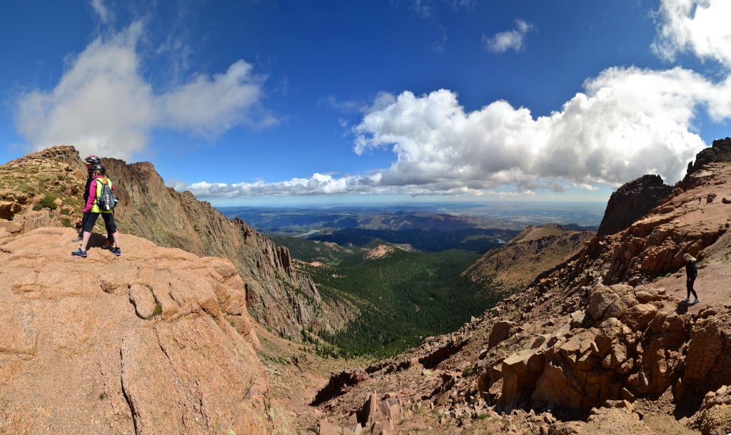
Bike Down Pikes Peak: A Photo Essay

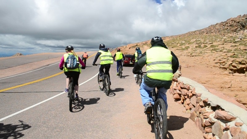
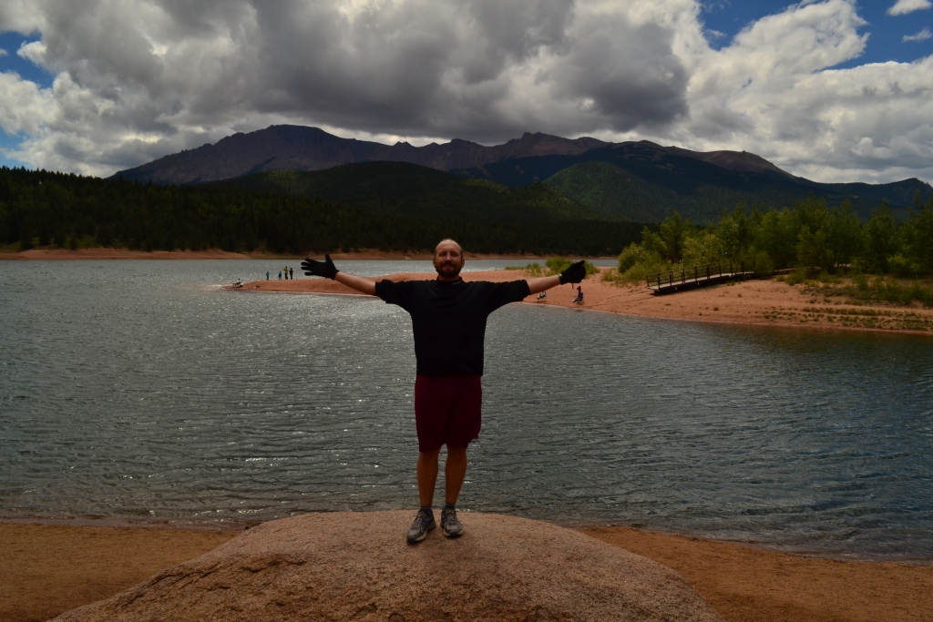
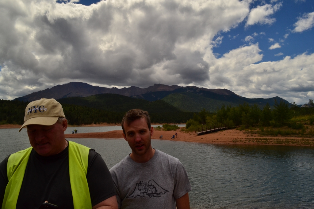
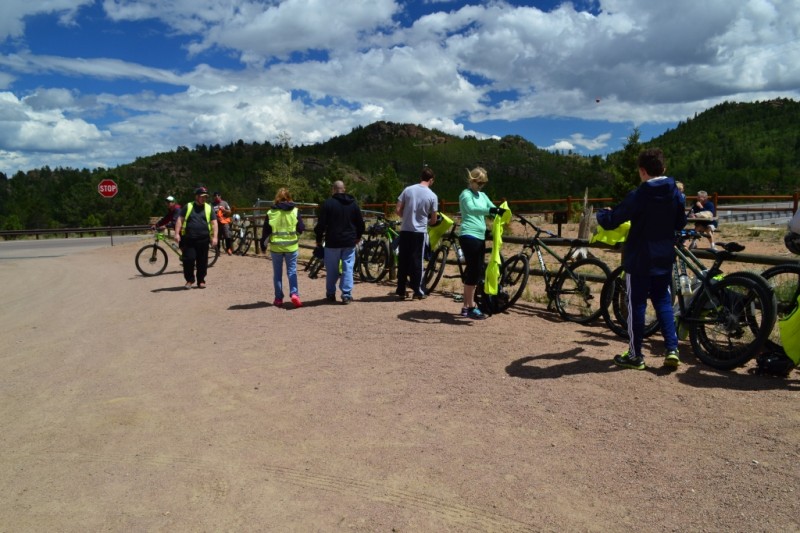
To celebrate Will’s birthday, we ventured down to Colorado Springs last weekend to enjoy an exhilarating ride down Pikes Peak, a 14,000 foot monster of a mountain and Colorado icon. It was a fabulous day, full of speed, concentration and adrenaline.
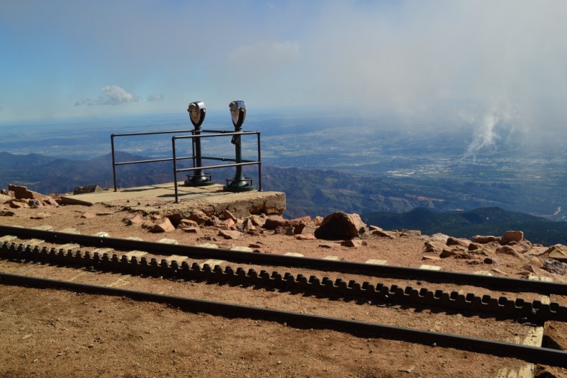
- A leisurely ride up in the van with Bike Pikes Peak Tours granted us pain free access to 14, 110 ft. We awaited the cog to arrive as a huge cold front rolled in devouring us in a cloud.

- We were able to catch a few pretty views before we were engulfed in clouds.

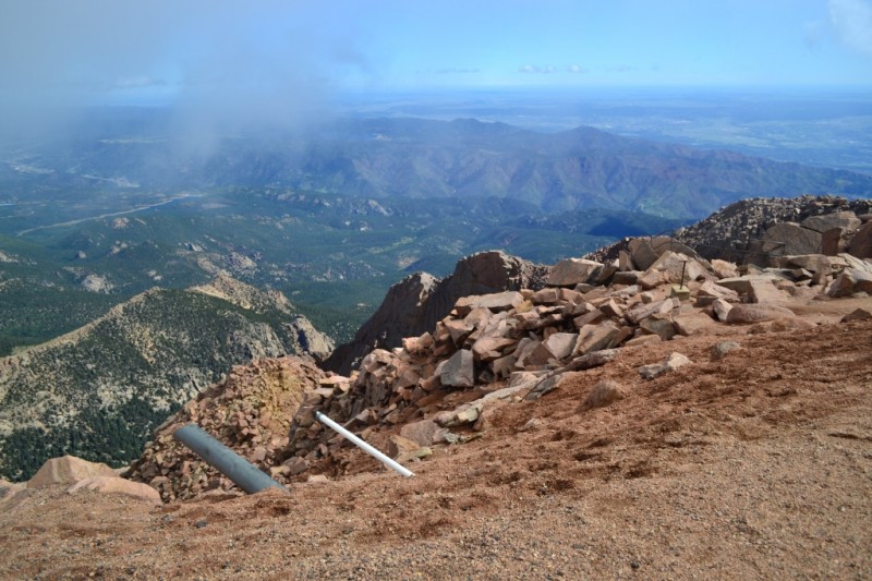
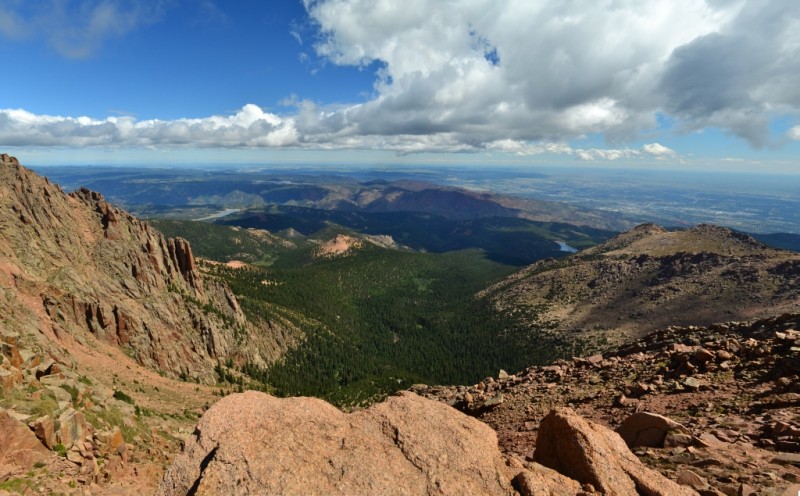
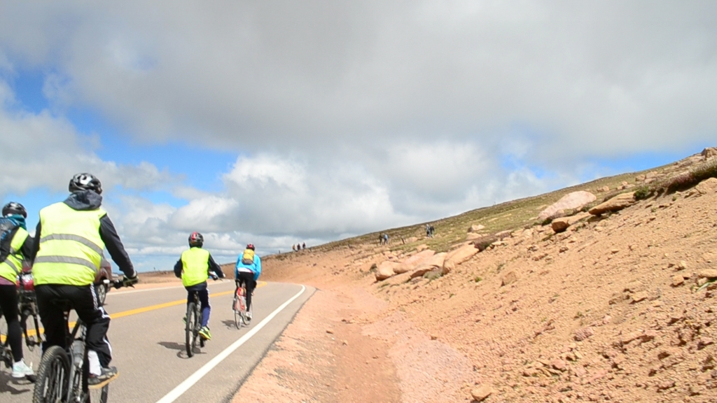
- Taking in the scenery at about 13,500 feet. We had just enjoyed an amazing first section of steep downhill from Pikes Peak Summit.

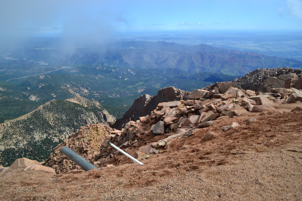
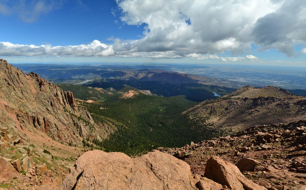
- An outstanding view from our first pit stop. Just about 800 feet below the summit we were greeted with an opening in the clouds. This big drop off is referred to on maps as the Bottomless Pit.
- Another view from the Bottomless pit. It’s best to watch your footing around here.
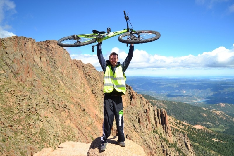
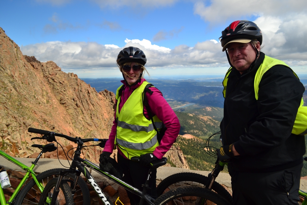
- Alternatively, you can choose to stand at the very edge holding a bike over your head. Will is getting pumped about the hills and hairpins we are about to encounter.
- But first, we had to tackle our first uphill section. Pedaling up a tough hill at 13,500 gets the heart racing.


- The picture does little justice to illustrate just how tough the hill was. Got oxygen?

- Our next stop allowed us to have a little fun off the bikes. These boulders provided some fun scrambling.
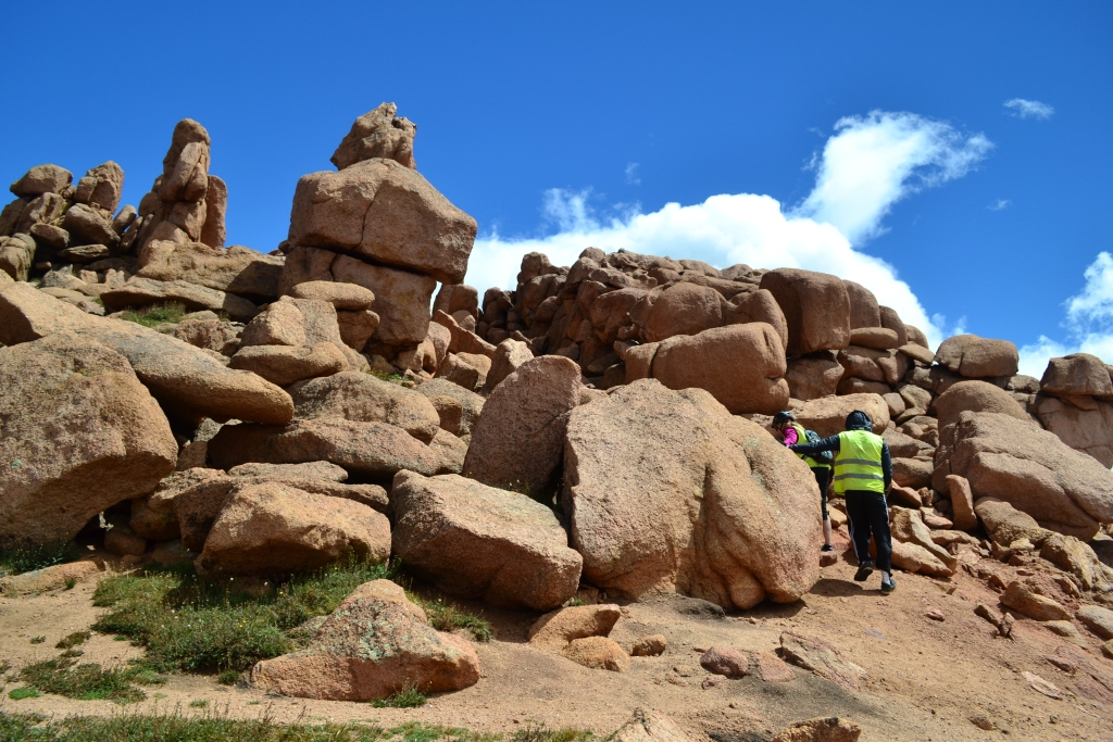
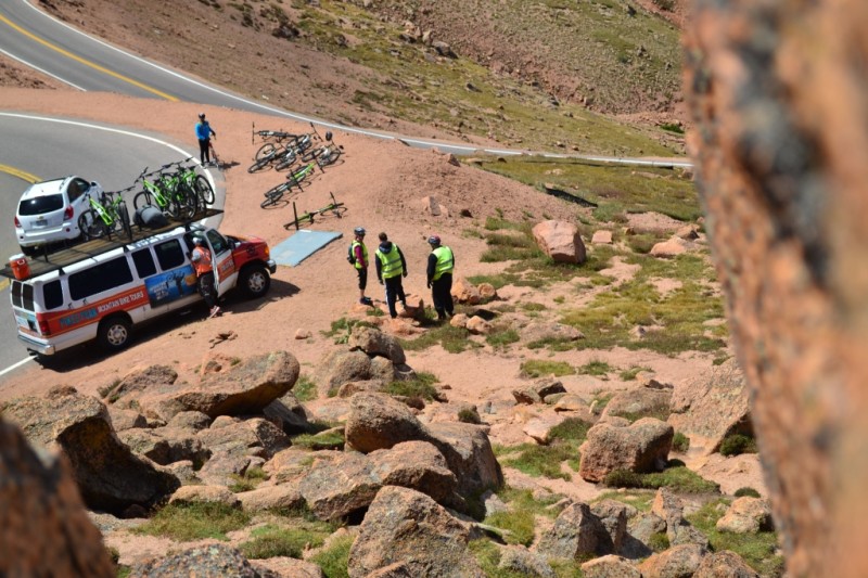
- Thomas hid in the rocks spying on the van and eager riders.

- Another view from the near the rocks. Several social trails were strewn about the area.

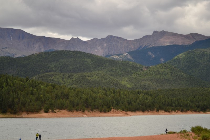
- After one more stop at a gift shop around treeline, we sped down to Crystal Reservoir. Our speeds were too high (try 45-50 mph at times) to take photos until we reached this beautiful piece of water. Pikes Peak can be seen in the background.

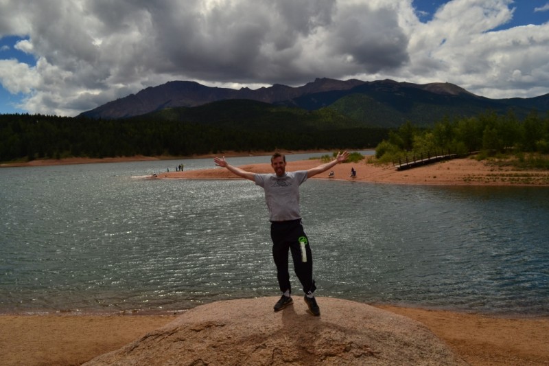
- Only 5 miles left to go. Freedom at the lake.

- Thomas coming off his adrenaline rush.
- A friendly goat greeted us at the Crystal Reservoir gift shop.

- The guys are a little wind blown from the epic speeds that were just reached. And…the wind was quite powerful.
- The happy couple relaxes for a few minutes before we take on the big hill. It was tough, but maybe a little over-hyped by the guides.

- The group prepares for our final climb and last few miles of the ride.

We finished off our day with delicious Greek food and shots of Ouzo with our riding group. We highly recommended this adventure for a good dose of adrenaline.
Here is a link to the company we used! They were great!
Interview with Terry Grosz

Interview with Terry Grosz
Written by Thomas Checkley
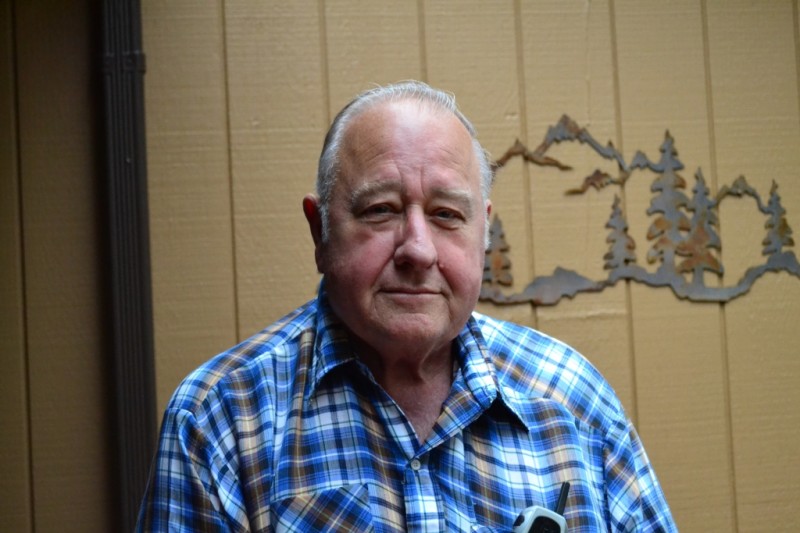
Terry Grosz is an award winning writer of 15 books and a legendary game warden. How we met and I ended up sitting on his porch interviewing him is a story unto itself. Last year I was in Bass Pro Shop here in Denver, Colorado, getting a headlamp for my wife. We became separated while heading up to the front of the store to check out and I became distracted by rows of booths set up near the cash registers. One of the booths was for a non-profit organization called Muley Fanatic Foundation (MFF), who are trying to help protect the Mule Deer populations of Wyoming and Colorado. A man named Scott was holding down the fort at that table and we talked a bit. I bought a raffle ticket and put my contact info in a jar for a chance to win tickets to a banquet they were hosting. Most importantly, Scott gave me a copy of Terry Grosz’s book No Safe Refuge.
I started to read No Safe Refuge and found the writing to be not only engaging but the material to be almost unbelievable. The book is a compilation of stories of the most atrocious killing sprees by poachers Terry saw over his long career as a game warden. His methods for dealing with these killers are almost as mystifying as the question of why these men and women (sometimes men of the cloth) were killing animals in such great numbers to begin with. As Terry told me, “If these people put as much energy into something positive as they did into breaking the law they could do amazing things.” But the book was about killing for killing’s sake, and it does a great job of illustrating the cold calculated killing American wildlife.
After reading the book Terry became an inspiration to me. His stories had sparked my imagination and shown me a world I didn’t realize existed. I thought it would be amazing to meet him, but didn’t give it much more thought than that. Then on a Saturday while Allyson and I were out at the store my phone rang with a number I didn’t recognize. I answered it, and on the other end of the line was Scott from MFF. He told me that a wealthy donor had given some tickets to the foundation so that interested parties could attend, and asked me if Allyson and I wanted to go. We said yes.
The banquet was a really nice event with music, speeches, a silent auction, many different raffles, and a live auction at the end. However, my greatest surprise was seeing Terry Grosz there signing books. I was frustrated with myself for not bringing my copy that Scott had given me, but went up to talk to him anyway. While speaking to him I asked if he would mind if I interviewed him for Take a Walk and he said sure thing. I found over the time I spent with him that he is a gracious and giving man who would do most anything to help not only other people but nature and the animals that call it home. And that is the story of how I ended up sitting on the porch with Terry Grosz in Evergreen, Colorado, watching birds, ground squirrels, and other creatures run around his front yard.
Now, Terry’s stories are already in his books. He has written thousands of pages of stories of his more than 30 year career in law enforcement as well as 5 books on the histories of mountain men. So when I went to meet with Terry I wanted to get to know how and why he wrote these stories down in the first place. What was his motivation? In the process I found out some incredible facts about his life, which I hope you enjoy reading about below.
In 1959 Terry graduated from High School, which was no small feat since he worked so much from a very early age. His first job was at the age of 9 as a grave digger. Multiple times he told me that he was terrified a hand was going to reach up from the dirt and grab him while he was digging graves! He worked through all of high school in various odd jobs and was logging by the age of 16 (he had to lie about his age to become a logger). But he had a revelation, he told me, while he was out in the forests looking around at the men surrounding him. He realized he wanted an education so he could do something different with his life than dig graves and log trees. He told me that “he didn’t know what an education was” but that he knew he needed it to do something more with his life.
But grades weren’t a strong suit for Terry in High School, mostly due to his focus on working. So when he went to look for universities to attend he realized he would need to go to a community college to get his GPA up before he could successfully apply to a 4-year university. Terry, a very focused and determined individual, did just this. He went to a local community college, did well, and ended up attending Humboldt University and graduated with a major in Wildlife Management. Little did Terry know that Humboldt University would award him with a Distinguished Alumni award in 2008 (his acceptance speech is on YouTube).
When I asked him how he chose Humboldt and the degree of Wildlife Management he told me a story. He said that while at community college in Santa Barbara, California, he went to the library to look at college brochures. When he walked in the library he found the brochure table, he picked one up, and that first brochure was for Humboldt University. Said to himself, “I’m going to go there.” Then he opened the brochure up and the first page it opened to was the major of Wildlife Management; he decided that was going to be his area of study. This sort of determination and decisiveness has been a theme in his life.
Terry told me that in eighth grade he saw a women come through the classroom door and he turned to his friend and told him, “I’m going to marry that girl.” His friend looked at him like he was crazy and told him that he didn’t even know who she was, so how could he know he was going to marry her. He told him, I don’t know how I know, but I’m going to marry her nevertheless. Over 50 years later, they are still married. His wife, Donna, is a school teacher with her B.A. and M.A. in Education. These stories of how he met his wife, how he decided to go into wildlife management, and how he decided to attend Humboldt University seem to be almost made up, but then again much of his life sounds sounds so fantastic that that it is hard to believe at times. In the end, the stories are so wonderful that even if they do have a little bit of a Big Fish aspect to them, we end up wanting to believe in them.
In his career he traveled not only the country but the world. He worked in California, Louisiana, Asia, and the mid-west just to name a few. The food in Louisiana was great he told me when I asked him about his experience there. “They can make anything taste good, even an old shoe,” he remarked when thinking back to his Louisiana days. That made Allyson smile when I told her, since her home-state is Louisiana. The stories he told me were wild. Involving shootouts in Asia, close encounters with rattlesnakes, brawls with poachers, and more. It’s no wonder they made a TV movie about him! But I wanted to know how and why he wrote, so you’ll have to go buy his books to read more about his stories.
One of the downfalls of his epic career as a protector of nature was that he didn’t have much time for his family. He called his career a “vision quest.” That he felt compelled to protect nature in a way that went above and beyond duty, but was elevated to an almost religious status. Because of this he spent 12 hour, 18 hour, 48 hour shifts trying to catch poachers and rule breakers, often missing out on events with his wife and children.
When he retired he started a daily ritual of hiking up a hill just outside his house. I looked at the hill he pointed to and it looked very serene and like a good place to think, and think he did. He went over his career in his head and then, back at the house, felt compelled again to write down these stories. Terry told me that they were originally intended for his family, “so that they could know about what he did and who he was.” But like most things, when he began something he was all in, and in very short order a 400 page manuscript of wildlife stories emerged.
He sent the manuscript around and it was eventually published. His family decided that the profits would go to a charity, but wasn’t sure which one. Terry told me that one day he was watching TV, and a commercial for Saint Jude’s came on. He knew in that instant that St. Jude’s was the charity that the money was meant to go to. Ever since, every dime according to Terry has gone to St. Jude’s Children Fund. What followed after that was a parade of more books and awards. His books became extremely well known in Sportsman and Wilderness communities; and he has had notable individuals such as General Schwarzkopf call his house and ask for books for gifts (70 books in General Schwarzkopf’s case). As it turns out, General Schwarzkopf is a big wildlife buff and loves big game — especially grizzlies.
As we continued to sit there we started to talk about the birds Terry was feeding. A stellar jay flew in and scarred off many of the smaller chickadees and ring-neck doves; I tried to get a few pictures of the jay, but couldn’t really get a good angle. Terry told me he loved birds, loved studying them in college. When I asked him why he told me that they had such amazing physiology. I asked him what his favorite bird or even animal was and he told me that it would have to be the Golden Eagle. This bird can reach speeds of up to 200 mph, quite the flier!
We talked a bit more about our favorite things, and Terry told me he had a fondness for geraniums, because they let you know if you piss them off; and that he loved Salmon, because they had this knack for overcoming obstacles to survive. This seemed to resonate deeply with Terry, and you can see it in his stories. The willingness and depth of Mr. Grosz’s actions to stop poachers and harmers to nature are legend. You can still see how strong and intimidating he must have been as a younger man, a lingering effect most likely of logging and digging graves starting at an early age.
Today Terry continues to write and still takes walks near his home in Evergreen, Colorado. The following link to his first book can be found here to get a feel for his writing. His books can be purchased from amazon.com, alibris.com, or almost any other seller.
Cheers,
Thomas