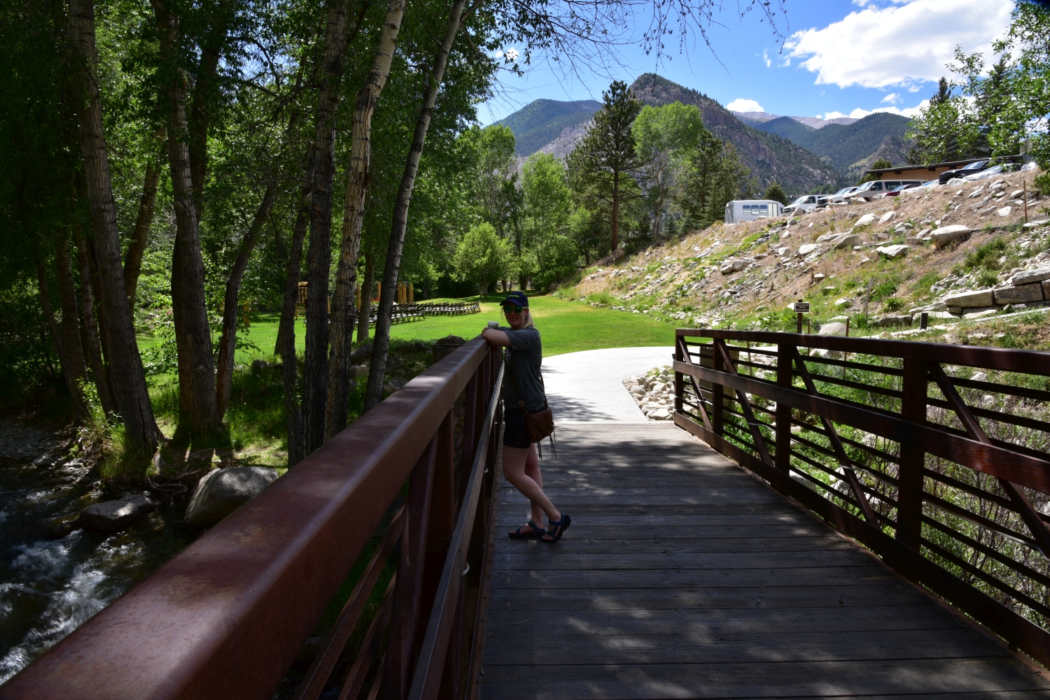
Take a Walk
A Quest into the Wild
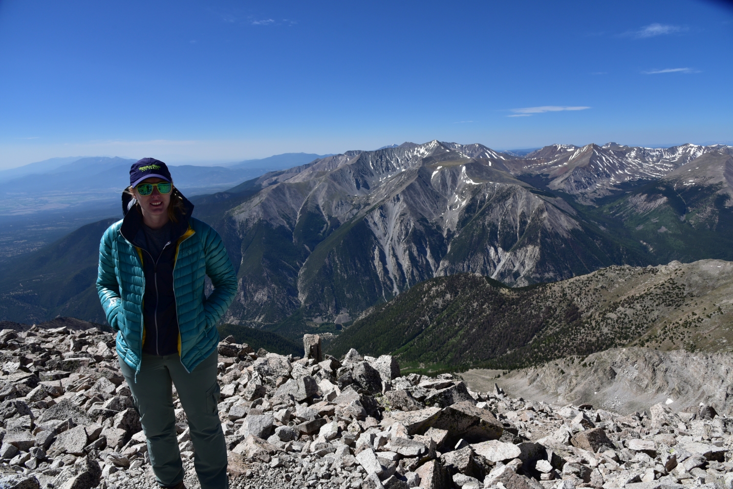
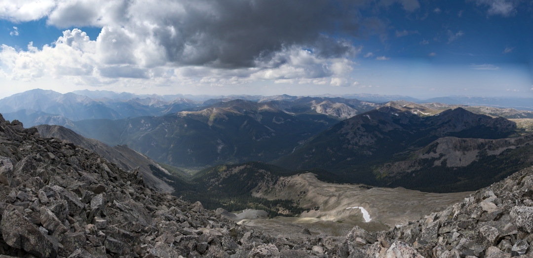
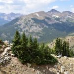
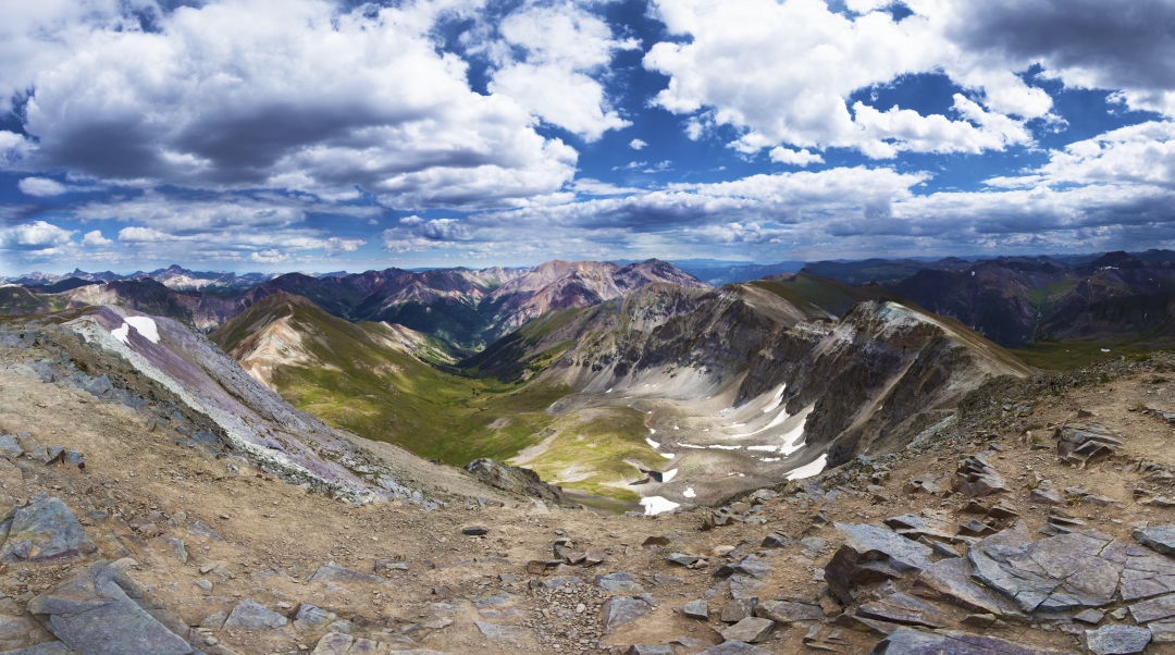
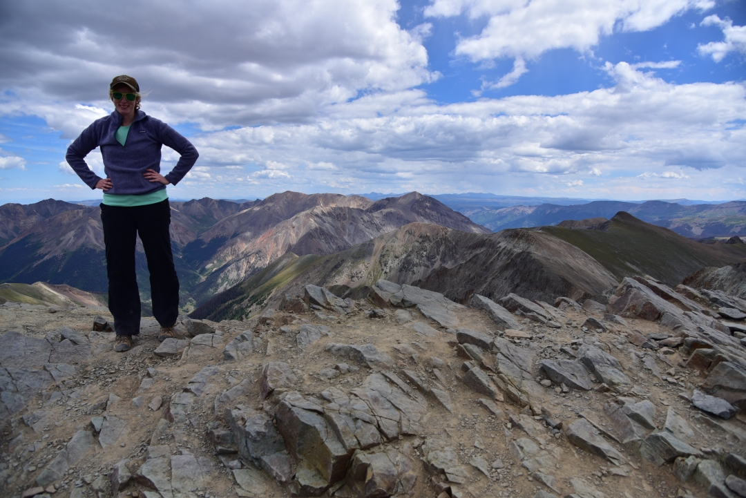
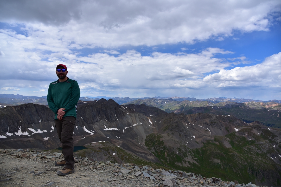
Mount Princeton 14,197 ft, Sawatch Range
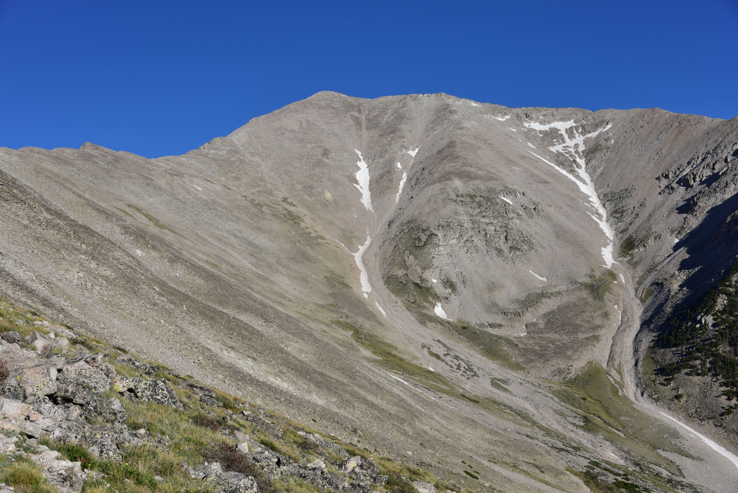

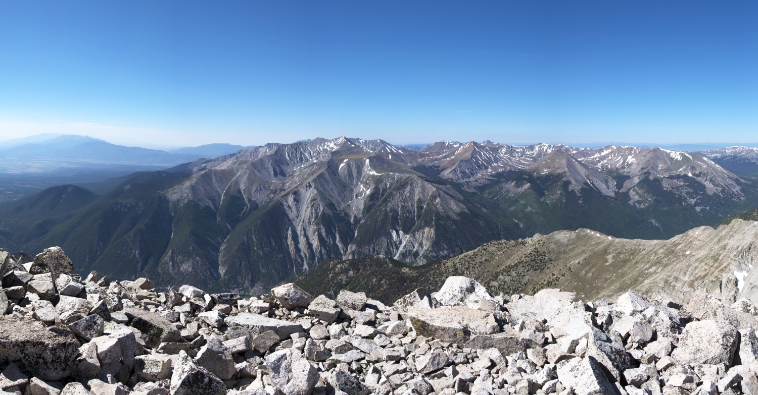
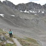
Though the hike up Mount Princeton will be described in better detail as we go along, the photographs above provides a fairly accurate summary of this mountain for those seeking to summit this summer. Talus hopping, navigating steep scree- filled slopes, and dodging the apparent infestation of spiders spinnning their intricate webs among the maze of rock were interwoven into our day. In between the scree surfing and selecting our next boulder step, we drank in the views of the bright blue sky above us and the exquisite alpine around us.
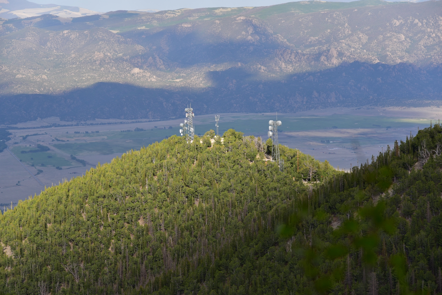
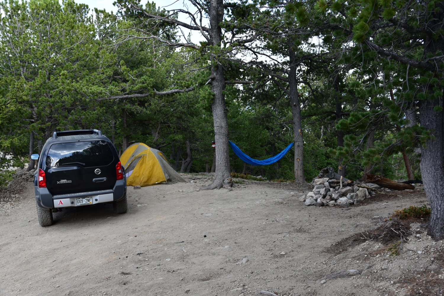
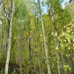
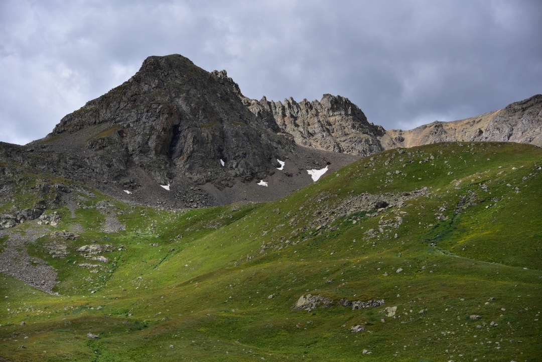
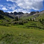
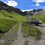
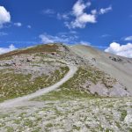
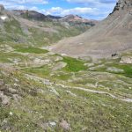
Mount Princeton is one of the Collegiate Peaks located in the Sawatch Range. It’s 14,197 feet above sea level and prominently sits above the small mountain town of Buena Vista. The lower TH is easy to get to, with a large parking area, but be warned, starting from here makes for a much longer, more strenuous day. Hikers will need to gain 5,400 feet of elevation and hike a total of 13.25 miles. We chose to take the X-terra with brand new all-terrain tires up the narrow 4WD road to reach the upper trailhead and camping spots located just past the radio towers. This reduced the gain and round-trip mileage to around 3,200 feet and 6.5 miles, respectively. Almost immediately, we encountered large dips and steeps gains along the road. However, the biggest challenge of the road is how narrow it is. There were several long stretches of the road in which there was no way for two-way traffic. We headed up around 4:30 pm on a Thursday afternoon hoping to not encounter any down hill traffic. Unfortunately, about half a mile up, three large suburbans/trucks were heading straight for us. While uphill traffic has the right of way, there was a small pull-out about 500 feet below, so we carefully backed down the road to let the others pass. The rest of the drive up was fairly uneventful, with the exception of some very large drop-offs as the path became a shelf road. It was slightly unnerving to have the truck lean slightly while skirting the edge of a cliff. Once we reached the radio towers, we continued on the road for another 0.2 miles and found a lovely campsite with room for our tent, two trees to tie our hammock, and spot for the truck. Seen below is a set-up of our camp, the radio towers, and wandering around the area prior to our hike the next day.
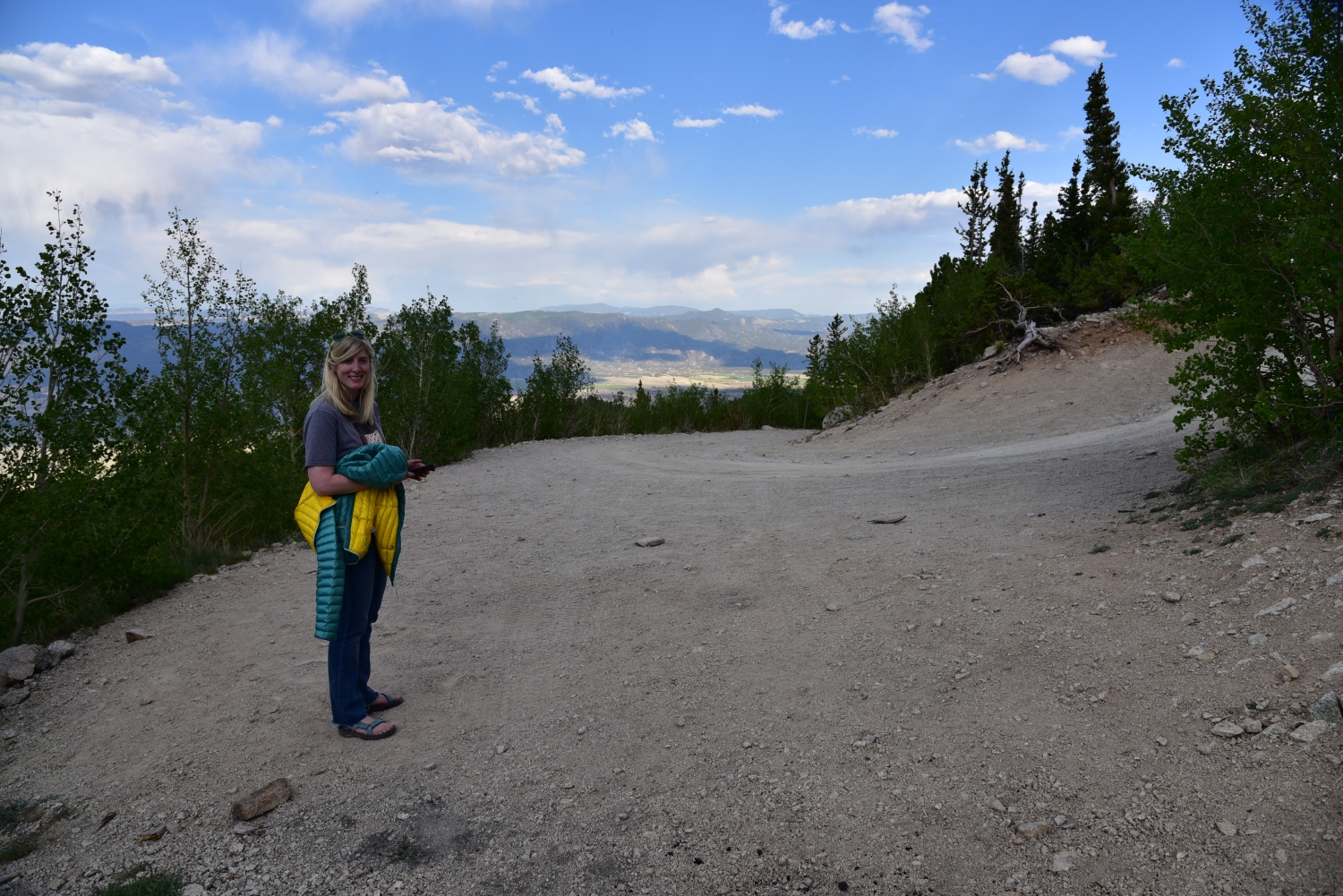
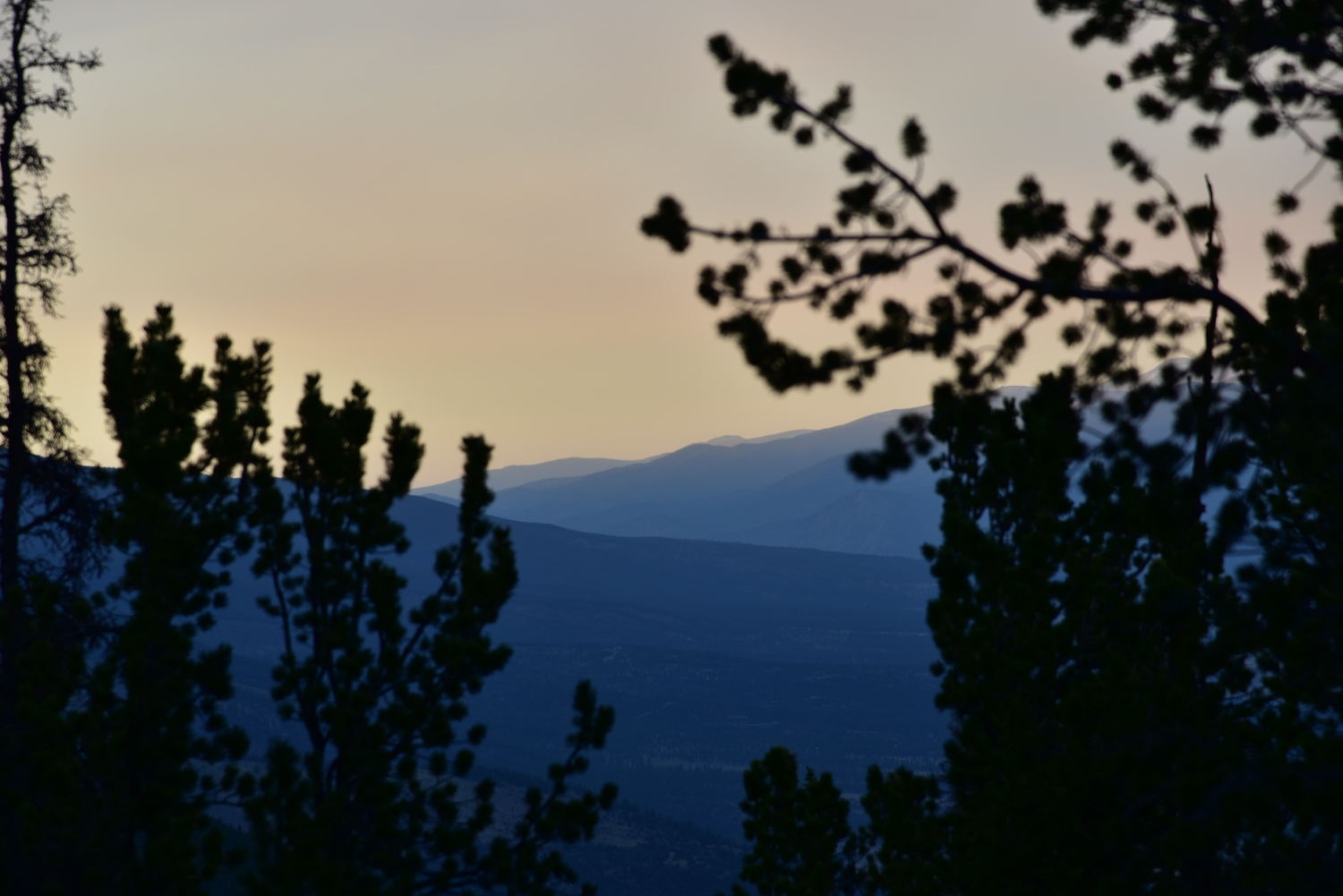
The temperatures were cool, but not cold as the sun began to set. We hiked up the road a bit further to enjoy the sun setting. Several spots had openings among the trees that offered views of the town below. As we hiked a little further, we also gained our first views of the summit of Mount Princeton. As it got dark, we retired for the evening. It was mostly a quiet night, with the exception of some strange noises at 3:00 am. At first, we thought it was the Colorado 14ers Initiative group perhaps working on something for the next morning. Their group was camping near us. However, as the noise got louder, it sounded as if it was coming from the car. We quickly flipped on the lantern, and made some noise, and the scrapping/grinding noise stopped. We never figured out what the noise came from, but we think some forest creature was attempting to get into our vehicle. At least this disturbance gave us a glimpse of the night sky. The inky black sky was dotted with a plethora of stars. The views were brilliant and such a amazing treat when coming from the city lights of Denver.
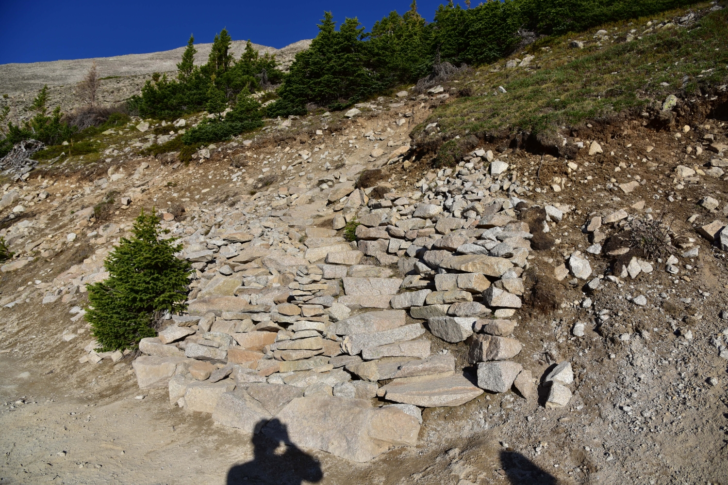
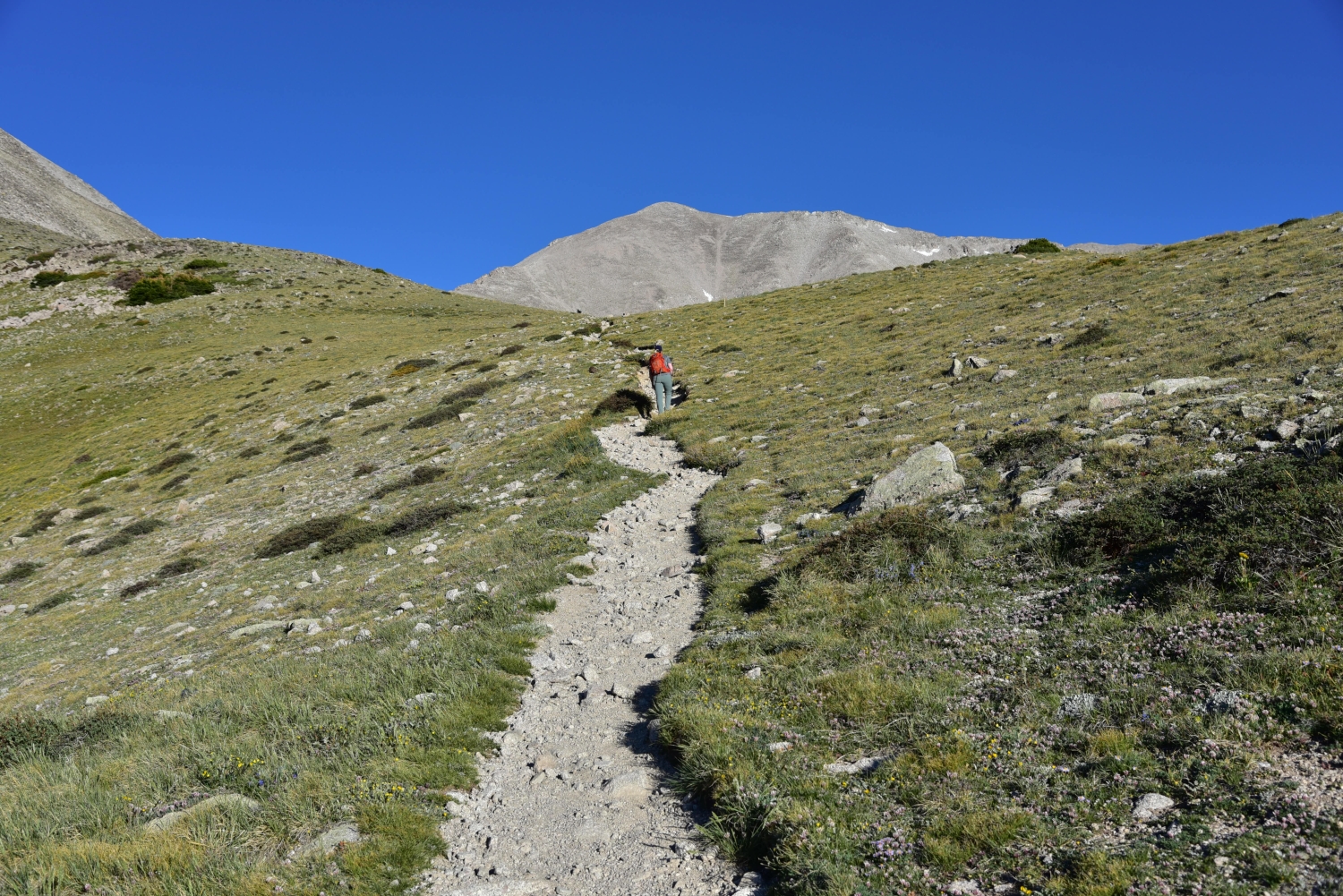
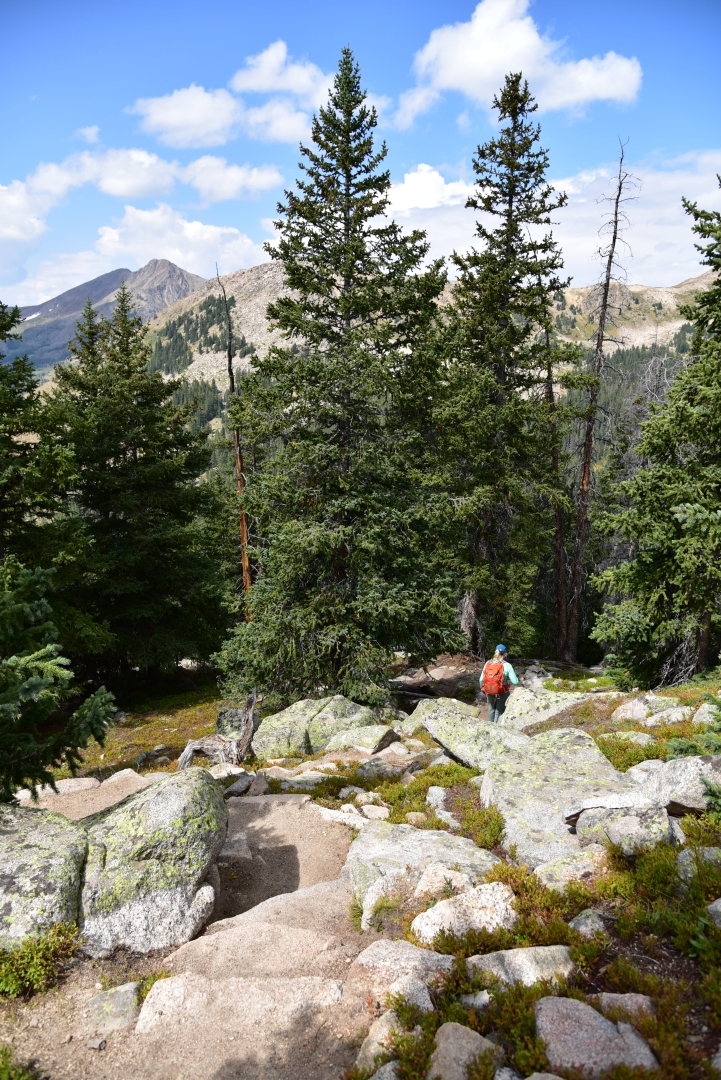
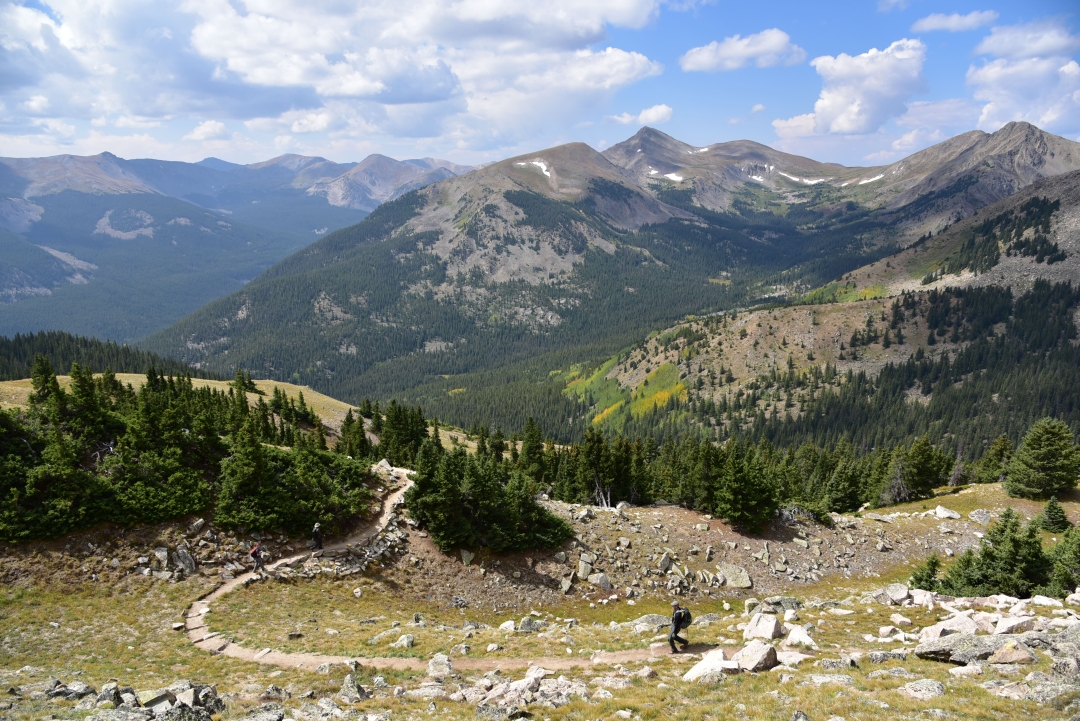
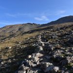
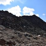
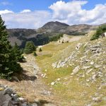
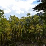
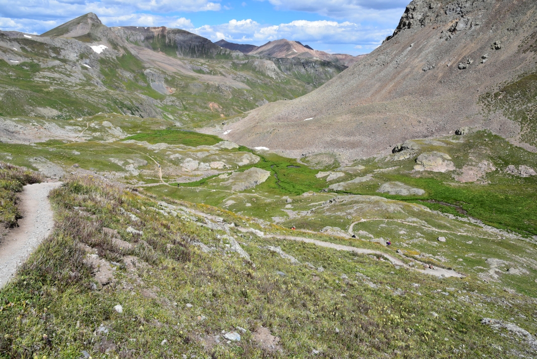
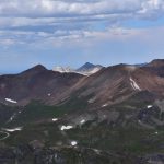
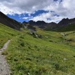
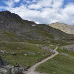
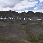
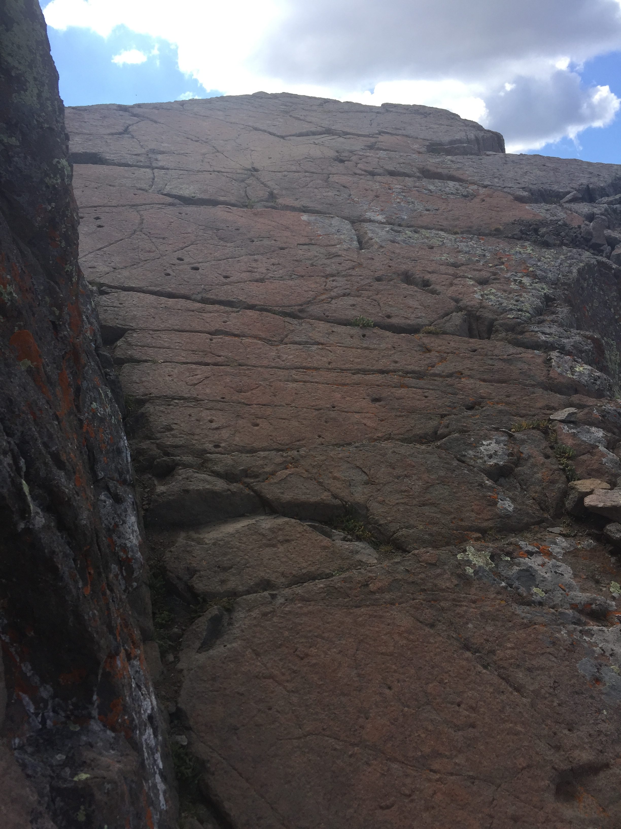
A short two hours later, the sun began to rise. It was time to get moving. All ready we could hear the few other hikers and CFI workers getting ready to start their day. We began our hike at 6:20 am. The morning temperatures were in the upper 40’s, but we quickly ditched our jackets as we made progress up the road. We continued to follow the 4WD road up for what seemed like close to a mile where we reached around 11,800 feet. As views of Tigger peak appeared, we began looking to our right for the trail turn-off for Mount Princeton. There is a large stone staircase that marks the start of the Mount Princeton Trail, and we didn’t have any trouble locating it. Online forums mentioned it can be easily passed by if snow is covering the steps or if you aren’t paying close attention. Missing the turnover will take hikers up the road to the top of “Tigger Peak” and then down the connecting ridge to Mount Princeton. This is the winter route to Princeton, and will add some distance and elevation gain to the day. Seen below are photos of the hike up the road and the turn-off to the Mount Princeton TH.


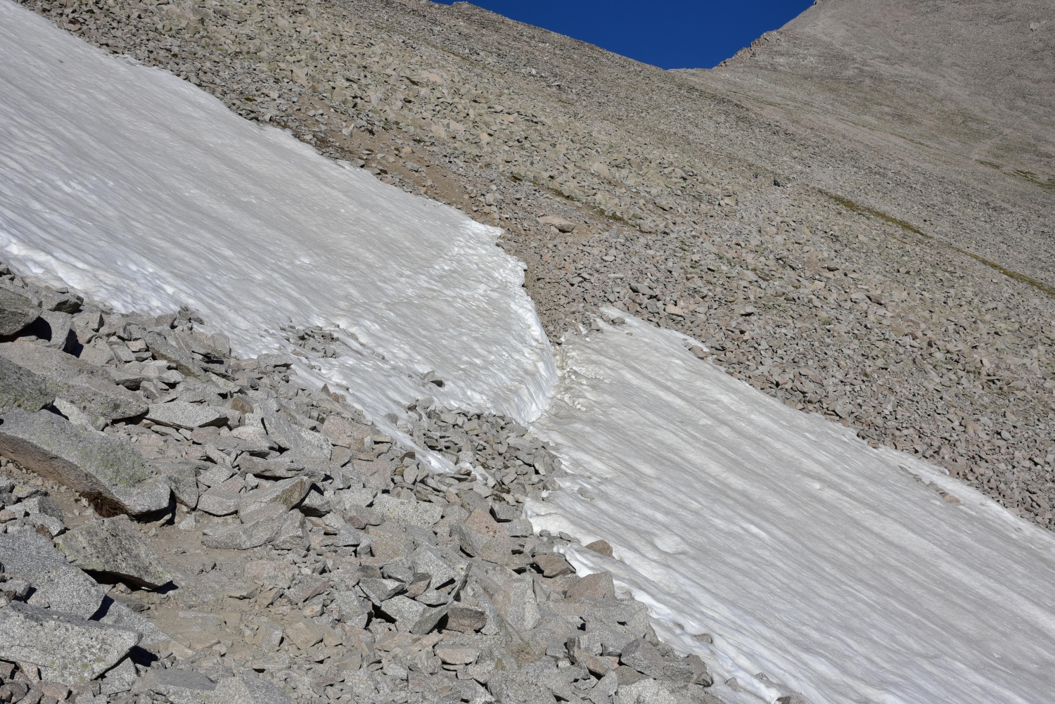
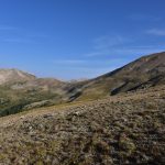
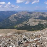
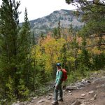
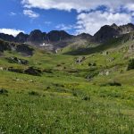
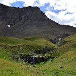
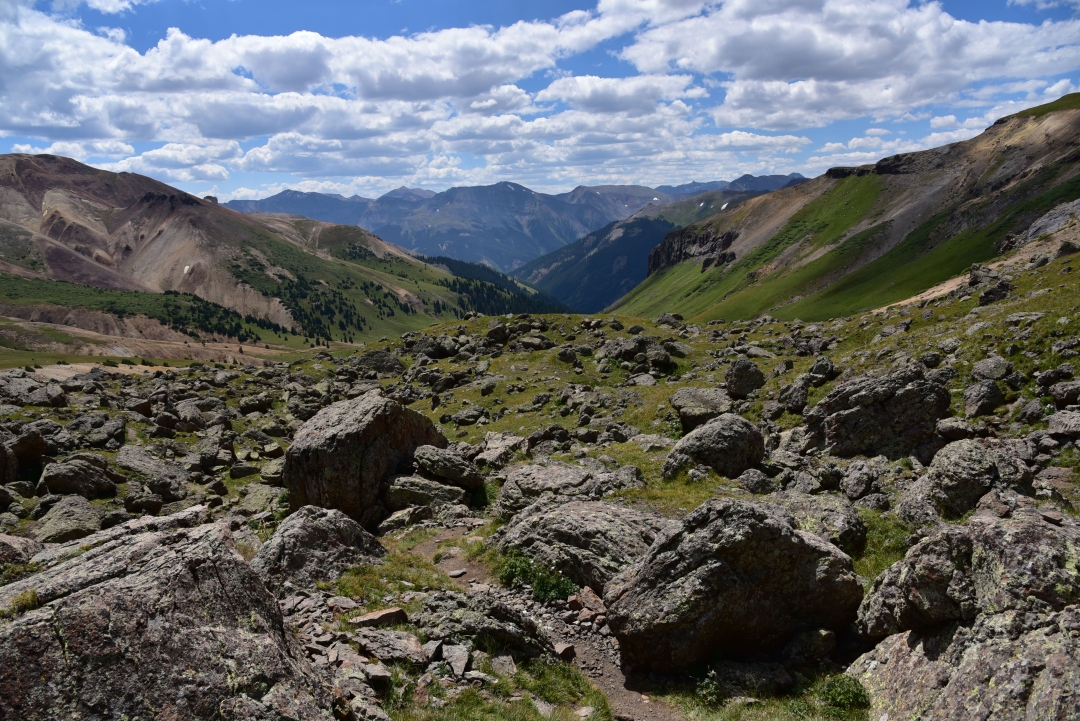
We were thankful to ditch the road and continue our journey on an actual trail, even if that trail became a talus field soon. We crossed the north side of “Tigger Peak” on relatively smooth trail for about a quarter of a mile until we reached the gullies. The trail crossed through mostly stable rock, and the elevation gain through here was modest. There was one remaining snowfield to cross when we summited on June 8th, but the section was well-boot packed and we had no trouble crossing. It was truly astonishing how little snow is left in the high country this early in the year, and also a bit concerning. As we hopped and skipped our way over boulders, we could see the remaining route in front of us and the summit of Mount Princeton. Compared to some of the other 14ers, we thought it honestly didn’t look too far away. Seen below are photos of the start of the Mount Princeton Trail and the fun gullies we had to cross. If you look closely, you can see the faint path through the gullies leading towards the summit.
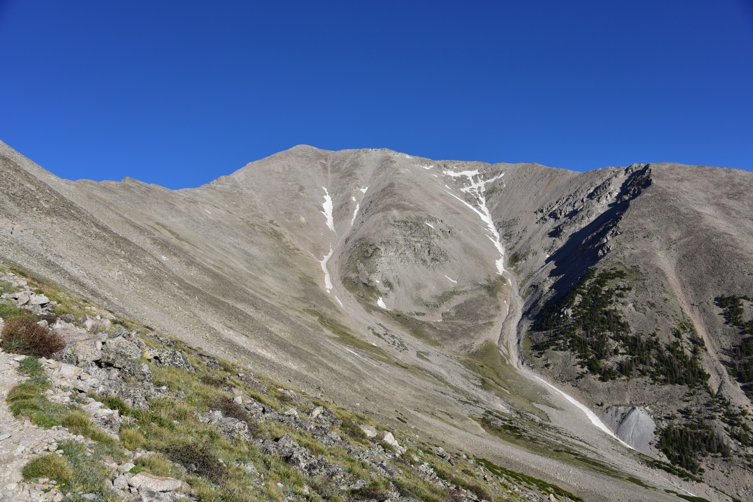
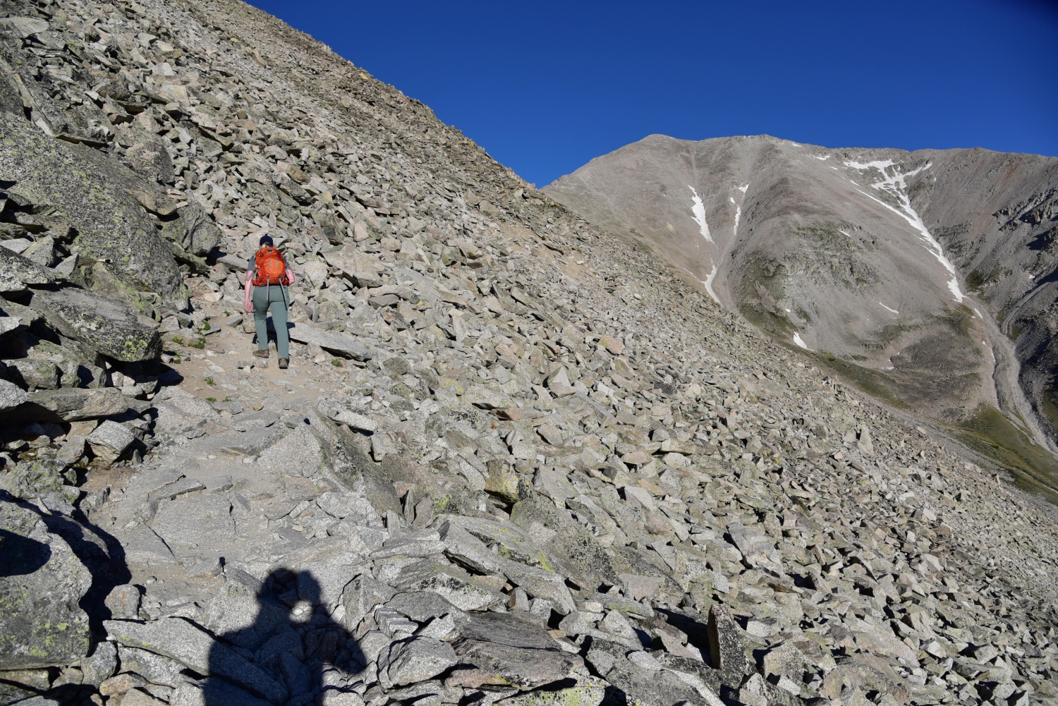
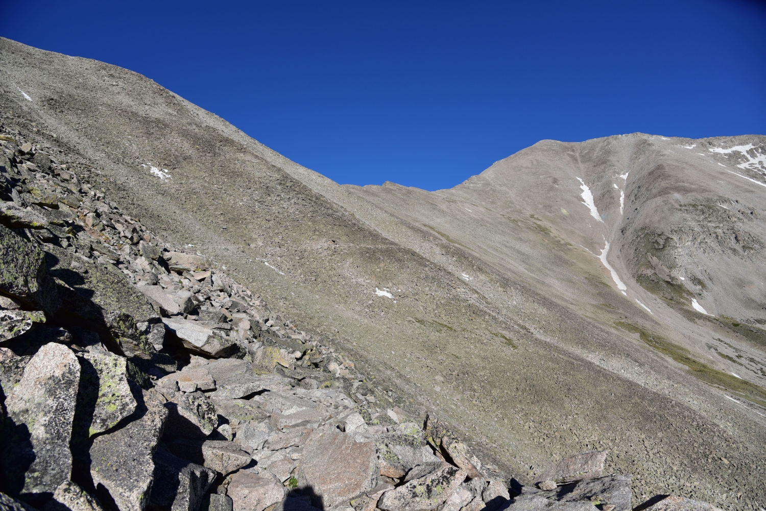
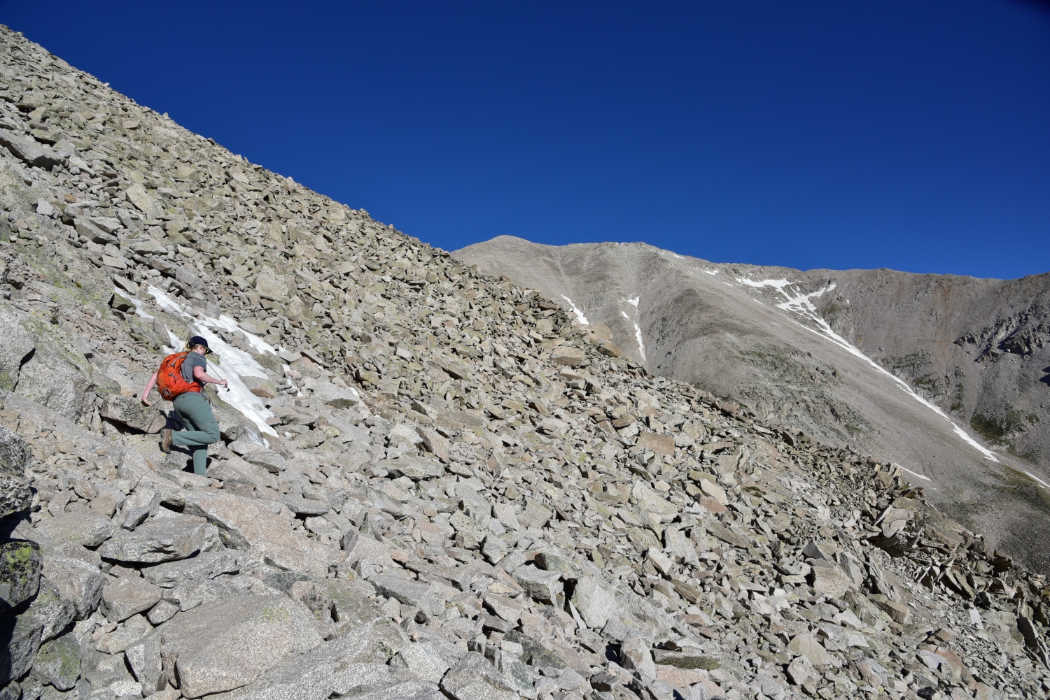
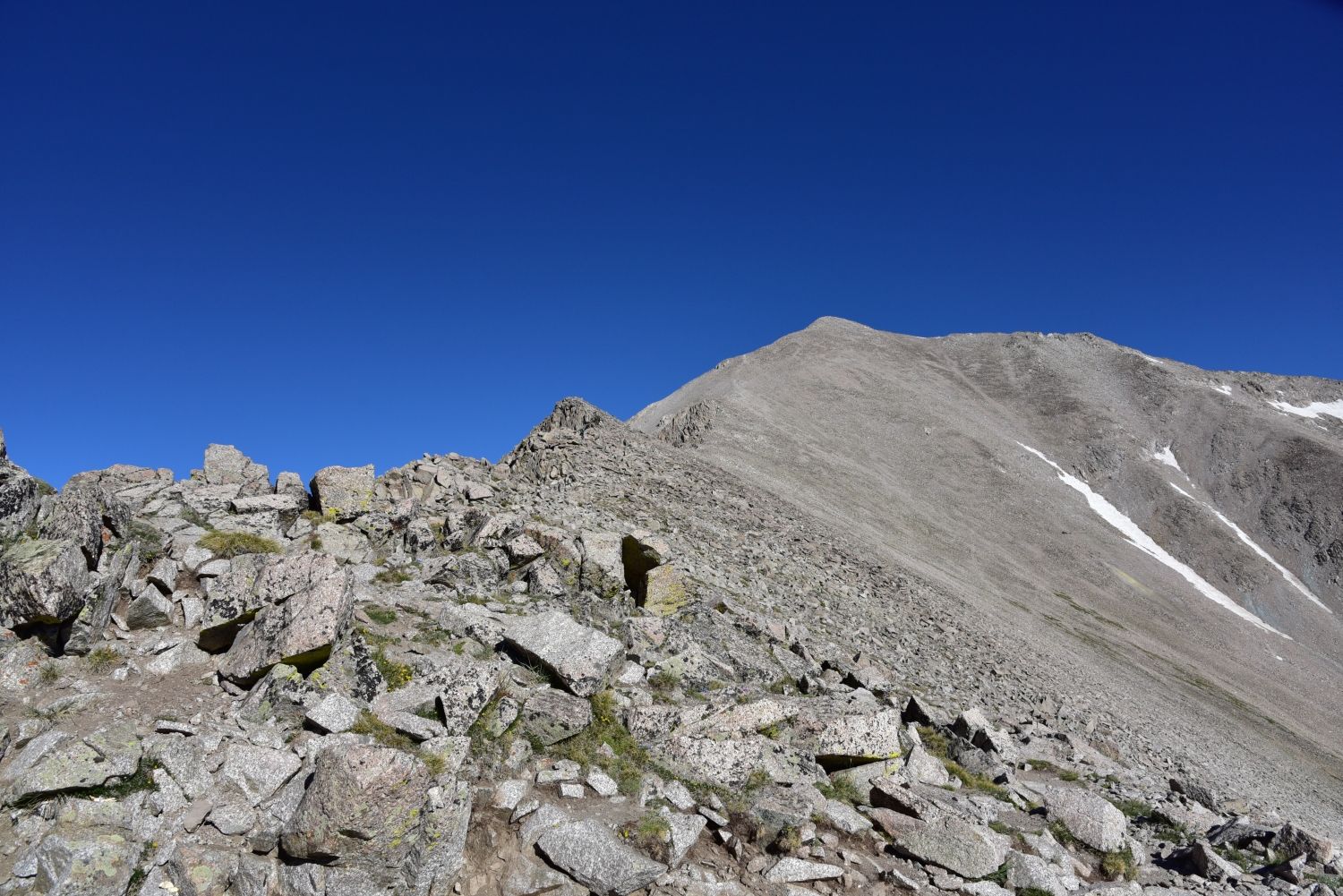
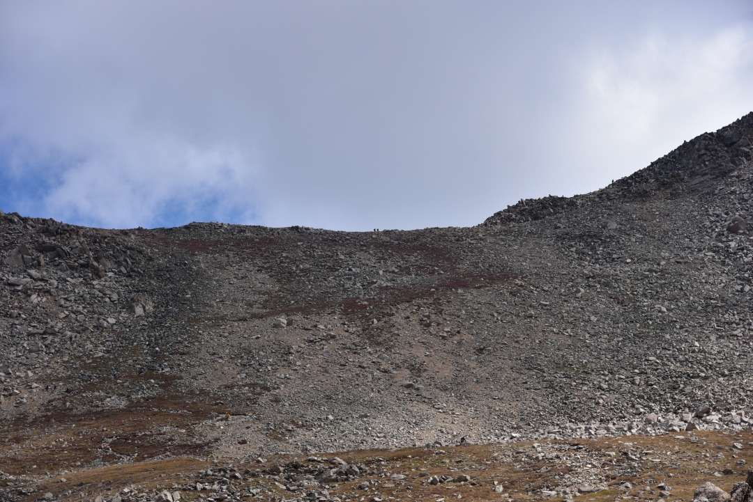
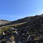
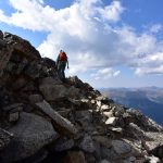
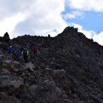
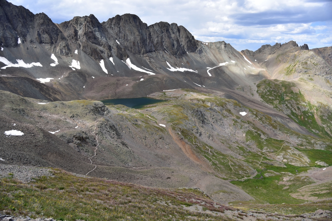
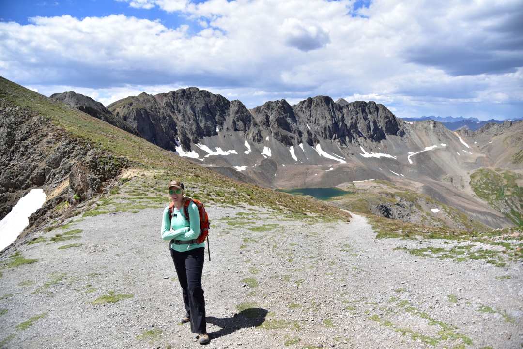
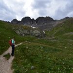
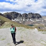
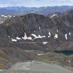
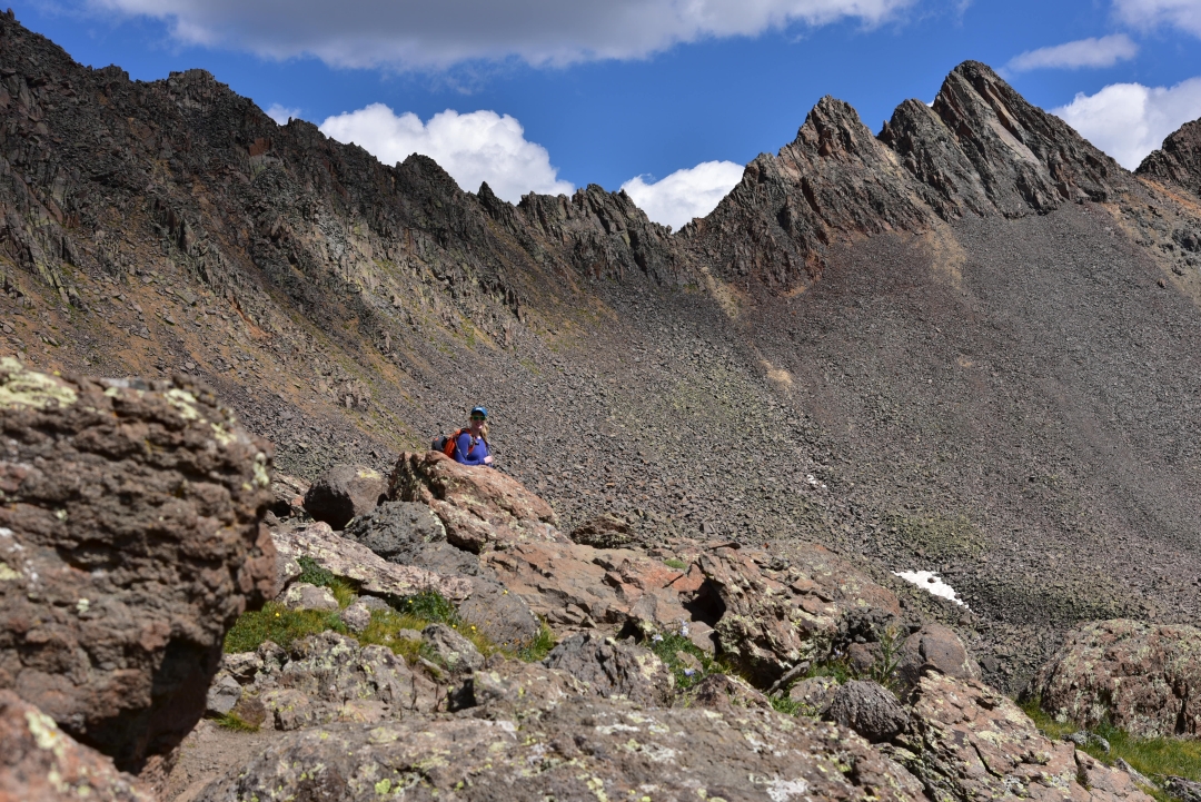
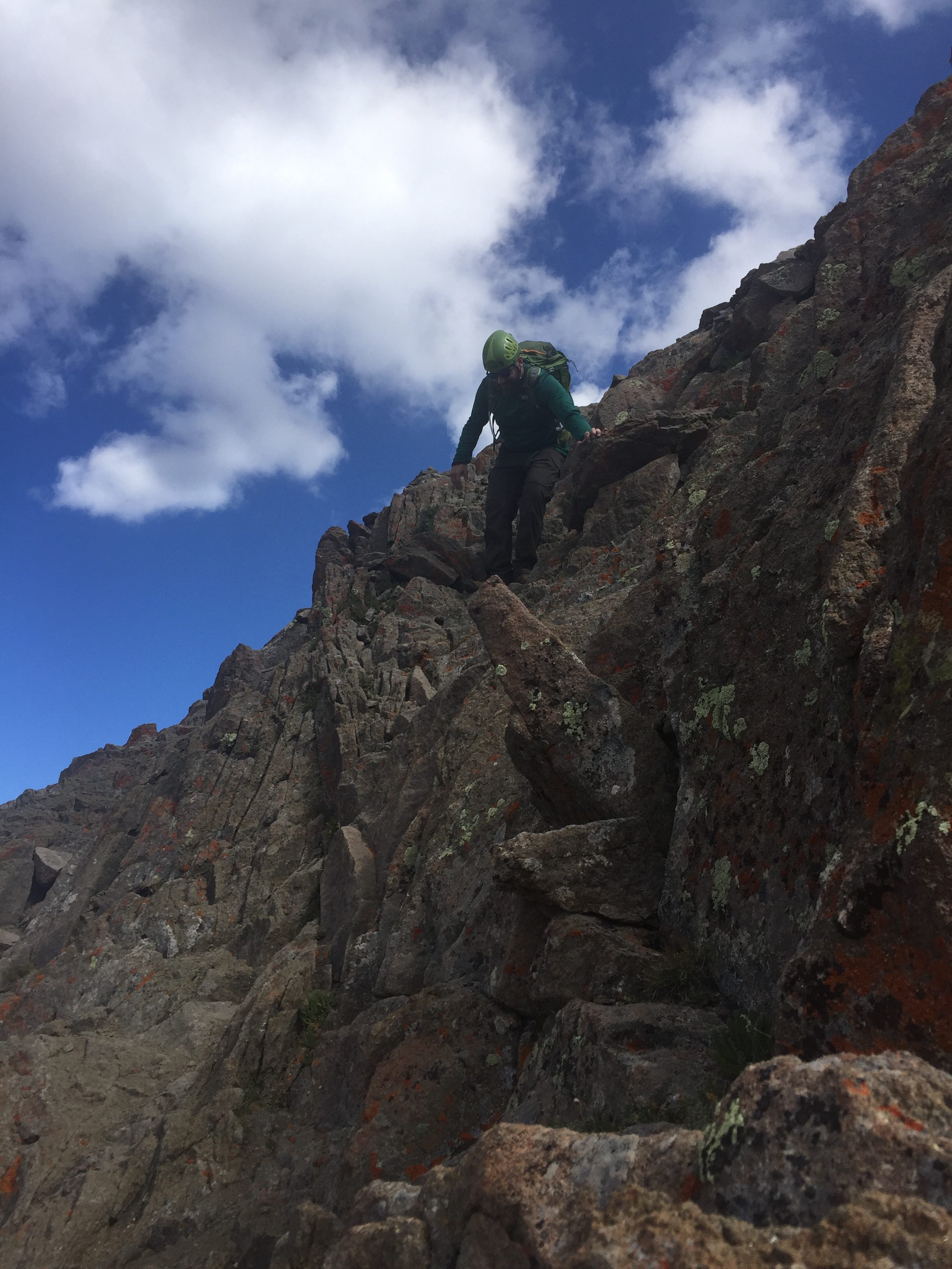
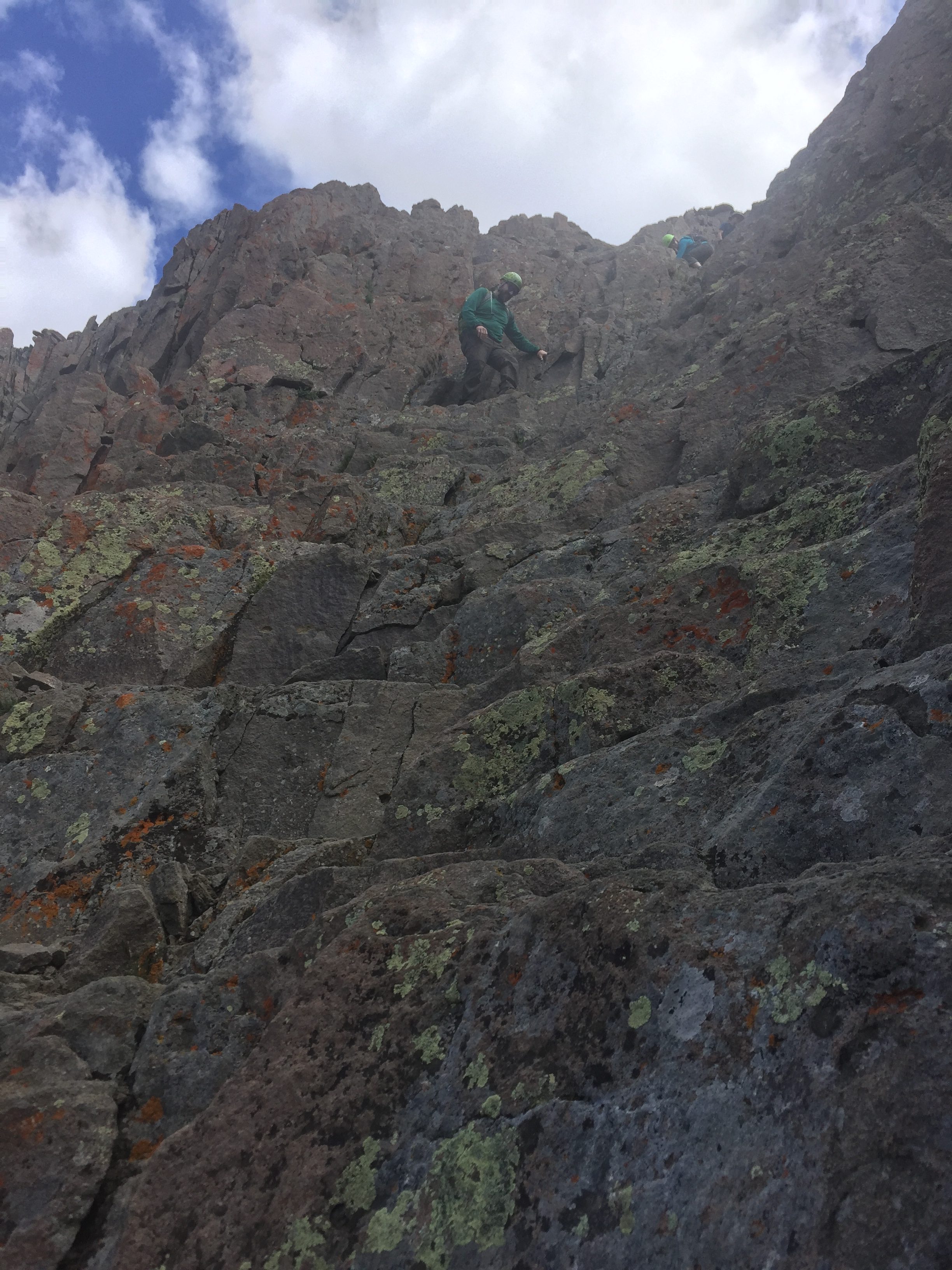
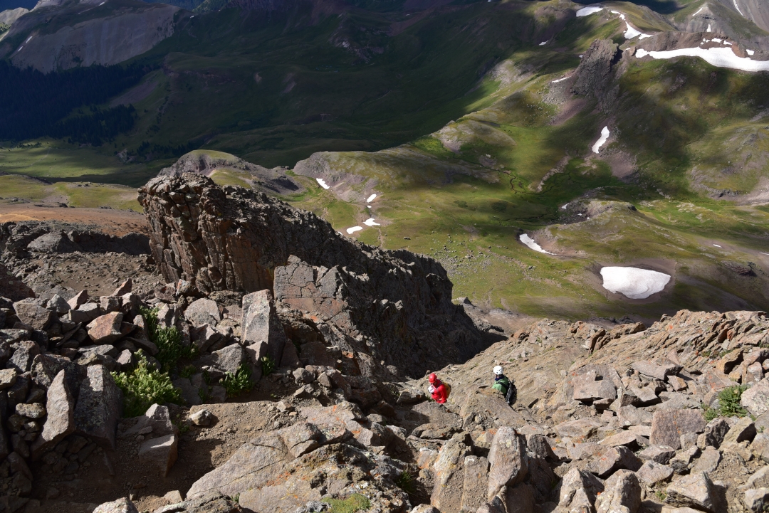
Shortly past the snow drift, the trail veers left to gain the ridge. We followed the series of steep-switch backs up the ridge and were greeted with some cold wind, but also striking views of the nearby 14er, Mount Antero. We could still see some remaining snow hanging on to the nearby slopes. We paused for a moment on the ridge to enjoy the views before carefully picking our way along the talus ridge towards the summit. The terrain and elevation made the hike slow going once we gained the ridge. We were now above 13,000 feet for the first time in several months. Despite the heaviness in our legs and strain on our lungs we could see the summit, and it looked so close. We continued to weave through large spider-webs and subequently pass large spiders that looked to be Mountain Spiders (Aculepeira carbonarioides). They were out in the bright sun, basking. Seen below are views of Mount Antero from the ridge, and the slog up the steep rock leading to Princeton’s summit.

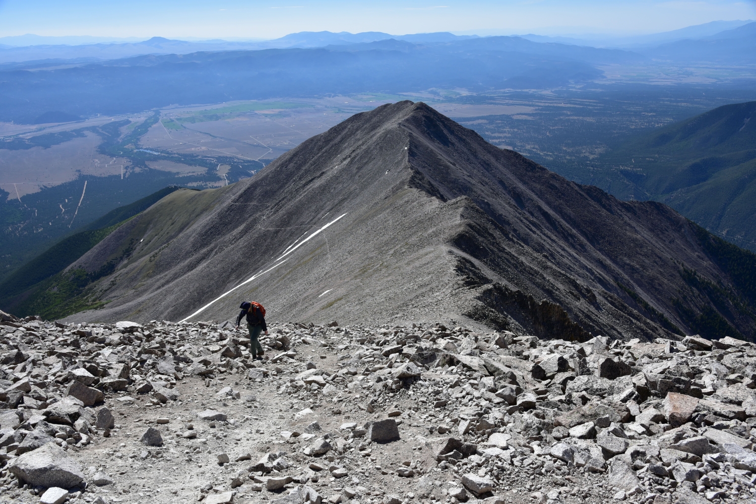
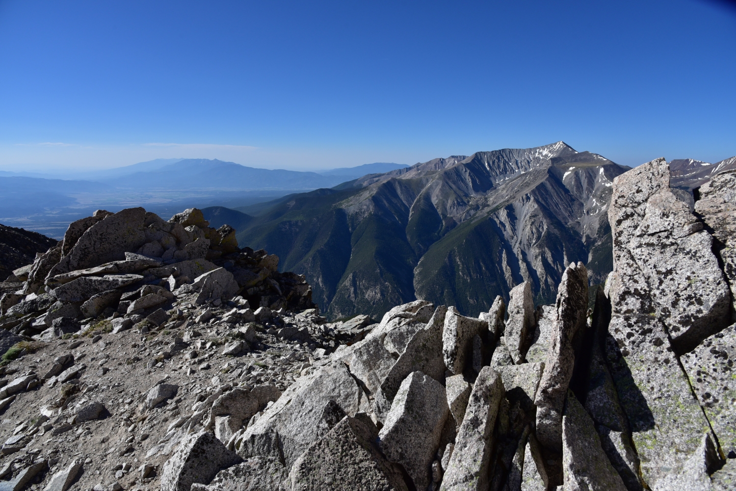
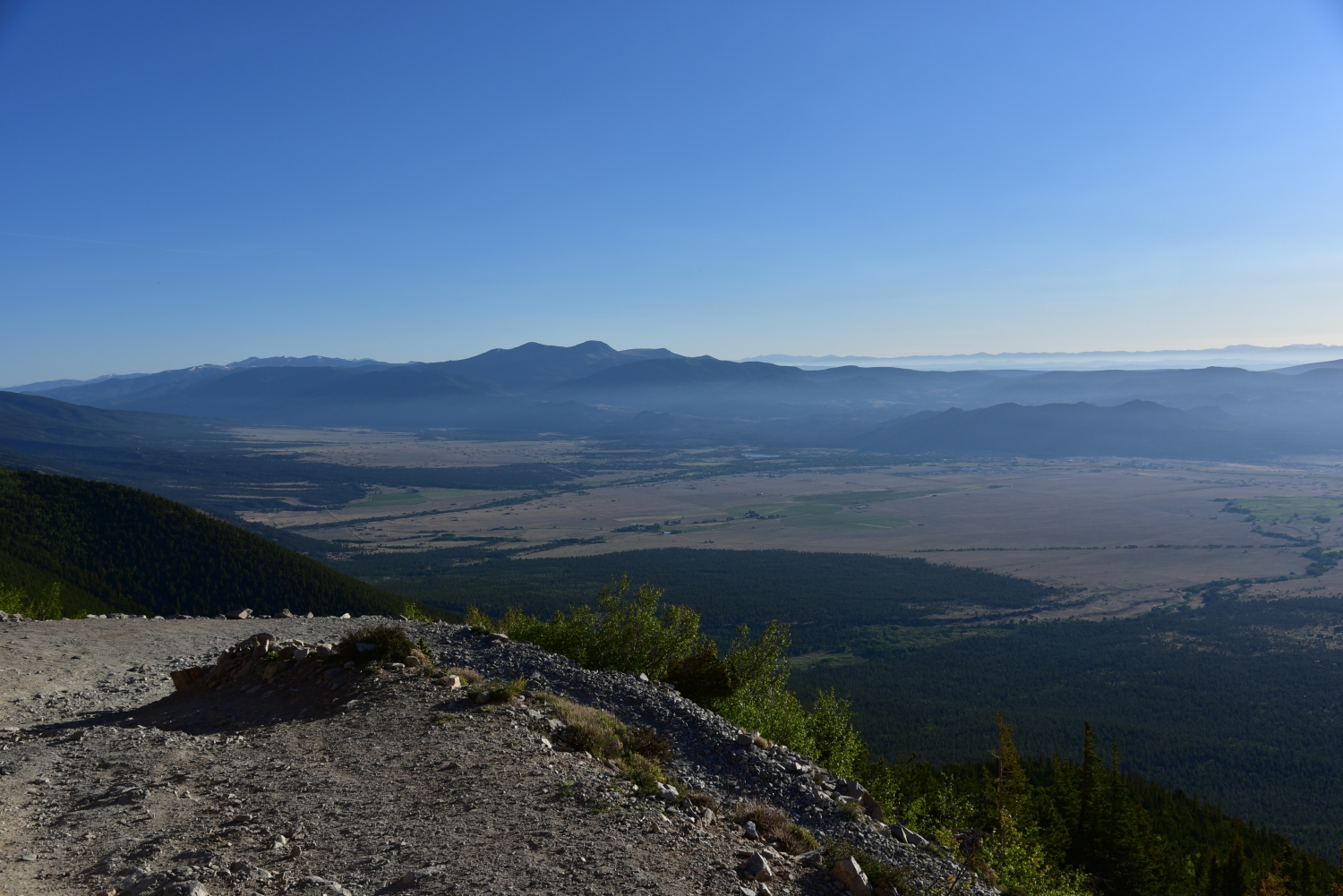
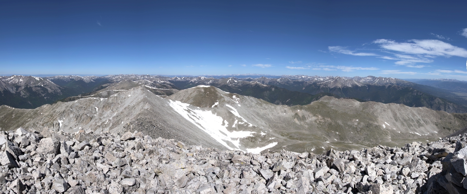
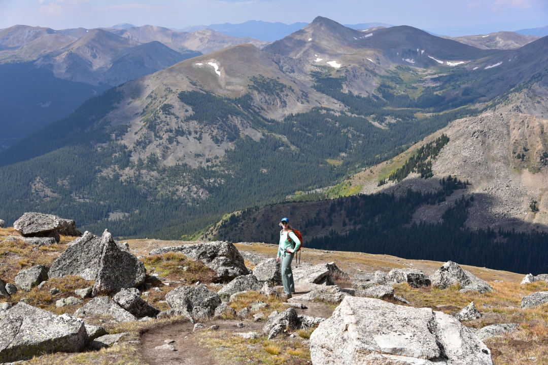
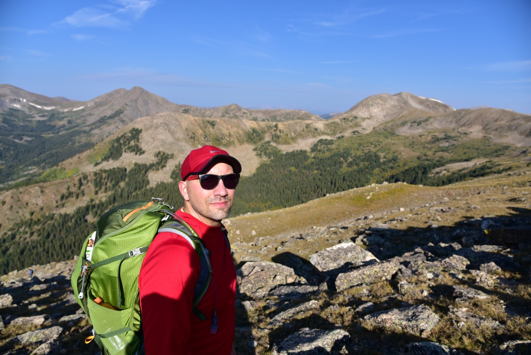
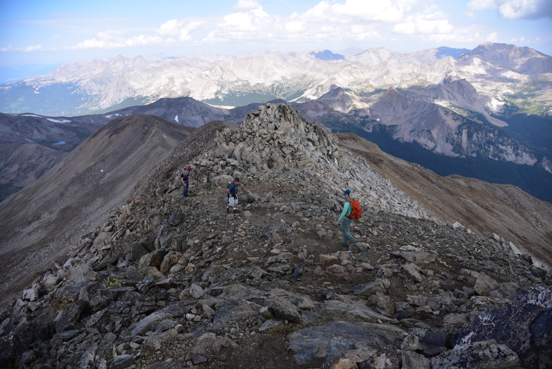
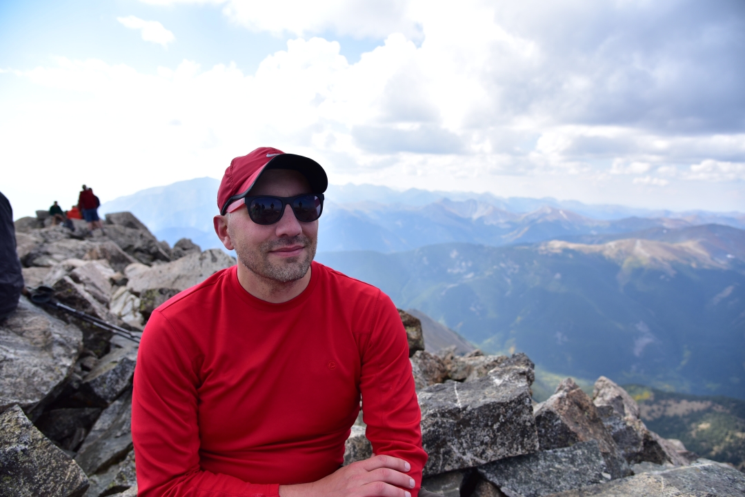
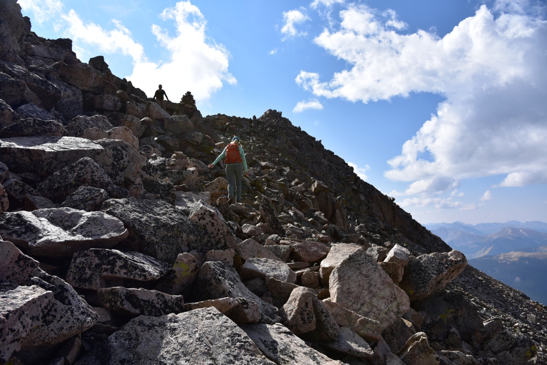
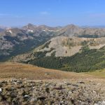
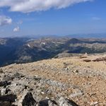
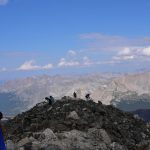
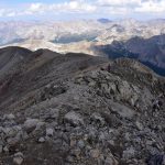
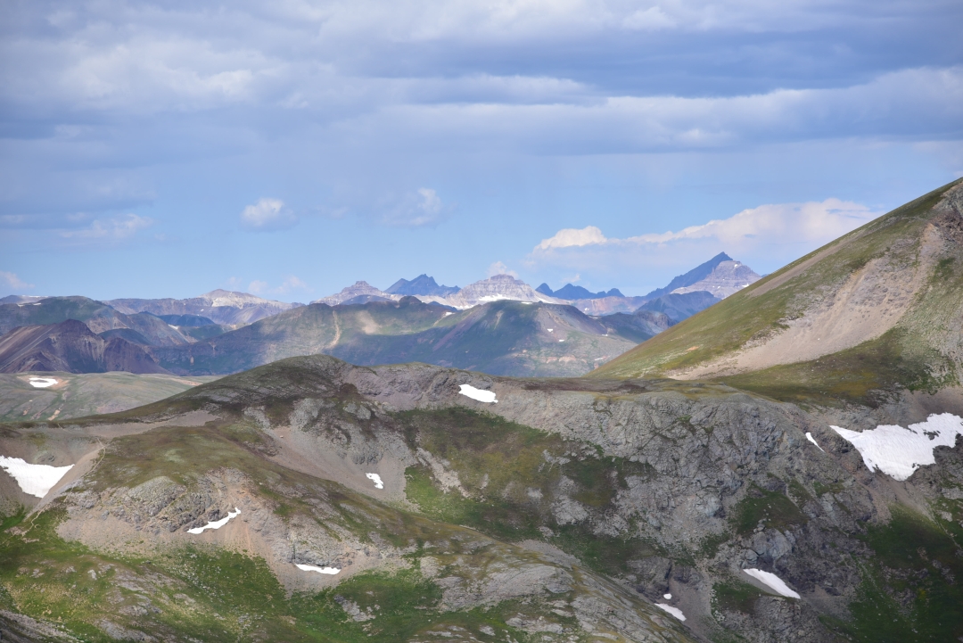
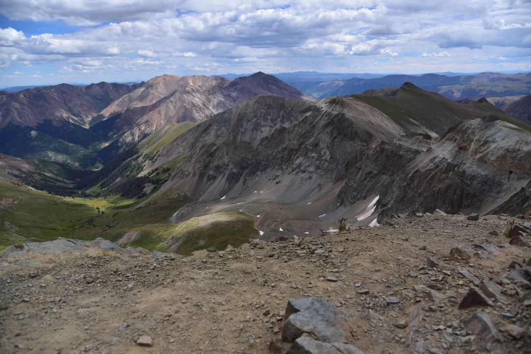
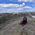
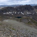
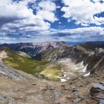
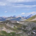
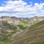
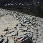
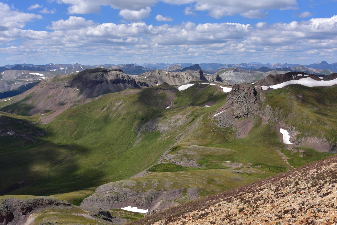
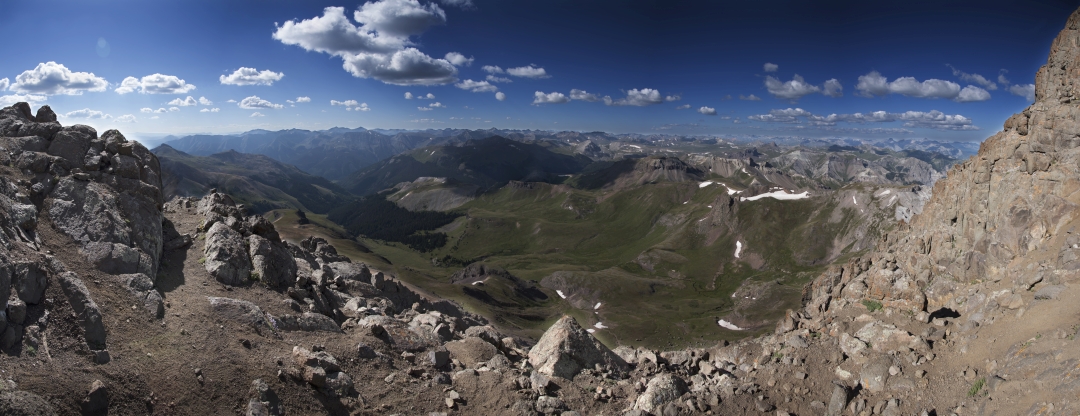
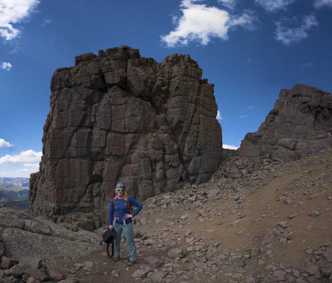
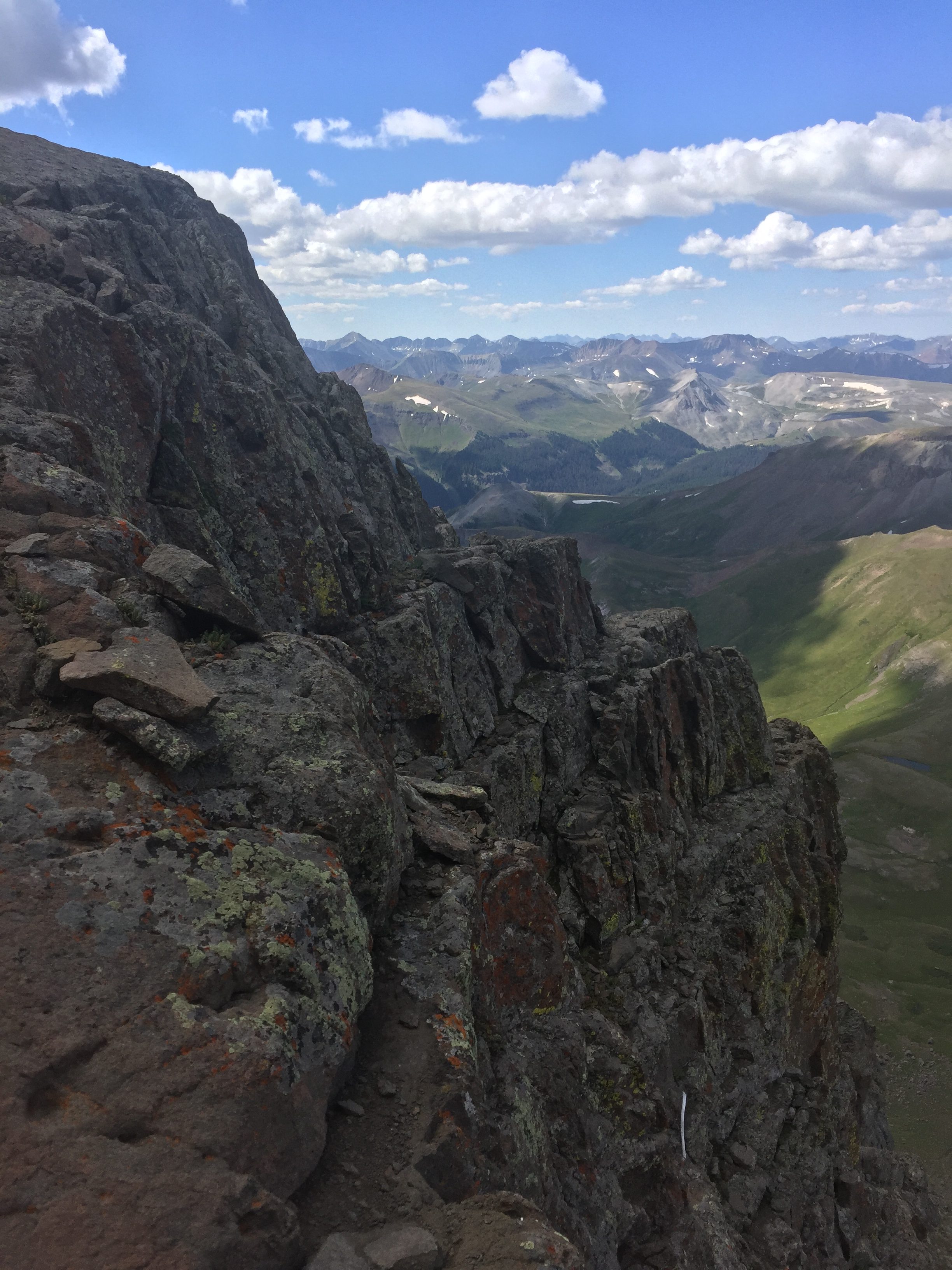
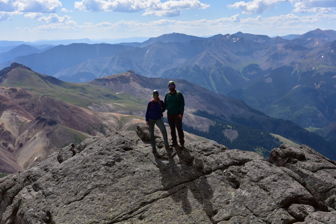
The final 900 feet (elevation gain) or so to the summit were tough. The trail turned to loose scree and dirt and was very steep. It took more energy to balance and gain elevation at the same time. Despite looking close by to us earlier, at this point, it seemed just out of reach with each additional step. At around 9:30 am, we finally topped out. The sky remained a perfect hue of blue and clear. We could see for miles in all directions. There were nice views of much of the Sawatch range including Mount Antero and Mount Yale and to our east we could see all of Buena Vista below. We took reprieve from the sudden gusts of wind in one of several rock shelters built on the summit for around half an hour. Seen below are photos from the Summit.

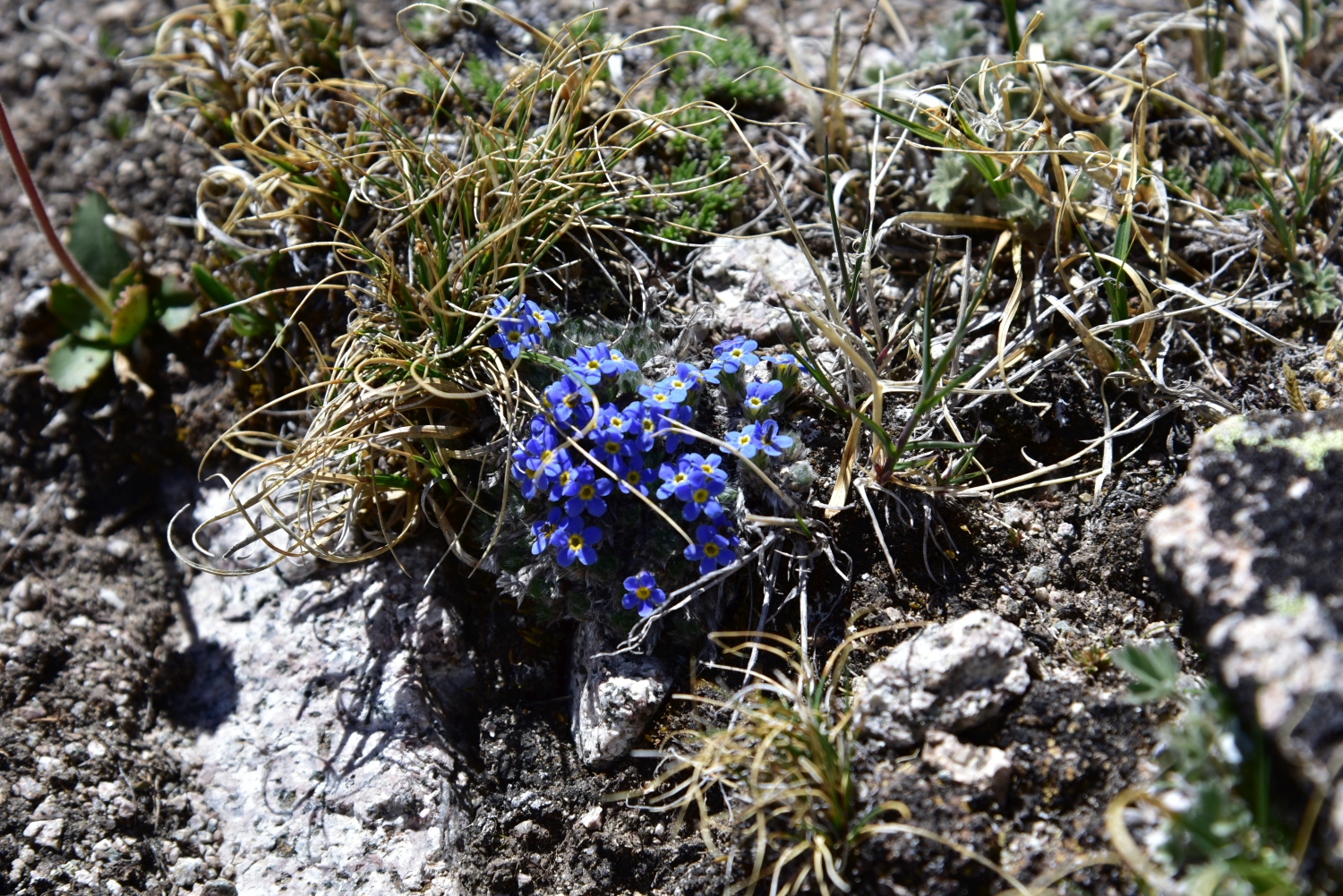
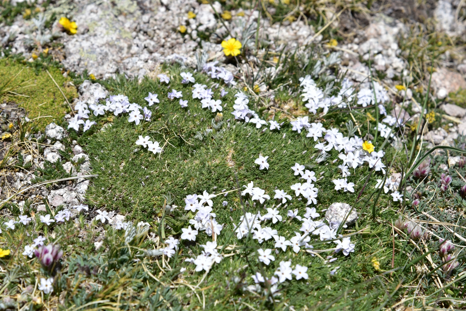
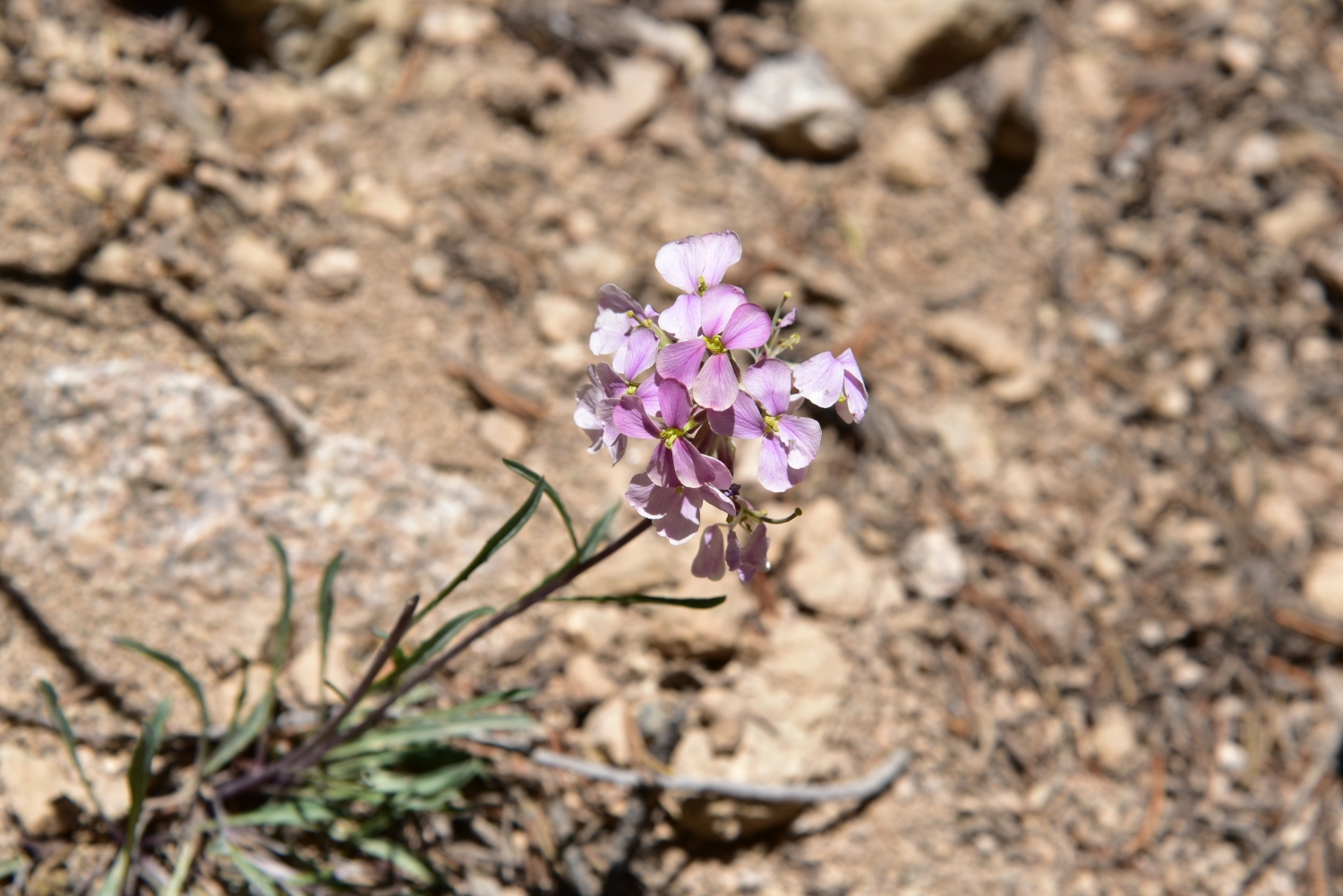
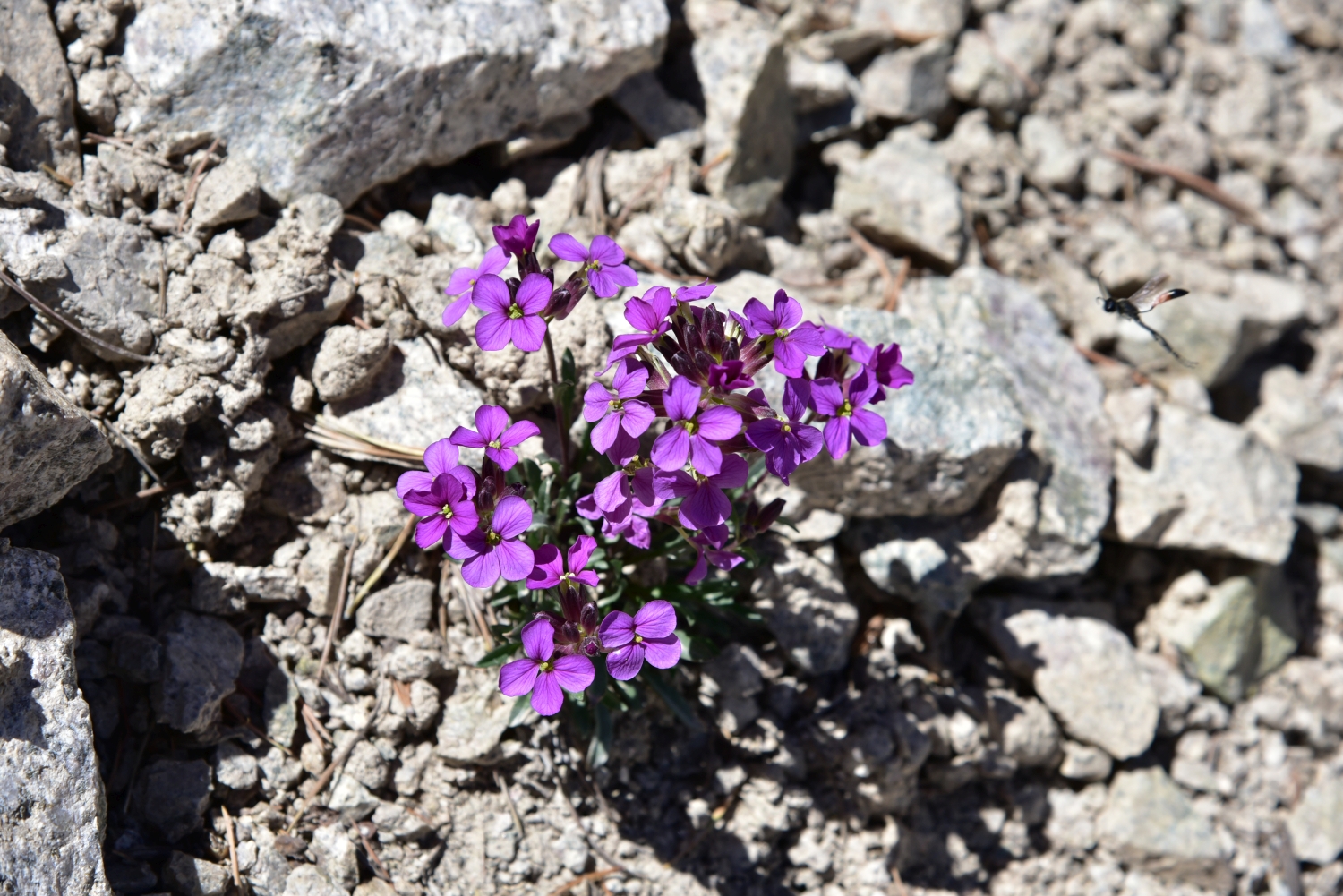
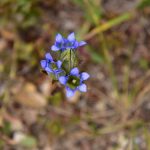
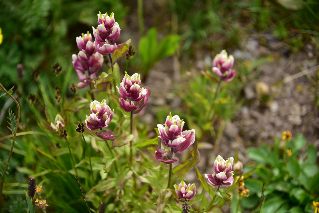
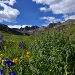
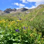
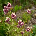
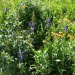
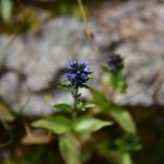
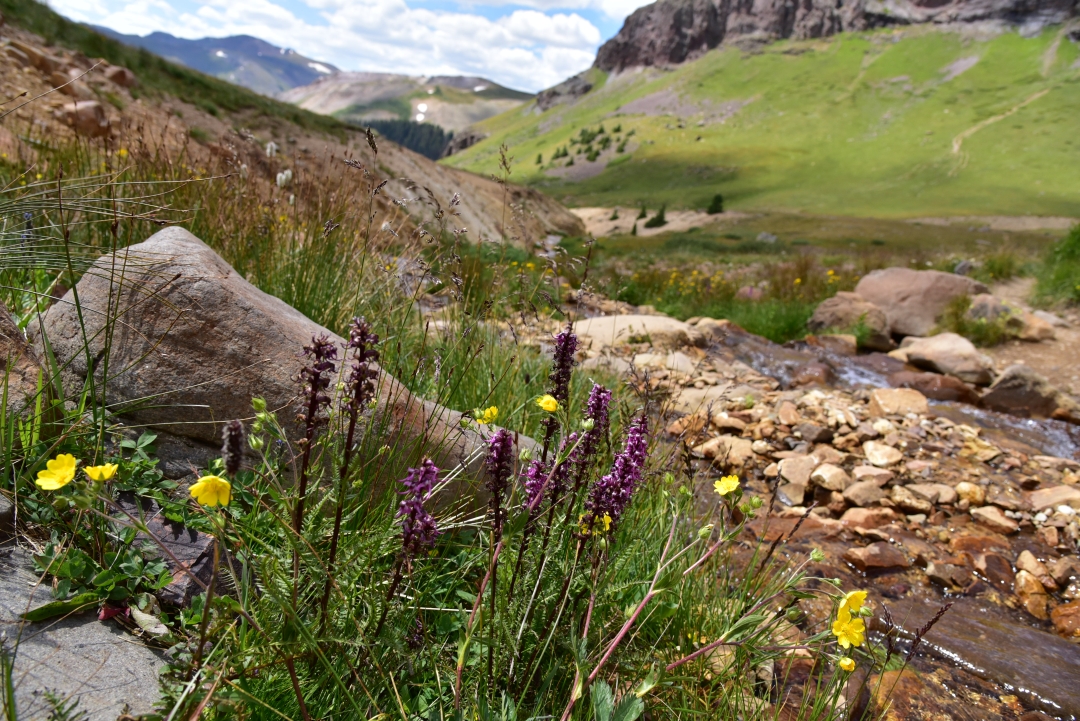
Interestingly, the descent from Princeton’s summit was not as fast as normal. The loose dirt and scree and series of boulder hopping across the gullies made for slow going for most of the journey back to the road. We took our time and ensured good footing, and also admired much of the alpine flora. It’s always amazing to see the brilliant display of flowers that manage to survive the harsh conditions of this environment. Seen below are a view of the many varieties that dotted the grassy slopes and the crevices between rocks on our descent.
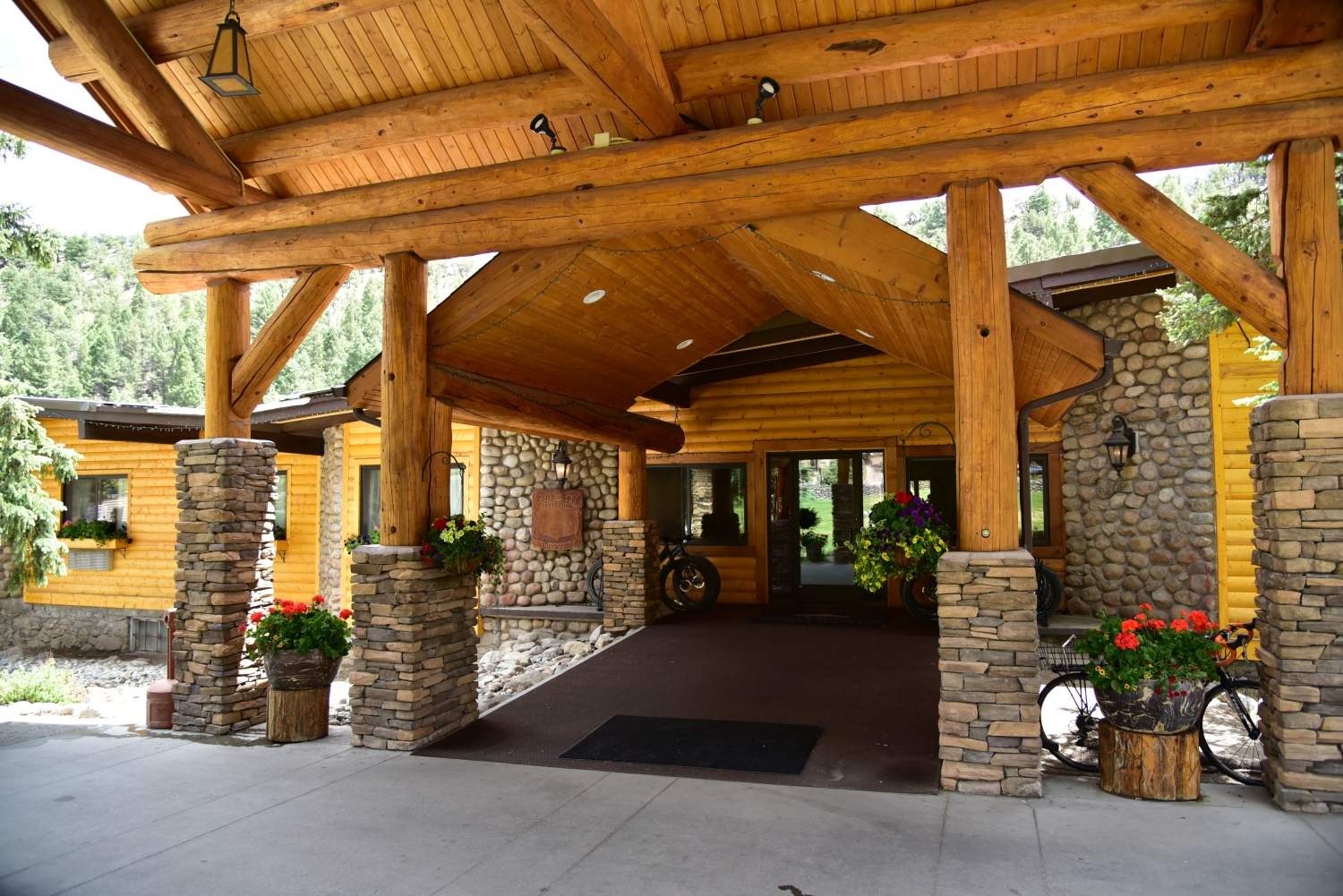
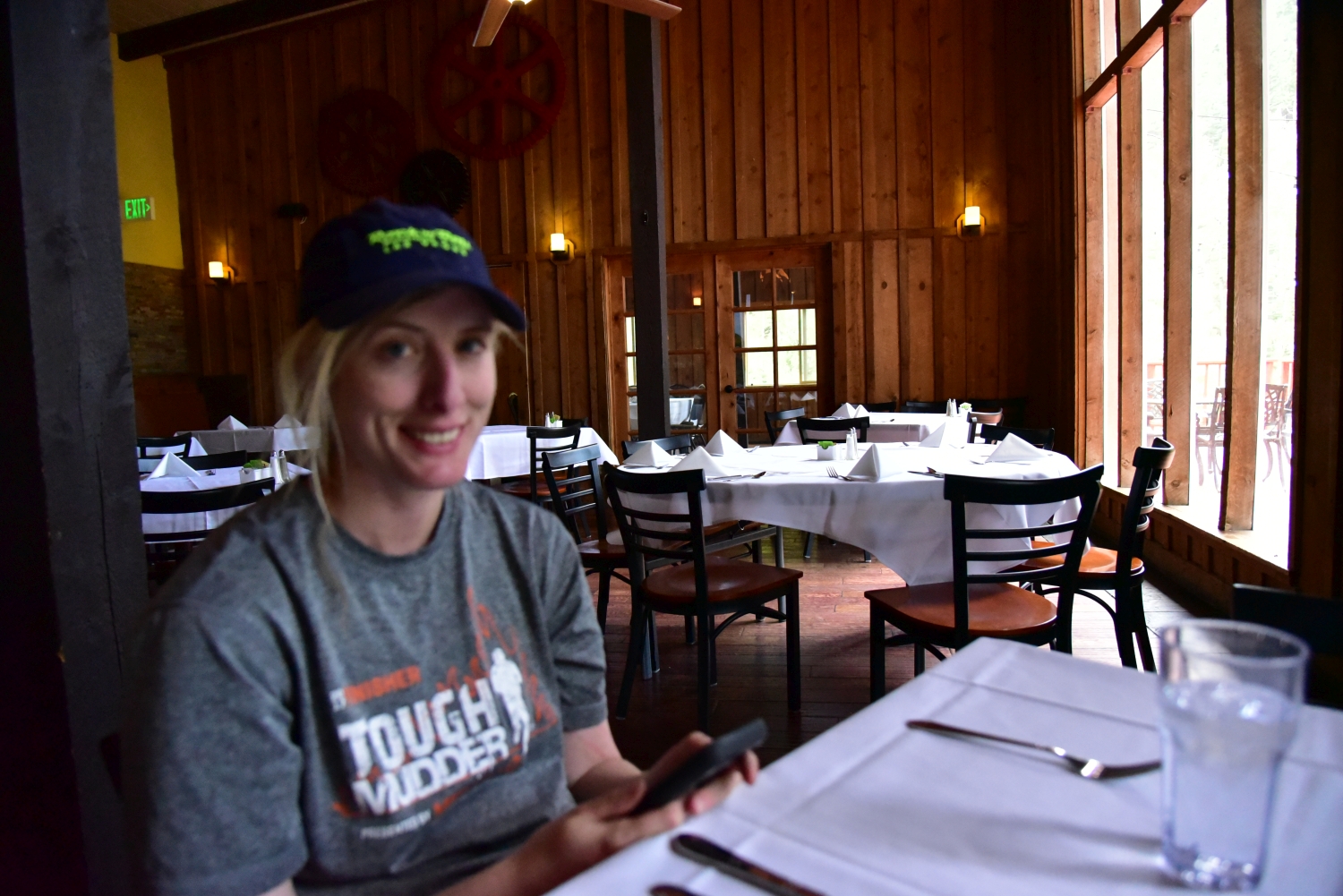
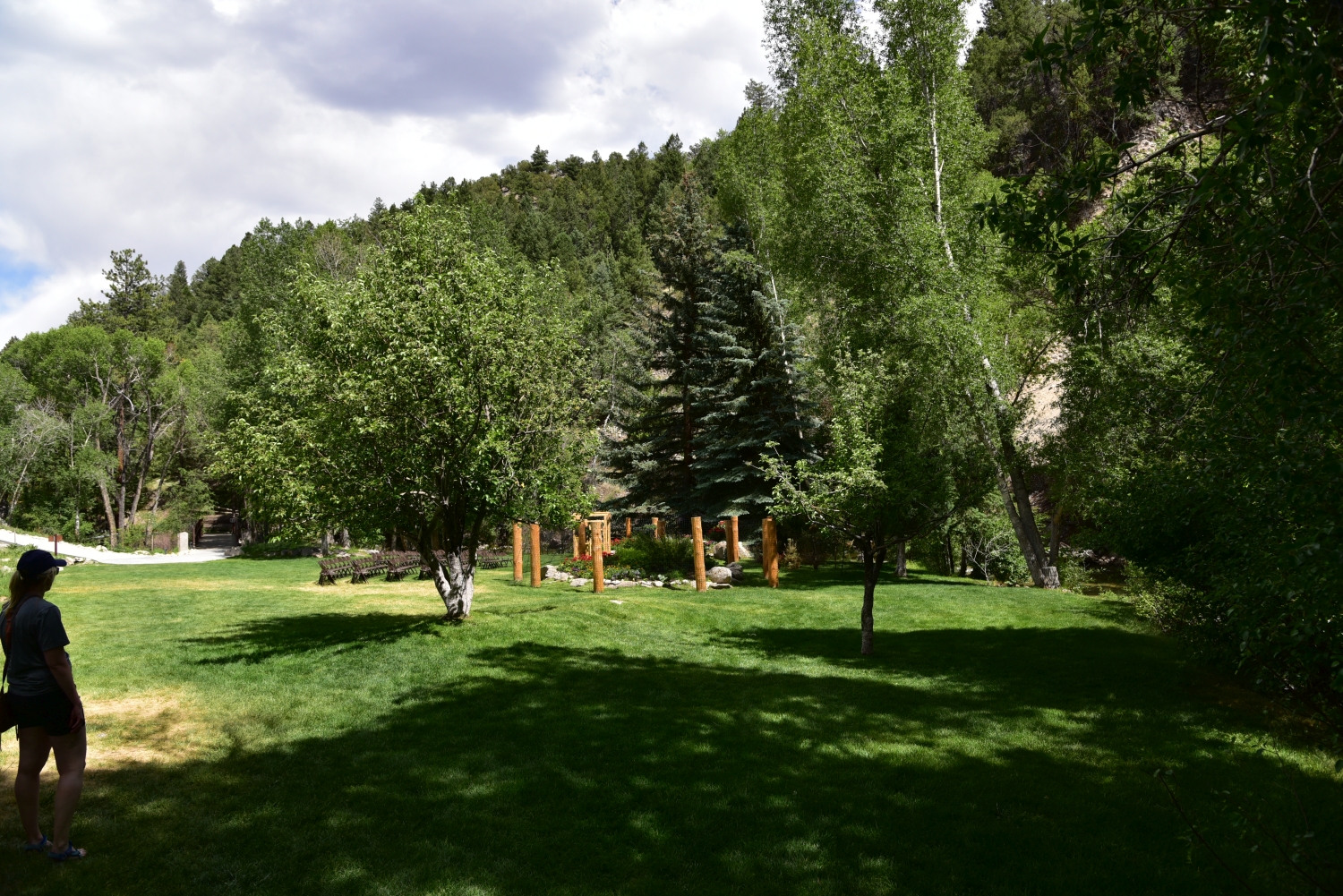
We reached our camp around 12:30-1:00, roughly 6 hours after we began. Though this hike can be done much faster, we took our time with footing and let ourselves adjust to the workload at high altitude since we haven’t been to 14,000 feet in a while. As we drove back down the 4WD road to the lower parking lot we had the road to ourselves, which was very nice. We stopped by the Mt. Princeton Hot Springs Resort — only a few miles from the trailhead — and had a nice lunch. It was far too hot to want to soak in hot springs for us, but we did walk the grounds, and we want to come back when the weather is cooler.


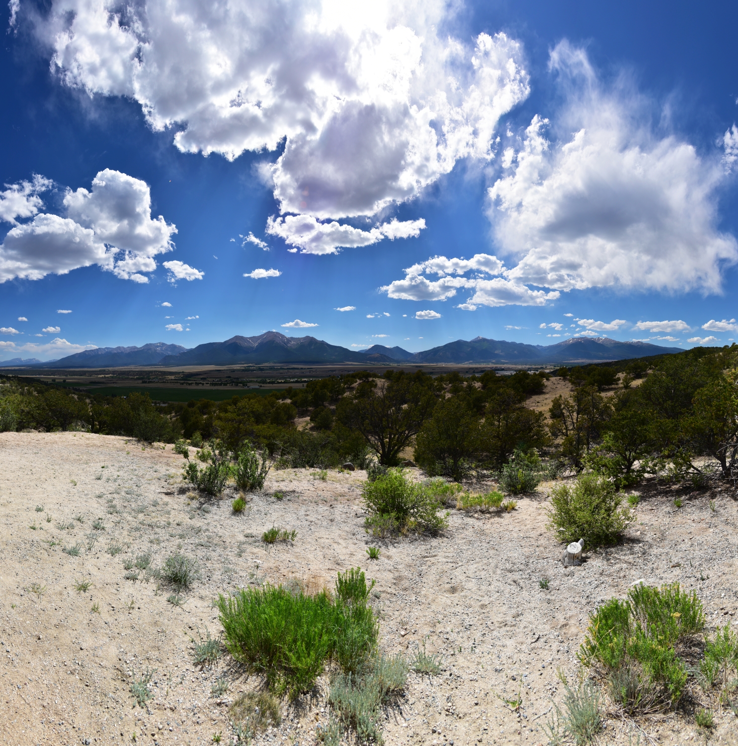
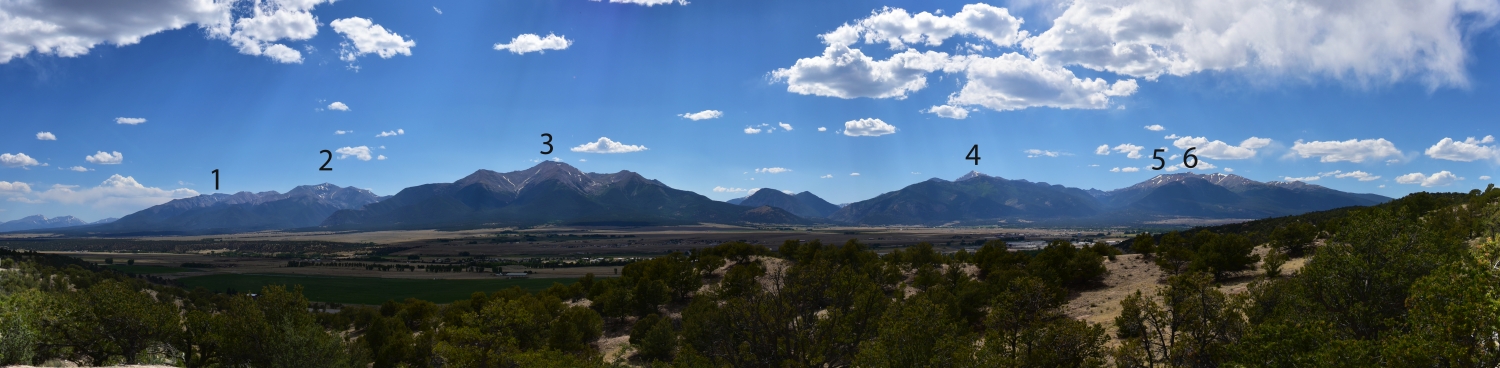
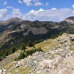
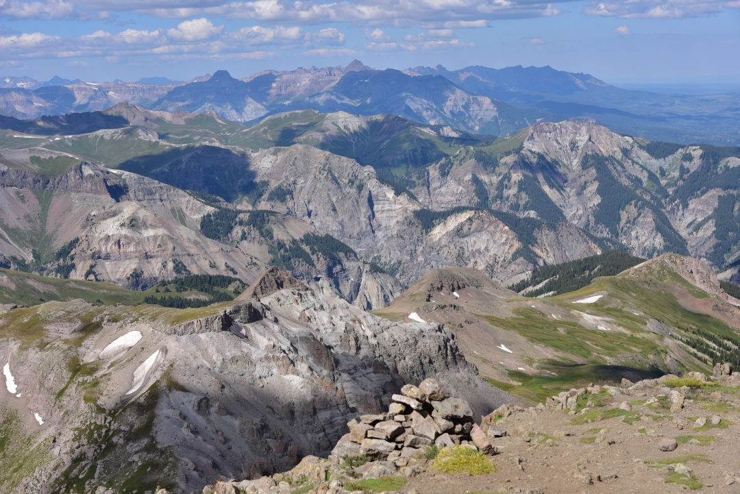
It was a quick drive back to highway 285 and as we passed Johnson Village we stopped briefly to look back at what we had just done. Even from miles away, Mt. Princeton stood prominently over the entire range. We could make out the trail to the summit and see the small snow field we crossed. Shavano, Antero, Princeton, Yale, Columbia, and Harvard were all in view (see below). It was a humbling end to a great trip and we look forward to coming back for more adventures.
Mount Yale Sawatch Range, 14,196 feet
It’s currently October 9th and already a fresh blanket of snow has fallen on the front range. Though not the typical dry fluffy snow of later in the season, the wet slushy puddles have definitely reminded us that the warm summer months are gone. As such, we reflect back on our last snow-free 14er of the season, Mount Yale which we climbed exactly one month ago from today. Mount Yale is another one of the gentle Sawatch Range giants nestled in the Collegiate Peaks just west of the Buena Vista. When we say gentle, we simply mean a lack of technicality to the climb. In no means was the peak gentle in distance and elevation gain. The trailhead to the peak is located just right off of Cottonwood Pass. A short 12 mile or so drive on a smooth paved road leads to a smooth paved parking lot and easy access to adventure. Nonetheless, the long distance of TH from the Denver metro area required an overnight camp in the nearby Collegiate Peaks Campground. Despite sleep deprivation and a large workload in the days proceeding, we shrugged off our exhaustion, drove to our destination, and set up camp just before the sun set. The moon remained bright this night. Once our eyes adjusted to the darkness of the night, we could actually see quite well. We hunkered down for what we thought would be a cold night, but to our surprise, the early fall weather did not make us suffer. Even at over 9,000 feet, temperatures did not drop below 48 or 49 degrees F. Throughout the night, there was the occassional rustle of the leaves and perhaps a mouse or two seeking shelter near our tent, but otherwise relatively quiet. When the sun rose, we reluctantly crawled out of our shelter and drove the half mile down the road to the TH.
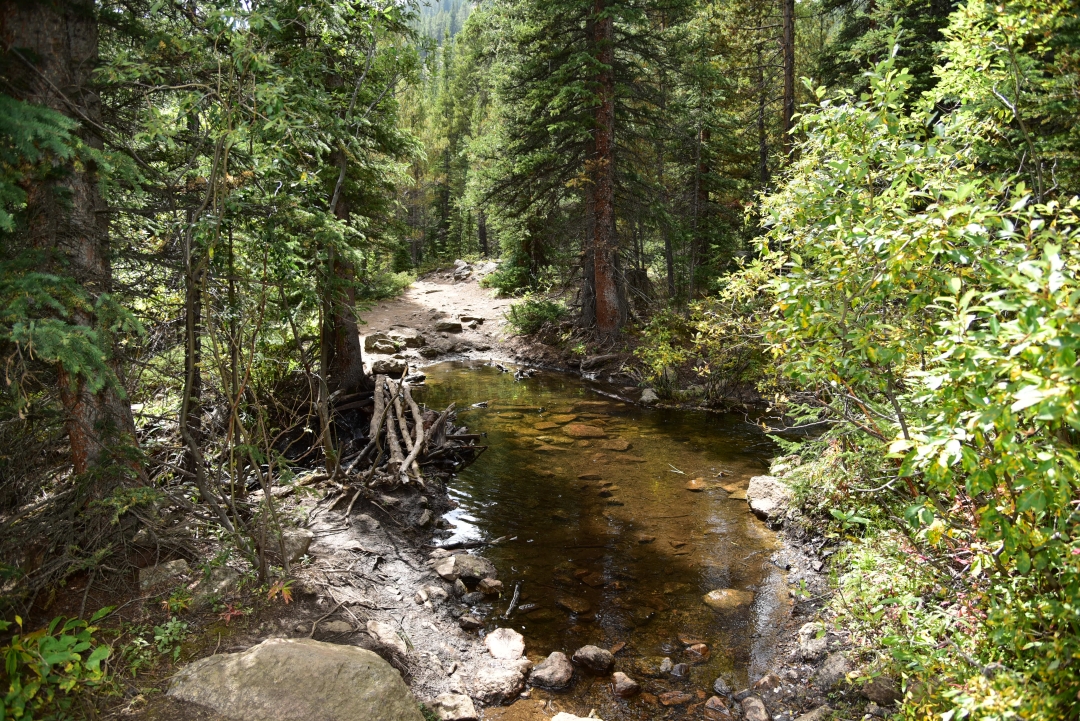
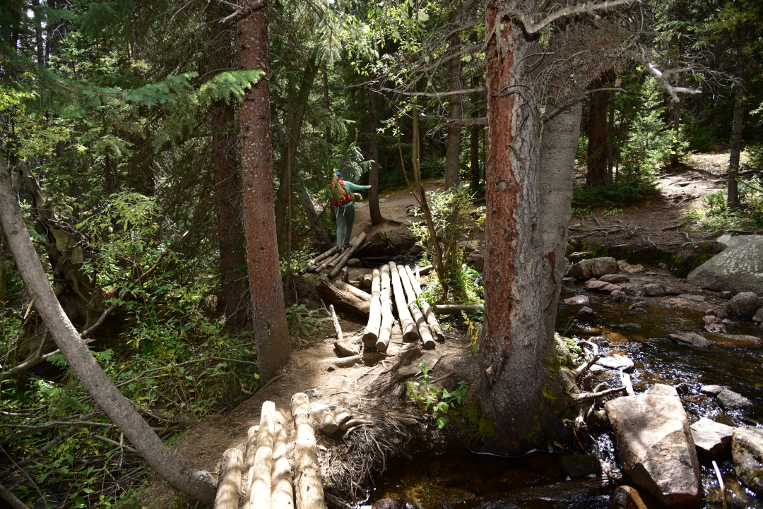
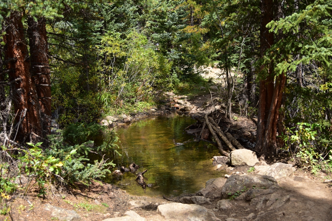
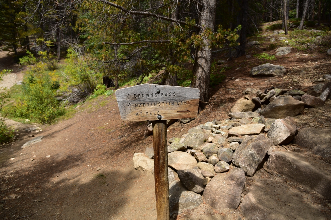
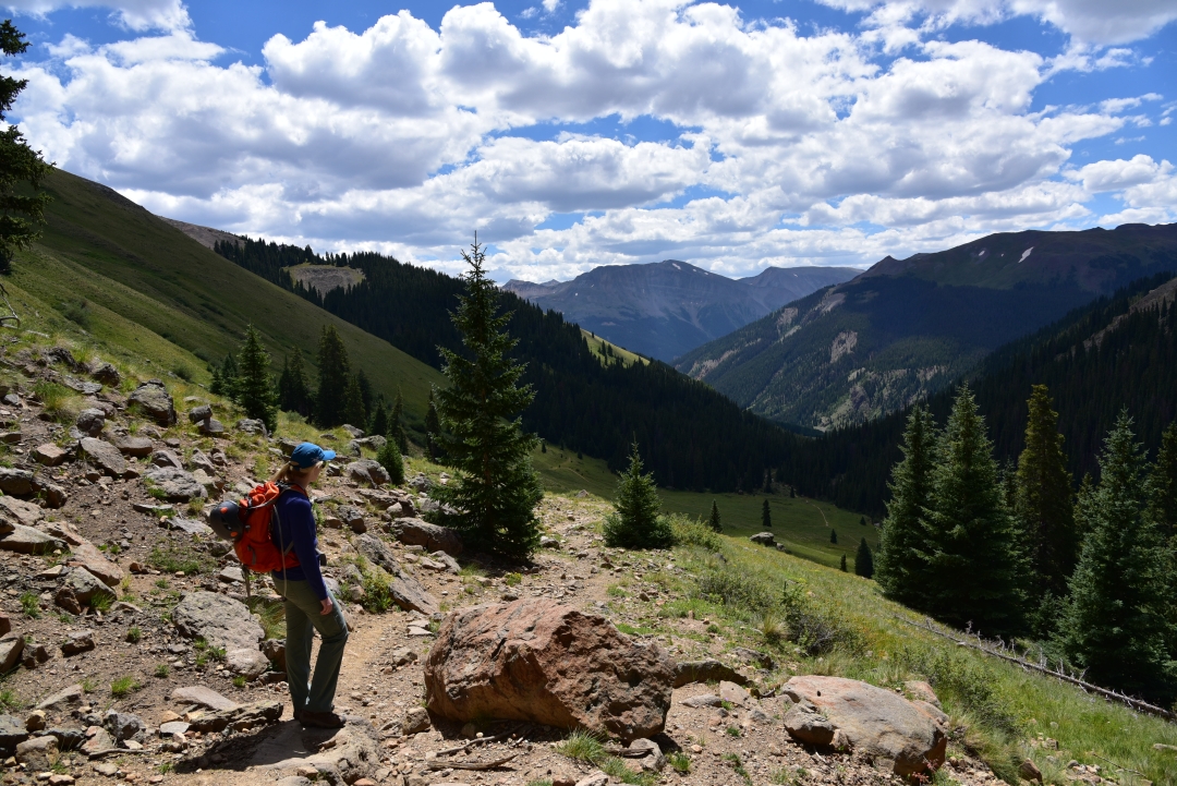
Though not completely full at 6:30 in the morning, the parking lot did have several other hikers prepping for their summit attempts. September truly can be one of the most spectacular times of year to hike and climb in Colorado. The crowds near popular THs are reduced, the fall foliage exudes color in every direction and the crispness in the air puts a bit of urgency in the step. Thunderstorms are less common, but snow and ice are known to commonly appear, particularly when one is close to the summit enjoying lunch or any other such activities. We started the climb about 7:00 am. The initial grade of the trail was mild and enjoyable. The aspen and lodgepole pine forest provided a cool canopy. The sounds of the Delaney Creek could be heard as we wove through the forest. About a mile into our hike, we crossed the creek over a log bridge (the first of many crossings it would seem). Shortly after we reached a trail junction. Head left for Browns Pass/Hartenstein Lake and right for Mt. Yale. Seen below are photos from the beginning our our hike.
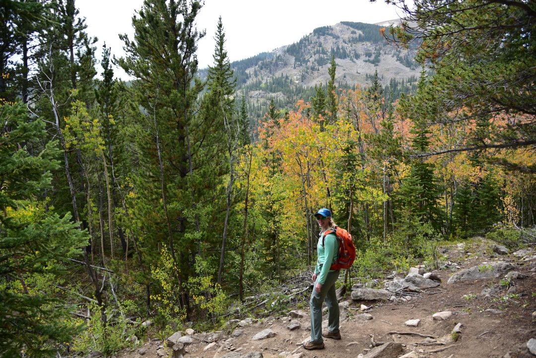
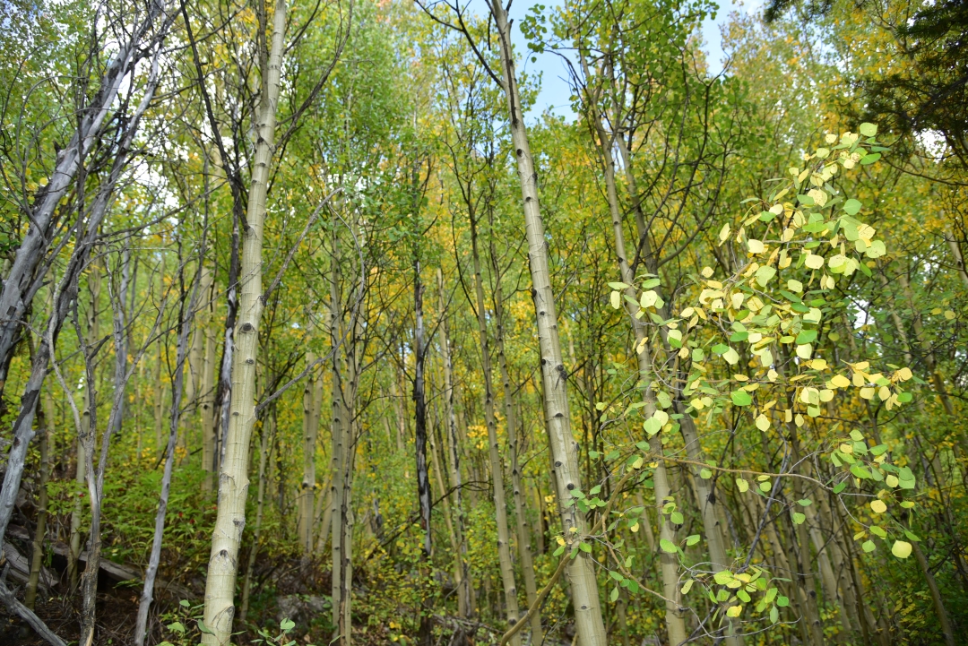
There were several flat areas of the initial portion of the hike which had us a bit concerned for the work load that was ahead. Just as we began to think we might actually be getting off easy, we reached a series of brutal switchbacks near 11,200 feet. We followed the steep trail up the hillside through more and more trees and thought that we would never reach treeline. Several hiking parties were passed during this time, and we kept our quick pace if only to avoid the constant leap frogging that can occur when sharing the trail. Everything was still so green and beautiful on this great trail. Seen below are photographs before we completely left the trees and green vegetation above 12,000 feet.
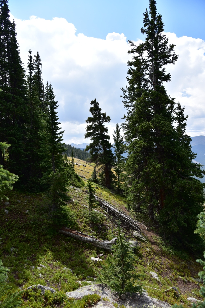
Aftering leaving the trees, we headed northeast toward Yale’s upper west slopes. Much of the remaining route was visible to us now. We followed a gentle trail on the shoulder of the mountain for a while soaking in the surrounding grandeur. A large boulder provided a brief break, as we snacked on a childhood favorite, pop-tarts. The gas station attendent the previous night had given us a hard time for our purchase of pop-tarts and barbeque potatoe chips. It was perfect on the mountainside this day. Near 13, 200 feet, a steep trail greeted us. We had nearly 800 feet to climb up in a very short distance to reach the ridge and final section to the summit. Nearly everyone we saw heading up this portion appeared to be on the struggle bus. It was a tough bit of work and the spot in which our exhaustion from the previous week began to really show. Seen below are photos of the shoulder of the mountain and struggle up the ridge.

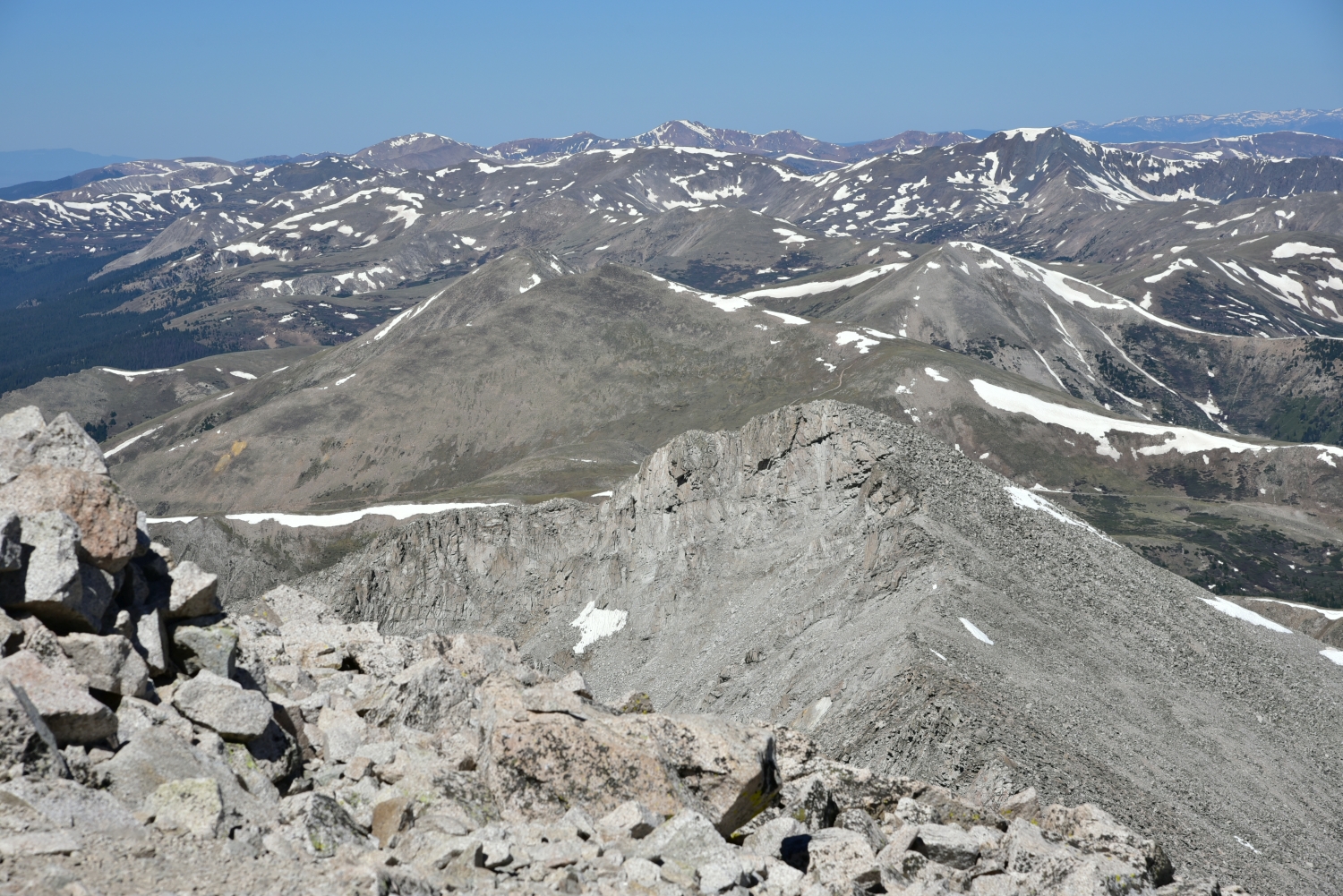
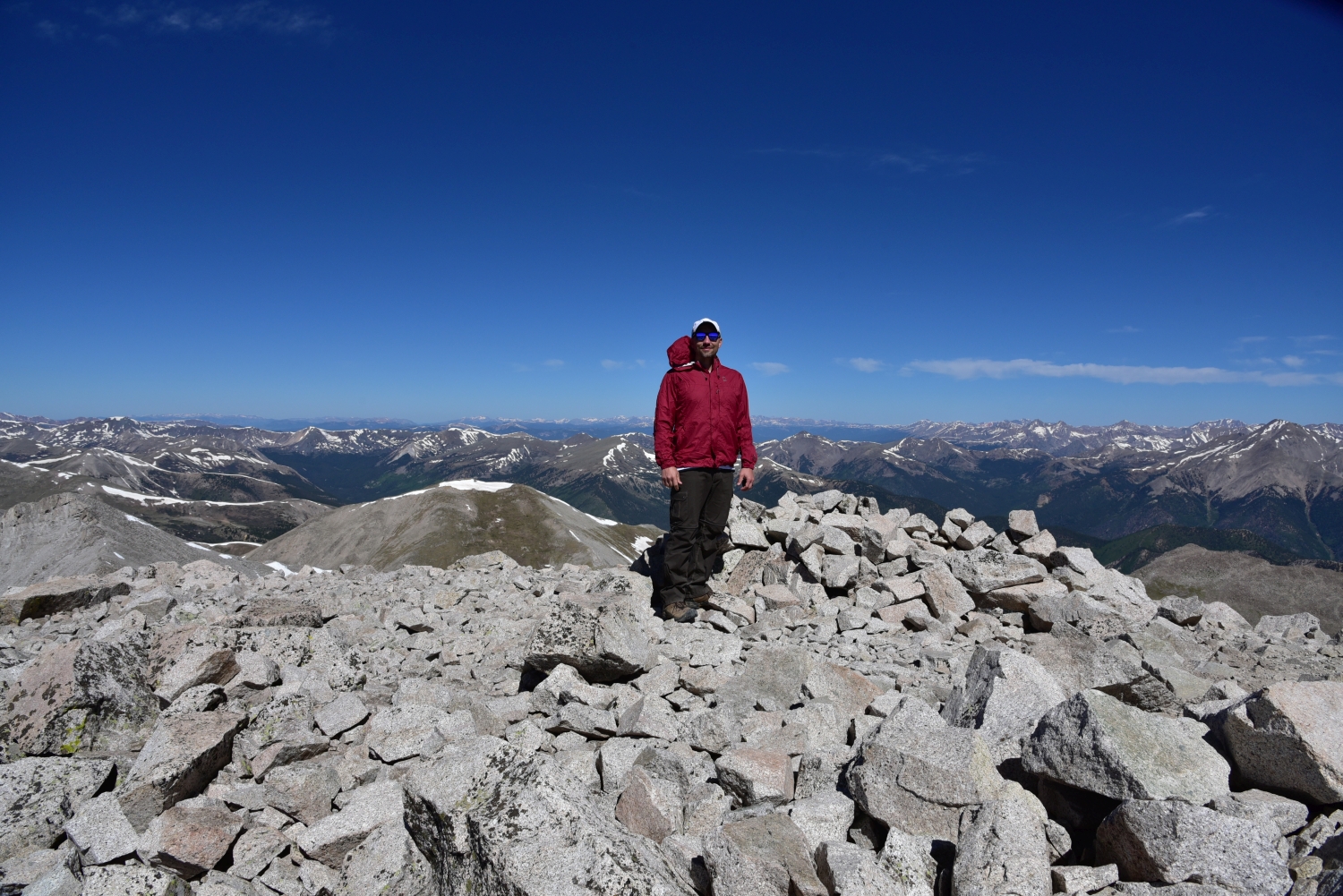
Once on the ridge, the trail to the summit disappears. There is several class 2 rock to navigate, and many places where the route can venture into difficult class 2 if chosen. It was much more fun and interesting than the rest of the hike, and we forgot for a while that we were tired and almost at 14,000 feet. We scrambled gleefully along the ridgecrest, primarily sticking to the right side. Several cairns were placed along the route to provide gentle guidance. They led the correct way for the most part. It only took about 15 minutes to reach the summit once we were on the ridgecrest. The summit is not really the most comfortable summit compared to the rest of the 14er tops we have visited. Jagged rocks protrude everywhere. Several other hiking parties were on the summit or got there shortly after us, and navigating around the rock was even more difficult dodging other people. We took a few photos, but spent very little time here. The clouds that were building caused a big drop in the temperature, and we needed to get moving.


As we carefully downclimbed the ridgecrest, the sleet began. It was cold and sharp to the skin, but was not heavy enough to affect our visibility. We were very thankful for this rather than a thunderstorm. Nonetheless, we moved very quickly because we still weren’t sure that a thunderstorm wouldn’t also move this way. As we reached treeline, the weather cleared for a while. Once again we were greeted with endless blue skies and greenery. On the way down, we stopped next to a hidden creek and small waterfall for lunch which consisted of bbq chips and chicken jerky. The trail seemed longer on the way down than on the way up as it always seems to. With about 1.5 miles left in the journey, it began to rain. For the first time in the life of our hiking packs, we were able to utilize our cool pack rain covers. Sometimes it’s the little things in life like the joy of using a neat feature on a day pack or the feel of the grip of hiking boots on smooth granite that add to our great experience in the backcountry. In the distance, we heard thunder and hoped that all the people continuing up the peak were okay. Shortly thereafter, we reached the truck. In total we hiked/climbed approximately 9.5 miles and gained a total of 4,300 feet. The Sawatch Range has 15 named/ranked peaks above 14,000 feet. After our summit of Mount Yale, we have now climbed 9 of them. While Yale wasn’t our favorite of this range (Mount of the Holy Cross is hard to beat here), it was certainly beautiful and well worth the journey. Seen below is a gallery highlighting the rest of the day and hike.


Handies Peak, San Juan Range (14,048 ft)
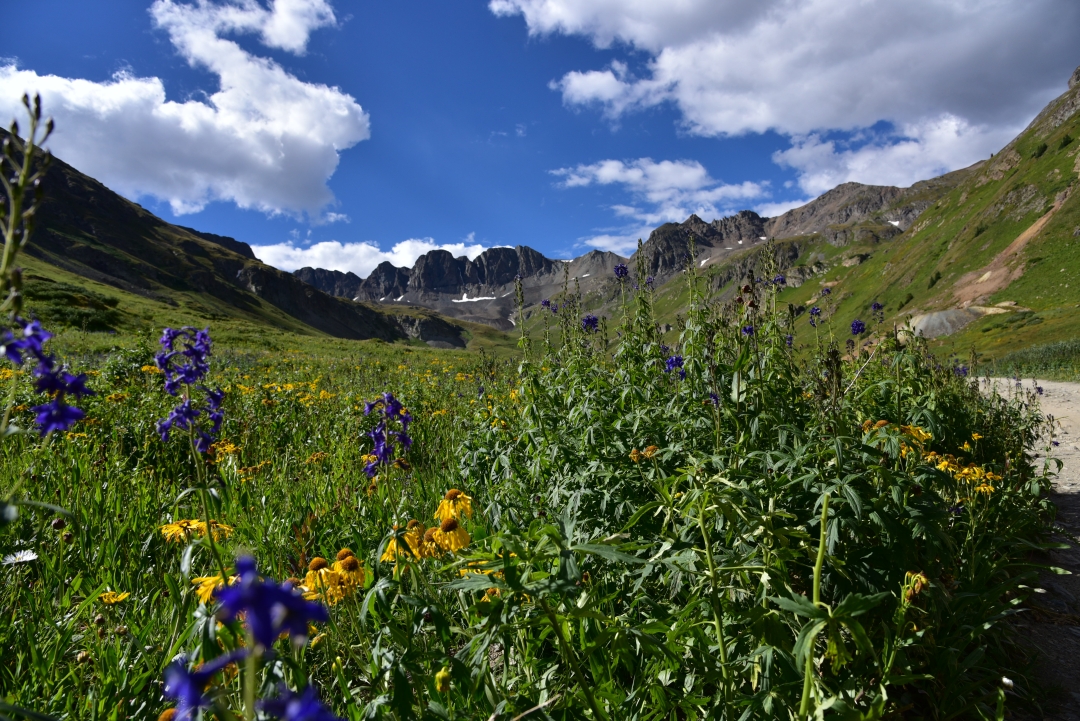
As part of our trip to Lake City in late August, we also reached the summit of 14er Handies Peak via the stunning American Basin. This time, we opted to leave a bit later in the morning in our summit attempt, as the route up Handies via American Basin is a much shorter, class I jaunt. Plus, our exciting class III scramble up Wetterhorn the previous day had left us a little bit exhausted. We left our Cabin in the light of morning this time, and set out on the Scenic Alpine loop to reach the trailhead. Per the detailed instructions on 14ers.com, we followed the road past San Cristibol Lake and then took the fork towards Cinnamon Pass. We had no idea that the adventure was going to actually start there, up that steep rocky road. We quickly gained elevation when the road forked. Dirt-bikes and ATVs flew past us, seemingly unnerved. If our ride were a bit smaller, I’m sure our confidence would have been just as high, but we were in the X-terra. As the elevation gain ceased, we realized that we were on a narrow, shelf road. Thankfully our current direction of travel allowed us to hug the side of the cliff, but the sheer drop offs on the left still left us tense. We prayed that another car would not turn the blind corners during this stretch. After a mile or so of intense sketchiness, the 4WD became more tame. Our truck now easily bumped along, passing the RedCloud and Sunshine 14er THs before getting closer to American Basin. We continued along this easier portion of the road for another 9 miles or so until the road forked to Cinnamon Pass on the right, and American Basin on the left. The truck took us about halfway to the upper 4Wd parking lot. At this point, we were incredibly anxious to get out of the vehicle. The magnitude of American Basin’s beauty mesmerized us, and we wanted to hike in this spectacular place as soon as possible.
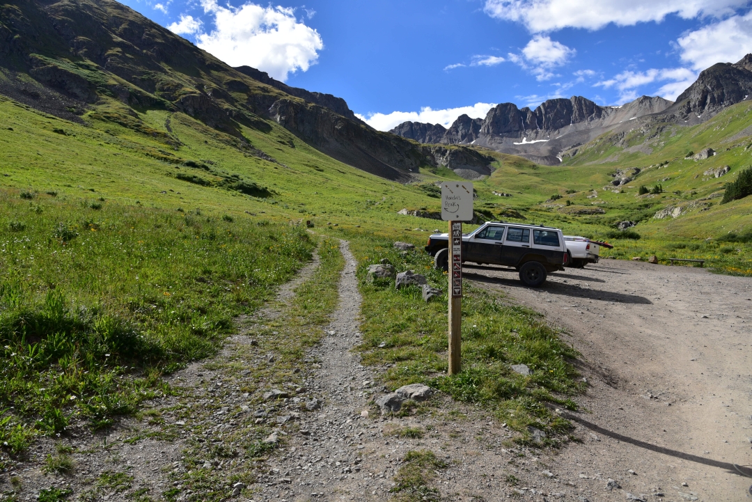

Even though it was late August, there was still a number of wildflowers in bloom in every color imaginable. We soaked in all the brilliant colors, as we hiked about half a mile to the upper parking lot and official start of the trail. From here, the total elevation gain is only 2,500 feet in a round trip of 5.5 miles. The trail steadily gains elevation here among throngs of flowers, almost as tall as we are. Looking ahead, we were provided impressive views of the jagged ridgeline in this glacial carved basin. The incredible scenery was enjoyed in almost solitude. Despite, it being a Saturday on an easier 14er, the trail was generally empty.
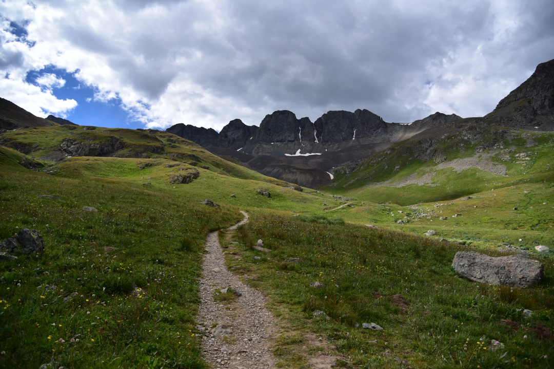

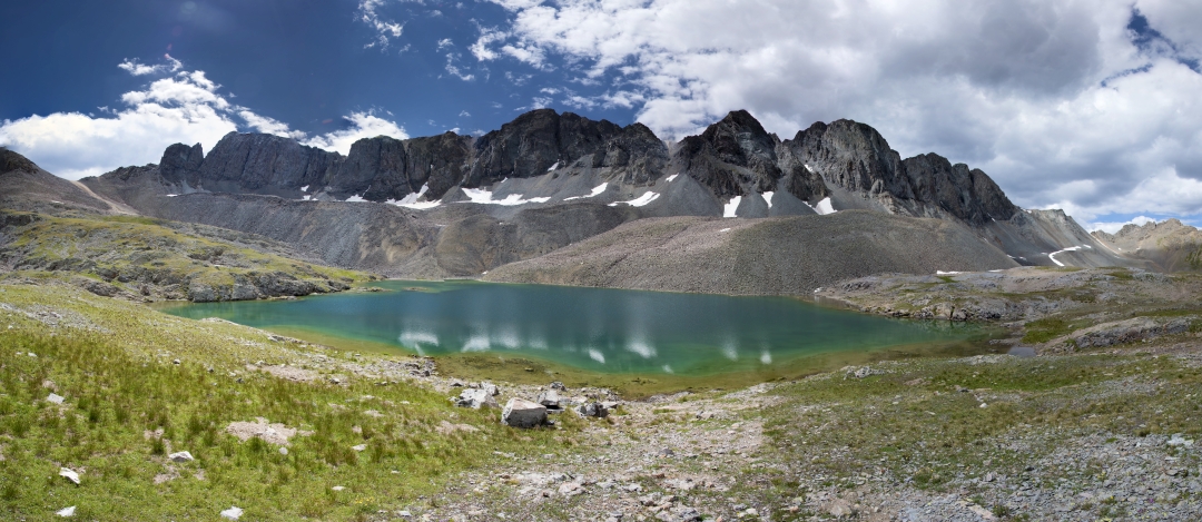
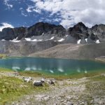
Aside from the outstanding beauty from the very second you reach American Basin, the first spectacular objective to see on this hike is Sloan Lake. After just 1.5 miles, a short social trail appears on the right that leads to the banks of this alpine wonder. We took a quick break at the banks of the deep, dark blue water to eat a snack and relax. This is truly, one of the most amazing places in Colorado we have ever been. All of the views were so dramatic. Standing on the banks of the dark expansive pool, we felt so small. The jagged granite towered above us. It was time to continue to the summit. Most of the remaining route was visible now, in the form of a faint line of switch backs drawn across the side the mountain. On other days, this would have been an easy ascent, but our legs were heavy from Wetterhorn. The remaining route felt physically hard, even though this is considered one of the easiest 14ers in Colorado.
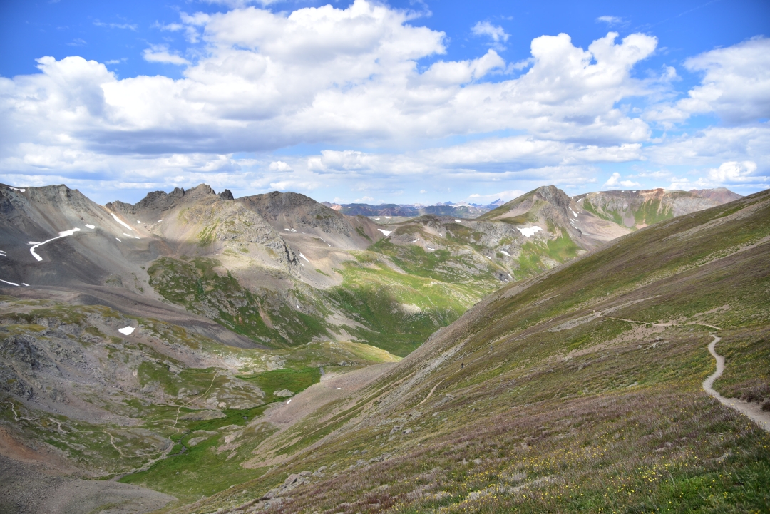
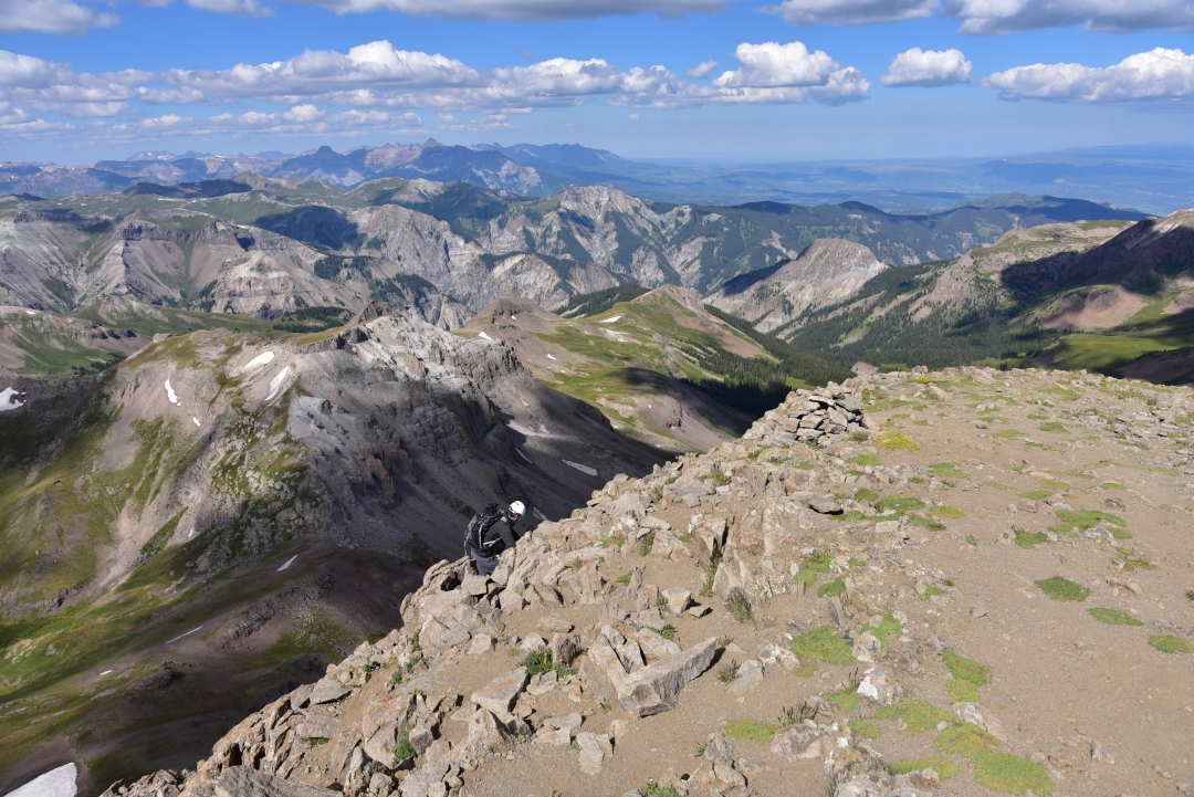
The higher we climbed, the looser the trail became. The final push to the summit was very steep and full of scree just waiting for us to make a mistake and slip. The lack of available oxygen to breathe was more apparent today than the previous day. Never did we anticipate that reaching such an easy summit would bring us such joy. We could now rest our legs for a while and soak in all the beauty. We shared this popular summit with just two other hikers for a few minutes in the late morning, and even had it to ourselves for a bit. The panoramic view from the summit included the Grenadiers and Needles Mountains to the Southwest and Wetterhorn and Uncompahgre Peaks to the North. Seen below are photos from the top of Handies.
Rained looked inevitable, so we decided it was time to descend. The climb down was a bit difficult until the scree mellowed out closer to Sloan Lake. Once to the lake, we made quick work of the hike back to the car. When we reached the upper 4WD parking lot, we realized the rain clouds were just teasing us. The sky once again returned to a perfect blue, a perfect accent to the emerald green expanse of the valley below. When we reached our truck, a group of fellow hikers were nearby and offered us some of their watermelon, which turned out to be probably the tastiest watermelon we have ever had the opportunity to eat. There is nothing quite as satisfying as the crisp, coldness of this sweet fruit after 7,000 feet of elevation gain in two days. Though it was tempting to stay in the beautiful basin for longer, we needed to start the long 20 miles back to Lake City. We still had the scary shelf road to travel on before we could breathe a sigh of relief and feel truly accomplished. To our surprise, the road was much more crowded in the early afternoon. Several ATVs and other vehicles shared the road with us. As expected, the shelf road was intense, though not as bad as it seemed on the way up in the morning. There is some benefit to knowing what to expect to help ease the nerves. In fact, we even filmed it this time which can be viewed via this link. We reached Lake City in time for a delicious dinner at none other than the Cannibal Grill and Packer Saloon. (we got salad and pasta…). Another outstanding day in the San Juan mountains was complete.


Wetterhorn Peak, San Juan Range (14,015 ft)
On August 17th of last week, we decided to climb Wetterhorn peak. You might be thinking…”you went to Switzerland!?” But, no in fact, we made a relatively easy 5 hour drive to the San Juan Range of Colorado and set up “camp” in Lake City, Colorado. The 14er Wetterhorn in Colorado is named after its European counterpart in the Bernese Alps. Members of the 1874 Hayden Geological Survey recognized similarities between the distinctive summits of these peaks. Though more photographed, Swiss Wetterhorn only reaches 12,000 feet compared to our Wetterhorn at just over 14,000 feet. Our peak is is probably less photographed due to the relatively hidden nature of our peak in the rugged San Juans.
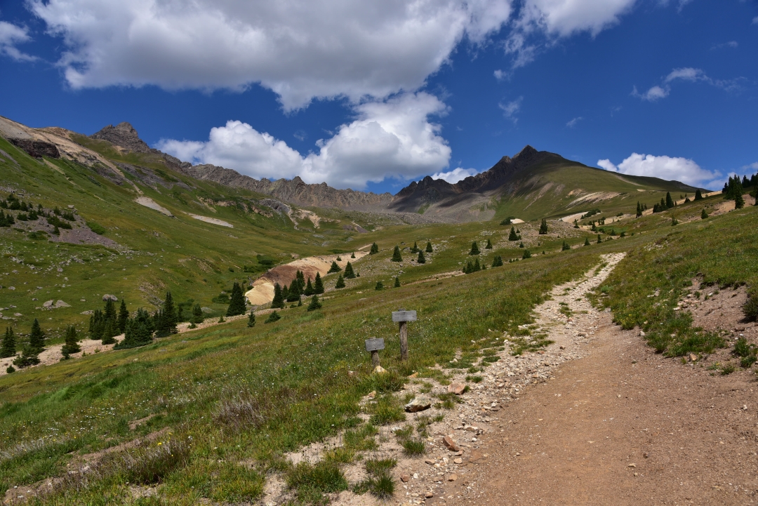
We say “camp” loosely as we stayed comfortable and dry in the Cannibal Cabins in Lake City to get some adequate rest. We’ll get to the name later, and the town’s odd obsession with a fellow named Alfred Packer. Our alarm went off at 4:45 am, and we quickly gathered our gear in the cold, dark morning. Though warmer than outside, we failed to turn the heat on in the cabin during the night and woke up to a crisp chill as we donned our climbing clothing. We hit the alpine loop in the dark and followed the gravel road for 9 miles before turning off onto the 4-wheel drive road, North Henson Creek Rd. Thankfully, the sun began to rise once we reached this terrain. The first two miles were relatively tame, but the final 0.7 mile to the upper trailhead was rough and narrow. It should be noted that there is some parking below this final section for vehicles that don’t have enough clearance. We were just fine in a stock Xterra though careful negotiation was required in two to three sections.
We began our ascent of Wetterhorn around 6:30 am and hiked easy terrain for the first 0.75 miles or so to a junction where we went right. We passed through some trees and saw a few campsites before the trail opened up to a gentle hillside. Around 12,000 feet, we reached another junction and followed the trail left towards Wetterhorn peak. At this point, we still had the trail completely to ourselves. It was so quiet and serene in the remoteness of the San Juans.

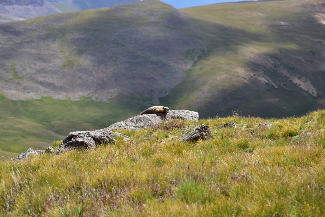
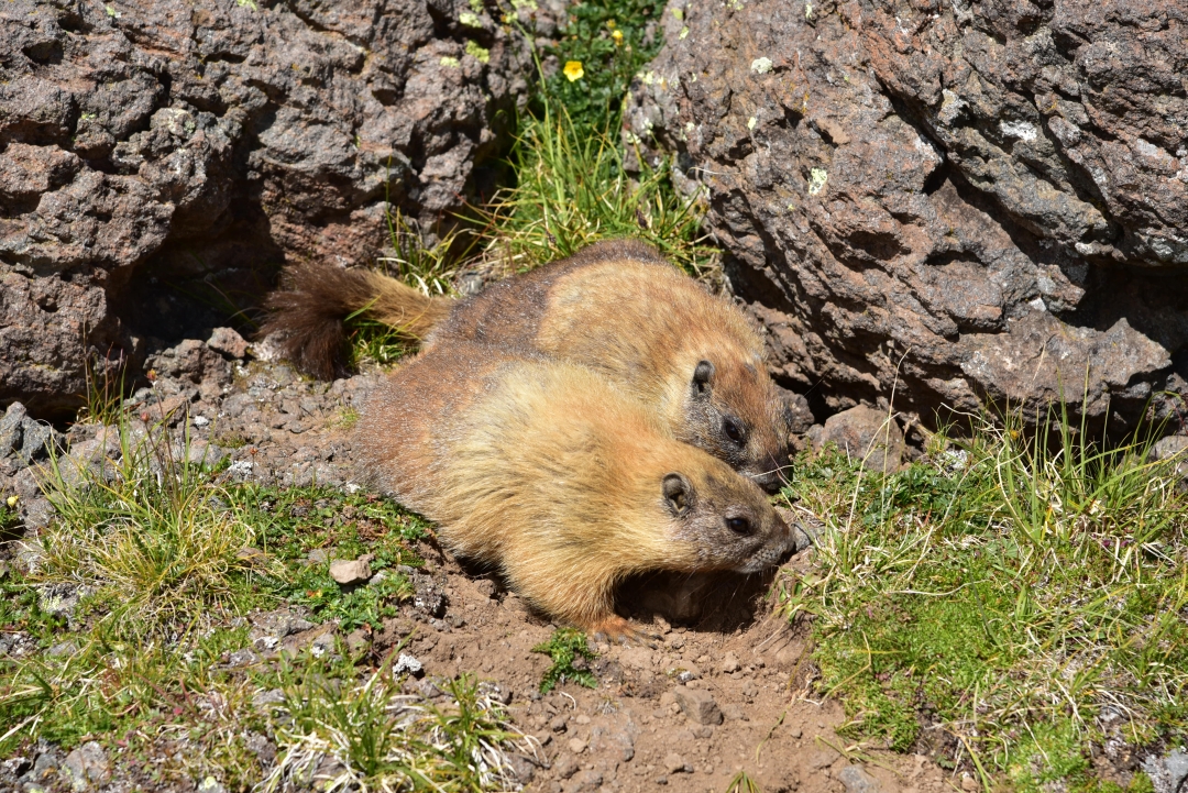
We continued to gain elevation, though it felt really gradual on this portion of the trail. As we reached a boulderfield, the terrain got a bit steeper, and the marmots began to make their presence known. They popped up amid the rocks and flora and stared us down. We also saw a chubby little Pika scurry in our path, its mouth full of a collection of various grasses. It was fun to see so much wildlife on the hike, however we were told by folks in town that these little critters (marmots) enjoy chewing the straps off of day packs and the handles off of hiking poles whenever you let your guard down. In between all the critters, we looked up and were greeted with outstanding views of our objective.

We continued upward through rocky terrain and reached the ridge to the summit and the “yellow” dirt that marks the start of the more difficult terrain. The yellow dirt was a collection of loose dirt and scree and not very enjoyable to ascend (descending it was worse). We quickly worked our way past the dirt to reach the part of the climb we had most been looking forward to: the class three terrain. Here, we were at approximately 13,200 feet and had less than a mile to the summit. We navigated the left side of the ridge on a faint, broken trail through difficult class 2 terrain before reaching our first class three climbing. We reached a “rock rib” which blocks easy passage. We climbed upward and bypassed it via a v notch on the left. It was easy, but fun climbing, and the notch was not difficult to spot, though we studied pictures of the terrain in detail before our attempt. There is also another option for bypassing this feature that we utilized on the way down. Instead of going through the v-notch, you can also climb over some rocks to reach the ridge crest. Both options were fun. Most this portion of the climb can be seen in our go-pro video as we really needed our hands and couldn’t take many photos.
Once on the ridge crest we continued towards the “prow,”. A distinctive feature of this climb, the prow is a towering fin-like rock feature that mimics the prow of a ship. On the ridge crest, we stayed as high as possible and climbed over more class 3 rock to reach the area next to the prow. There was a faint trail skirting the left side of the ridge, but the rock was loose, and the bits of path filled with scree. At 13,800 feet, we walked passed the right side of the prow. Near the prow is a flat area to rest and chill out at if one is so inclined, instead of the continuing onward to the exposed final route to the summit.

We continued past the prow to two notches leading to an open area below the summit block we can be seen above in the photo on the left. We climbed up and through this obstacle to reach a polished rock ramp slanting downward to a narrow ledge that marks the start of the over 150 foot “staircase” to the summit. The exposure here is quite intense but the rock is stable and climbing relatively easy. Essentially, it is a series of knee to thigh high ledges with plenty of solid handholds. Both of us wore helmets, as rock fall could potentially be a hazard from climbers above. Seen below is the ramp leading to the most exciting part of the climb and the exposure looking back behind it once you have reached the ledge to start the climb.
Our video we made of this hike begins here at “the Prow.” Check it out below!
About halfway up, the crux of the route mimics an amphitheater with several wider ledges in an arc shape facing the vast terrain. Here, we followed a narrow ledge towards the left and then proceeded to climb the final 50 feet up slightly easier terrain. The photos below are from climbing up the staircase. We popped up on the summit and joined two other climbing groups.
 We spent about 15 minutes enjoying the truly amazing views of the Uncompahgre Wilderness and the rest of the San Juan range. The colors were amazing. Bright green grass, red and yellow rock, and a brilliantly blue sky peppered with fluffy white clouds filled our vision in all directions. Despite enjoying our accomplishment and the wonderful scenery, the nagging thought of the down climb kept plaguing us. We waited for the other groups to safely descend the peak before we started down. The first 50 feet down towards the ledge didn’t require us to face inward to the rock, but after we reached the ledge and area that looked like an amphitheater, we faced inward to safely reach the bottom of the stairs. The downclimb felt harder than climbing up, but we managed just fine and reached the slanted slab in no time. Once we were on less exposed terrain near the prow, we paused for some food and photos that some fellow climbers took for us.
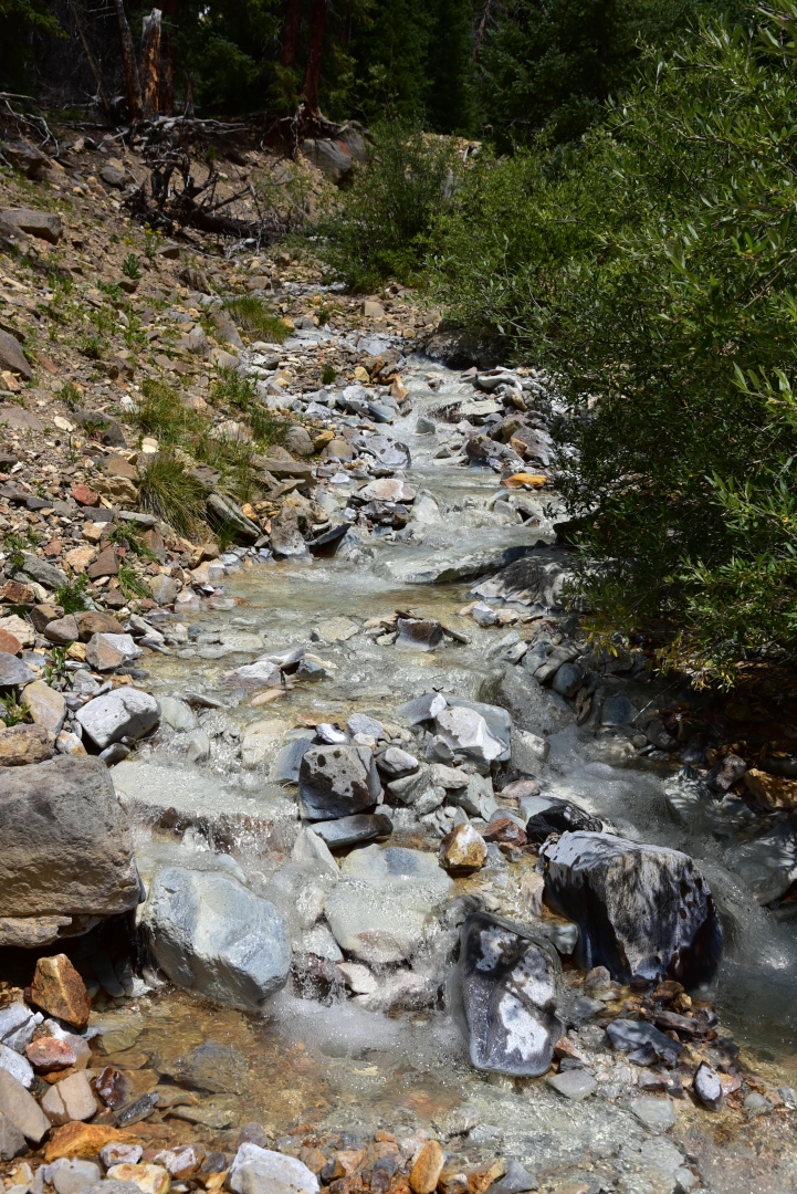
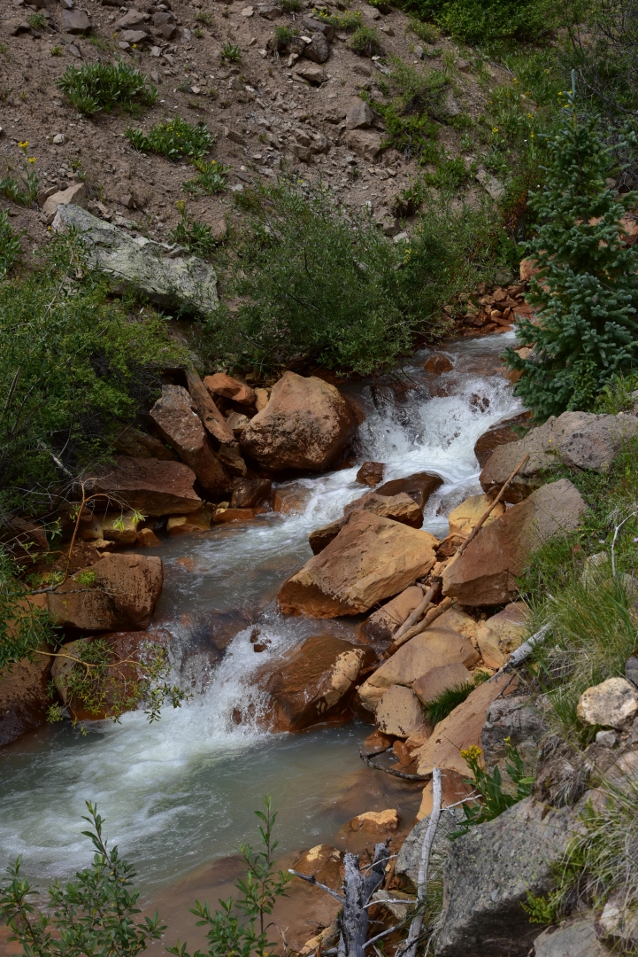
The remaining downclimb was uneventful, but nonetheless enjoyable minus the “yellow” rock section. Once off the ridge, we took our time getting back to the truck and took many photographs and enjoyed our time in the backcountry. On our way back, features that were hidden in the darker morning appeared to us more clearly. Several of the creeks we hiked by appeared a unique whitish blue color that can been seen below. We are still in the midst of researching why the water and rocks are so uniquely hued and will update at a later time.

We reached our truck, ready for some food and relaxation. Despite the relatively short hike and climb (approximately 7 miles RT, and 3,300 feet of elevation gain), tiredness set in. The peak was, after all, a bit mentally taxing with all the exposure. It took us about 45 minutes to get back to Lake City where we stopped at Southern Vittles for some amazing food. (Just about everyone in Lake City is from Texas) so they know good food.
Wetterhorn peak was an extremely fun class 3 climb with spectacular views. It provided much needed adventure and a step up from an everyday hike. Nonetheless, those attempting it should be comfortable with class 3 climbing and enjoy great exposure. There is a also a bit of route finding necessary on this peak to keep the terrain on the easy side.
Now, back to the “cannibal” cabins thing. Way back in 1874, good ole Alfred Packer (an American prospector) attempted to travel through the southwestern colorado mountains in an extremely harsh winter. Essentially, he took 5 men with him and only he returned to Lake City. He at first claimed that the group left him, but inconsistencies in his story emerged and eventually he admitted to living off the flesh of his companions to survive. Apparently the remains of the men in his group were found just outside of Lake City, and the town can’t seem to shake this event. There is a restaurant called Cannibal Grill and Packer Saloon and of course our cabins. Despite the creepy name, the restaurant and saloon are really fun with great food and an amazing patio with live music. The cabins are quaint and clean.
Stay tuned for our a trip report from our second peak of the trip, Handies Peak.