Take a Walk
A Quest into the Wild
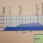
Browns Creek Waterfall and Lake: Nathrop, CO
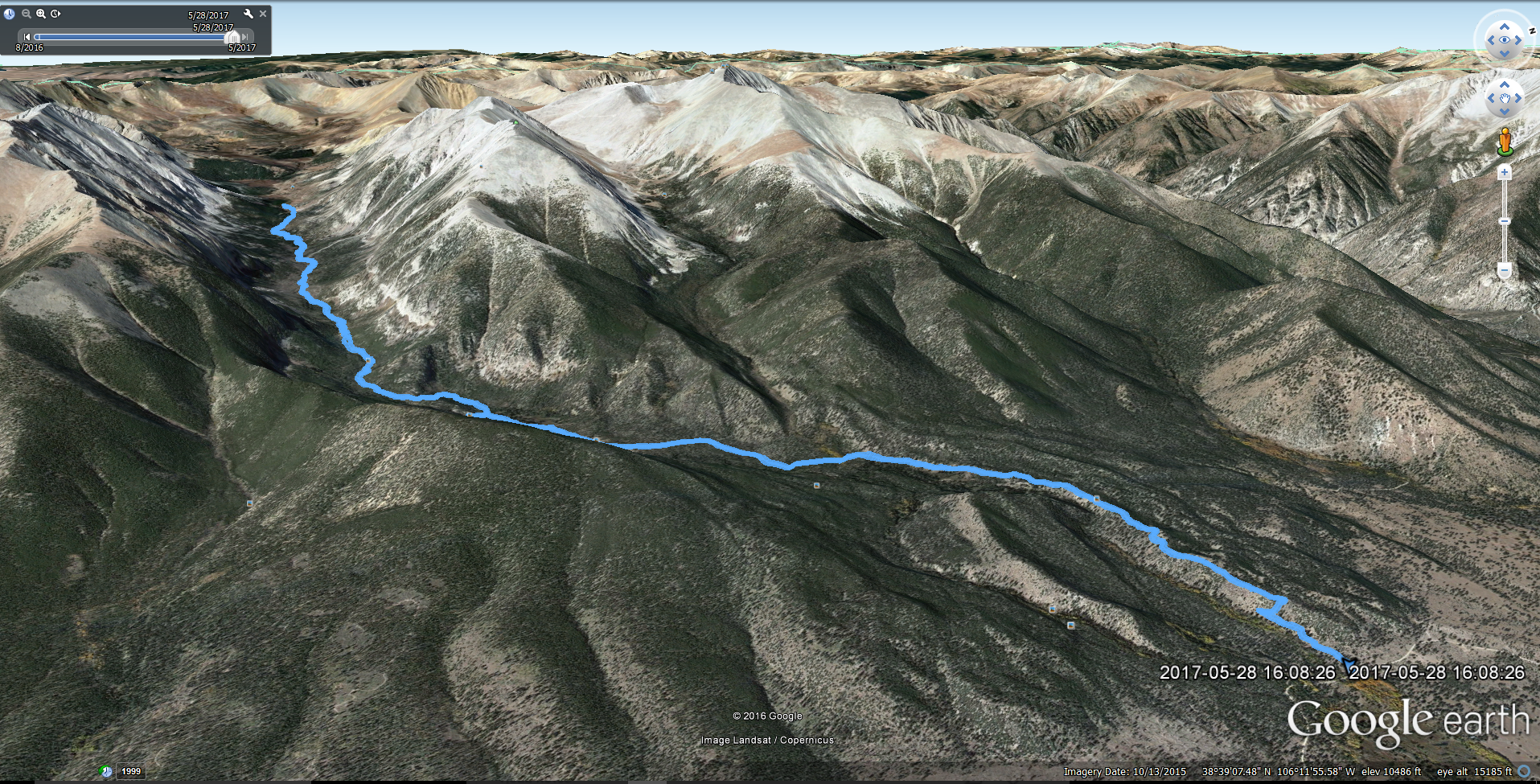
Miles: 12.11 (Out and Back) Min Elevation: 8,918 ft Max Elevation: 11,309 ft Total Elevation Gain: 2440 ft Net Elevation Gain: approx. 2,391
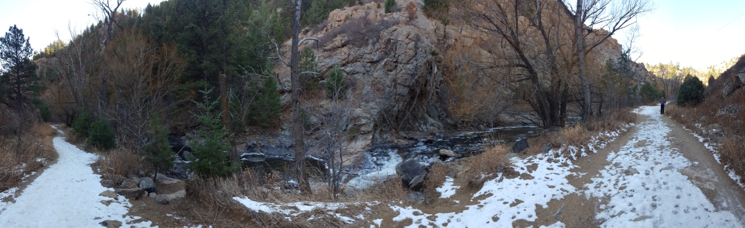
Memorial day was finally upon us this year, marking the quintessential start to summer and the brilliant array of activities that accompany this change in season. However, while Denver was awash in bright sunlight or bathed with warm rain for most of the month, the high country in Colorado continued to get blanketed by late season snow of the wet and heavy variety. May 29th marked our 7th wedding anniversary, and despite no promise of prime conditions, we were determined to seek refuge in the mountains to celebrate. On Saturday May 27th, we piled into the truck on little sleep and headed southwest towards Salida, CO in the hopes of bagging Mount Shavano and kicking off the climbing season early. Due to a little procrastination on our part with lodging, we were left with the Monarch Mountain Lodge off of Hwy 50 as our romantic getaway. As we pulled into the lodge late afternoon, we were greeted by a creeky old building that looked as if it was many years past prime time. We wandered through the doors and were greeted by a single employee that informed us that there was no restaurant and no bar as advertised. We were disappointed but figured since we planned to rise at 4:30 in the morning to summit Shavano, it would be of no consequence. To make a long story short, the hotel was too noisy to sleep from dogs barking and holiday revelers, and we couldn’t fall asleep until 3:00 or so in the morning. Sadly, we had to forgo plans on any summit attempt on our trip to due to sheer exhaustion. Despite our disappointment, we got a few more hours of sleep and opted to head late morning to Browns Creek TH and complete a waterfall and lake hike.
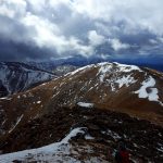
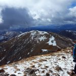
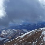
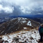
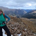
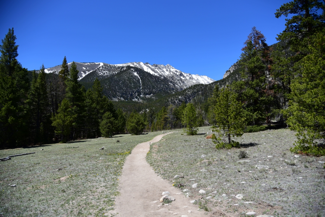
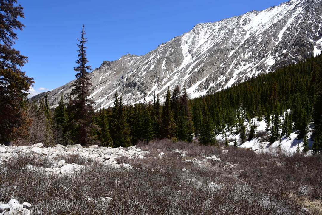
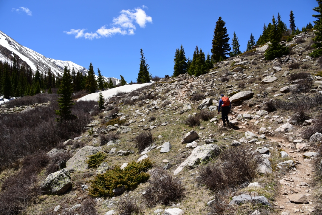
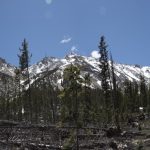
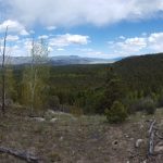
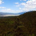
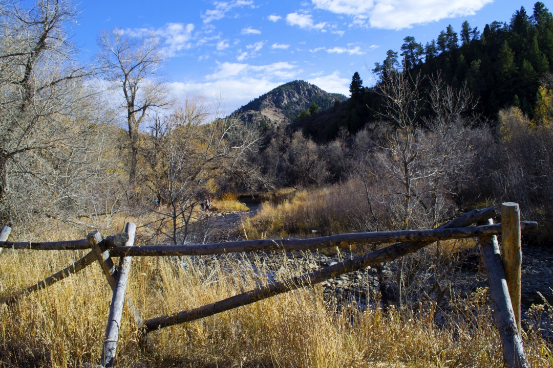
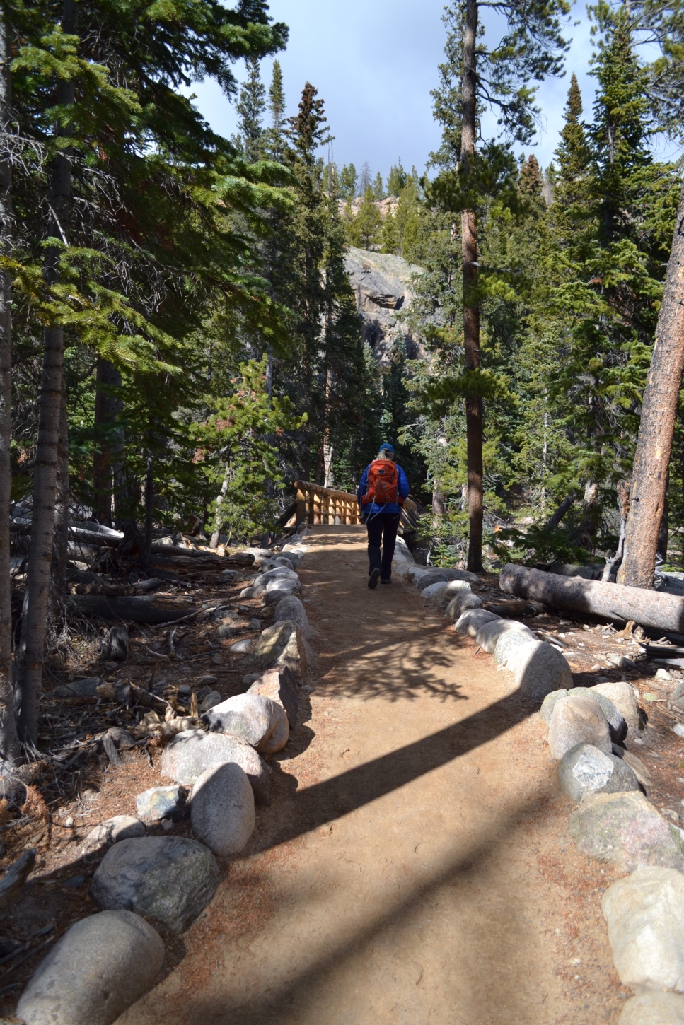
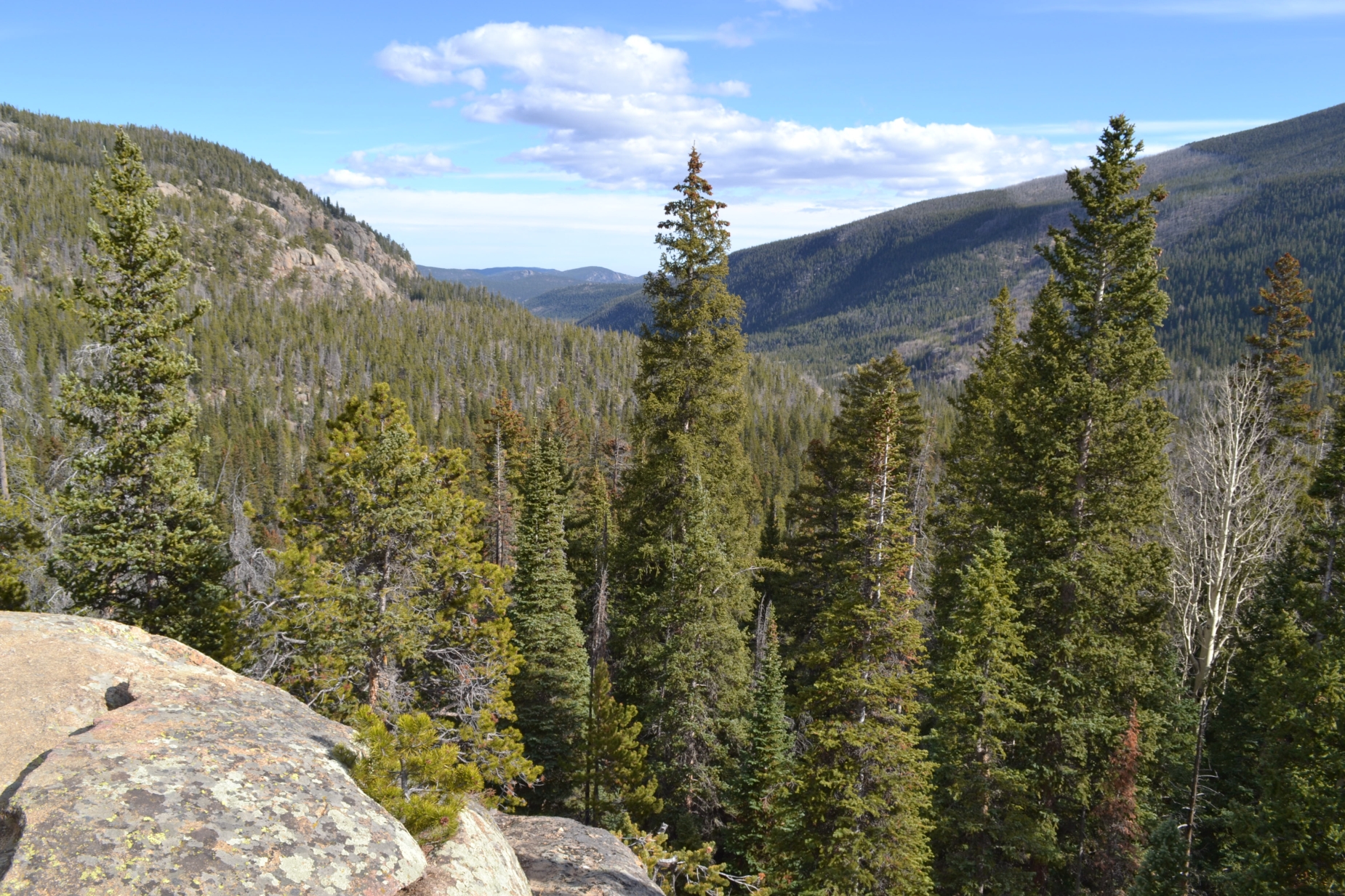
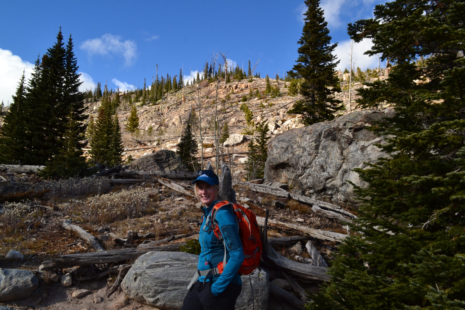
To reach the trailhead coming from Salida, we went north on Hwy 285 and made a left (west) on County Road 270 and traveled for several miles on a dirt 2WD road to reach the TH. There is a smallish parking lot there with room for 25 or so cars. Browns Creek flows in a beautiful canyon with 13ers Mt. White and Jones Peak towering on each side. The trail starts at just under 9,000 ft and reaches 11,300 at Browns Lake. We started the hike just after 10 am with a clear blue sky in front of us. Immediately the trail gains elevation, with absolutely no warm-up time. We weaved in and out of the trees for about a mile until the path reached a ridge and briefly flattened for a bit giving way to exquisite views of the surrounding valley and mountain ranges. At these elevations, we were pleasantly surprised to not find any snow or mud.
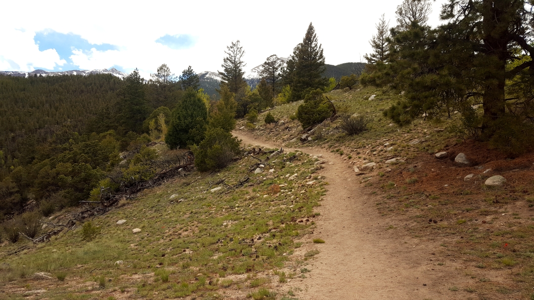

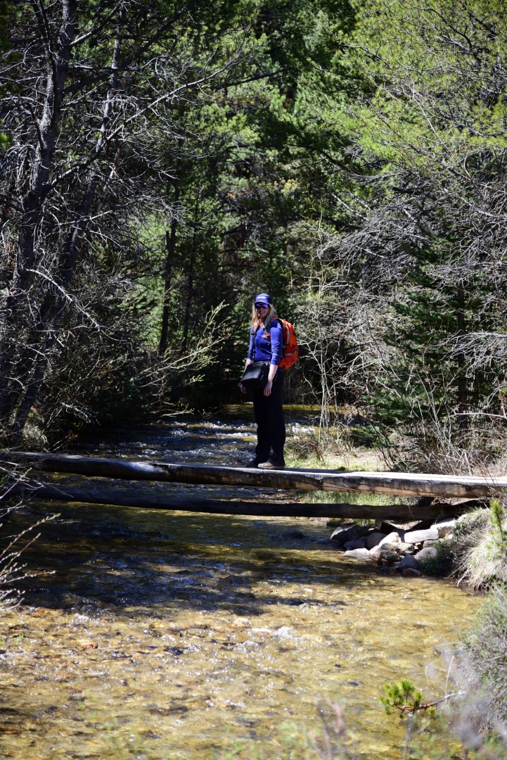
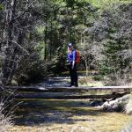
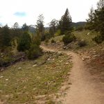
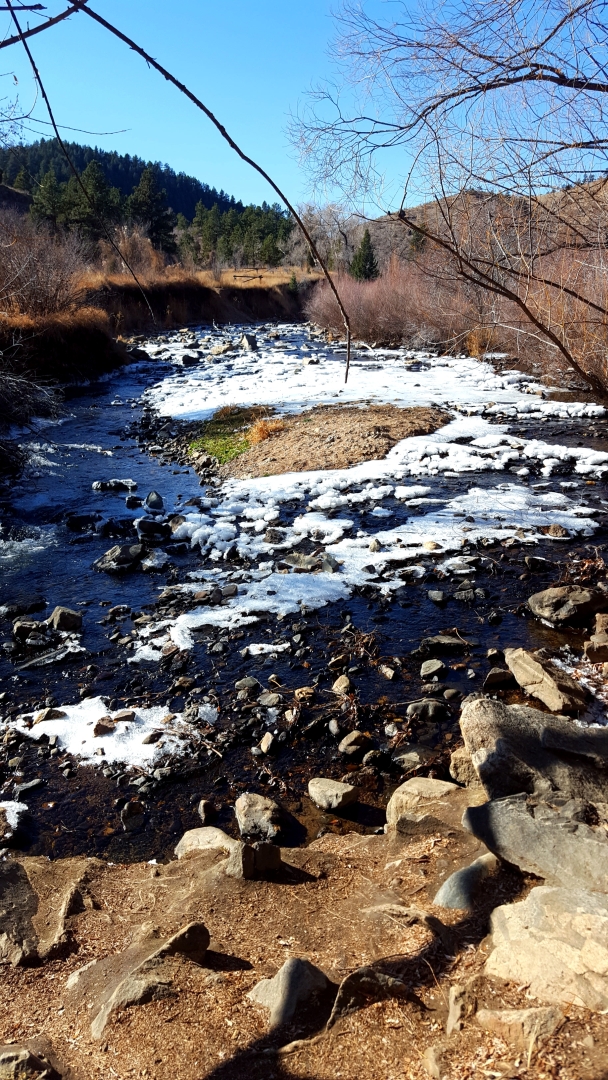
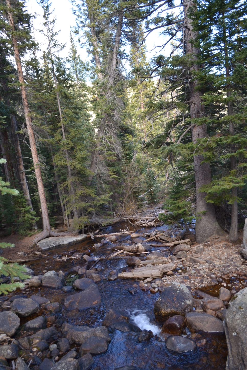
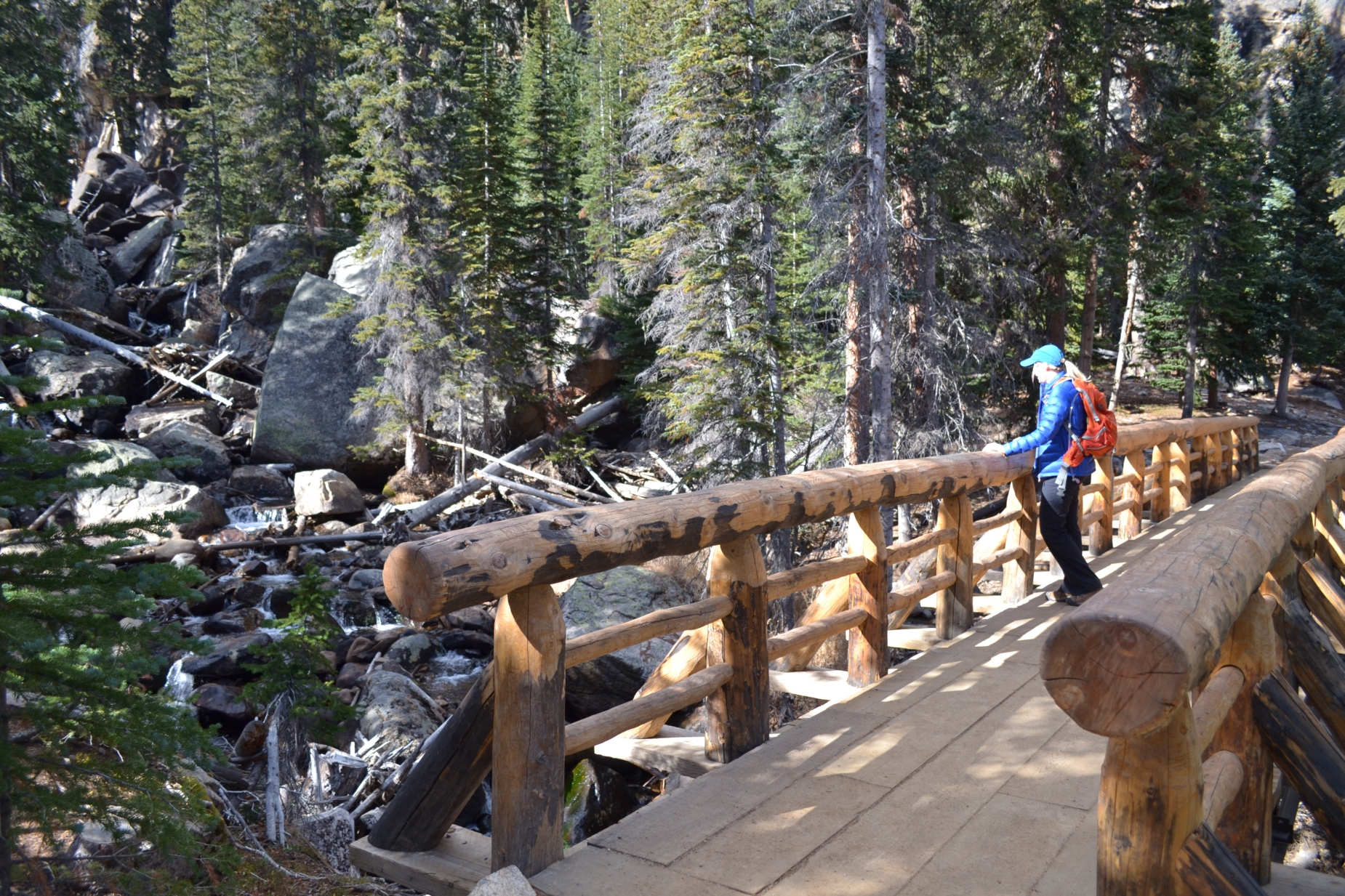
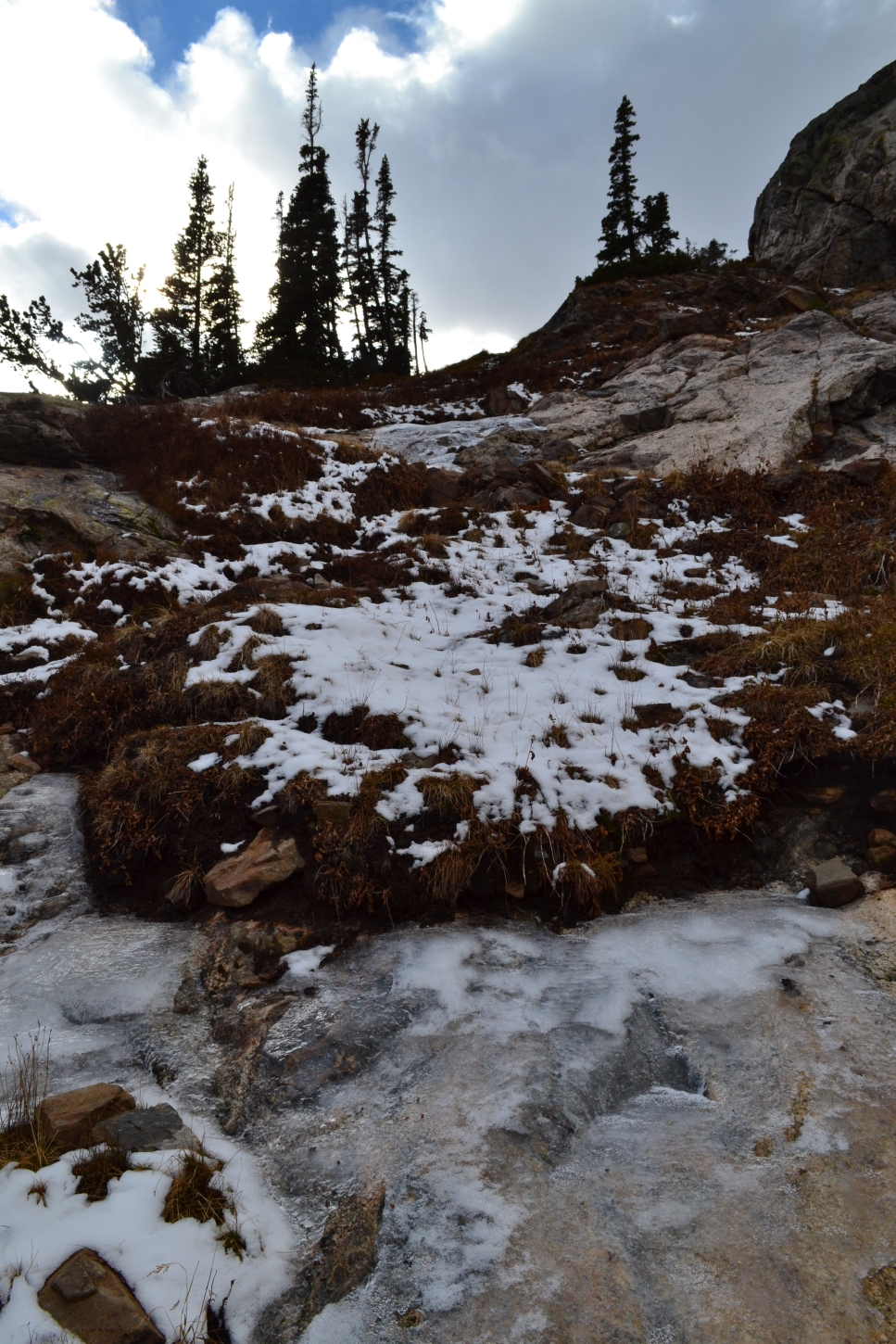
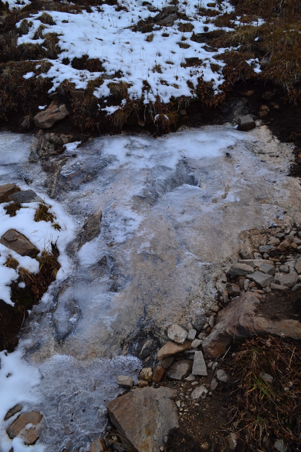
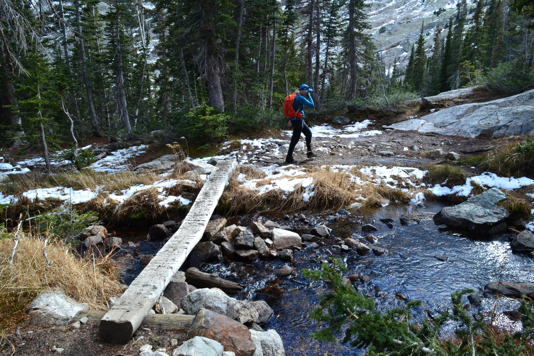
About halfway to the waterfall (1.5 miles), the elevation gain eases up quite a bit and eventually the trail opens into a beautiful meadow. The sandy path through this portion is wide and easy hiking. We followed it pleasantly and reached our first creek crossing which we navigated with a perfectly placed and constructed log bridge. Shortly after, the trail meets another creek crossing, with a heavier waterflow. The majority of this hike is near freshly flowing water greeting guests with one of nature’s peaceful rhythms. Seen below are photographs from the meadow and creek crossings prior to reaching the waterfall.


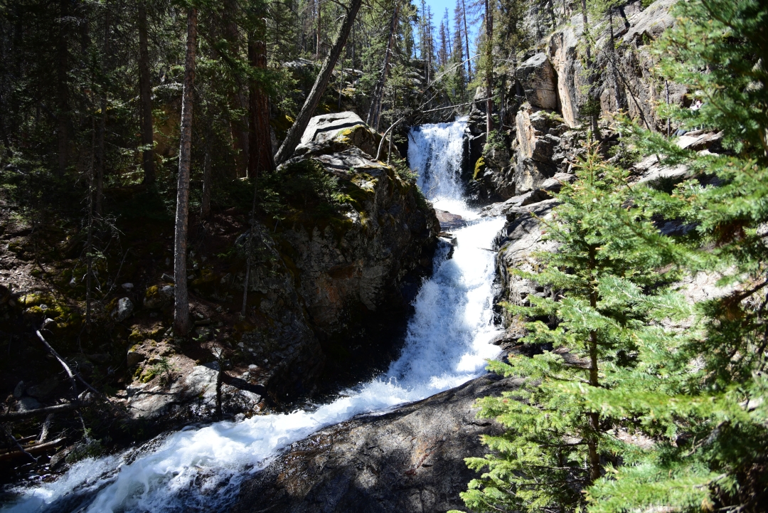
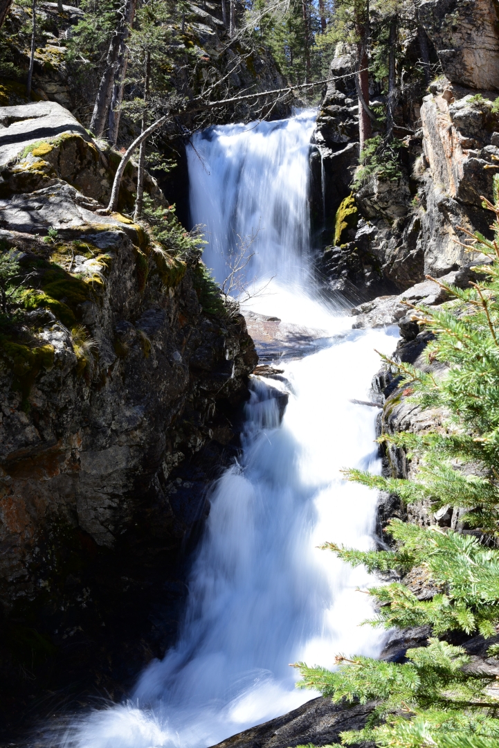
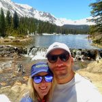
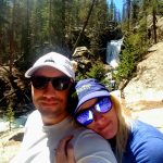
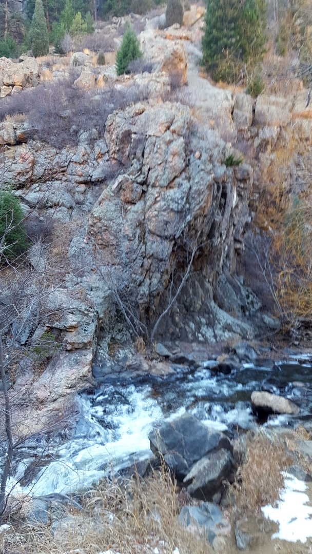
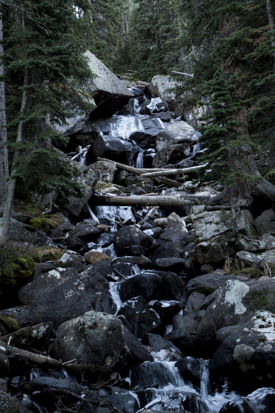
After these two creek crossing, the trail fairly quickly reaches the waterfall. There is a sign that says Falls directing hikers to the left on a short social trail. We excitedly veered off the main trail, as we heard the powerful rush of the water plummeting downstream. The Browns Creek Waterfall is absolutely amazing, and in our opinion, even rivals that of the famous Ouzel Falls in Rocky Mountain National Park’s Wild Basin. There were several large boulders to sit on near the falls to enjoy a snack and the pleasant sounds of the roaring water. Several hiking parties were at the lake, but there was still plenty of space for everyone to see and enjoy. We spent about 20 minutes here taking photographs and relaxing in the warmth by the water.
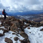
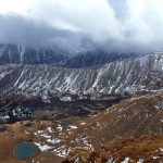
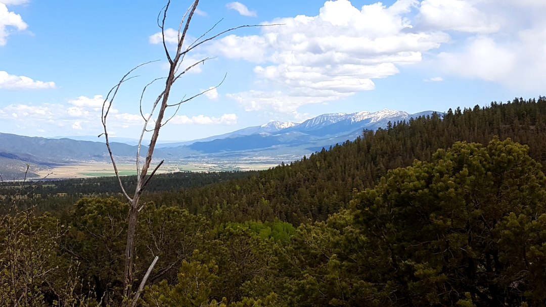
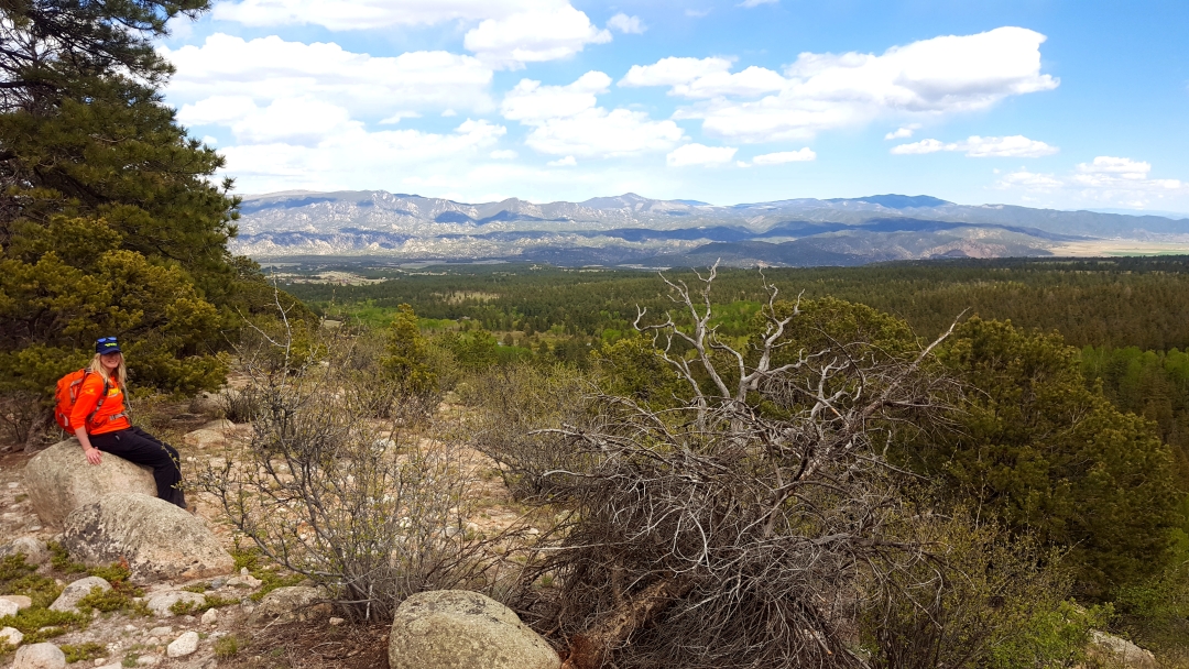
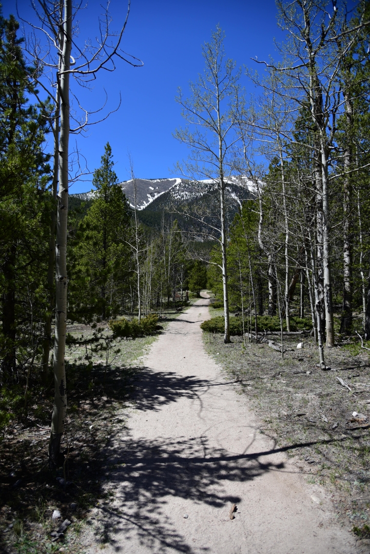
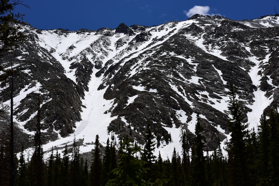
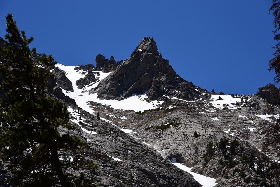
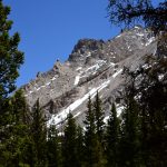
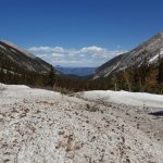
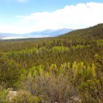
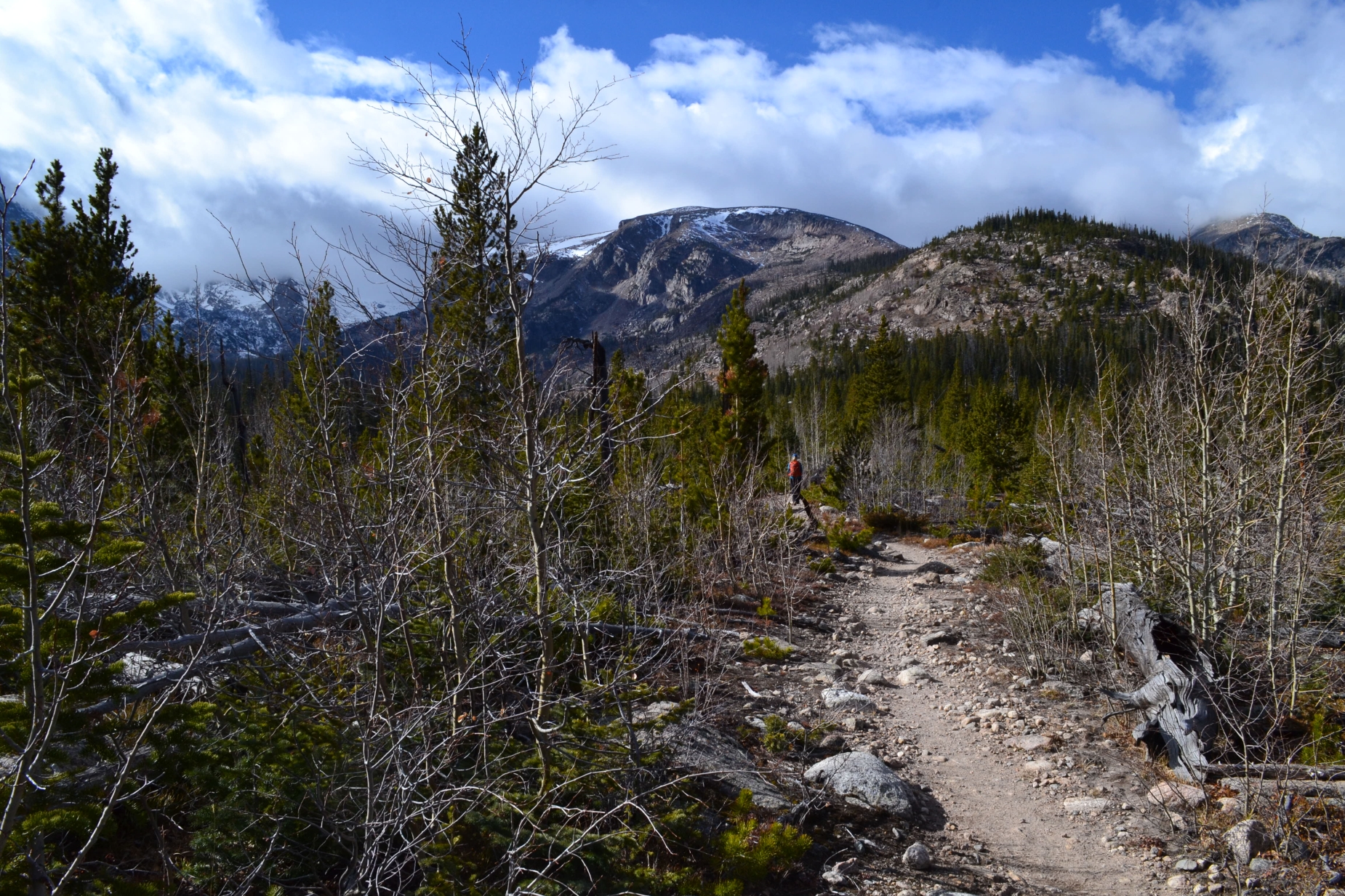
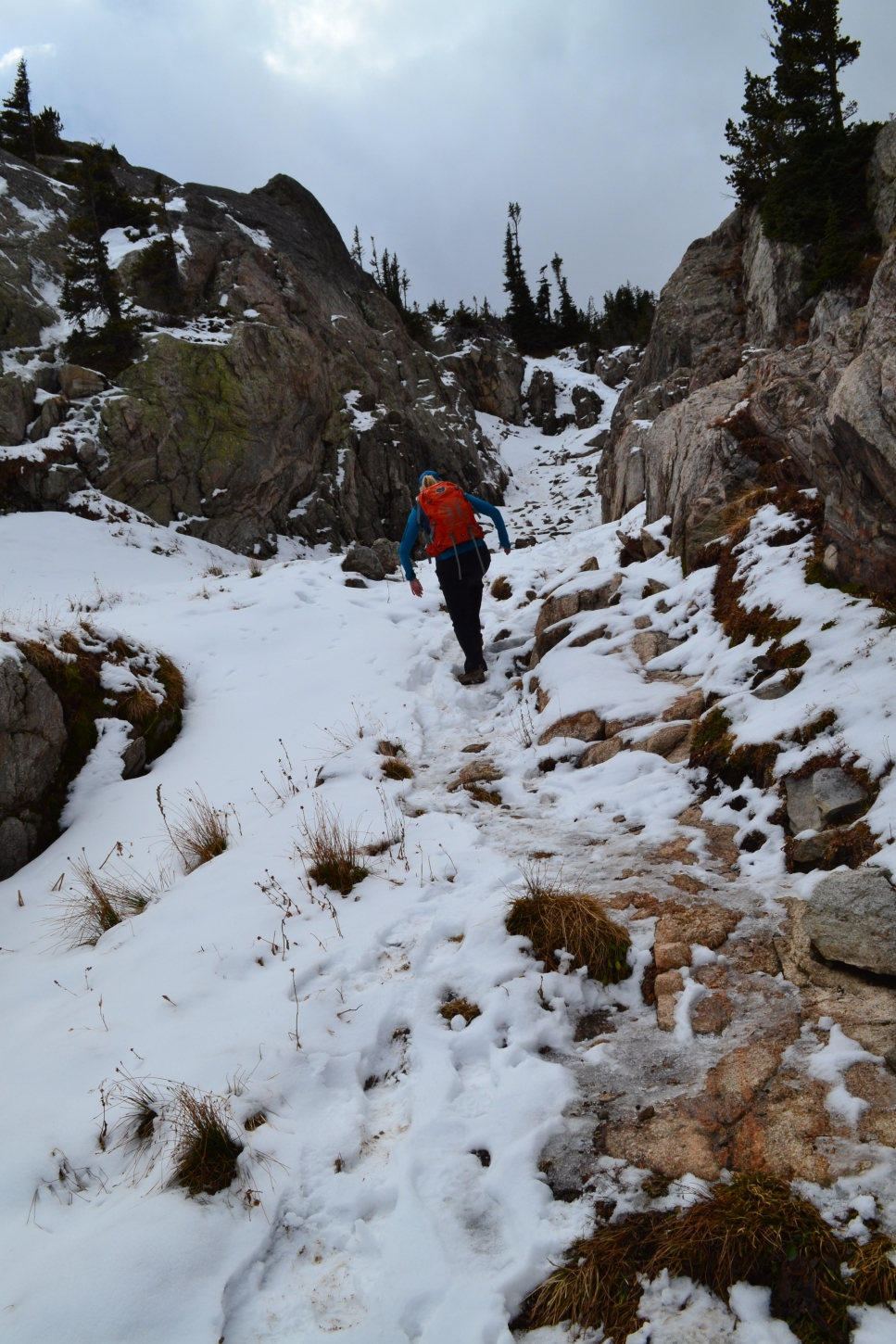
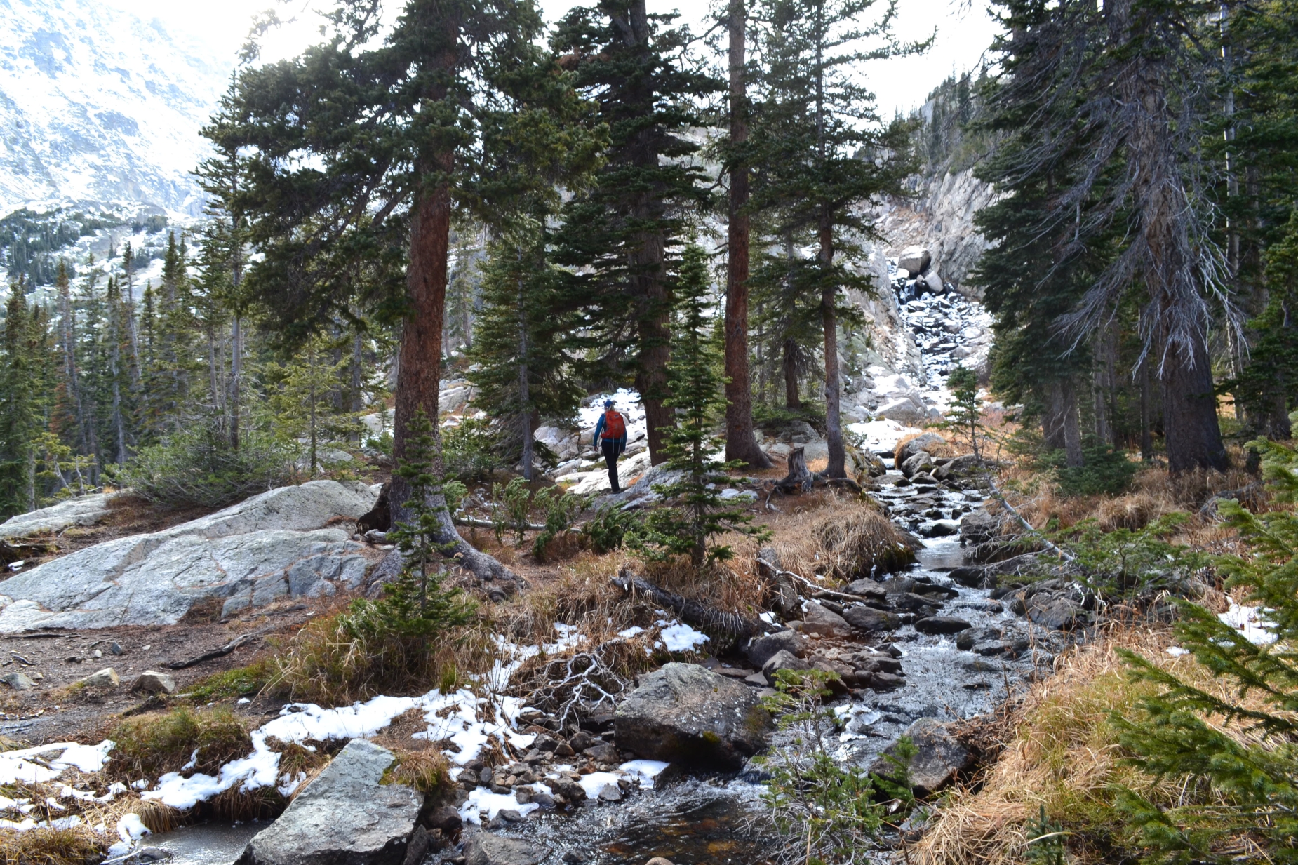
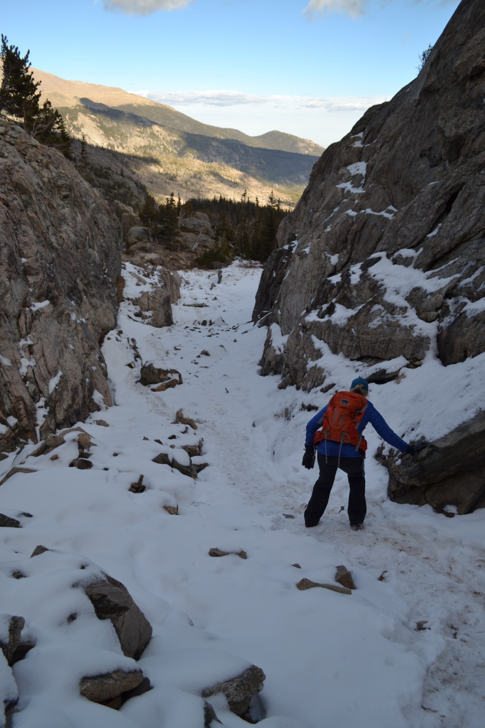
It was still very early in the day when we reached the falls and barely a cloud was in sight so we decided to head back to the main trail and hike another 3 miles to Browns lake. Our enthusiasm began to wane about a mile an a half into this second portion of the trek. After the falls, the trail becomes infinitely less popular. We navigated lots of rocks and fallen trees as we began another rapid gain of elevation as we followed along the northern side of Browns Creek. It is apparent by the newfound ruggedness of the trail that many people turn back at the falls. Despite our fatigue from a less than stellar night of sleep and the intense rays of the sun, we felt that we had gone too far not to see the lake. Once we emerged from thick forest of conifers and ponderosa pines, the views from the trail became much more enticing. We were greeted with powerful granite snow capped peaks of 13ers dwarfing us from either side. Seen below are photos prior to reaching the lake.
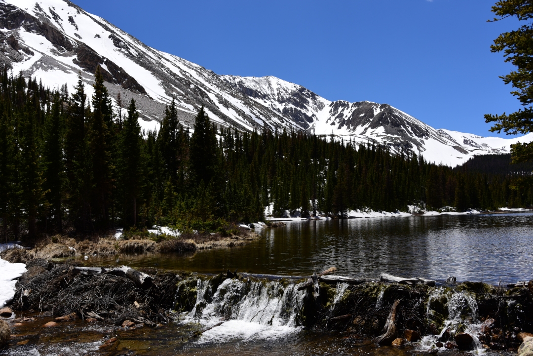
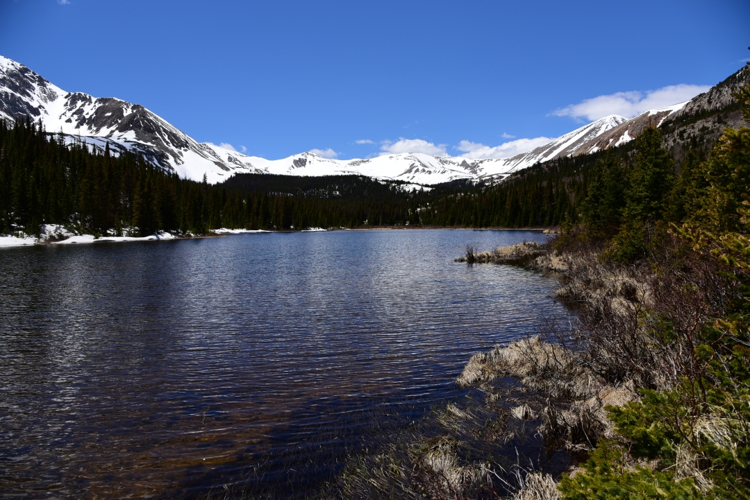
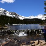
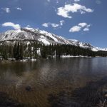
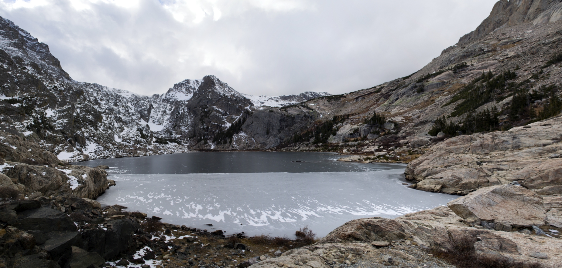
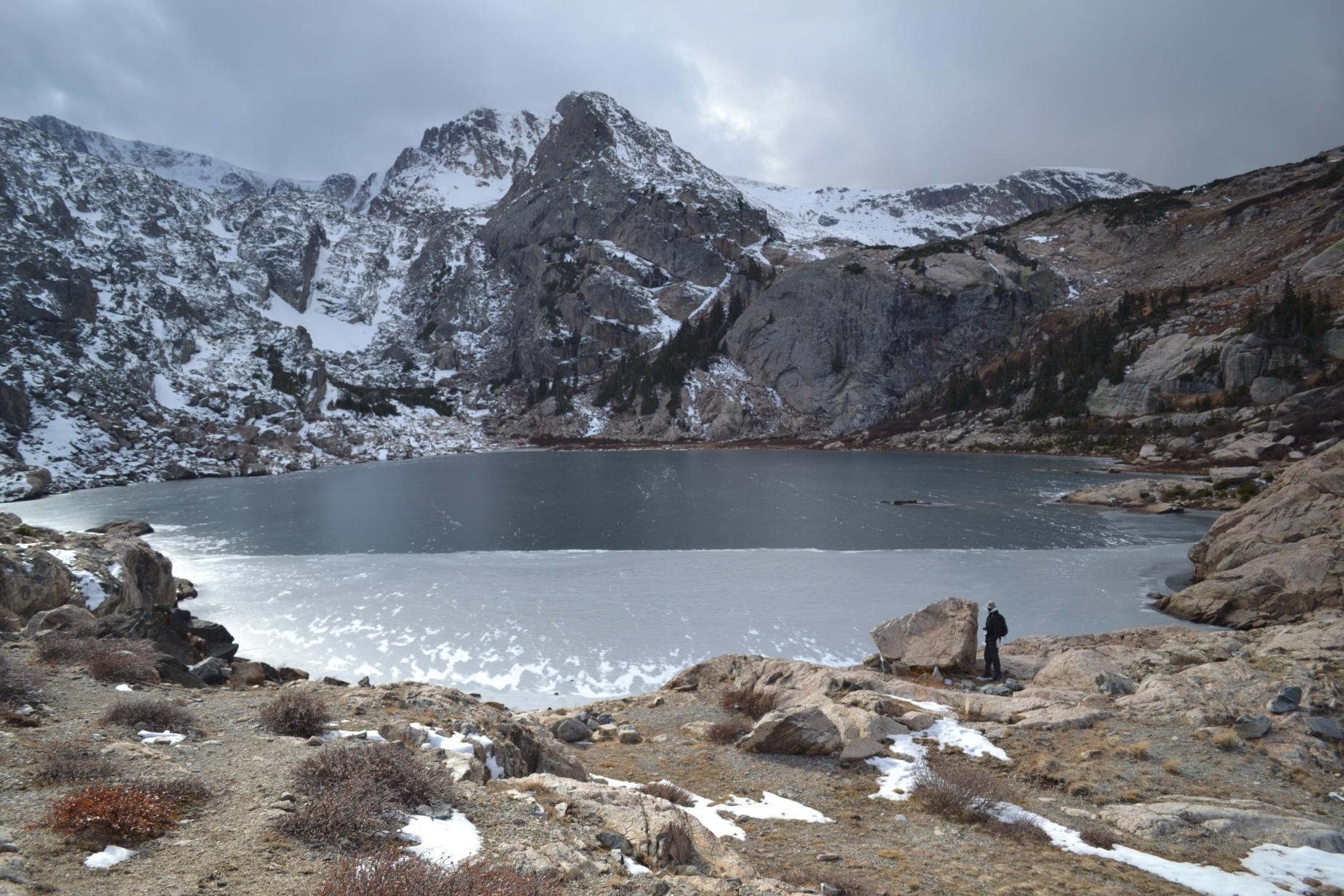
The final push to the lake is a steep boulder strewn path. We anxiously weaved through the rocky course, and just as we felt that we didn’t want to go any further, Browns Lake appeared. We met the narrow lake at the east end where water spills over a log and branch beaver dam into Browns creek. The water was bright, clean and full from all the recent snow melt. We said hi to a few fisherman on the northern banks and relaxed for 30 minutes or so. Despite an elevation of 11,300 feet, temperatures remained relatively mild at the lake. A nap next to the calm waters was quite tempting. Nonetheless, it was approaching 2:00 pm, and our water supply was getting low. We begrudgingly packed up and began the over 6 mile descent to the truck.

We made it back to the trailhead about 4:00 pm and headed into the wonderful little town of Salida to enjoy some food and drink and celebrate an almost half marathon hike in the Sawatch range. Despite lacking the glamour of a 14er summit, the Browns lake hike felt appropriate for the occasion. We were able to relax and enjoy each others company in our favorite place, the rocky mountains.
Lair o’ the Bear Park
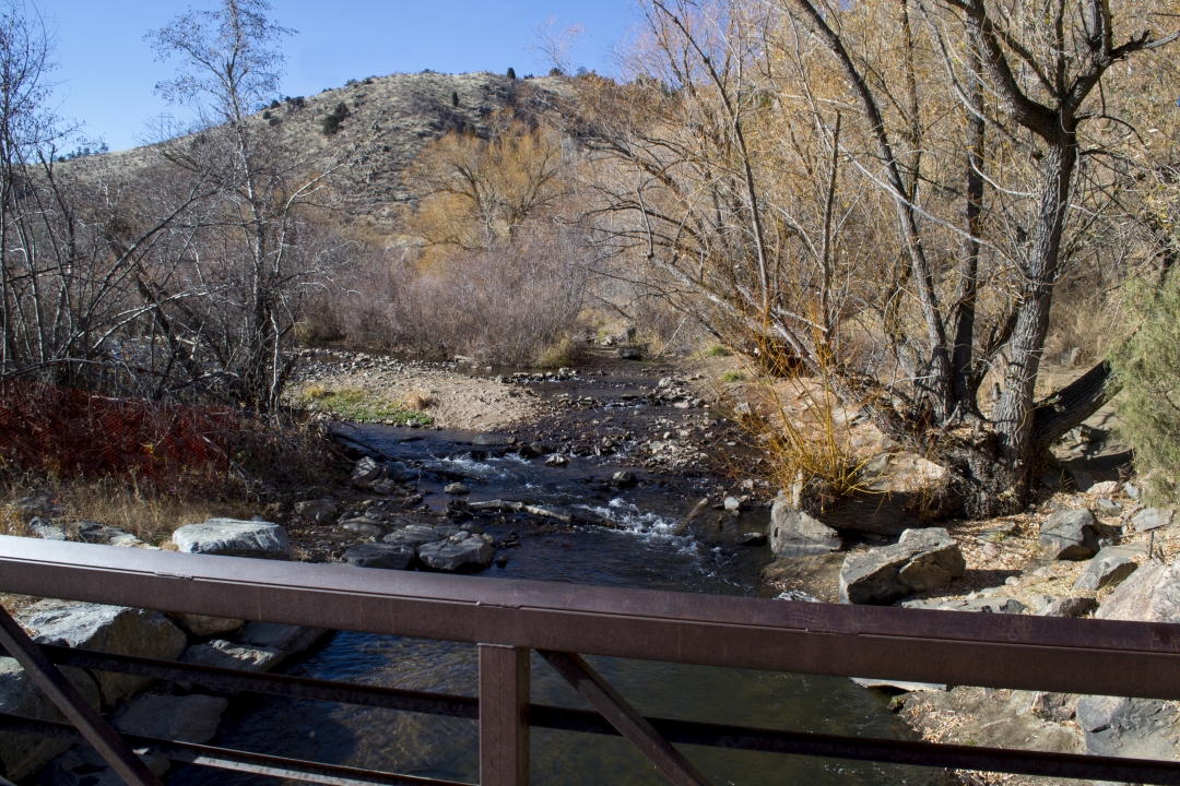
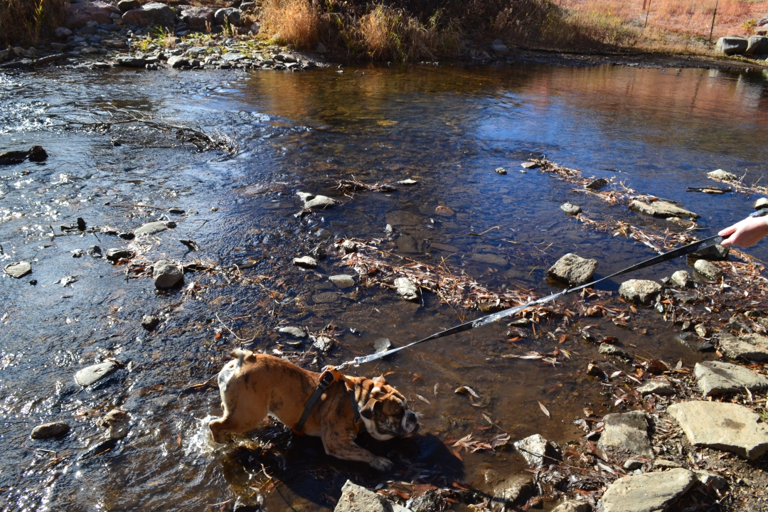
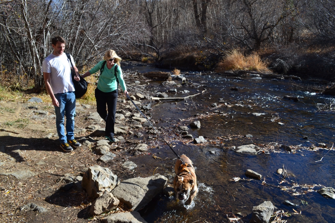
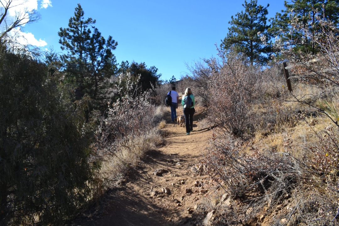
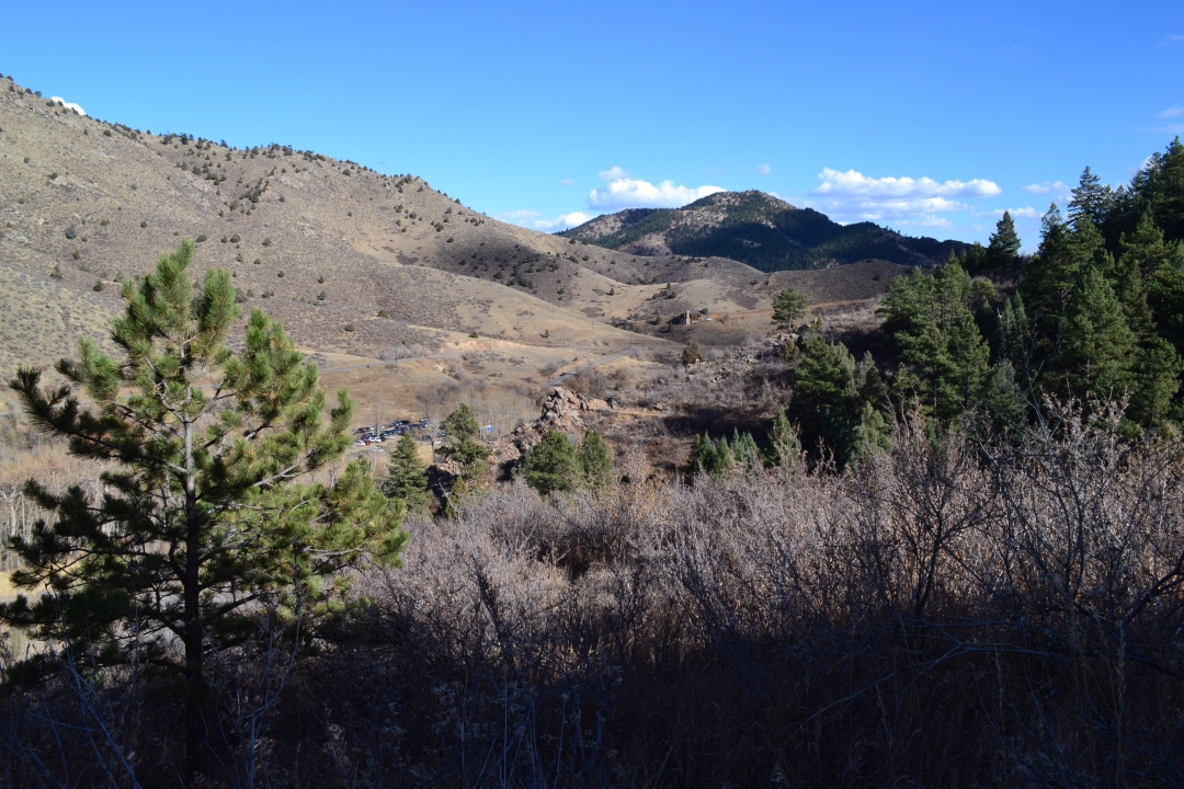
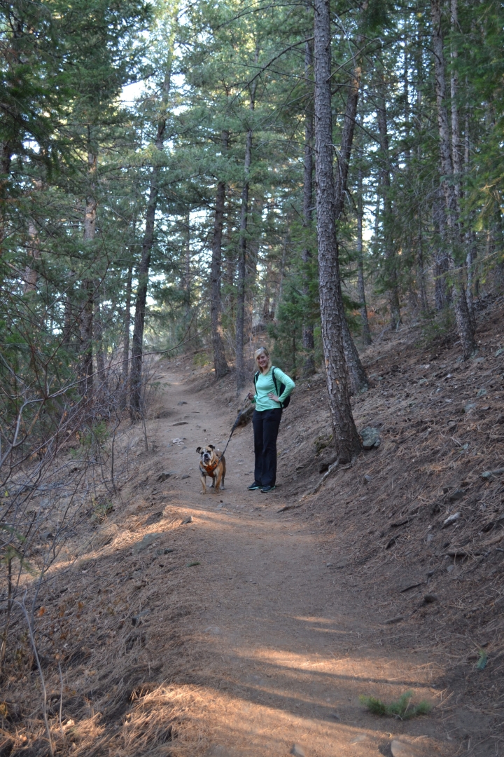
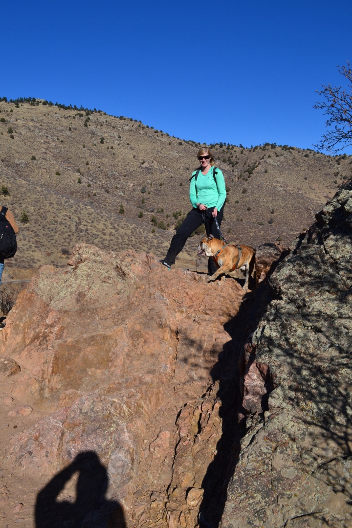
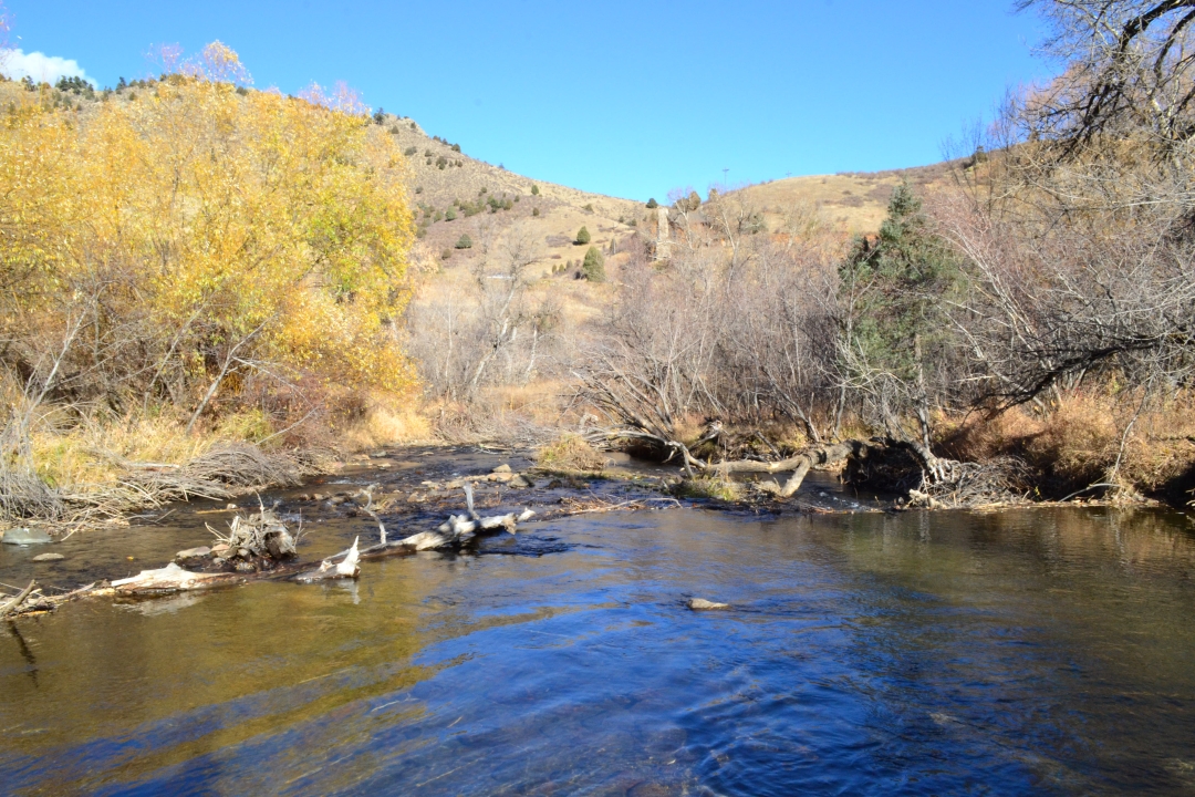
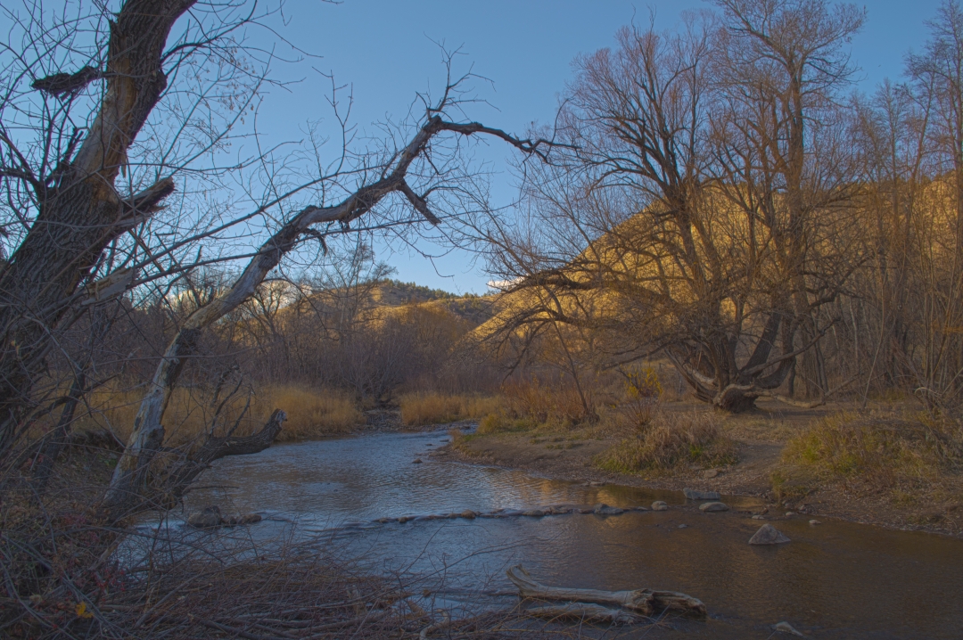
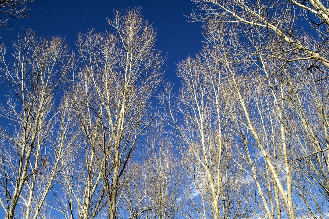
It continues to be gorgeous weather here in the Front Range and so we decided to go hiking with Will and Moses in the Foothills on Saturday, November 12th. We had heard of a little park called Lair o’ the Bear Park near Morrison in Jefferson County and began to drive that way. The drive was scenic and short compared to most of our hikes; and we arrived at Lair o’ the Bear Park in the early afternoon. Parking was close to full, but there were spots left. We hopped out and began to explore the trailhead and our options.
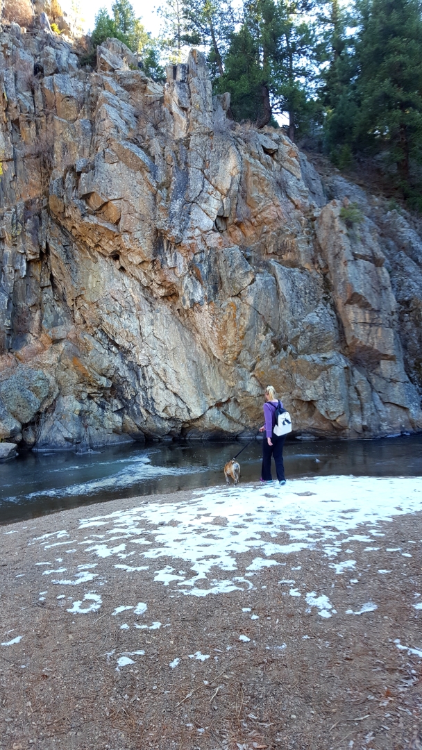
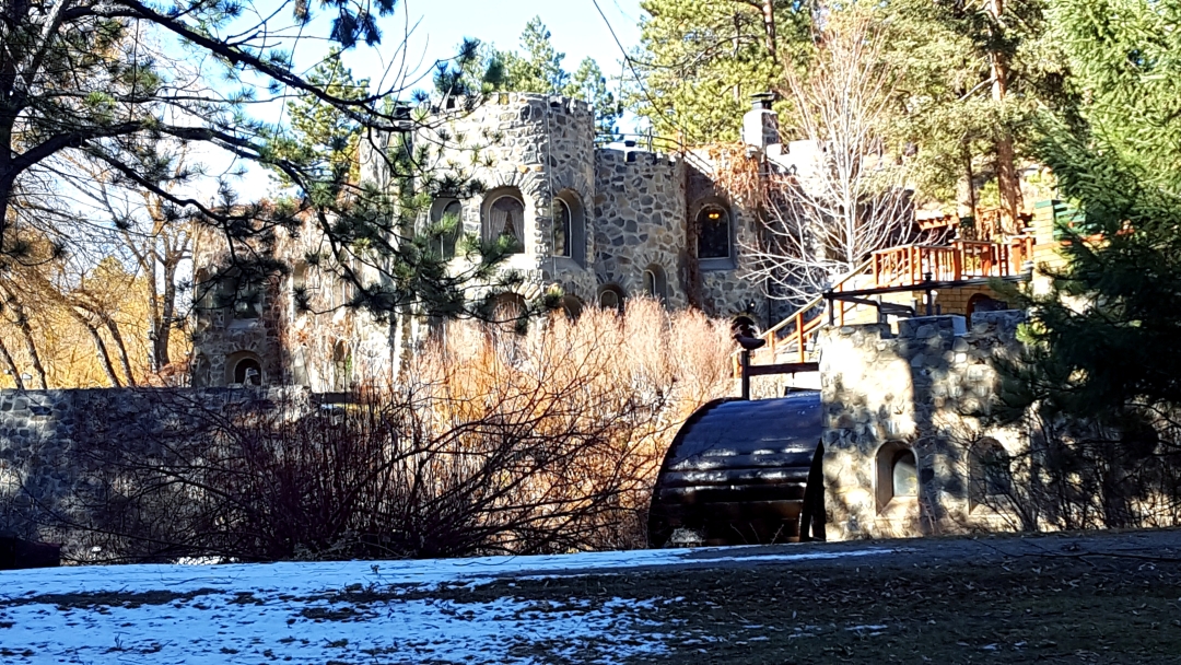
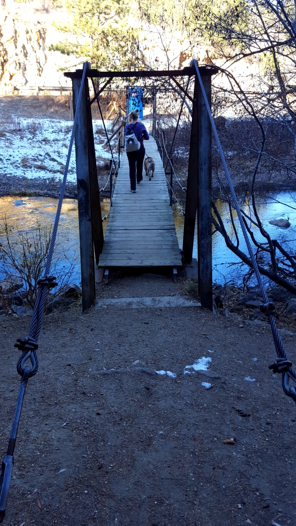
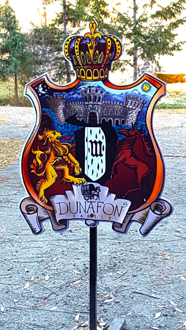
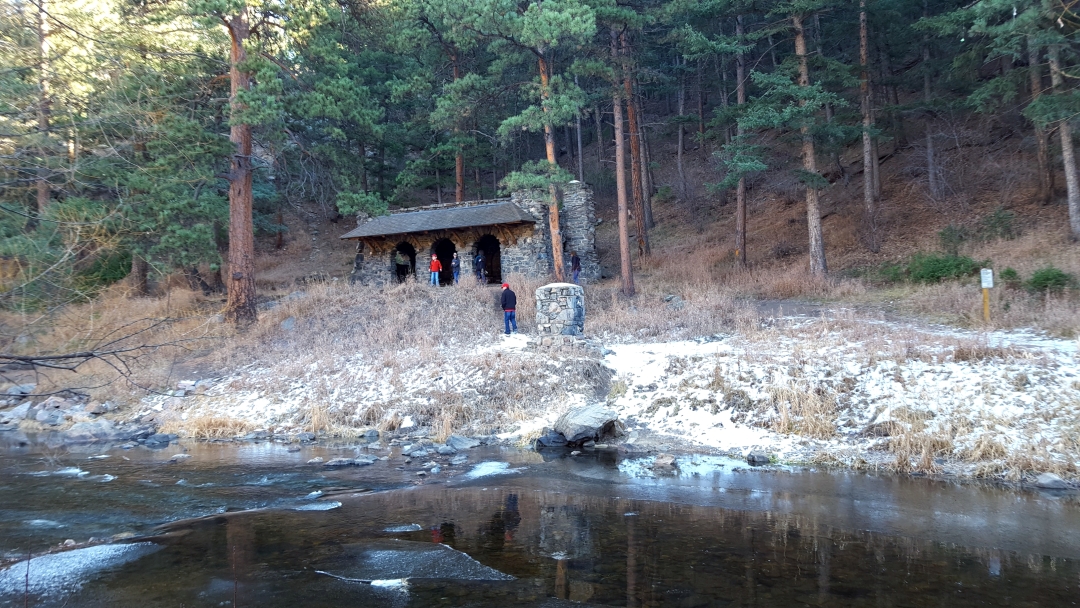
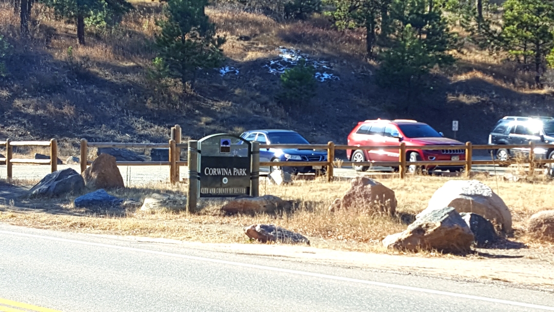
The options at this park are numerous, and so we came back again on Friday, November 24th. As crazy as it seems, the trails were still relatively clear of snow even as we get close to December. Our first time out we walked on the Bear Creek Trail, which runs along Bear Creek, until we hit a bridge that led us to the Bruin Bluff Trail. The Bruin Bluff Trail loops around the park and gives some pleasant views from the hills to the south of the park. As we looped back around, we met back up with the Bear Creek Trail and followed the trail back to the parking lot. On our next adventure, we opted to visit a castle we had read about which is located about a mile out on the Bear Creek Trail. We hiked approximately one mile to Dunafon Castle and then kept going another half a mile to Corwina Park. This was an out-and-back. Both hikes were around 3 miles, and below are details and pictures from our adventures.


 s wish with some help.
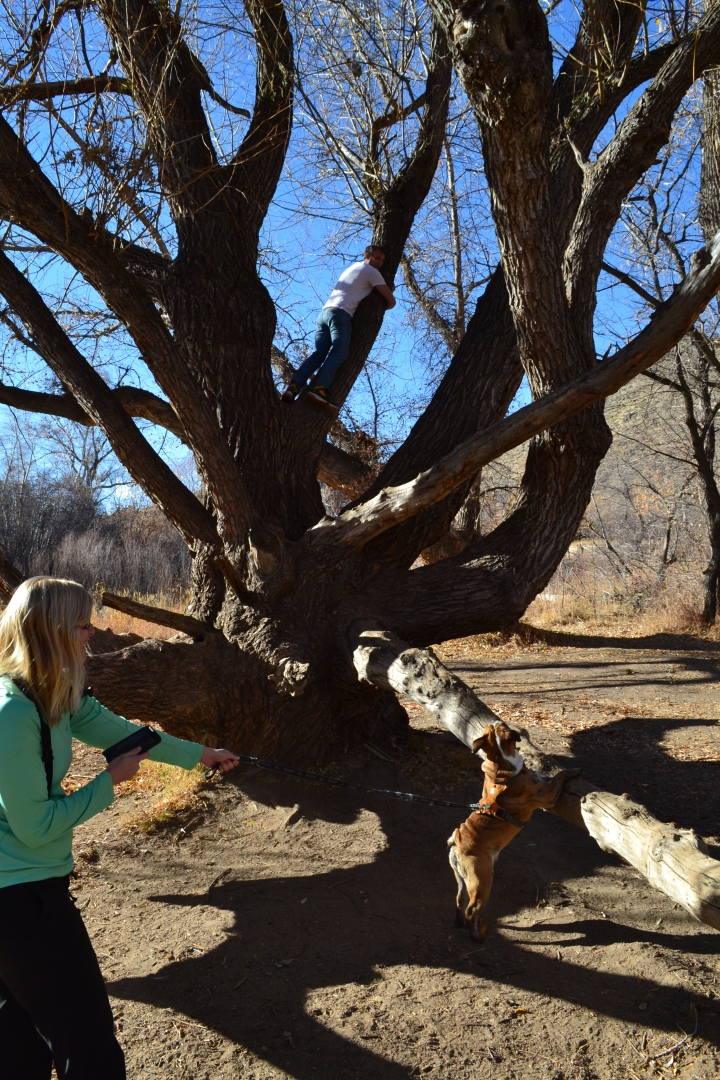
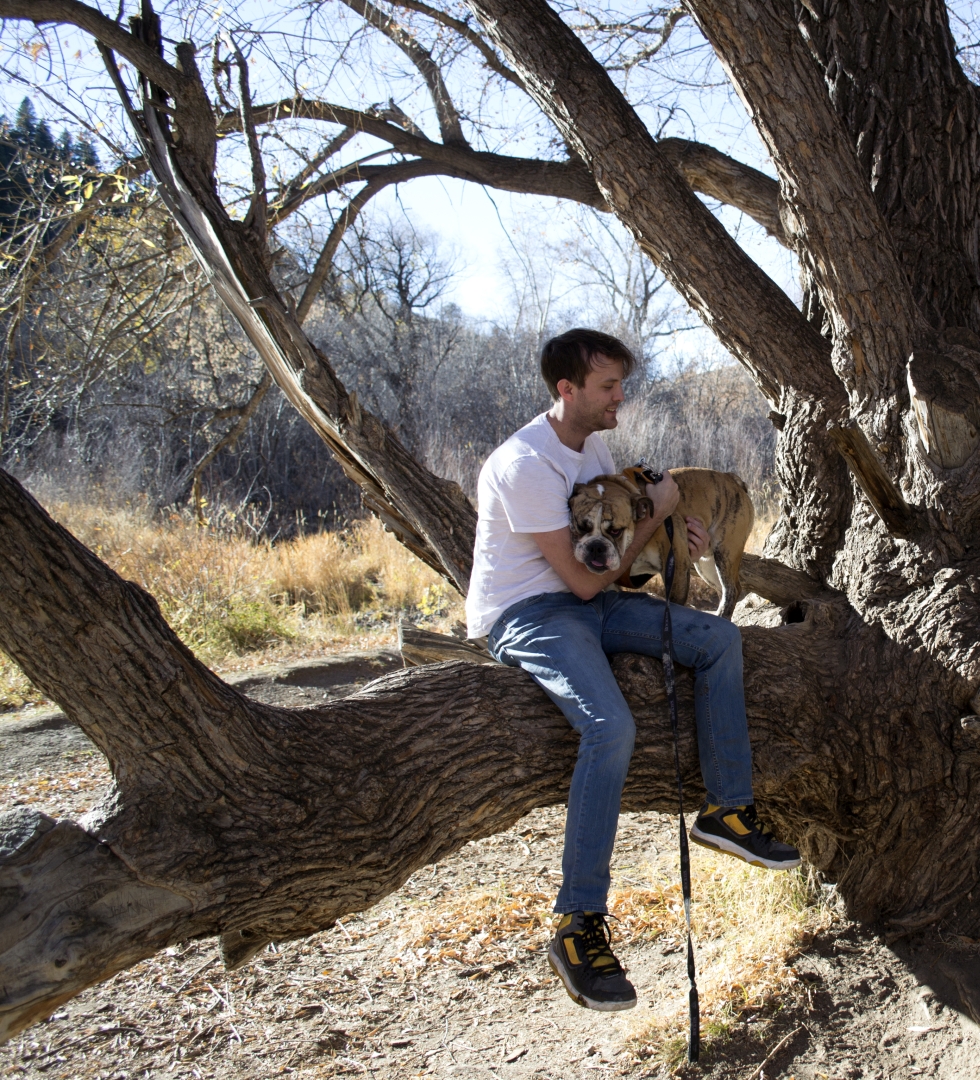
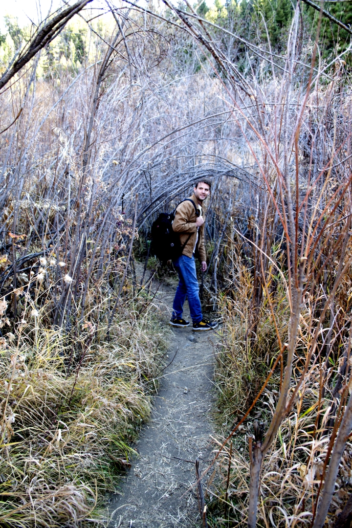
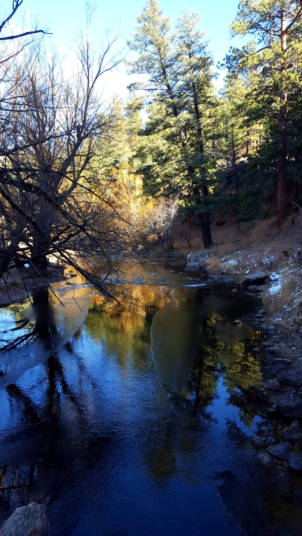
There are quite a few trails leading off from Bear Creek Trail, almost all of them go to the water. One very interesting trail we explored had an arch made of plants that led down to a beach. The Creekside Trail does run along the creek as well, and is a nice short diversion from the other trails. However, there are many other unnamed trails to explore. Just be careful, since erosion can be a problem and damaging the wildlife isn’t anyone’s goal.
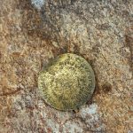
Also, the park had a sign that mentioned a problem with New Zealand Mud Snails. The sign warned anglers on how to sanitize their boots and clothing if they go in the water. Because of this, it would probably be a good idea to head this warning signs if you do travel down into the water. The snails themselves are tiny, only about 4-6 mm in length on average, and cause problems for the ecosystem.
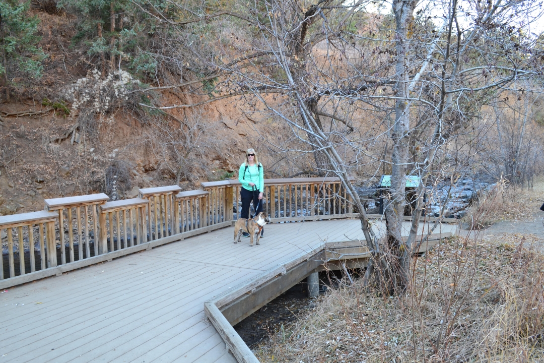
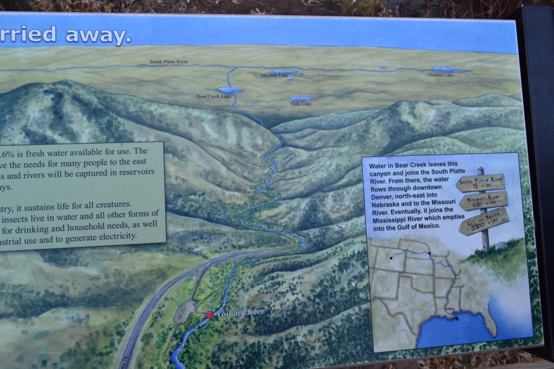
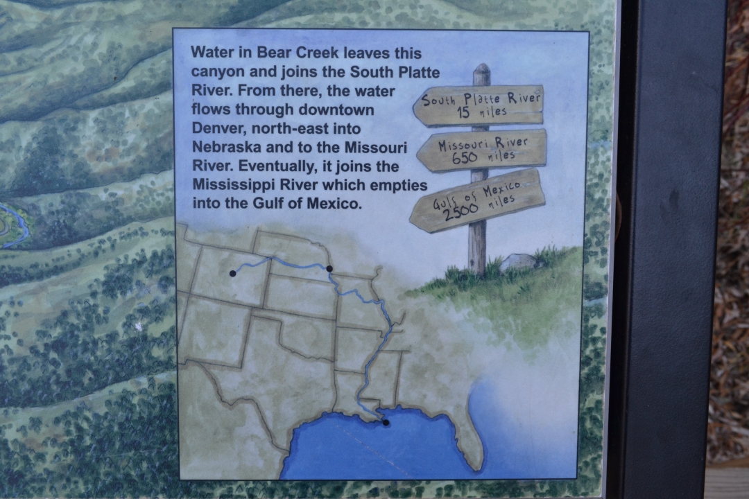
To the left you can see Will standing under the arch on our way to explore the beach. After the beach we continued on and found a little deck that was a nice resting spot for Moses and also had some interesting information on the creek. Being so close to the Continental Divide, we sometimes take it for granted, but by definition, all the water on the east side of the divide flows into the Gulf of Mexico or the Atlantic Ocean. The creek here flows for 15 miles to the South Platte River, which flows for 650 miles until it merges with the Missouri River on the Nebraska-Iowa border, and from there it flows another 2,500 miles to the Gulf of Mexico. Thinking about the journey the water was going to take that we were playing around in was quite humbling. Below are a few pictures from the end of the hike.

All things considered the park offers plenty of activities and diversions; from picnicking, to hiking, to mountain biking there is always something to do here. We’d recommend this for anyone wanting to get outside in a group with mixed abilities, as the trail is easy and almost anyone can do it. The options on distance are nice as well. Whether you want to take a long 12 mile hike or a short 1 mile jaunt along the creek, it’s all up to you. After your activity, we also recommend stopping in Morrison for some food and drinks. We particularly like the The Cow and they have a great happy hour. Cheers!
Bluebird Lake Rocky Mountain National Park
Distance: 12.44 miles (out and back) Elevation Gain: 2,974 ft. (net) Max. Elevation: 11,016 ft. Min. Elevation: 8,527 ft.
Date hiked: November 6, 2016
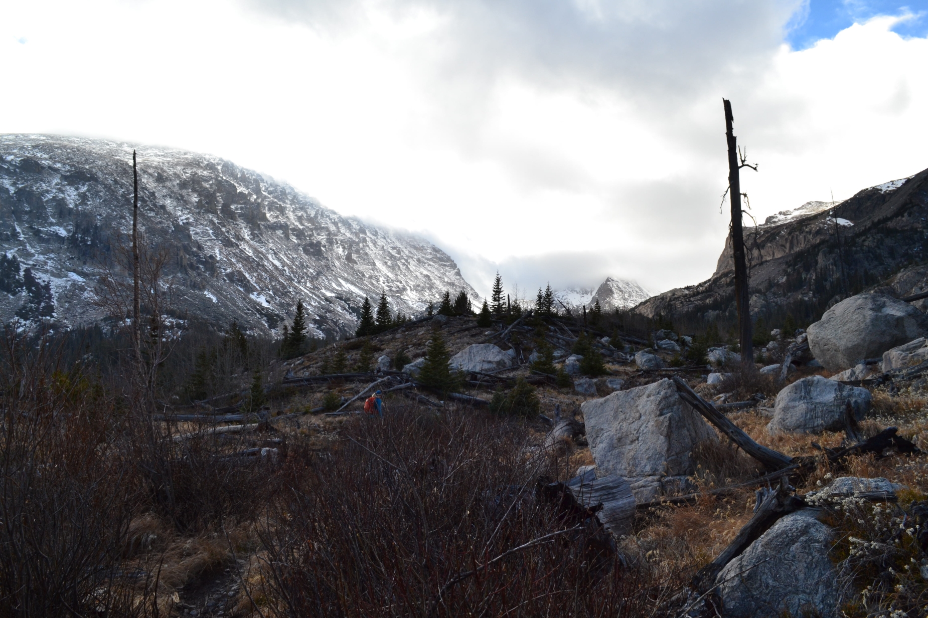
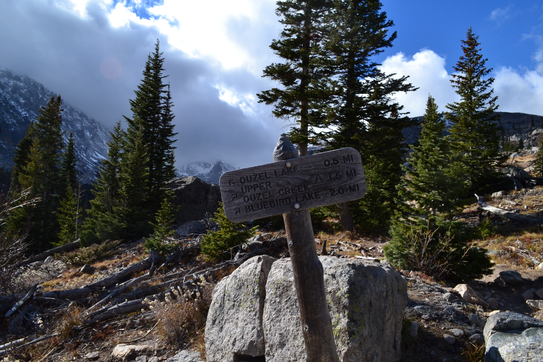
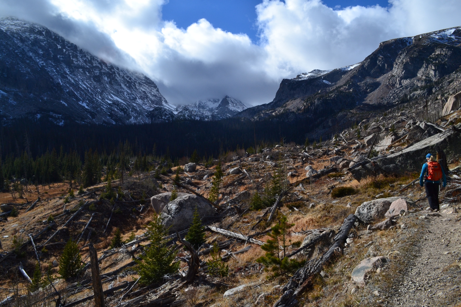
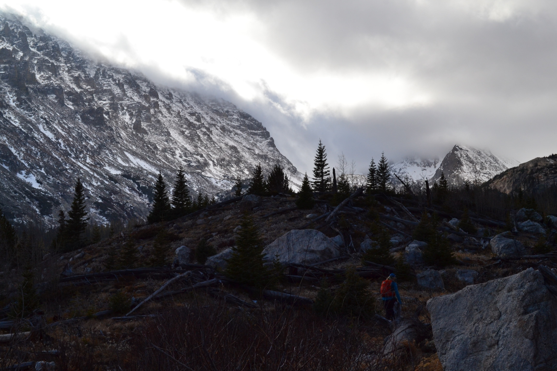
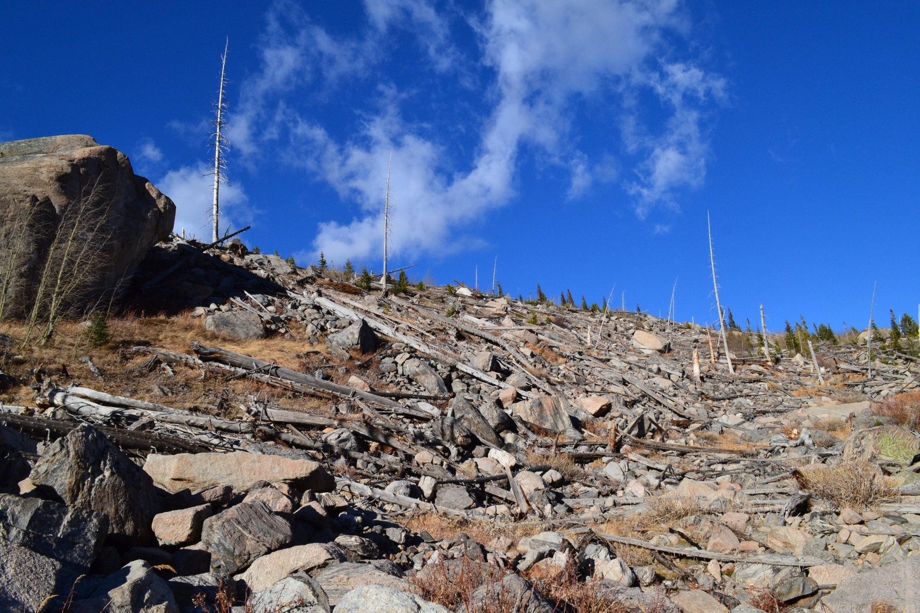
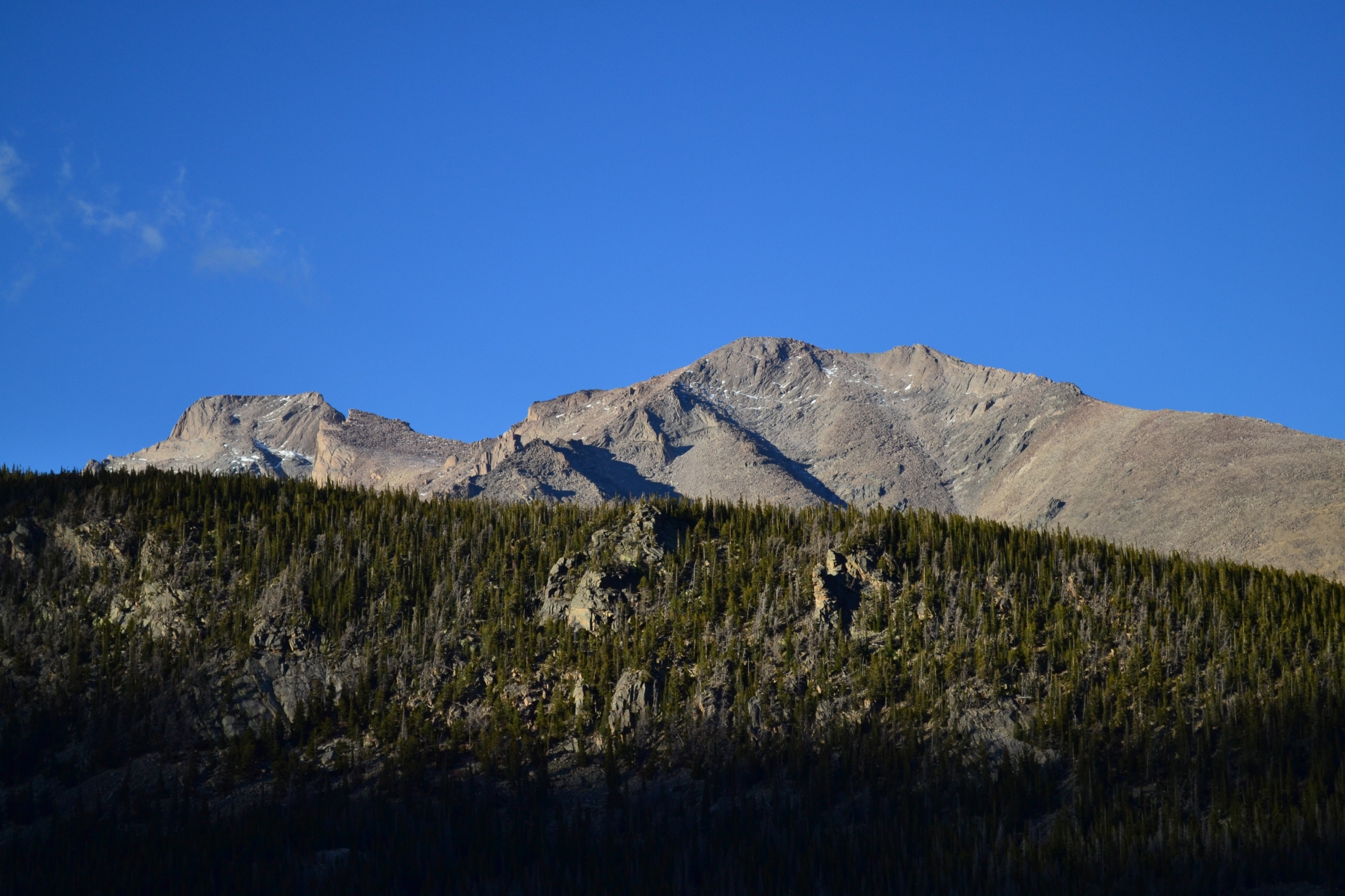
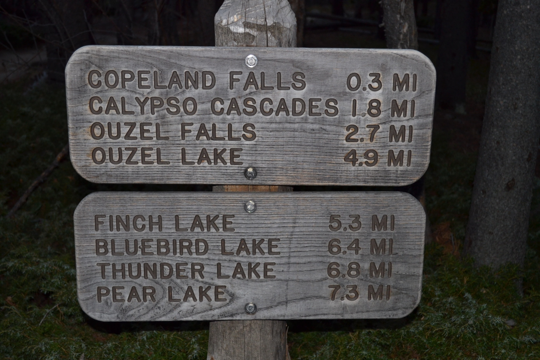
The cool evenings and brisk winds of fall brought us crunchy leaves beneath our feet and colors of brown and beige, but the snows we are so accustomed to this time of year in the high country are lacking and have left us unseasonably warm. Scant snowfall in many regions of the high country this year has extended summer/fall hiking conditions, and a trip to Rocky Mountain National Park was no exception. With no snow for our skis, we threw our hiking boots on once again and drove to Wild Basin, a gem in the vast expanse of the park. After a long, late morning drive, we arrived at the park. The entrance to the park and ranger station is approximately 20 miles from Lyons, CO on Hwy 7, and as a word of caution, there is very limited to zero cell service on this drive and throughout most of the hike. While this is a relatively nice opportunity to cleanse the soul from the distractions of politics, email, etc., it doesn’t help with worried family members waiting for a check in call. As we approached the entrance booth, there was no ranger on duty and a simple sign which read “please proceed.” We happily obliged and followed the summer narrow, dirt road all the way to the summer parking lot. On a typical summer weekend, there is absolutely no parking in this relatively small lot after 8:00 am, thus we were thrilled to have the opportunity to choose a space on this fall return trip. The hike to Bluebird lake follows the same path that leads to Copeland Falls, Calypso cascades, Ouzel Falls and Ouzel Lake that we visited on a few earlier trips. As you can imagine, there are several attractions to distract from the altitude gain along the way. Seen below are photos from the first few miles of our trip including Calypso Cascades, as well as information on ease and distance to each point of interest.
Calypso Cascade: 3.6 miles Round Trip (Easy)
Ouzel Falls: 5.2 miles Round Trip (Easy)
Ouzel Lake: 9.8 miles Round Trip (Intermediate due to distance)
Bluebird lake: 12.8 miles Round Trip (Intermediate due to distance)


Mount Sniktau, Front Range, 13,234 ft
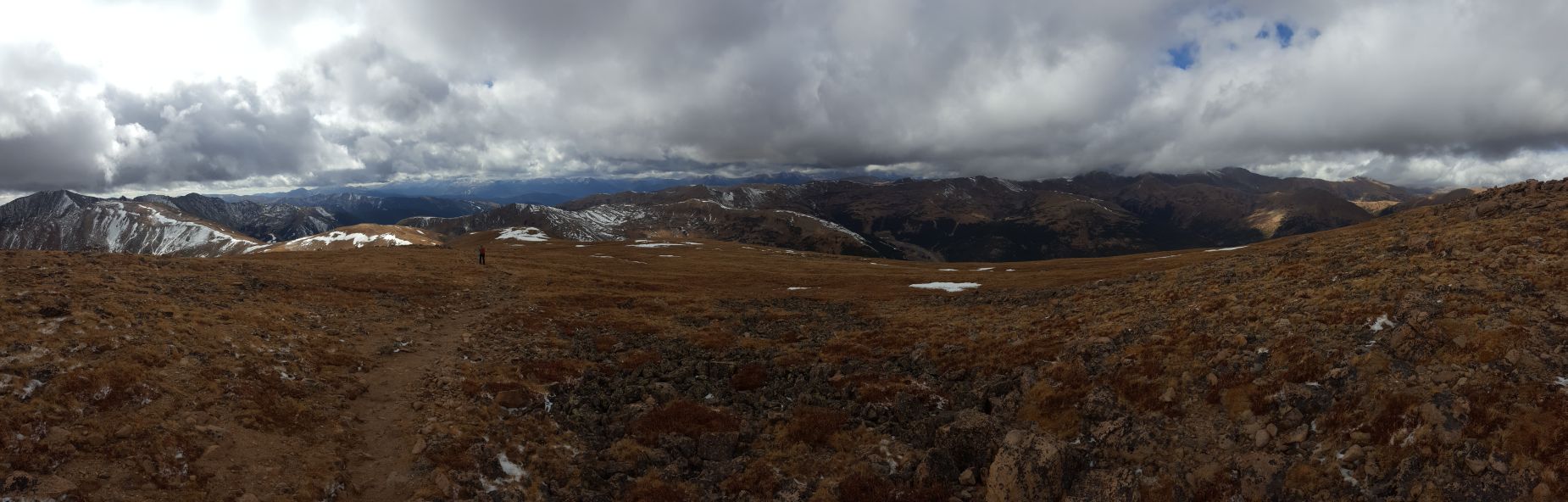
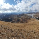
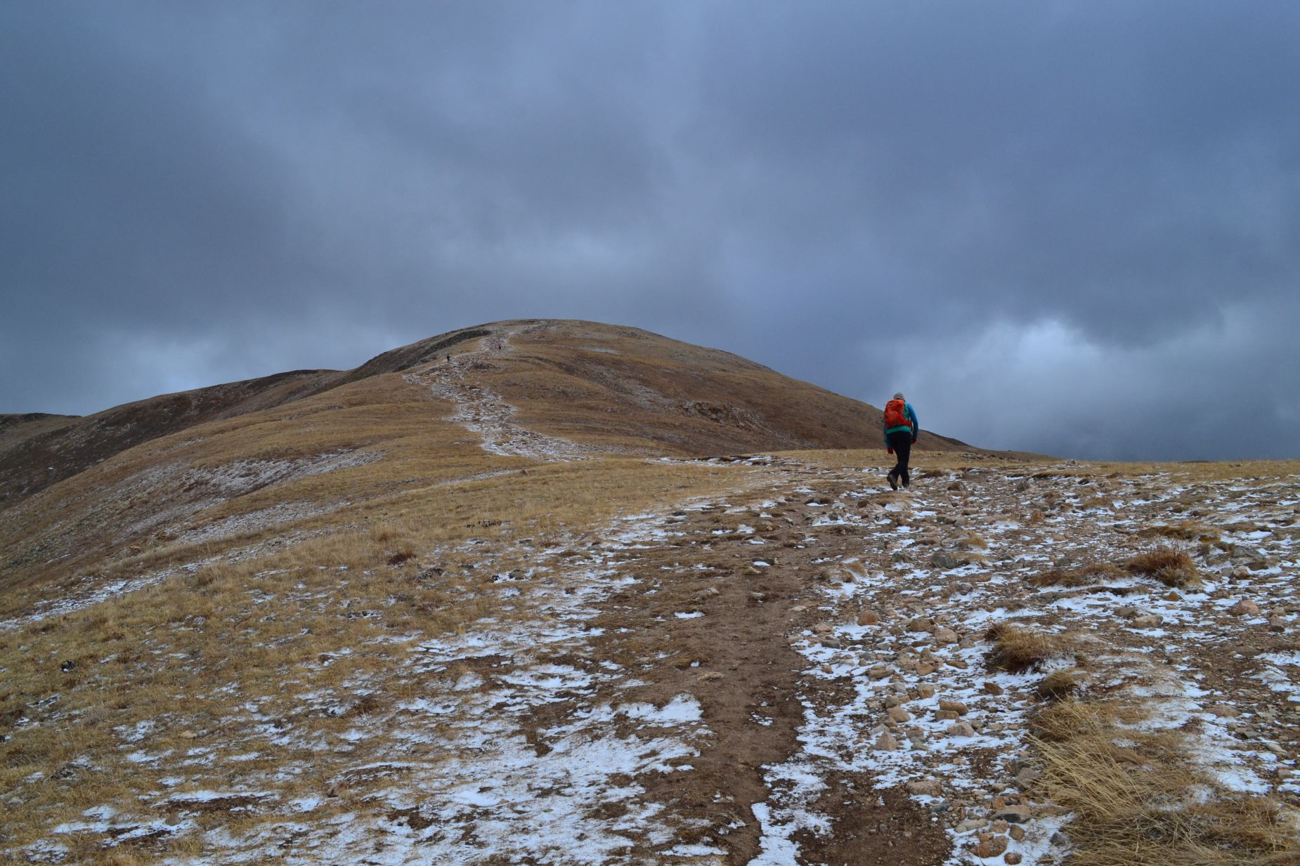
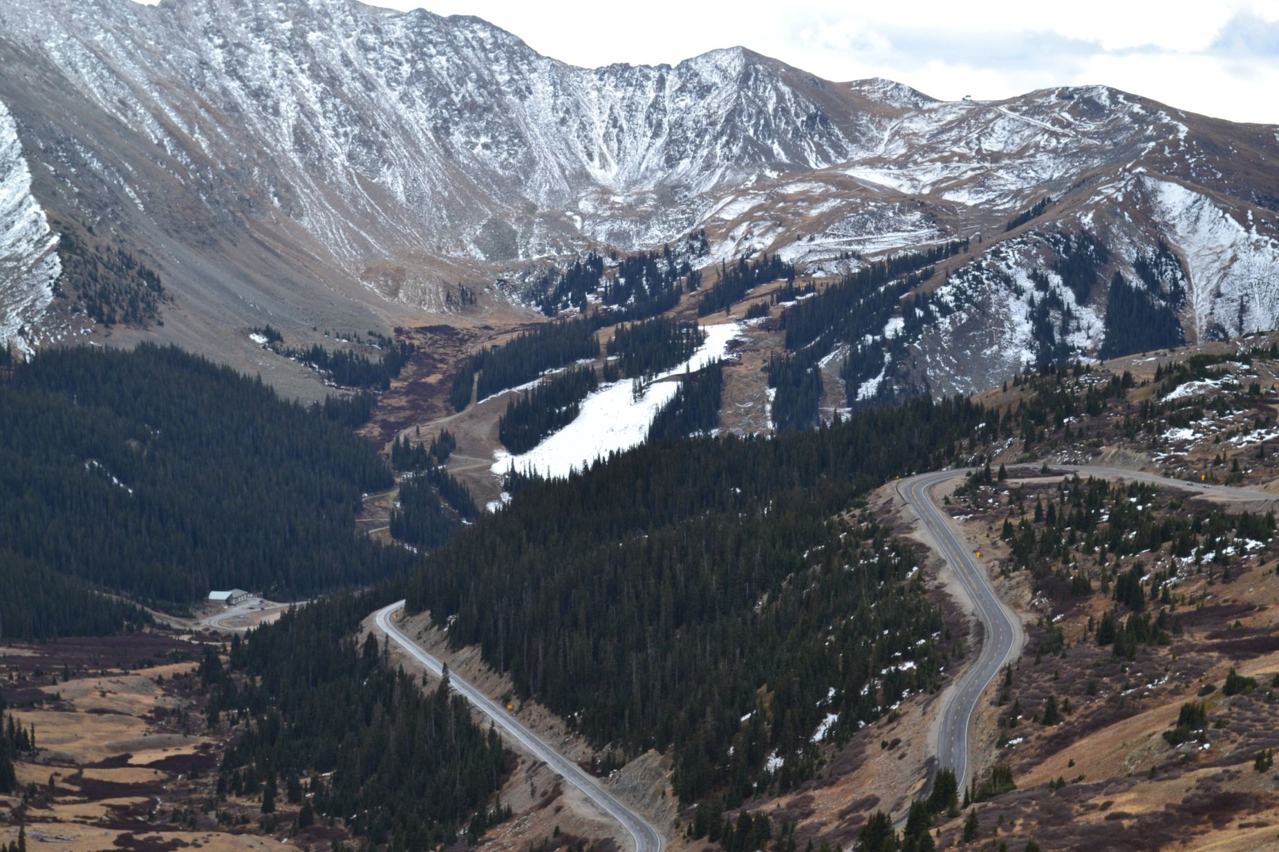
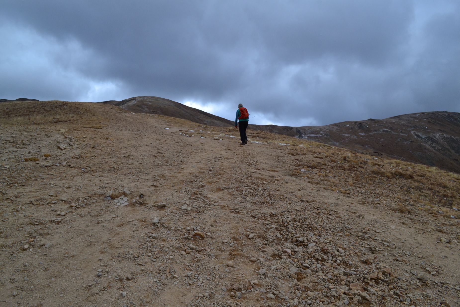
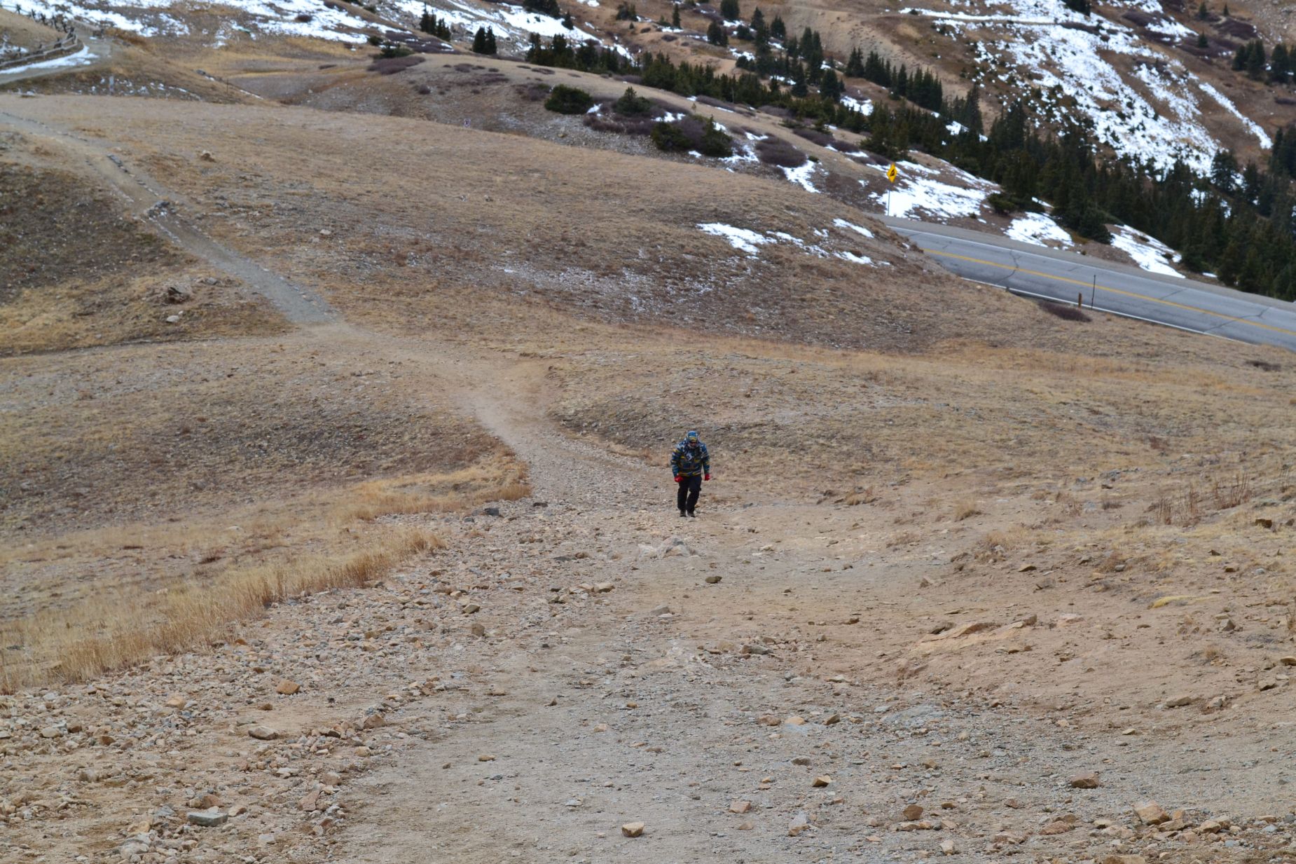
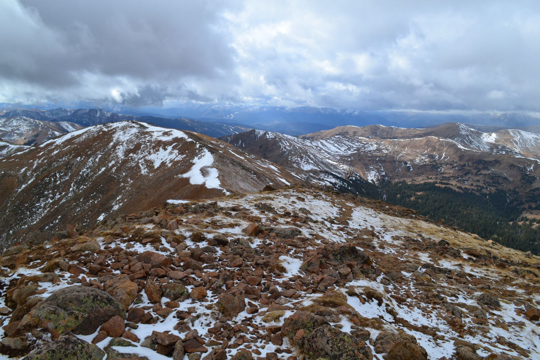
We’ve driven by this unassuming peak on numerous occasions on our way up I-70 towards other mountains and adventures. Most of the time, we fail to even notice Sniktau as we focus our attention on 14ers, Gray and Torreys or lately, at the smattering of early season snow at Loveland. Nonetheless, Mount Sniktau is a ranked peak that hovers above 13,000 feet. With little time for a longer trek, we opted to give this short 13er hike a try last Saturday, October 29th. We began our journey from the small parking lot at Loveland Pass at approximately 11,990 feet above sea level. The lack of earlier season snow and unseasonable warmer temperatures resulted in a mostly dry trail for the majority of our hike, though the temperatures were quite cool as expected for late October. We began the hike by walking up a short set of stone steps followed by a quarter to half mile of steep sandy trail. Though the hike is only 3.8 miles RT, there is a significant amount of elevation gain in the short trip to the summit. Seen below are photos of first portion of the hike. Notice, you can see the one ski run currently open at Arapahoe Basin.
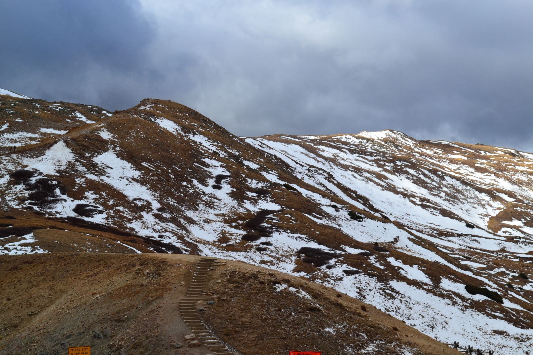
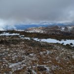
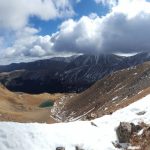
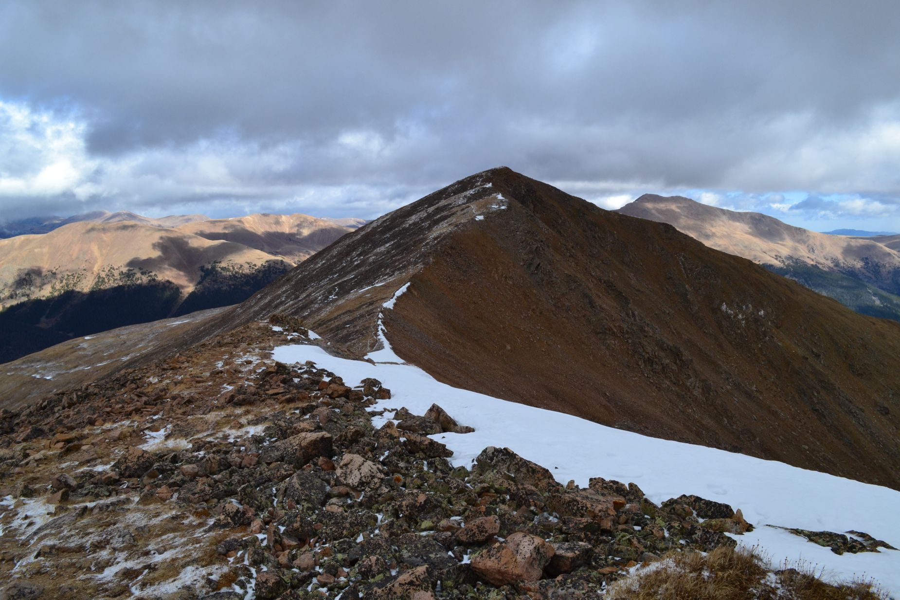
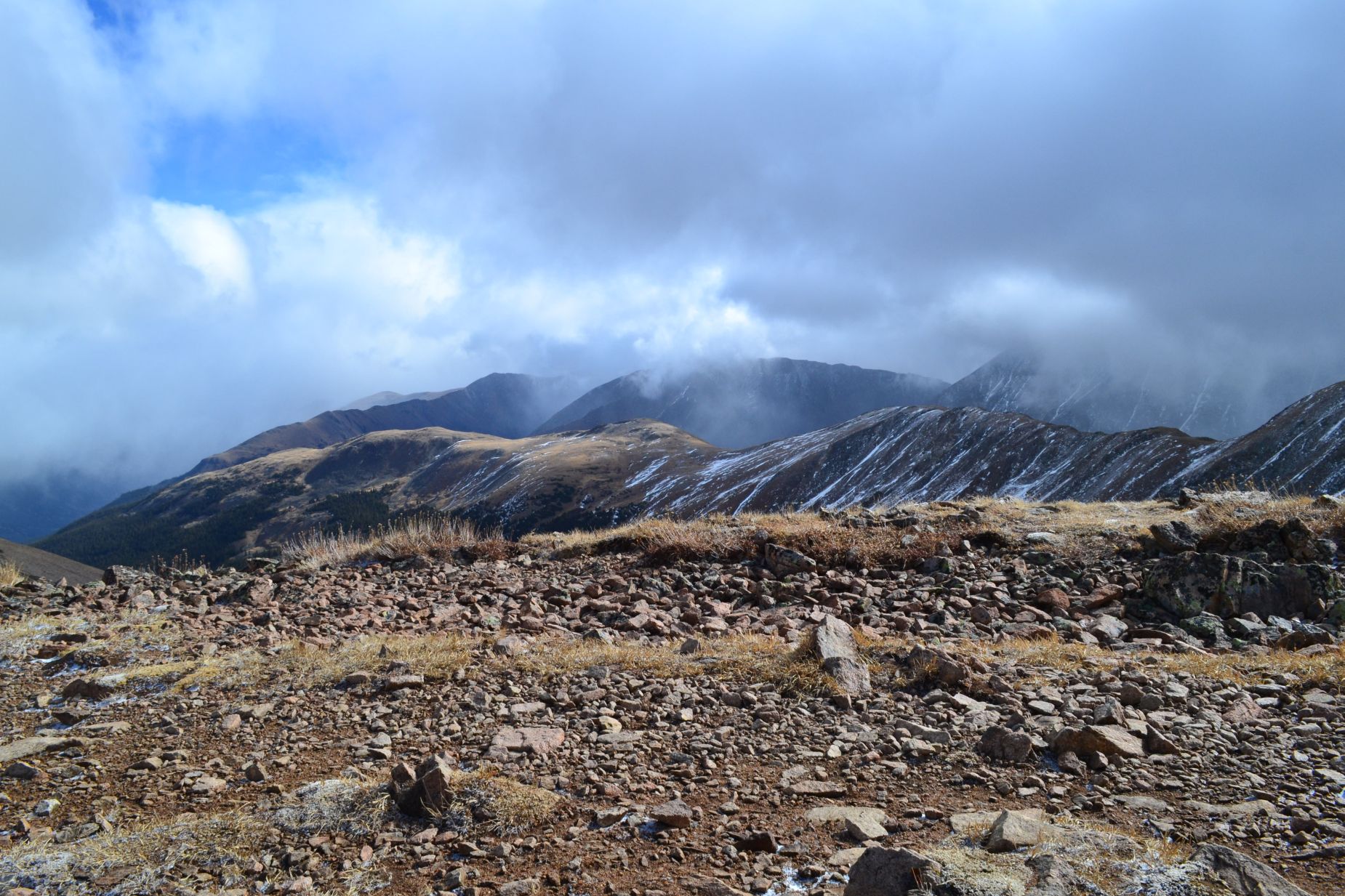
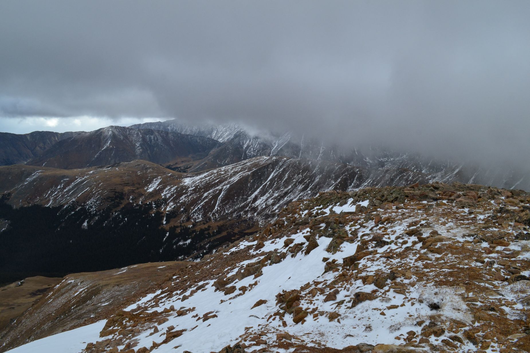
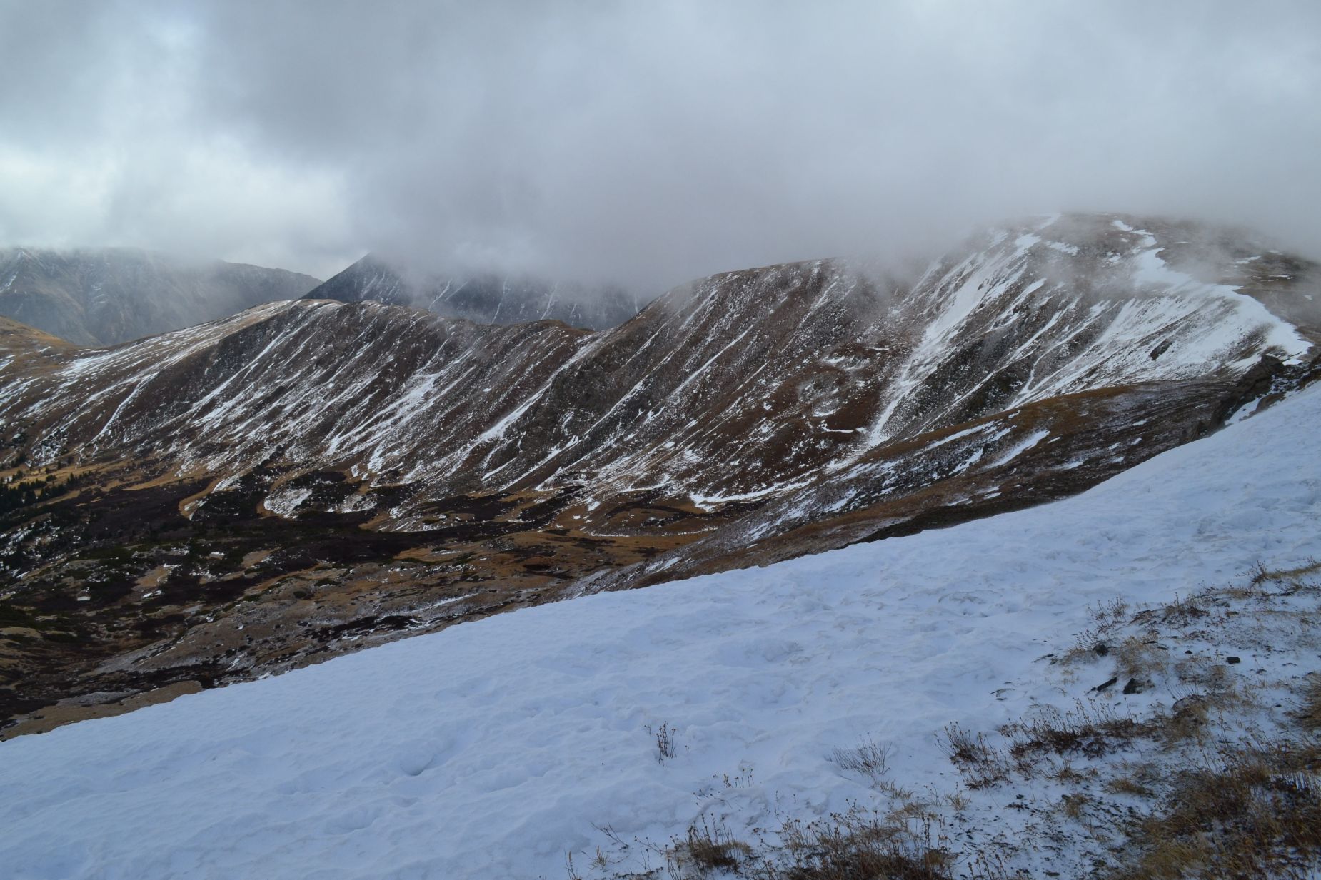
Unfortunately for us, dark snow-filled clouds begin to quickly engulf our route as we reached the first set of rock wind shelters and brief flattening of terrain. Our timing for reaching these shelters was perfect, as gusts of strong wind and sleet/snow began to fall. We were essentially sitting among rocks in white-out conditions. Several parties 10 minutes behind us turned around. We decided to wait for 10-15 minutes to see if conditions improved so we could continue to the summit or at least avoid an uncomfortable hike back to the car. Our patience ended up greatly rewarding us as hints of blue and warmth from the sun emerged to greet us after a short wait. With visibility on our side once again, we continued onward and upward. Seen below is the view to south where Grizzly peak can be found and the first glimpses of the false summit after the storm cleared (photos top to bottom).

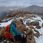
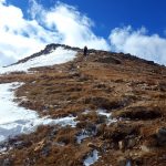
Though we could see our path, the winds were now relentless on the ridge walk. Gusts of near 50-60 mph frigidly blasted us as we pushed our lungs and legs up the moderately steep incline. Thankfully, there were not steep or sheer drop offs to fear on this easy summit attempt since we held a genuine fear of being blown over. As we reached the top of the false summit, we found the first hints of snow among the rocky outcroppings of the trail. It was not enough to require the effort of putting on microspikes, but brought us hope that we may begin to see some normal weather soon for this time of year. There was another wind shelter on the false summit that we sought refuge in from the wind once again. Though it was filled with wind blown snow, it provided a bit of relief. Below are photos from the false summit and the interesting weather patterns we witnessed while on the peak.
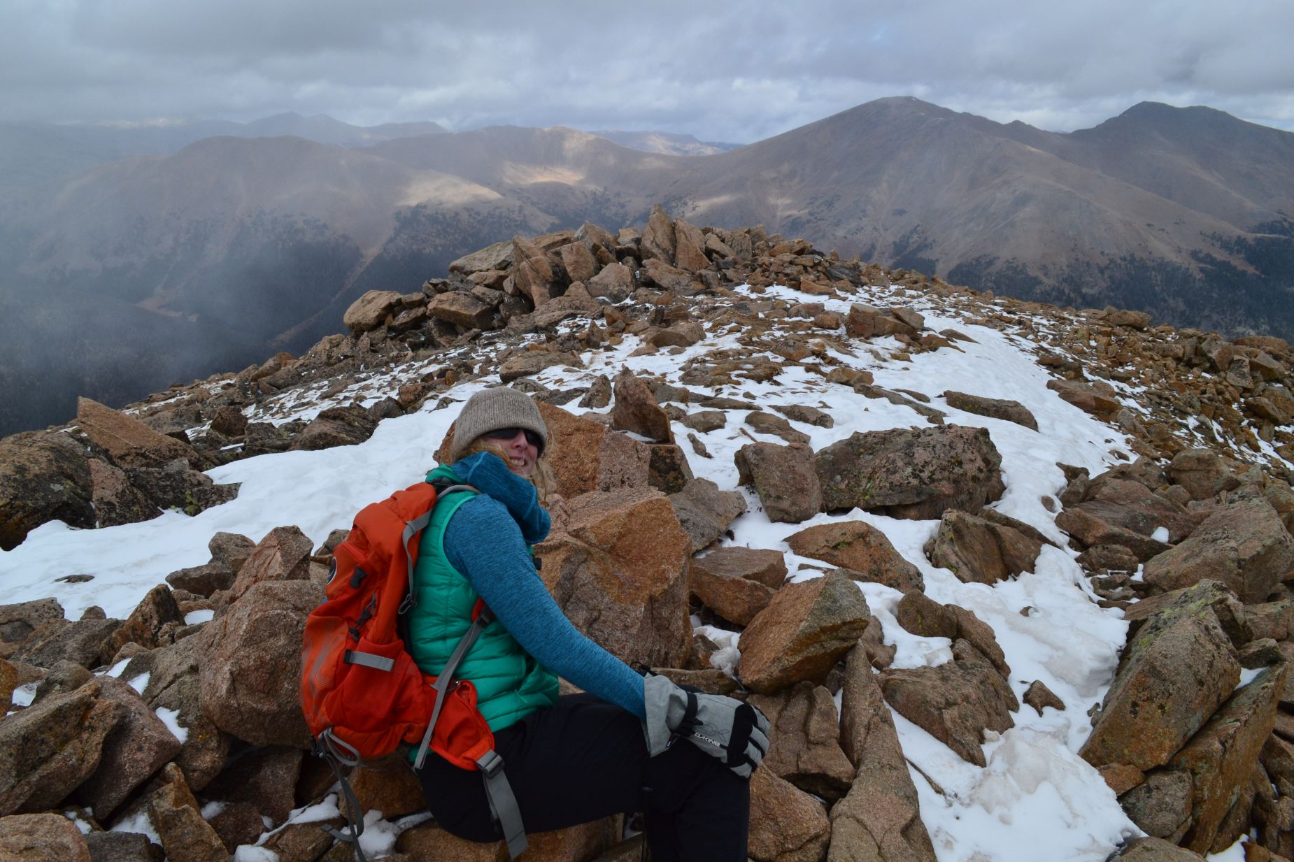
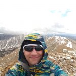
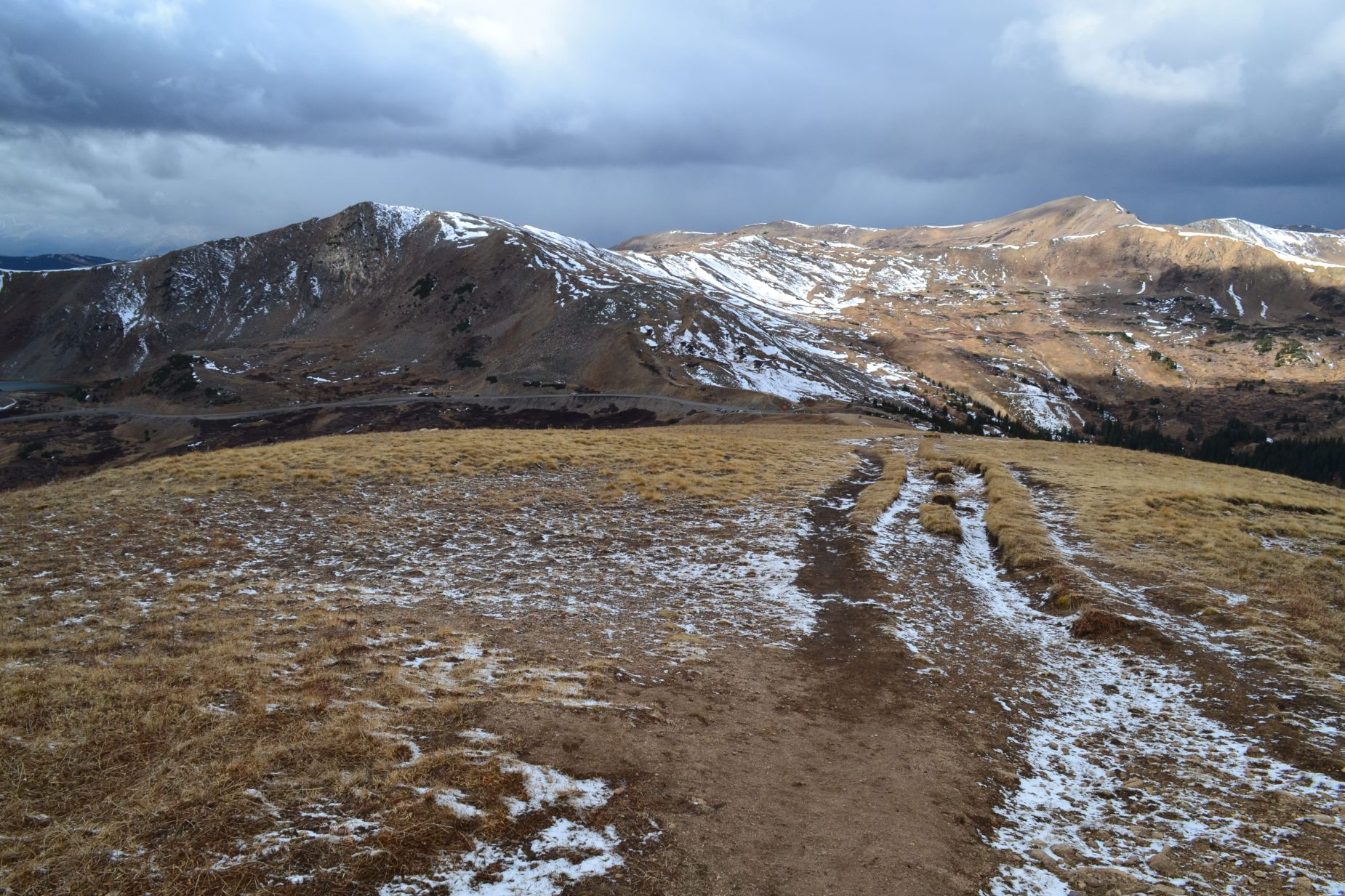
From the false summit, we made the decision to embrace the gnarly winds and brave the summit. It was only a short, steep jaunt away. We had to briefly descend into a saddle and then regain some of the elevation. Within 15 minutes, we were on the summit. We saw spectacular views of Grays and Torreys but unfortunately also of I-70 to our north. We spent an ever so short amount of time on the summit due to cold temperatures and winds but at least we had it to ourselves.
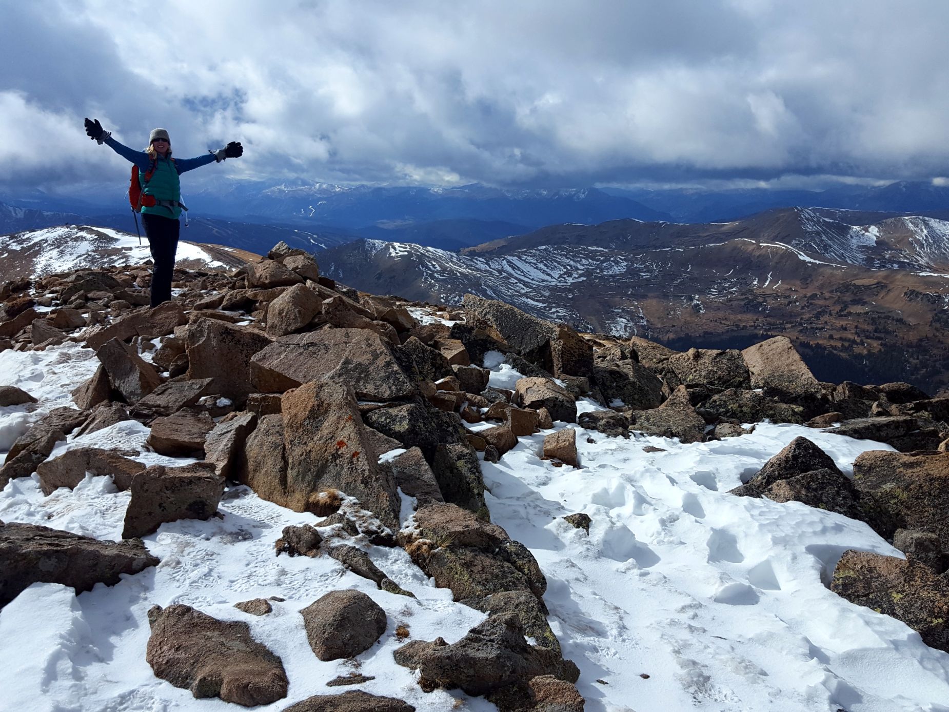
The hike to Mount Sniktau proved to be beautiful, short, and adventurous. Despite the lack of complete detachment from society that Mount Sniktau offered, it still provided a quick high altitude mountain fix. With the weather we encountered, it morphed from what could have been an uneventful hike, into an alpine enterprise that reminded us of why we pursue these treks as often as we can. Overall, we hiked about 3.8 miles and gained around 1,600 feet in elevation according to our GPS. If you have the time for a shorter, alpine hike to tag a 13er, Mount Sniktau isn’t a bad way to spend the day.