Take a Walk
A Quest into the Wild
Mount of the Holy Cross via the North Ridge Route
Distance: 12 miles (out and back) Elevation Gain: 5,649 ft. (total)
Max Elevation: 14,005 ft. Min. Elevation: 10,311 ft.
For years, rumors circulated that a natural cross could be found deep in the rugged back country of Colorado. Until photographer W.H. Jackson produced the famous photograph in his geographical survey expedition with F.V. Hayden in 1873, the existence of the beautiful religious symbol was just speculation. The beautiful image taken just after dawn from Notch Mountain erased any doubts. The natural cross of snow lays across the rugged face of the mountain formed by two deep ravines and has been tempting hikers, nature enthusiasts and pilgrims ever since Hayden and Jackson’s famous expedition. While the mountain and surrounding wilderness has been the subject of beautiful poems, famous paintings, and a place of prayer, it has also been a place of tragedy. Since 2005, there have been two deaths, one presumed, as no trace of the hiker has ever been found. Every year numerous hikers have required rescue after becoming lost, and The Gazette of Colorado Springs has gone so far as to have called it “the Bermuda Triangle of Colorado.” In fact, a member of Vail Mountain Rescue Group we encountered on the summit ridge told us they have already had to assist 6 climbing parties that have become lost on the descent this season.
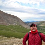
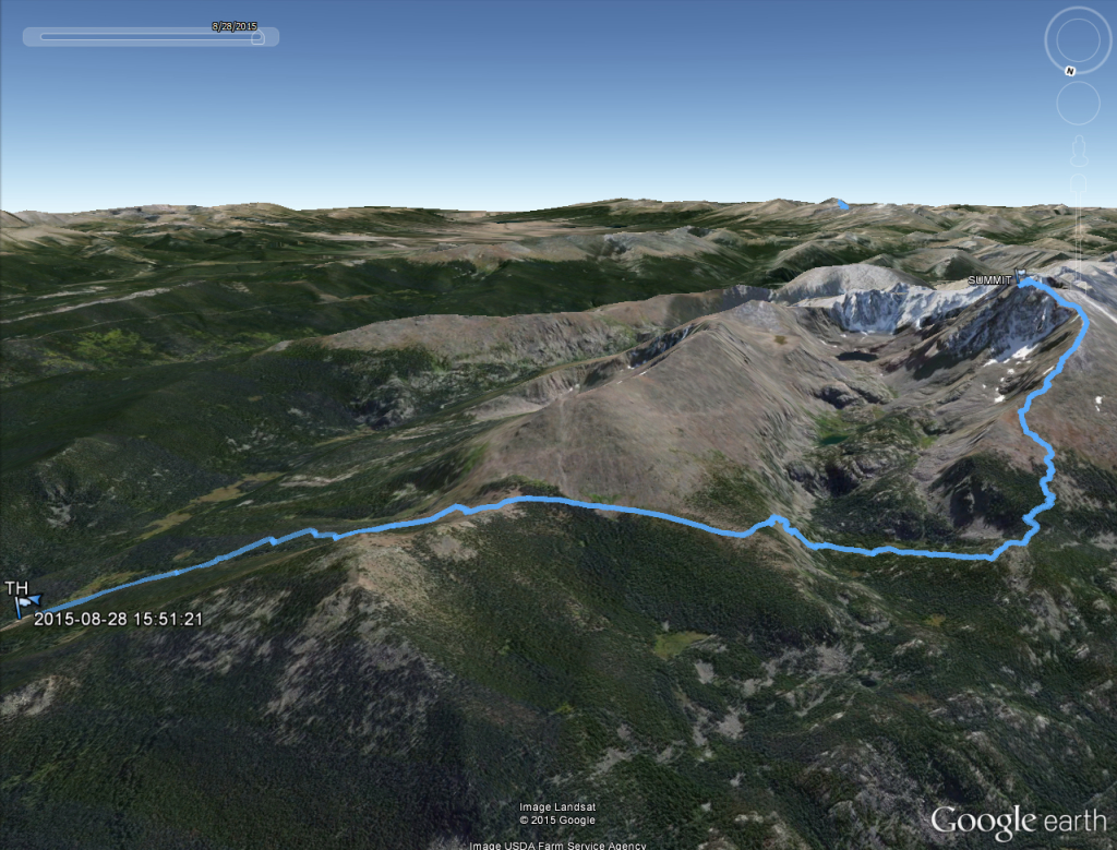
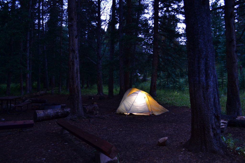
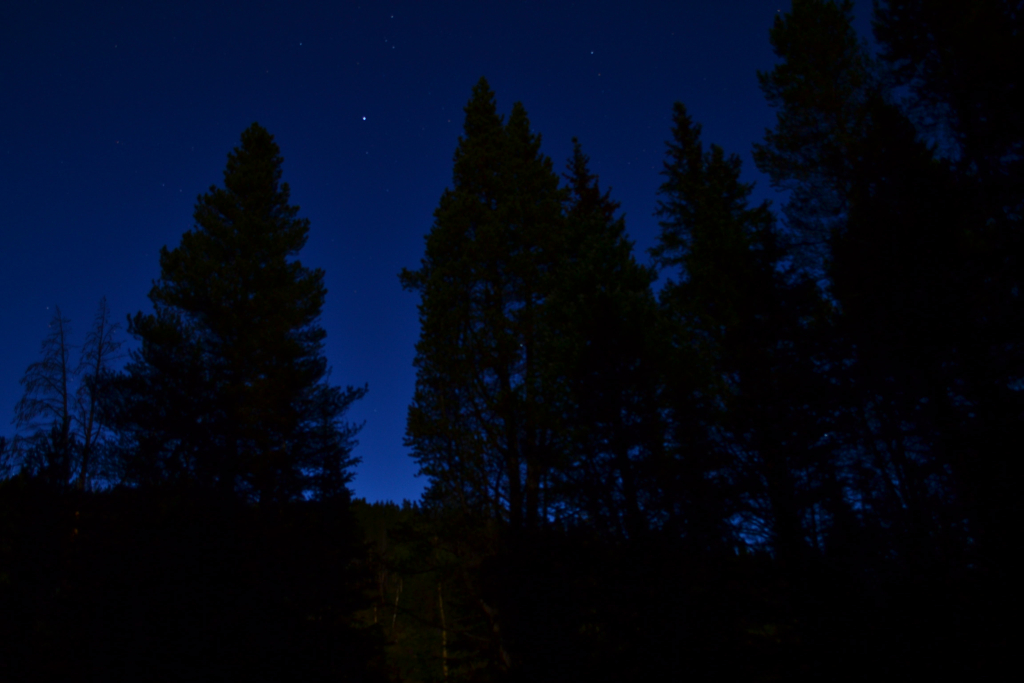
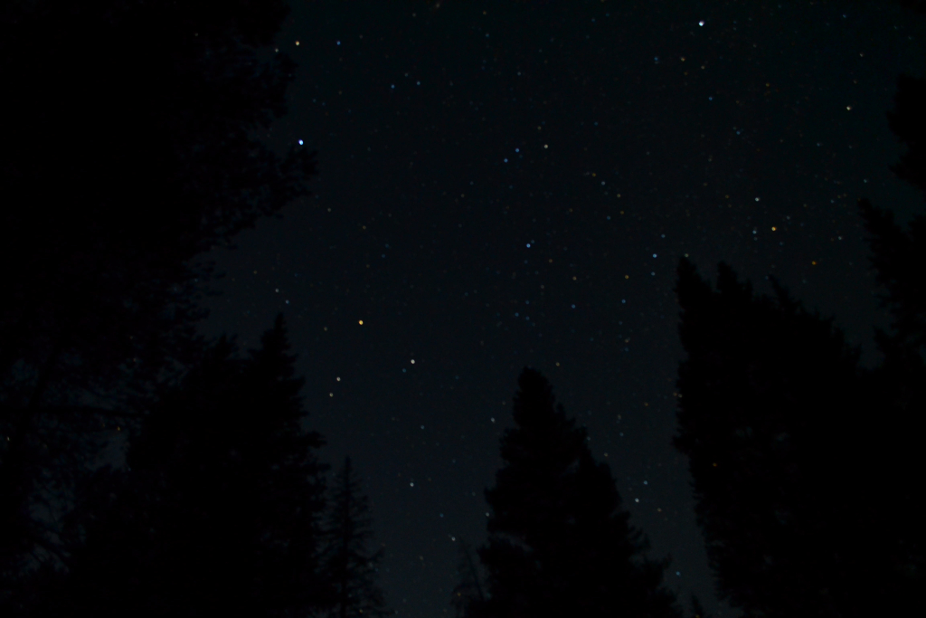
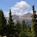
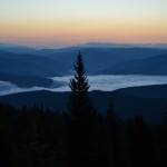
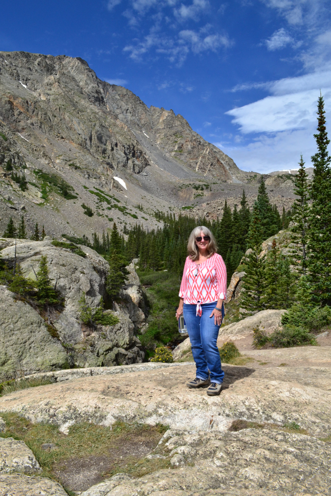
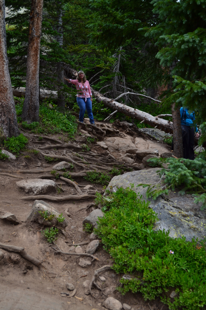
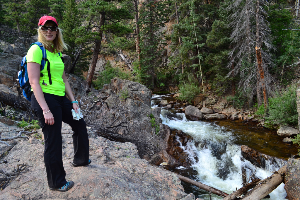
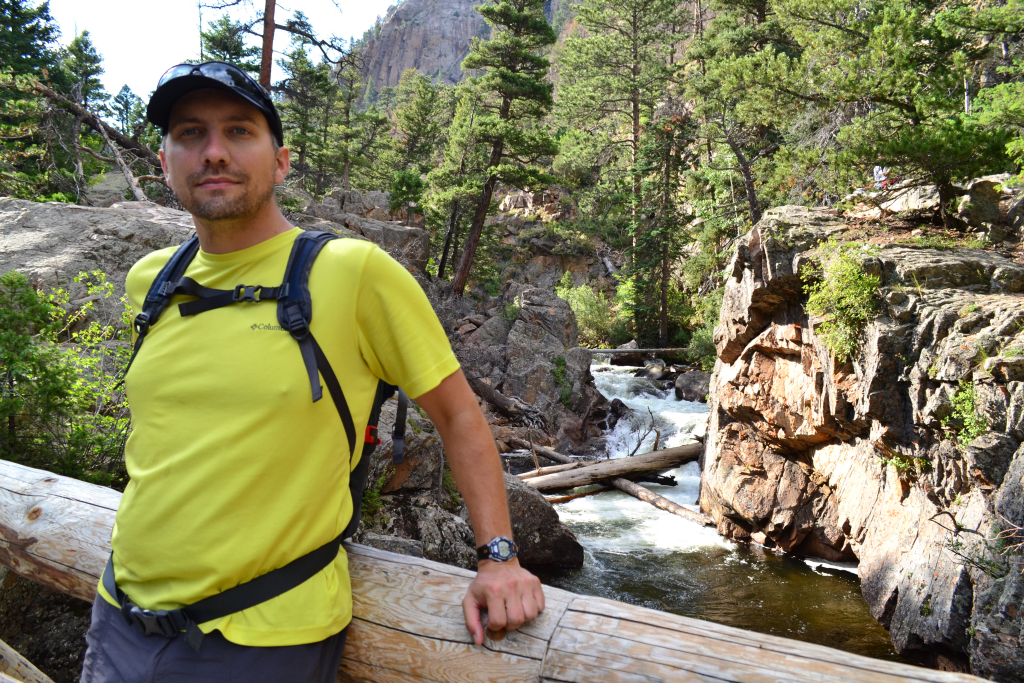
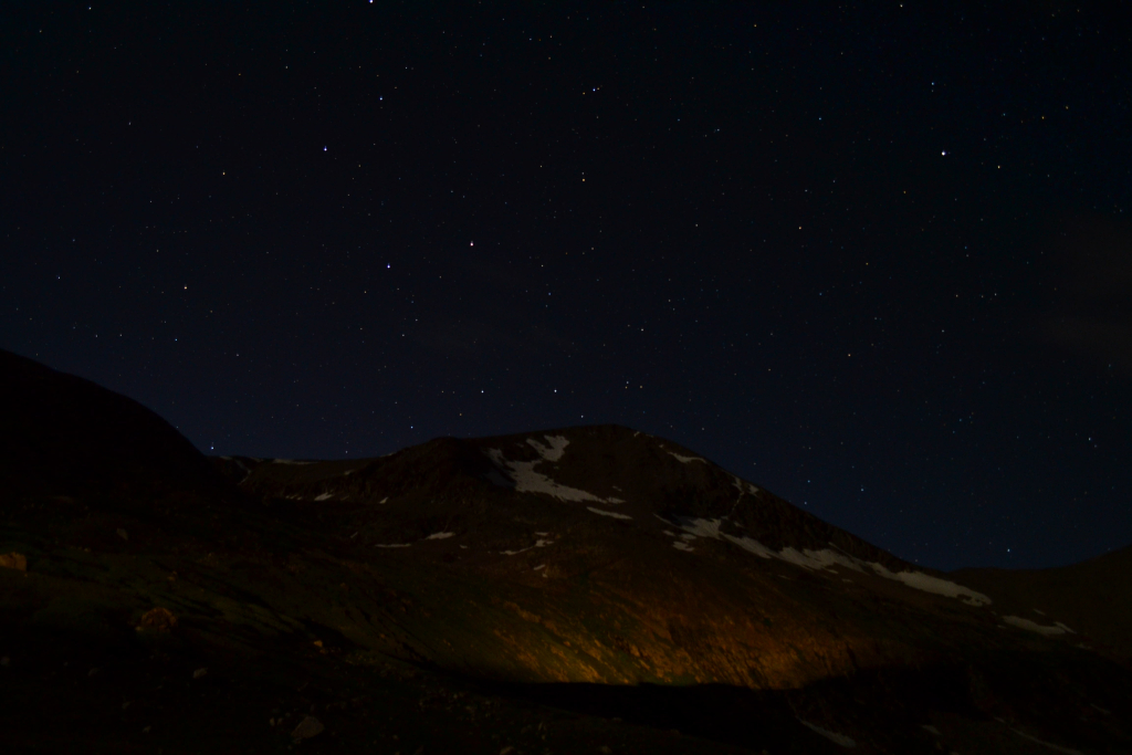
The allure of Holy Cross has not eluded us either. The mystery, intrigue, and challenge of the mountain finally pushed us towards a summit attempt on the last week of August. Mount of the Holy Cross stands prominently in the northern portion of the Sawatch range at a height of 14,005 feet, just making the cut-off for an official Colorado “14er”. To reach the summit trailhead, we drove to Minturn which is just south of Vail. From Hwy 24 we took a right on Tigiwon Rd. and followed the rocky dirt road 8 miles. We tent camped at the Halfmoon campground and enjoyed a quiet (well almost) night under the stars. Seen below are photos of our arrival in Minturn, our campsite and the brilliant night sky.

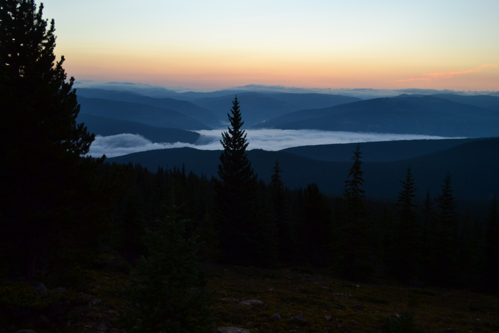
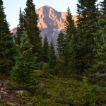
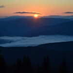
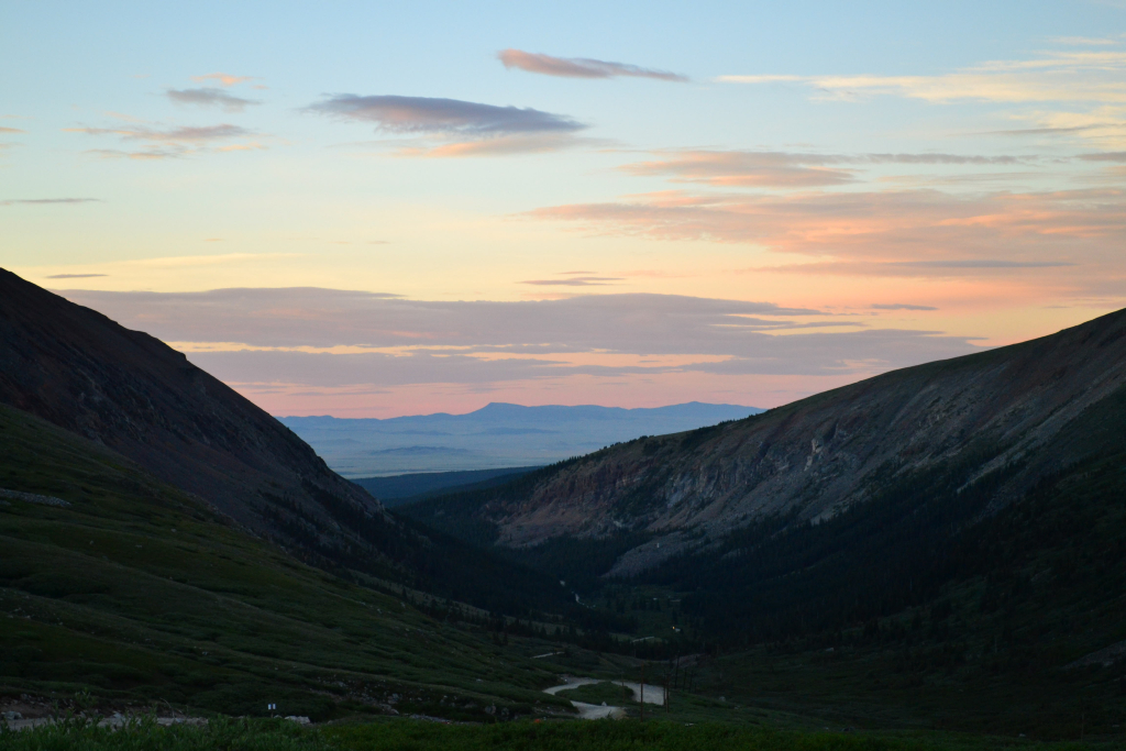
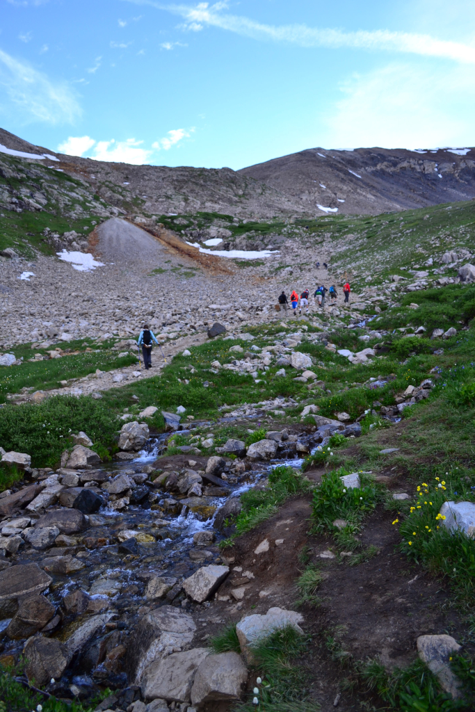
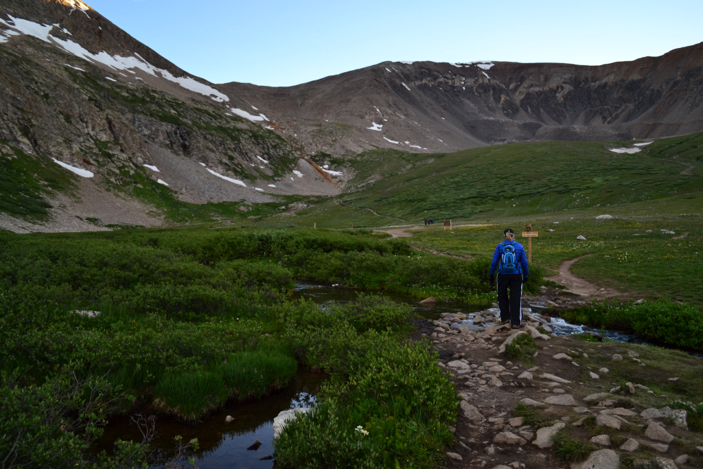
We tucked in for the night at around 10:00 pm. Shortly after, we were awakened by a violent thunderstorm. The lightning lit up the sky brightly. Every minute or so another loud clap of thunder sounded, and then the rain began. We huddled under the protection of our tent and prayed that the canvas would keep us dry. We eventually fell asleep, and the tent thankfully kept us dry until morning. The alarm went off at 4:15 am, and we slowly got packed up and ready without a full night’s rest. We donned our head lamps in the darkness of the cold early morning and hit the standard North Ridge trail. Fortunately, the sky was clear and the storms had ceased. We quietly hiked for 1.5 miles in the dark towards Half Moon pass. We gained about 1,300 feet of elevation during this early morning portion, but the darkness has a way of hiding the ascent and thus it went by quickly and without much notice on our part. As we approached Halfmoon pass the sun started to rise revealing a thick layer of fog below us. The moist air looked like a waterfall rolling over the thick treeline in the distance.
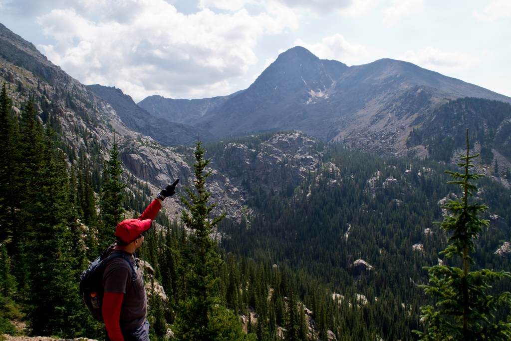
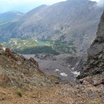
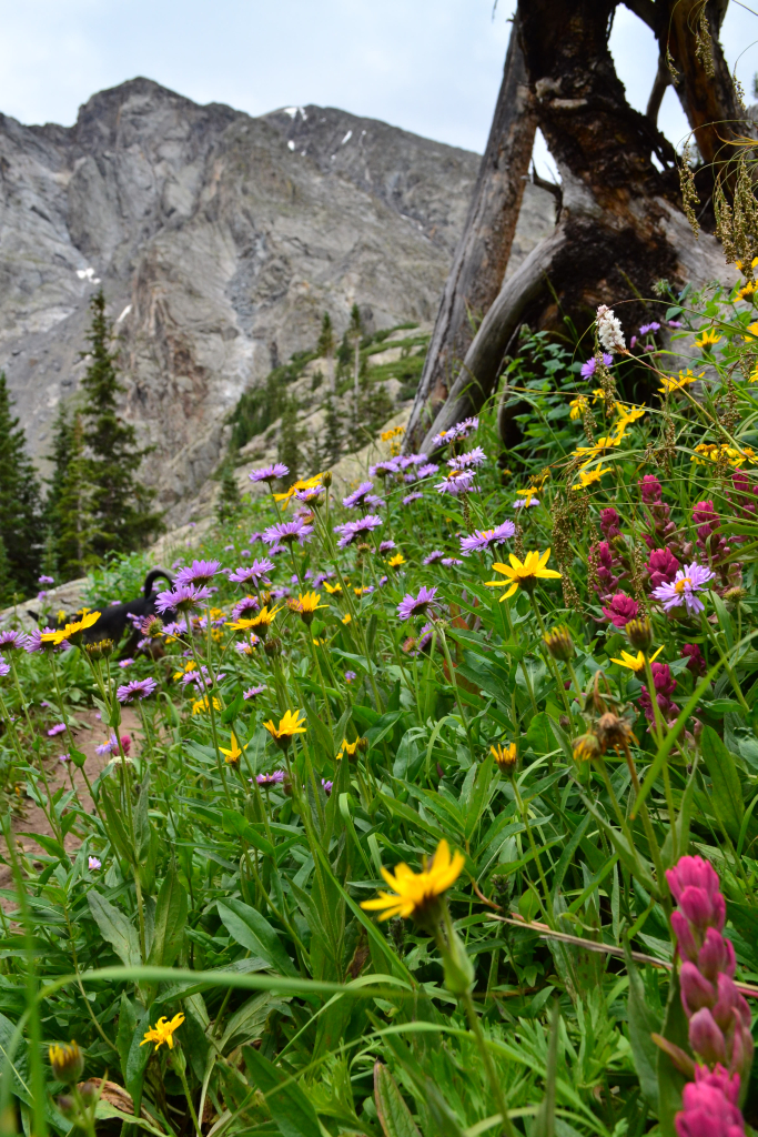
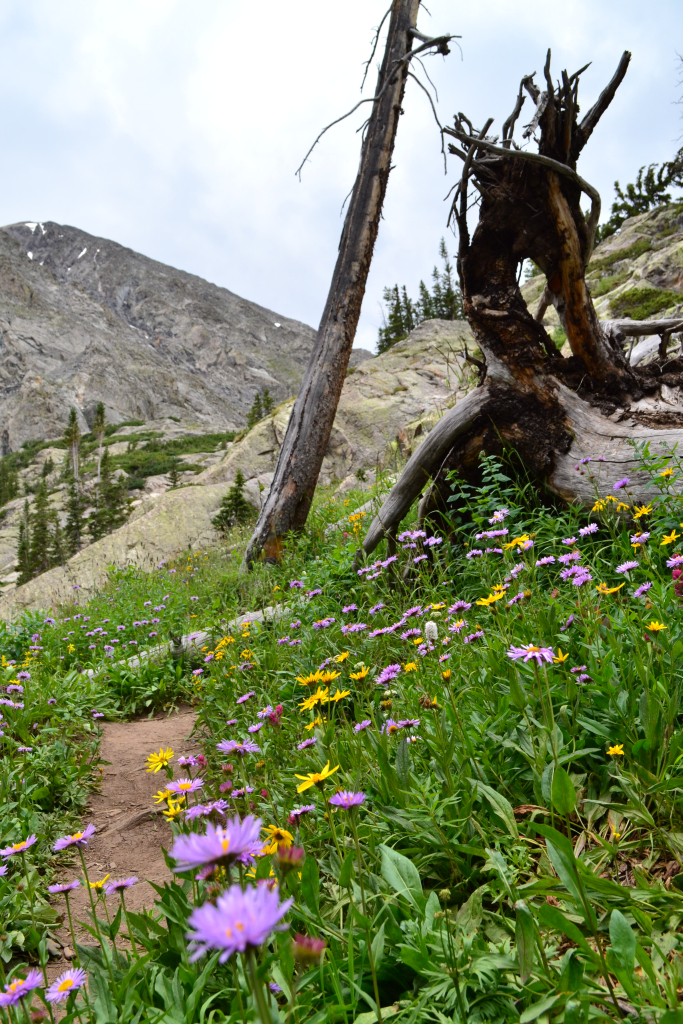
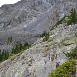
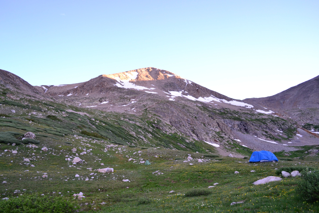
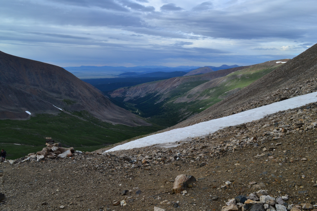
Utilizing the North Ridge route requires climbing Half Moon Pass and then descending into East Cross Creek thereby losing a bunch of elevation before gaining the summit of Mount of the Holy Cross. In fact, many hikers choose to attempt the summit in two days by camping at East Cross Creek to minimize the daily elevation gain. As we descended the pass, we gained our first views of the distinct and exquisite mountain. Unfortunately, the cross cannot be seen from the route we took. In order to gain a view, the Halo Ridge route via Fall Creek and Notch Mountain trails must be taken. In addition, the cross is not well visible during the late summer months as much of the snow has melted out. We plan to attempt the more demanding Halo Ridge early next season or at least climb to the Notch Mountain shelter to get a great view. The first photo below reveals alpenglow on our first view of Mount of the Holy Cross. The second photo was taken during our return to give some perspective of the distance necessary to reach the summit.

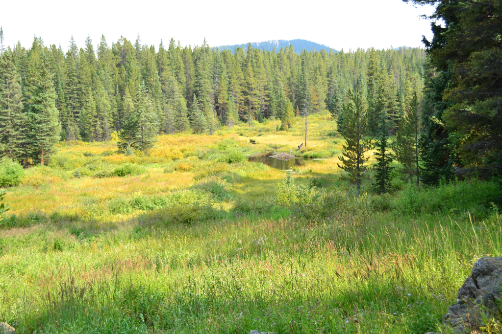
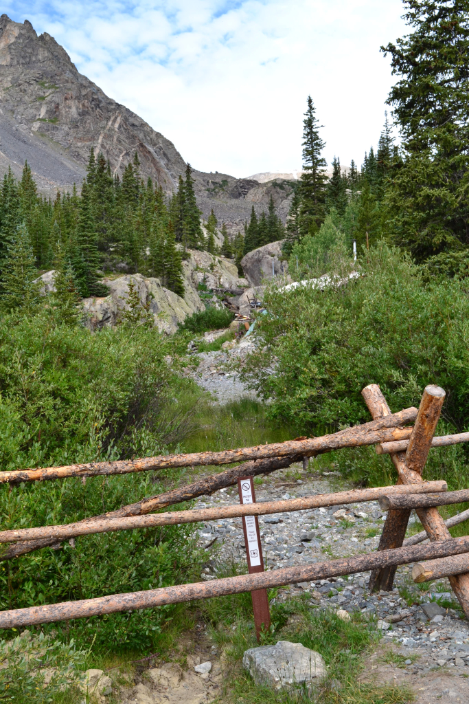
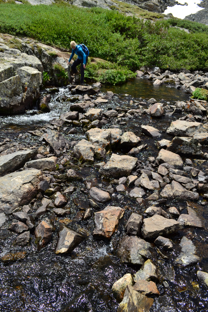
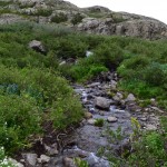
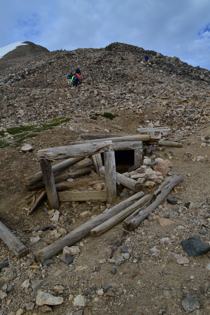
The descent into East Cross Creek proved to be very steep. After about a mile of down climbing, we finally reached the creek crossing and all the backcountry campsites. After crossing the creek, the trail began to regain elevation. We followed several steep switchbacks to treeline.

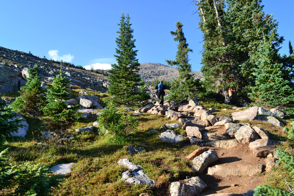
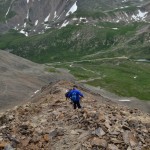
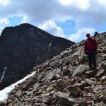
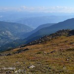
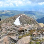
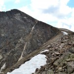
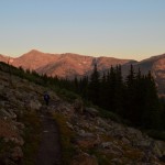
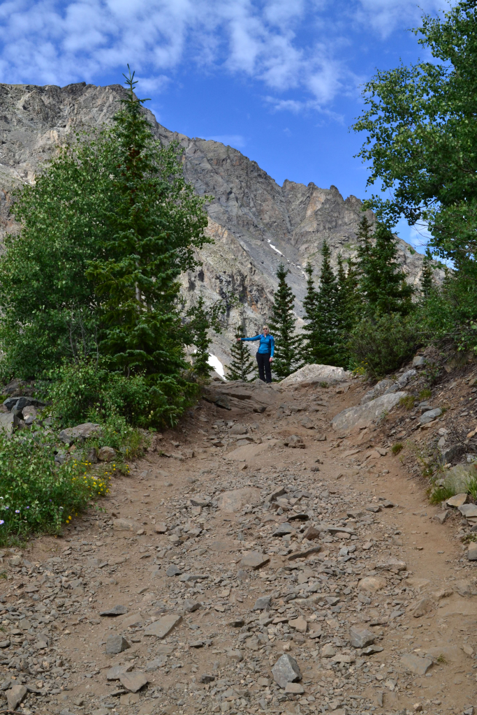
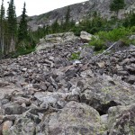
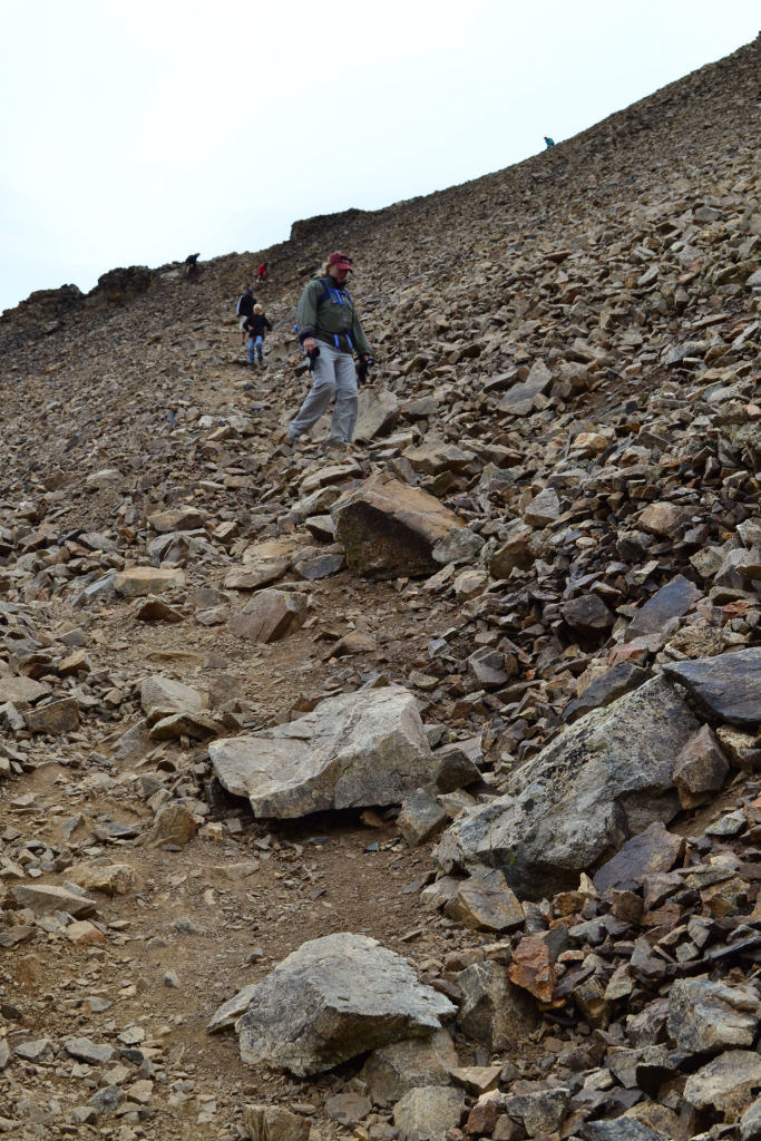
After treeline the real challenge began. From the creek to the summit we gained approximately 3,330 feet of elevation in 2.7 miles making for an average grade percent of around 23. However, we encountered a mile of 30% grade incline before reaching the ridgeline, and another 30-35% grade incline in the final 0.35 miles to the summit. Seen below are photos taken just after treeline while we pushed for the ridgeline. The summit of Holy Cross can be seen in the background.

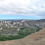
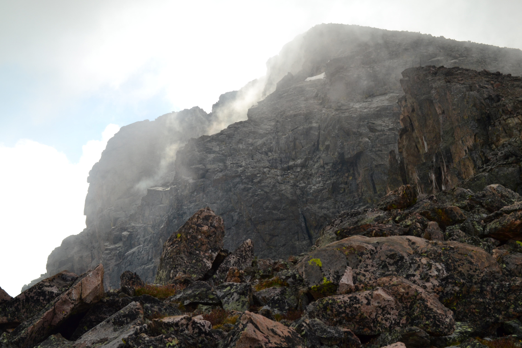
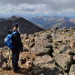
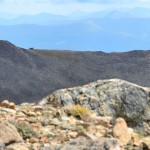
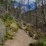
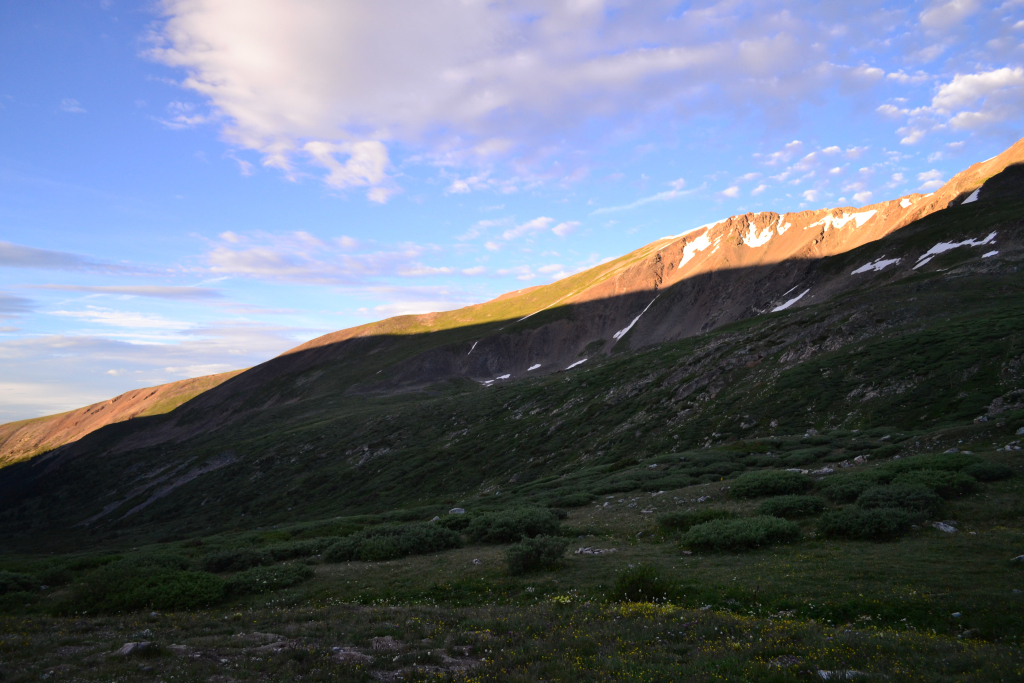
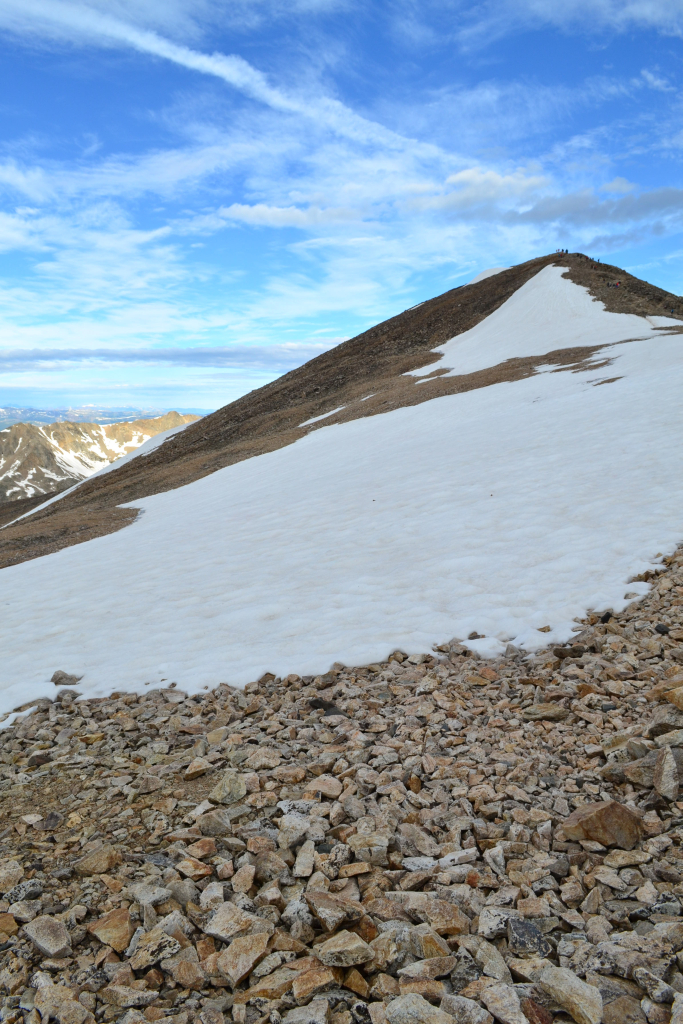
With each foot of elevation and distance gained we got to see a little bit more of Holy Cross. Despite our progress, her summit still looked impossibly far away. The trail above treeline was very rocky and consisted of many stone steps and rocks. Route finding was not necessary at this point due to all the work the Colorado 14er’s Initiative has been doing maintaining the trail. Once we reached the ridgeline the incline of the trail mellowed out briefly, and we were able to enjoy the impressive views of the mountain and surrounding wilderness. This was a wonderful portion of our ascent. A layer of fog surrounded the summit of Mt. of the Holy Cross for a brief 15 minutes. We captured the moment below.
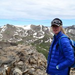
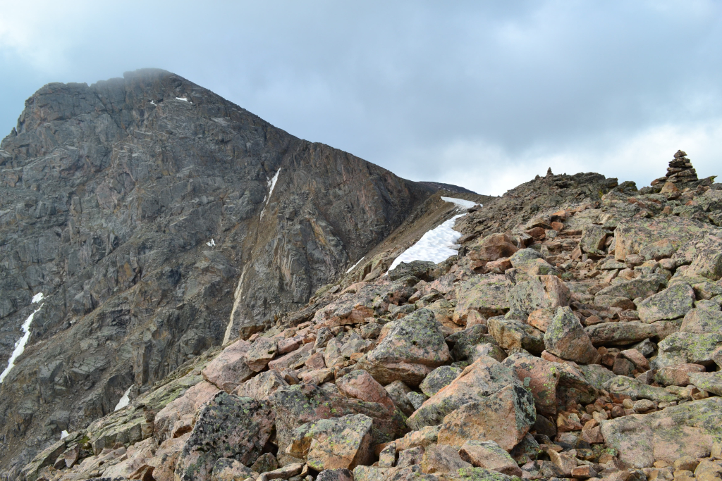
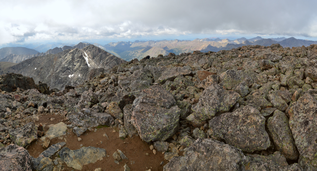
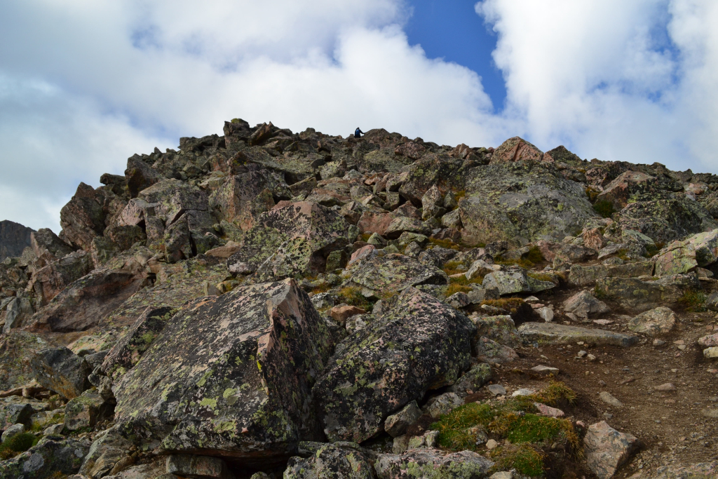
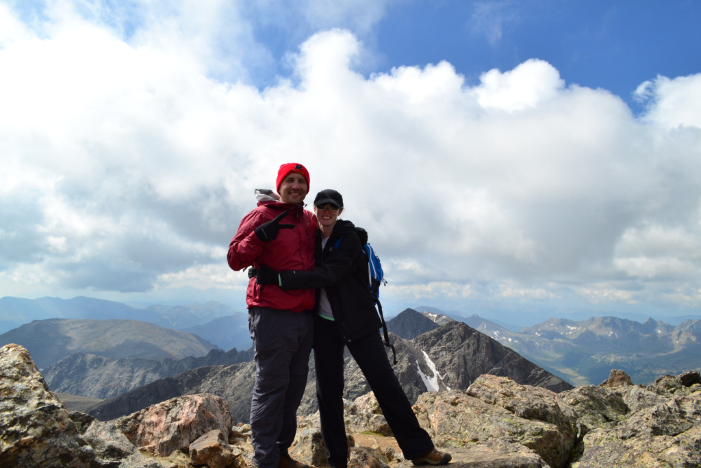
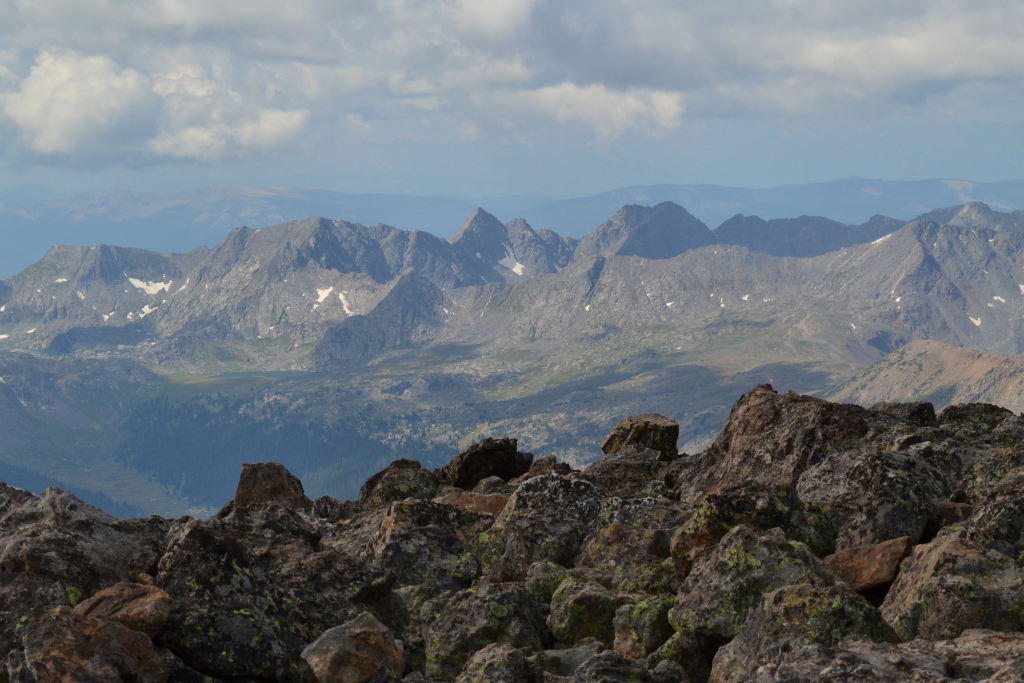
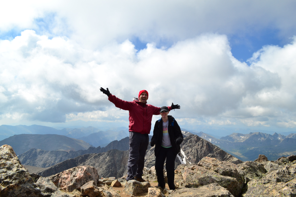
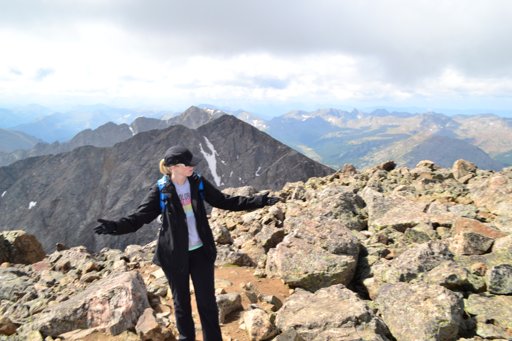
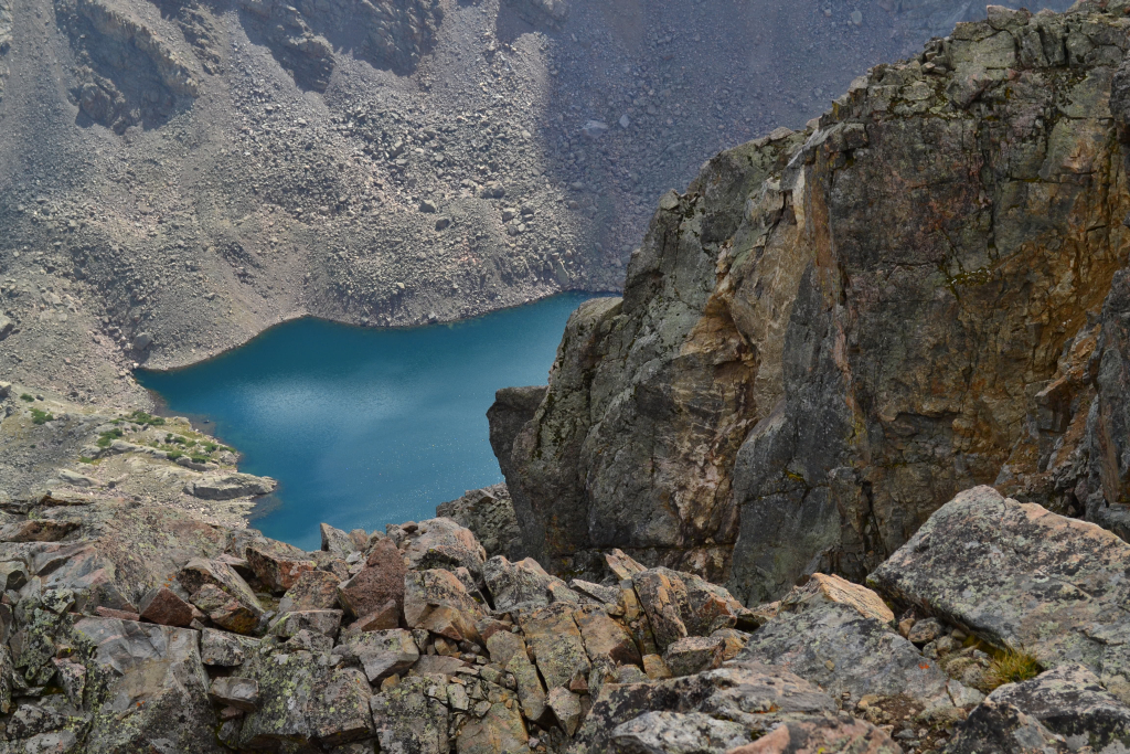
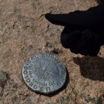
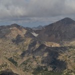
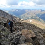
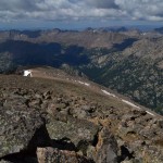
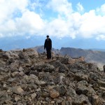
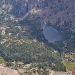
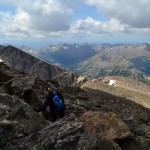
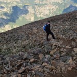
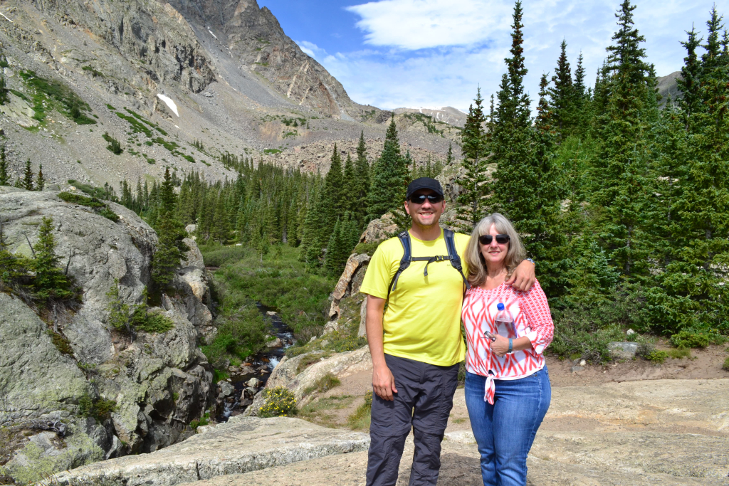
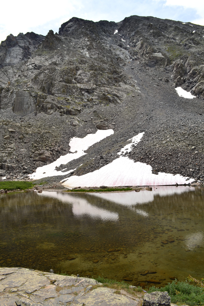
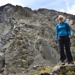
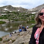
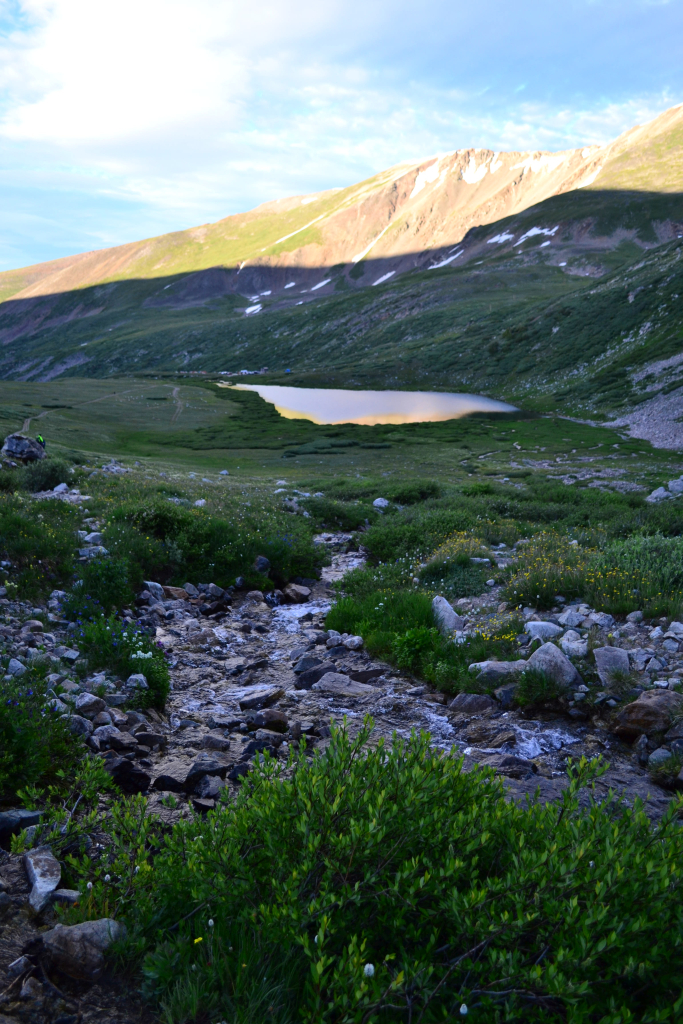
Just before the crux of the route we passed the Angelica Couloir on our left. There was no snow in the couloir at the time of our trek (August 28th), but this is probably a really great route when snow is present. After the couloir the trail ends, and the remaining route is a fun scramble through large talus. This is a good place to practice route finding skills as there are many ways to get to the top. We chose to veer more towards the right side to stay away from the steep drop off of the couloir. We scrambled up about 300 feet and joyfully tagged the summit marker. We were the only ones on the summit for about 20 minutes. It was mountaineering bliss. We set the camera up to autoshoot and took a few photos. The lake in the bottom photograph is the Bowl of Tears. This beautiful lake serves as one of the headwaters of Cross Creek and rests at about 12,000 ft. Fisherman take heed: sources say there are no fish in the lake.

After spending about 30-40 minutes on the summit, we decided to head back down. This was the first time in a while that the weather was stable and beautiful allowing us to actually enjoy our time on top of the mountain. After much research and reading about various lost hikers, we were very cognizant of our route. Many hikers have taken the incorrect descent of Mt. of the Holy Cross. Instead of veering right and following the ridgeline some hikers miss the turn and head straight down the mountain which leads into a vast wilderness. There is also a cliff band in one spot. Quite honestly we were surprised this was a common mistake. We had no trouble finding our way back. On our descent we did take a route closer to the couloir to save time. Perhaps if we were really tired and dehydrated we could have made the mistake. We did study and plan the route really well prior to the hike and brought a map and GPS just in case to avoid any mishaps. Nonetheless, the sheer size of the wilderness area of Holy Cross is amazing. It would not be difficult to become lost or disappear if not properly prepared.
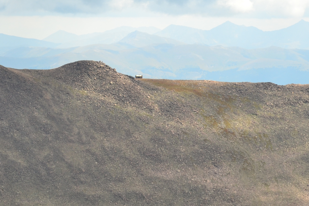
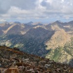
We took our time on the descent, enjoying the wonderful views the ridgeline has to offer. Directly across the summit and visible from the ridgeline is the semi-famous Notch Shelter located near the summit of Notch Mountain. It was built in 1924 as a stone shelter for visiting pilgrims to spend the night and awaken to the illumination of the cross come morning first light. Today it still stands though it is somewhat run down. It has been equipped with lightning rods to protect hikers on the ridgeline in the event of a thunderstorm. Camping is no longer allowed in Notch Mountain Shelter. The shelter can be seen distantly in the photograph below.
On our descent we encountered a few more hikers ascending, perhaps 8 total. Our early start let us have the whole mountain to ourselves for most of the day. This was the most isolated 14er we have done so far and one of our favorites. We took our time and relaxed on a warm sun-baked boulder on the way down. We refueled with some peanut butter and Gatorade. The sun still shone brightly and the sky was still peacefully blue. We crossed back over the creek and mentally prepared ourselves for the uphill climb back over Half Moon Pass. Contrary to logic, we hiked the quickest we had all day to get back over the pass. While it wasn’t exactly pleasant, it wasn’t quite as bad as most people make it sound. Seen below are photos of the climb back up and out.

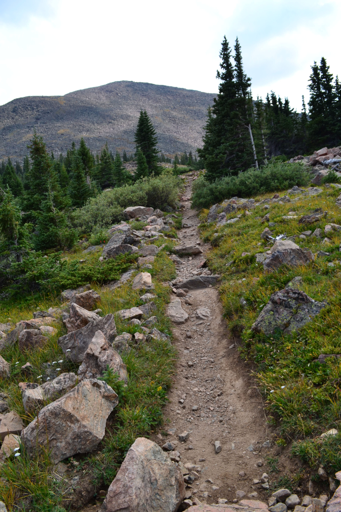
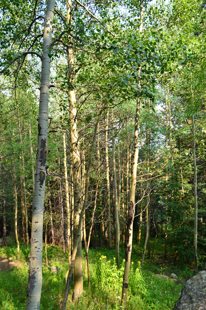
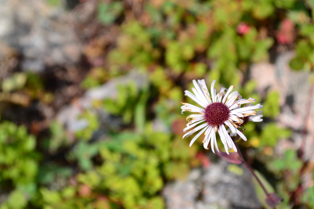
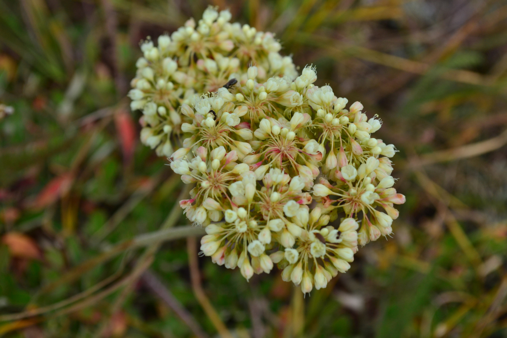
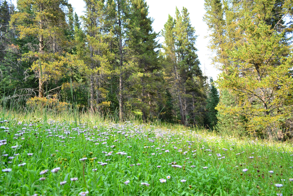
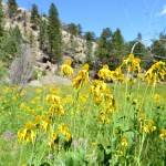
It was dark when we first climbed Half Moon Pass. Thus, on our return down to the truck it was like a completely new hike. We were greeted with beautiful meadows of wildflowers and lush greenery.
We reached the truck mid-afternoon and quickly headed into Minturn for an early dinner at Kirby Cosmo’s BBQ to celebrate. We had finally visited Mt. of the Holy Cross after 2 and a half years of talking about it. We completed the standard North Ridge route this time around. We are by no means done exploring this area. Next time we would like to try the Halo Ridge Route, or even just climb to the Notch shelter. There are so many hidden gems to find in Holy Cross wilderness beckoning the curious outdoorist to come explore.
Writing by Allyson Sandifer Checkley
Photography by Thomas Checkley
McCullough Gulch 2015
We decided to hike McCullough Gulch again, but this time with different company: Thomas’ Mom. Last year we hiked McCullough Gulch on a trip for Allyson’s birthday and the trip report can be found here: McCullough Gulch 2014. This year’s hike brought new adventures and excitement.
The hike itself is roughly 2.7 miles RT to the Blue Reservoir, but it can be longer or shorter depending on what you want to do. At the trailhead the trek begins at roughly 11,102 ft and at the lake the elevation is approximately 11,936 ft, all according to our Garmin GPS, for a net elevation gain of about 834 ft. It is a short and easy hike relative to it’s neighboring hike of Quandary Peak, which looms next door for the entire jaunt of McCullough Gulch; but is still above 11,000 ft and there are some rocky and steep areas making it not a walk in the park.
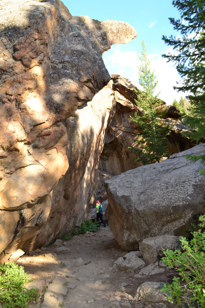
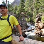
The hike begins with an 18-20% grade up an old mining trail. There are views along the beginning to be had if you are looking to take your time, which we were. After passing an abandoned mining area there is a natural scenic overlook formed by an outcropping of large boulders. We stopped here for a photo-op and to enjoy the scenery. Below are some of the images from the scenic overlook and the initial start of the hike.
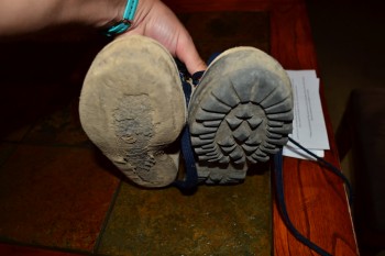
The hike continues to rise until about 2/3 of a mile and then flattens out a bit as the trail narrows through pine trees. Mom started to notice that outer-sole of one of her boots was coming off, which was not ideal. Her boots were a bit old according to her, perhaps 18 years old. Eventually, the outer-sole of the boot did come off completely, and she walked more than half of the hike on the mid-sole of the boot. Lesson learned: check your equipment before you hike! Below are some pictures of the flat section and of her boots.
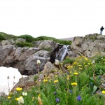
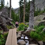
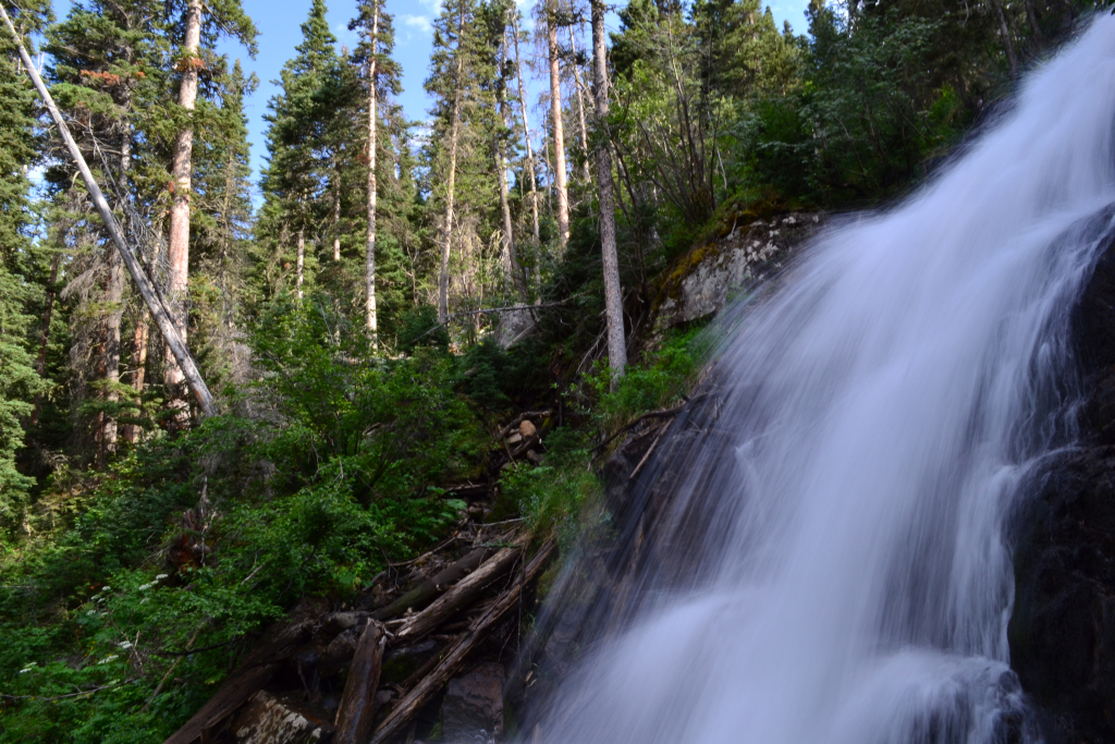
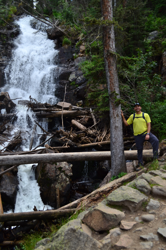
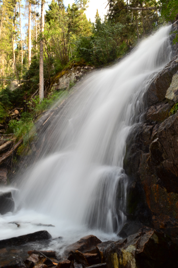
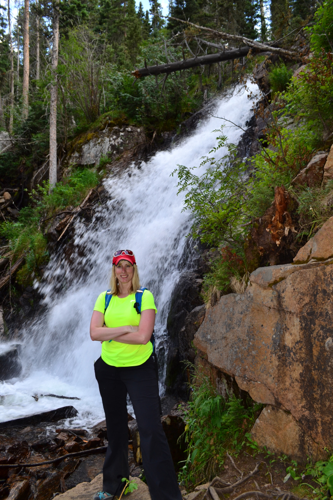
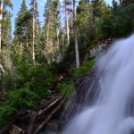
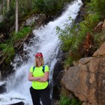
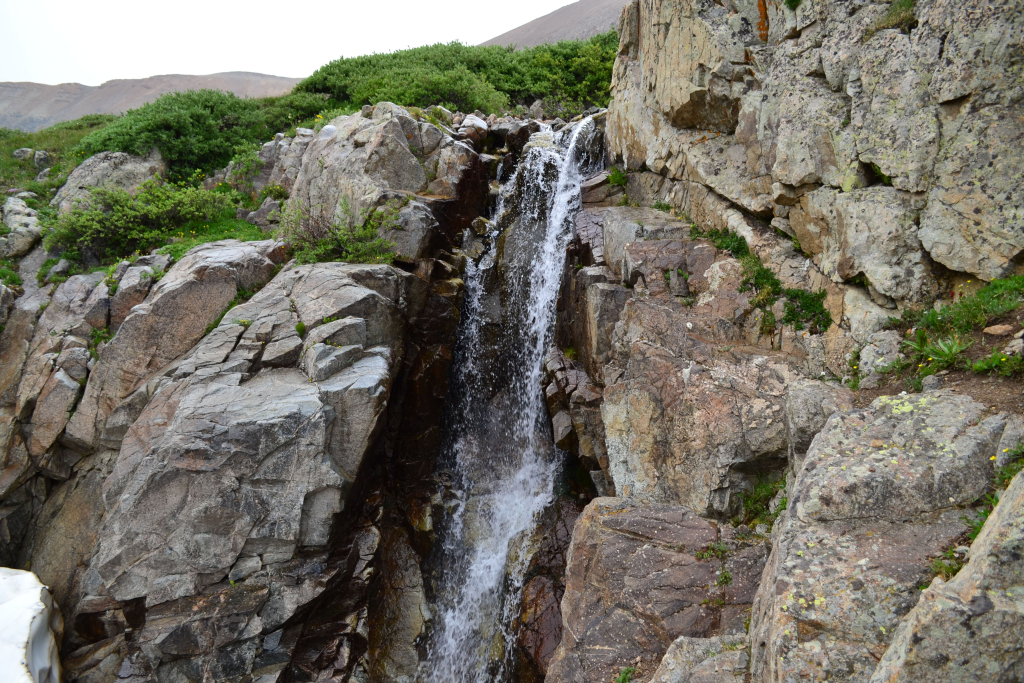
After going up for a little while you reach a small talus field, which has a nice, clear path leading through it. Just after this is a small single beam bridge over a creek (pictured above bottom left), and just after this bridge you reach a crossroads. You can either continue making your way up to the Reservoir by veering to the right, or take a small detour loop to the White Falls by aiming to the left. We wanted to see the Falls — because they are really very majestic — and so we took the quick detour. Some pictures of the Falls are below.
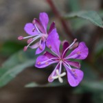
The Falls trail loops back around rejoins the McCullough Gulch Trail shortly after the falls and the trail begins to steeply rise again towards the Reservoir. There is only about a third of a mile from this point to the Reservoir. Along the way you can see Quandary Peak looming to the left along with an array of gorgeous wildflowers. The rock can be a little loose and it is important to watch your footing here, especially if you aren’t a regular hiker; but the goal is just around the corner. Mom was having some trouble here on some of the rocky parts due to her outer-sole coming off and having very little grip on her left foot. This tells us that having shoes with good grip, either trail running shoes or hiking boots, are nice to have for this hike. Below are some pictures from this portion of the journey.

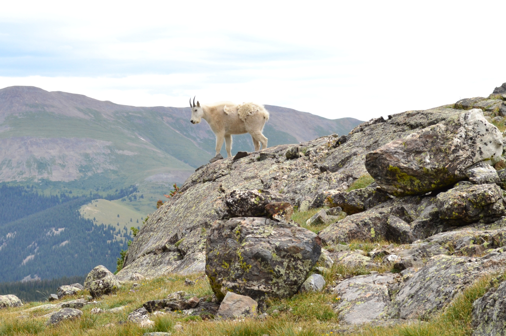
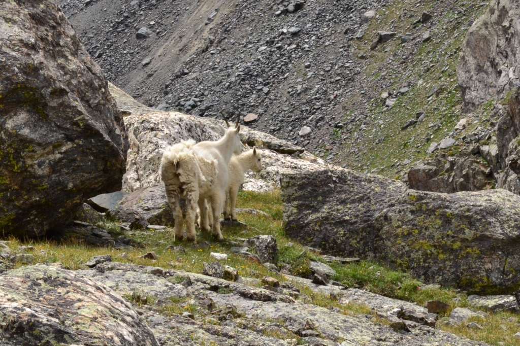
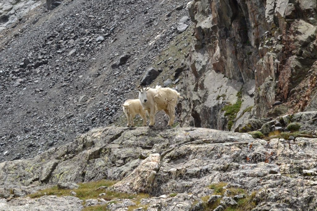
After one last push up a rocky portion of the hike the view of the Reservoir appears and you have made it. As you approach the lake there are at least three options to be had, not all exclusive to one another. There is an option to take a left turn and hike across the outflow of the Reservoir, a small creek pictured below, and onto a hill on the Quandary side of the Reservoir. This area gives great views of the Reservoir and is often inhabited with mountain goats. In fact, the day we went there was a herd of mountain goats on the hill with a baby mountain goat in tow. It was really awesome to see the mountain goats, and especially the kid.
Mountain goats are typically not aggressive to humans, but there have been attacks on humans and at least one fatality. See this article from Backpacker.com about a man who was gored by a mountain goat in Olympic National Park. Even so, it is never wise to approach wild animals and it is illegal to feed any wild animals. It is in everyone’s best interest — hikers and animals — to keep a safe distance from wild animals. Below are some pictures of Blue Reservoir and the mountain goats (for reference I used 200mm lens and cropped the resulting images for the mountain goat shots).
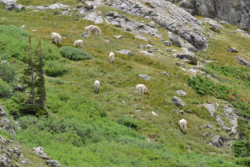
The hill also lends itself to taking a nice panorama of the cirque and Reservoir, which we did! Mom stayed on a rock and had a nice time refueling and enjoying the scenery while we explored the area. In fact, if you click on the image below, and zoom on the large rock on the right side of the Reservoir you can see a person wearing a black jacket, that is Mom! What is also nice about the image below is that you can see the path leading up to that large rock. If you so desire, you can keep following that path past the Reservoir and towards a group of three lakes higher up (the path is visible from Google Maps). If you choose to explore these upper lakes, be aware that it turns this hike into a 6 mile RT hike from a 2.7 mile RT hike. As far as I know these upper lakes are not officially named.
The hike back down was pleasant, but the mosquitoes were out and that kept us moving. We would recommend bringing spray to keep the bugs at bay. This is a very nice hike, especially for beginners, and can be used as a trail run, which Thomas did the following day. It is a very versatile trail, and you can spend well under an hour running the trail to a half day exploring and taking pictures; to top it all off it is next to the very friendly town of Breckenridge, where we spent the remainder of our excursion.
Photography and writing by Thomas Checkley


Cub Lake, The Pool, and Fern Falls: Rocky Mountain National Park
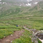
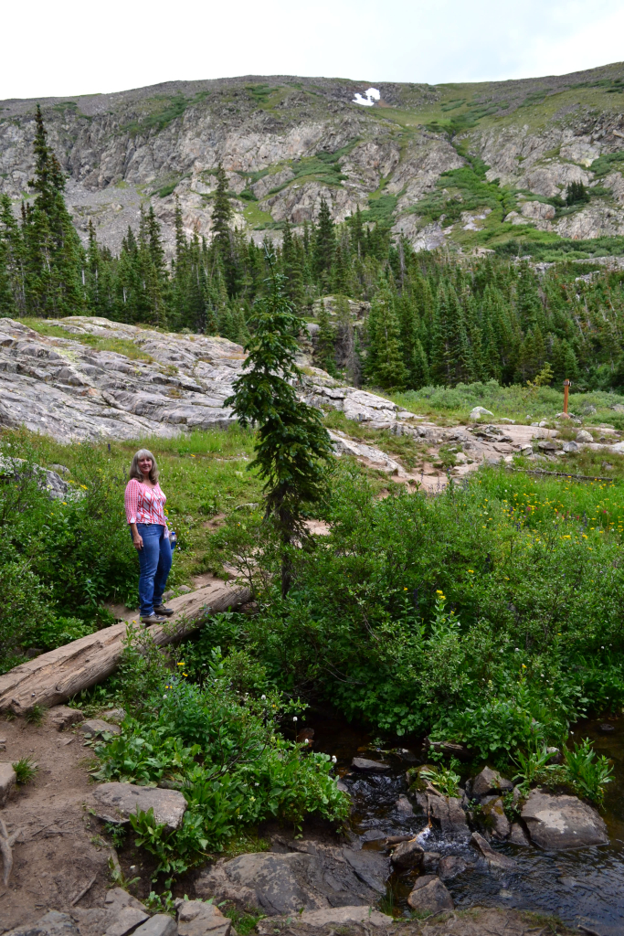
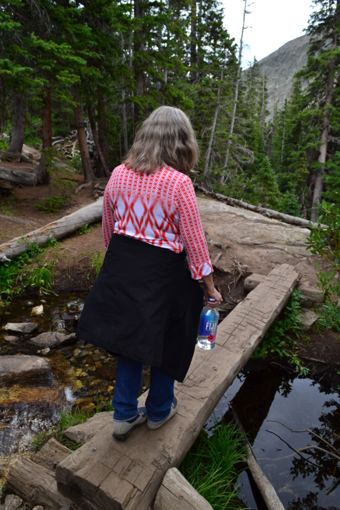
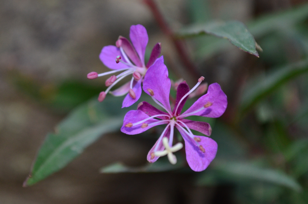
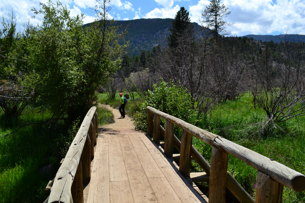
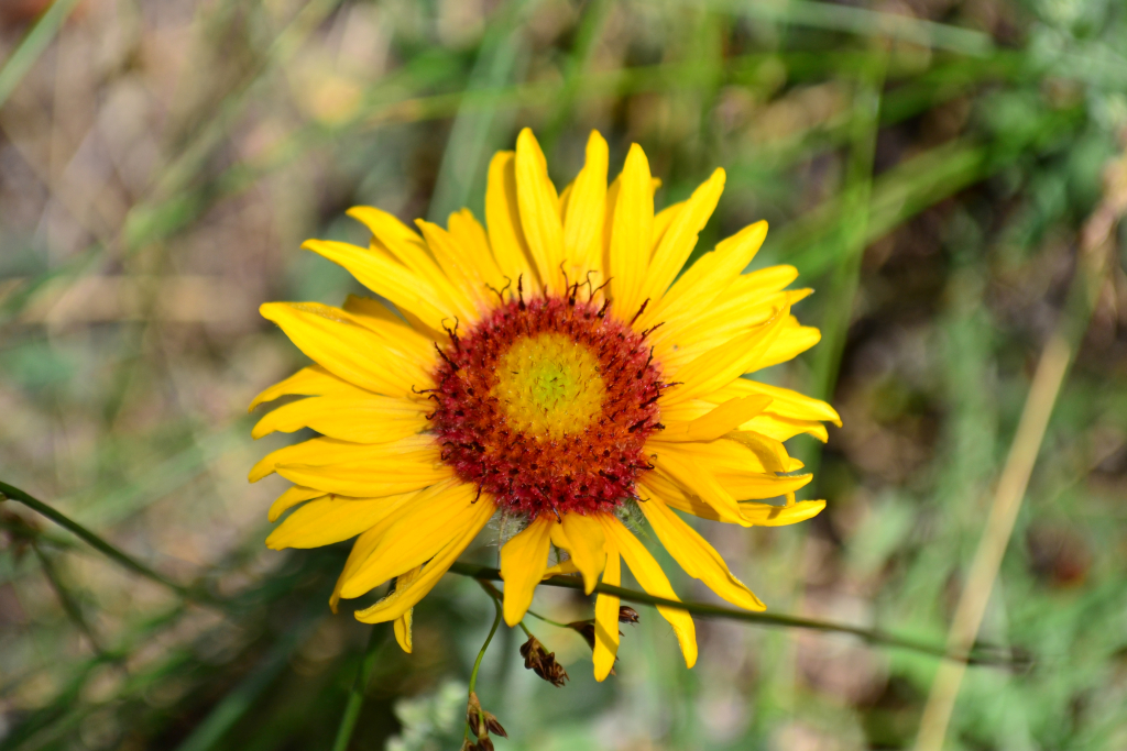
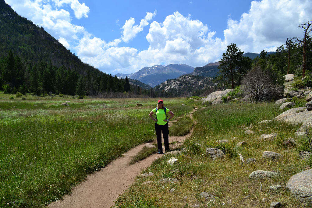
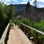
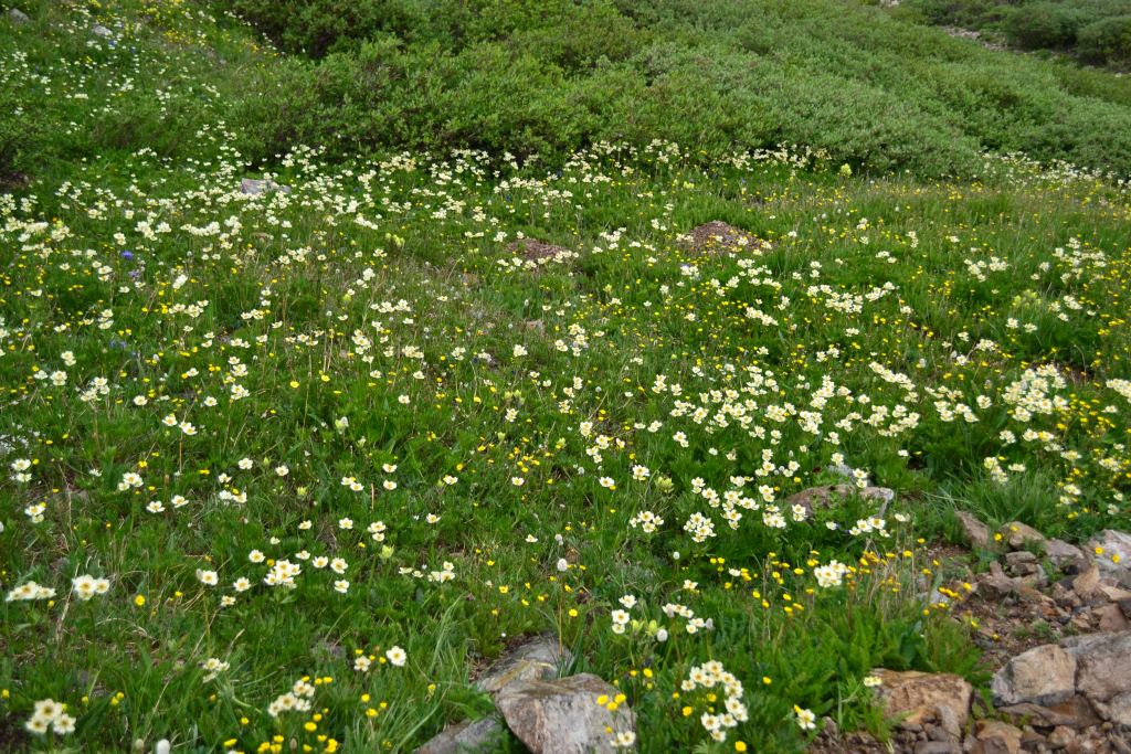
We’ve been to Rocky Mountain National Park many many times before, but have only explored a small fraction of what her 415 square miles have to offer. After a tough climb above 14,000 feet the prior weekend, we were craving some relaxing lower elevation exploration. And when we say lower elevation, we mean 8,000 to 10,000 feet above sea level. Our destination on this particular jaunt into the park was Cub Lake in the Moraine Park region on the eastern corridor of RMNP. The Cub Lake trailhead sits just above 8,000 feet about half a mile off Moraine Park Rd., which is accessed via Bear Lake Road. We arrived on a late July Friday afternoon at about 2:00 pm to avoid the earlier summer and weekend crowds, and we were able to find a decent parking spot. Our hike began with a bridge crossing of the Big Thompson River and continued onward skirting the western side of Moraine park. The elevation gain was minimal to non-existent for the first mile or so of the hike. We enjoyed the easy stroll and admired the plethora of wildflowers along the way. Seen below are photos.
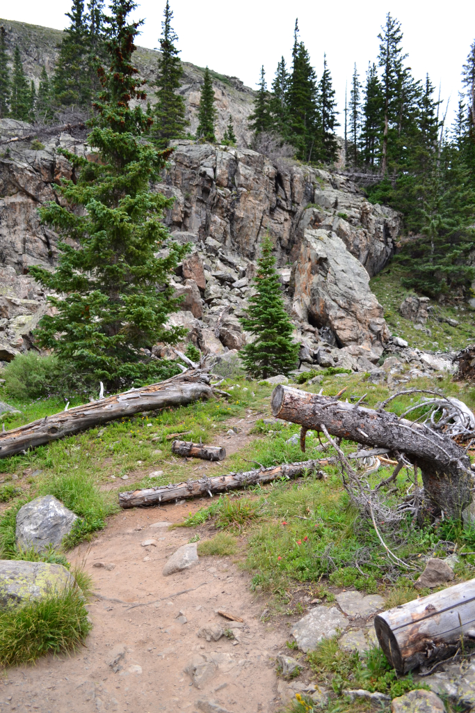
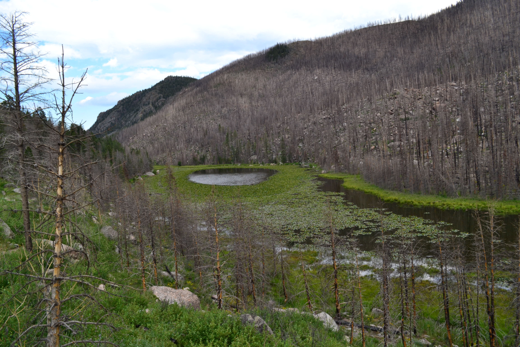
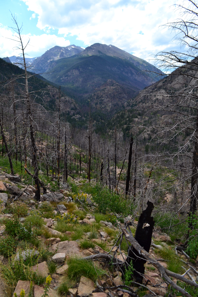
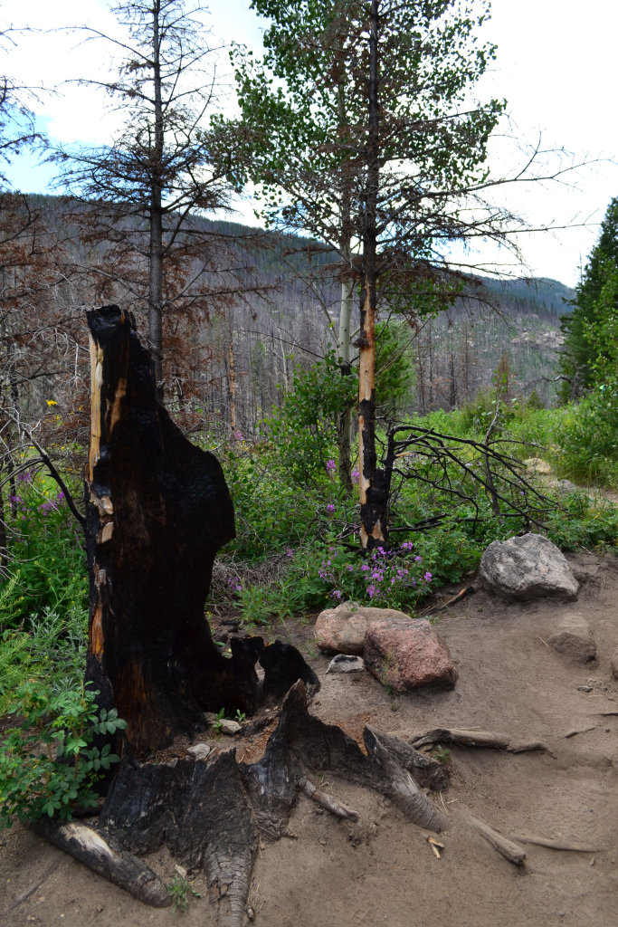
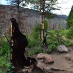
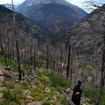
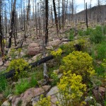
The sun was high and the temperatures warm, and we were ready to gain some elevation and get a cool breeze. Eventually we ended up following the Cub creek and stumbled upon several small ponds before the trail was engulfed in a grove of aspens and ferns. Everything was green and lush. The landscape almost resembled something tropical. In fact, the insect life along this trail did in fact resemble the tropics. We battled large mosquitoes along much of the trail. Past this portion of the hike, we began to notice the remnants of the 2012 Fern Lake fire. Instead of beautiful alpine forests, we saw charred branches, dead trees, and meadows in place of alpine forests. Unfortunately, someone made an illegal campfire (backcountry campfires are not permitted in RMNP) and the steep terrain and pine beetle infestations made it catch very quickly. According to website data, the fire engulfed nearly 3,500 acres before an early season snowstorm quieted it. Seen below are photos.
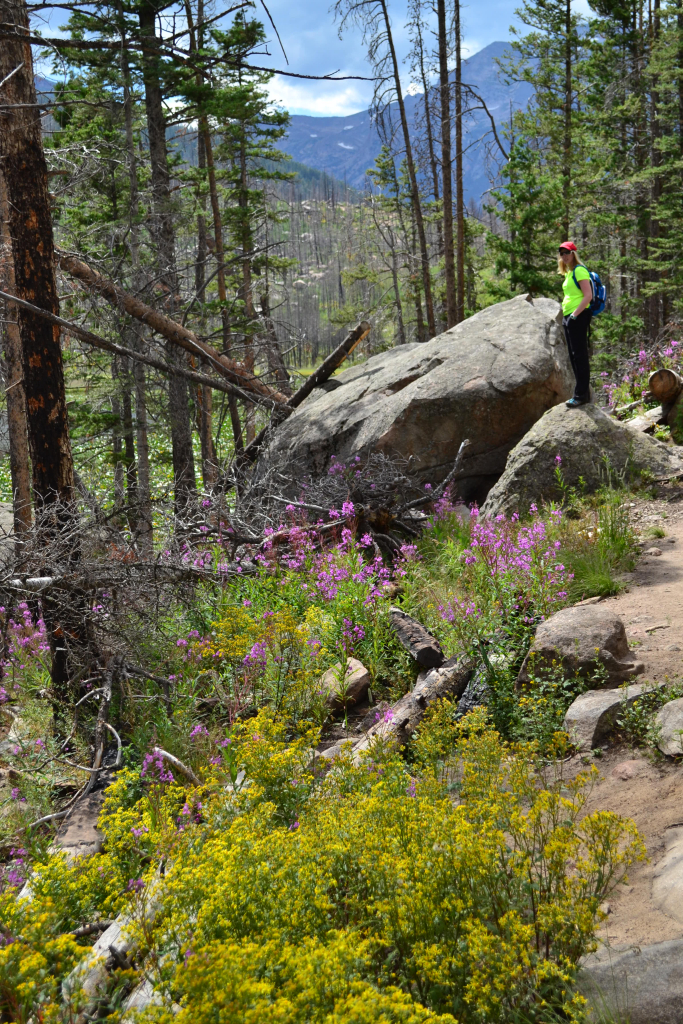
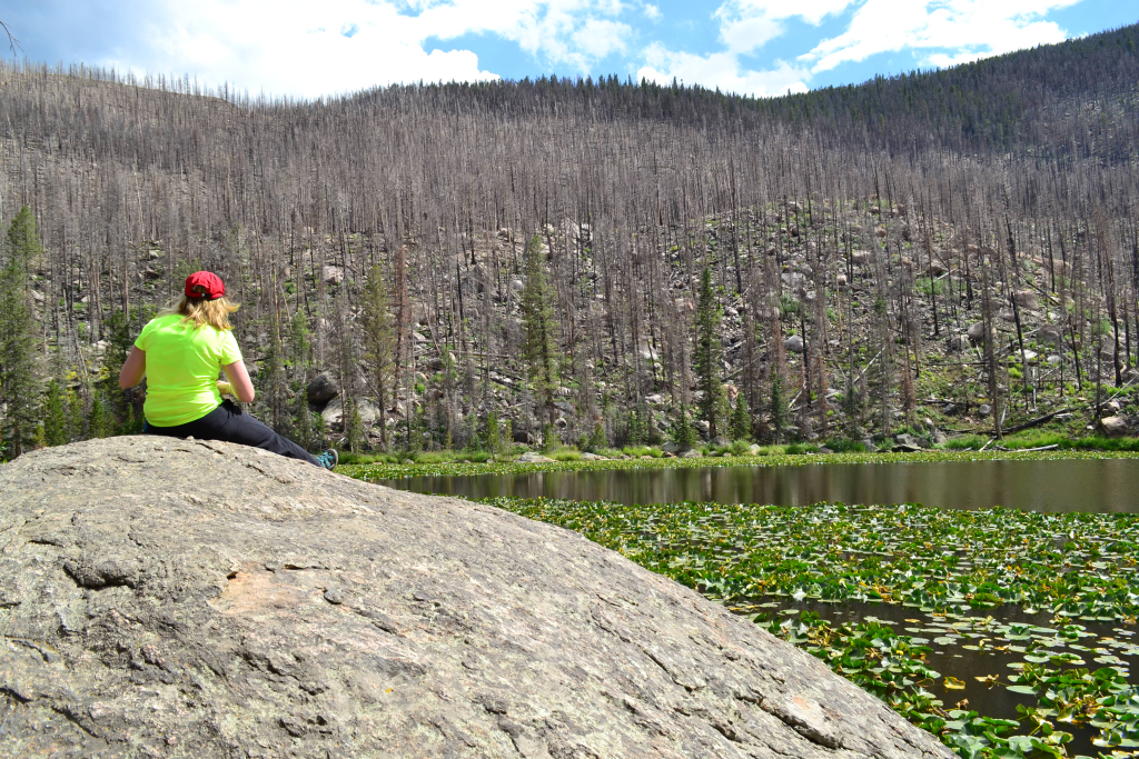
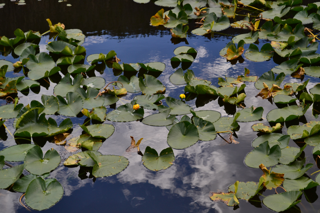
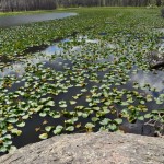
Nonetheless, the wildflowers, animal and plant life among the charred trees reminded us that ecosystems are equipped to adapt and sometimes fire can lead to biodiversity and support the natural progression of the environment. After about 2.3 miles, we reached Cub Lake. While Cub Lake isn’t as striking as many of the other high alpine lakes found in RMNP, it’s quiet beauty is a worthy hiking goal. In summer, the lake is covered in the thick green of lily pads. Marshy banks surround the lake, but a few large boulders on the north shore make a nice place to sit and relax. Seen below are photographs from Cub Lake, our first destination of the day.
Instead of returning the way we came, we continued northwest on a one mile connector trail leading to The Pool. We quickly gained a bit of elevation, which provided sweeping views of Cub Lake below. The trail then descended sharply into Forest Canyon. After the quick downhill, we reached the Pool and the Fern Lake Trail. Instead of completing an out and back hike, we opted to make a loop and hike back to our truck via the Fern Lake Trail. There were many other hikers at the Pool, which is easily reached via the 1.7 mile Fern Lake TH. Essentially, the pool is a continuously churning bit of water fueled by falls from up river. It is quite a pretty site, but not the most exciting of destinations in the park in our opinion.
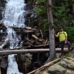
We still had plenty of time and daylight at The Pool, so instead of returning we proceeded to follow the Fern Lake Trail further out towards Fern Falls and Lake. Just before reaching the Falls, we ran into two hikers who said they had just encountered a black bear about 10 min past the Falls. They mentioned he/she didn’t retreat and they were afraid to continue towards the lake. We heeded their advice and stopped at Fern Falls. Fern falls is quite spectacular and well worth the additional mile ascent from the Pool. Seen below are photograph of us enjoying Fern Falls.
We encountered a few hikers coming down from Fern Lake while we relaxed at the Falls. Many of them had seen the bear and claimed it was just foraging and didn’t bother them. Thankfully the last grizzly bear to be seen in Colorado was in 1979. However, we are not anxious to run into a black bear on the trail. After 15 or so min, we returned to the Pool and proceeded back via the Fern Lake Trail. The Fern lake trail was mostly downhill towards the parking lot and led us through a dense forest of aspen and lodgepole pine. The trail followed along the Big Thompson River, and eventually led us to Arch Rocks which is a large collection of boulders of interesting shapes and sizes planted next to the river. We were unaware of this unique formation when we set out on the hike and were pleasantly surprised. Seen below is a portion of the Arch Rocks.
We continued for about 1.7 miles until we reached the Fern Lake TH. Unfortunately, this meant we would have to hike 1.2 miles on a dirt road to get back to the Cub Lake trailhead. The mile went quickly, and we made it back to the Cub Lake TH and our truck in no time. According to Garmin our loop hike was 8.6 miles. While we enjoyed this hike, it does not offer the same high alpine experience that many other lake destination hikes do in RMNP. Despite this, if you have multiple days to spend in the park, especially in the fall when the aspens are changing and the elk are bugling, Cub and Fern Lake would be a great viewing spot.
Writing by Allyson Sandifer Checkley
Photography Thomas Checkley


DeCaLiBron: Mt. Democrat, Mt. Cameron, Mt. Lincoln, Mt. Bross
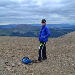
During the late afternoon hours of July 23rd, we grabbed our camping gear and day hiking packs and loaded up the truck for an overnight adventure to complete the famous “DeCalibron”. The DeCalibron is a 7 mile, high altitude loop trail that allows hikers to tag the summit of three or four of Colorado’s 58 fourteeners (both official and unofficial). Due to the unpredictable weather of 2015 thus far, this was our first 14er attempt of the season. We arrived in Alma, CO, which is about 10 min north of Fairplay on Hwy 9, at about 8:00 pm and slowly proceeded up the old Kite Lake Trailhead road. After 6 miles of rough dirt/rock road we reached the Kite Lake Campground just before dusk. We quickly began to set up camp before the mountains completely covered the remaining glow of the sun. Nestled at 12,000 feet above sea level, this campground offers a truly exquisite alpine camping experience. There are 5 pay campsites each with a fire ring and some with a picnic table (rate: 12 dollars per night, parking 3 dollars). Seen below are photos of the Kite Lake Campground.
We hunkered down around 10:30 pm to get some sleep. There was also a large group of girl scouts from Texas camping at a nearby site and many late night car camper arrivals which made for a somewhat loud evening. We finally drifted off in the cold mountain air, and snuggled up in our sleeping bags until the the soft white light of morning drifted into the tent. The clock read 5:00 am. We were not quite ready to move. At 5:30 am, we braved the cold morning air and began to pack up camp and make some breakfast. At 6:30 am, we were on the trail. Seen below are photos of the trailhead, Kite Lake, and our early morning start.
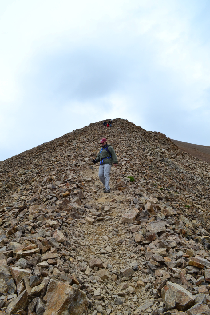
We planned on summiting Mount Democrat first and then evaluating the weather and our stamina to determine whether to continue the loop route. The trip up Democrat proved to be as easy as a 14er can be. It was a beautiful cool morning hike, and we were greeted with sweeping views of the Sawatch Range and distant high plains. Old mining relics littered parts of the trail. When we reached the last half mile of the trek, the trail turned from Class I to Class II. We enjoyed climbing over some rocks and a little route finding before we reached the false summit. A short jaunt over a remaining snowfield as well as a 50 foot ascent up a well defined trail led us to the summit. Seen below are photographs of our ascent to Mt. Democrat.

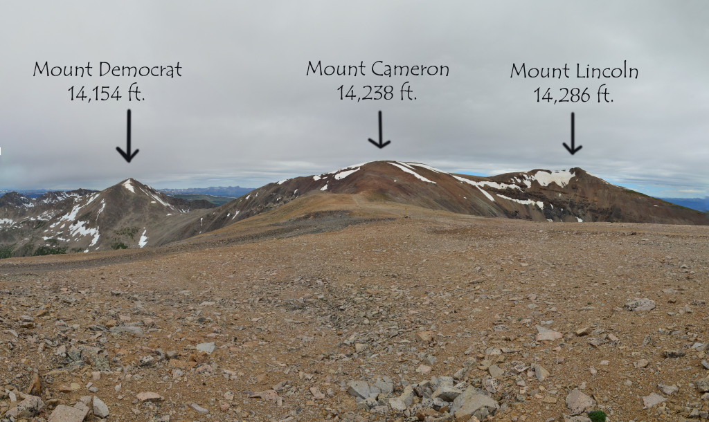
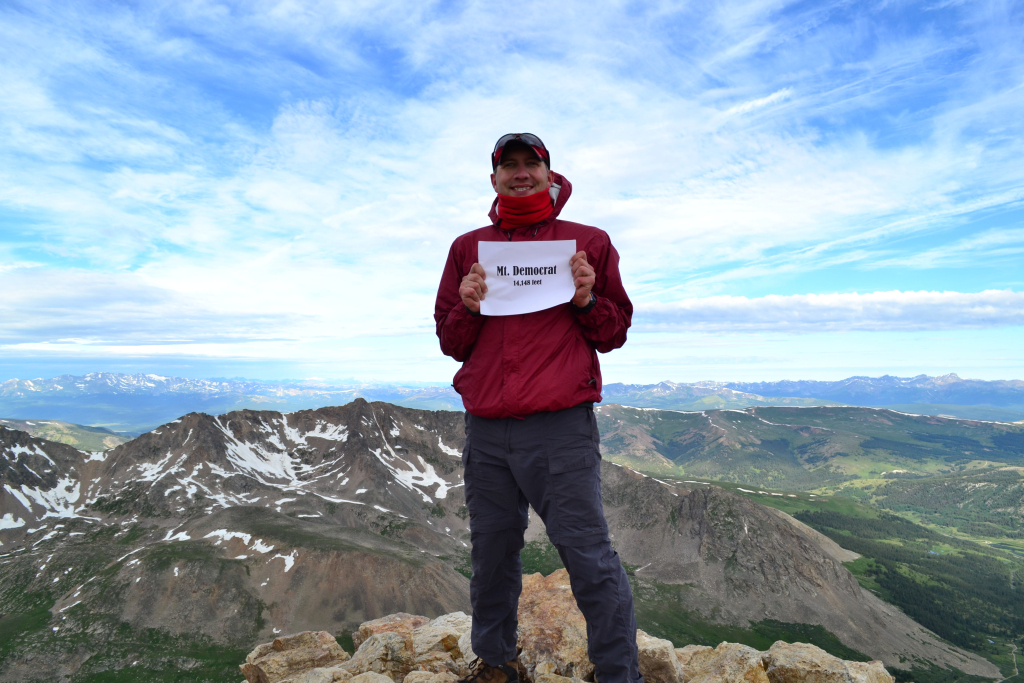
We reached the summit at approximately 8:00 am, an hour and a half after we started. From the Kite Lake TH to the summit of Mt. Democrat is only about 2 miles and 2,150 feet of elevation gain. Mt. Democrat is 14,148 feet tall (some sites say 14,154) and ranked 28th in height compared to all official 14ers. Seen below are photographs of our first summit of the day/season!

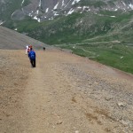
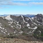
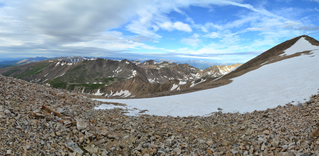
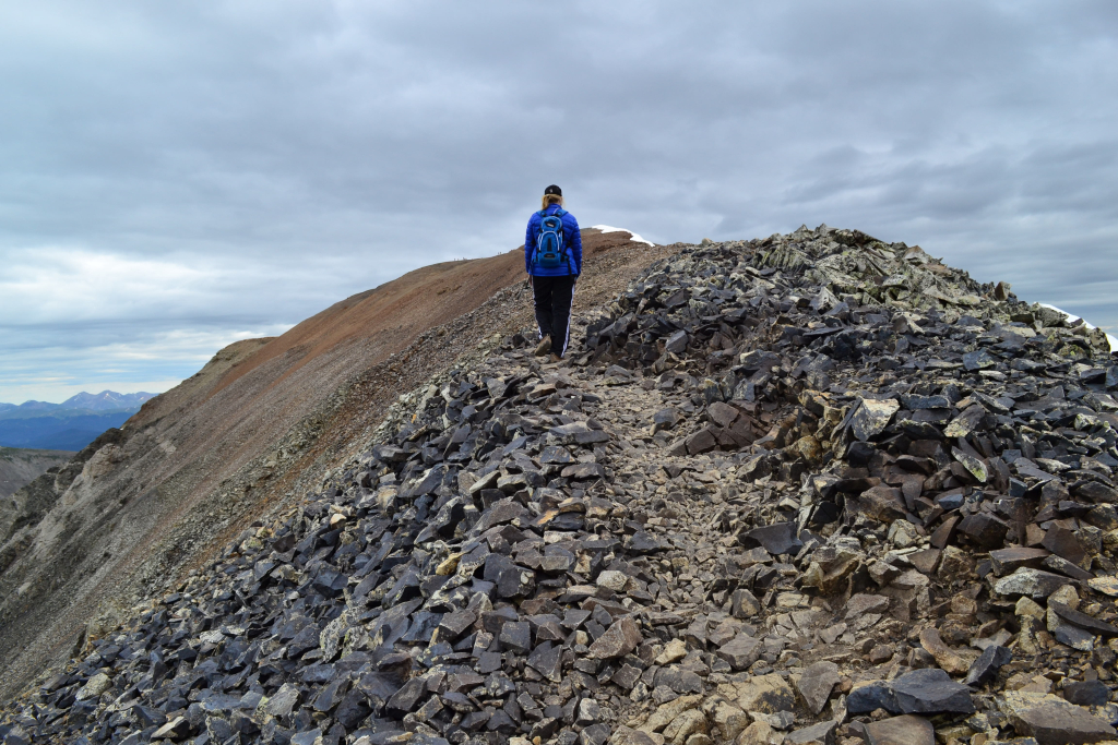
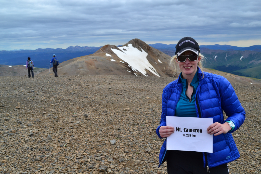
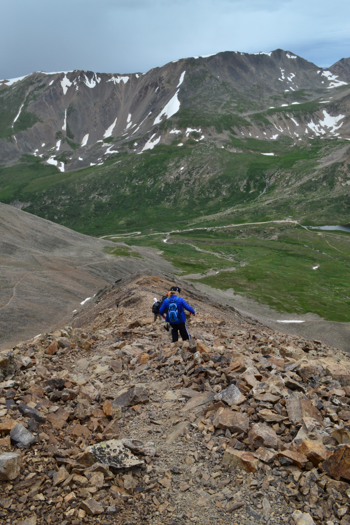
It was still quite cold on the summit, and after a few photographs we began to descend to the saddle of Mt. Democrat and Mt. Cameron. Once we reached the saddle, we decided it was early enough to continue towards Mt. Cameron. We lost approximately 786 feet in our descent according to our GPS unit. It is roughly 873 feet of elevation gain to reach Mt. Cameron which serves as a mid way point to Mt. Lincoln. Mt. Cameron is approximately 14,238 feet tall, but isn’t classified as an official peak due to its lack of prominence from Mt. Lincoln. (It must rise at least 300 feet from the saddle). The trail is a bit rocky, but quite manageable up to Mt. Cameron. We hiked for a while on the ridgeline above 14,000 feet before actually reaching Cameron. Seen below are photos of the hike up the saddle and ridgeline.

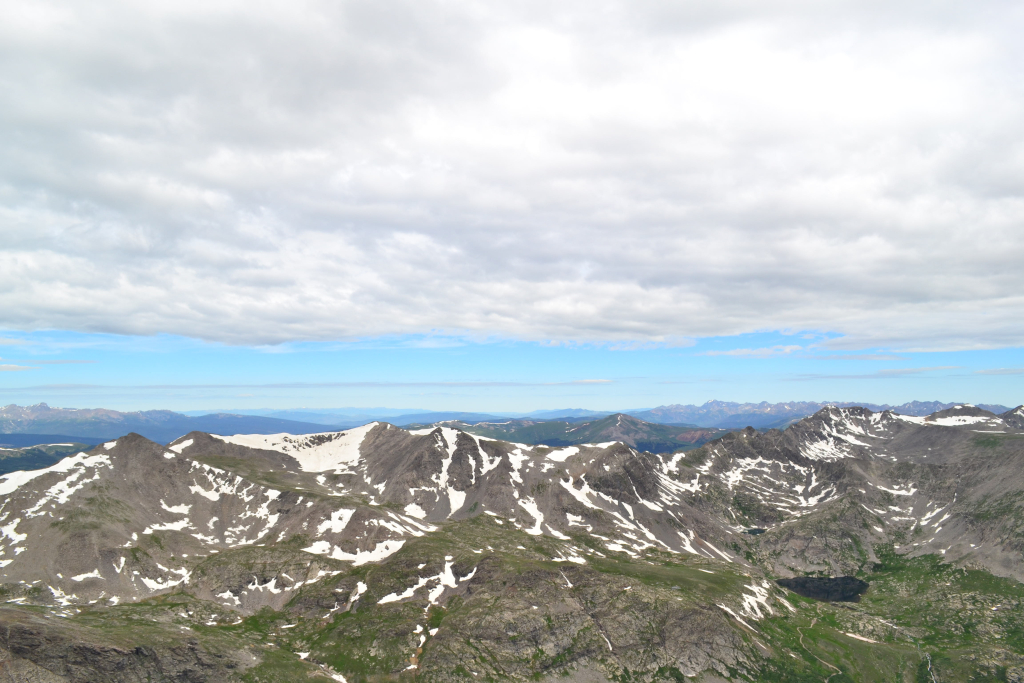
Cameron has a large flat summit that was quite honestly anticlimactic. We shared the summit with only 2 other people, though it was large enough to have a party with over 100. We took a few photographs and continued onward. Seen below are photos of the summit of Mt. Cameron.
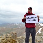
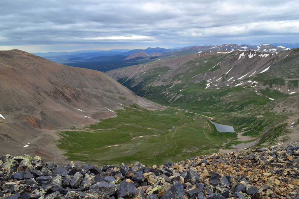
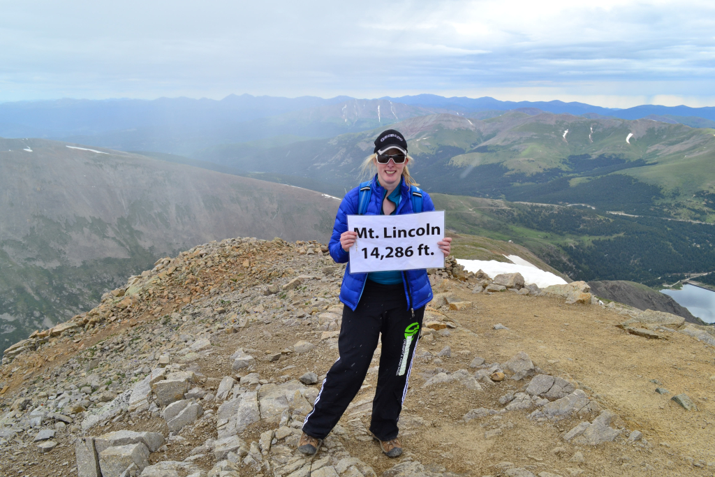
We could see the summit of Mt. Lincoln close by, and quickly began a mild descent into the saddle (156 feet) and a short climb back up to her summit (215 feet). Mt. Lincoln has a much smaller, rocky, jagged summit. It was quite different than Cameron and offered amazing views. Unfortunately, as we reached the top it started to sleet. It was 10:05 am. The weather forecast predicted sunshine all day. Another testament to the unpredictability of mountain forecasts. We took a few summit photographs, and a nice couple took our picture. Again we shared the summit with only two other people.


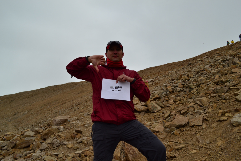
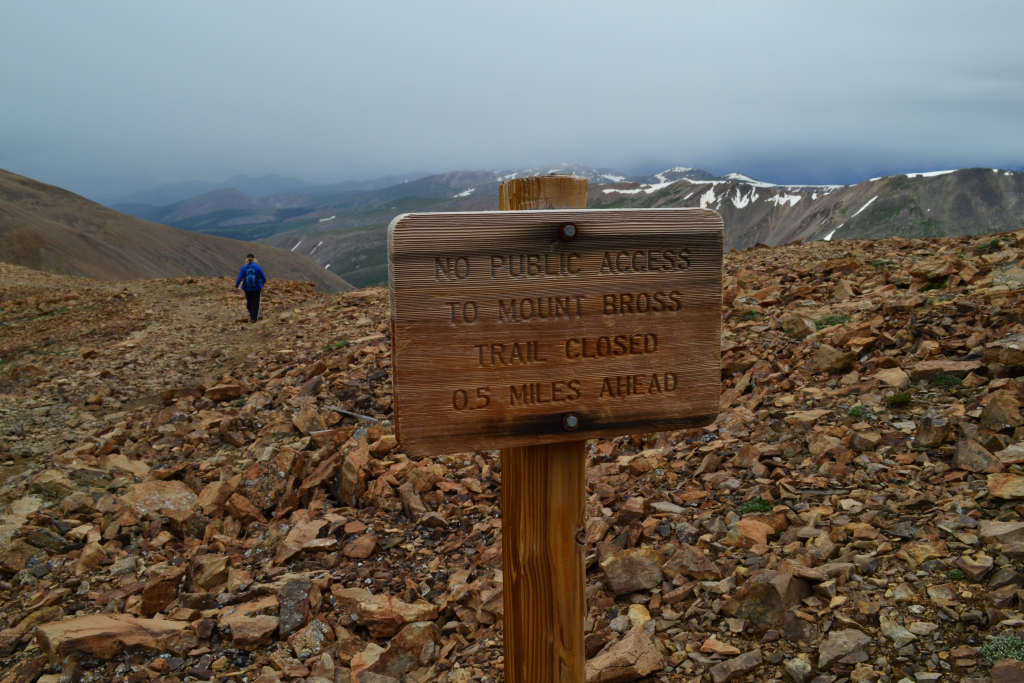
We proceeded down Mt. Lincoln and instead of heading back up Cameron, took the trail that skirted her summit and led toward Mt. Bross. The trail was mostly downhill and flat for much of the saddle between Bross and Cameron. This portion of the loop contained lots of red rock and maintained the look of a mined mountain. Needless to say, it wasn’t the most aesthetically pleasing of 14er routes. It should be noted that Mt. Bross, standing at 14,172 feet is a 14er that is currently deemed private property. There are several signs that state attaining her summit is illegal and that a a trail that circumvents the top of the summit is available as part of the loop back to the Kite Lake TH. 14ers.com states that hikers/climbers should respect these signs as officials continue to “work” with owners to allow for open access, and that climbing without permission may jeopardize this effort. Well, we called people with the 14ers initiative and spoke with various park rangers. There is no active effort that we could currently find into helping the public gain legal access to the summit. In fact, part of the problem is that several of the owners of Mt. Bross cannot be located to give permission. For legality reasons, we will not include in this post whether or not we reached the summit of Mt. Bross. Seen below are photographs summarizing our experiences with the Mount Bross portion of the trip.

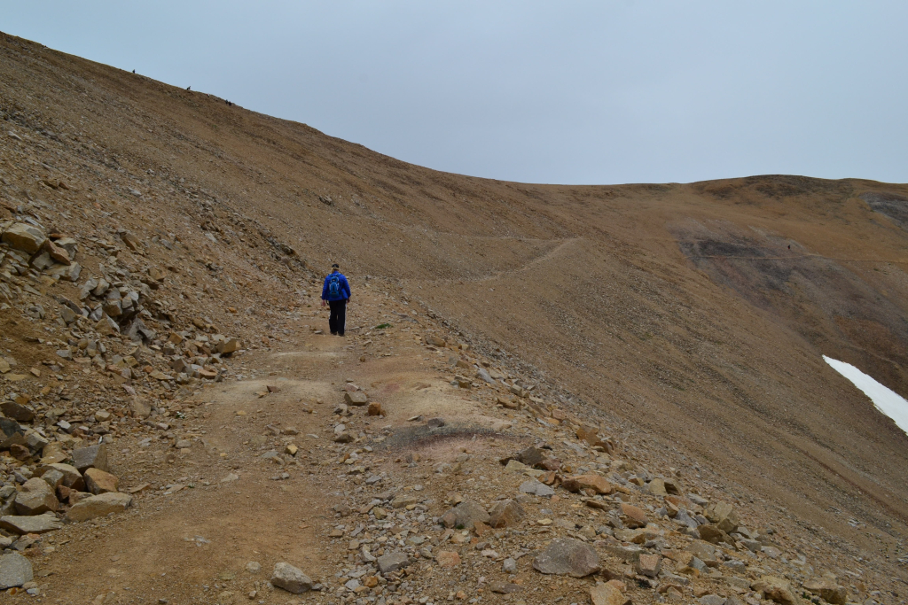
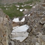
The descent from the Bross portion of the loop was not a highlight of the hike for us. There was extremely loose rock and scree on very steep terrain. We kept thinking the trail would improve around the corner, but it never did. We saw several people fall on the way down (not off a cliff or anything). It also began to rain on the way down making conditions even more dicey. Seen below are photographs of the horrible descent.

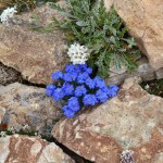
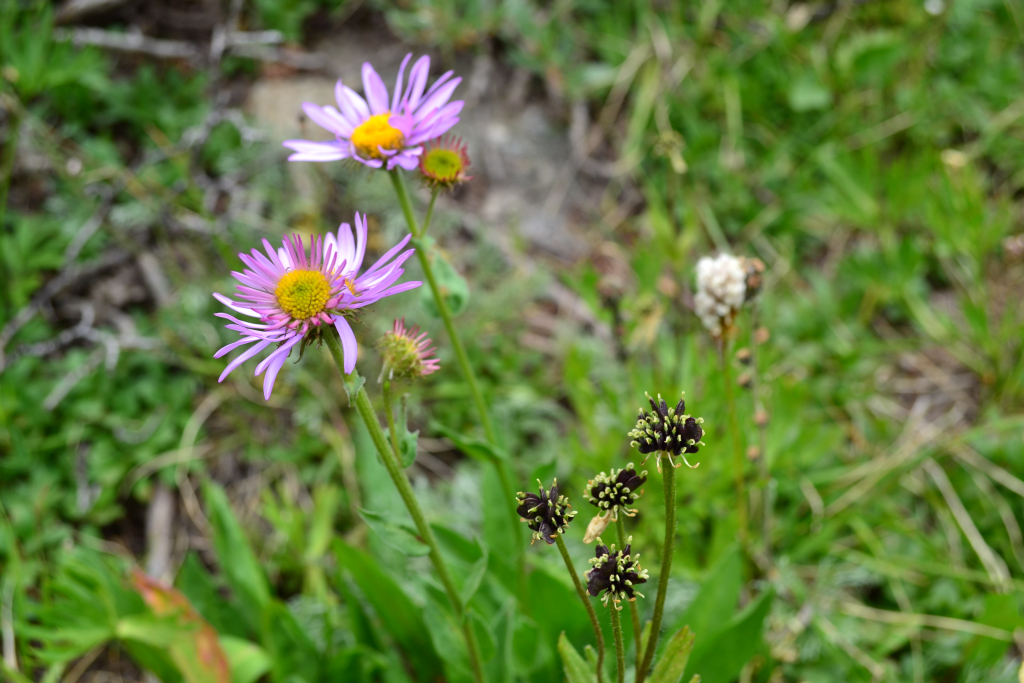
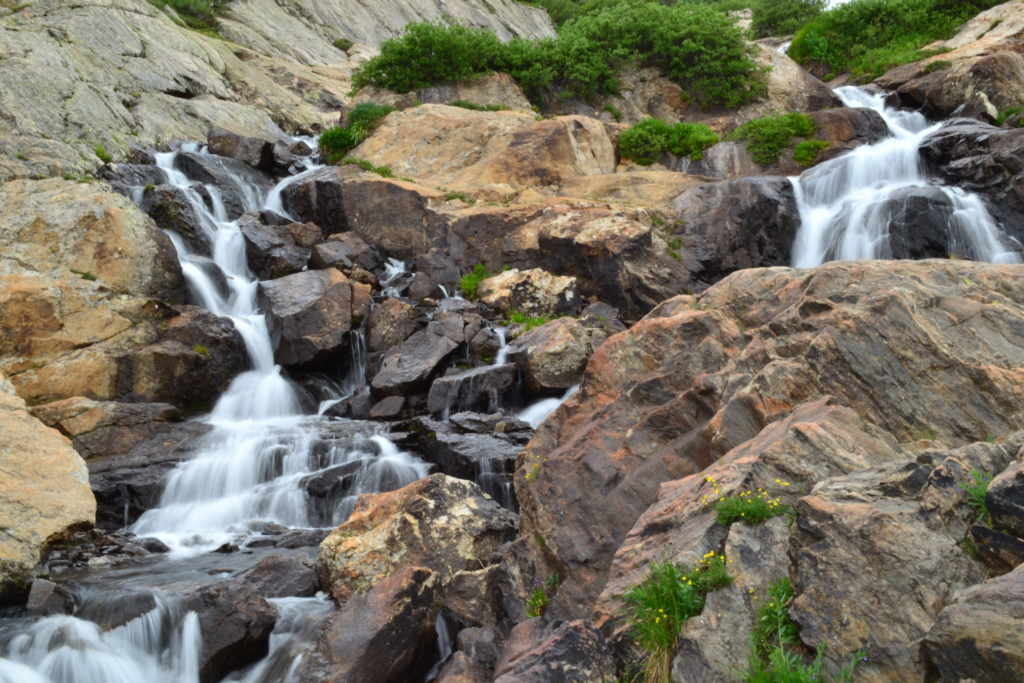
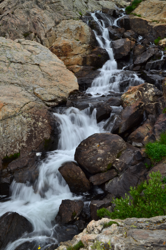
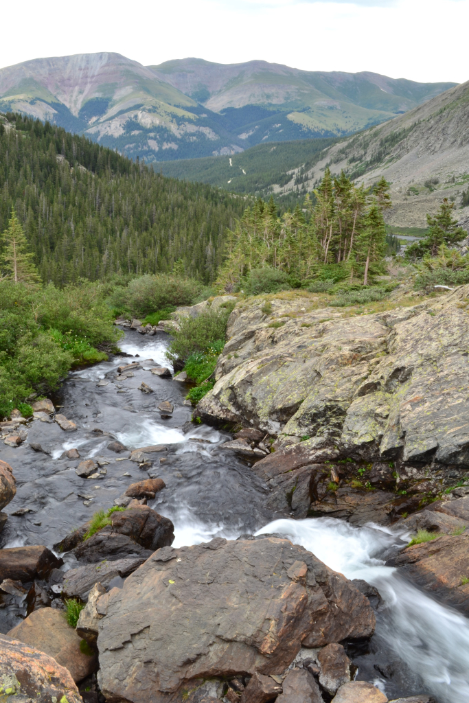
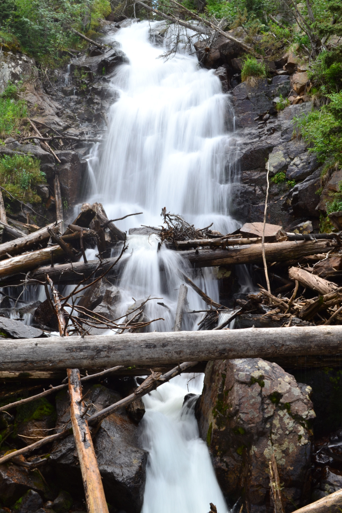
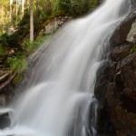
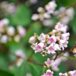
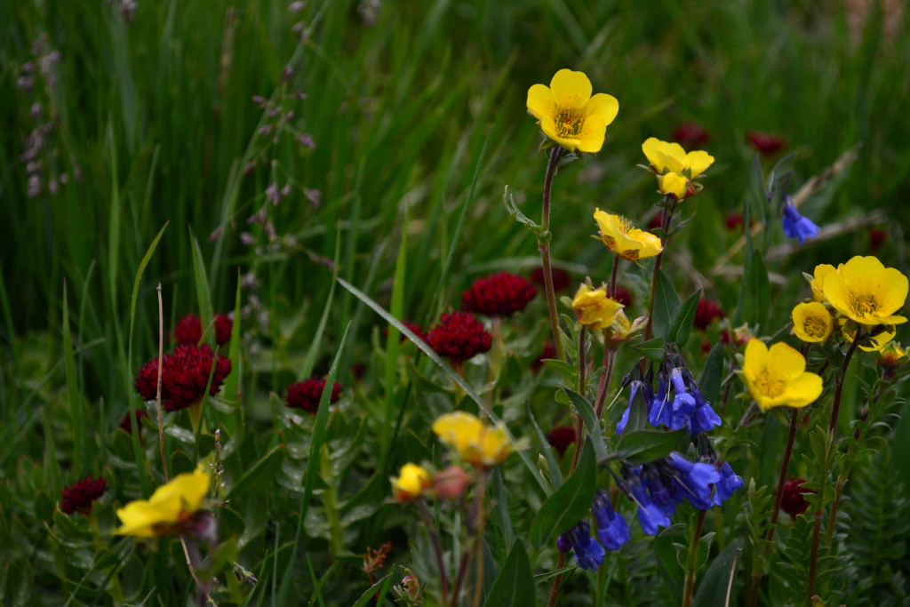
As we got closer to the trailhead, a trail runner sped past us at top speeds down the scree field. These can be very humbling moments on the mountain, and we still have no idea how he managed to navigate that terrain while running. As the lake got closer and our legs got more tired, the trail opened up into a lush wildflower abundant meadow. A waterfall greeted us to our right. There was a silver lining to this portion of the trail after all, and it materialized in the form of a colorful array of botanical beauty. The most amazing part of this was the mind blowing diversity of wildflowers. Seen below are the wildflowers and falls near Kite Lake.
We concluded our trip back in the Kite Lake parking lot. The steady light rain had turned to heavy rain, and we were glad to be back. We reached the truck at about 12:45 pm which made our RT time 6 hours and 15 min. Overall, the route was moderate in our opinion compared to other 14ers. The sustained time above 13,000 feet on the route, and the Mt. Bross scree descent aided in this ranking. Accorrding to the Garmin Forerunner 15 GPS watch, we covered a little over 7 miles and 3,600 feet of net elevation gain. Overall, we highly recommend a visit to Kite Lake Campground and the amazing 14ers that tower behind.
Writing by Allyson Sandifer Checkley
Photography by Thomas Checkley