Take a Walk
A Quest into the Wild
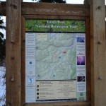
Grays Peak Summit: 14er
Distance: 7.7 miles (out and back) Elevation Gain: 3,239 ft (total) 3,034 ft (net)
Max Elevation: 14,274 ft Min. Elevation: 11,240 ft
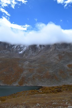
With summer gone for the year and thus the lingering darkness in the early morning hours, we opted for a 5:00 am wake up time instead of 3:30 am for our 2nd 14er climb. The forecast predicted a crisp, clear fall day at Grays Peak, and we were excited for this new challenge to take on. Grays Peak is the highest Peak located on the Continental Divide and one of the 54 fourteeners found in Colorado. In fact, it is the 9th highest peak in Colorado and offers amazing views of the area including Mt. Evans, Bierstadt and the Breckenridge and Keystone ski areas to name a few. And it’s just a Class 2 climb up to the summit making a nice, but smart challenge in early season snow fall. With the seasons changing, we anticipated this ascent would be much more difficult than Mt. Bierstadt. Snow and ice had already accumulated on the trail and temperatures were quite low. As we drove in the dark up I-70 to the Stephens Gulch Rd. which leads to the summer Trailhead, we had no idea just how cold. At the dirt 4WD road, a giant cherry picker was blocking the entrance. However, there weren’t any signs saying the road had closed for winter yet. We were stressing out a little bit at this point, because if you can’t drive in to the summer trailhead, you have to hike up this road which adds 6 miles RT to the hike. Not wanting to add this mileage to an already strenuous hike, we put the X-terra in 4-wheel drive and maneuvered around the cherry picker on some nice rocks and hill. The rest of the drive up was very bumpy and had some ice and snow but nothing too bad if your vehicle has enough clearance.
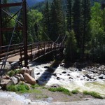
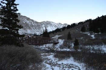
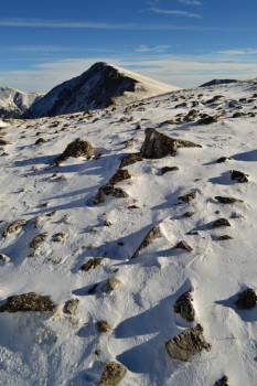
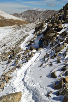
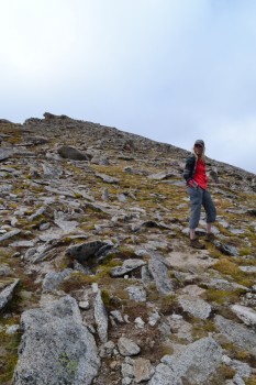
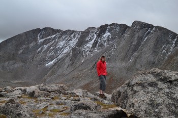
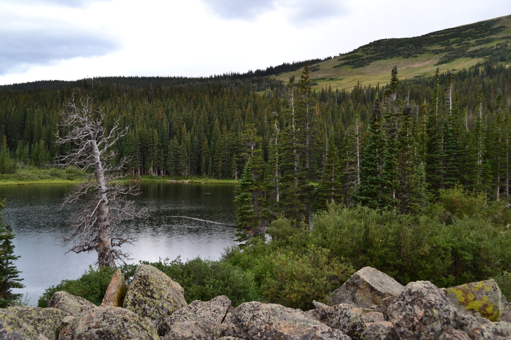
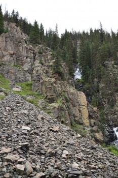
When we arrived there were only three other cars in the lot. The sun was now starting to come out, and we were ready to begin our ascent. The trail starts at an elevation of approximately 11,200 feet as it crosses a bridge over Stephen’s Gulch Creek. We crossed the icy bridge and began a steady climb up a well maintained portion of trail that enters Stephen’s Gulch and the upper valley. Our hands were numb and faces very cold at the start despite our gloves and gear. As we kept a nice pace, feeling slowly started to return. The first half mile through the valley, was free of snow, but small ice rinks seemed to form from where the snow had melted and refrozen the day before, and we had to take it slow at points to keep from falling. Seen below are photos from the start of the hike with Stephen’s Gulch Bridge.
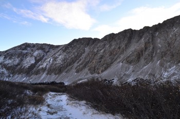
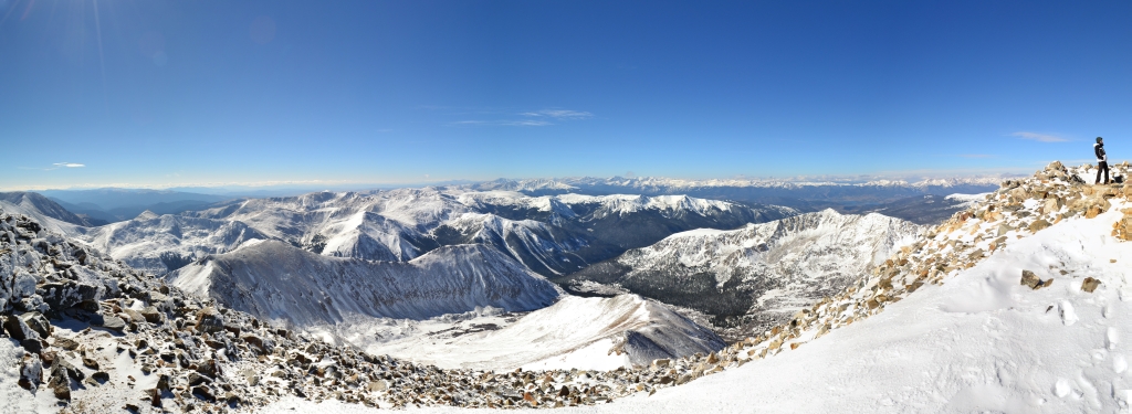
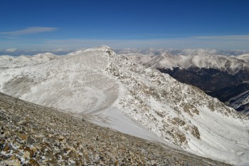
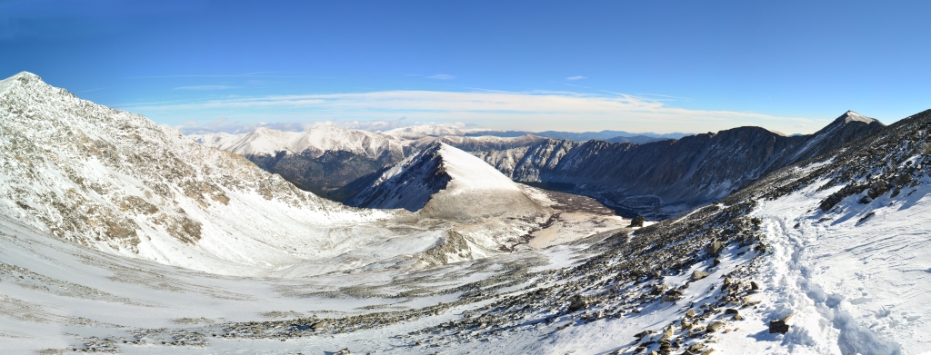
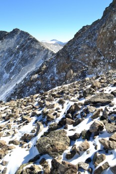
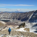
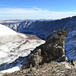
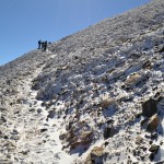
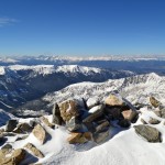
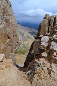
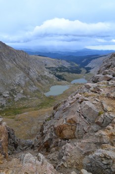
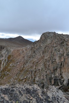
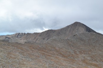
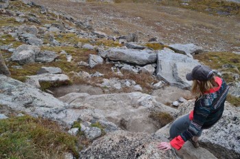
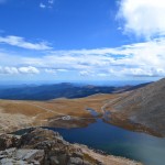
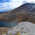
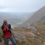
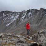
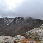
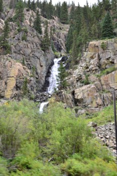
We continued through the valley steadily upwards for about a mile after which the trail flattened out for a almost a mile. This was a nice break, however a few inches of snow had accumulated here making speedy travel a bit more difficult. We skirted around Kelso Mountain, a 13er to the north of Grays and then proceeded once again, this time more aggressively, to ascend into the alpine tundra. At about 12,300 feet, the trail took us up and over a ridge in the upper valley. The snow began to get much deeper at this point forcing us to put on our Yaktraxs. Though microspikes would have been really nice for this climb, we both felt safe and more confident with just the Yaktraxs attached to our hiking boots. We climbed and climbed and our pace seemed very slow due to the snow which was 2 feet deep at some spots. Finally, we reached a sign at which the trail splits. Going left leads up to the Grays Peak Summit and going right to the neighboring fourteener, Torrey’s Peak. Our number one goal for the day was Grays so we headed left. As we climbed higher in the sky, the valley seemed further and further away. The views from above 13,000 feet were some of the best we have ever seen. The snow dusted mountain tops provided much more dramatic views than the summer could ever offer us. Seen below are photos from halfway up the switchbacks to the summit. The large photo displays views from the north of the peak and Kelso’s Mountain. Grays Peak Summit is featured in the bottom right photo.
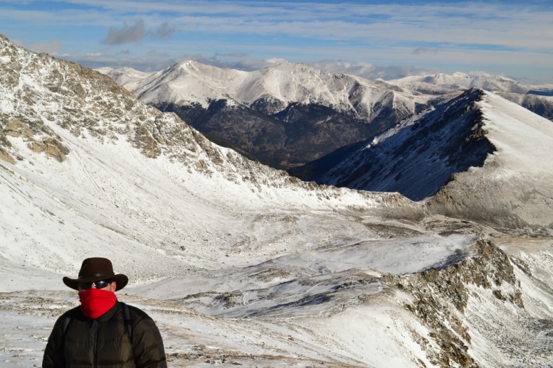
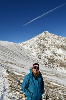
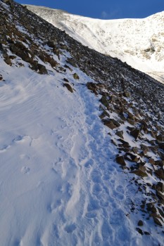
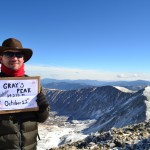
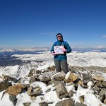
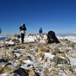
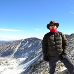
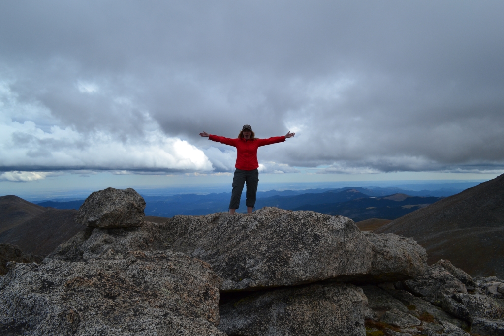
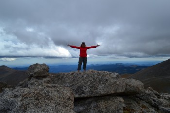
The next half mile of switchbacks were the hardest portion of the climb. Snow was very deep and only allowed room for one on a narrow portion right next to the edge of a steep drop off. We went very slowly here and carefully watched our footing. The switchbacks were also very steep, and we were also now above 13,000 feet with much less available oxygen. We had not been in high elevation in over two weeks, so breathing was a challenge. However, after checking the GPS and realizing we only had about 500 feet more in elevation gain to go, adrenaline kicked in and gave us the final push we needed. Our pace improved dramatically, and when we reached the summit we were actually surprised. Typically, we were used to false summits and promises of the summit just over that ridge…but after finishing the last short switchback, we looked up and were greeted with the smiling faces of two other hikers who had just made the summit before us. Seen below are our summit photos and view in all directions from the top of the peak.
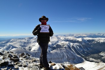
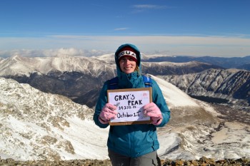
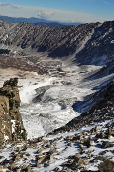
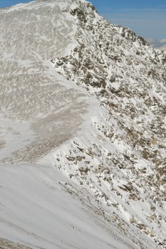
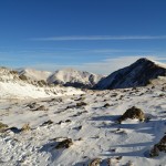
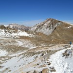
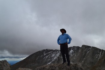
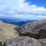
The windchill at the summit was in the single digits, and the actual temperature was somewhere around 16 degrees. We explored for a while and chatted with a few other hikers, though there were not many of us up there. We then proceeded to eat a twinkie at 14,278 feet. Perhaps we set a world record or something, but the Hostess’s comeback snack dessert was quite sweet and revitalizing and completely worth our desperate attempts to open its package in the frigid cold. We spent a few cold minutes debating whether or not to summit Torrey’s Peak as well. This would mean descending the west edge of the Grays summit nearly 600 feet, crossing a narrow saddle and re-climbing 600 feet in just under one mile with the ascent occurring all in a quarter mile. The bitter cold made our decision for us. We opted to return and conquer Torreys Peak in the warmer summer months. However, we got some nice shots of the saddle and trail all the way up to the summit of Torreys which can be seen below. The photo on the left is a view from the Grays Summit, the photo on the right is looking up at Torreys Peak from the Grays Trail.
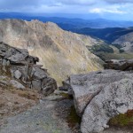
Usually our descents from peaks are made in record time, but the deep snow and slippery ice made this one slower than usual. On our trek down we encountered a lot more hikers than on our way up. This was a little tricky on the narrow paths and required one party or the other to stand in deep snow or the edge of a cliff to allow for passing which was not fun. In fact, we would recommended gaiters for this hike now (which we did not have). The snow kept getting in our boots (at least in Allyson’s), making for some uncomfortable blisters the last mile of the hike. Seen below are some photos from our descent.
The day had warmed up quite a bit and much of the lower trail in the valley had turned to slush and mud. In our weariness, we turned and looked back at our great accomplishment. We climbed and reached the summit of our 2nd 14er, and in snowy conditions this time. Despite the blisters, hunger, and altitude induced hallucinations (that hiker in the trail head photo really was moving in real time!) it was all worth it. We had ascended over 3,000 feet and covered almost 8 miles in snow and cold. We trudged back to the car and Thomas being the gentleman that he is, off-roaded out of there and drove back home. Chinese food for dinner and then off to sleep. A nice fall Saturday.
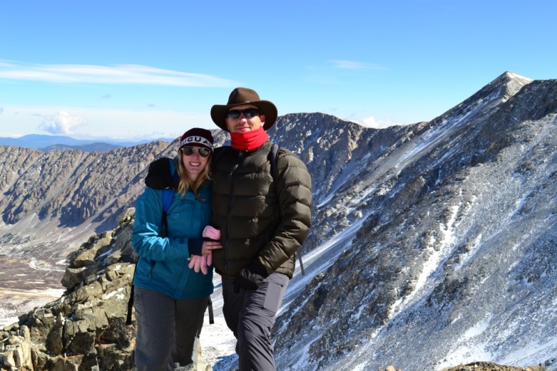
Photo Gallery


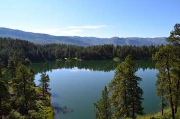
Mount Spalding: Summit Lake
Distance: 2.55 miles (out and back) Elevation Gain: 1,314 ft (total) 978 ft (net)
Max Elevation: 13,827 ft Min. Elevation: 12,849 ft
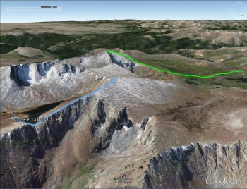
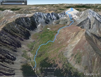
This weekend was quite an adventure. Our friends Catherine and Steve were married and their wedding was in Pine, Colorado, which is just outside of Evergreen. Well, we noticed that Mount Evans was near the venue and decided we’d stop by on our way out, however, due to weather, we were only able to summit Mt. Spalding. Our GPS map (above) from Google Earth shows in blue our hike up Mt. Spalding and the green was our hike up Bierstadt. It made for a very cool GPS map.
As usual the weather was an issue today. On our way out to Mt. Evans we could see dark clouds in the sky and had a feeling that they might put a damper on our day. But Mt. Evans boasts the highest elevation automobile road in the country. You can literally drive almost to the peak; the parking lot is at 14,130′ (4,307 m) and the summit is at 14,264 ft. The fee to use the road is $10 for 1-12 individuals (per vehicle). The road is about 15 miles long and the last 5 miles of road are closed after Labor Day. The road is closed for the season after the first “significant snowfall” or after the first weekend in October. So this drive is best done in the summer months.
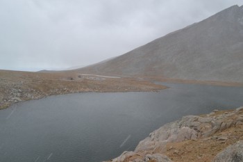
Since it was after Labor Day the road wasn’t open to the top. Also due to this fact the fee was half-price for us ($5). We were a little disappointed that the last 5 miles were closed and that we couldn’t drive to the top, but we still wanted to drive up to Summit Lake, which is at around mile 10 of the drive, and look around. It was chilly at the base of the drive, 45 degrees Fahrenheit according to the thermometer, with a wet snow falling. As we drove up we saw quite a few angles of the Mount Evans Wilderness as well as a number of peaks which can be accessed from the road. Some of those include Mt. Warren, Rogers Peak, Goliath Peak, and further away Gray Wolf Mountain and Epaulet Mountain (most of which are 13ers). There was a light rain/snow driving up, but we did manage to get a few pictures of the drive.
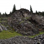
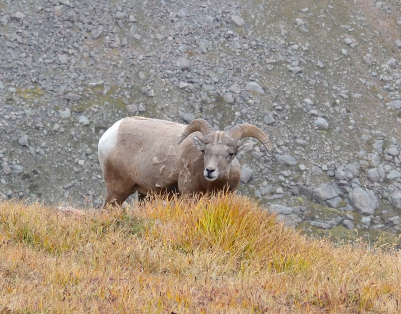
After about 10 miles we were forced to enter the Summit Lake parking lot. We drove in and were greeted with some sleet. It was cold and at first we decided we would just go over to the lake, look around, and leave. But then fate intervened. As we wandered over to the lake and the lookout area we saw a bighorn sheep. He looked at us and then walked away behind the ridge-line. We both really wanted to get a picture of him and thus we plodded up the path to try and see if we could still see him. At the ridge we saw two sheep staring back at us, as if saying, “Hey, we live here. Quit being wimps and hike around.” At about that time the wind let up, the sun started to come out, and it felt pretty good. So we decided to try and see if we could make the Mt. Spalding summit, a 13er on the way to Mt. Evans. Below is the bighorn sheep who inspired us.
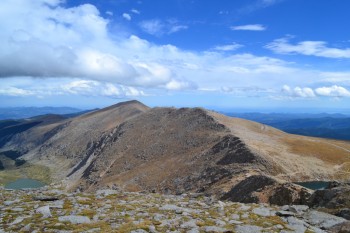
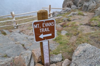
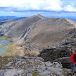
As we continued up the Mt. Evans trail it became a beautiful afternoon. The sky was extraordinarily blue, the light was perfect, and we felt great. It is a rocky hike, with some mild scrambling at times; but with good hiking boots it is only a mild challenge. As we made our way up we were treated to some amazing views of the Chicago Lakes and Summit Lake. Gray Wolf Mountain and Mount Warren were both visible to the north and we had a great view of the north face of Mount Evans the entire way up. Below is a block of pictures from this gorgeous segment of our hike.
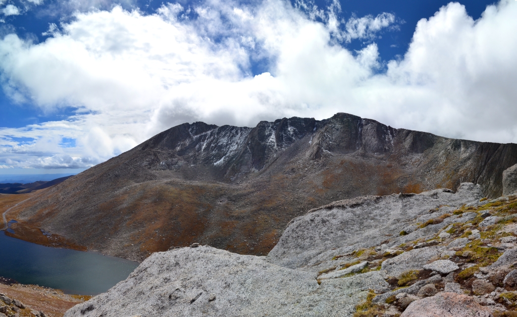
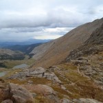
After a little bit of looking around and talking to a few other friendly hikers we were able to see the summit. It was a pretty neat sight. In the forefront was the summit of Mount Spalding (13,827 ft.), behind it we could see the the ridge of the Sawtooth, which led further back to Mt. Bierstadt (14,060 ft.), and then to the left we could see Mount Evans (14,260 ft.). Below us was Summit Lake, in which we could see ripples gently forming as the wind blew through the valley floor below. Below are a couple shots from this vantage point, with the first shot (left) fitting the above description.
It was a quick walk up to the summit after taking the pictures above. While on the summit of Mount Spalding we noticed that the sun was going away behind some rather dark clouds and we decided it was a good idea to head back down, but not before taking a few pictures! There are a couple shots of us standing on the summit, and one shot of Bierstadt from the summmit of Mt. Spalding.
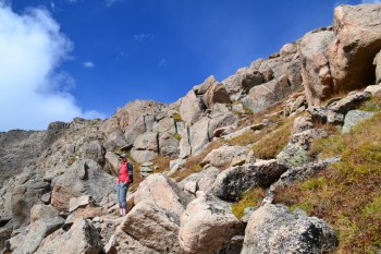
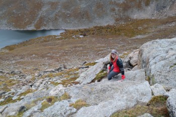
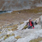
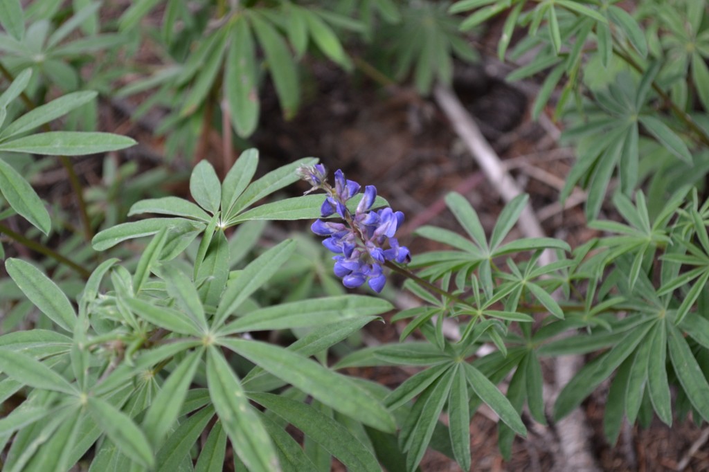
Down-climbing from the summit wasn’t too challenging and the path is very clear and worn. There is one section of the hike which is a little steep and requires the use of hands to navigate. We imagine that in wet, icy, or snowy conditions these rocks can become very slippery. There were still some flowers left in this area, mostly alpine avens. Below are a couple pictures of Allyson down-climbing this section.
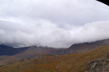
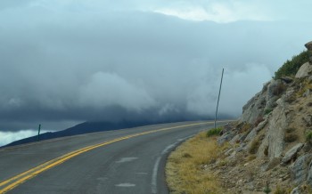
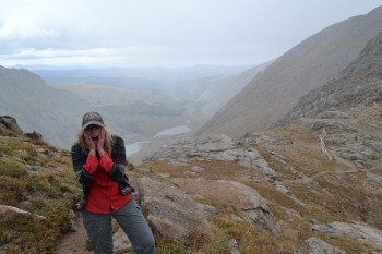
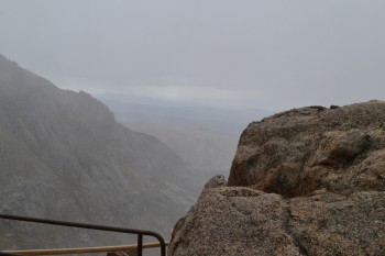
As we neared the trailhead it began to become very cold and windy. Pretty quickly after that drop in temperature it started to sleet pretty heavily. This hike was a great reminder of how fast the weather can change in the mountains. It had been nasty out initially, turned into a wonderful day with sunshine and blue skies, and then snapped back to even nastier conditions. The wind was strong enough that it came close to knocking us off balance at least once or twice. Despite the rapidly deteriorating conditions we oddly saw more people heading up the mountain at this as we neared the base than we had seen on the entire hike thus far. Below are some images from after the poor conditions set in — the white streaks in the images is sleet speeding by.
We were pretty excited once we were down and back in the warmth of the truck. At first we had thought we’d look at the lake and head out, but we ended up on the summit of a 13er! After our hands were warmed up and we had a little snack in the car we headed on out. The drive down was pretty and the sleet let up and then stopped while we were on our way down. Many of the aspen trees were bright yellow and the rest were on their way. Next weekend will most likely be a brilliant display of foliage. Our plan is to camp and try and glimpse the elk and the turning trees. Until next time we leave you with the gallery below.


Rainbow Lakes: Indian Peaks Wilderness
Distance: 2.65 miles Elevation Gain: 401 ft Min Elevation: 9,976 ft Max Elevation: 10,267 ft

This hike was done in mid-August. One or both of us had been sick for almost 2 weeks and thus we weren’t able to do much hiking for a bit. After we were both feeling better we decided to go out and just do a nice easy fun hike; and that’s what we did. But, life happened and we never had a good good opportunity to publish our story. Now that flooding has overtaken much of our part of the country we have had to stay indoors, making this a good time to share our experience at the Rainbow Lakes.
The Rainbow Lakes in Indian Peaks Wilderness are a collection of nine or so lakes and ponds. Indian Peaks Wilderness is 76,586 square acres according to the Forest Service and is on the southern border of the Rocky Mountain National Park and the northern border of the James Peak Wilderness. Much of the water for Denver and Boulder is in a reservoir just north of where we hiked. The hardest part of the hike by far is the drive to the trailhead. We would not recommend trying to navigate this without a high clearance vehicle. The road is very rocky with large potholes.
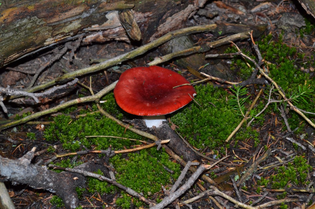
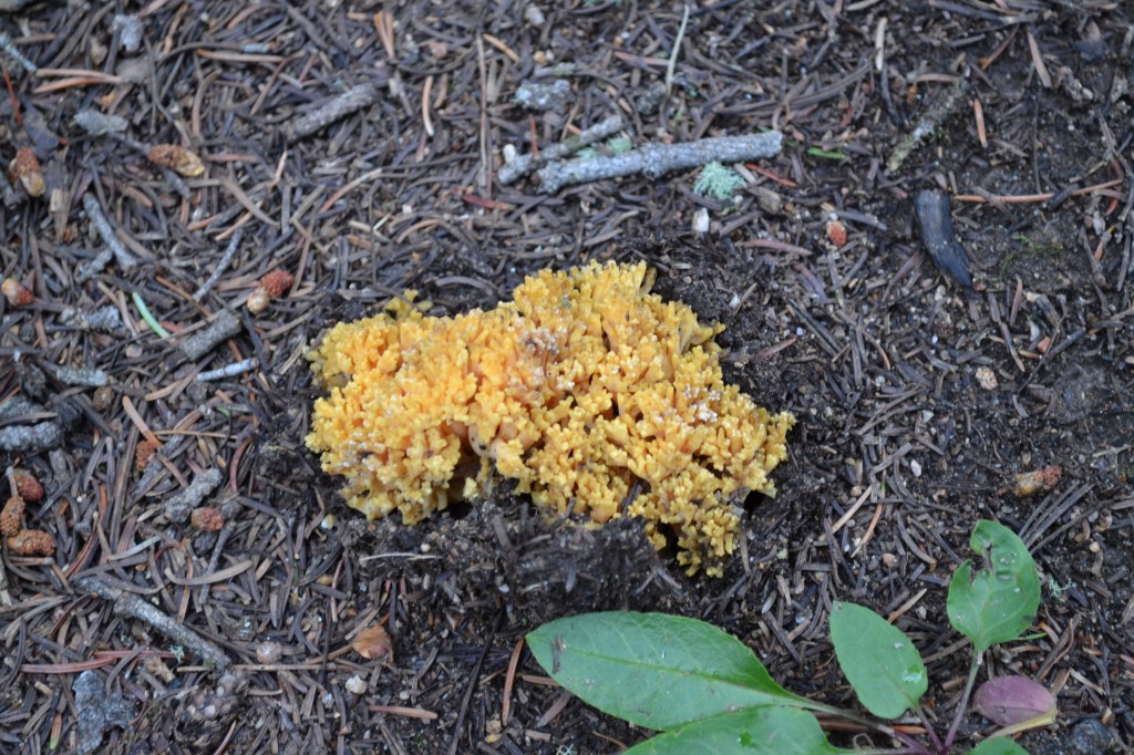
One of the first things we noticed on the hike were the abundance of aspen trees. We intended to go back to the area to see the aspen trees change color and put on a show for us, but the flooding may have made that an impossibility. Mixed in with the aspens were many Lodgepole pines and a few spruces and firs. Another point of interest was the diversity and quantity of fungi on the hike. Amamitas, coral mushrooms, puffballs, boletes and many others were littered all over the trail. Some had gorgeous red and yellow colors. Below are some of the plants we saw on the hike.

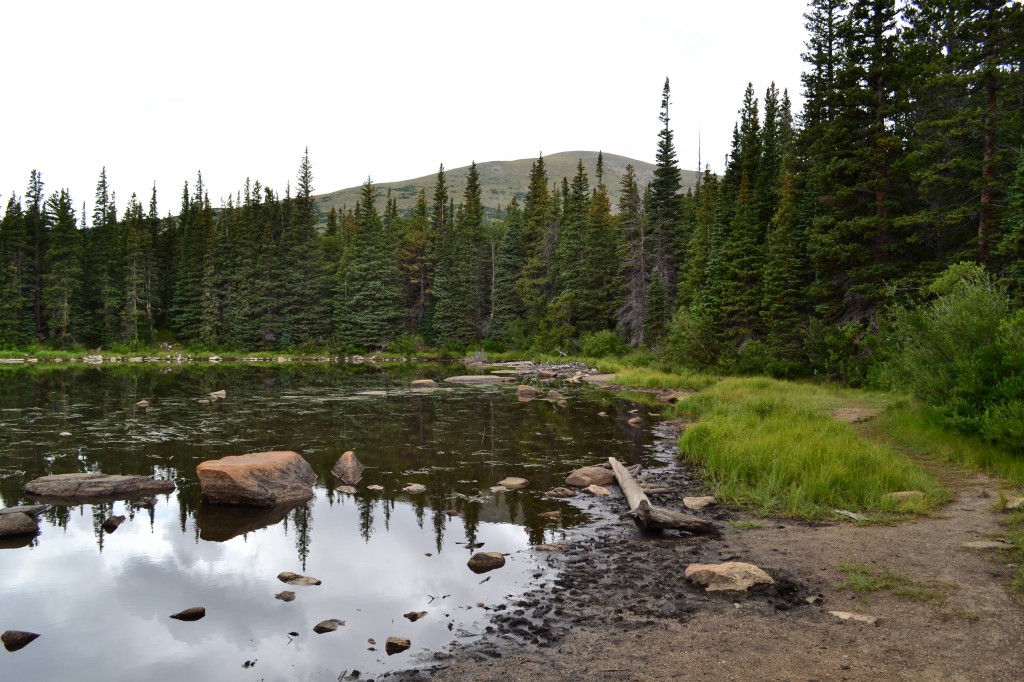
After a very brief hike we reached the first of many interconnected lakes. This first lake was a bit marshy and didn’t have a huge appeal to us, but had its own charm nevertheless. The second lake, however, was quite pretty. It was significantly larger than the first lake and much less muddy. It felt more open and the mountains behind the lake to the west made a nice backdrop. Both of those lakes are shown below.

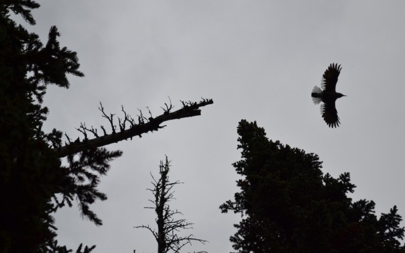
We kept going and found ourselves crossing a small stream. Quickly after crossing the stream we noticed a small talus field and we went to explore it a little bit. Once on top of the talus field we could see two more good sized lakes with numerous anglers on both lakes. The view was very pleasant and we took a seat atop a boulder and began to notice many small yellow birds flying in and out of the trees in front of us. We couldn’t get a good shot of these guys due to their shy nature and our lack of having a zoom lens, so we’re not sure what type of bird they were. There were many other birds around those lakes and we did see some gray birds who were hopping around the boulders and on the ground. Below are some of the pictures we got of the lakes and the birds.

In what became a very wet summer indeed, a very typical afternoon shower came through and we headed back to the trees. It was only a mild drizzle, but it was a little chilly up there. On our way out we saw some more of the lakes and ponds and got a really cool picture of a large bird. This bird had a small rodent in its mouth as it flew to the top of a tree right next to us. An image of the bird in flight is below. However, due to lighting and distance we weren’t able to get a good picture of it.
It was a short hike, but fun. We ran into some very friendly people and had a great time out there. There are other hikes that can be done from the Rainbow Lakes trailhead which are much more substantial, such as a glacier hike. If it is possible to get back out here this year we are going to try, since we want to do the Aparahoe Glacier hike; but the rains have flooded the area so badly that many roads into the mountains no longer exist. We will have to see.
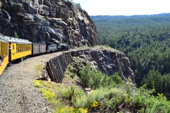
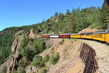
Durango and Silverton Narrow Gauge Railroad
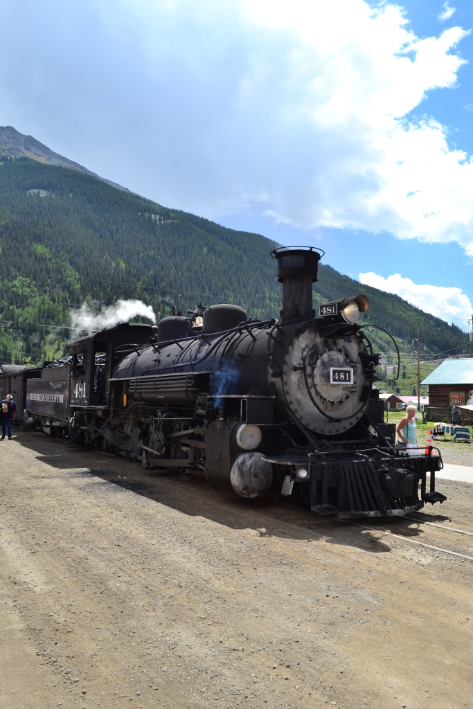
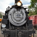
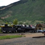
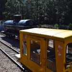
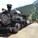
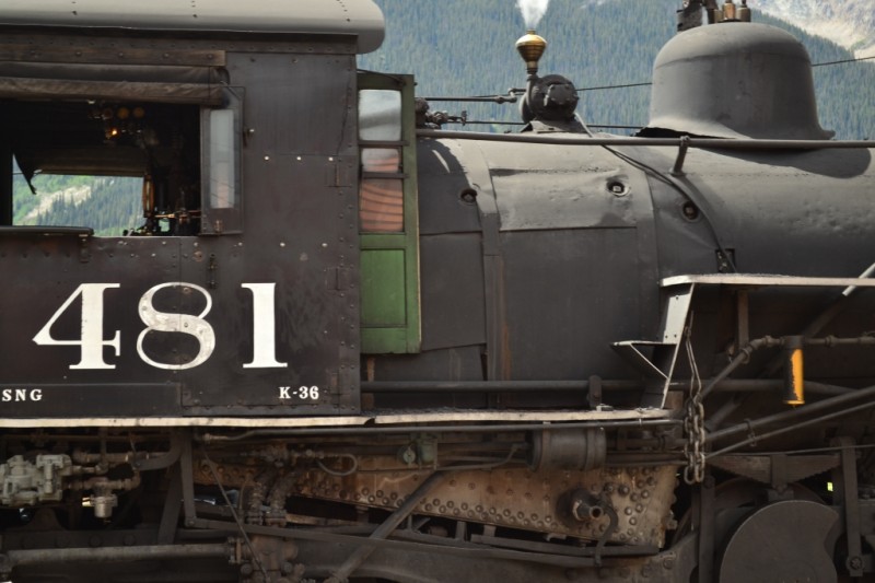
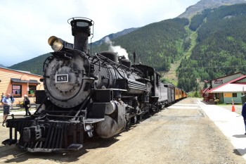
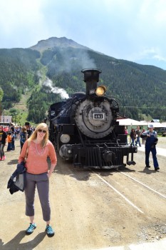
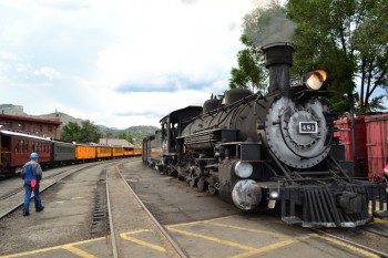
A few weeks ago, as part of our long journey to the wild southwestern side of the state, we took a ride on the famous Durango and Silverton Narrow Gauge Railroad. It’s somewhat of a Sandifer family tradition to travel to Durango and ride this all steam locomotive up to Silverton and way too many opportunities to follow this tradition have passed us by over the years. For labor day weekend, it was our turn to relish in the rich history of these towns and the 45 miles of three foot narrow tracks that link them. Seen below is steam engine 481 that we rode.
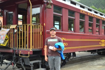
The railway was built in 1881 and has continuously run since then, first to carry miners and supplies up to search for gold and ore in the San Juan Mountains and now to carry travelers to visit these relics of the past. The locomotive we rode on this trip was built in the 1920s. We began our day bright and early and drove down to the original train station in Durango which was erected in 1882. The platform was a vibrant scene full of eager passengers ready to board the train. We picked up our tickets fairly easy considering the crowd and made our way to car number 21. Though there are many options to choose from for cars and seating while aboard, we opted for the open air gondola ride. Instead of being confined to the inside of a car, we wanted to feel the wind and be among the vibrant scenery. The train departed at 8:45 am sharp and we were off!
We were excited to get the right side of the train for the journey up in elevation. This side is known to get the best views first. From the moment we sat down on the train, it felt like we were going back in time. The conductor and train engineers were all in classic attire and graciously welcomed us onboard as well as meticulously checked and punched our tickets. The only thing that brought us back to reality was the introduction to the concession cart and the promise of bloody mary’s, pictures and souvenirs for a small fee. The train began slowly and we rolled through the town of Durango at a leisurely pace. The sun was just beginning to rise higher in the sky and warmed our cheeks as we gazed out at the Animas River. In the early part of the ride, we saw many people, parks, buildings, but despite the suburban setting, we also saw a large buck mule deer.
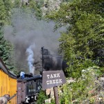
After the first 45 minutes of the ride, the train slowly snaked its way up into the mountains. As the train worked hard to gain power, we could feel the warm droplets of steam hit our skin from the engine. We also had to save our eyes from the constant flow of cinder and ash from the burning coal. If not careful, eyes can be burned very easily. Seen below are photos from the train as we began to climb into the mountains. Notice the powerful steam released from the engine as we gained speed!

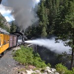
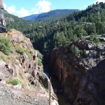
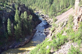
The ride became amazing at this point. We kept climbing higher and higher. Overall, the train gains over 3,000 feet in elevation in those mere 45 miles to Silverton. As we climbed, the Animas River to our right became much smaller. And then we noticed that our proximity to the edge of a cliff became closer. The “narrow” gauge railway fits its name in more ways than one, narrowly creeping along the edge of a precipitous cliff face. Though scary, it made for the most exciting part of the ride. As we looked over the edge of the car, we could seen hundreds of feet below us. The train also makes a large curve at this point and allowed us to see the front of the steam engine and the old wooden bridge we had to cross. Seen below are photos of the cliff climb.
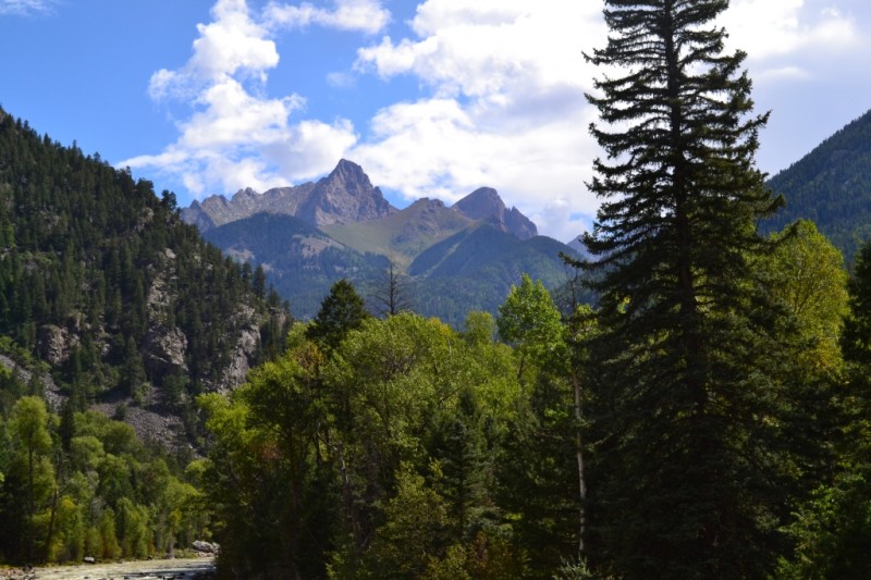
After crossing the narrow bridge and in and out of tunnels blasted out of rock, brilliant views of the San Juan Mountains emerged. We made a few stops along this portion of the route. Once to fill up with gallons and gallons of water to allow us to reach Silverton and twice to let hikers off and pick up hikers. One of the most famous spots was the Needleton stop. Tons of backpackers hopped off at this stop to hike to the famous Chicago Basin and tackle a variety of San Juan summits (14ers) in the area. Next time, that is our plan. Seen below are the Needles Mountains and the bluebird sky that stayed with us for the first half of the trip.
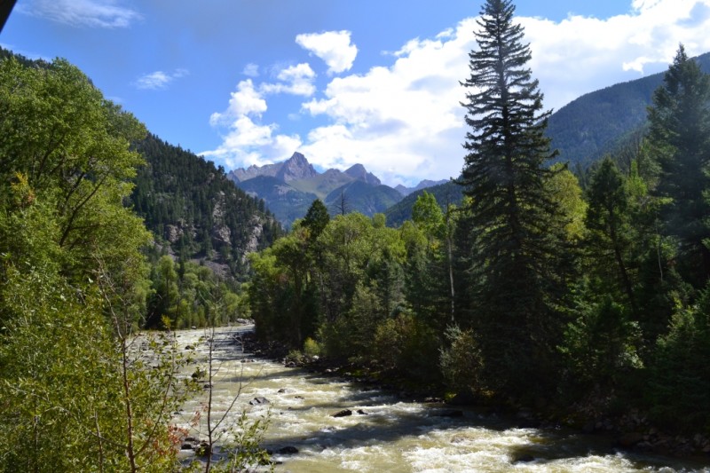
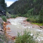
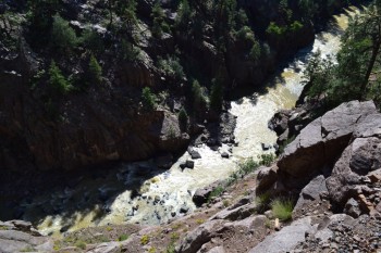
The Animas River also followed us throughout the train ride. We ended up crossing it 5 times as the rail tracks snaked in and out of the river’s path. The river was not as crisp and clear as we had originally imagined it to be, but rather appeared more wild and muddy. Nonetheless, it’s power and beauty was a highlight of our trip on the DSNGR. As we approached Silverton in the last 20 min of the ride up, it began to rain on us. While some sought shelter in the covered cabs, we welcomed the cool, rain as it did become pretty warm in the sun exposure outside. Amid the steady rain, we caught glimpses of waterfalls in the background of the river. Seen below are photos of the waterfalls and the quaint town of Silverton.
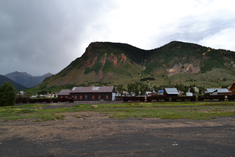
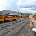
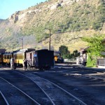
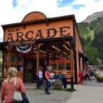
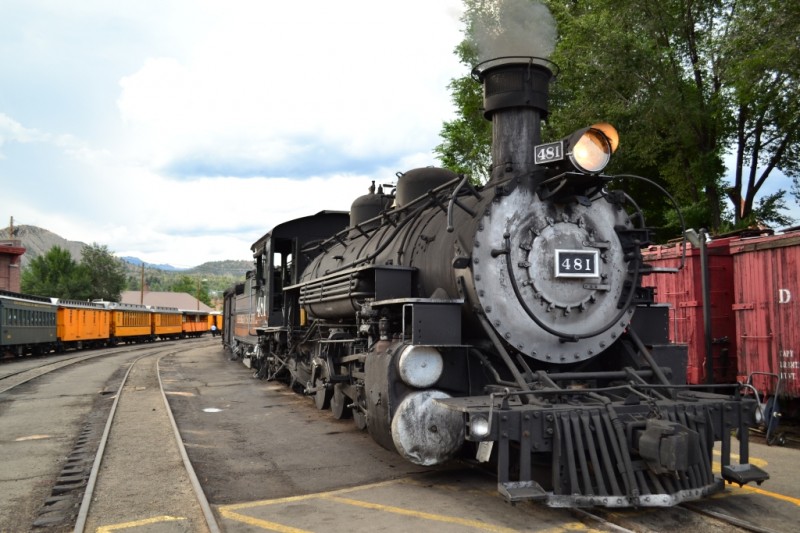
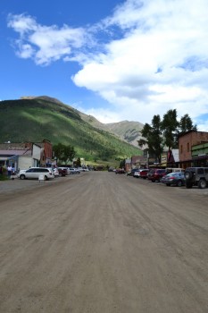
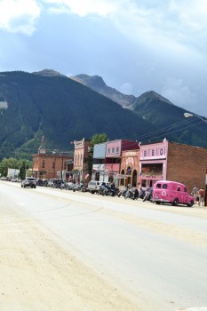
After about 3 hours and 45 minutes, old 481 rolled into Silverton just a block from main street. The tracks appear to just run out in the middle of the street in town. We kind of wished that we had stuck around to see how the train turns its self back around to head back to Durango. When we returned to the train for our trip back, it was already positioned south ready to go. The train trip allows for a 2 hour stop in town to enjoy lunch and some shopping. After a bit of wandering around we stopped in The Pickle Barrel to enjoy some soups and wraps and then shopped a bit around town. The two hours we stopped were all too brief and in a short time, we had to head back. However, we returned to town a second time on this trip after exploring a ghost town that we’ll share later. Silverton is a unique, history rich town still exuding its mining rich heritage. Seen below are photos of the train stop in Silverton.
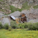
The train ride back was long but still an enjoyable experience. A lot of the passengers that rode up with us decided to take the bus back so we had more of the train to ourselves. Plus, since we looking west this time, all the views were different and unique. We got to witness views of the Animas that we missed the time before as well as Tacoma Power Plant (hydroelectric). This plant was built in 1906 and originally supplied power for Silverton mine operating projects. It is still operational today providing renewable energy for many in the area. Though we didn’t get a photo, the vintage plant in the middle of the wilderness provides a unique perspective.
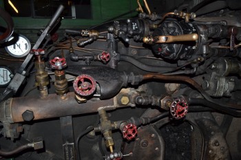
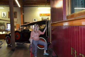
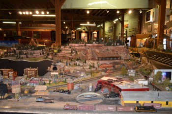
Once back at the train station we took a few more glances — and pictures — of the train and engine and then went into the train museum (which is free with train tickets). The museum was really cool. It had a large collection of miniature figurines, historical firearms, a large model railroad, two large real life steam engines, four historical automobiles, and an old airplane! A very diverse collect. All the objects were well documents and the staff were friendly. When we walked back outside the train was gone and the station felt very empty. The day of trains had definitely come to an end. Above are some images from the end of our ride and the museum.