Take a Walk
A Quest into the Wild
Thunder Lake Wild Basin: RMNP
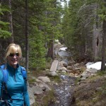
A week away from the summer solstice, we decided to try our luck with a mountain hike in Rocky Mountain National Park. The weather has been memorable to say the least this year in Colorado, and we weren’t entirely sure what to expect on the trail in early June. We arrived at Wild Basin’s summer trailhead at about 10:30 am, and quite unexpectedly got the very last parking spot. After some banter with the volunteer park rangers about which lake to pursue on our hike, we opted for Thunder Lake. Rangers informed us that no one had yet reported making it to Thunder Lake as the trail becomes muddled and lost in fields of snow about a mile from the lake. Previous trips to Wild Basin have taken us to most of the other lakes and destinations, so we decided to go for it.
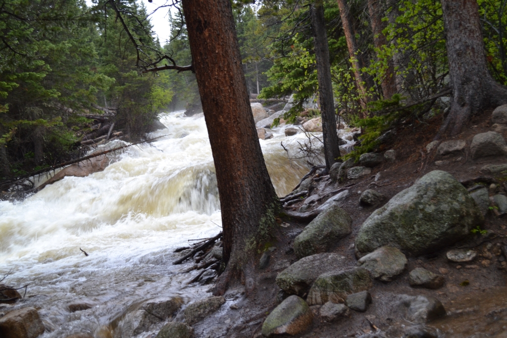
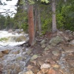
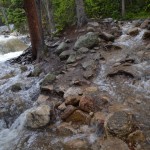
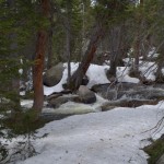
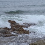
Weather reports suggesting isolated storms for later in the afternoon, so we figured we might have a chance of getting rained on but we thought we’d make it out in time. We began on the familiar trail that follows along the St. Vrain to the majestic Copeland Falls. Due to the excessive rains this spring, the river was extremely high. Seen below is the St. Vrain during the first mile of the hike.
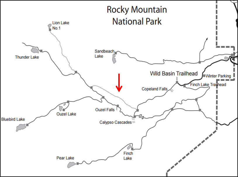
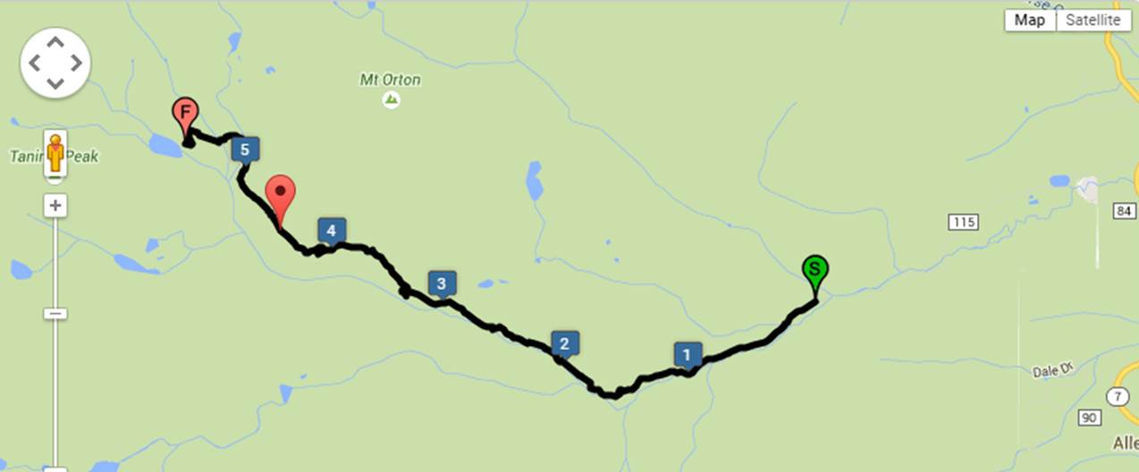
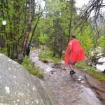
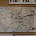
Due to the devastating floods of 2013, the Ouzel Falls bridge that leads to Ouzel lake and the junction for Thunder lake was washed away. We were told by park rangers that there are cairns leading around the top of the falls as a secondary means to cross, however the recent heavy rainfall made this route dangerous. Instead we took an old camping trail that skirts around the falls. Seen below is a map of the Wild Basin trail system courtesy of the National Park Service. The red arrow points to the connector trail we utilized. This stretch of trail was about 1.3 miles and led us mostly uphill through dense woodlands. We could hear the sound of the water and falls as we made our way along this trail. But, it was disappointing that we couldn’t see Ouzel Falls on this route anymore.
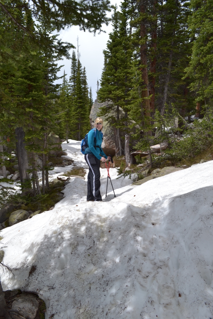
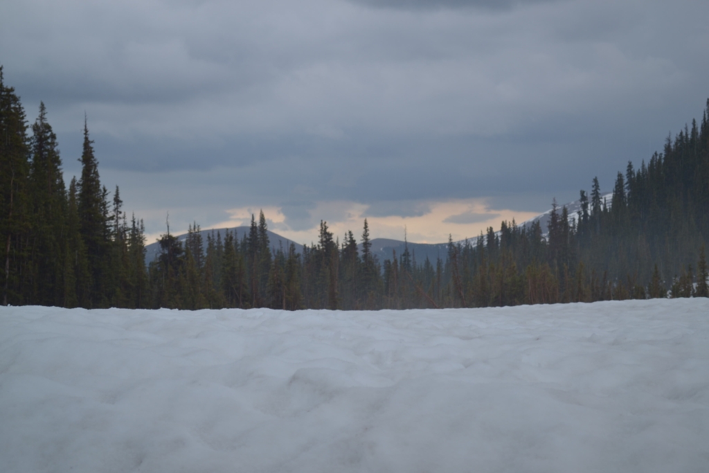
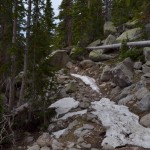
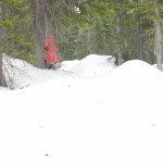
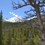
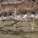
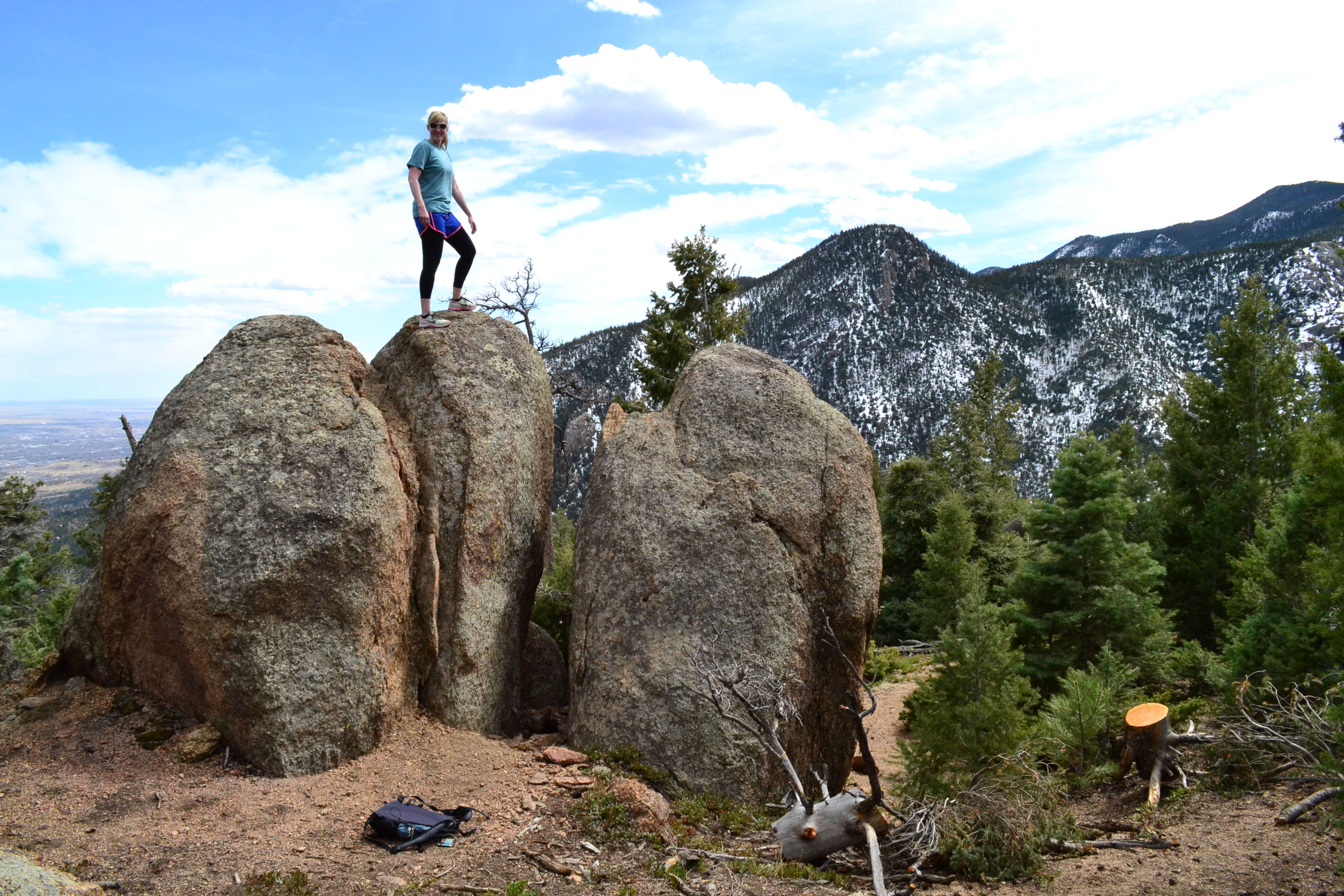
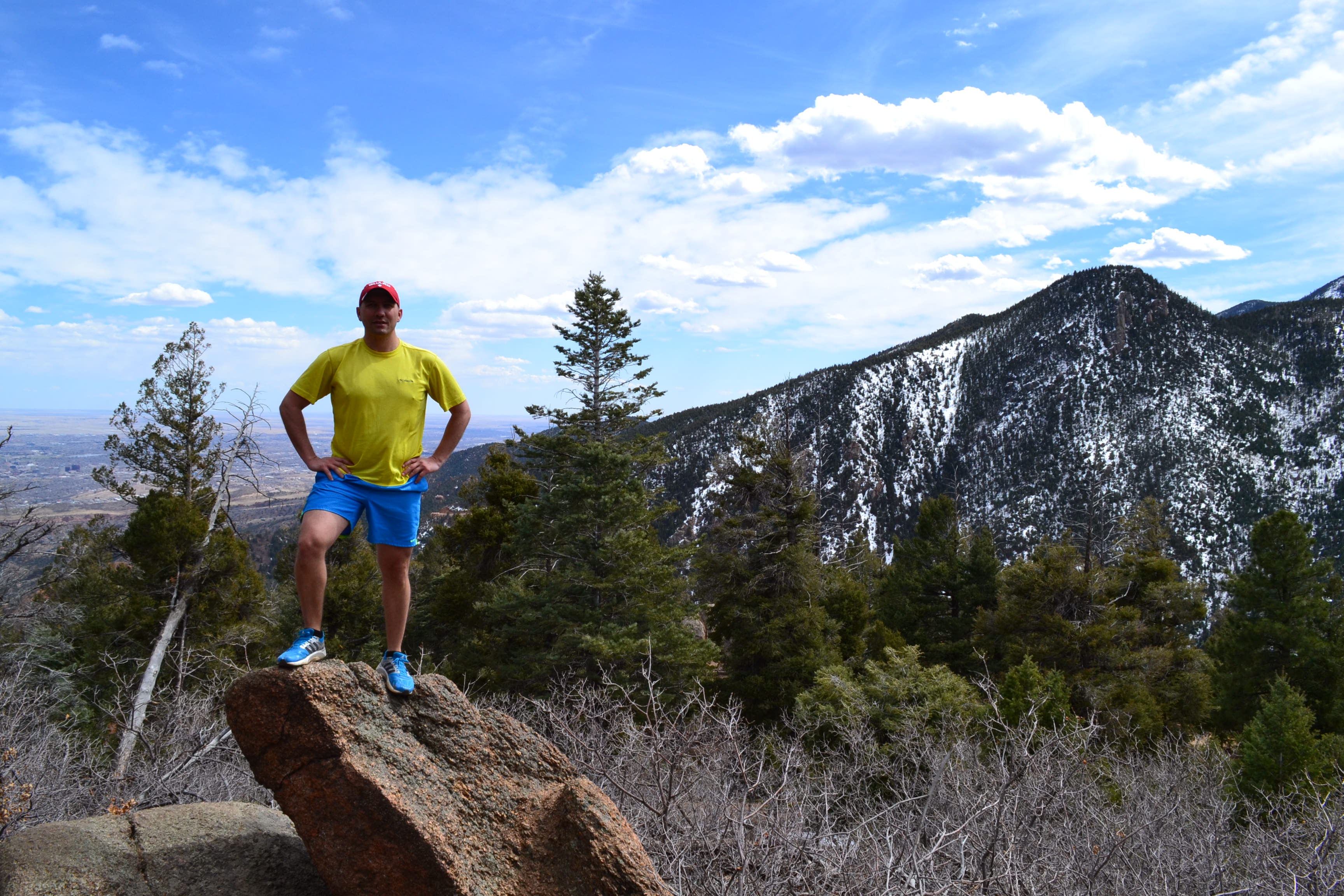
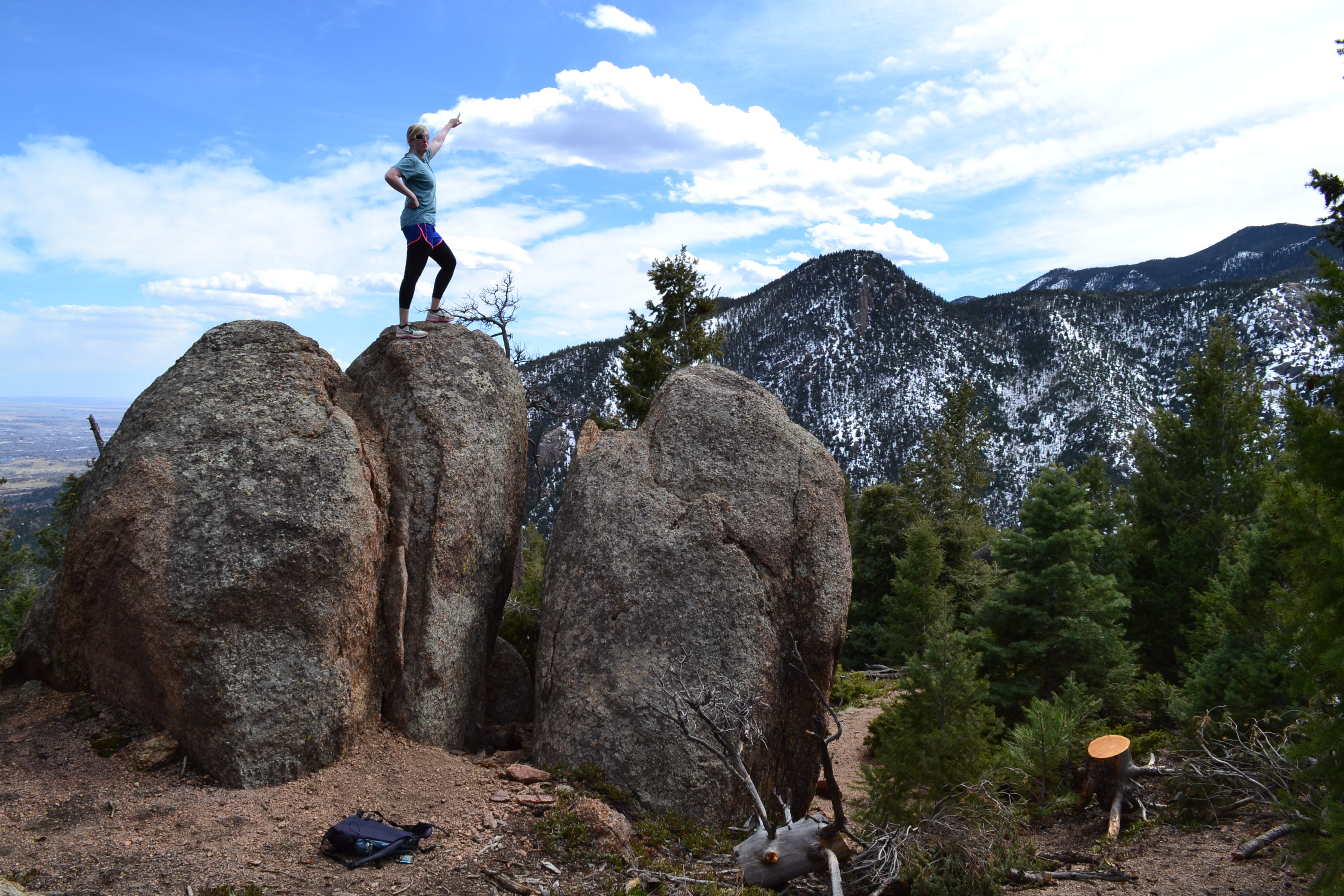
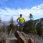
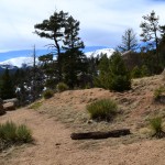
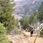
At the end of the connector trail, there is a sign indicating a trail junction. One way leads to Ouzel Falls, the other towards Thunder lake and Lion Lake #1. At this point in the hike, we met up with another solo hiker for company and continued upward towards the lake. As we gained elevation, we began to lose the warm temperatures we had grown accustomed to and began to see patches of snow. These patches of snow got larger and deeper once we passed the Lion Lake No. 1 trail junction. Seen below are photographs of the trail.
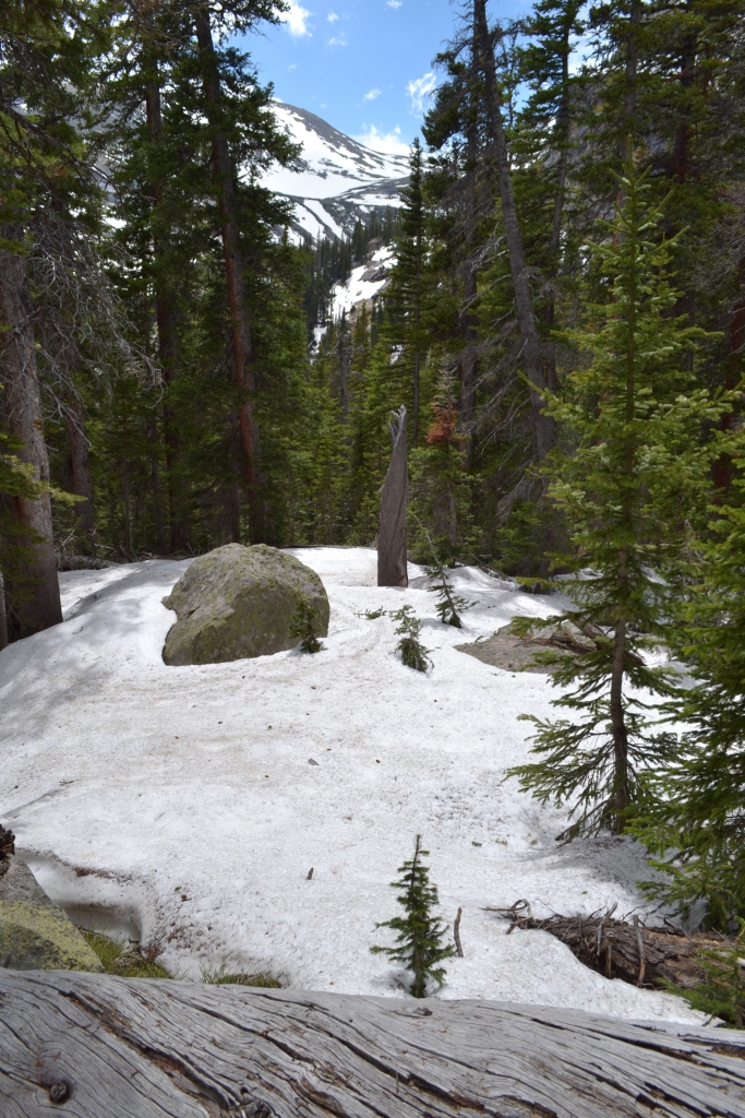
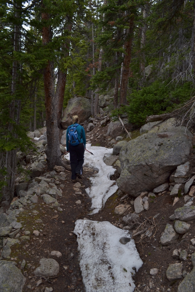
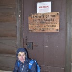
When we got about a mile from the lake, the trail disappeared. We ran into a a few other hikers who directed us to follow their footprints and veer left of the river. Unfortunately, we forgot our Garmin GPS and only had a cellphone fitness app to track our location. A few hundred feet in, and we had already lost signal. We used footprints, the river, and sun to guide us to the lake. The route took us up and down 10 foot piles of snow, though most of it was well packed in. About 100 yards from the lake, the sun vanished, the sky turned dark, and hail began to plummet down on us. We took shelter for 15-20 min under some dense branches of nearby trees. The hail didn’t stop. We saw what looked like a cabin 50 yards away and decided to make a run for it. It was the Thunder Lake Patrol Cabin, and it was locked. There was however a decent porch with an overhang that we took shelter under. Seen below are photos. We had to climb down 4 feet of snow to reach the porch.
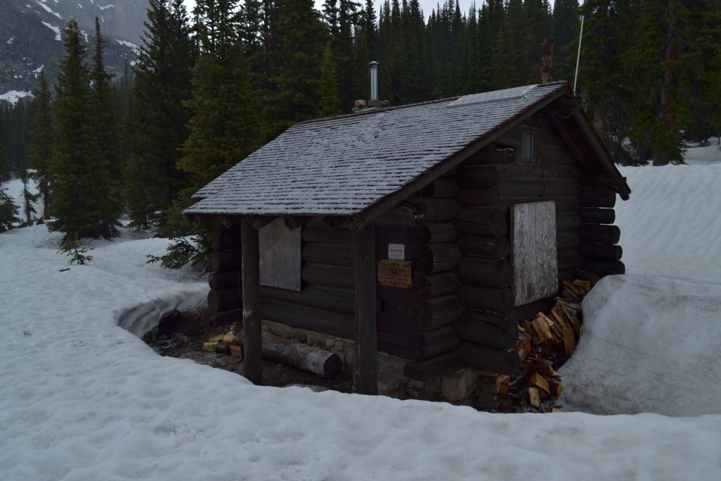
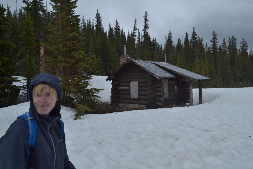
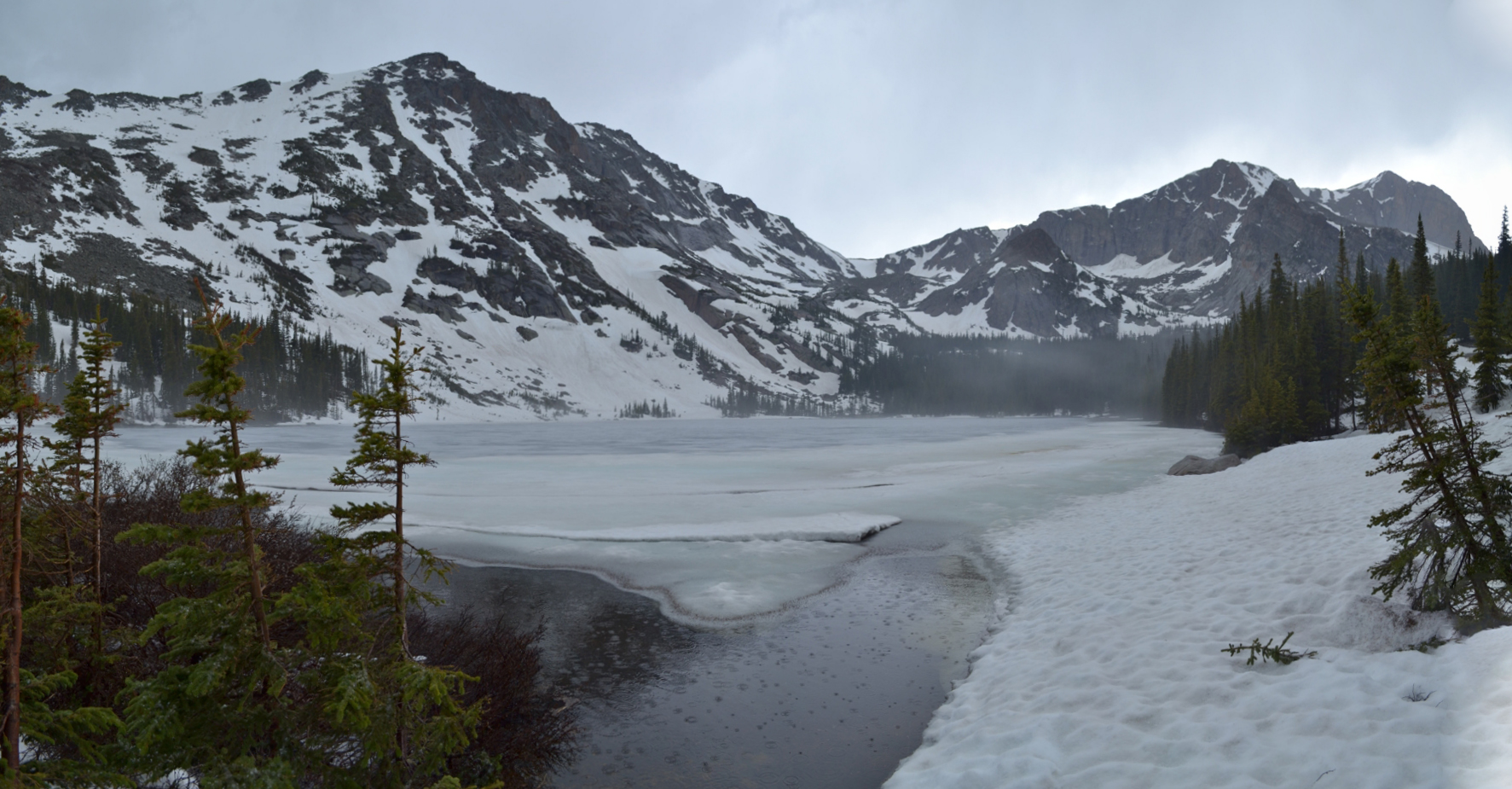
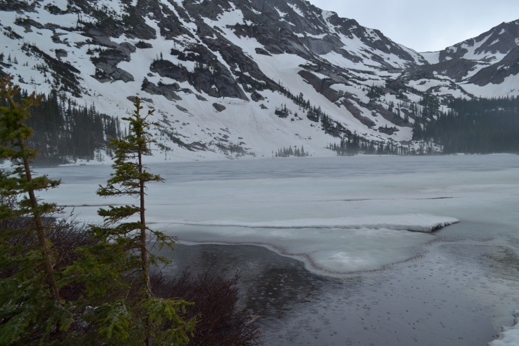
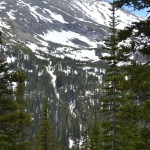
We huddled under the porch for close to an hour with our new hiking friend. It was cold. Really, really really cold. We were pretty upset that the cabin was locked up tight with a sign on it that said breaking and entering could lead to prison time. When the hail turned into a steady rain, we decided that since we made it all the way to the lake, we should at least walk up to its banks. Thunder lake is quite stunning with large picturesque mountains standing proudly behind it. It was still mostly frozen in early June. Seen below are photographs.

We stood at the lake for 5 min. It was 6.5 miles of uphill work for a few moments of quiet beauty. Was it worth it? Of course. The mountains rewards are great but always hard-earned. We then headed back to find our trail. This proved to be very difficult. The hail and rain had covered up our footprints from earlier. We had to rely on memory and landmarks to get back. We had one moment of anxiety which developed when we lost our way for a moment. Luckily a small frozen lake directed us back. We finally made it to a distinguishable trail. The rain kept coming and was much heavier now. Waterproof clothes proved to be otherwise. When we made it back to the St. Vrain, much of the trail was beginning to flood. We finally saw the welcome sight of the warm X-terra, climbed in and headed to Estes Park to celebrate our rain-drenched, hail-pummeled, snow-filled trek to Thunder Lake. The name was quite fitting after all.
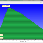
Below is a map of the route. We traveled about 12.3 miles RT and gained a little over 2000 feet in elevation.
Writing and cartography by Allyson Sandifer Checkley
Photography by Thomas Checkley
Torrey Pines State Reserve: La Jolla, CA
In the celebration of our 5th wedding anniversary this year, we placed an emphasis on our commitment to being healthy and fit together. Living in Colorado and sharing our posts with friends and family has helped motivate us to stay in shape and continue to push ourselves further. On the weekend of May 29th, we headed to sunny San Diego to complete our very first half marathon, part of the San Diego Rock n Roll Series.
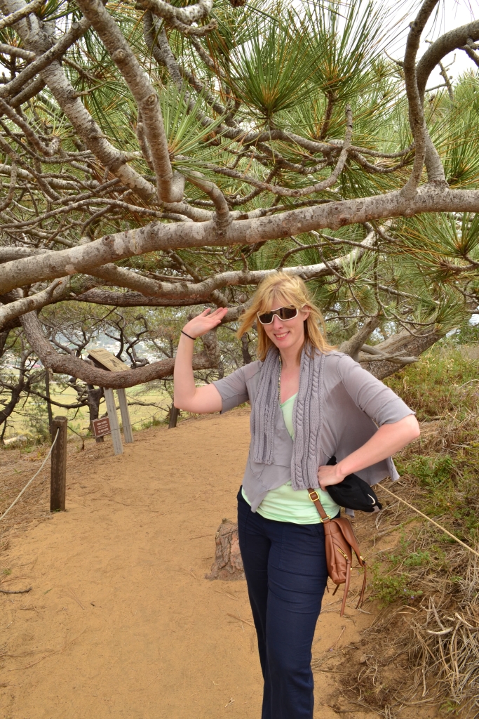
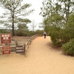
In addition to a successful and enjoyable first race, we had the opportunity to hike some scenic coastline trails in and around San Diego. A short drive north of the city led us to the exquisite Torrey Pines Natural State Reserve. Torrey Pines is 2000 acres worth of wild Southern California landscape, a preservation of a much earlier time in California history when Spanish explorers first lay eyes on the sweeping sands and sandstone bluffs that border the great Pacific. The state reserve is a unique hiking experience from the moment of arrival. Free beach parking is available near the north entrance of the park, but very limited. We parked here and hiked uphill 15 min to reach the various trailheads. Alternatively, parking is available inside the park for 15 dollars and allows visitors to drive to the top and park next to the visitor’s center.
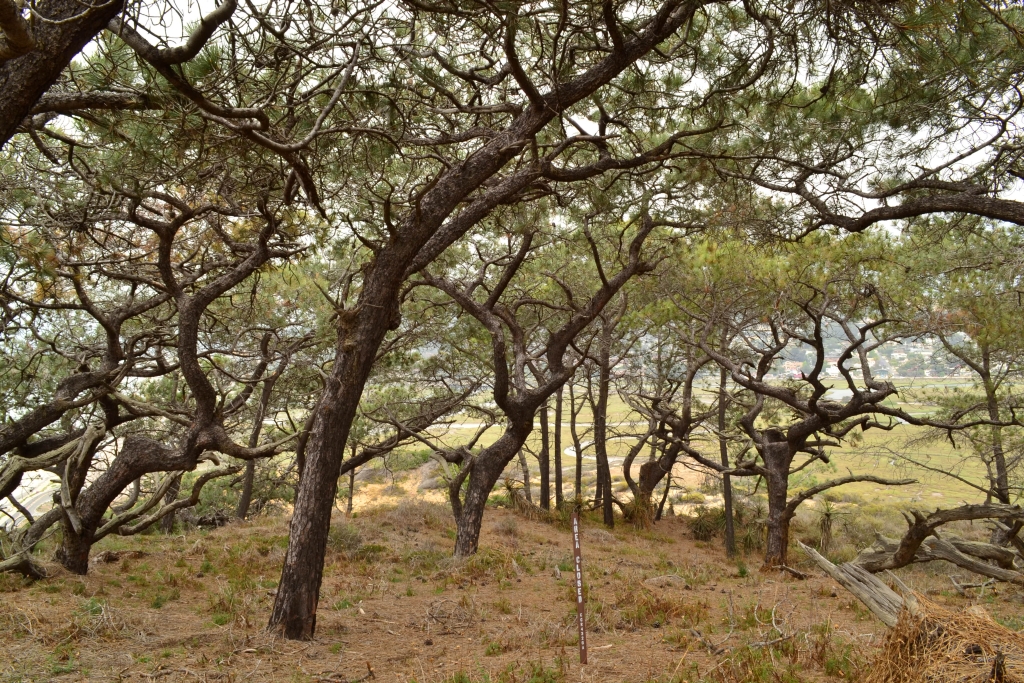
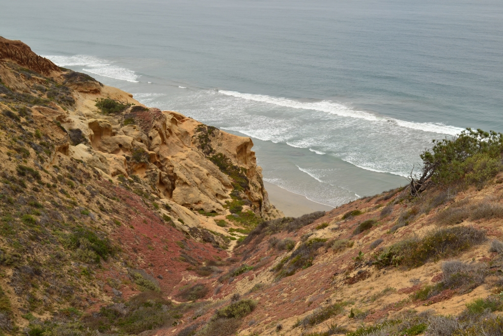
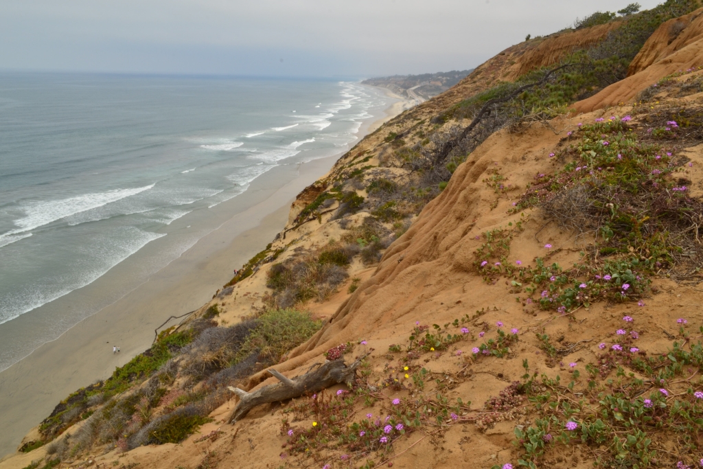
After hiking uphill, we first explored the Guy Fleming Trail. This 3/4 mile loop is often overlooked in favor of Beach Trail, but we highly recommend it. Taking this short loop gave us the opportunity to see the famous Torrey Pines, the rarest native pine in the US. They are characterized by broad open-crowns that form large canopies. In addition to their unique appearance, Torrey Pines are extremely resilient. They have to survive in extreme drought, poor sand that hardly qualifies as soil, and the hot sun. Their location on the coast makes them susceptible to sudden and powerful storms. Nonetheless, the species continues to survive. The Guy Fleming trail also offers sweeping ocean vistas. The unique sandstone formations are also seen here providing a dramatic backdrop to the deep blue Pacific. Seen below are photos of a pine canopy we encountered on the loop and the oceans overlooks.
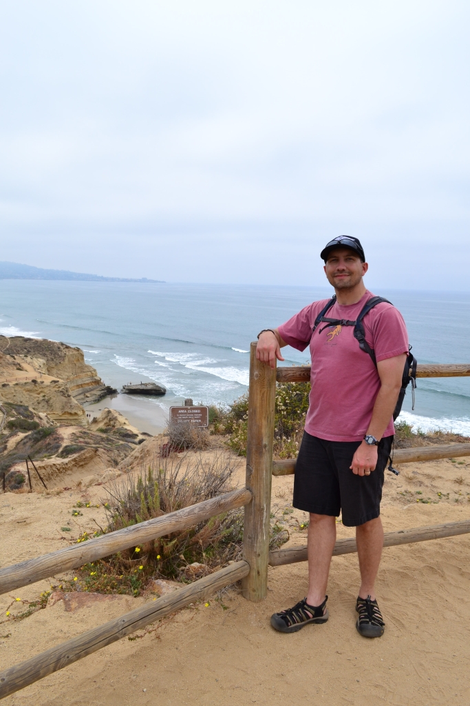
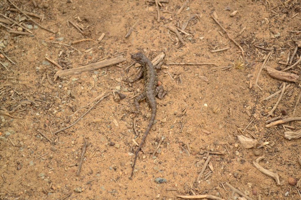
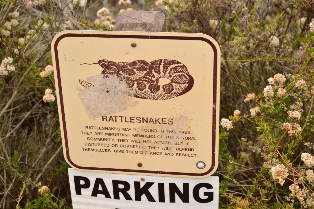
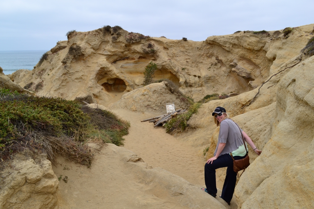
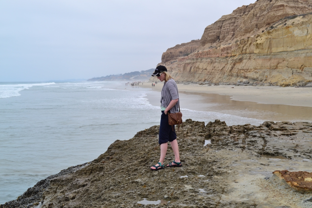
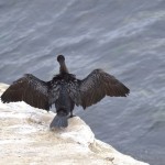
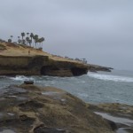
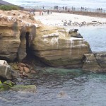
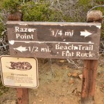
After completing this Trail, we continued up the road on foot and passed the Visitors Center. The trailhead for the most popular Beach Trail is found in the parking lot directly across from the center. Reaching the beach and the famous “flat rock”, requires downhill travel on a steep sandy trail for about 3/4 of a mile. Along the way, we explored a few spurs of this trail which led to more beach and ocean vistas. Though we only saw a lizard as part of our wildlife experience here, there were several signs dotting the trail warning of the presence of rattlesnakes. See photographs below.
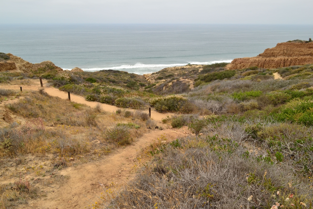
As we approached the beach, the trail became steeper and more rugged. One section required skirting over a few rocks and concluded with a steep staircase that led to the sand below.
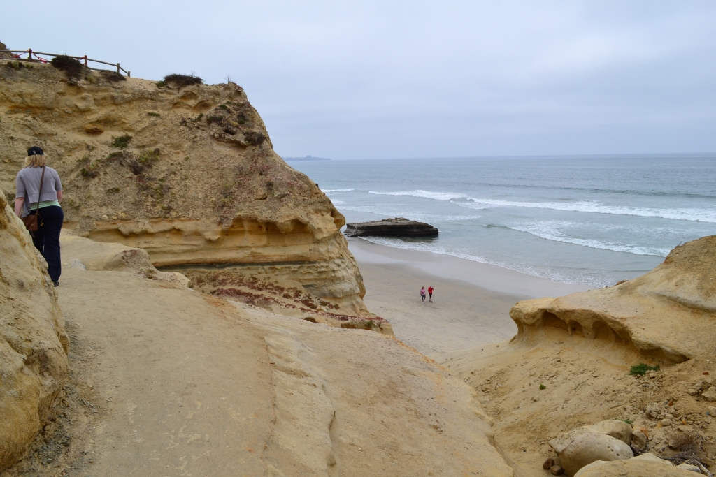
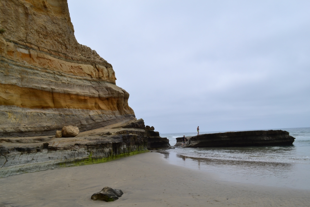
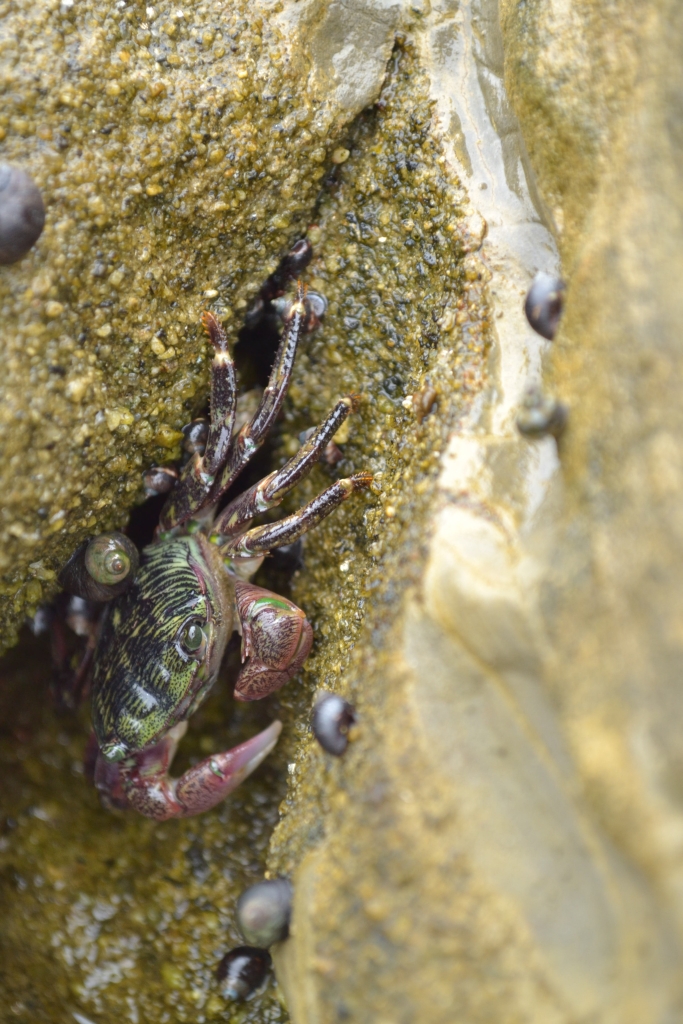
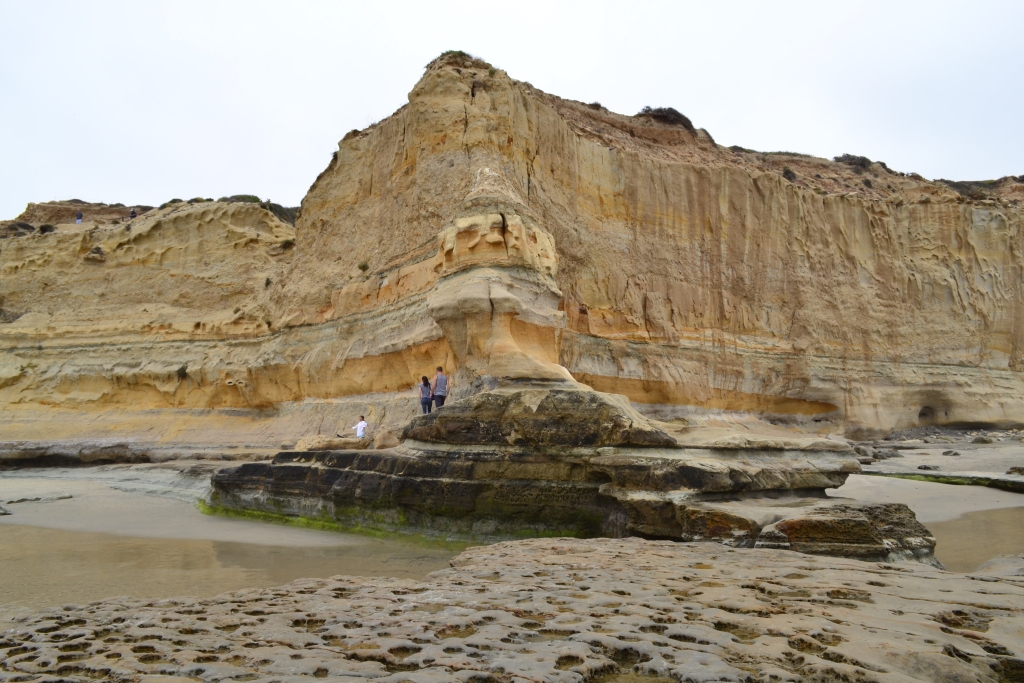
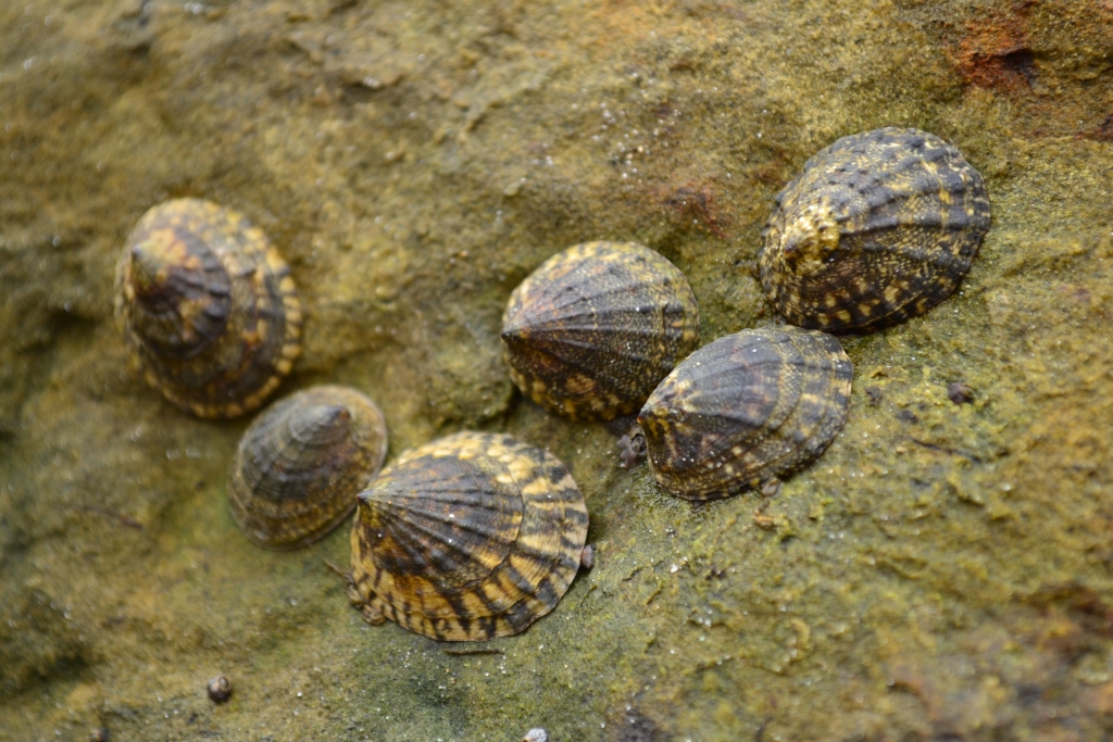
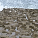
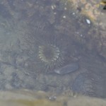
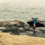
At the base, we encountered Flat Rock. Flat rock is a sea stack that remains after wave erosion took away most of the Delmar Formation which is sedimentary rock that is 48,000,000 years old! The tide was low, so we rolled our pants legs up and climbed atop flat rock. Various tide pools lay atop the rock, and allowed us to gaze at a colorful array of marine life. We saw shore and hermit crabs, mussel beds, and the unique goose barnacles. Torrey Pine’s is truly a biologist’s playground of exploration.
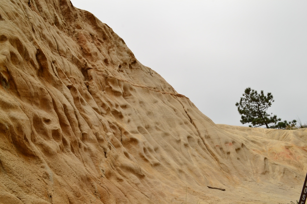
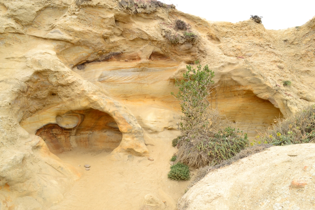
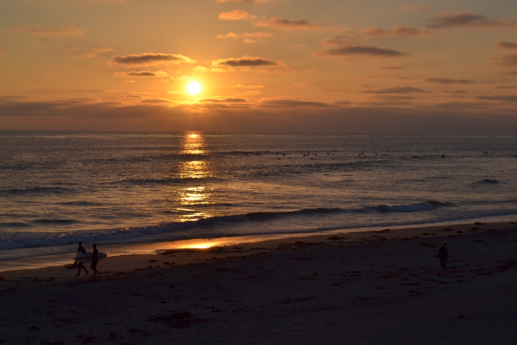
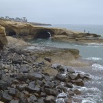
We concluded our hike by a long stroll along the beach back to our car. We let the cold ocean water wash over our feet as we gazed at the impressive sandstone cliffs that bordered us opposite the ocean. The cracks,caves, and depositions in the walls of the cliffs were fascinating but we are biologists not geologists and cannot explain the incredible changes and processes of the earth that led to its current state.
We highly recommend visiting Torrey Pines Nature Reserve. It is a natural oasis, nestled in between very urban areas. We’ve also included some other pictures in our gallery from our explorations of La Jolla Cove and various other San Diego attractions.


.
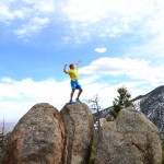
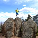
Manitou Incline: Manitou Springs, CO
Distance: 4.0 miles (.89 mile up incline; 3.1 down Barr Trail ) Elevation Gain: 1,944 ft. (total)
Max Elevation: 8,576 ft. Min. Elevation: 6,605 ft.

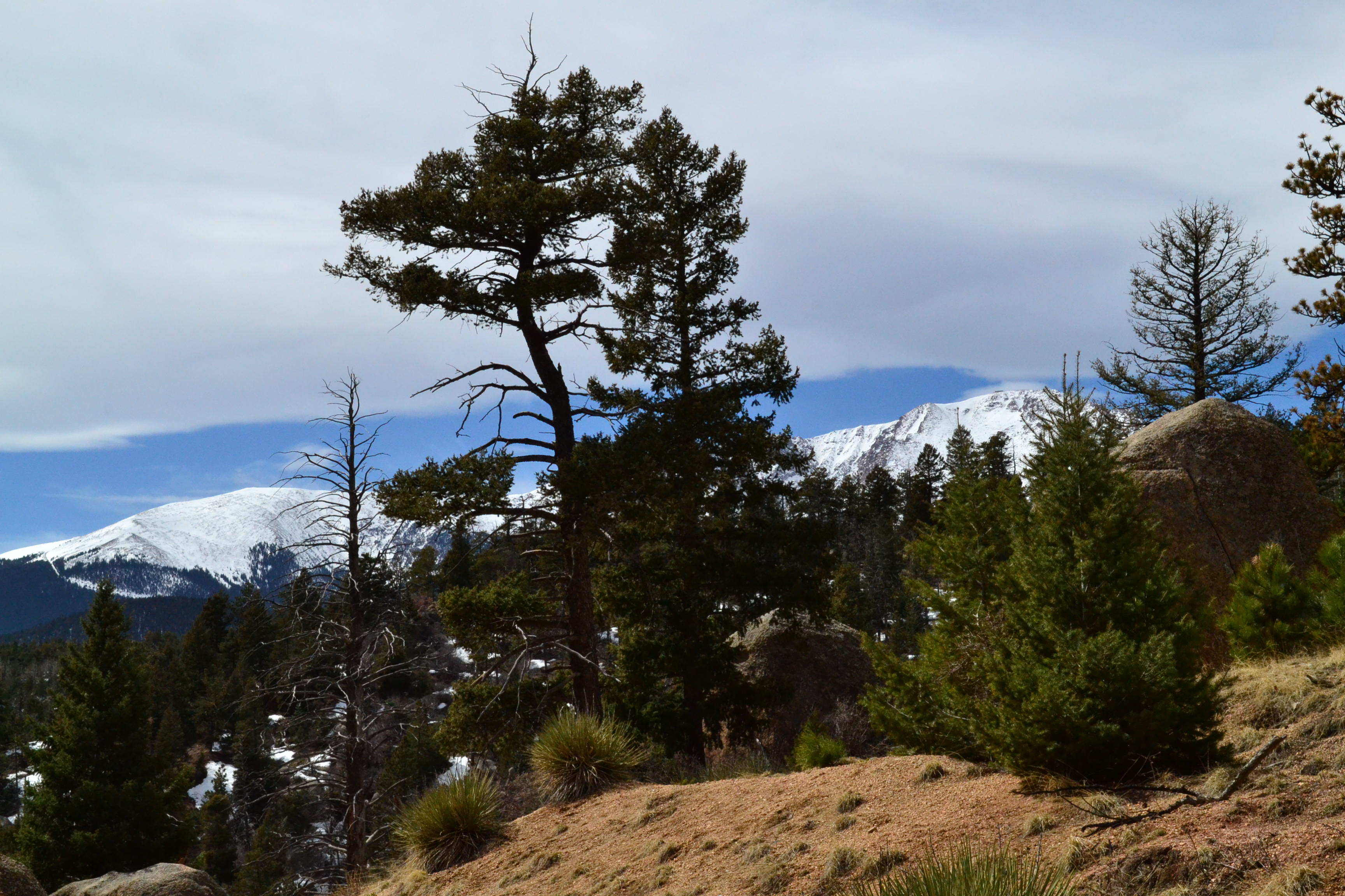
Usually in early spring or winter, we are quite content leaving the task of ascending 2000 feet in just under a mile to the mechanical ski lift, which has been helping the masses ascend to the heavens both quickly and comfortably since 1936. Some lapse in our judgement occurred this weekend, perhaps caused by the first sights and sounds of Springtime developing on the Front Range. While we haven’t hung up our skis entirely for the season, we did opt for a change of pace and decided to test our fitness levels on the famous Manitou Incline.
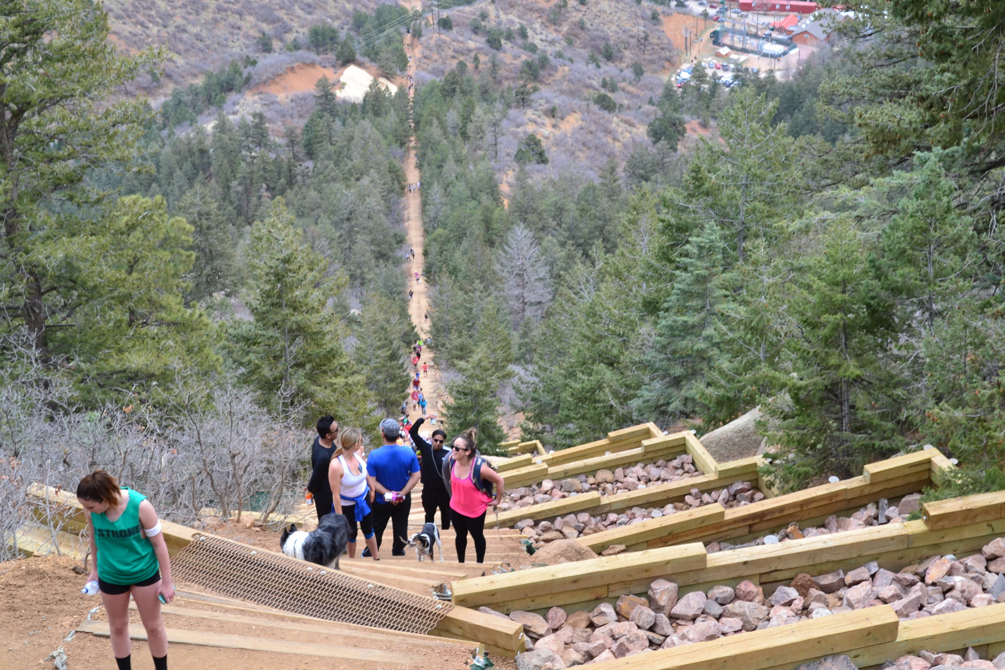
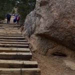
Originally built for cable cars to carry pipeline supplies to the summit of Pikes Peak, the Manitou Incline now remains solely for those testing their fitness. Up until this past fall, all that was left was old rotten cable ties, with random pipes and stakes jutting up and around the incline. In fact, due to the dangerous terrain (as well as private property battles) it was illegal to hike the trail until early 2013, although it really stopped hardly anyone from trying. About 20% of the trail has just recently been restored, making travel much less hazardous in the steeper sections. Various news stories and guide books have compared the incline to “climbing the empire state building…twice”. Seen below is the first tie… the first of many.
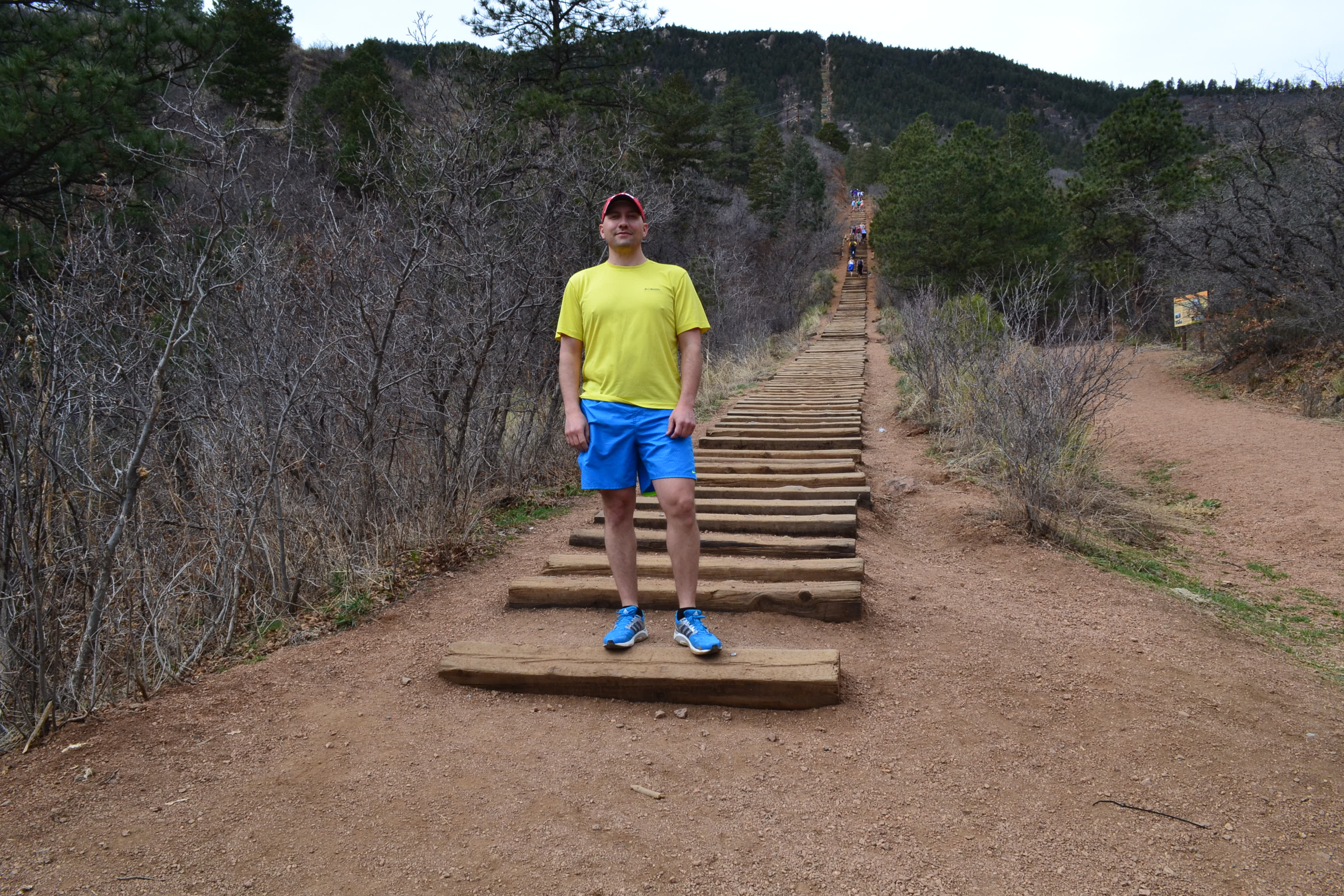
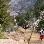
Most people start the incline with a time goal in mind, while others just hope to make it to the top without collapsing. For our first time up, our goal was to just finish in under an hour. The official record is held by Olympic athlete Apolo Ohno at 17:45. The fastest unofficial time is held by Mark Fretta at 16:42. Many enthusiasts do not recognize this time due to Fretta violating anti-doping rules and regulations. The first third of a mile on the incline in our opinion was not overly strenuous. We were both able to maintain a steady pace with out stopping. Seen below are photos of the incline during the first half mile.

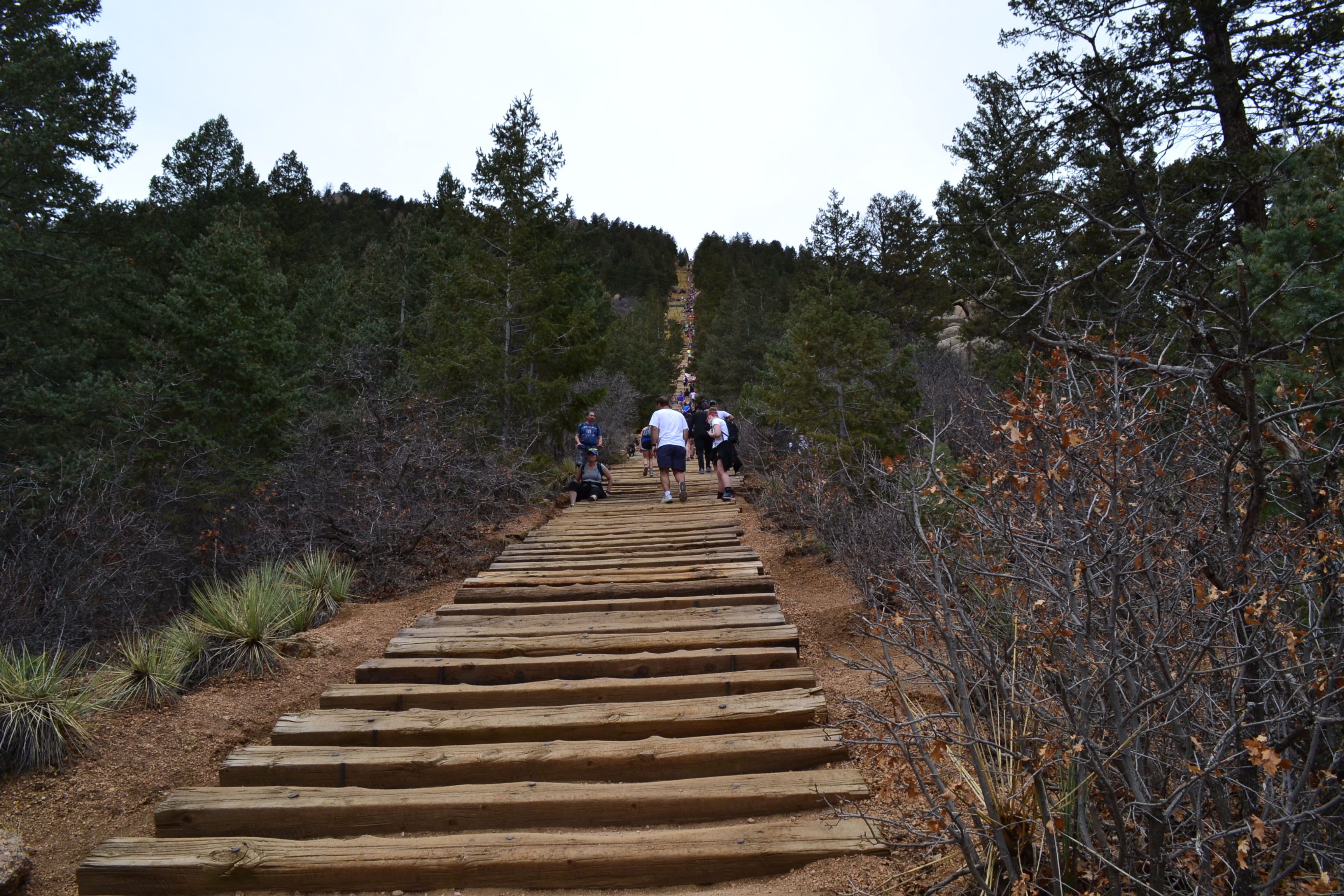
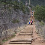
Just past the halfway point as the trail begins to steepen, there is a bailout point with access to the Barr Trail. The Barr Trail is the recommended route down, due to the danger of traveling down the incline as well as the risk of over congestion with two-way traffic. Locals apparently call this the “wimp-out” or “wuss-out” spot. Nonetheless, reaching this point isn’t exactly easy. We trudged onward and upward from here as things became more tough. Seen below are photos of the upper portion of the incline and views from the “false summit.” The incline is so steep at this point, that hikers are not able to see the true summit leading the naive to think they are almost done. There are still 300 steps to reach the top from here.
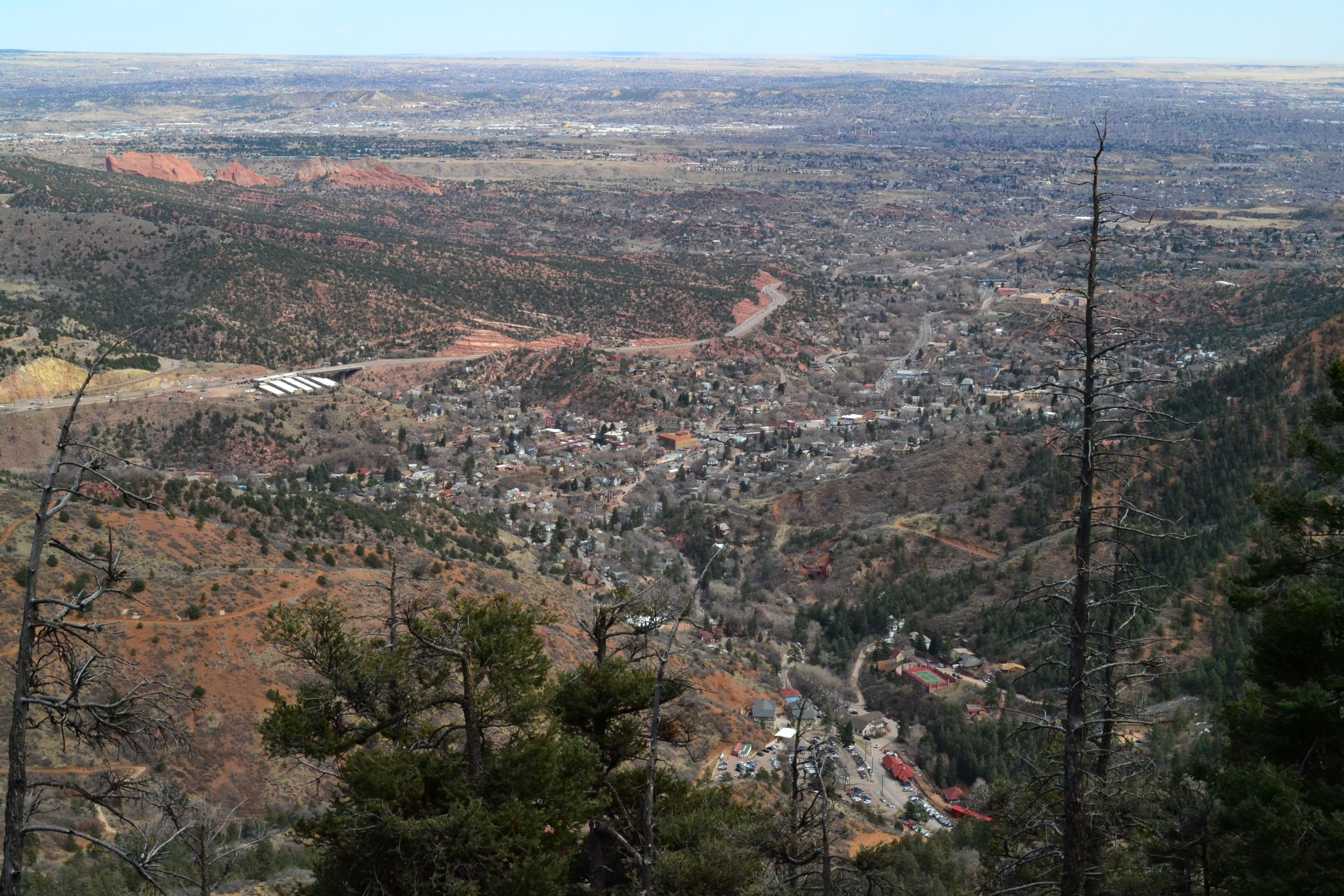
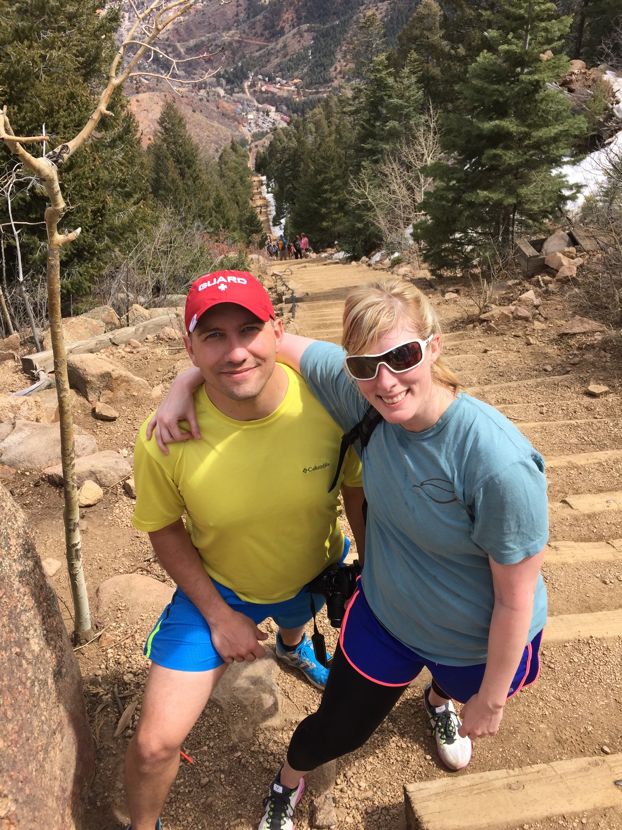
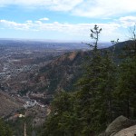
The last 300 steps were only spread out by about 0.1 miles. It was steep and tough. But we both completed the Incline in under an hour. One thing we noticed on the trail was the genuine sense of camaraderie among all the hikers. Everyone was in the challenge together and offering one another words of encouragement. Seen below are photos at the top and the view of Manitou Springs below.
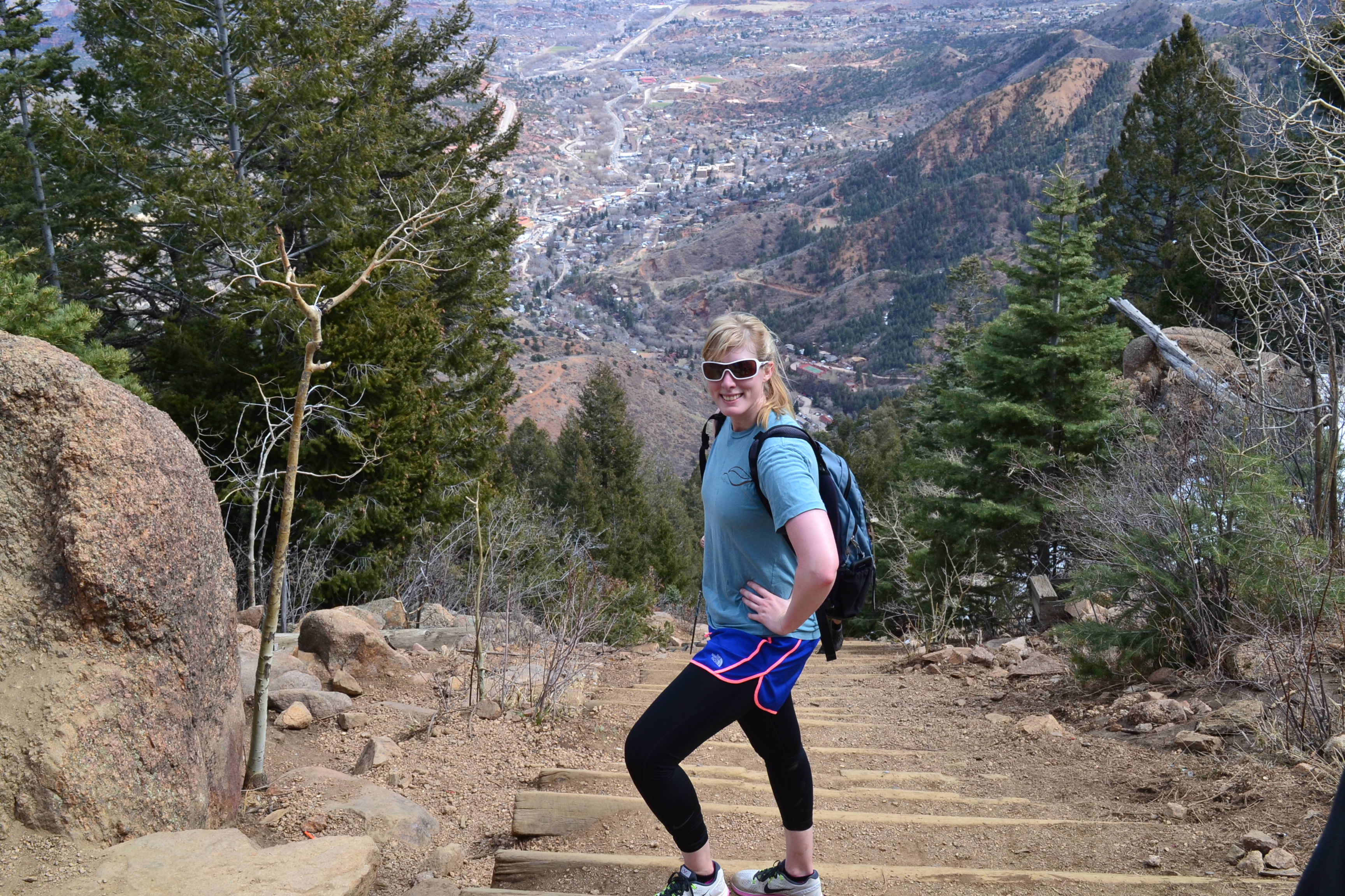
After resting a couple of minutes and chatting with some other hikers, we headed back down via the Barr Trail. The trail was almost completely dry and consisted mainly of a long series of switchbacks. According to our GPS, it was about 3 miles back down to the upper parking lot. Many people chose to run down the switchbacks, but we took our time and enjoyed the scenery.

We finished the trail with a sense of accomplishment. It was a great workout, and if we lived closer we would do it more often. We are now more inspired to get some weekly workouts in at the stairs of Red Rocks. If you choose to do the hike, wear lots of sunscreen and bring lots of water. Also, parking does fill up quite fast and is 5 dollars, credit card only. And, if you can still walk afterwards, take some time for a stroll around the arcades and shops of Manitou Springs. Happy hiking and spring. …and look for more frequent posts from us now that our beloved Colorado summer is nearer each day.


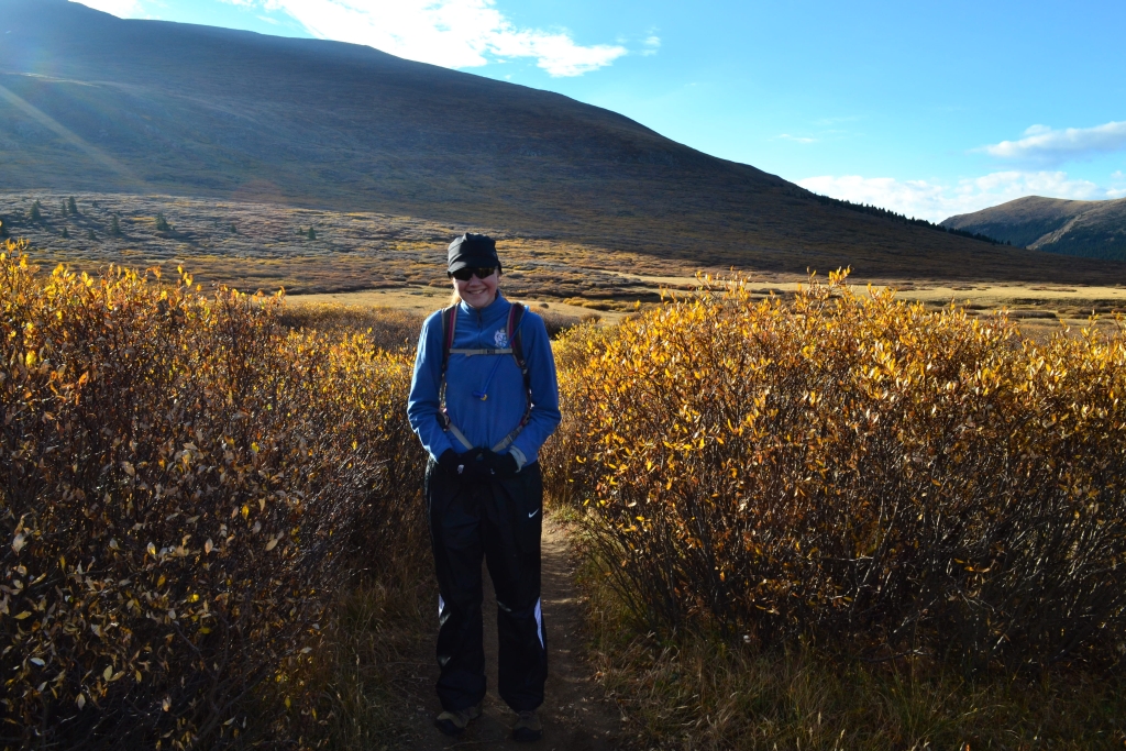
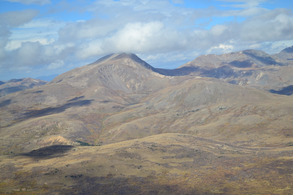
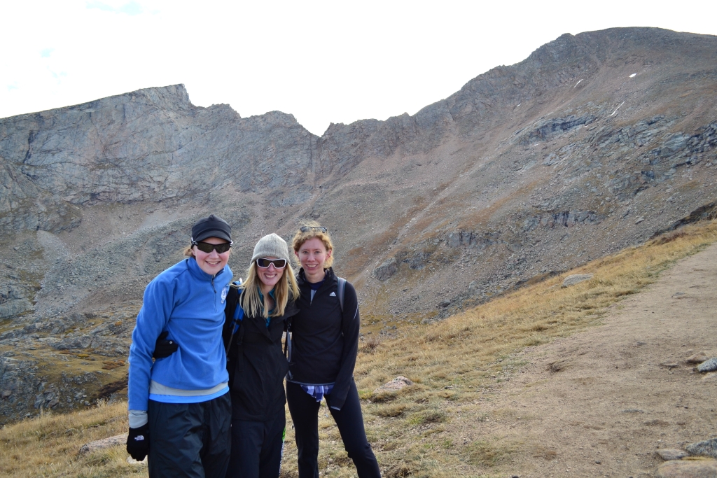
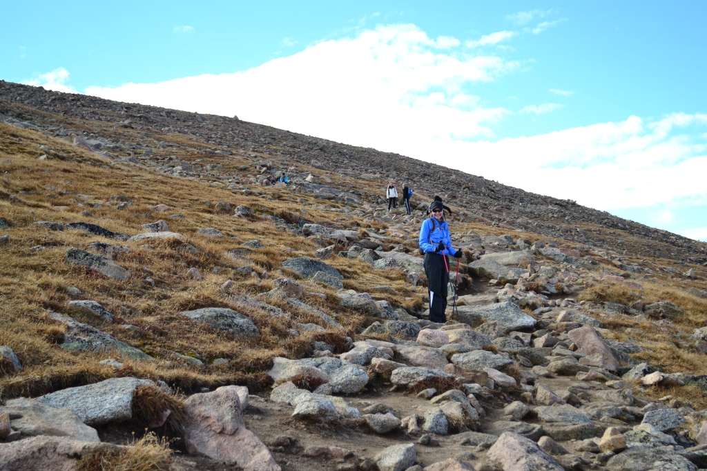
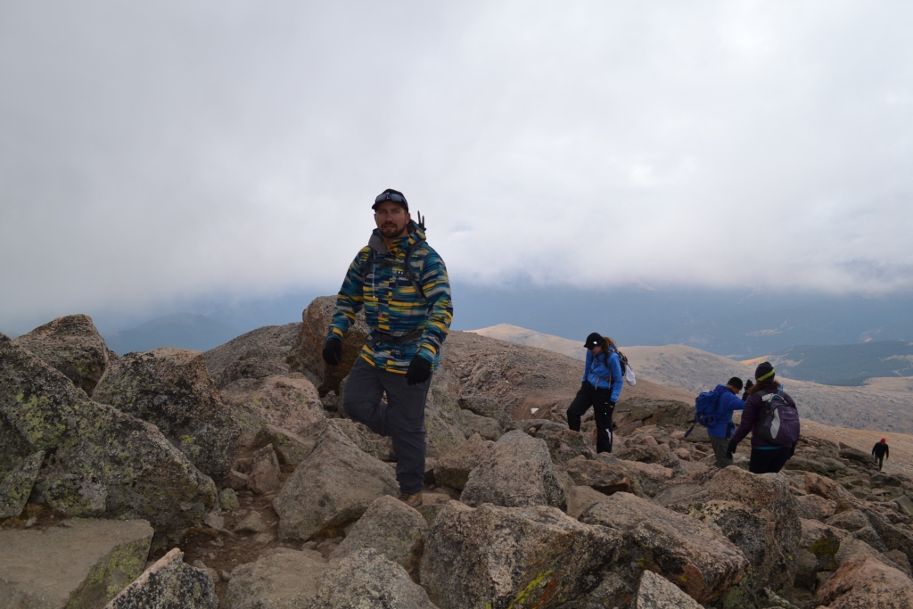
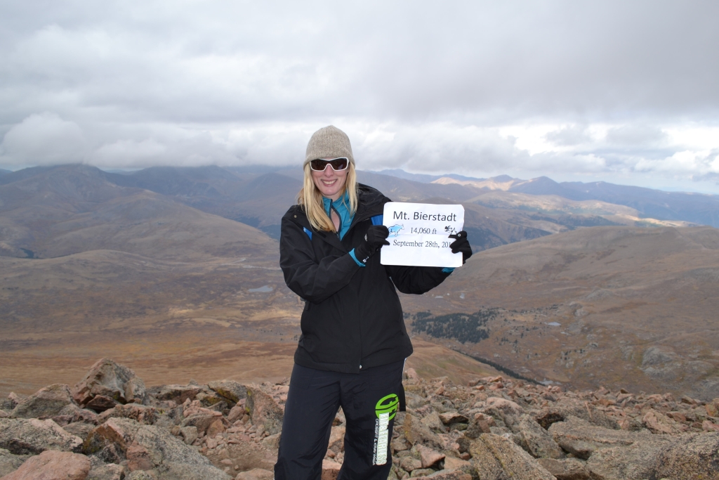
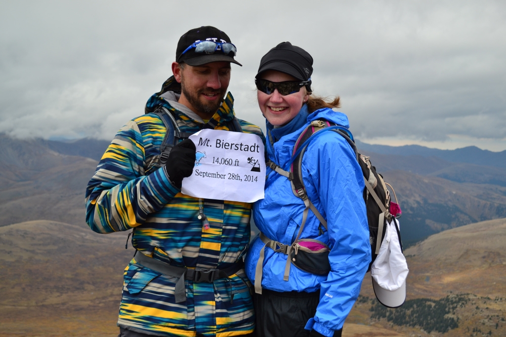
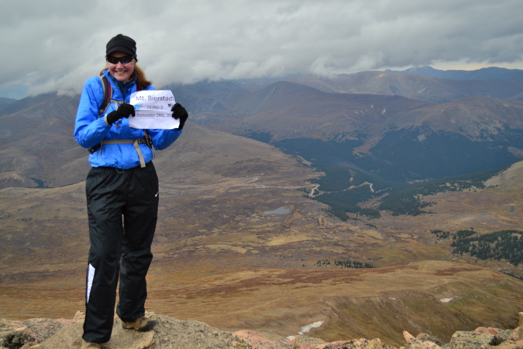
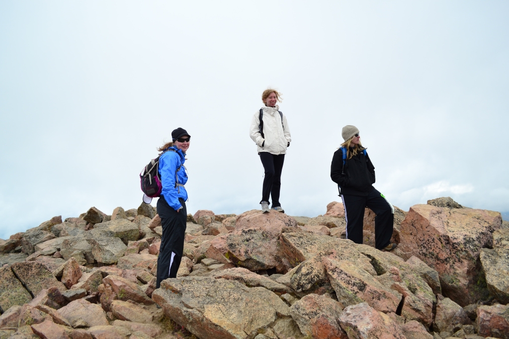
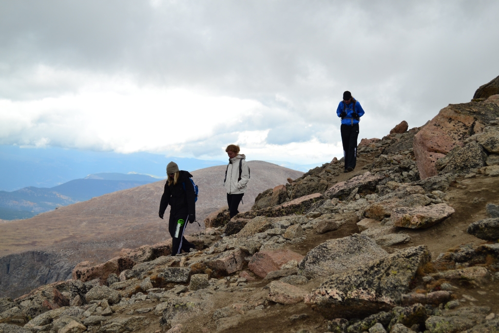
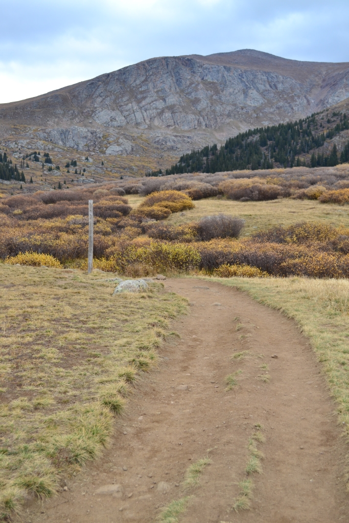
Mt. Bierstadt: A photo essay
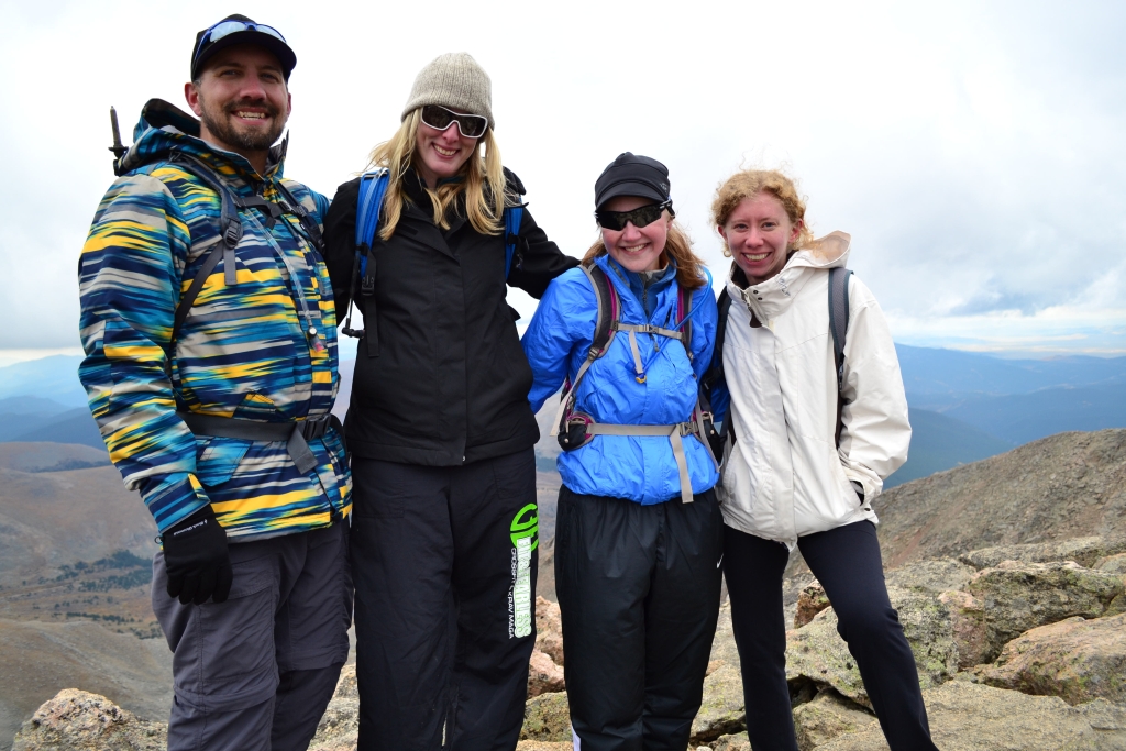
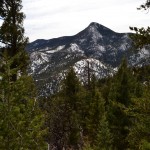
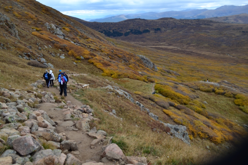
Perhaps it was a our desire to breathe some fresh mountain air that brought us back to Mount Bierstadt this late September Sunday. Or maybe it filled a longing to see some of the early signs of fall in the form of brown and gold crackling under our feet. Undeniably, we couldn’t withhold the unfaltering desire to stand atop 14,000 feet once more this season before our path was hidden in the deep blankets of white that comes too quickly as the days shorten in Colorado. This was a special trip to the top of Mt. Bierstadt. Our friends Liz and Maggie were attempting their very first 14er. A little more than a year ago from the time of this trip, we were making our first climb of this mountain. Since then, we have climbed over 36,502 vertical feet and 92.42 miles (that’s just the documented stats) plus numerous lovely day climbs and hikes.While we have offered trip reports of this hike/climb in the past, we would like to simply share our climbing experience through a collection of photographs today.


*Photography by Thomas Checkley
*Narrative by Allyson Sandifer Checkley
We concluded the hike in the light rain. Just as we reached the car, it fell upon us in full force, sometimes as liquid other times in frozen sheets. No matter the mountain or the difficulty a climb is a challenge. We each accepted and completed our individual challenges during this trek. Until next time….Take a Walk 😉