A Quest into the Wild
Igloo Peak 13,060 ft. – Independence Pass
“It is not the mountain we conquer, but rather ourselves.”
Sir Edmund Hillary
Go Forth
Sometimes you just have to get out of the house, and yardwork just won’t cut it. Allyson and I headed up to the mountains with no real plans — only to get outside. We brought the tent and some supplies and we headed west. An initial idea was to go to Twin Lakes and find a campsite; but, alas, there were no campsites that we could see. The road kept on going and so we kept on following it. Eventually, we found ourselves on Independence Pass, which is the highest paved road in North America (or so I’m told).
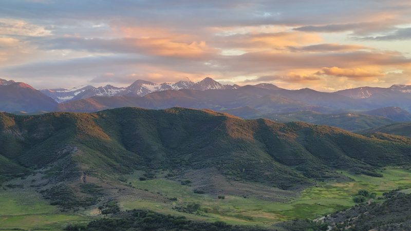
We took a quick look around and noticed a trail that ran out towards some peaks off in the distance and our minds began thinking about whether we should head out on them. However, we didn’t have a campsite yet and so had no clue where we were sleeping. We ended up in Basalt, Colorado, and at dinner pulled up the forest services maps and found a promising site. Turned out that we lucked out and found a spot on a gnarly 4WD road. Below is the view from out campsite.
Decisions
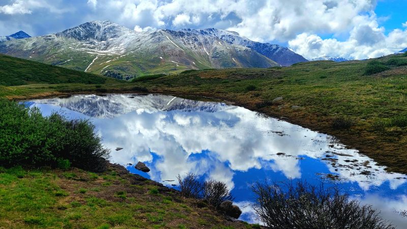
We got up the next morning and found ourselves heading back towards Denver by way of Independence Pass. In our minds we thought we might run at McCullough Gulch or perhaps paddleboard on Twin Lakes. But when we came upon the pass again we saw the title image of this post. Perfect reflections of the mountains and sky in calm waters with a freshly dusted vista of mountains. We decided that we would just run here on the trail we saw yesterday and see where it goes.
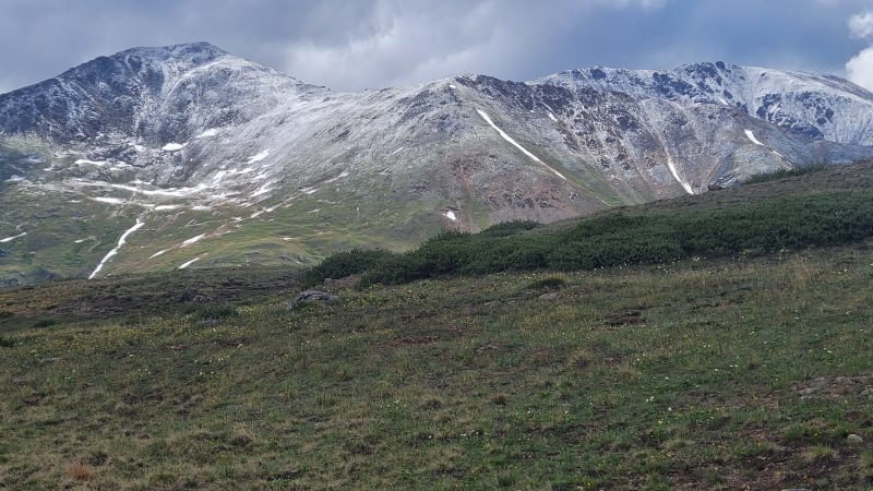
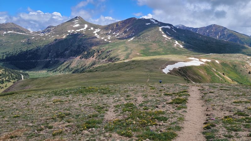
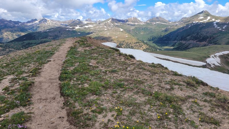
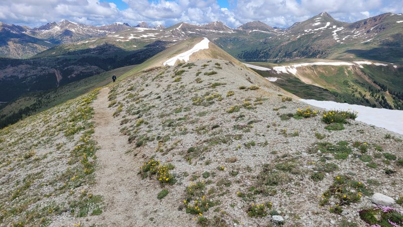
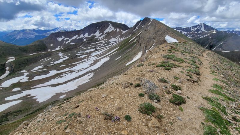
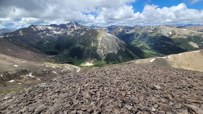
As is becoming our modus operandi we didn’t know the names of the peaks or really even if they were named. Just that they were there and we felt called to them. So, we started jogging up the trail, and it was pleasant at first. The grade was modest and there were very few people on the trail despite a very busy parking lot. But, then the climb became steeper and the elevation more noticeable. I took some pictures (below) to catch my breath.
We’re Doing This
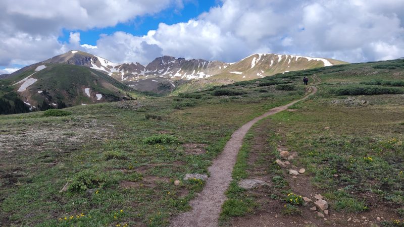
I don’t think we really had a good plan on where we were going. Were we just exploring? Were we trying to go to the middle peak? The farthest peak? No one knew. We just headed out on the trail and figured we couldn’t get lost. But after the climb up to the first summit we knew we were going to at least the middle peak, which we later learned was named Igloo Peak and was 13,060 ft. tall.
My lungs were on fire by the time we hit the steep climb up to that first summit, but we were feeling good overall. The mountains looked beautiful and the weather was cool — much better than the 100 degree weather we had a few weeks ago in Denver. There were a number of wildflowers out, mostly little blue groundcover and yellow alpine Avens, but some alpine clover and other species. Below are some images from the first section.
Igloo Peak
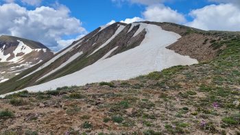
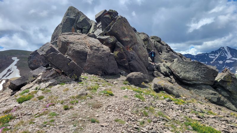
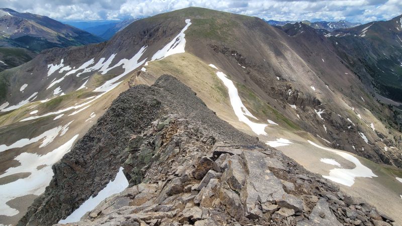
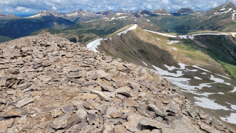
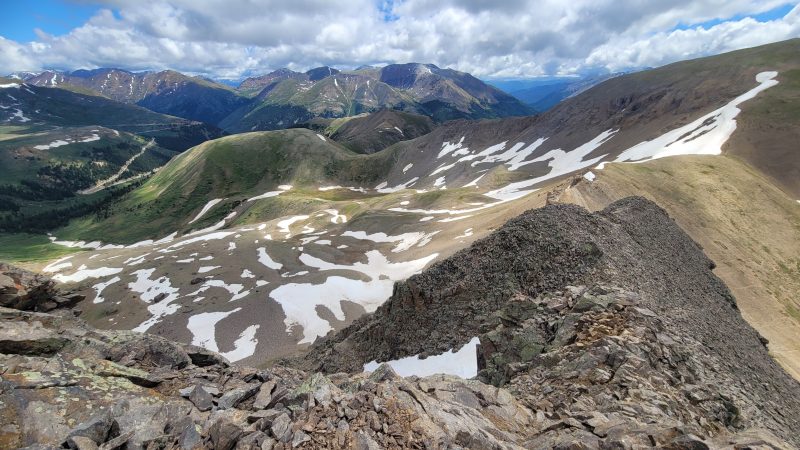
Eventually, we came to a rock tower and thought, does this go? And not only does it go, it has a trail along the backside. The trail was loose rock and scree, but a trail nonetheless. We continued on and found ourselves at the peak of Igloo. The trail, sadly, did appear to stop; or at the very least it became a tad sketchy. Later, I read that if you continue on the ridge proper to Mountain Boy it is a dangerous class 4 climb on loose rock — so I’m glad we turned back. There were other trails and we speculated, apparently correctly, that one could climb down and approach from lower down. Below are some images from the summit of Igloo and the rock tower with Allyson on the trail.
Heading Back
The jog/hike was a nice surprise; and we didn’t expect for the peak to have a name. But like most things in life, now we have even more to explore than we did before. If you go north from the Independence Pass TH there is another trail that goes to other 13ers; and we will have to come back for Mountain Boy, which we didn’t even know existed. And now we have seen Grizzly Peak (the tallest 13er at 13,988 ft.) and countless other 13ers. The area could provide weeks of exploration. Not only that…but we do have to go back and paddle Twin Lakes and explore the Independence ghost town.
So we headed back down and continued on our adventure. Overall the route is about 5 miles RT with maybe 1,300 ft. of elevation gain (or thereabouts). I’d say that over 90% of the trail is runnable, but that last section before Igloo is too loose (at least for me). Happy adventuring!