A Quest into the Wild
Fletcher Mountain (13,951 ft)
The allure of standing atop 14,000-foot peaks and sense of accomplishment at reaching each one in Colorado remains a goal for us though our perspectives have shifted over the last several years. Popular trails have become even more popular, and nearly impossible for seeking solitude or a trailhead parking spot for that matter. It’s been interesting to see the world trade the routine of daily commutes, happy hours and Netflix in favor of more adventures in the great outdoors. Though it is clearly a positive direction for our country to collectively share love and respect for these diverse ecosystems, overuse is inevitable and even heightened when leave no trace isn’t practiced. Reservation systems have been put in place and fees increased for many national parks and even some 14er parking (looking at you Quandary) in the hopes of managing more of the crowds though this is not without many issues including the loss of freedom and spontaneity but more importantly the development of access and equity concerns.
One way that we can help mitigate some of the overuse of popular areas is expand our areas of interest and explore all the nooks and crannies around us. We have started to transition our weekend adventures to trail running in less popular trails or exploring the hundreds of other majestic peaks under 14,000 feet that this state has to offer. In fact, there are 583 ranked peaks that fall between 13,000 and 13,999 feet in Colorado making seemingly endless options for varying degrees of adventure and solitude.
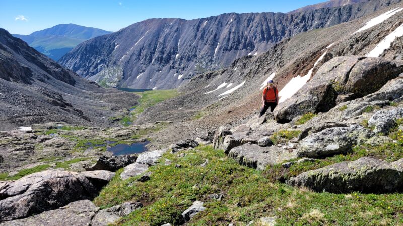
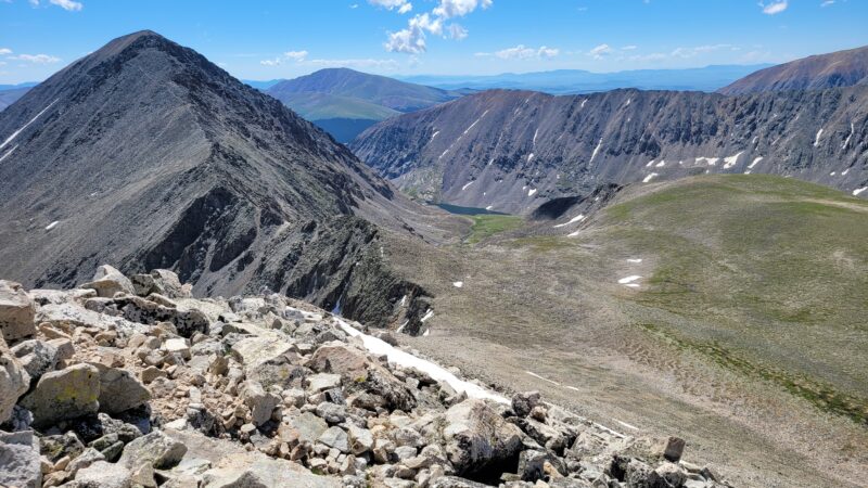
On July 9th , we decided to finally make our way up a nearby centennially peak in the Tenmile range, Fletcher Mountain, which sits majestically at 13,951 feet above sea level — a mere 49 feet from 14er status but therefore not on as many checklists. We decided to climb the class 2 southeast ridge of the peak which begins at the Blue lakes TH right next to the dam (seen above). Parking access at the Blue lakes TH is currently fee and reservation free allowing us to base our decision to climb on the predicted weather and our energy levels that day rather than whether we committed to something on the internet weeks ago.
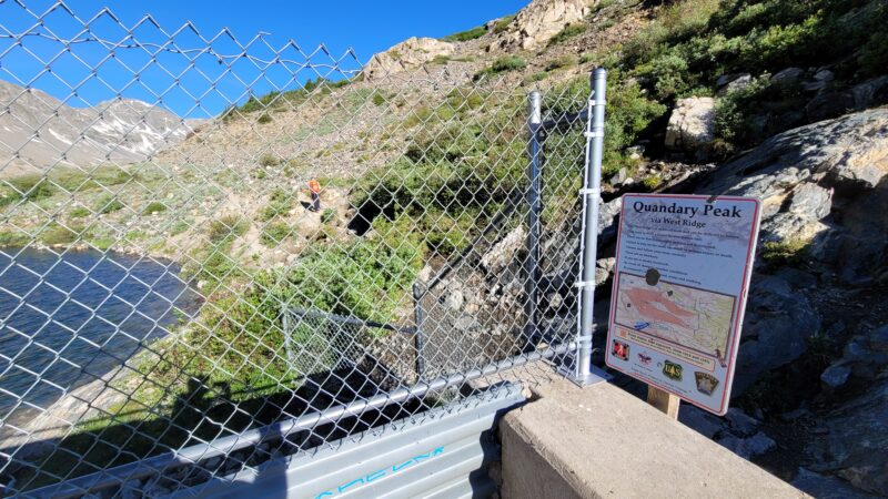
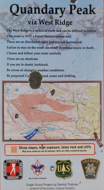
Trip reports we read promised us a short day and easy climb, but if there is one lesson that we have learned over the years is that everything is relative, and conditions can be quite different from month to month or even summer to summer. To start, our day began at the lower parking lot, because to our surprise, the gate to the upper large parking lot next to the dam was still closed despite summer conditions in and around the lakes. The extra hike up the road to the dam was only 0.6 miles (one-way) and around 350 feet of elevation gain, but already extended the day slightly longer than we had planned. Once we reached the dam, we followed a rocky path up and around the right side of the dam, passing by the warning sign for Quandary Peak’s West Ridge Route. This is a Class 3 exposed route up the famous 14er. Despite the extra challenges of this route, we suspect it might be gaining popularity as there is no reservation required and free parking.
We quickly followed the trail and traversed rapidly up the west slope and found ourselves high above the lake within 10-15 minutes of steep hiking. Be cognizant and follow the upper trail rather than the lower social trail that follow the lakeside. There is a trail restoration sign by the trail that incorrectly leads by the lake. We went the wrong way on a hike here several years ago and ended up bushwhacking up a steep scree slope to regain the appropriate trail. One thing to note about this hike, is that it is all truly an alpine experience. The trail begins above tree line at around 11,700 feet and quickly gains elevation making most of your day spent very high in one sense of the word.
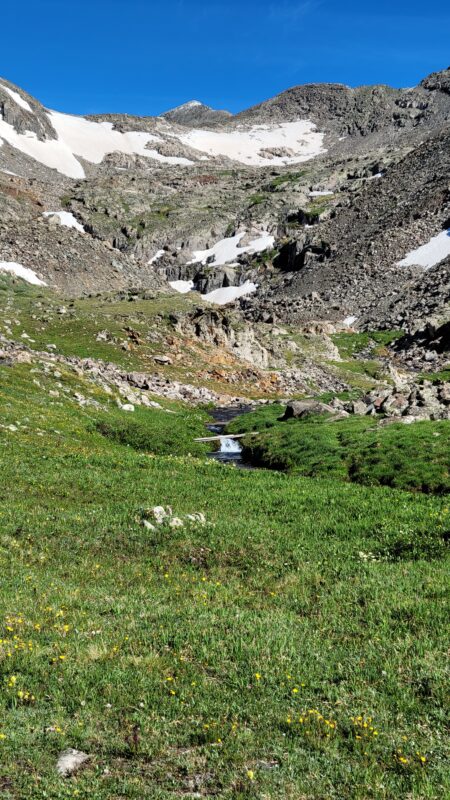
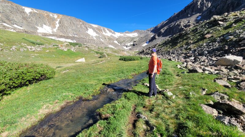
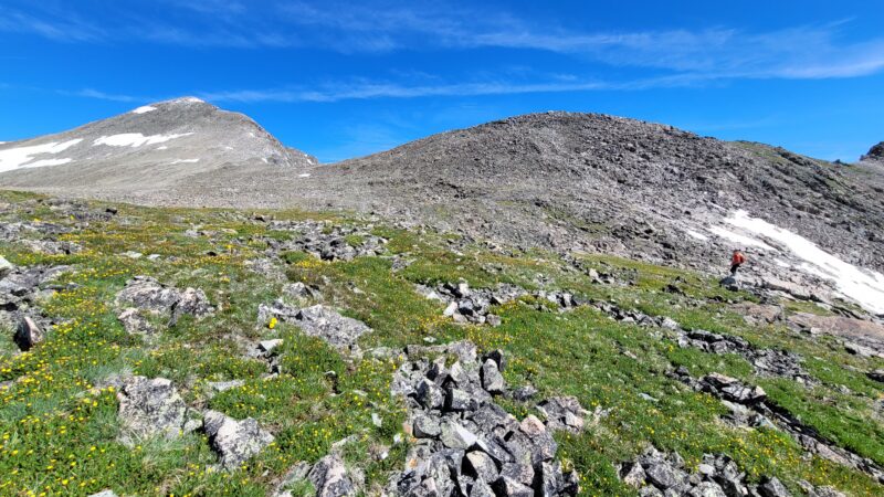
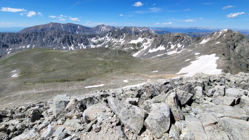
Once above 12,000 feet, the trail begins to angle northwest leading into a verdant basin, also known as
the Monte Cristo gulch. One thing we noticed about this hike was the abundance of water. Creeks
flowed everywhere, with the trail seemingly weaving in and out of rushing snowmelt. We carefully rock-
hopped over streams and deep mountain pools. There was some remaining mud, but nothing too
unmanageable. As we gained elevation in the basin, we also passed by some old mining ruins.
The skies remained a brilliant blue with very few clouds in sight as morning progressed along. We
continued hiking a wonderful trail through the basin as views began to open of the gully in front of us
with Fletcher Mountain peeking out above all. Once we reached the gully, the trail sort of slowly
dissipated, and we had to spend a few minutes evaluating our options for ascending the steep rock.
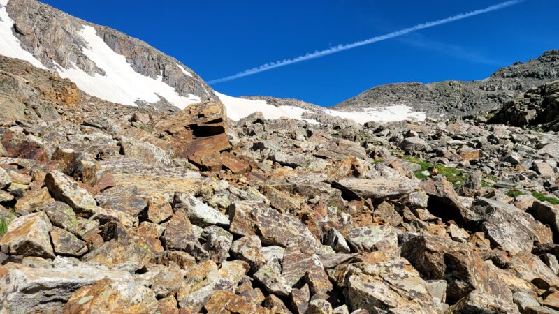
There were still several snow fields in the gully that were too steep and slick to ascend without the
appropriate gear. We initially climbed steeply up a rust-colored creek in the center of the gully before
veering left and bypassing a snowfield. This allowed for some fun scrambling among the rocks as we
ascended higher. Carefully test all holds or talus before stepping as much of this rock was quite loose.
We did note several cairns as we made our way up the gully, but there were plenty of different options
for gaining the ridge allowing for variation in the effort and difficulty of this climb.
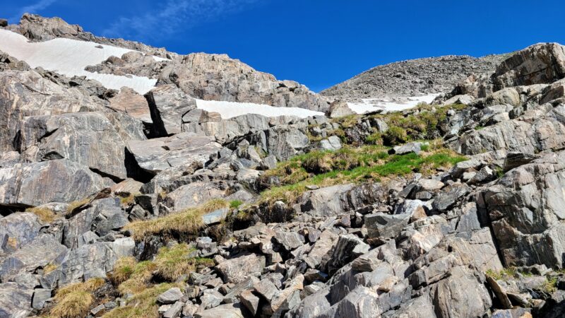
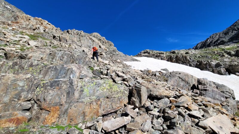
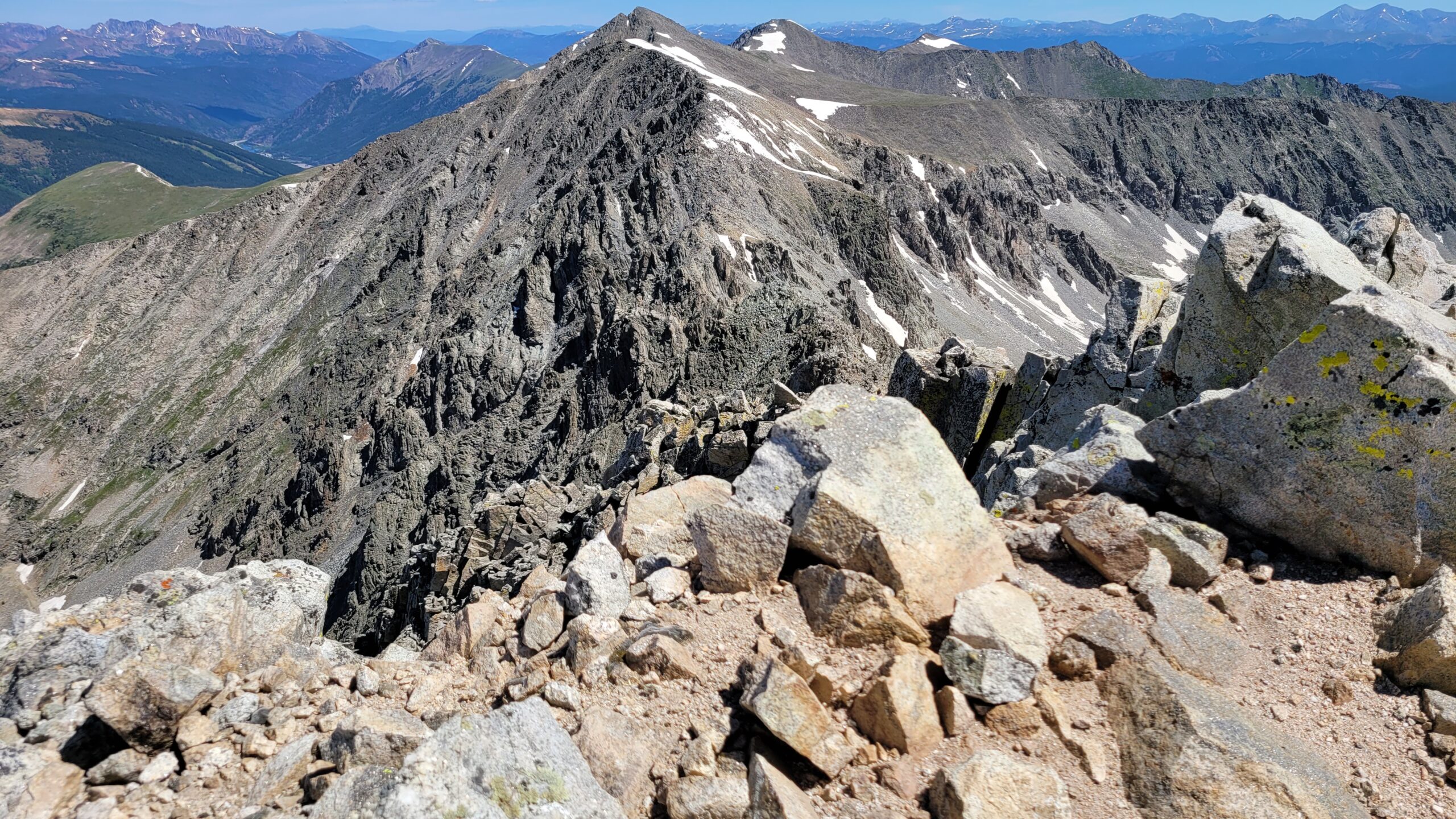
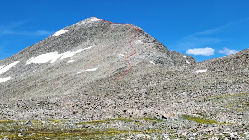
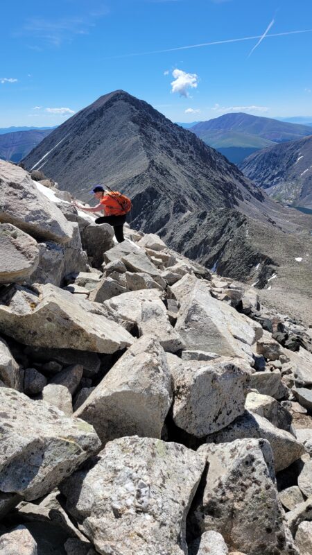
After much rock hopping, we veered west and exited the gully/basin around 13,100 feet which we noted was marked by a large wooden stick that proved quite useful for guiding us during the descent. Fletcher mountain was now in full view before us and to our dismay, appeared to be a large, very steep pile of rubble. We headed the obvious direction towards the southeast ridge of the peak gaining minimal elevation (roughly 100 feet) as we navigated uneven, rocky terrain on a large plateau. Unfortunately, we didn’t take the most straightforward path up the peak following the ridge, but instead tried to head straight up the south face. This didn’t save time and we soon found ourselves in a talus nightmare, climbing and hopping very large boulders, many that were not very stable. Eventually, we reconnected
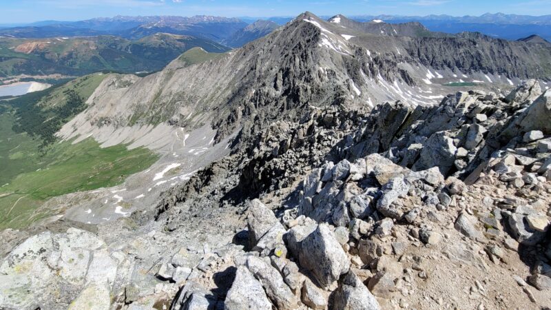
with the ridge only to discover it was covered in a slab of snow just shy of the summit. Here, we downclimbed a little to avoid the snow, adding a little more work to our summit adventure. Despite our heavier than needed workload, we made the summit and enjoyed spectacular views of the Tenmile range including Quandary Peak, Atlantic Peak, and the impressive east ridge over to Pacific Peak that we climbed last year. The basins and gulches were still holding some snow alongside their fresh wildflower blooms and alpine grasses making for an impressive explosion of colors.
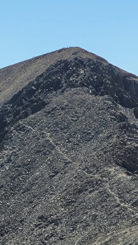
There was no one that we shared the summit with, but we did enjoy looking over at all the tiny human
dots on the top of Quandary towards the east. After a few minutes of relaxation and snacking, we
decided to head back down. This time, we followed the ridge proper as closely as possible for our
descent. The snow just below the summit was avoided by staying slightly left of the ridge and very
carefully negotiating the rock as there were some serious drop offs below us. Once past the snow, we
followed a rough path through the large talus. While it was still rough class 2, this was a much easier
route option than we encountered on our ascent. Solitude was finally gone as we made our way down,
and we encountered a solo hiker and then a group of 3 making their way up the ridge. For perspective,
in a game of boredom on a descent of gray’s peak several years ago, we tallied 700 hikers seeking an
“adventure” and wildflowers on a pleasant July weekend. There was scarcely a moment in our descent
that we didn’t have to move the right of the trail. Though that was frightening example of overuse and
the strain on our natural resources, the number of hikers ascending Fletcher or Quandary and the few
playing in the gulch seemed to strike a good balance.

The sun was now high in the sky without a cloud in sight and beginning to bake us a bit in its warmth. Sunscreen is inevitably never applied as evenly or abundantly as needed and that was quickly become apparent as we hiked back through the basin. The cool, blue alpine streams beckoned us to dip our hats in the icy coldness for some relief. Though, thoughtfully, this sounds dramatic now as temperatures were roughly 70 degrees at the time.
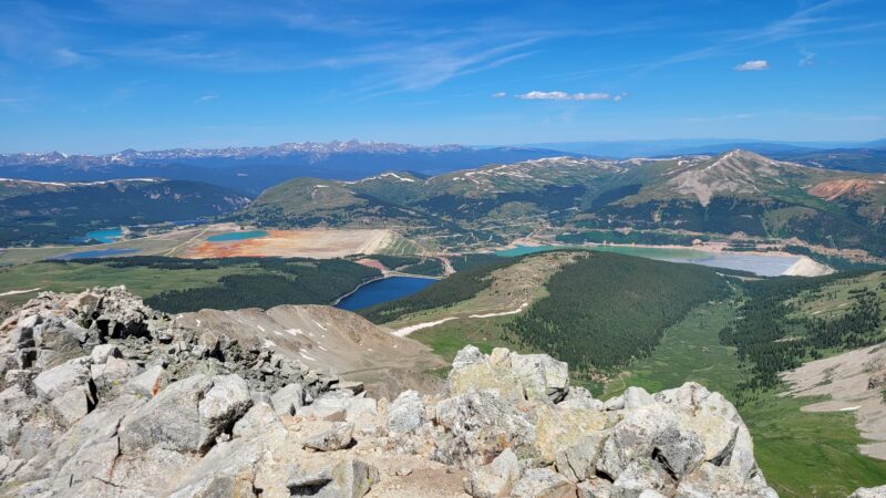
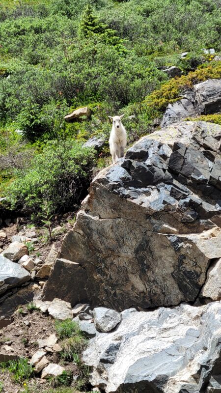
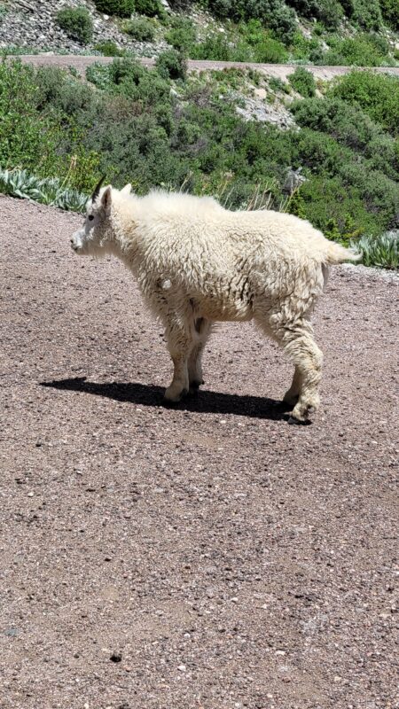
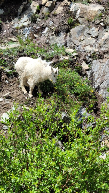
As we reached the dam, we began our walk back down the road. It was now lunch time, and many families were out and about walking up the road to view the waterfall just below the dam. Mountain goats continue to find us this summer, and today was no exception. Down the road, we encountered a group of 10-12 goats hogging much of the road including a precious baby. We were not oblivious to the protective mother and kept our admiration at a distance.
As we reached the truck, we noticed a few late comers vying for our parking spot. Popularity is gaining at this TH too though an earlier start affords a spot and quiet for a while. The diet coke we had been saving was too warm to enjoy and we settled on the remaining bladder water that had been baking in the pack throughout our hike with its signature plastic flavor. Once in town, we made our way to Breckenridge Brewery for lunch. Oddly enough, on a Saturday at lunch, we pulled into a rock star parking lot right in front and were immediately seated when we walked in. Guess everyone was still out on the trails. How the times are changing.