Take a Walk
A Quest into the Wild
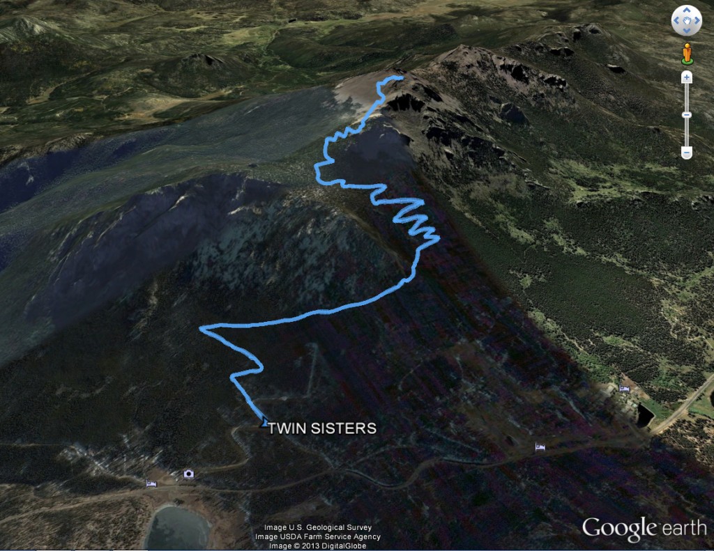
Twin Sisters Peaks
Distance: 7.04 (Out and Back) Elevation Gain: 2,556 ft
Max Elevation: 11,406 ft Min. Elevation: 9,168 ft
“When preparing to climb a mountain, pack a light heart!” ~ Dan May
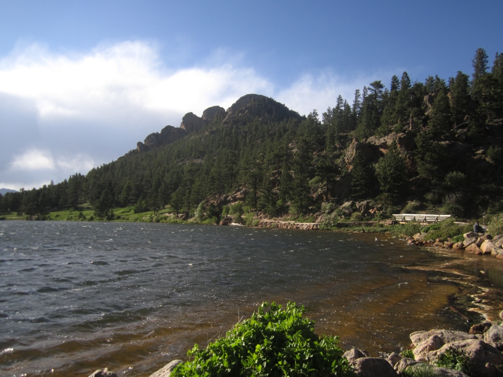
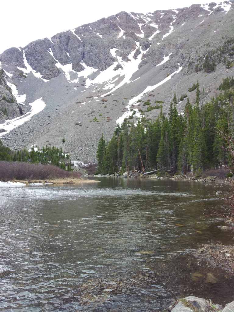
Sometimes, our best laid plans do not materialize leaving us restless and discouraged. The original plan of the day was to visit Wild Basin in Rocky Mountain National Forest to hike along St. Vrain Creek to Ouzel Falls and Lake. The weather was perfect, and we were excited. At the park entrance, we were greeted with a line of cars that were turned away one by one. When we reached the gate, we were told they were already at capacity, and we should go eat some food and try to come back later or do another hike. The hike we planned was 10 miles round trip, so we couldn’t really afford to wait around. Though disappointed, we knew a few other hikes were very close by. We drove a few more miles down the road and found the gorgeous Lily Lake trailhead and stopped for a moment to admire the scenery and views of Long’s Peak. Seen below are photos of Lily Lake before and after our hike.

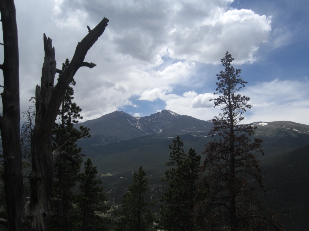
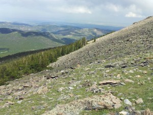
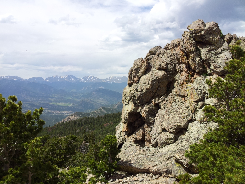
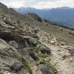
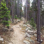
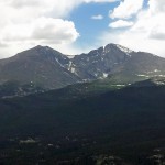
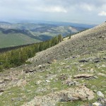
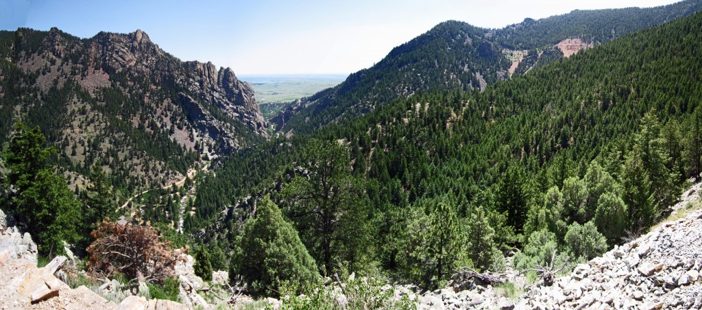
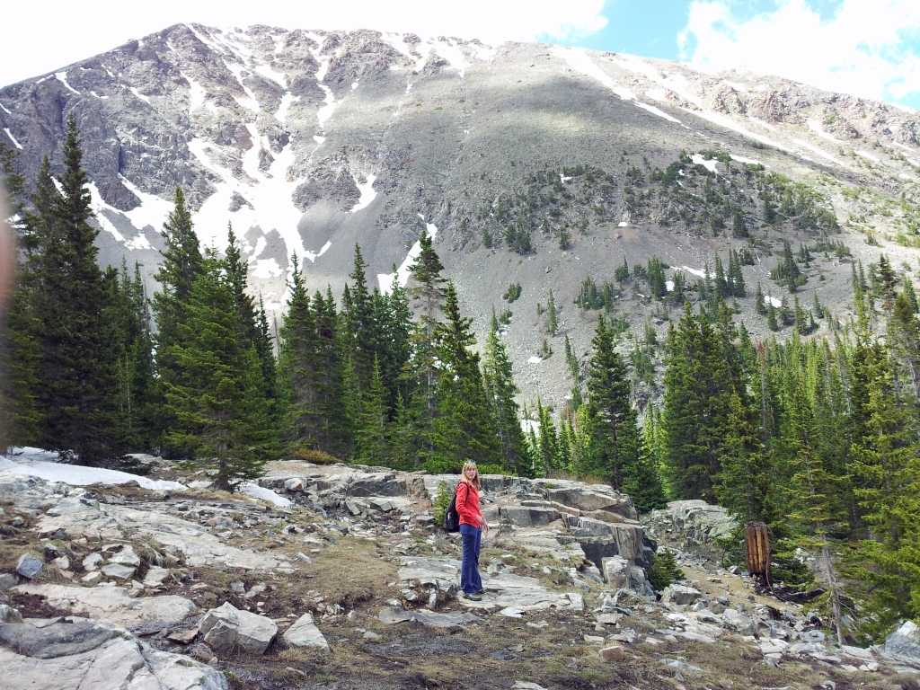
After a brief stop at the lake, we headed across the street and up a little dirt road to the Twin Sisters’ Trailhead as an alternative trek for the day.The Twin Sisters’ Peak ridgeline runs along Rocky Mountain National Park’s central-east boundary. The east peak is approximately 11,428 ft and the west peak is 11,413 feet and each offers up fantastic views of the Continental Divide, Long’s Peak, Mt. Meeker and Estes Cone. The trail begins at a little over 9000 feet and steadily leads upward through a thick Lodgepole pine forest. Shortly thereafter, the trail leaves Rocky Mountain National Park and enters Roosevelt National Forest for a brief stint. Most of the first mile of the trail is a steady climb through the forest with very limited views. About 1.2 miles in, we found a clearing which provided a view of Long’s Peak and a nice break for our legs. A photo from the clearing can be seen below.
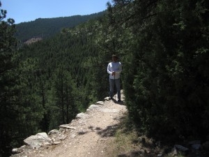
As we ascended, life seemed to be teeming all around us. Trees were budding, flowers were blooming, and life stirred all around us. Unfortunately, mixed in with all that life were a healthy number of mosquitoes. They were mostly a nuisance while hiking, and swarmed us only if we ever tried to sit down and rest. We assumed they were there to keep us motivated. Thus, with no rest breaks we began the draining climb up many, many switchbacks to reach the summit. To help with motivation, we held on tightly to our Garmin and frequently checked our gains in elevation. At about 10,000 ft, the vegetation began to change. Tall pines and Aspens gave way to more spruce and fir. As elevation increased, we had to carefully watch our footing for tree roots as the trail made the transition from subalpine forest to alpine tundra.
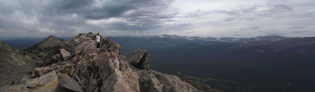
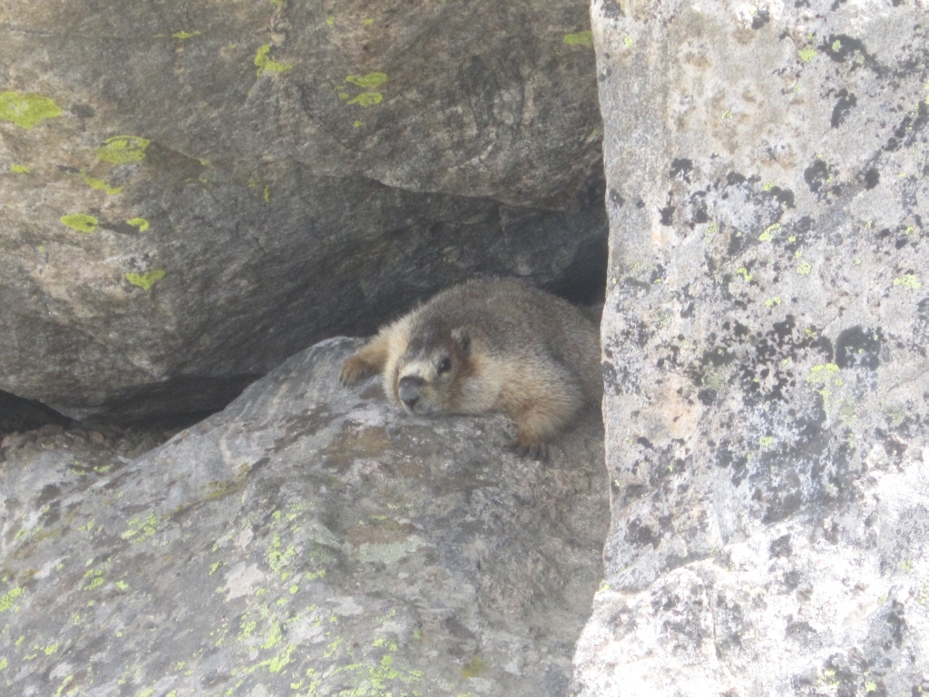
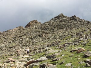
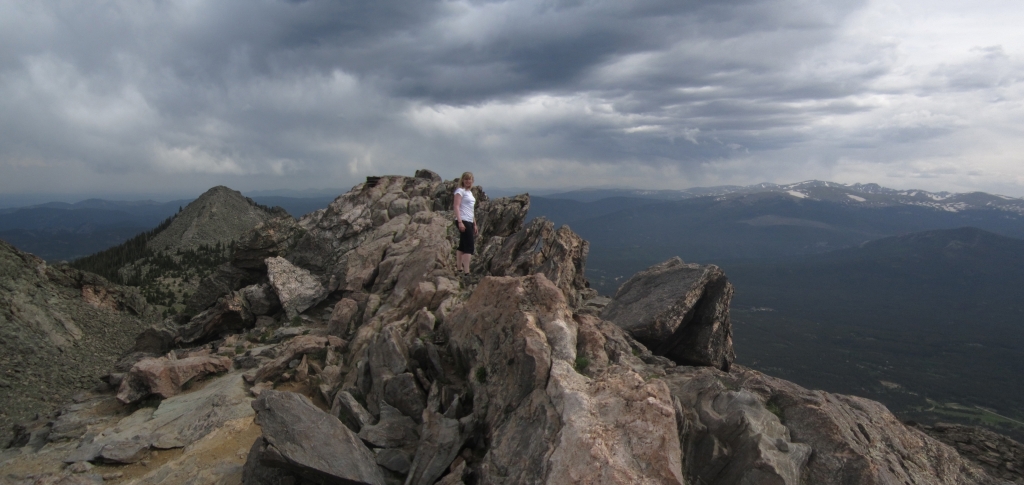
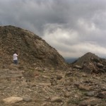
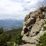
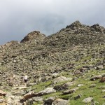
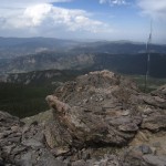
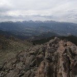
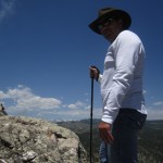
At just over 11,000 feet and three miles into our ascent, the trail crossed treeline. Here, the trail forced us into a very rocky, boulder filled steep area to make the final push to the top. The altitude and high cardio output at this elevation, made defeat seem a slight possibility. We were tired, and once past treeline cold as the wind ripped across the mountain. As we wearily continued, our eyes spotted an animal’s tail popping up and down among rocks just ahead of us. At first, we assumed maybe just a dog someone brought along. However, we realized dogs were not allowed on the trail. At this point, we were a little nervous. What could this creature be? As we cautiously continued, the animal emerged and to our surprise, we were greeted with a cute, curious little marmot. He stared us down for a little, probably hoping to steal our food. Seen below are pictures of the last portion of the hike above treeline and our little friend.
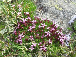
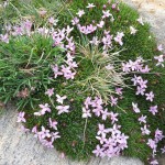
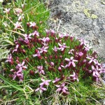
The plant life above the treeline was also amazing on our hike. We were treated to numerous flowering plants. We saw Blue Columbines, Chiming Bells, Moss Campion, Alpine Avens, and many others. Chipmunks darted around the rocks and among the flowers as we made our push to the peak. You can see below some of the flowers and views we had making our way up.

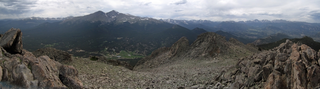
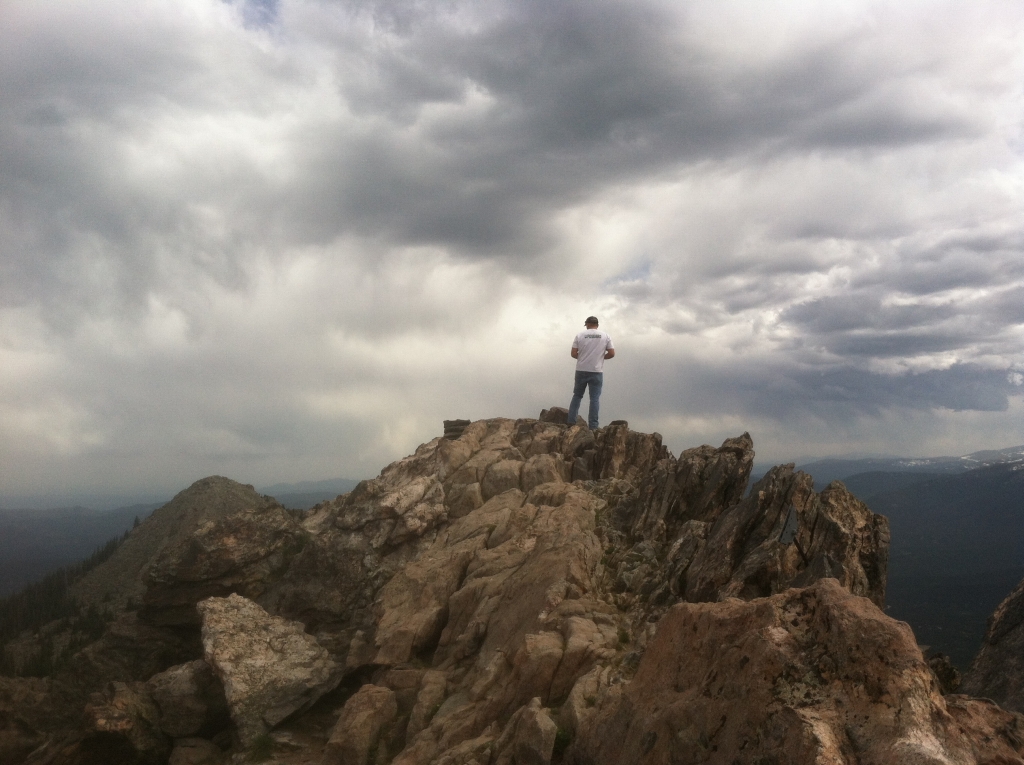
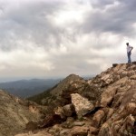
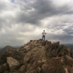
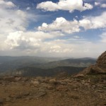
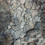
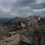
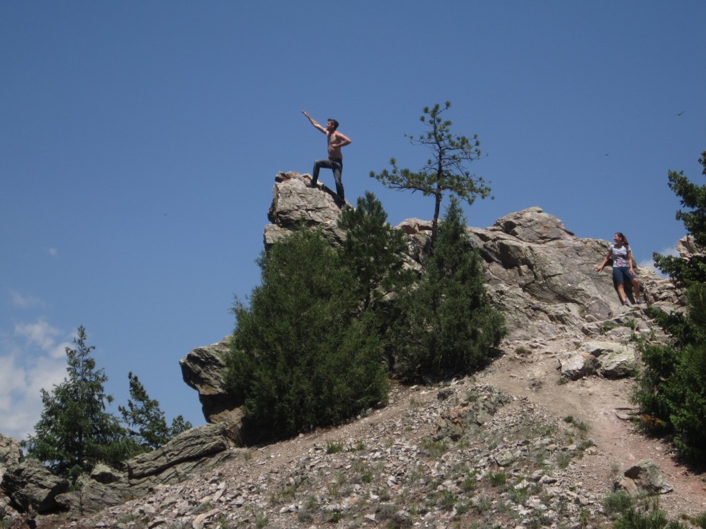
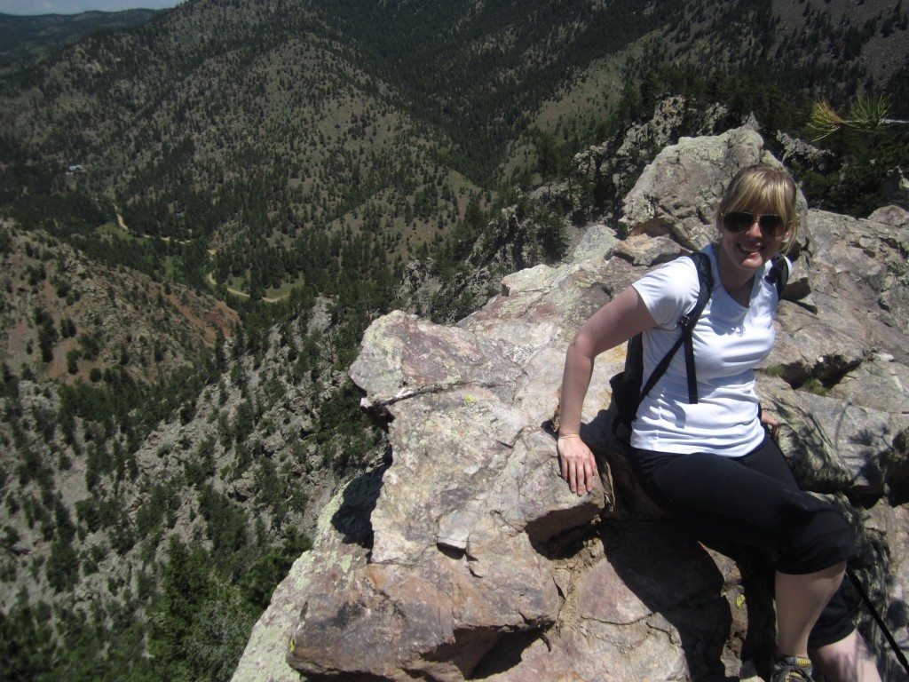
After traversing numerous switchbacks we arrived at the summit. There was a radio station there with a sign on the door of a stone building that read: “Please Protect This Site, These radios are used for locating lost hunters, locating downed aircraft, and saving lives.” Just past this building was a path that led up to the summit of the east peak of Twin Sisters. It was only a brief journey before we were standing on the summit with an amazing 360 degree view of our surroundings. Looking around a bit we noticed another marmot curiously rummaging around on a ledge below us, and we saw a baby chipmunk with his parents playing around on the rocks. Below are some images we captured from the peak.
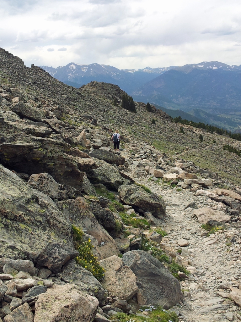
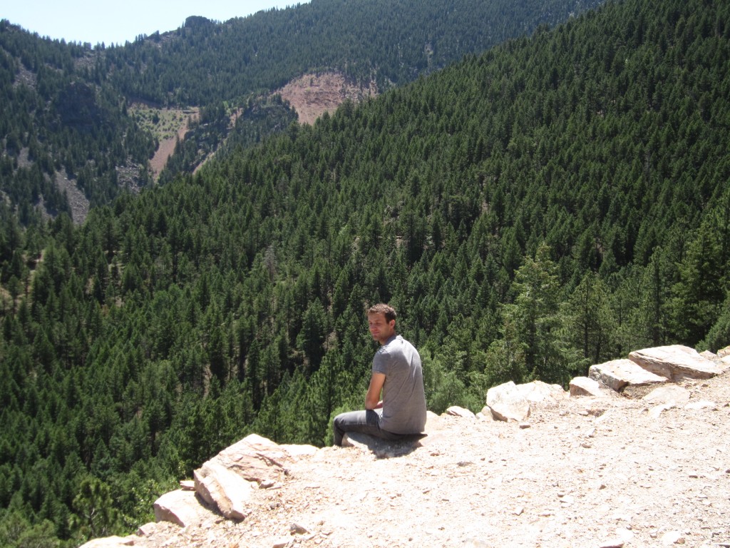
Clouds began forming and the wind picked up while we were on the west peak, so we opted to head back down below the treeline instead of hitting the saddle and trying to make the east peak and true summit. So after a few more glances around and a goodbye said to our chipmunk and marmot friends we began our descent back down the mountain. It was much easier going moving down instead of up and we made very good time. Also the wind had helped to keep the mosquitoes at bay, which made the trip down much more pleasant. As with many out-and-back hikes the return felt like a different path and we noticed views and things we didn’t on the way up. Below is an image from just after left the summit.
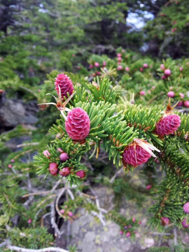
Once we were back below tree line we really started to notice beautiful red alpine fir pine cones. The light from the sun was illuminating them and they were glowing red like little red lights in the trees. We also noticed a pretty amazing view around halfway back down as we made our way around one of the switchbacks. You can see the pine cones and view below.
Hunger and fatigue at this point were prevailing, so we did our best to get down quickly and back to the truck. While it took us about 2 hours and 45 min. to get to the summit, we managed to get back down in about an hour and a half, for a total trip time of about 4 hours and 15 min. While, this wasn’t the hike we had planned for the day, it was a great training hike for some higher peaks we would like to climb later this summer and offered breathtaking views in return for our efforts. There is ample parking along the road to the trailhead as well as at the base near Lily Lake. Access to the trail is free. Enjoy.


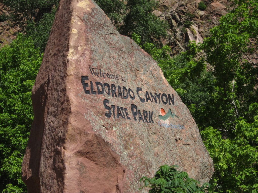
Eldorado Canyon State Park Hike: “The Coney Island of the West!”
Distance: 4.22 miles (loops; spurs) Elevation Gain: 1,555 ft
Max Elevation: 7,061 ft Min. Elevation: 6,022 ft

“Happiness is not a state to arrive at, but a manner of traveling” Margaret Lee Runbeck
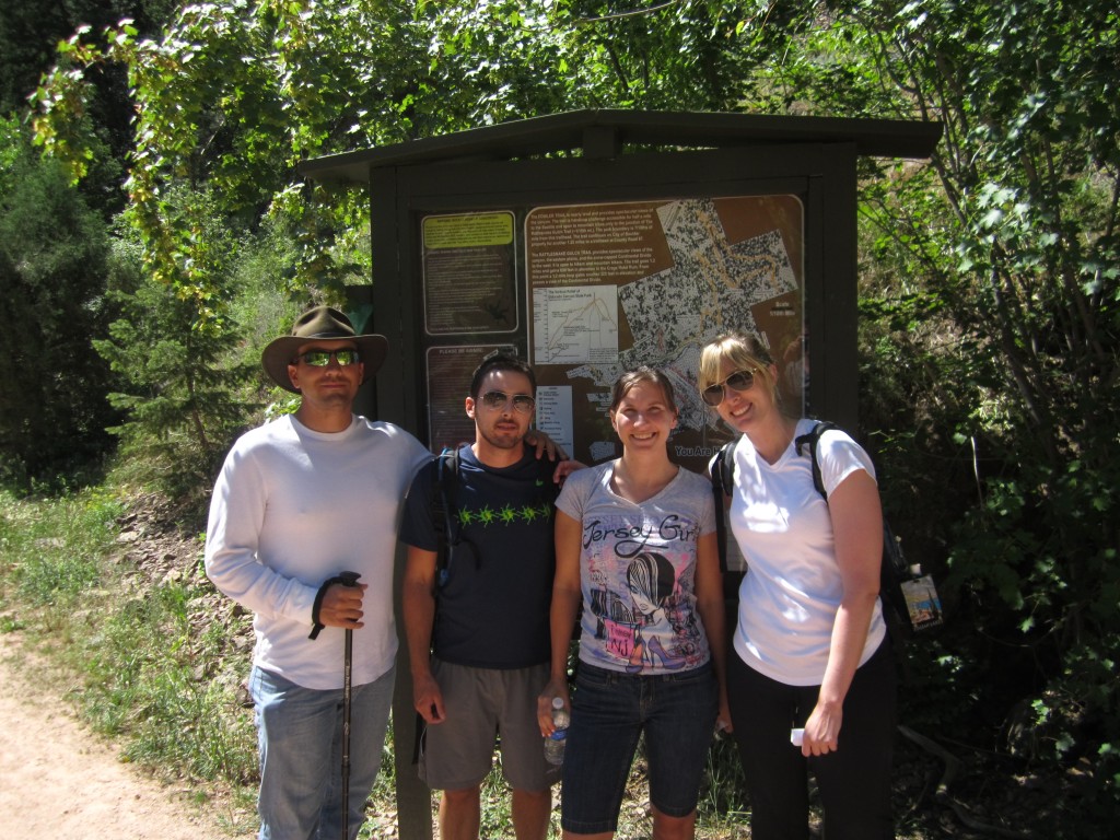
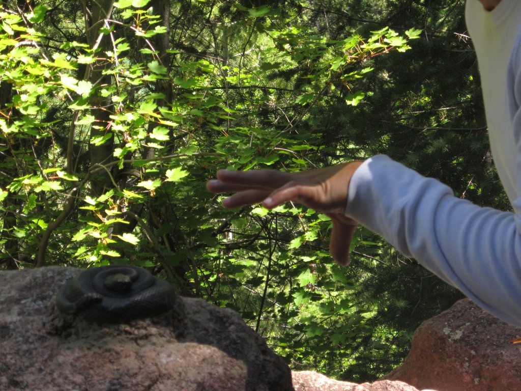
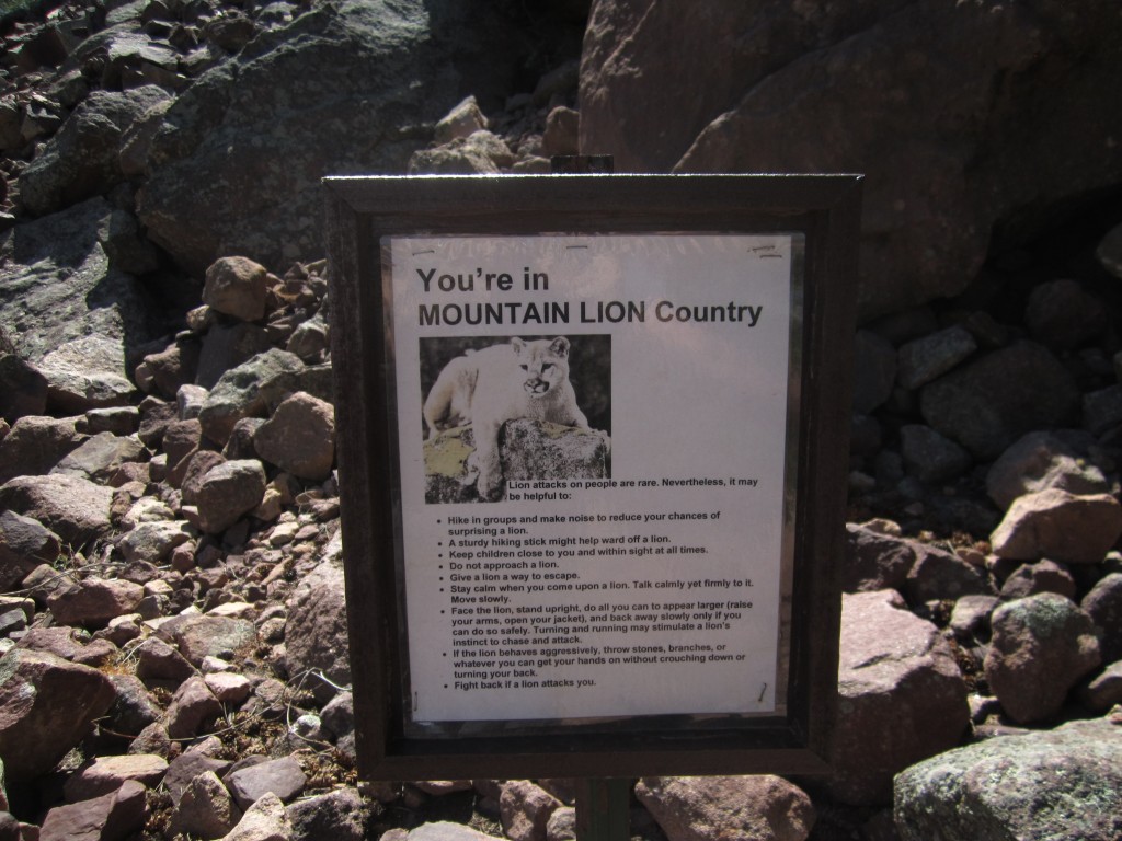
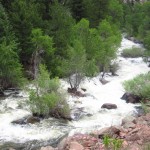
In addition to a swift trip down Clear Creek this weekend, we also managed to squeeze in a hike on Saturday morning near the lovely quaint town of Eldorado Springs just south of Boulder nestled below the Eldorado Canyon. We followed 170 also known as Eldorado Springs Rd. off of 36 N and proceeded until the road turned to gravel and dirt. As we approached the small town, once a renowned vacation destination in the early 1900s known as “the Coney Island of the West”, it felt as though we must be trespassing. The few shops and homes there are closely connected and shaded by a canopy of trees and gives off the vibe of a private little community. To the right is South Boulder Creek as well the historic artesian spring fed city pool which was opened in 1905. From there, the narrow gravel road runs into the entrance to Eldorado Springs State Park. For an 8 dollar fee (8 dollars per car, 3 dollars on foot), we entered the park and followed the road alongside the waterfalls and white water of the creek to a small parking area near Fowler Trailhead. The Fowler trail or nature walk consists of about 0.7 miles of trail (one-way) with 12 marked points of interest along it. A brochure describing each stop can be found at the trailhead. We only followed Fowler Trail for a brief while and thus only saw a few of the points of interest one of which included a fake rattlesnake curled up on a rock. Upon first glance, it was quite jarring. Shortly into the nature walk, the trail diverges, and we proceeded onto the Rattlesnake Gulch Trail. Seen below is most of our group at the Fowler Trailhead, the park entrance, snakes and mountain lion warnings!
 |
 |
 |
 |
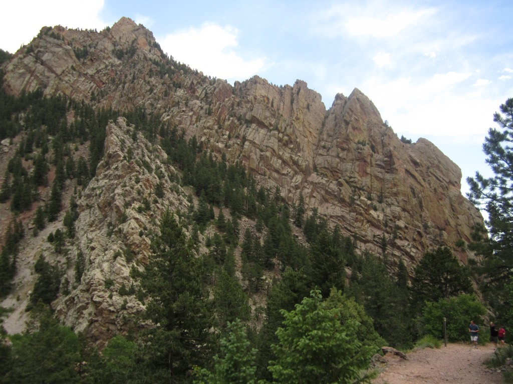
This trail is rocky and steep, and led us steadily upwards for about a half mile before descending into a gulch. From there, we proceeded up a series of switchbacks on the south wall of the canyon which kept our legs quite warm. Parts of the hike were shaded, but as we ascended up the mountain, there were large bouts of trail that were exposed providing exquisite views of the Cadillac Rock formations. Photos from these famous climbing rocks taken during our ascent can be seen below.
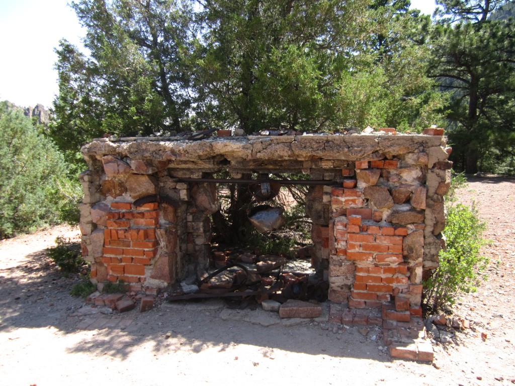
The first point of interest occurs at about 1.2 miles into the hike. As we finished a climb up a switchback, we were greeted with the ruins of the old Crags Hotel. The hotel was built in 1908 and provided nice accommodations and entertainment for guests. The hotel only remained here until 1912 after which it burned down mysteriously. Though few ruins remain of the hotel, it is still an interesting place to explore. Quite impressively early travelers managed to get automobiles up the narrow Rattlesnake Gulch Trail (Crags Boulevard) to reach this hotel. Our group stopped here for a few photos and exploration which can be seen below.
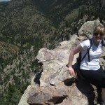
At this point, we followed a spur that led us a short way to the Continental Divide Overlook. Though the hike leading up to this second landmark was taxing, the cool breeze that greeted us at the top was wonderful as was the scenic wonder of the mountains and park. We spent a good deal of time here taking pictures and looking over the vertical ledge that surrounds the Overlook. Photos from the Continental Divide Overlook can be seen below.

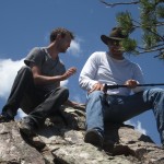
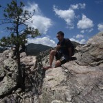
After resting and enjoying the Overlook, we were then faced with the option of returning the way we came or making the loop around the entire Rattlesnake Gulch Trail which eventually returns to the Crags Hotel Ruins. Of course of our group kept going! And we were very glad we did. As we trudged along and started to get a little hungry, Kathleen noticed a small trail that went up a hill. Curious as to what was on the other side, she proceeded to run up the hill and report back. We then all followed and were greeted with a great open space view of the countryside. From there, another short path led straight upward to what appeared to be a large set of rocks or boulders. What we didn’t realize was that once you climbed up to these and looked over, it was a straight drop off. We all made the brave effort and climbed up on the rocks to seize the spectacular views and feel the adrenaline rush of staring down 700 feet. While some of the group chose to simply enjoy the views quietly and calmly, others seized the opportunity to imitate their favorite bodybuilder….or Thor. We are still not quite sure. See photos below.

We concluded our hike by completing the loop and heading back down the trail to Fowler. We knew we were getting close as the roaring sounds of the churning creek water drifted through the trees. Once we got back onto the Fowler Trail, we paused a few moments and enjoyed the views from the nature walk and reflected on the hike. We thoroughly enjoyed our morning in Eldorado Canyon State Park. The hike was moderate but a good workout nonetheless and also provided rewards for our burning legs. We would love to return and picknick along the banks of the creek or try our hand at fly fishing again. Come check this one out if you are in the Boulder area. Bring cash if you plan to drive in and get there before 10 am on the weekends to get a parking spot and avoid the crowds. Oh, and despite the name “Rattlesnake Gulch”…not too many rattlesnakes are spotted here anymore. A park employee said he had not seen one in two years..


Clear Creek Rafting Excursion
Though not a walk in the traditional sense, one of our many excursions this weekend included a wild ride through class III, IV and IV+ rapids on Clear Creek in Idaho Springs Colorado. In honor of sibling Will’s graduation, we embarked this Sunday late morning on an advanced half day trip through the high, swift, arctic water of Clear Creek. Though the morning held promise of warmth from the sun, early afternoon gave way to clouds and light rain and a coldness that made us thankful for our wetsuits. We were informed that the water was a chilling 34 degrees. At Clear Creek Rafting Co. outpost, we were given a brief safety lesson, suited up and made to do a few practice maneuvers before hauling the raft into the creek.
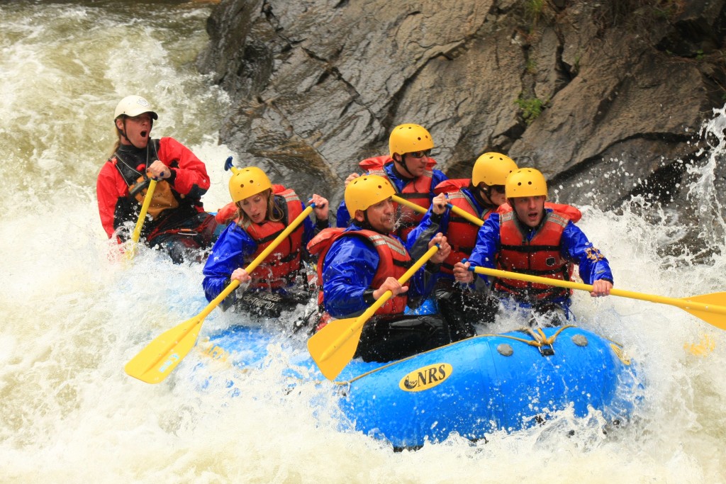
The first two miles of the advanced excursion were a mere warm-up for what lay ahead. During this time, we practiced forward and backward paddling as a group and chatted while enjoying the scenery. Shortly after we tackled our first challenges, Upper and Lower Beaver Falls which were class III-IV rapids. White water rushed over us as we descended over the falls. Photos of the group on the first falls can be seen below. Thomas and Allyson are on the left and Will is in the front right. All pictures in this post were taken by Clear Creek Rafting Co.
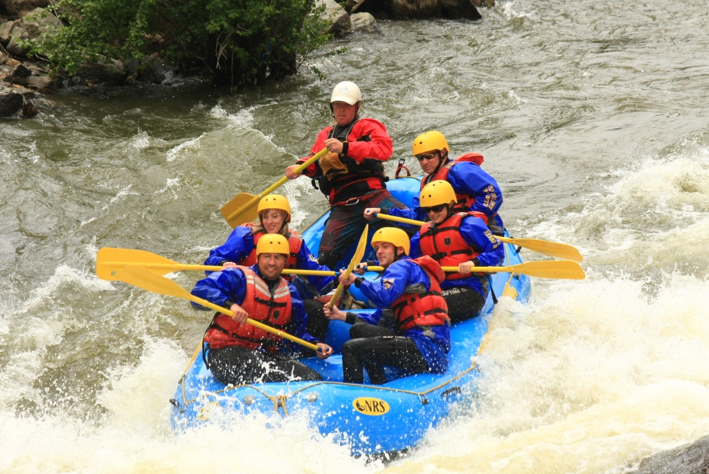
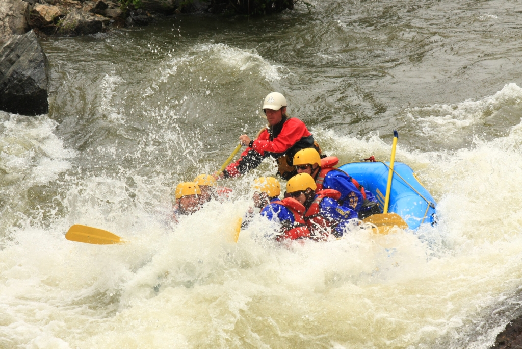
From there, we continued through some more Class III rapids and plenty of boogie water before getting to the really challenging stuff. And that’s when things got interesting. As we approached the mile of continuous rapids including Hell’s Corner, Ejector, Horrendous Left Turn, and Double Knife, somehow the group became out of sync and we plummeted into a giant boulder which was just submerged. The force of the rapid pushing us into the rock ejected Will from the raft into swirling icy water and powerful rapids. While he made a reach for the raft, it was too far and the water quickly swept him away downstream. We were all terrified. Our guide screamed for him to swim as hard and as fast as he could to the left bank. He grabbed for a few tree branches hanging off the shoreline, but a few broke before he maintained a good hold. We all watched helplessly from the rock as he struggled to pull himself ashore. Finally he made it and was instructed to hike back up the rocky and vegetation filled bank to near where we were with the raft. Though in a little pain, Will made the four foot leap from the shore back into the raft. We were then dislocated from the rock and thrust right back into the wicked white water. Seen below are photos following the incident once we had gotten back on track with our teamwork. Hopefully you can grasp the intensity of the water from the expressions on our faces as well as the guide.
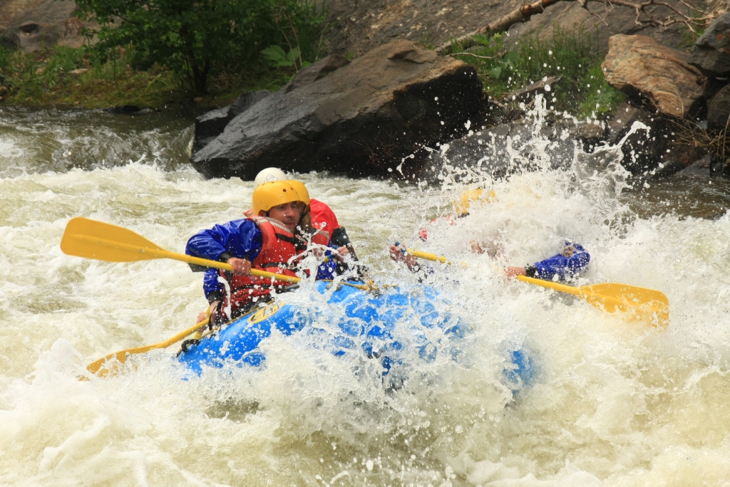

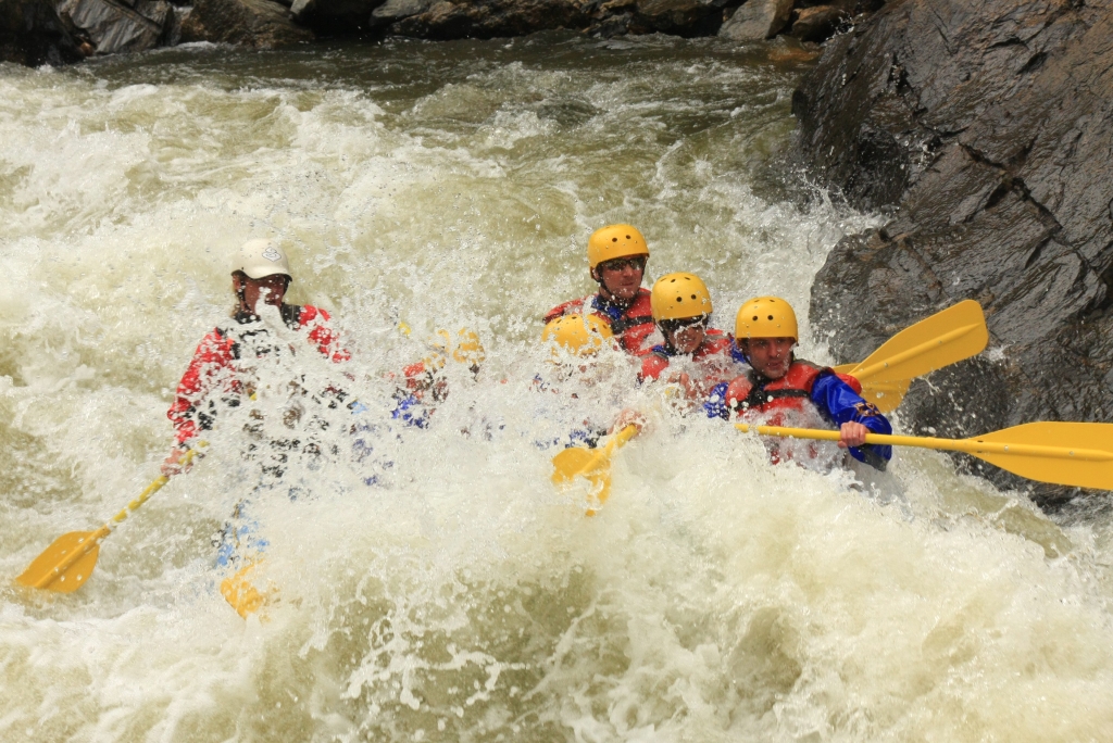
The rest of the trip ended with terminator and corkscrew rapids which were quite intense. Nonetheless, we all remained in the raft. We ended the adventure well and were picked up by the company van which drove us about 15 min back to the outpost. By this time, our arms and backs were tired and our feet and hands numb. Though the trip was quite exciting, we were thrilled to get out of our cold wetsuits. In total, we ran about 9 miles of the river in about an hour due to the swiftness of the water during this time. We highly recommend checking this trip out.
[subscribe2]
Spruce Creek Trail and Continental Falls
Distance: 6 miles (out and back), Elevation Gain: 1,331 ft
Max Elevation: 11,439 ft, Min. Elevation: 10,354 ft

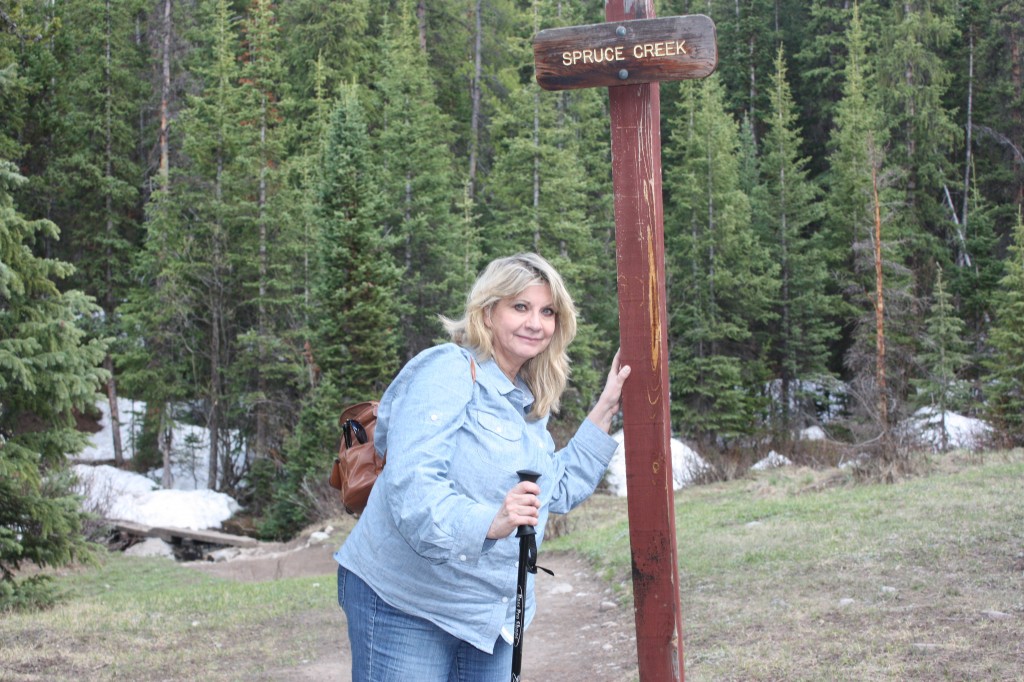
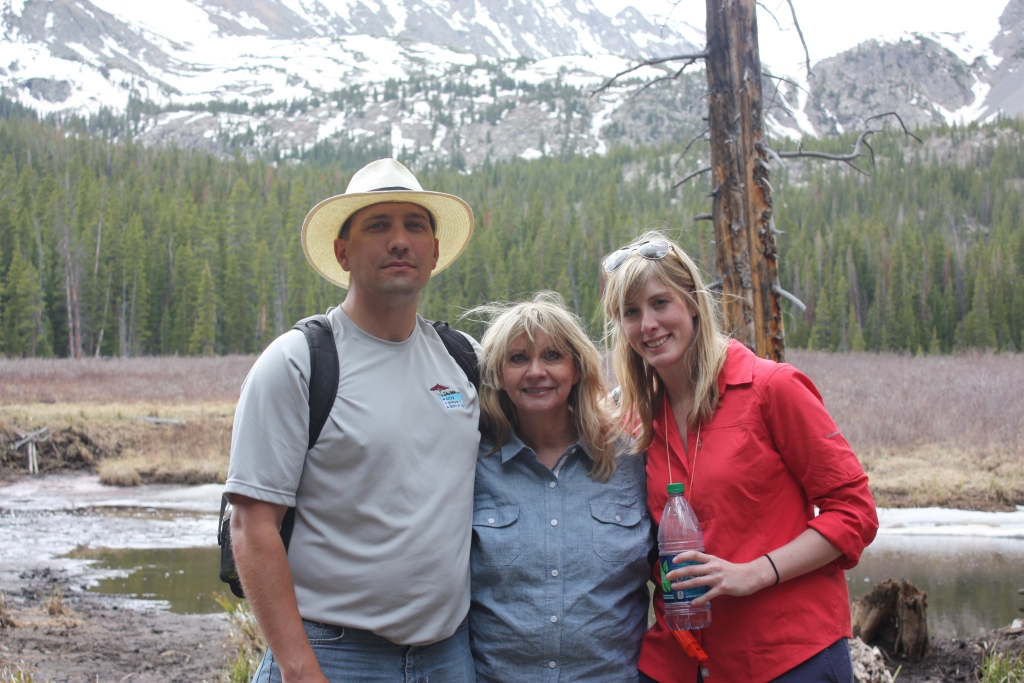
A very special guest this weekend, my mom, inspired this hiking destination. Tales of her college trips and fun in the past led the three of us all the way to Summit County, past the Continental Divide into Breckenridge, CO. While the temperatures are steadily climbing in Denver this June well into the 90’s, the elevation above 9,000 feet found in the Breckenridge area offered a refreshing breath of cool mountain air to propel us along the miles of trail. We explored Spruce Creek Trail which can be found just to the south of Breckenridge off of Highway 9. To the reach the trailhead, we drove 2.4 miles past the last light in town and turned right onto Spruce Creek Rd. We followed the dirt/rock road upward for about a mile until we reached a small parking lot which was quite full by 10:30 am.
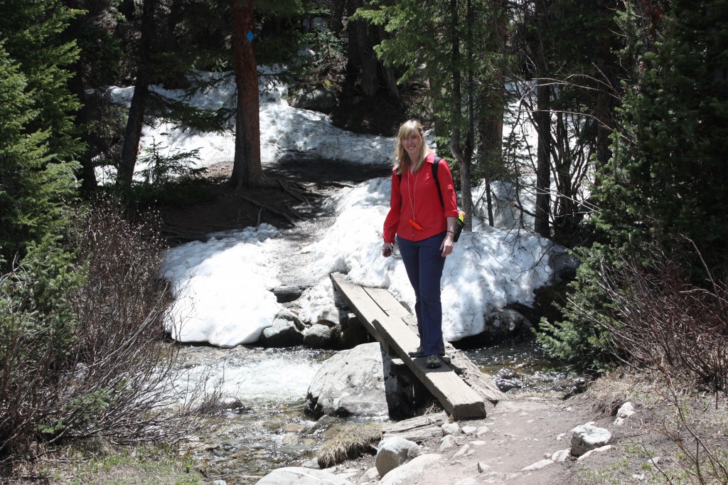
Though the sun was shining brightly, the first section of the hike was pleasantly shaded by a dense lodgepole pine forest. The first 0.5 miles of the hike covered a relatively flat section of trail that ran parallel to Spruce Creek. Though shielded from view by the trail most of the time, the gurgling creek could still be heard by the gentle rumblings of its many falls. We followed the trail to a small clearing with a sign directing us to a narrow bridge formed by two wooden planks which crossed the creek. Seen below are pictures of Spruce Creek Trail, the creek and the foot bridge.
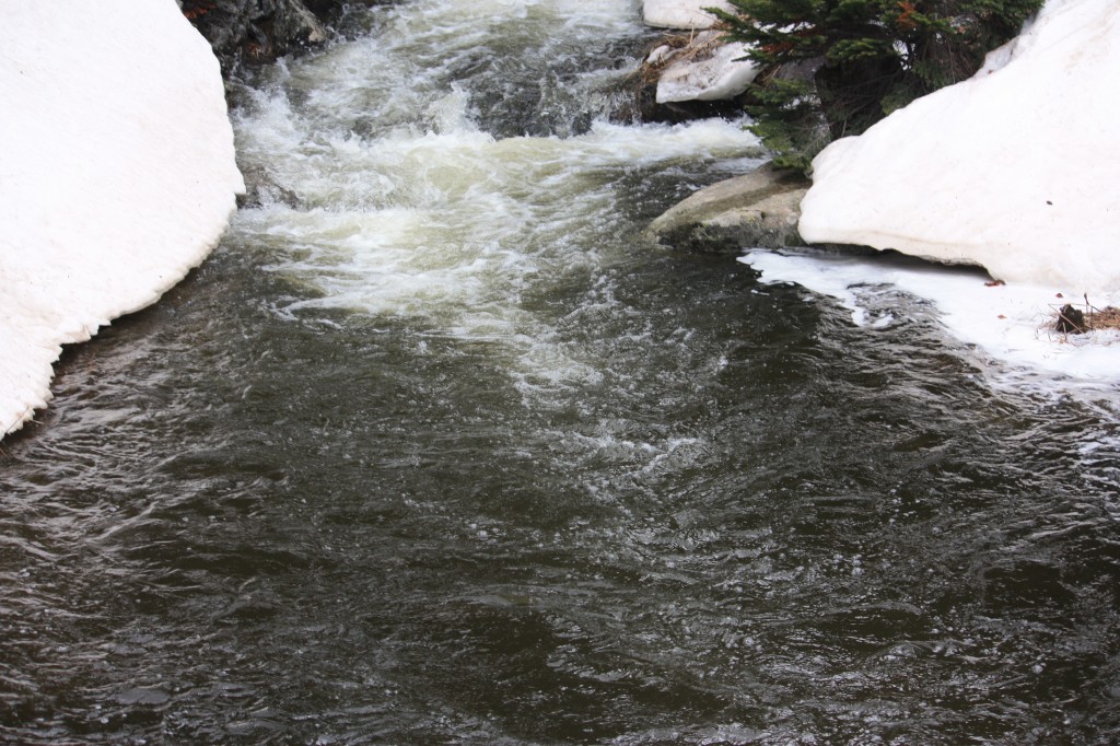
After the footbridge, the trail began to steadily gain elevation, and we were once again shaded by a dense forest. As our elevation increased, so did the mud puddles and large snow piles which had not yet melted this early in the season. We reached mile one, which can be recognized by a large 1 carved into a tree (this marking also matched our GPS device). After this mile marker, slick snow piles were present every 30 feet or so. The trek was very slow at this point, however a small reward awaited us shortly ahead. At approximately 1.8 miles, the trail opened, and a quaint little lake nestled in a marshy meadow greeted us. The lake appeared to have formed from a beaver dam which could be seen right off of the trail. Glorious mountains, including Mt. Saint Helen provided an exquisite backdrop to the lake. If we looked close enough, we could also see the rumbling waters of Continental Falls plummeting down the side of the mountain. It was also a little daunting as we realized how high and far we still needed to travel to reach the falls. **It should be noted that the trail diverges here with the option to continue on Spruce Creek Trail or take Wheeler Trail which loops back to the road and parking lot. Seen below are photos of the group at the lake.
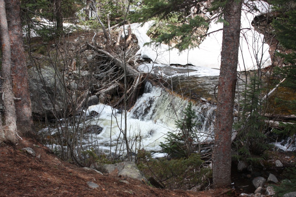
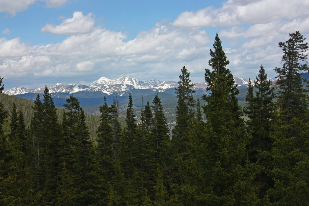
We continued on Spruce Creek Trail upward toward the falls and the lakes (including Mayflower, upper and lower Mohawk lakes). We climbed, slipped and struggled through the next 0.6 miles of steep terrain to another opening which harbored a dam of a small reservoir. Additional spectacular views awaited us here, one of which can be seen below. Trail signs here guide hikers on towards the lakes and Continental Falls.
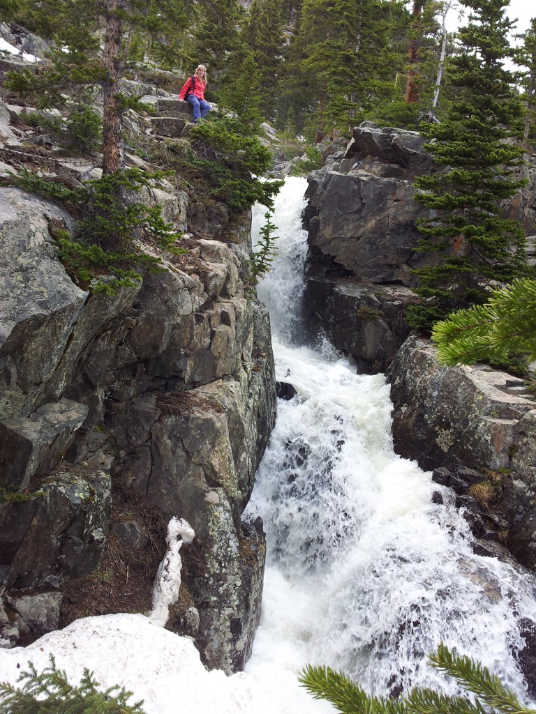
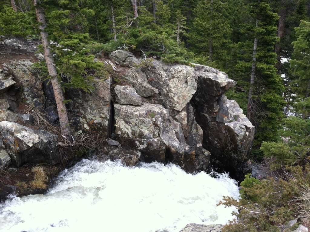
We continued upward through very steep sections of rocky trails. Eventually we came upon another trail junction in a small marshy region near a creek bed and followed it towards Continental Falls. The trail crosses the creek again via a rugged log bridge and after this point becomes difficult to follow. However, we could see the beautiful falls and old mine settlers’ ruins on the rocky slope of the mountain side and we continued to climb. Closer to the top, we were greeted with what was the most rewarding sight of all of our hikes thus far. Continental Falls thundered loudly, sending its crisp clean waters hundreds of feet down the mountainside. We were able to get right next to the edge of the falls and look into the white swirling mix. Occasional flickers of tingly coldness from the fall’s water landed on our skin. We had to speak very loudly to hear one another over the rush of falling water. Magnificent! Seen below are photos of the falls and surrounding settlers’s ruins.

At site of the falls, the trail continues another 0.5 miles to Lower Lake Mohawk and from there, an additional 0.5 miles to the upper lake. We opted to come back to the lakes later in the summer after the trail has melted more and instead headed back down the trail. On our way back, we followed the detour to the still waters of Mayflower Lakes and paused a few moments to take in the scenery before heading back to the car via Spruce Creek Trail. Though there was one body of water, several small glacial pools surrounded the area. Pictures of Mayflower lake can be seen below. Portions of the water were so smooth and still, reflections of the mountains could be seen in its waters.
This has been our favorite hike thus far due to the spectacular views of the falls and mountains. There was a fair amount of people on the trail, as we saw fellow hikers every 15 min. or so which was expected due to the hike’s proximity to Breckenridge and the beautiful June day. We highly recommend this hike, but would wait until Mid-July before attempting the hike to avoid the large snow piles and mud. Parking is free at the Spruce Creek trailhead, but limited. Get there early and pack plenty of water as none is available on the trail.