
Distance: 7.44 miles (out and back) Elevation Gain: 3,148 ft (total) 2,431 ft (net)
Max Elevation: 12,276 ft Min. Elevation: 9,845 ft
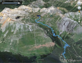
This labor day weekend we ventured out of the Front Range to explore the rugged and wild San Juan Mountains of southwestern Colorado. This area of the state still maintains a sense of old time tradition and reflects the mining days of past. In fact, its hard to find a hike or scenic drive through the area that’s not littered with abandoned mine structures or ghost towns. With hundreds of miles of beautiful trail to explore, including the famous Colorado Trail, it was challenging to pick just one hike. Ice lake lured us in with the promise of pristine, caribbean blue waters amid throngs of 13ers.
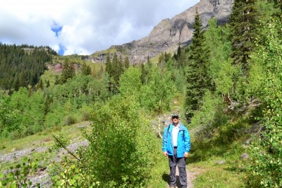
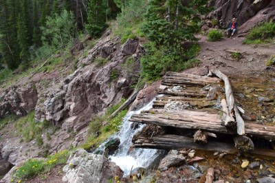
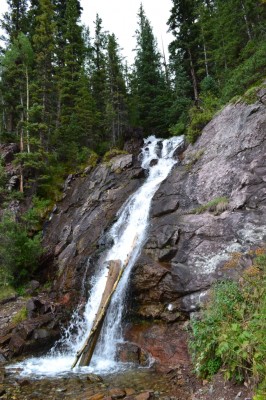
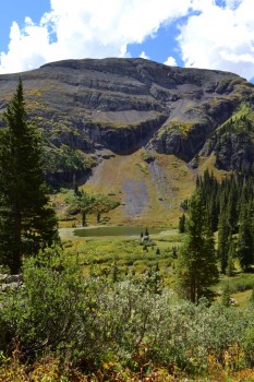
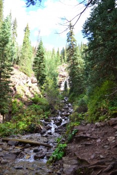
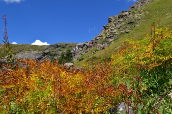
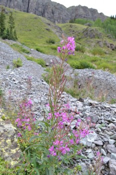
To reach the Ice lake Trailhead, we followed 550 north out of Silverton for about 2 miles. We then turned left on County Road 7 into the mineral lakes campground and trails area. We followed the dusty dirt road for about 5 miles to a small parking lot. Just north of the lot, is a tiny sign reading “Ice Lake Trail”. No mileage signs were present which contrasted with RMNP and the Front Range where they are very common. In fact, this was the only sign for the remainder of the hike. At times, it added to the remoteness of our hiking experience. At other times, we kept wondering “how much further…it feels like we have been climbing forever.” Almost immediately, the trail begins to gain elevation. In fact, the first 2 miles we gained over 1,600 feet in elevation while passing in and out of a dense forest followed by a brief stroll through a meadow and finally to the lower ice lake basin. Despite the intense climb, we were frequently rewarded with waterfalls along this portion of the hike and majestic views of Mt. Vermillion and Fuller Peak once we reached the basin. There is an option before reaching the open meadow to take a brief side trip to view an amazing waterfall. We were able to carefully cross the fall. However, extreme caution should be executed. It is slippery on the rocks and logs in the water and one wrong step could be fatal. Seen below are photos of this waterfall and “bridge” and views from the meadow.
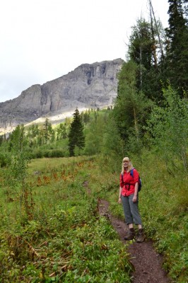
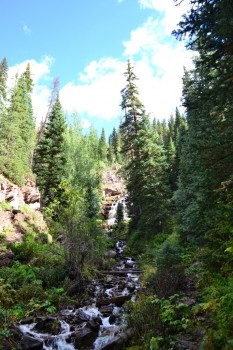
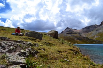
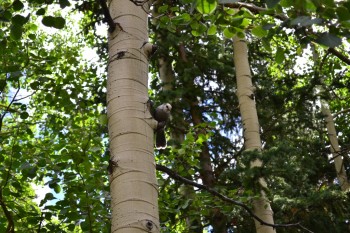
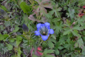
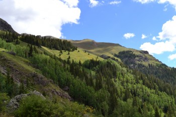
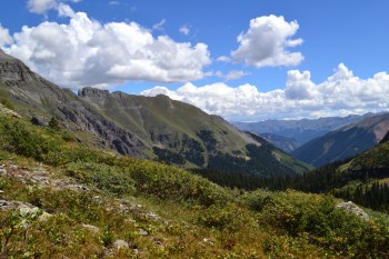
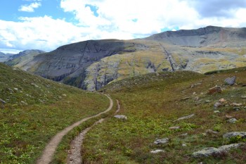
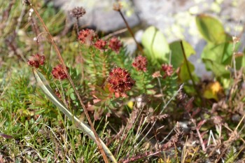
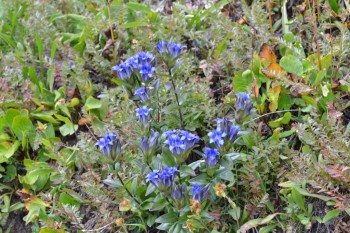
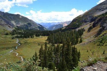
After passing through the first meadow, we continued to climb up steep switchbacks. While intensely vertical, the trail was a smoothly packed red clay surface which was a bit helpful. After a little over 2 miles, the trail opened up to Lower Ice lake Basin. Even though it was early September, the landscape was still mostly green, and wildflowers still dotted the trail and hillsides. The trail levels off for a little while here and gave our hearts a much needed rest. It should be noted that this is a very high elevation hike. At the starting point, we were already about 9,800 feet. As we arrived at the lower basin we were over 11,000 feet. Simply standing in the basin was mesmerizing. In all directions we were surrounded by enormous peaks. Emanating from the sides of the mountains were powerful waterfalls, fueled by unseen alpine lakes from the terrain above. These waterfalls formed gorgeous streams which drained into the lower Ice Lake. We were in an alpine wonderland. Seen below are photos from the basin before we began our the remaining ascent to Ice Lake.
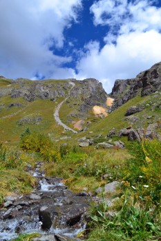

After our all too brief break in the Lower Ice Lake Basin we began our ascent to Ice Lake. This was a steep climb and at times very rocky with loose gravel. It should be noted here that according to our GPS the average percent grade on this portion of the hike was around 21% and at times was above 80% on the hike (40 degree incline). This made for a challenging hike and we were really hoping for a great reward at the top, which we found.
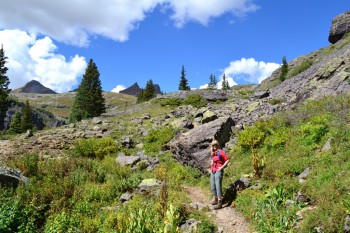
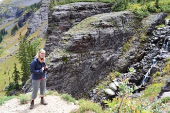
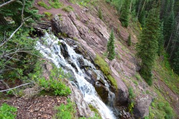
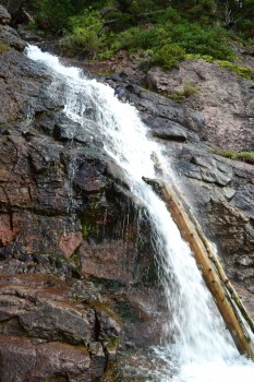
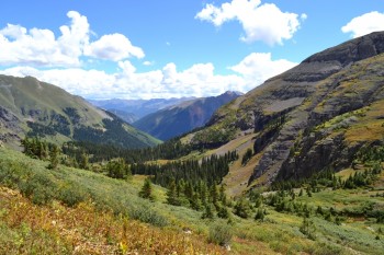
One of the best parts of this portion of the hike was looking back at where we had come from. On this part of the trail we were surrounded by peaks in almost every direction save the direction we came from. The geology formed what almost looked like a large theater where the area we were climbing up was the stage and the peaks around us were the stadium seating. Towards the beginning on this portion was a large waterfall fed by a stream from Ice Lake. On one part of this section you must hike harrowingly close to a cliff that drops down into a crevice the waterfall has created over the millions of years it has been eroding the rock away. Below are some of the pictures we got of the waterfall and looking back towards the Lower Ice Lake Basin.
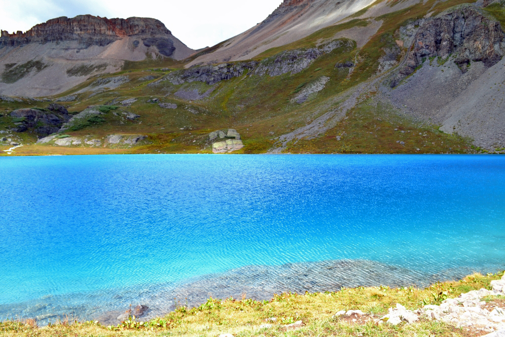
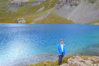
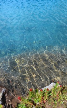
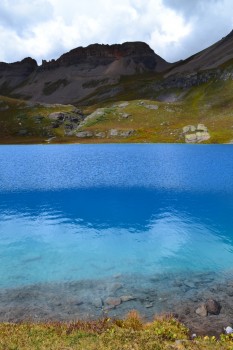
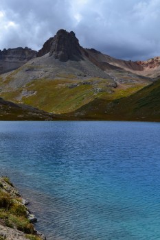
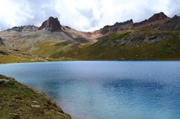
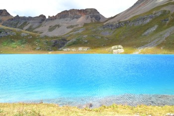
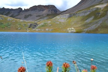
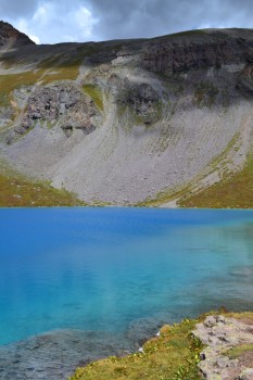
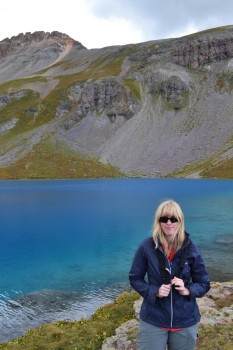
After what felt like forever we finally saw what appeared to be four-wheel drive tracks that led to what we could only imagine was the lake. We walked up those tracks for a few hundred feet and were greeted by the most beautiful azure alpine lake we have ever seen — Ice Lake. The sun was out and made the lake almost glow a turquoise blue usually reserved for post-cards and expensive coffee table books. We strolled up to the lake and savored the scenery. Vermillion Peak, Golden Horn and Pilot Knob, all 13ers provided a powerful backdrop to the bright blue lake. Below are some of the pictures we took at the lake.
After enjoying the lake for about 20 minutes, as if on cue, a large crack of thunder erupted overhead. For a moment we thought perhaps someone had set off some dynamite at a nearby mine; but then we saw the dark clouds crest over Pilot Knob and Golden Horn. We took a few last looks at Ice Lake, regretted not being able to continue to nearby Island Lake and headed back down, quickly.
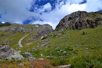
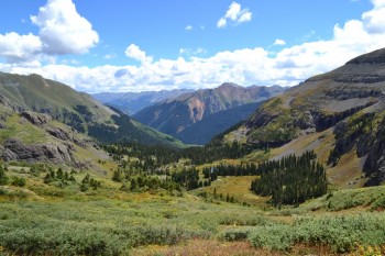
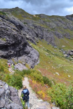
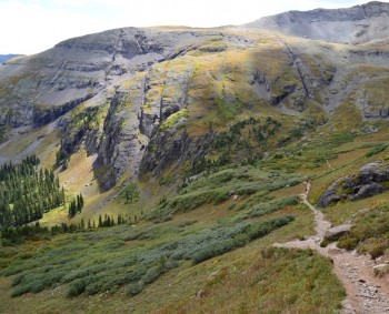
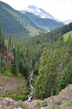
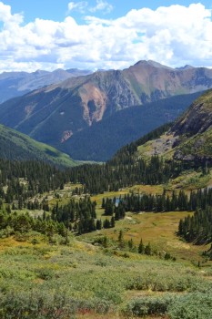
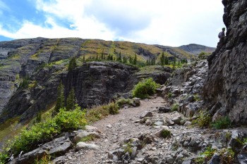
The climb down was much easier than going up; however, the loose gravel and steep grades did force us to be careful and watch our step. Every now and then we’d hear a huge crack of thunder and be reminded of the urgency to get back to the tree line. We did manage to get a few good pictures of our early descent which really put into perspective the immensity of the area — they are below. In both pictures if you follow the trail you will notice small dots on it, which are people.
We made it quickly back to tree line, across the Lower Ice Lake Basin, and into the last part of the descent. Once there we realized that we might have lucked out and stayed ahead of the rain; and that we might end up staying dry. By the time we were below 10,000 feet we knew we had dodged the rain and were very excited to be back at the truck, dry, and with plenty of daylight left. Leaving our hike we knew that we had really only sampled what the San Juan Mountains had to offer and we have already decided we will have to come back in the future to explore the plethora of 13ers, 14ers, lakes, mines and ghost towns which seem ubiquitous in this area.


Indescribably beautiful! But you did a great job of describing it in photos and words!
Wow! That lake is amazing!!! I am now obsessed with making it out there to see it myself! Thank you for sharing, was it crowded? It looked like you had some other people out there but mostly had it to yourselves ….
Hey! This hike was not very crowded at all. We mostly had the trail to ourselves. Not very crowded at all. Probably one of the best hikes we’ve done in colorado! Just a unique and fascinating area of the state. Check it out!