A Quest into the Wild
Redcloud and Sunshine Peaks
Stats: 12.25 miles with 4,800 ft elevation gain; Class 2; climbed 8/2/2024.
This will be the first post in a while for our blog. We have been climbing and getting out there, but life just seems to have happened. We did climb Mt. Blue Sky and Bierstadt this year as well as some other hikes to get ready for Redcloud and Sunshine. It was a long day and we were a little tired coming back to Redcloud from Sunshine. I gave it a difficult rating for length, but we’ll have to think about a better rating system for our hikes, since they are so diverse. But let’s get into it.
We stayed in Lake City, Colorado, for this hike and drove in on Colorado 30. It is a pretty nice road and I’ve talked about it before for the hike on Handies Peak. The shelf road is still in pretty good shape and I’d say that a vehicle with good clearance can make it to the trailhead just fine. I never used 4-wheel drive in the X-terra, which we’re still driving. For fun, here’s a picture of that shelf road and of the trailhead parking lot.
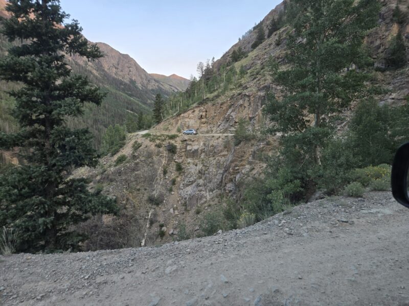
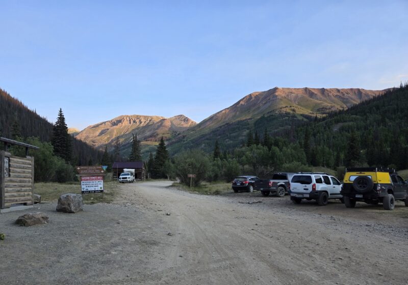
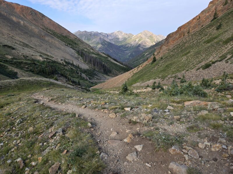
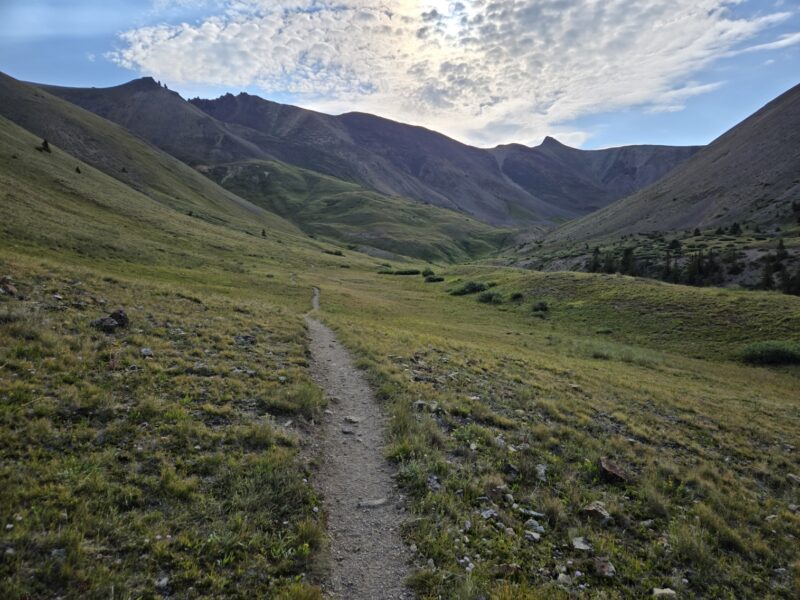
Be careful on those turns, since it is only wide enough for one car and someone is going to have to back up. Anyways, we got going at 7:11 am with a solid weather forecast and decent looking sky. I’ll say that the first quarter mile or so is pretty steep with not much of a warm-up. It is through some trees and you can hear the creek on your right. But a solid trail and I’d say it doesn’t surpass class 1 until you get to the first saddle. I have some shots below that look back towards the trees from the trail, except for the one in the middle which is looking up towards the basin.
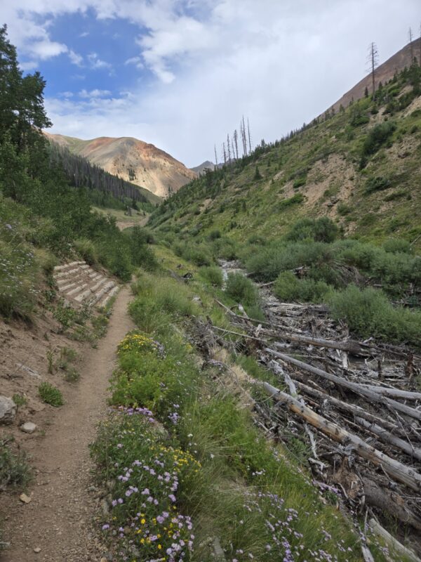
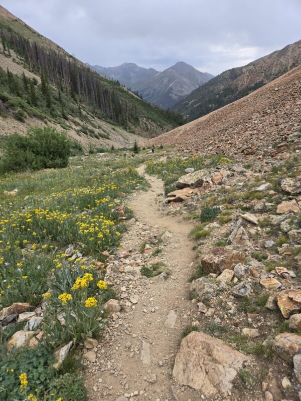
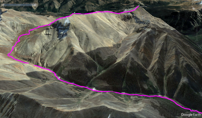
As you can see in the satellite image I put up of the hike, you make a ‘U’ shape around the basin as you head up towards the first saddle at around 13,000 feet. It was a beautiful basin and the trail was very, very nice. Lots of wild flowers were still out. We were feeling strong and loving the cool mountain air. Below are some images from that portion of the hike.
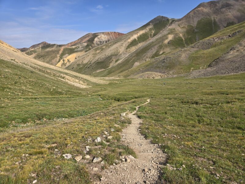
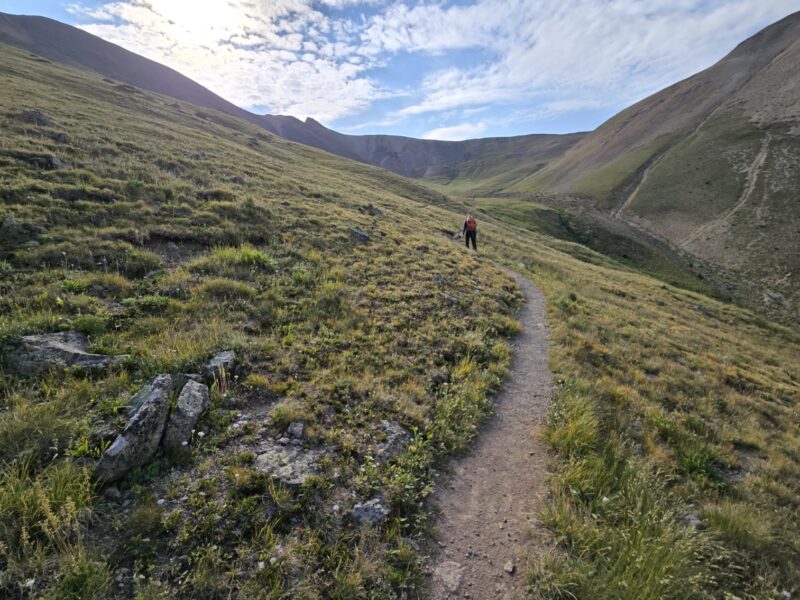
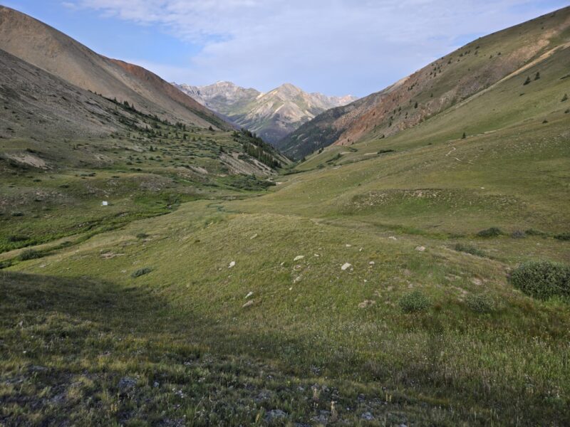
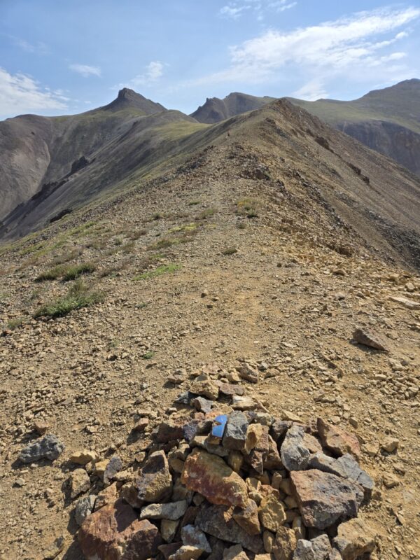
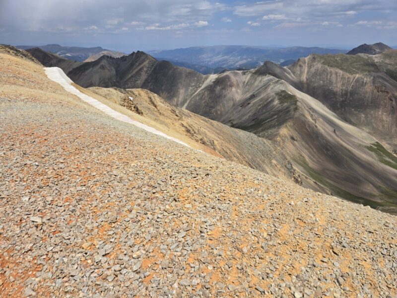
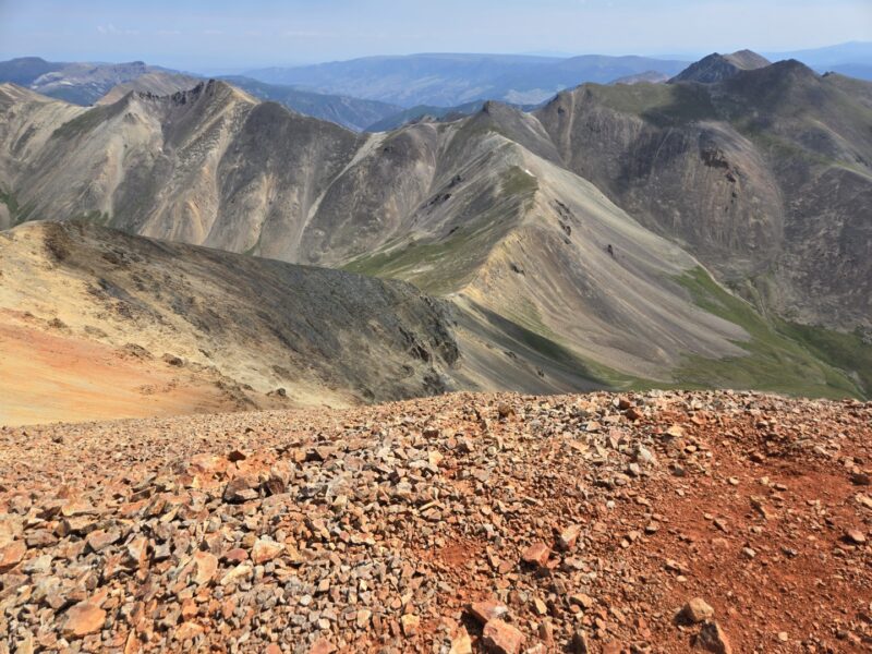
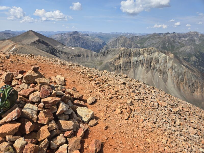
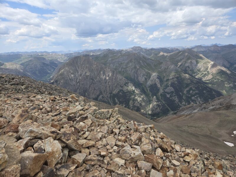
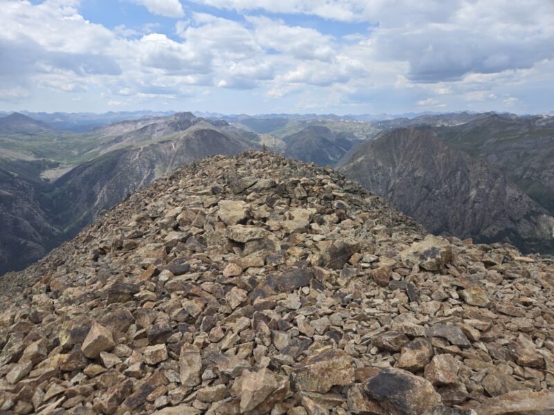
After hiking through the basin area you begin to head up steeper terrain towards the first saddle. It provides pretty views looking back at what you just hiked. At this point, you have hiked about 3 miles and it is hard to believe that Redcloud is only 1.5 miles away, though you can’t see it yet. Making your way up to the saddle you will see a large cairn at the top. Once there when you look right you will see two peaks with a saddle. The peak on the left (the big red one) is Redcloud. You are at about 13,000 feet and can see most of the remaining route to Redcloud. The images below show the view towards the remainder of the route as well as looking the opposite direction towards other non-14er options for hiking.
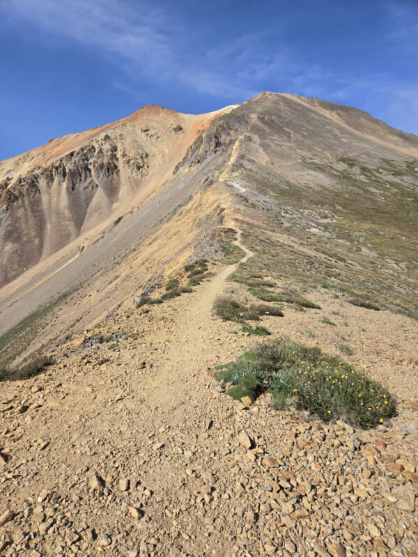
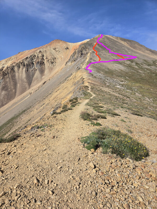
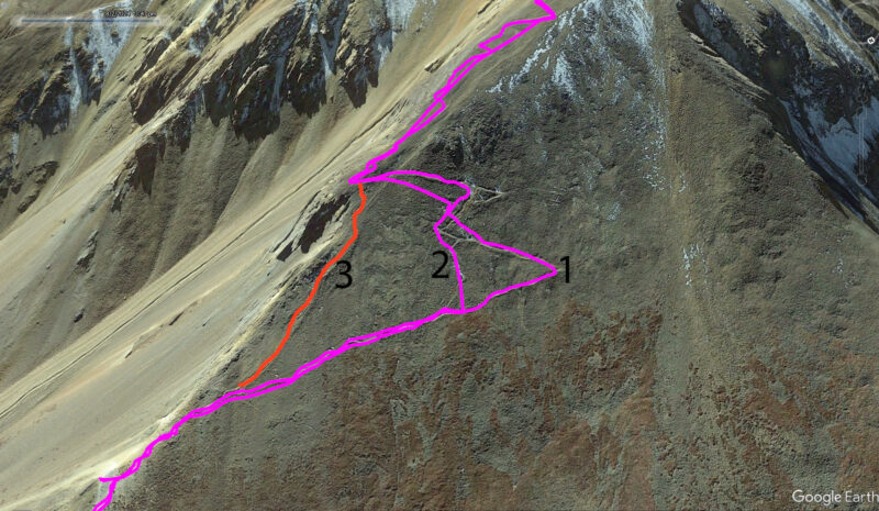
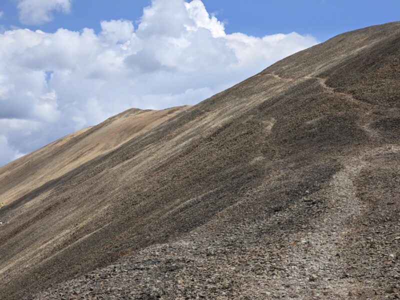
This is where I’d say the climbing changes from class 1 to class 2. This is due to some route finding you have to do going up to the false summit. I’m going to post below an image of the GPS as well as an edited picture of the hike up, since it is a little confusing as noted by a few other hikers. Alright, so there are two signs that say “Trail” with an arrow pointing to the correct (or official) route. The signs are at the base and top of the route labeled 3 in red on the image on the right, which is why that is not the “correct” way. The official route is the path labeled 1 in the image on the right. Route 2 is what we accidentally took on the way down when we turned too early on a byway trail. It was very loose and rotten and not a good path. I will say I saw hikers on all 3 of these and let’s face it, none of them are going to get you into class 4/5 climbing, but in an effort to minimize erosion and keep the trails nice I’m posting this here. Bill Middlebrook has similar images on 14ers.com.
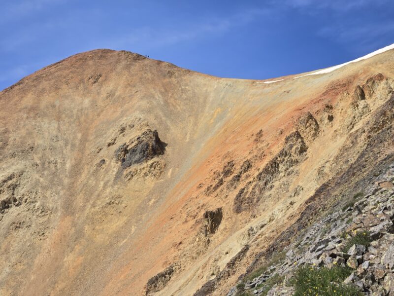
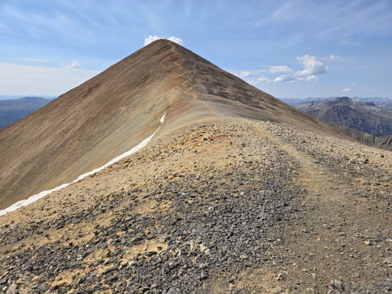
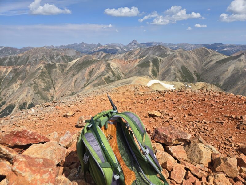
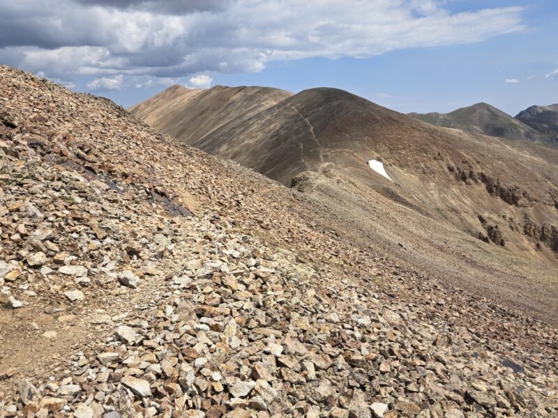
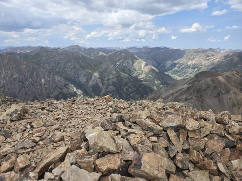
Once you get up to the false summit you can see the last 100+ ft of the climb. It looks kind of cool with all the red dirt and rocks, and you can look back towards the saddle for a cool view. Honestly you can look anywhere and you have amazing views. This is a really awesome peak. The big image is the remaining route. You are at about 13,900 feet here and have hiked about 4.25 miles.
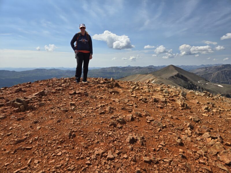
The summit was so red! It was really cool. I could imagine how on a foggy and cloudy day if you just saw that red up in the sky it could look like a red-cloud. The summit has a little rock shelter but not much else. It is flat and not very rocky, easy to walk around. You can see the route to Sunshine from here, but part of the route is obscured by a hump in the middle of the route. But I do have a picture with Allyson that shows Sunshine in the background (top left and top middle show Sunshine). It took us about 3 hours and 30 minutes to summit Redcloud with breaks, which covered 4.5 miles and about 3,700 feet of gain.
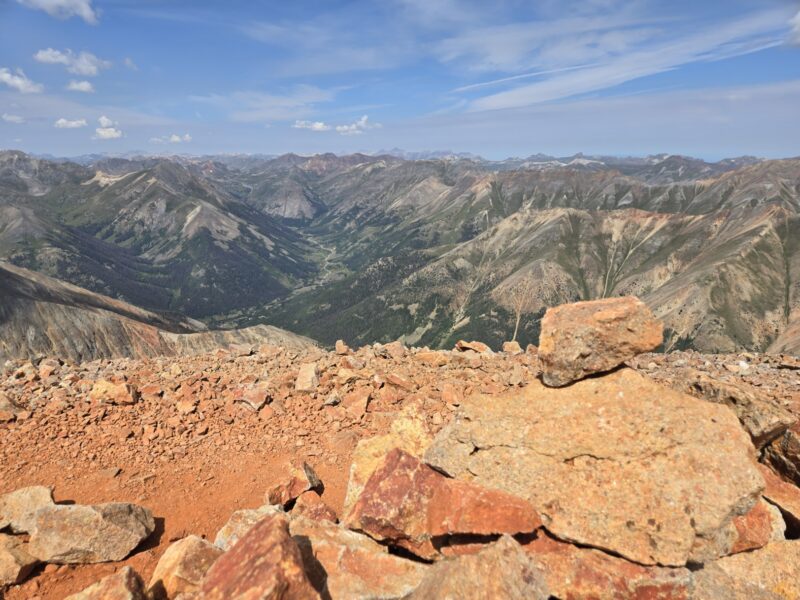
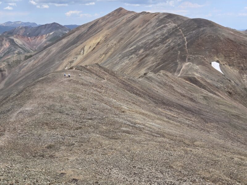
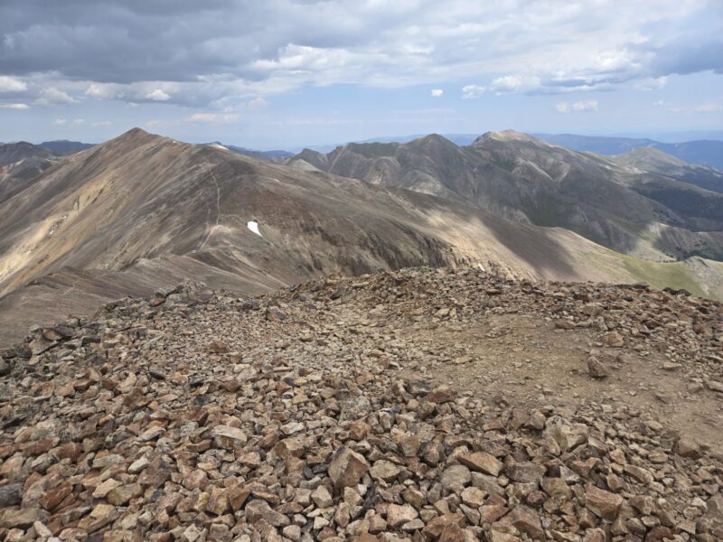
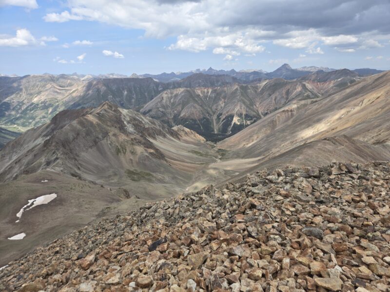
From here the trail is pretty clear and is class 1 hiking — albeit at 14,000 ft. We were feeling pretty strong and the weather looked good so we decided to go for Sunshine. I will say that headed up to Sunshine I realized I was feeling pretty fatigued, and wondered if I had made a mistake! The ridge hike over to Sunshine is a little rocky at points, but never exceeding class 1 in my opinion. It is 1.5 miles one way and adds 3 miles and 1,100 feet of gain total. I am going to post some images below of that section. Since it’s easiest I think to see the route from Sunshine I’m going to post some shots in order looking back towards Redcloud along the hike. The first image is closest to Redcloud and so forth until you get to the big one which is looking back from the summit.
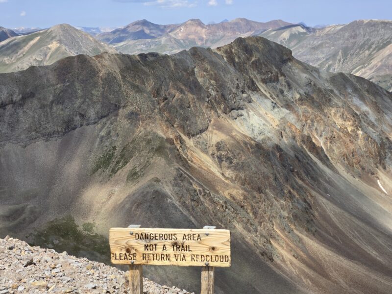
When you get to the saddle between Redcloud and Sunshine there is a sign that tells you not to descend the gully. Don’t descend here, if you want to make a loop then check out the notes further down. I’ll put a pic of the sign with a cool shot of Sundog (a 13er) in it.
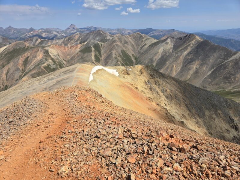
The summit of Sunshine was nice, but not red at all. Just shows how dramatically different summits can be even when their neighbors. You can see Handies off to the northwest and Uncompahgre to the north. Below are a few pics.
On Sunshine Peak we noticed some clouds rapidly forming, and it was around noon, so we hustled on back to Redcloud (the weather folks were saying chance of storms maybe after 3pm but probably more like 6pm). The hike over to Sunshine and the hike back to Redcloud took almost exactly an hour each — so maintaining about 1.5 mph with breaks. Once back on Redcloud, we opted not to linger too long before making our way to the 13,000 foot saddle. However, as discussed above about the route finding heading up/down from the false summit, we turned too quickly and ended up on a very steep and nasty segment. However, back at the saddle point we felt we were in pretty good shape and were feeling more energized after eating and drinking a bit.
Naturally, once turned around on Sunshine the rest of the hike was just the first part but in reverse. You can make this a loop, but it is reported it is much harder and can get you into trouble if you don’t know the route well. To make it a loop, you’d take the Northwest Face route, which is described on 14ers.com, either down from Sunshine or to summit Sunshine. I’m thinking I’d want to try summiting Sunshine first, then hiking to Redcloud, and then going down the standard route. But hikers do it in reverse. I do have an image that I marked up to show which gully you’d drop into (14ers has much more information on this so I’d go there if you plan on doing this route).
There is somewhat of a trail down Sunshine to the West that leads to the flat section you see in the image. There is a trail that leads over towards the ridge with the x’s and checkmark. You want to find the gendarme between the checkmark and the big x and hike down to the right of it. If you’re coming up you’d hike up to the left of it. The green line/arrow shows the route to go to Sundog Peak, which is a 13er.
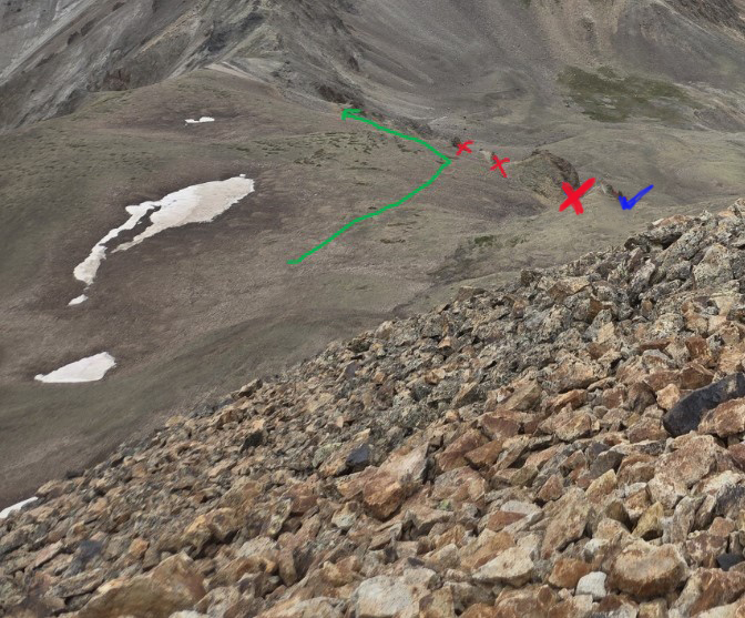
Given that we haven’t done this route. I’d go to 14ers or another site/trip report for more info. But since I was looking at it thought I’d post this pic and mention it as a possibility.
Alright, so we had reversed it and headed back. Unfortunately for the area it did not rain, despite threatening clouds. We noted that the water towards the top (above maybe 12,000 feet) looked pretty clear, but that lower down it looked like it was polluted potentially with mining run-off. I’m not sure how safe it is to drink (luckily we were good on water). I want to post a few nice pics below to showcase the hike.
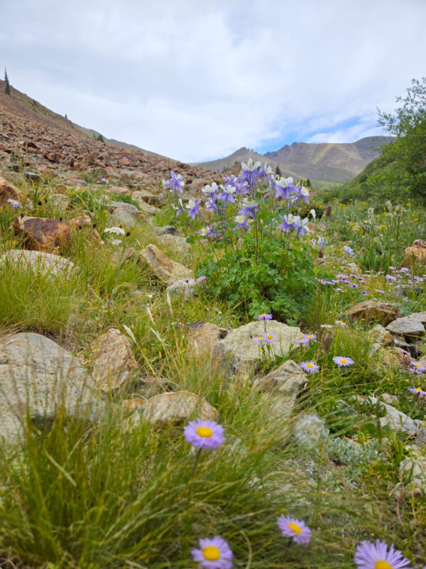
Really beautiful columbines on the hike with mountain daisies.
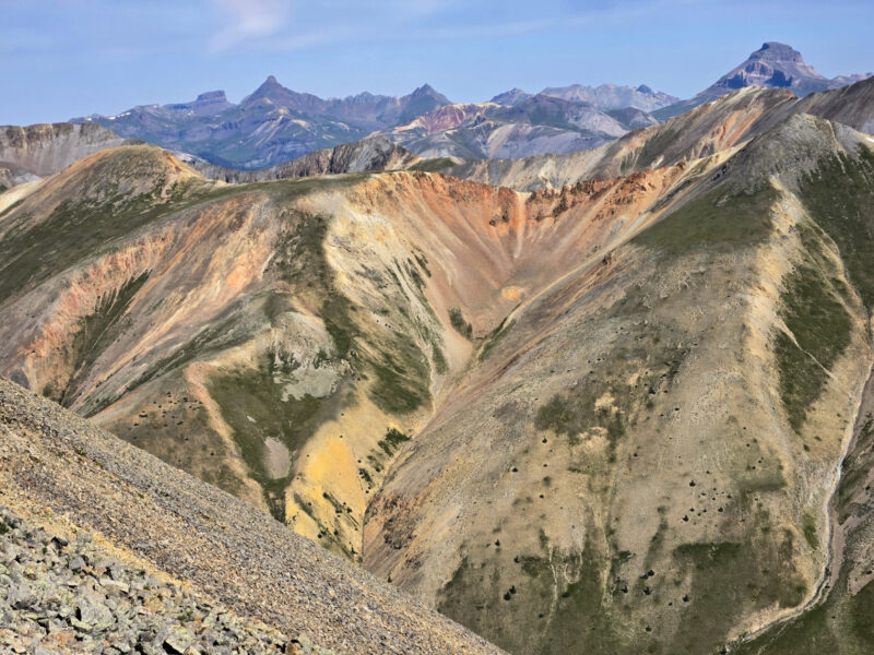
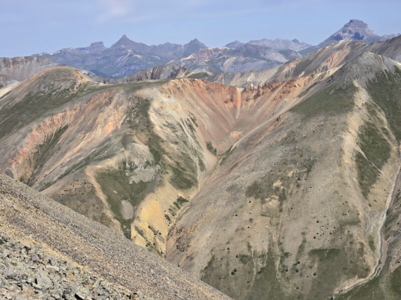
Just such a cool vista with Uncompahgre in the top-right corner of the image. Taken near the false summit of towards Redcloud.

Highlighting the vivid colors on the hike. Taken near at the summit of Redcloud.
Thank you for reading. Our GPS lost us at a few points and at a particularly long section near Sunshine Peak. So the stats are based on 14ers and my own estimates. Be safe and have fun out there!
Your hiking report and tips should be in brochure form at the trailhead for anyone setting out on the journey!!
Thank you 🙂
Hey people!!!!!
Good mood and good luck to everyone!!!!!