Take a Walk
A Quest into the Wild
Clear Creek Rafting Excursion
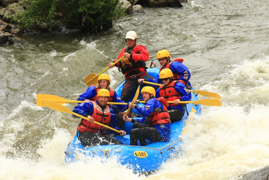
Though not a walk in the traditional sense, one of our many excursions this weekend included a wild ride through class III, IV and IV+ rapids on Clear Creek in Idaho Springs Colorado. In honor of sibling Will’s graduation, we embarked this Sunday late morning on an advanced half day trip through the high, swift, arctic water of Clear Creek. Though the morning held promise of warmth from the sun, early afternoon gave way to clouds and light rain and a coldness that made us thankful for our wetsuits. We were informed that the water was a chilling 34 degrees. At Clear Creek Rafting Co. outpost, we were given a brief safety lesson, suited up and made to do a few practice maneuvers before hauling the raft into the creek.
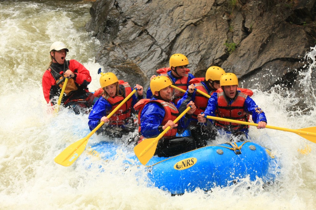
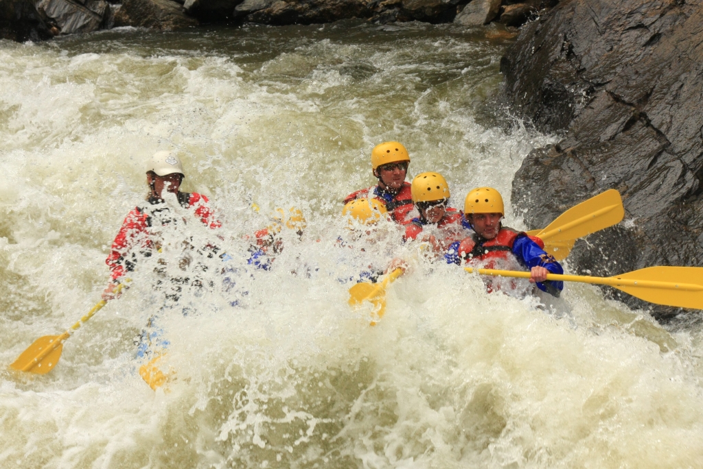
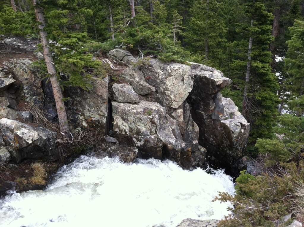
The first two miles of the advanced excursion were a mere warm-up for what lay ahead. During this time, we practiced forward and backward paddling as a group and chatted while enjoying the scenery. Shortly after we tackled our first challenges, Upper and Lower Beaver Falls which were class III-IV rapids. White water rushed over us as we descended over the falls. Photos of the group on the first falls can be seen below. Thomas and Allyson are on the left and Will is in the front right. All pictures in this post were taken by Clear Creek Rafting Co.
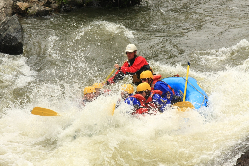
From there, we continued through some more Class III rapids and plenty of boogie water before getting to the really challenging stuff. And that’s when things got interesting. As we approached the mile of continuous rapids including Hell’s Corner, Ejector, Horrendous Left Turn, and Double Knife, somehow the group became out of sync and we plummeted into a giant boulder which was just submerged. The force of the rapid pushing us into the rock ejected Will from the raft into swirling icy water and powerful rapids. While he made a reach for the raft, it was too far and the water quickly swept him away downstream. We were all terrified. Our guide screamed for him to swim as hard and as fast as he could to the left bank. He grabbed for a few tree branches hanging off the shoreline, but a few broke before he maintained a good hold. We all watched helplessly from the rock as he struggled to pull himself ashore. Finally he made it and was instructed to hike back up the rocky and vegetation filled bank to near where we were with the raft. Though in a little pain, Will made the four foot leap from the shore back into the raft. We were then dislocated from the rock and thrust right back into the wicked white water. Seen below are photos following the incident once we had gotten back on track with our teamwork. Hopefully you can grasp the intensity of the water from the expressions on our faces as well as the guide.
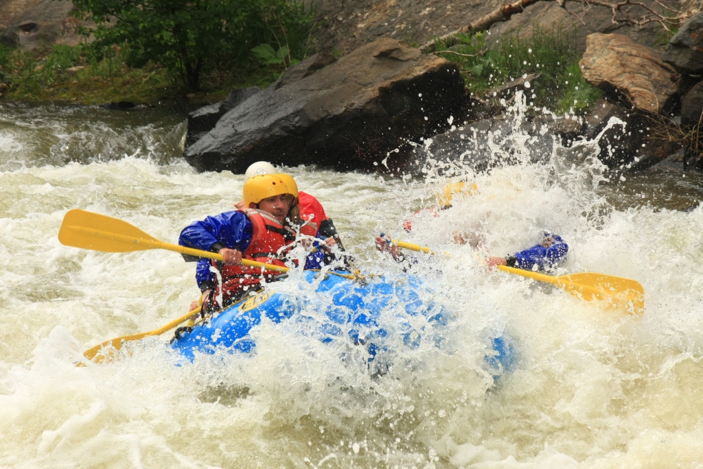

The rest of the trip ended with terminator and corkscrew rapids which were quite intense. Nonetheless, we all remained in the raft. We ended the adventure well and were picked up by the company van which drove us about 15 min back to the outpost. By this time, our arms and backs were tired and our feet and hands numb. Though the trip was quite exciting, we were thrilled to get out of our cold wetsuits. In total, we ran about 9 miles of the river in about an hour due to the swiftness of the water during this time. We highly recommend checking this trip out.
[subscribe2]
Spruce Creek Trail and Continental Falls
Distance: 6 miles (out and back), Elevation Gain: 1,331 ft
Max Elevation: 11,439 ft, Min. Elevation: 10,354 ft

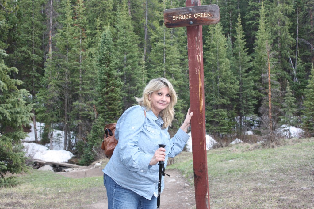
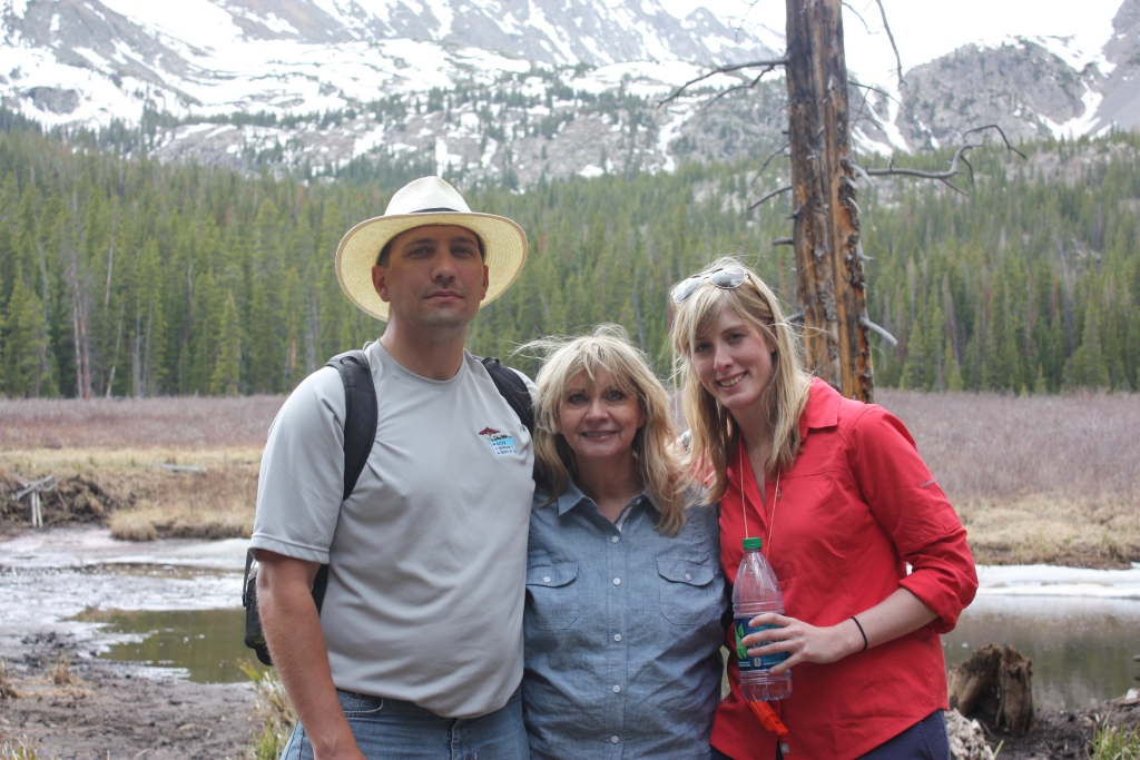
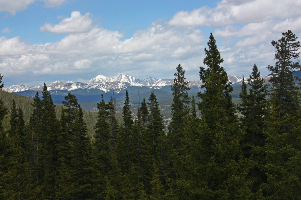
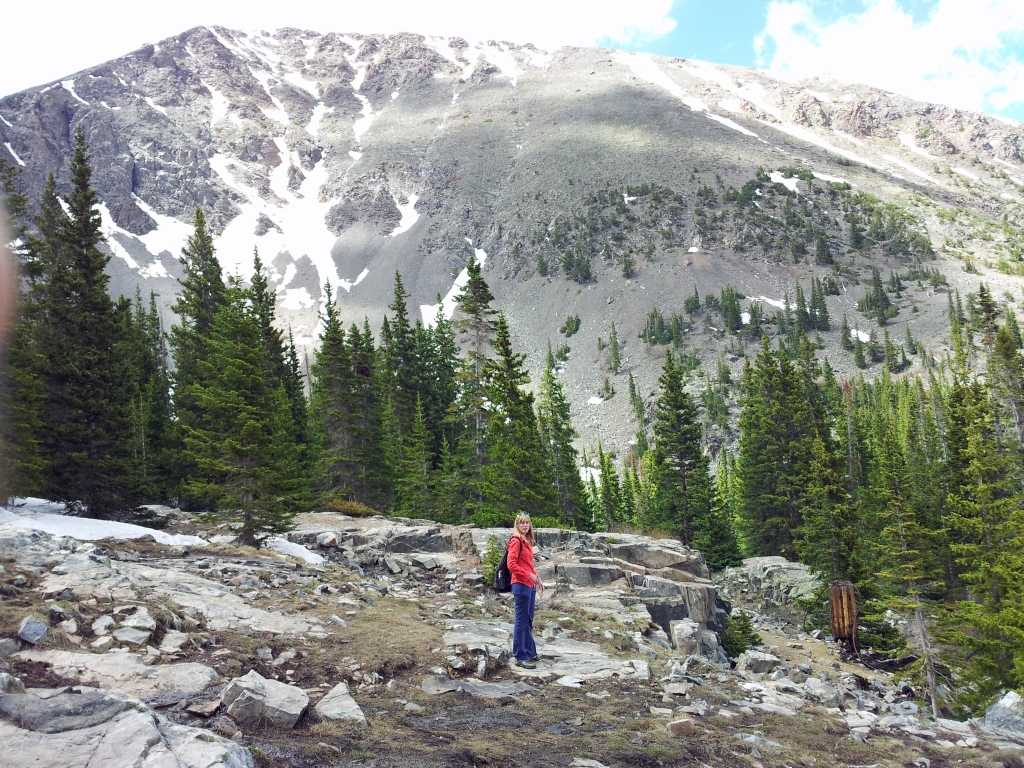
A very special guest this weekend, my mom, inspired this hiking destination. Tales of her college trips and fun in the past led the three of us all the way to Summit County, past the Continental Divide into Breckenridge, CO. While the temperatures are steadily climbing in Denver this June well into the 90’s, the elevation above 9,000 feet found in the Breckenridge area offered a refreshing breath of cool mountain air to propel us along the miles of trail. We explored Spruce Creek Trail which can be found just to the south of Breckenridge off of Highway 9. To the reach the trailhead, we drove 2.4 miles past the last light in town and turned right onto Spruce Creek Rd. We followed the dirt/rock road upward for about a mile until we reached a small parking lot which was quite full by 10:30 am.
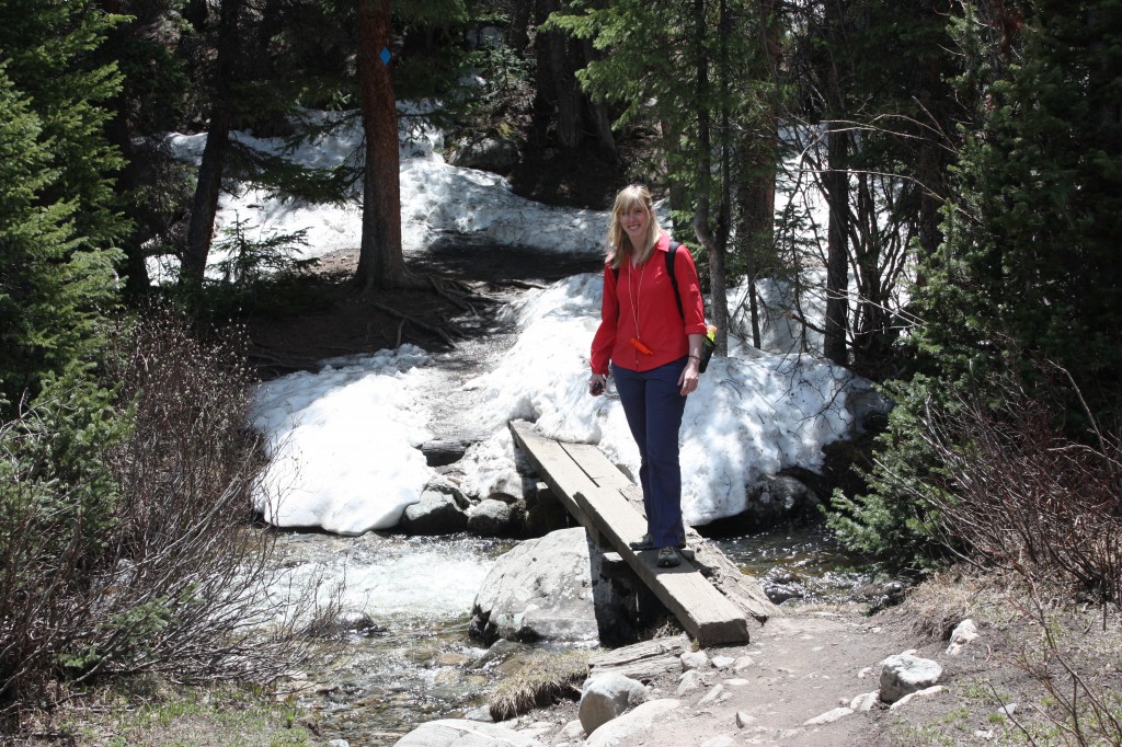
Though the sun was shining brightly, the first section of the hike was pleasantly shaded by a dense lodgepole pine forest. The first 0.5 miles of the hike covered a relatively flat section of trail that ran parallel to Spruce Creek. Though shielded from view by the trail most of the time, the gurgling creek could still be heard by the gentle rumblings of its many falls. We followed the trail to a small clearing with a sign directing us to a narrow bridge formed by two wooden planks which crossed the creek. Seen below are pictures of Spruce Creek Trail, the creek and the foot bridge.
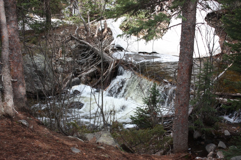
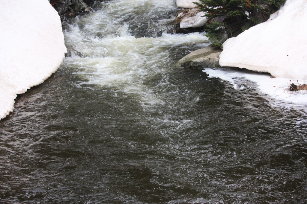
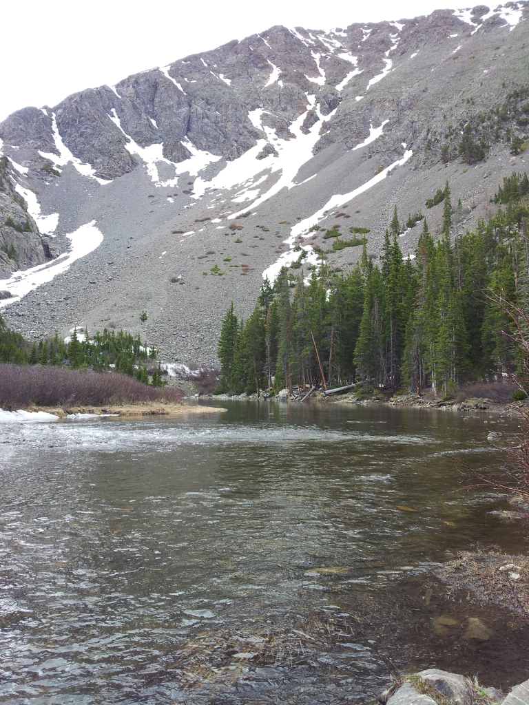
After the footbridge, the trail began to steadily gain elevation, and we were once again shaded by a dense forest. As our elevation increased, so did the mud puddles and large snow piles which had not yet melted this early in the season. We reached mile one, which can be recognized by a large 1 carved into a tree (this marking also matched our GPS device). After this mile marker, slick snow piles were present every 30 feet or so. The trek was very slow at this point, however a small reward awaited us shortly ahead. At approximately 1.8 miles, the trail opened, and a quaint little lake nestled in a marshy meadow greeted us. The lake appeared to have formed from a beaver dam which could be seen right off of the trail. Glorious mountains, including Mt. Saint Helen provided an exquisite backdrop to the lake. If we looked close enough, we could also see the rumbling waters of Continental Falls plummeting down the side of the mountain. It was also a little daunting as we realized how high and far we still needed to travel to reach the falls. **It should be noted that the trail diverges here with the option to continue on Spruce Creek Trail or take Wheeler Trail which loops back to the road and parking lot. Seen below are photos of the group at the lake.
We continued on Spruce Creek Trail upward toward the falls and the lakes (including Mayflower, upper and lower Mohawk lakes). We climbed, slipped and struggled through the next 0.6 miles of steep terrain to another opening which harbored a dam of a small reservoir. Additional spectacular views awaited us here, one of which can be seen below. Trail signs here guide hikers on towards the lakes and Continental Falls.
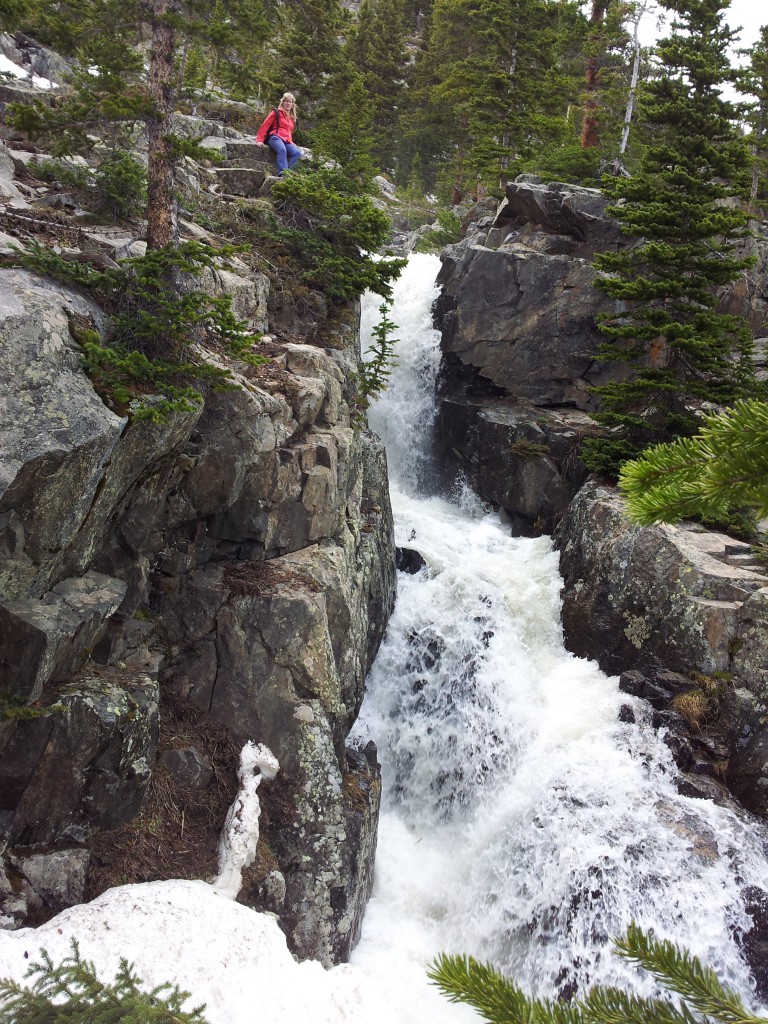
We continued upward through very steep sections of rocky trails. Eventually we came upon another trail junction in a small marshy region near a creek bed and followed it towards Continental Falls. The trail crosses the creek again via a rugged log bridge and after this point becomes difficult to follow. However, we could see the beautiful falls and old mine settlers’ ruins on the rocky slope of the mountain side and we continued to climb. Closer to the top, we were greeted with what was the most rewarding sight of all of our hikes thus far. Continental Falls thundered loudly, sending its crisp clean waters hundreds of feet down the mountainside. We were able to get right next to the edge of the falls and look into the white swirling mix. Occasional flickers of tingly coldness from the fall’s water landed on our skin. We had to speak very loudly to hear one another over the rush of falling water. Magnificent! Seen below are photos of the falls and surrounding settlers’s ruins.

At site of the falls, the trail continues another 0.5 miles to Lower Lake Mohawk and from there, an additional 0.5 miles to the upper lake. We opted to come back to the lakes later in the summer after the trail has melted more and instead headed back down the trail. On our way back, we followed the detour to the still waters of Mayflower Lakes and paused a few moments to take in the scenery before heading back to the car via Spruce Creek Trail. Though there was one body of water, several small glacial pools surrounded the area. Pictures of Mayflower lake can be seen below. Portions of the water were so smooth and still, reflections of the mountains could be seen in its waters.
This has been our favorite hike thus far due to the spectacular views of the falls and mountains. There was a fair amount of people on the trail, as we saw fellow hikers every 15 min. or so which was expected due to the hike’s proximity to Breckenridge and the beautiful June day. We highly recommend this hike, but would wait until Mid-July before attempting the hike to avoid the large snow piles and mud. Parking is free at the Spruce Creek trailhead, but limited. Get there early and pack plenty of water as none is available on the trail.
St. Mary’s Glacier Hike
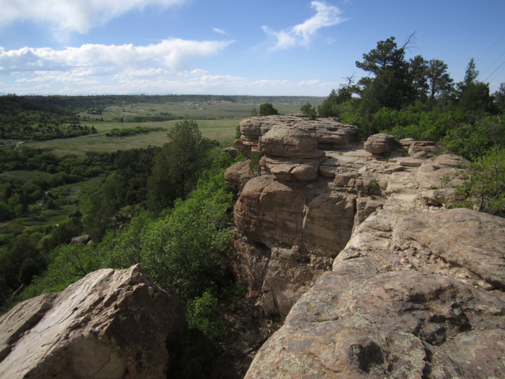
With the title of this entry you may be thinking ” Did they leave Colorado this time?” Perhaps they finally stole time away from post doc duties and work to venture to Alaska. However, you’d be incorrect! In fact, we were able to visit this natural wonder in Idaho Springs, CO approximately 1 hour from the Denver metro area in Arapaho National Forest. To name the site correctly, St. Mary’s is a semi-permanent snowfield (year round accumulation of snow and ice typically found below the snowline).
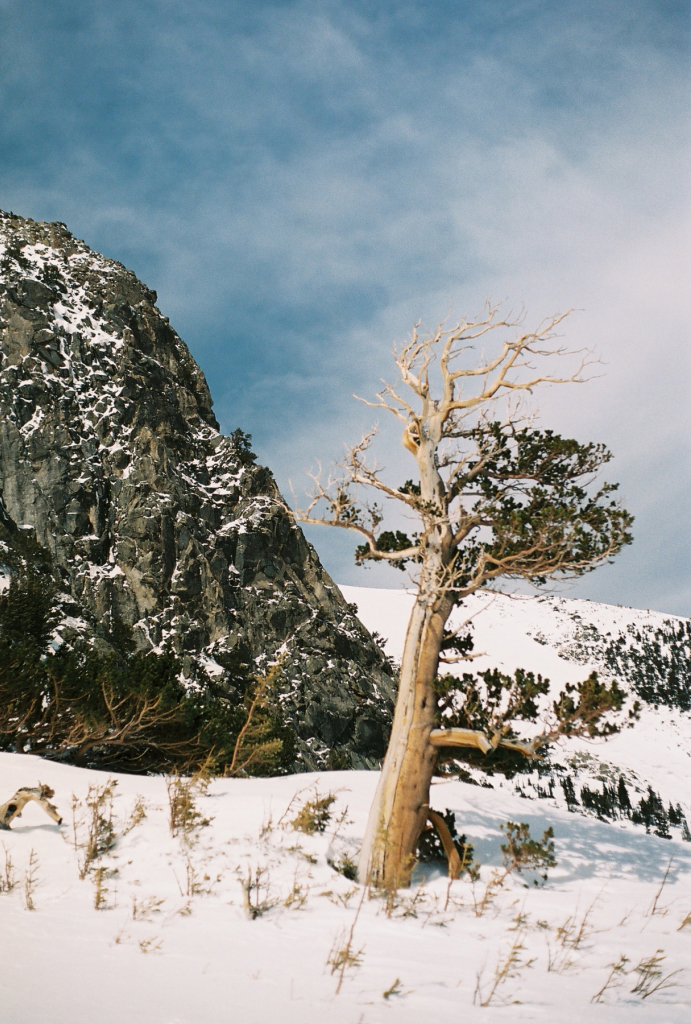
While we made this trek back in March of this year with snows still covering the ground, we thought it would interesting to post our quest here prior to returning in the summer to compare and contrast the conditions of the snowfield and lake. Our quest began just at the Trailhead found off of Rd 275 (about nine miles in) which is accessed via I-70 in Idaho Springs. There are two small parking lots found near the trailhead which cost 5 dollars to park. This is the only parking around as everything else is private property. The trail head is very rocky, and at the time we went, covered in snow. The trail continues steadily upward (sometimes drastically upward) about 3/4 of a mile until it reaches the lake. Our starting elevation was approximately 10,430 feet. Most of the short hike up was through a forest and snow with the occasionally view of the Rockies. But, upon reaching St. Mary’s Lake and Glacier, we were thrilled! We were now at an elevation of about 10,848 feet. The lake was a beautiful frozen mirror with the slick surface of the glacier and surrounding peaks as a backdrop. Seen below is Thomas near the base of the Glacier.

While the lake was beautiful and we had a nice view of the glacier, seeing wasn’t enough. We wanted a chance to hike on it as well and maybe even get all the way up to James’s Peak. Past, the lake the trail continues and climbs upward to the glacier. Unique trees greeted us along the way. Some of which can be seen below. (Note: these trees are called bristlecone pines and are the oldest organisms on the planet.)
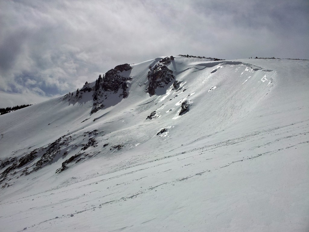
We then proceeded onto the glacier. It was quite steep and slippery but we kept on trekking. The temperature dropped sharply as we ascended higher and higher and large gusts of wind nearly knocked us over. The elevation also made the vertical climb much more strenuous. We really wanted to keep going all the way to James’s Peak but conditions were too rough and the risk of avalanche was real. Pictured below are views from on the glacier.
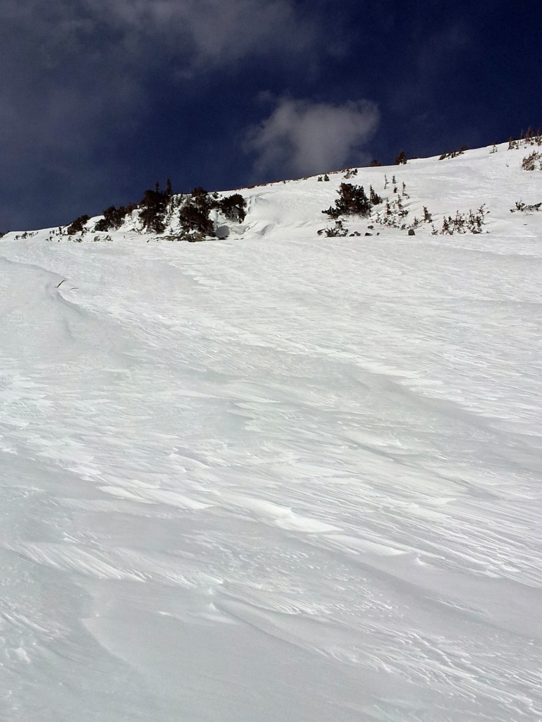

Overall, this a short but really nice hike. The trail that reaches the lake and base of the glacier is easy to moderate with a very short round trip distance of 1.5 miles and elevation gain of 430 feet. Once, you continue onto the glacier and then proceed towards James Peak, the hike become very difficult and strenuous. We are very anxious to come back this summer and trek to the top without oppressive wind and snow.
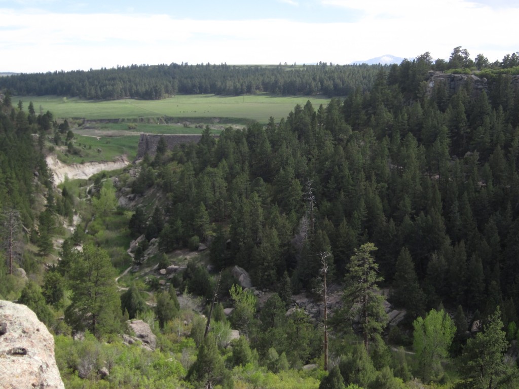
Castlewood Canyons State Park Hike
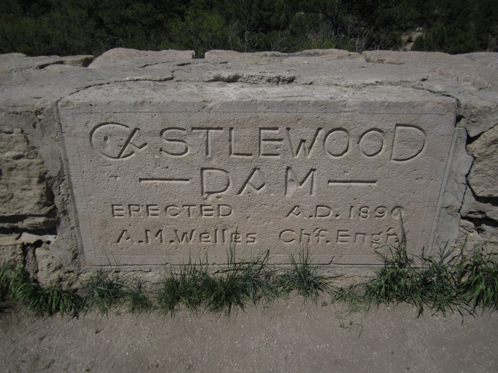
During the late 1800s, as the city of Denver began to grow rapidly, farms and orchards near Franktown helped to supply the city’s growing demand for food. However, due to the lack of precipitation (17-20 inches per year) a narrow dam was built in Castlewood Canyon just below Lake Gulch and Cherry Creek to provide a constant source of irrigation water. In addition to providing a valuable source of water, the area became refuge for the Denver city dwellers who frequented the area for hiking and camping along its shores as well as canoeing its waters. Many fond memories were made in those years up until the summer of 1933 when the dam came crashing down. Torrential downpours of rain flooded the area upstream of the dam for 4 longs days, bringing one of the worst floods the Denver area had ever seen. Billions of water were released, flooding the lowland plains sending over 5000 people fleeing. A compilation of eye witness accounts published by the Castlewood Canyon State Park describes the night as terrifying as homes, porches, and model T’s were uprooted. Some people had to hang on to telephone poles to survive.
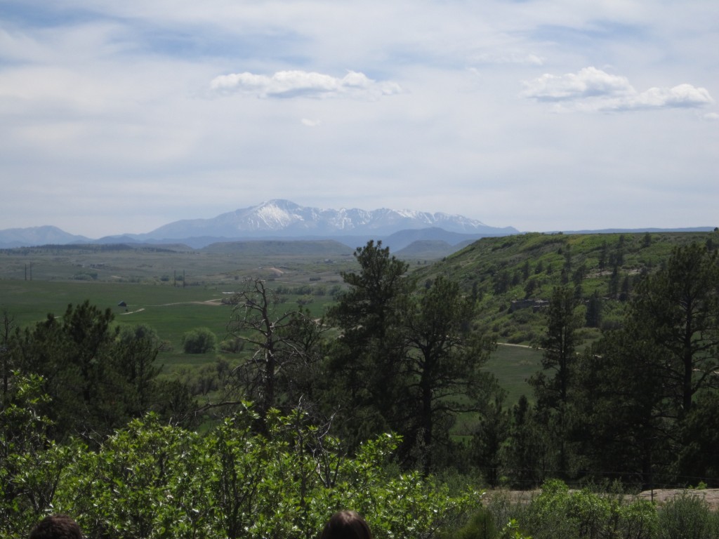
Today, the area is still quite beautiful with majestic views of Pikes Peak and surrounding meadows to be witnessed from the eastern cliffs hanging over the depths of the canyon as we discovered with our trek this time. We began the day by entering the Castlewood Canyon State Park, which is about 50 min. southeast of Denver. We parked at the Canyon Point parking lot and started our hike on the Lake Gulch Trailhead. This portion of the hike we would consider easy to moderate. It slowly winds downward into Cherry Creek covering about 0.8 miles. Along this portion of the hike, you can witness beautiful mountain views from Pikes Peak Amphitheater as well as the lush plains and grasses some of which are pictured below.
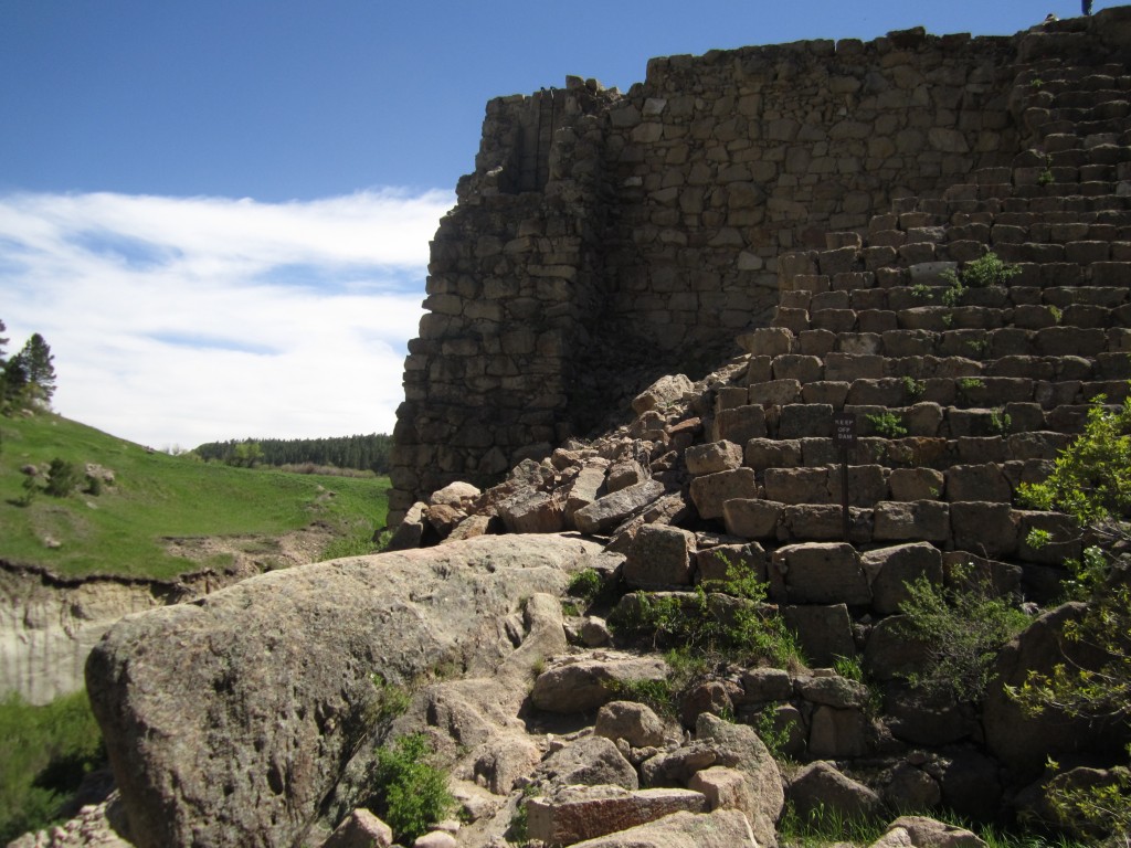
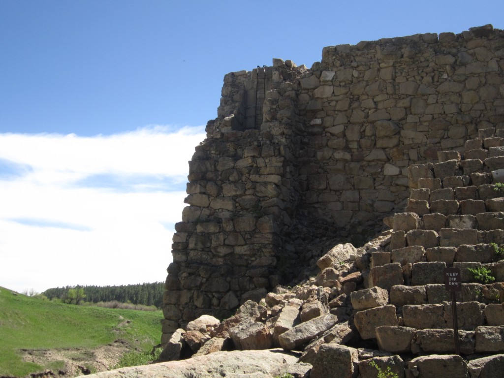
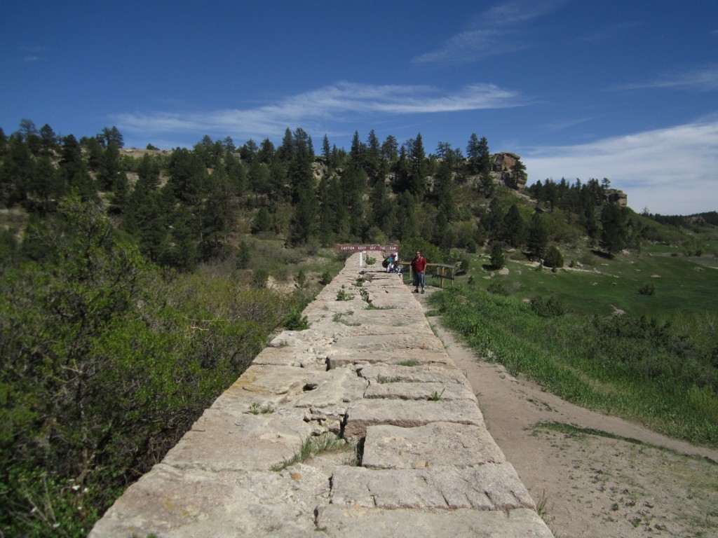
Lake Gulch Trail ends after crossing Cherry Creek via jumping over several large sandstone boulders. At this point, the trail junctions giving the option of a short loop around Inner Canyon Trail, a trek of the canyon cliffs via Rim Rock Trail or an up-close view of the dam ruins. We opted to continue onto the 0.33 mile Dam Trail to take in the very scenic ruins of this great catastrophe. What is left of the dam can be seen pictured below. In the top right picture you can make out the remains of a ladder running up from a large pipe at the base of the dam. The Dam trail winds upward to the top of the dam ruins before sharply descending down into the canyon.
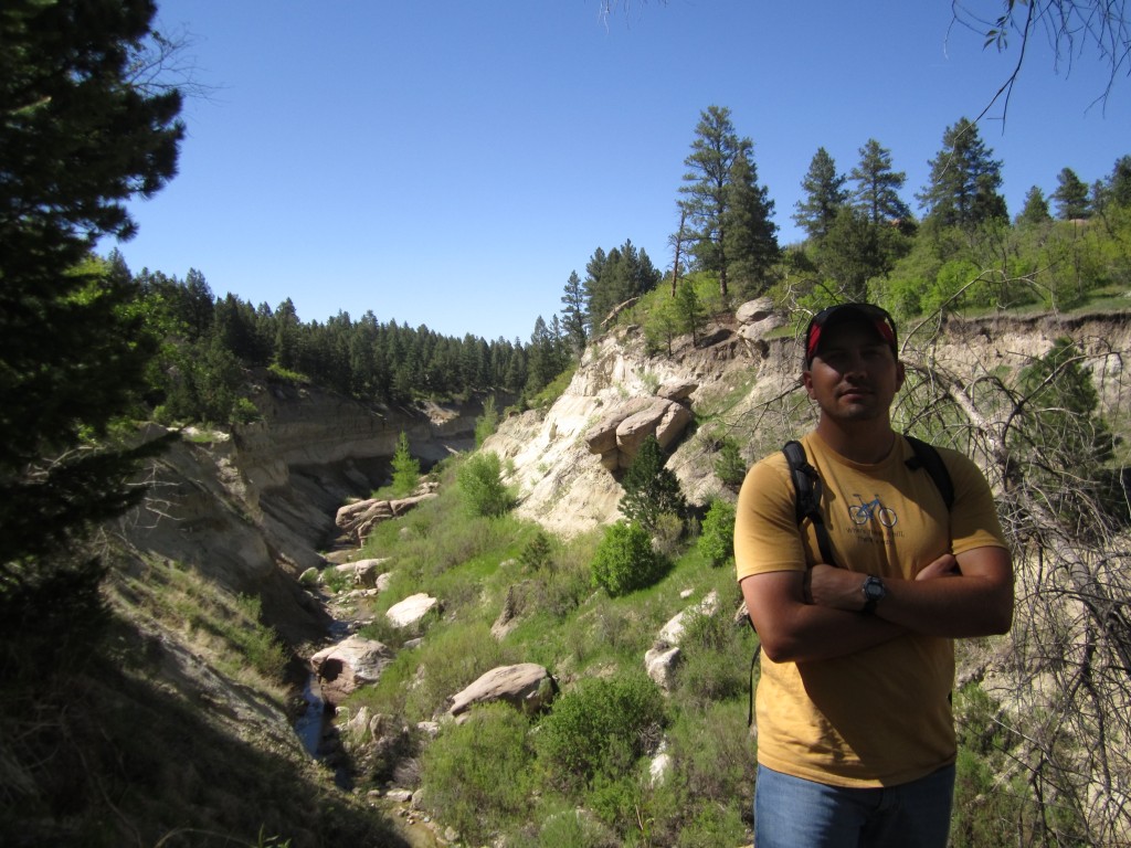
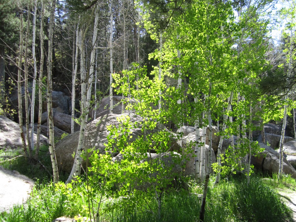
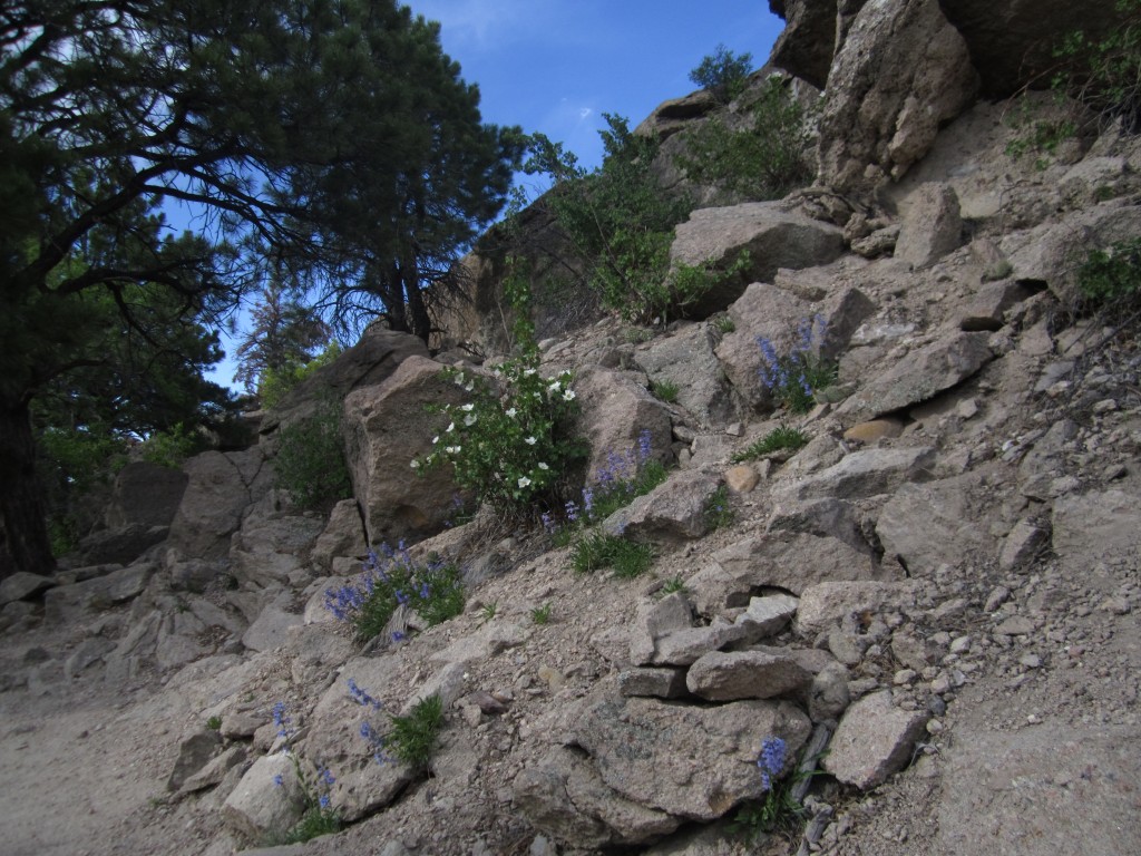
After exploring the dam area we began hiking the Creek Bottom trail which is about 1.7 mi. long. It is quite beautiful and has a dizzying variety of flora and fauna as well as many geological interests. Along this trail you can see the Castlerock conglomerate, which is a type of rock which is made up of many different types of rock, and also ashy alluvial deposits from ancient volcanoes. Many flowers were about including blue penstemons, purple loco plants, red paintbrush flowers, yellow alpine sunflowers, blue columbines, and some other unique flowers we had never seen before. We also ran into numerous species of trees including a glorious grove of aspen pictured below. Massive Rocky Mountain Junipers with their blue berries and Ponderosa pines gave us some shade and pine cones were scattered here and there as raptors and other birds flew overhead.
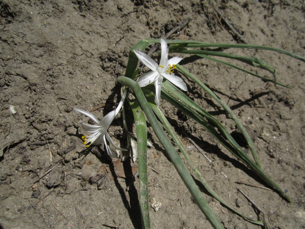
As we followed Cherry Creek we eventually hit the waterfalls. They were gorgeous, but we encountered one of the few dislikes of the trip here. Due to the fact that the west entrance of the park allows easy access to the falls area there were groups who were smoking cigarettes as they relaxed by the water. Smoking is prohibited in the park due to the risk of wildfire, but more than that it just made the experience here less than awe inspiring and we left without investigating the area. Pictured below is one of the falls where a couple was swimming, on the right Thomas standing in front of what used to be a massive ancient river, and below those is the aspen grove on the left and a sand Lilly on the right.

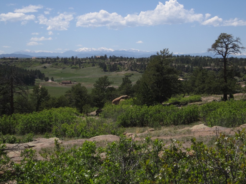
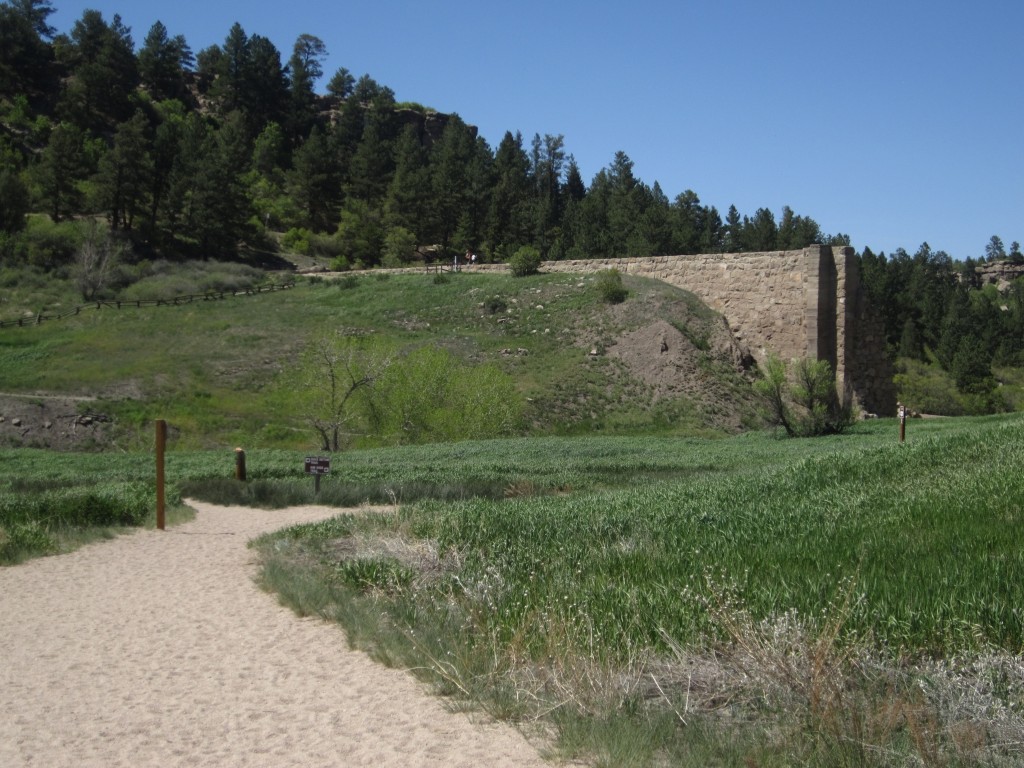
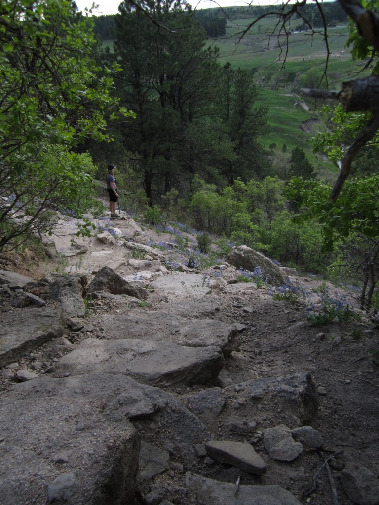
We found ourselves at the end of the Creek Bottom trail and decided to keep going onto the Rimrock Trail which is 2.14 mi. and rated as moderate to difficult by the park and intermediate by us due to the steep ascent to the ridge. We ascended to the ridge on the north side of the park and made our way back towards the dam. The trail treated us to plentiful views of the idyllic farms below, Pikes Peak, and the remains of Castlewood Dam off in the distance. We also ran into many prickly pear cacti, some of which were about to be in bloom. Below are some pictures from the Rimrock trail, including a view of the Castlewood Dam from the ridge on the bottom right.


Descending from Rimrock trail is a series of steep switchbacks that lead back to the Dam trail. It was an awe inspiring sight coming down with Pikes Peak in the background, the ruins of the dam in front of us, and flowers in bloom alongside our path. Once down we made our way back along Dam trail to the Lake Gulch trail and back to the trailhead. The pictures below are of the south descent we made from Rimrock trail.
Once back our hike was roughly 6.14 miles long and lasted about 3.5 hours. The elevation of the park ranges from 6,200 ft. on the Creek Bottom trail to 6,600 ft. on the Rimrock trail. Some special considerations to make are to bring plenty of water, since there aren’t any good rest stops along the way, watch for rattlesnakes as they used to be quite numerous (especially on the east side), and watch for poison ivy. We didn’t encounter any rattlesnakes, however, we did see quite a bit of poison ivy along the north side of the Rimrock trail. Lastly, flash floods are possible and when hiking the Creek Bottom trail be vigilant of the weather in surrounding areas as blue skies do not mean that it isn’t raining somewhere else. There is a fee to enter the park of 7 dollars (they do take cards) and make sure to put the permit in the car window!