Take a Walk
A Quest into the Wild
Land’s End at Los Cabos: Lover’s and Divorce Beach Hike
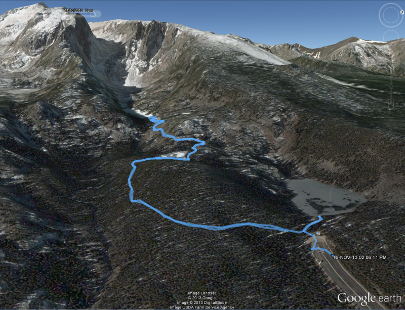
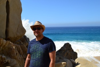
To celebrate our four year anniversary, we decided to head down to the Baja Pennisula in Los Cabos, Mexico. We stayed at the Solmar Resort right on the Pacific side of the ocean. While the rip tides were too strong to go swimming in the Pacific, this didn’t hinder us. Our location turned out to be absolutely perfect. It enabled us to go on a great hike along the beach and take a class 3 rock scramble to where the Pacific Ocean meets the Sea of Cortez. Seen below is a map of our trek.
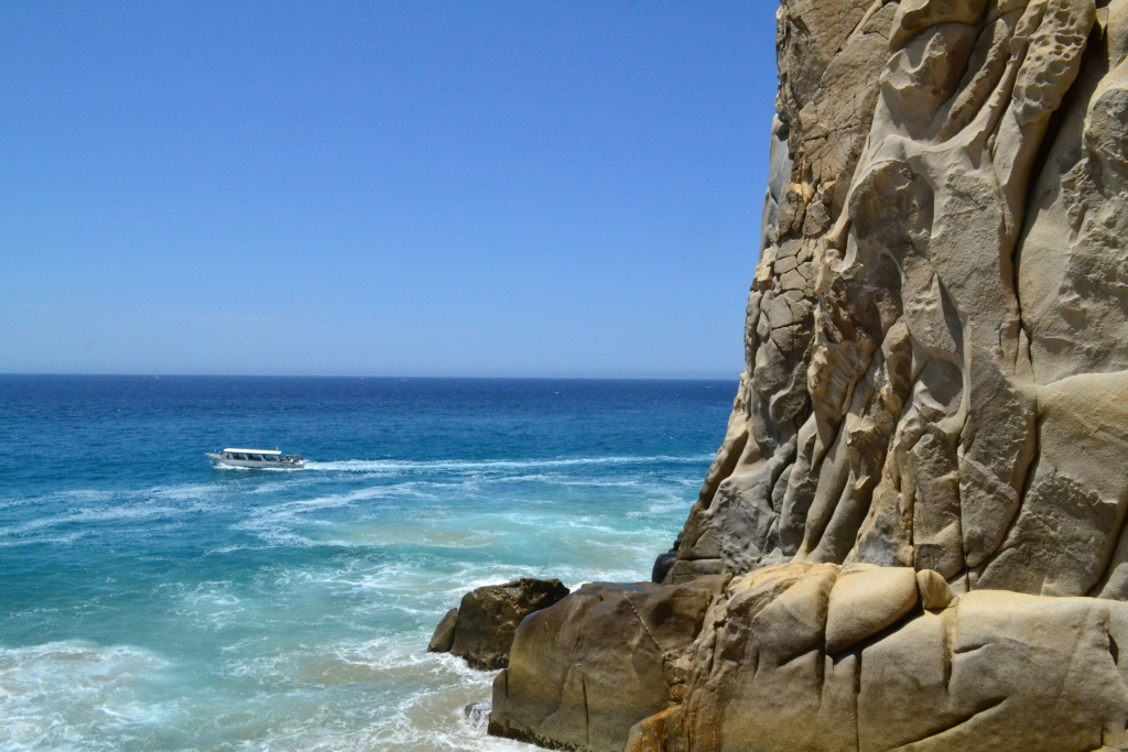
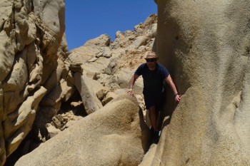
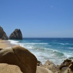
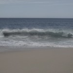
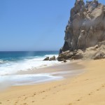
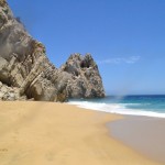
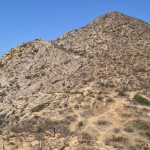
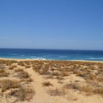
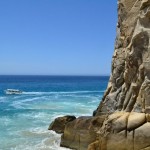
We began our hike right in front of our hotel overlooking the Pacific Ocean. For most of our stay the tide was quite high, and the waves came powerfully crashing into the beach. At one point, someone from the hotel on a four-wheeler warned us we were walking too close. Sneaker waves have been known to get people and suck them out to sea. We continued our hike heading south toward Land’s End, which refers to the rocky formations that comprise the southern most tip of Baja. After about a quarter mile, we reached the magnificent rock structures and our climbing entry point. Seen below are photos leading up to the climb and the Pacific side of Land’s End.
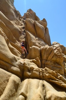
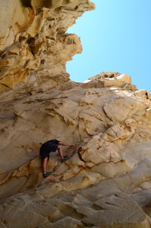
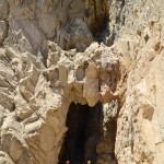
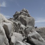
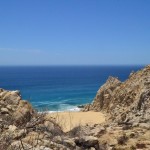
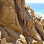
Upon reaching the rocky outcrop, we began our climb up the slick taffy-colored rock. This part is of the hike/climb was, for the most part, not too bad. The only issue was the abundance of sand layered on the rocks from high tide which made traction difficult. Once we reached the top, we began a descent toward our secondary climbing point of entry. Hopping down from boulder to boulder led us to a small beach inlet and Pacific water rushing wildly toward us. In times of low tide, it is actually possible to forgo a secondary climb and simply walk in the sand over to the famous Divorce Beach. When we were there, the safer route was to climb rather than risking the dangerous rushing water. Seen below are photos of this inlet and the beginning of our next ascent.

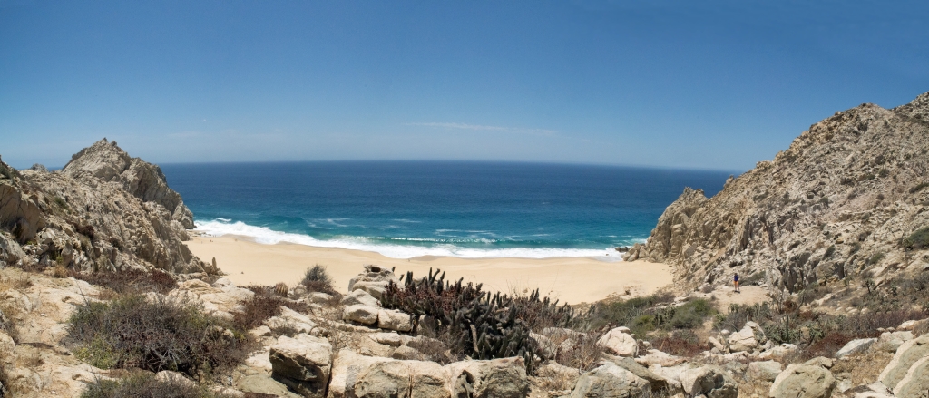
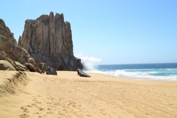
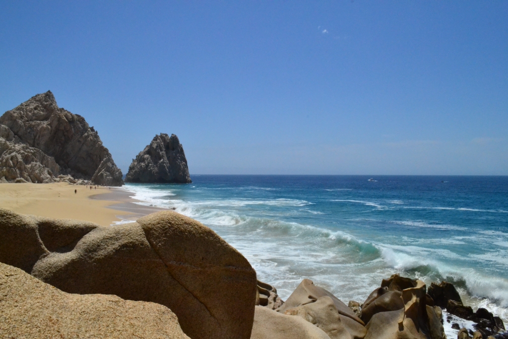
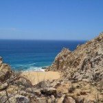
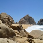
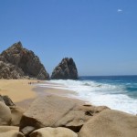
After climbing and bouldering on the descent, we were rewarded with our first views of Divorce Beach. Though spectacular, this beach is still on the Pacific side and off limits to swimming. This is actually why the beach is named Divorce. The locals say, “if you are unhappy with your partner, encourage them to take a swim…problem solved”….Seen below is Divorce Beach.
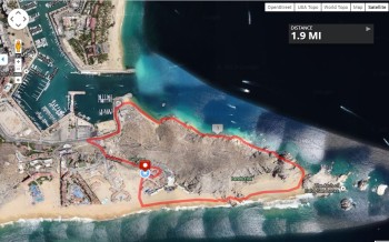
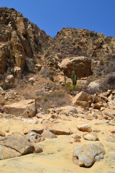
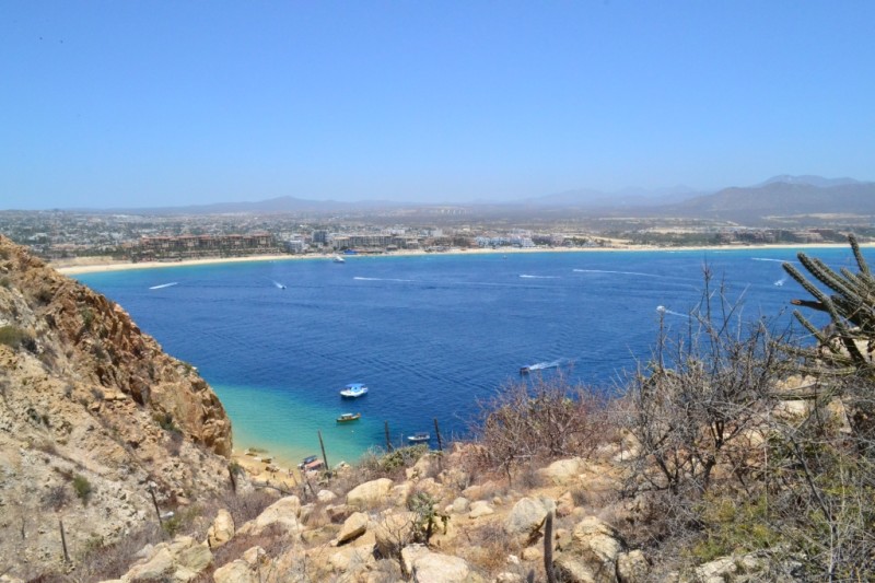
 On our second hike here, we made a detour and took a hiking trail that leads up a steep hill that overlooks the marina and town. It was 97 degrees outside with no shade when we made this attempt, so it was a bit challenging due to the extreme UV as well as loose scree. Once we reached the top, we were rewarded with sweeping views of the marina and Sea of Cortez. Seen below are photos leading up the trail and from the top.
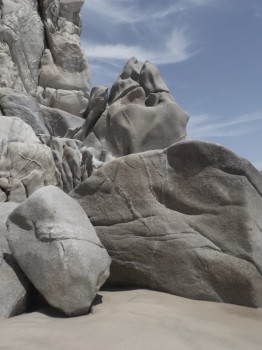
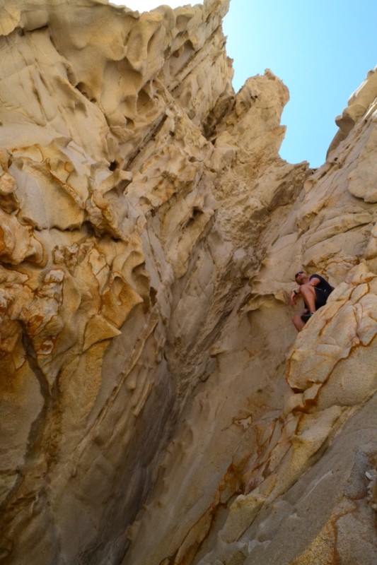
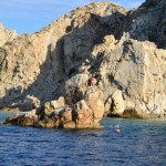
When the heat became too much, we quickly descended and headed toward a shady region in the form of a partial cave. This cool little inlet of granite allowed us another opportunity to play on some rocks while we cooled off a bit in the shadows. The formations are so unique, it is difficult from the photos and angles of the sky to determine which way is up or down. Seen below are photos of our rest break.
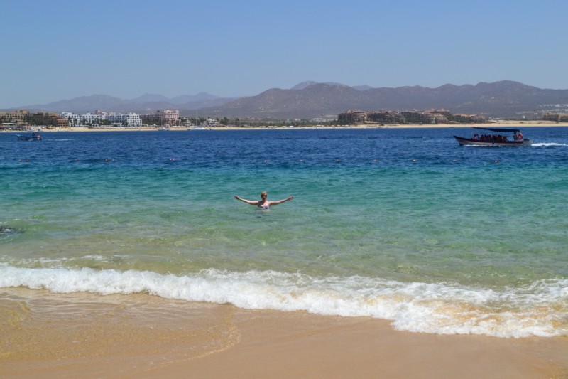
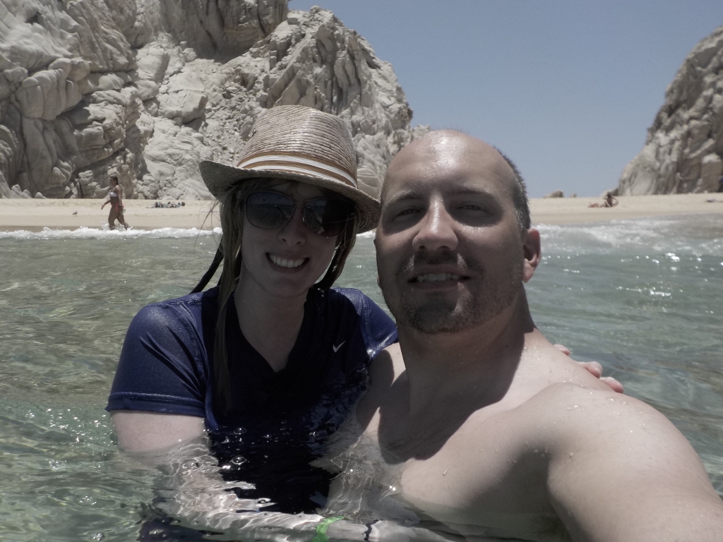
We then proceeded to the famous Lover’s Beach on the Sea of Cortez to finally get to jump in the cool water. There were more people on this side of the beach, as water taxis frequent the area to drop sun bathers and swimmers off for an hour or two. This is, in fact, the more common method to reach Lover’s Beach. Some of the locals seemed shocked that we climbed our way over to bliss. The water was cool and refreshing and crystal clear. We swam toward a large rock that was covered in pelicans. The water was deep here and snorkeling gear would have been perfect. Seen below is a “selfie” of us floating in the sea and Lover’s Beach.
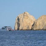
![]() On our first day on this route, we made a loop back toward the hotel by following Lover’s beach and then the rocky coast to Pelican Rock and eventually a local beach which took us to the marina. This route is shown in the map and was about 2 miles long. The second time we did this hike, we made the climb back the way we came to save time. Overall, this was a truly unique beach experience enabling us to explore a desert meets sea landscape unique to the California Baja Peninsula. The abundance of rock randomly situated in areas of long flat beach was intriguing to the eye. Los Cabos was a wonderful trip and allowed us to do our favorite things all in the same day: hike and relax on the beach.
On our first day on this route, we made a loop back toward the hotel by following Lover’s beach and then the rocky coast to Pelican Rock and eventually a local beach which took us to the marina. This route is shown in the map and was about 2 miles long. The second time we did this hike, we made the climb back the way we came to save time. Overall, this was a truly unique beach experience enabling us to explore a desert meets sea landscape unique to the California Baja Peninsula. The abundance of rock randomly situated in areas of long flat beach was intriguing to the eye. Los Cabos was a wonderful trip and allowed us to do our favorite things all in the same day: hike and relax on the beach.


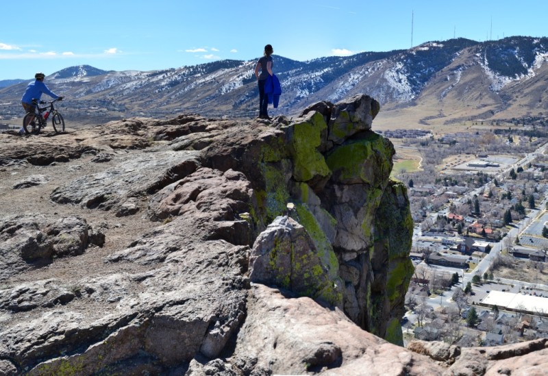
South Table Mountain Golden, CO; In Memory
Last week I lost a very special person. Evelyn, my sweet granny said goodbye to us one last time. And as my heart breaks, I console myself with my precious memories. I am reminded of how blessed I am to have had 29 years with such an amazing person.
Growing up, I can’t say with conviction that I looked forward to weekly piano lessons. Honestly, the saving grace of the experience was getting to go to Granny’s house after school and sneak in a few extra minutes of last minute practice. She would always get us an afternoon snack and sit in the piano room listening. Whether we were perfecting a piece or struggling to hit the right notes, she was there pushing us to do our best and try.
Years down the road, I gained a strong appreciation of those lessons particularly when I got the joy of listening to Chopin or Schumann of my own accord on some old ivory keys, at a friend’s house perhaps, or maybe an old cafe. Even once, I was asked to play in a famous coffee shop in Vienna, the Café Sperl, which in fact was a travel destination recommended by Granny. Before I embarked on my first European trip, we sat down together and went over the must see points of interest. I debated Venice or Vienna for a week long side trip, and with much certainty she said I must visit Austria! I took an overnight train from Germany and my best friend and I awoke to a city of old- world beauty and elegance. We saw Schonbrunn Palace and wandered the exquisite summer gardens. I was so utterly thrilled to be following in Granny’s travel footsteps.
To me, Granny embodied the absolute definition of culture and sophistication, attributes that I grew up striving to achieve and embrace as she had done her whole life. Visits with Granny through the years for me involved taking afternoon tea, absolutely in English fashion and discussing travel, school, and everything in between. In 2007, I graduated from Centenary College and joined the alumni ranks along with Granny. Education was so important to her, another common thread between us. Last year, I donned cap and gown to receive my PhD. For this very important day for me she was there. It meant so much to me. I hope she knows that she played such a large role in helping shape my education and path.
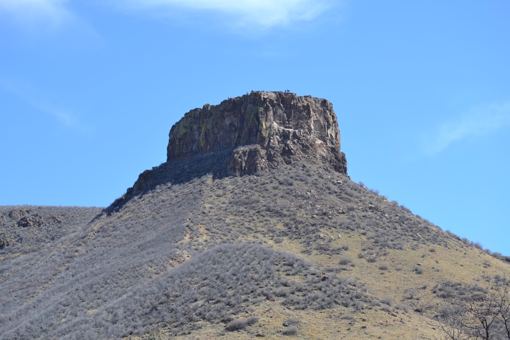
I found out Sunday morning that she had quietly left us in the night. I wasn’t sure what do to. Sadness and darkness overcame me in stark contrast to the brilliant sun that engulfed Colorado. In her honor, Thomas and I decided to climb somewhere beautiful. She loved travel, nature and photography, all things that we embrace too. We ventured outside the city to South Table Mountain in Golden, CO. The climb was short but very steep. When we reached the top, the beauty and immensity of the views brought tears to my eyes. Granny is in a better place now. I feel that in my heart. I like to think that it looks something like our travels.

Enchanted Rock State Natural Area: Fredericksburg, TX 11/27/13
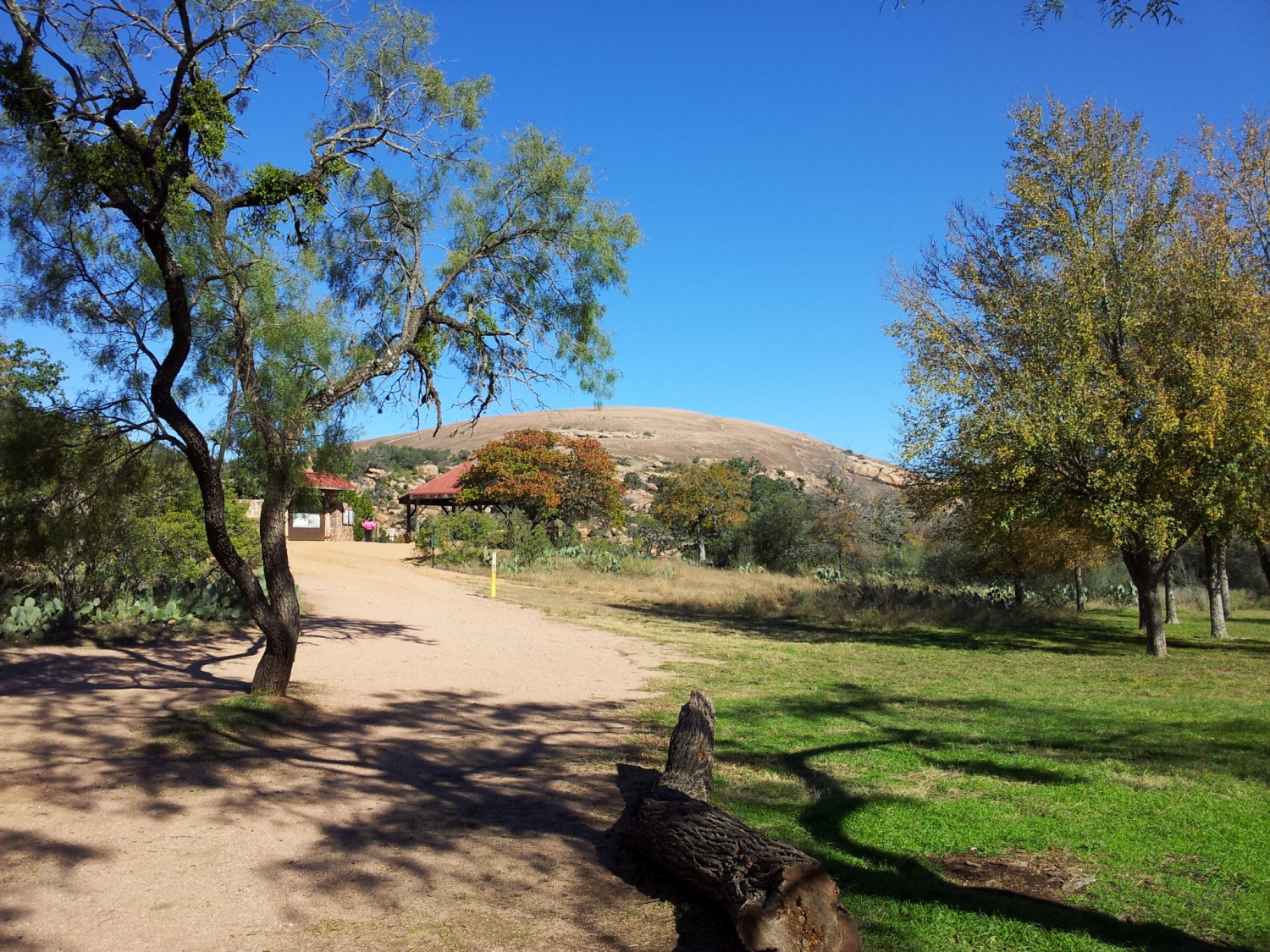
Oh, where does the time go. I ran across the start of this post from 2013. For the Thanksgiving holiday that year we headed down to Austin, Texas, to reconnect with friends and family. While there, we decided to go hike Enchanted Rock, which was one of our first dates back in 2008. It would appear, that we intended to make a post about it, but never finished it. I happily found the stub of a post and picked it up today.
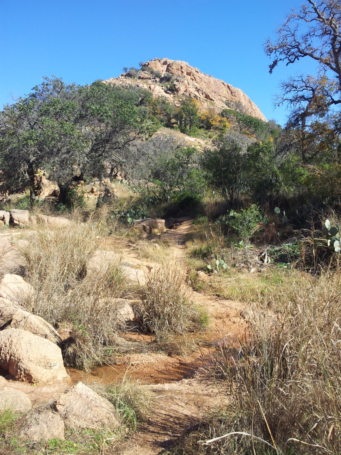
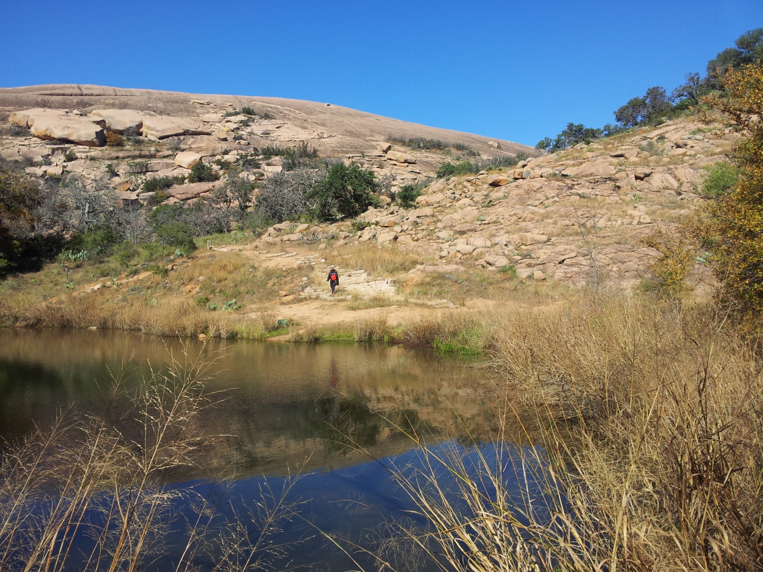
Enchanted Rock is the second largest granite monolith in the country and has a summit that sits at just above 1,800 ft. It is no 14er, but the rich history and beauty of the Texas hill country makes this a very popular hike. Humans have been living at Enchanted Rock for around 12,000 years, and the Apache used the granite to mill their grains, which can still be seen in the park in areas called bedrock morters.
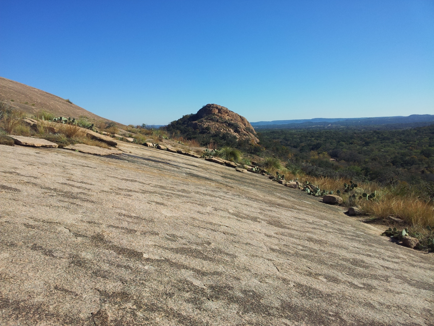
Enchanted Rock holds a special place in my heart, not just because Allyson and I went here early in our relationship and it is one of our first hikes together, but from learning how to rappel and camp here as a child as well. Today, from what we read online, it is very busy and frequently closes due to capacity. So arrive early and plan accordingly. It can also get very hot in Texas, and the summit trail is climbing a rock and therefore has no shade. Depending on your ability, it could take anywhere from 5 minutes to 45 minutes to climb up to the summit. It is a mere 390 ft. of total elevation gain, and it is barely more than half a mile one way (0.67 miles). But there are always people taking rest breaks. But hiking around Enchanted Rock isn’t about “bragging rights” or a sense of some physical feat, it is just pretty. But if that isn’t enough for you, then there is climbing. Enchanted Rock has trad climbing that ranges from 5.4 to 5.11a. In some areas there are bolts for draws, but it is mixed sport and trad at best in those places.
Summit Trail
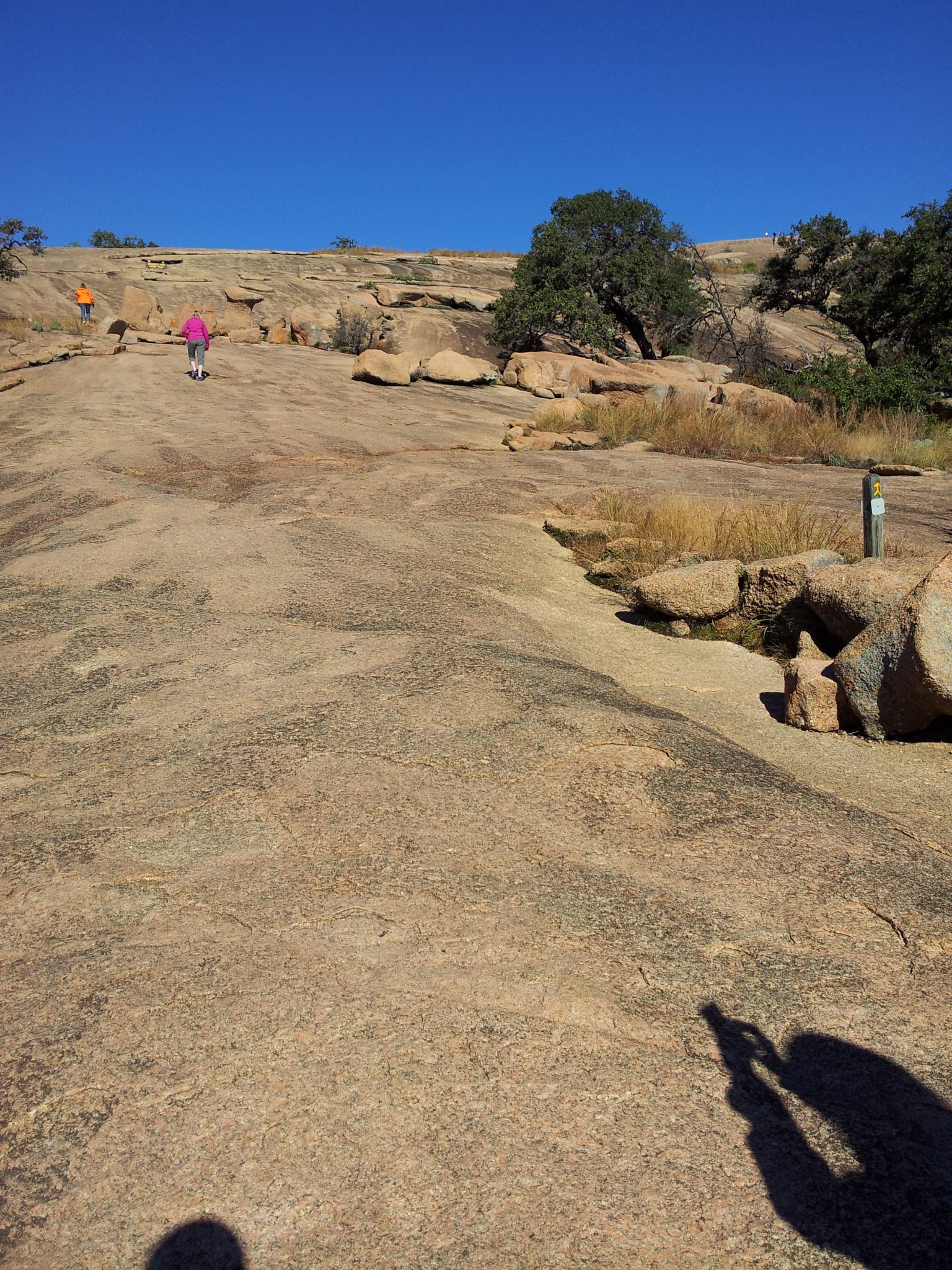
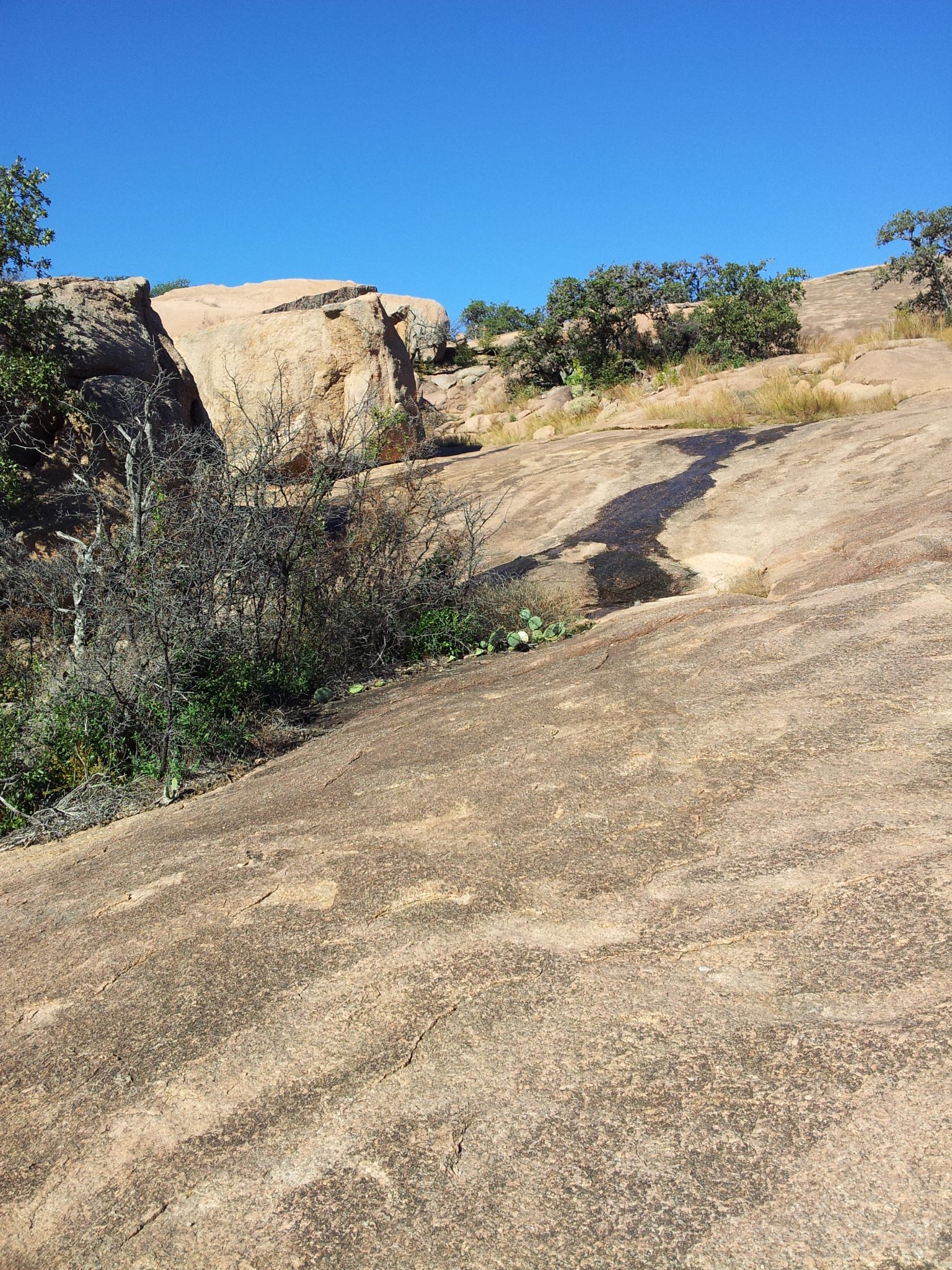
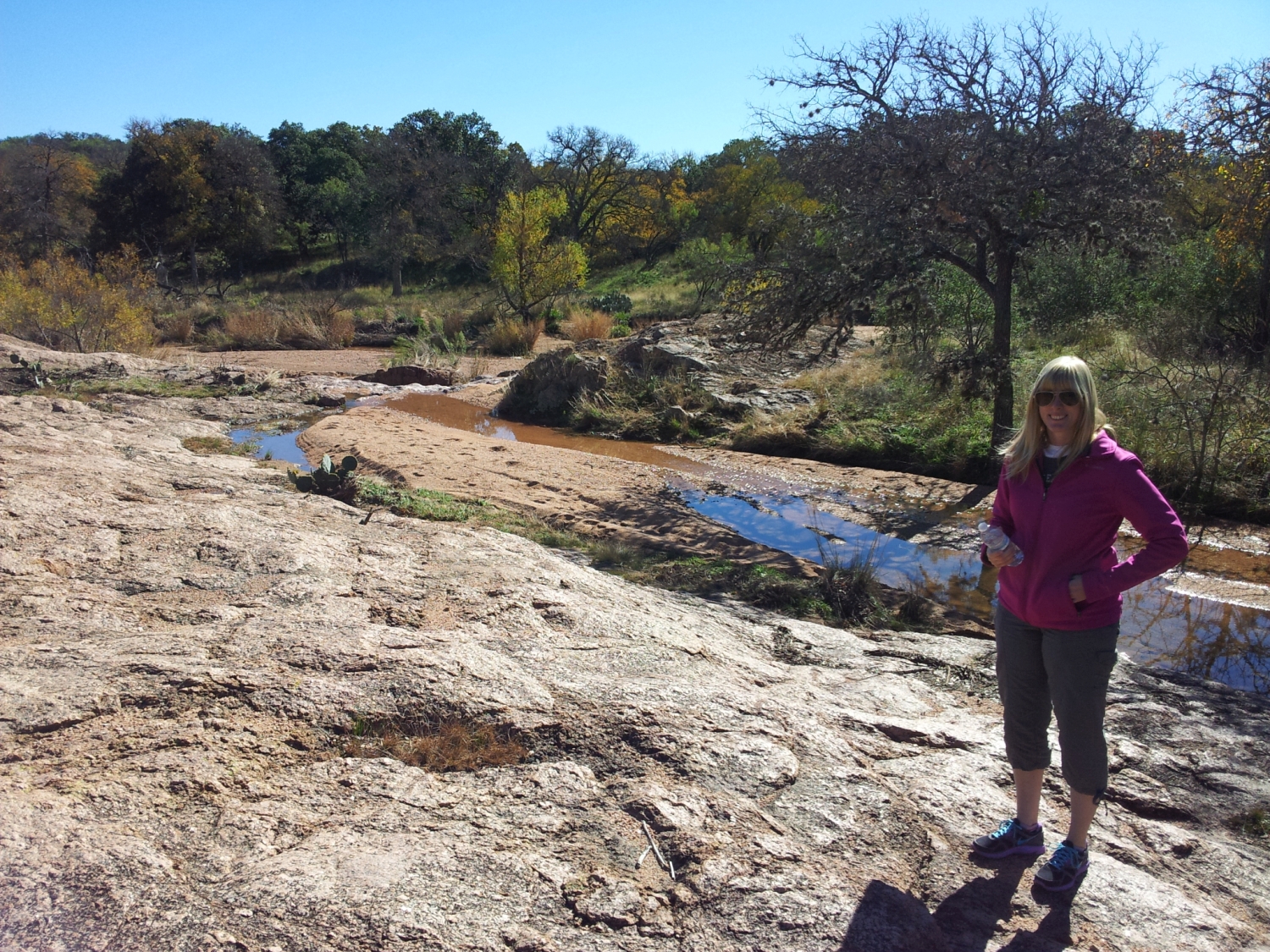
As you can see in the photos above, you are relatively exposed to the elements on a slab of pink granite. So, make sure to pack water and sunscreen, perhaps wear a wide brimmed hat, in the summer. It can get very hot out there; but, since the trail is short with minimal elevation gain, you can make a pretty quick escape if need be.
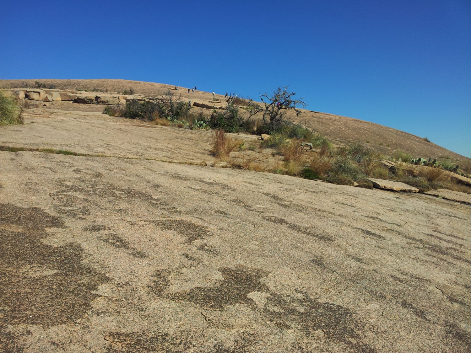
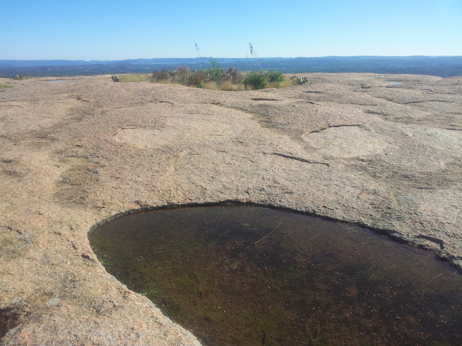
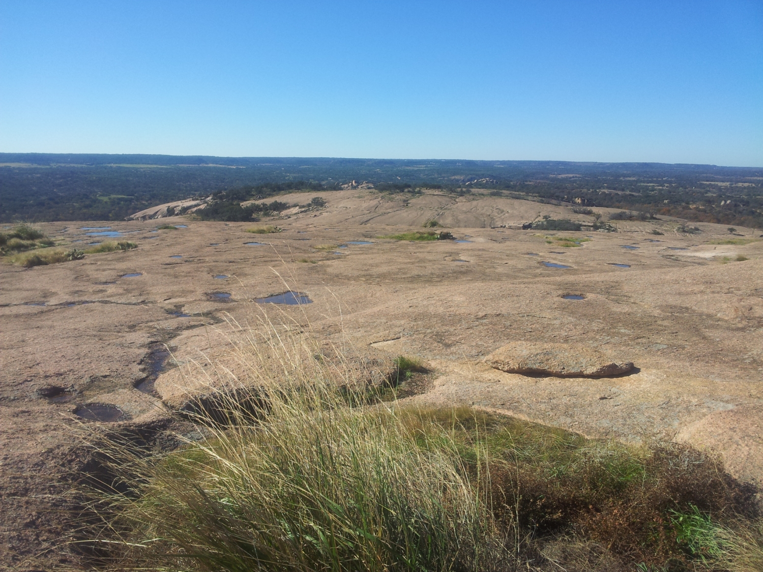
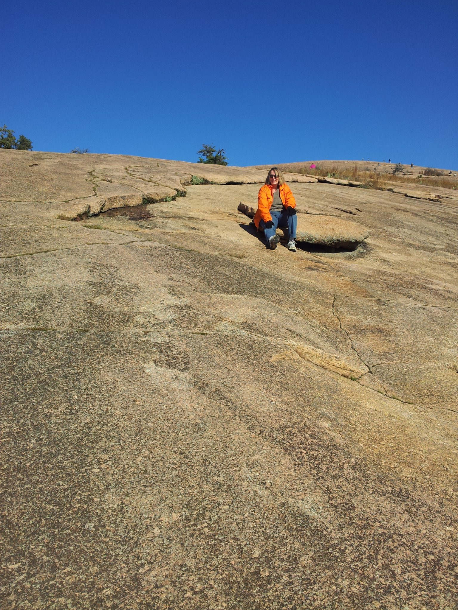
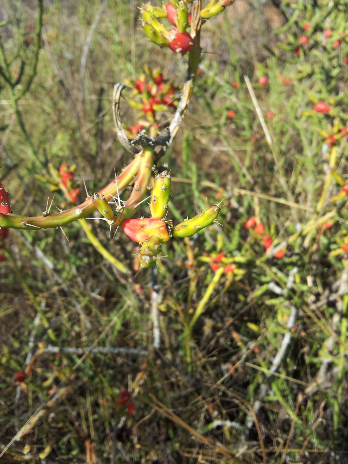
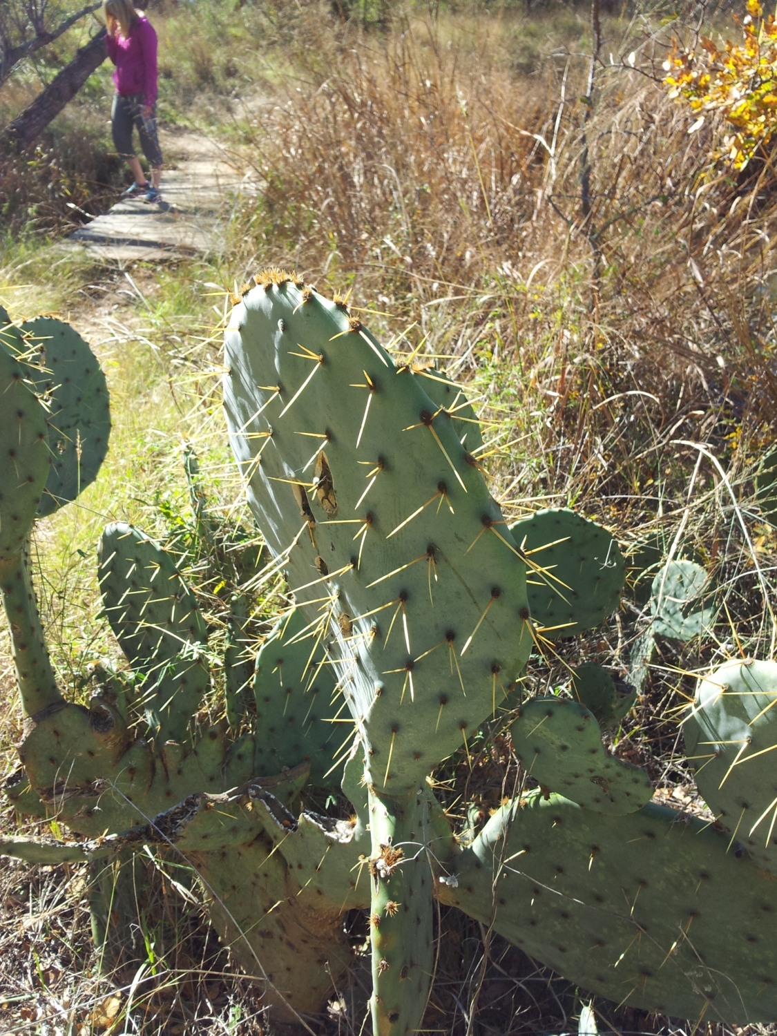
The “summit” is — as you can see above — just as exposed as the hike up. Small pools in the rocks crevices offer little miniature ecosystems to examine; and, the views of the hill country are stunning. Take your time to enjoy the rock — just make sure you are respectful of others and of nature. They say that those with evil intent will be cursed.
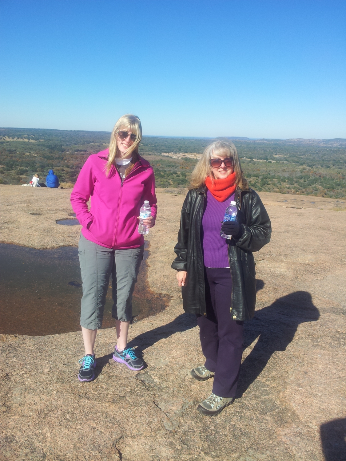
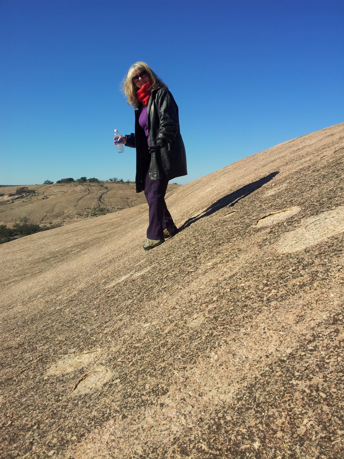
You can see in the middle picture the steepness of the hike, but the rock grips well and it isn’t scary. There really isn’t any exposure to speak of either. The leftmost photo shows Linda Checkley and Allyson on the summit. And the rightmost photo shows I believe the trail up to Turkey Peak.
Exploring
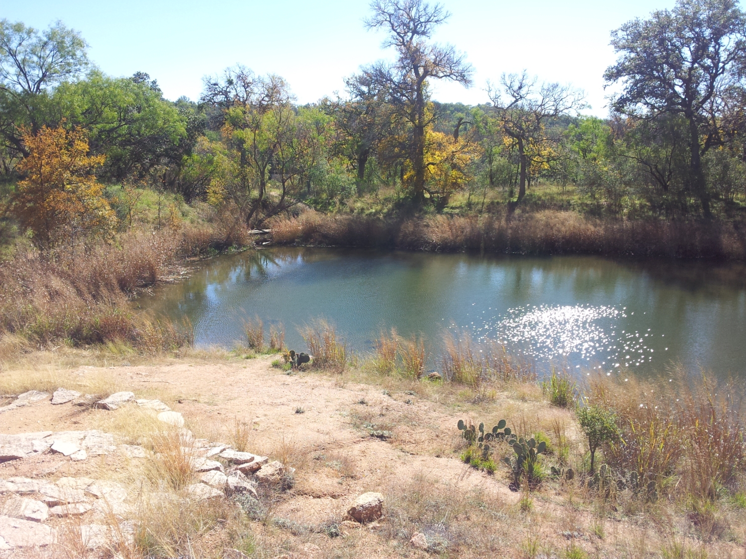
Here we are exploring the creek and what I believe is Moss Lake below. There are extensive opportunities for wildlife and plant viewing. But, if you really want to maximize your viewing then camping is the best route to go. The stargazing combined with the wildlife activity you will see in early morning is worth it.
As a final note, the park if famous and has been very popular over the last decade or so. Make sure there is space by calling ahead and even try and plan going on a weekday.
That’s all for now.
Nymph Lake, Dream Lake, Bear Lake: RMNP 16. Nov 2013
“In every walk with nature one receives far more than he seeks.”
— John Muir
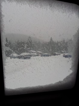
A few weekends ago, Will came to visit us for the first time since he moved away this summer to New Jersey. One of our favorite places to go with him while he was here in Colorado was Estes Park and Rocky Mountain National Park. With Hwy 36 reopening ahead of schedule allowing access once more to Estes Park since the floods and Will in town, we decided it was the perfect weekend to visit, hike and do a little shopping and dining in this cozy, perfect little piece of Colorado. We left Denver around 9:00 am and headed up into the mountains. We should have checked the weather a little closer before we left. When we arrived in town, a steady snow fall began to cover the town and surrounding landscape. Our team is not one to shy away from an adventure so nonetheless we headed into the park via the Beaver Meadows visitor center entrance and proceeded another 10 miles to the Bear Lake Parking lot. As we drove deeper into the park, the snow came down heavier, blanketing the road and our car. We finally made it to the parking lot and joined a few other hikers, park rangers, and one determined family posing for a snow filled holiday Christmas card picture. (kids, dogs, Christmas sweaters!). Seen below left is a photo taken from the window of the car before we braved the outside world.
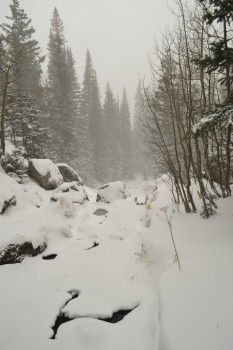
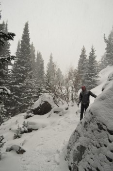
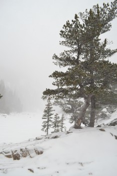
We conjured warm thoughts and left the warm car for the snow. We began our hike at the Emerald Lake Trailhead. The trail led us slowly up a gentle incline for about 0.6 miles to Nymph Lake. The snow was still falling quite hard and the trail was very icy in places so we took it slower than normal. We saw a few people returning to the trailhead at this point, but no one else was going out when we did. When we reached Nymph Lake, it was in stark contrast to our images of it from this summer. The yellow and green of the lily pads and flowers resting on the cool lake’s surface were replaced with white and gray sheets of ice. The snow that continued to fall began to accumulate on the icy frozen surface, further hiding the water from our view. We paused a few moments to take it the views but were too cold to linger longer. We continued around the small frozen lake for another 0.7 miles towards Dream Lake. The snow was not deep enough to require snow shoes at the beginning of the trail, but some yak trax would have been helpful for icy portion of the hike. As we got further away from the trailhead, and as snow continued to heavily fall, it did become harder to travel as well as see the trail. There did not appear to be any markings on trees to guide hikers in winter conditions. However, it did add to the excitement and feeling of solitude which is seldom found during summer months near Bear Lake. Seen below are photos of the trail between Nymph and Dream Lake.
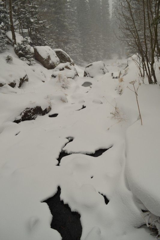
As we approached Dream Lake, we all took a moment to enjoy the silence of the winter mountains. The only sound was our breathing and the wind, carrying with her the snowflakes that came to rest on our coats and the tips of our noses. It was truly a magical experience. We looked in all directions and could only see the trees and white powder. Dream Lake was again, similar to Nymph Lake, and only revealed a few remnants of its summer splendor in the form of a narrow creek draining from it. We crossed the creek on a small wooden bridge and could faintly hear the gurgling water that had not yet frozen. Seen below is the creek near Dream Lake.
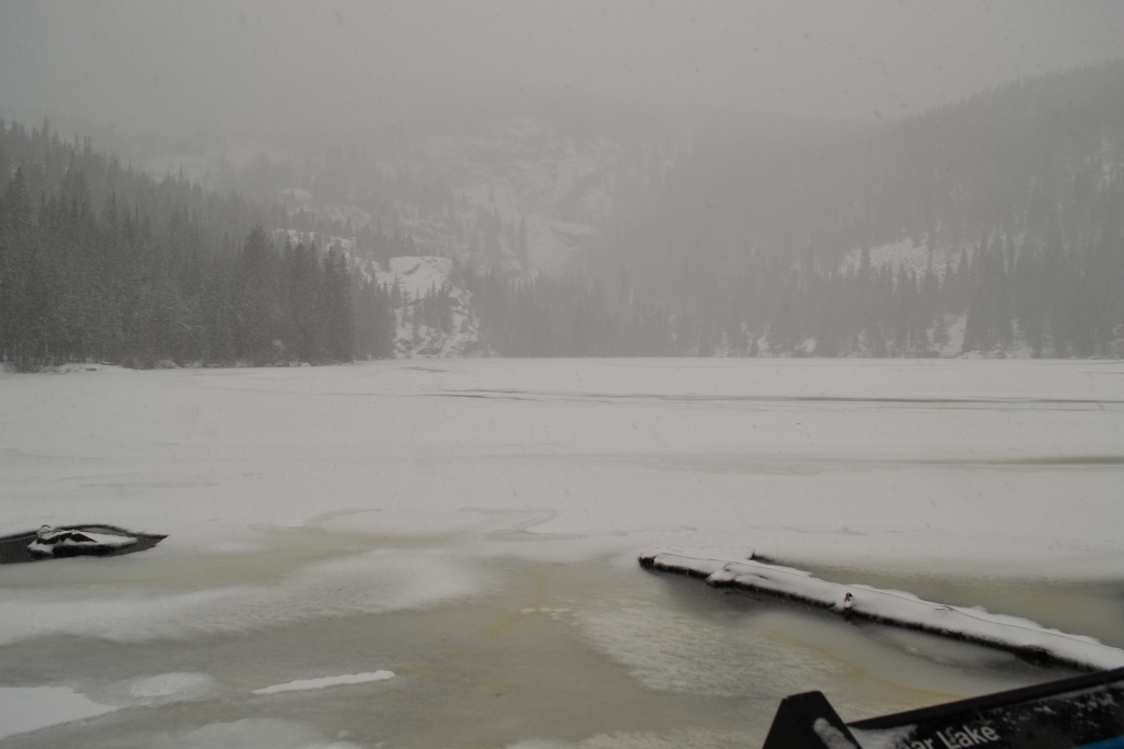
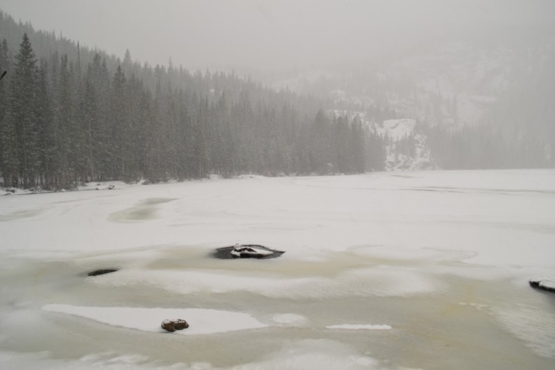
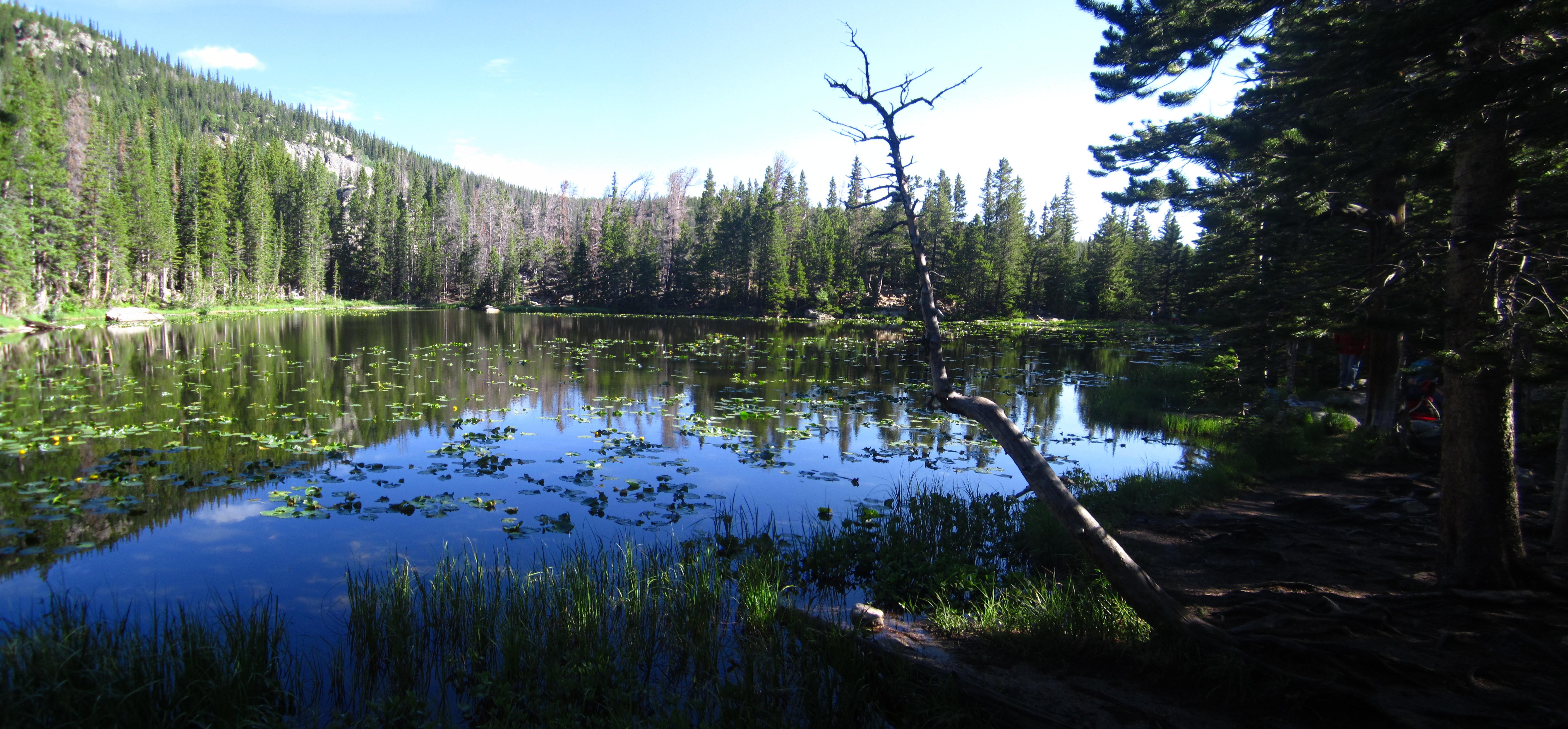
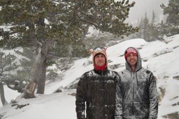
After Dream Lake, (and a snow dance by Will) we opted to return back to the car. Our hair and eye lashes began to freeze and we were losing site of the trail. We returned the same route we came. As we approached the trailhead, we made one small detour to the famous and popular Bear Lake. It was so beautiful and quiet. Bear Lake is never quite. It was nice to experience the large majestic alpine lake without the busloads of people in the summer. Seen below are photos by Bear Lake on the left and Dream Lake on the right.
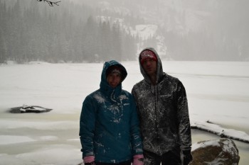
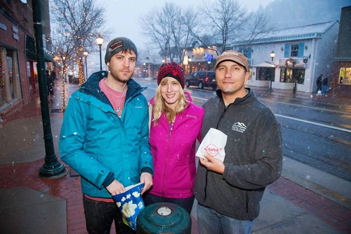
At this point, we were ready to return to Estes Park and grab a hot chocolate. We first stopped by The Red Cup Paperie and Coffee and got some of the most delectable hot coco we have ever had. We wandered around shops and bookstores and grabbed more snacks and treats. It was really great to be back in Estes Park! Seen below is a photo snapped of us by a local photographer posted on the Joint Photographer Estes Park Facebook page. Notice all the snow still falling around us.
We finished the evening up at the iconic Stanley Hotel enjoying drinks and appetizers and then sadly finished up our day in Estes Park and headed back towards Denver. It was a fantastic experience hiking in winter conditions and has given us hope for keeping up with some snowy hikes in between skiing this season.
Summary
Distance: 2.3 miles (out and back) Elevation Gain: 708 ft (total…not bad for a blizzard)
Max Elevation: 9,928 ft Min. Elevation: 9,446 ft