Take a Walk
A Quest into the Wild
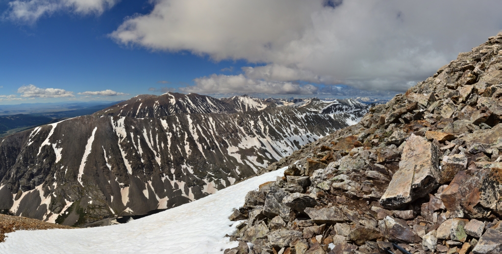
Grays and Torreys Combo (Standard Route)
Distance: 8.52 miles (out and back) Elevation Gain: 3,640 ft (total gain)
Max Elevation: 14,278 ft Min. Elevation: 11,225 ft
A couple of factors made us get into the X-terra at midnight, drive out to the Grays-Torreys trail-head, and start hiking to the summits at 2 in the morning. For one thing, Grays and Torreys are argued to be the most popular climbs in Colorado. They are easy to access from the major metro areas of Colorado (Denver, Boulder, and Colorado Springs) and are just off I-70. They are also relatively easy climbs and afford amazing views. Because of this there can be throngs of people in a veritable conga line all the way up. So there was that.
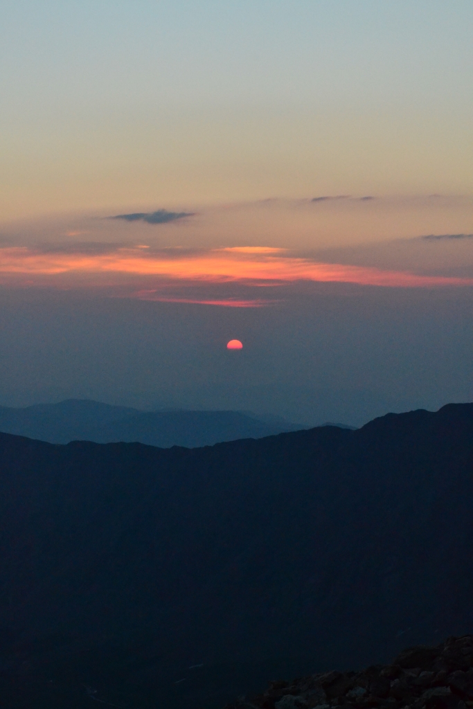
We also wanted to watch the sunrise at least once from a 14er. So why not from the top of Grays? The added bonus of missing the crowds just made it that much sweeter. And so there we were at 2 am with headlamps and bleary eyes staring off into the darkness. We started officially at 2:15 am.
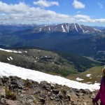
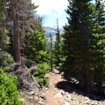
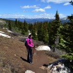
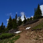
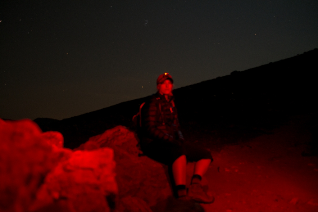
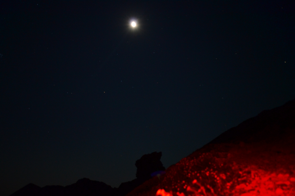
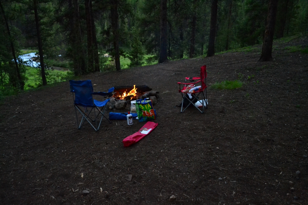
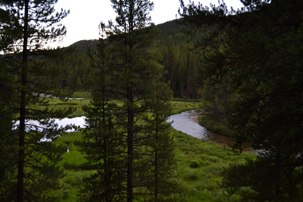
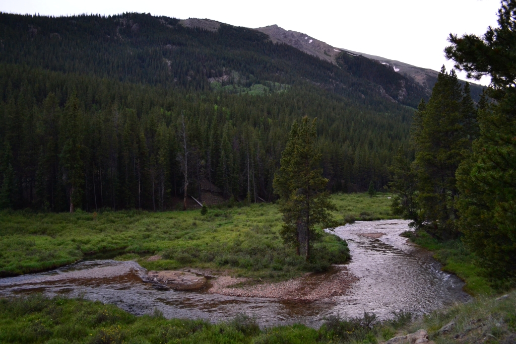
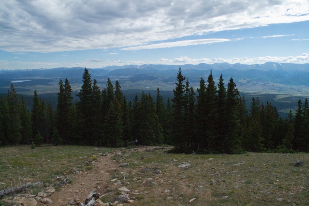
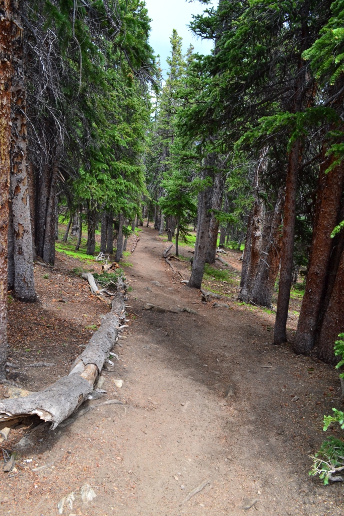
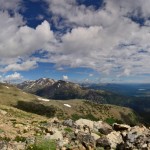
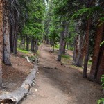
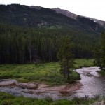
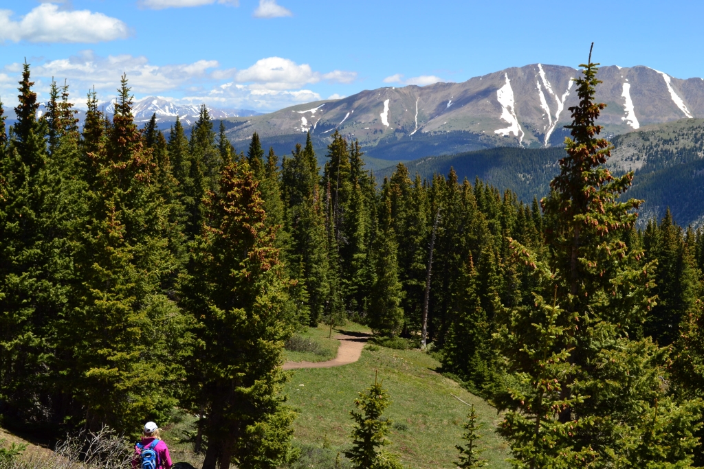
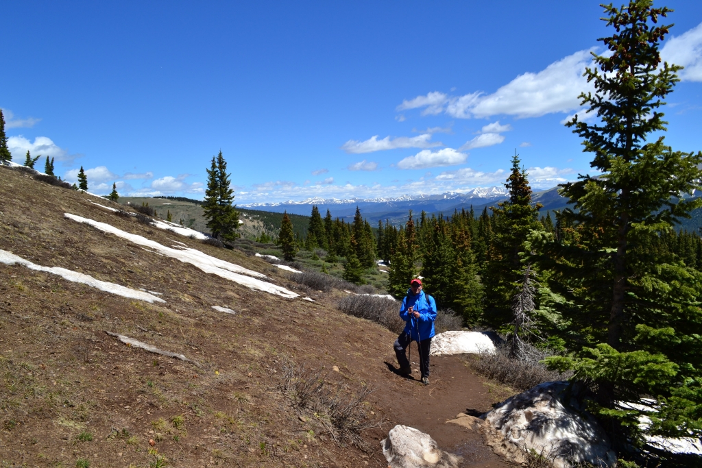
Even though it’s summer here it can still be chilly in the mountains, and since the trail-head starts at around 11,225 ft. we were wearing a few layers, and our breath was clearly visible in the light of our lamps. Beginning the hike we just set our lamps to low red light and admired the stars, beauty, and stillness of the night. We made quick work of the willows and even quicker work of the open area in the basin before the real climbing began. Below are some pictures from our night hiking.


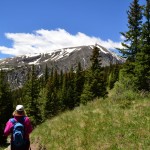
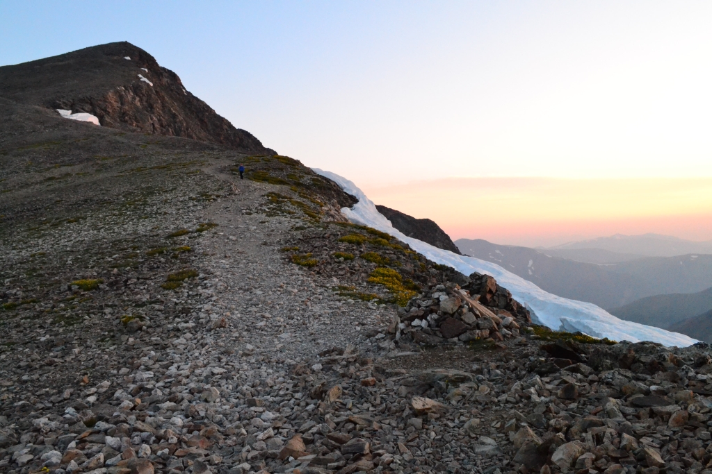
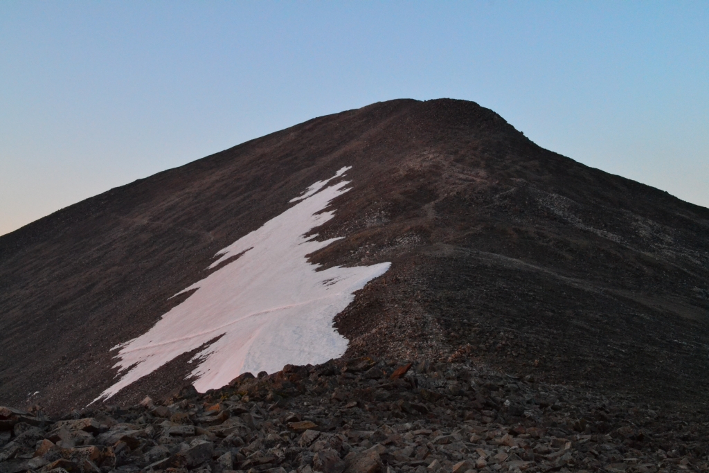
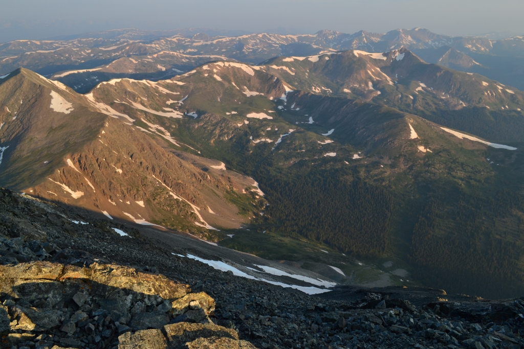
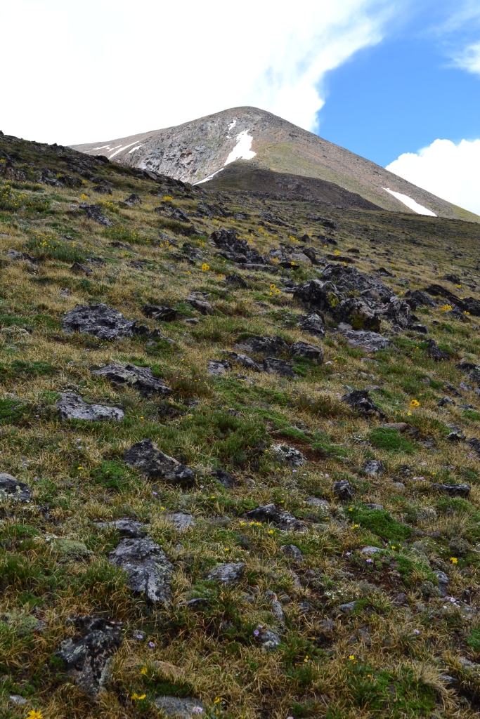
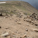
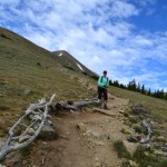
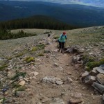
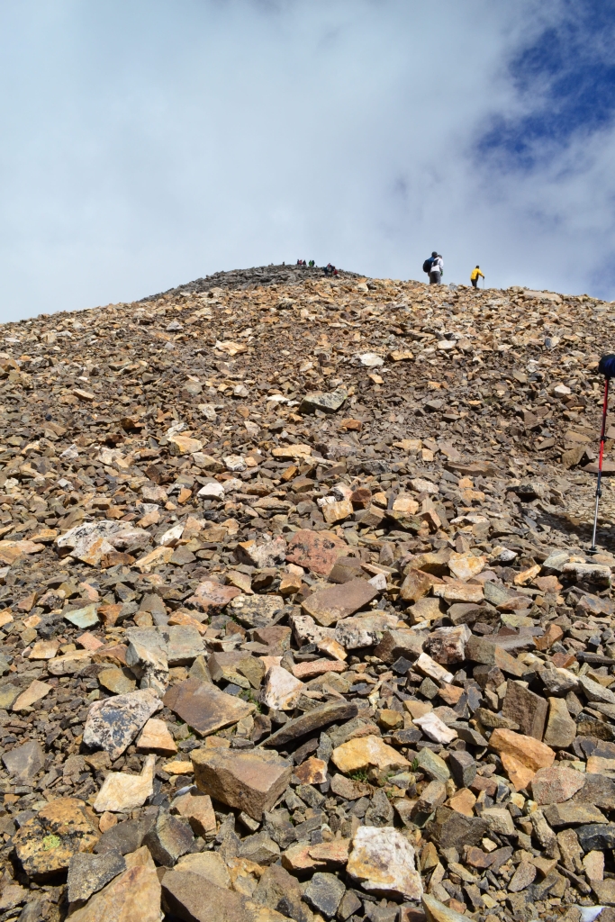
Around mile 2.5 the most challenging part of the hike begins. The trail gains roughly 1,180 ft. in 1 mile. It’s not the Manitou Incline or anything, but it is steep, and the rock can be loose. After this section (2.5 – 3.5 miles into the hike) you are at about 14,000 ft. and are nearly there. The summit of Grays sneaks up on you quickly and you think, “Wow, I’m here already?”
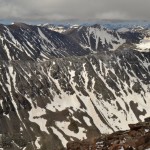
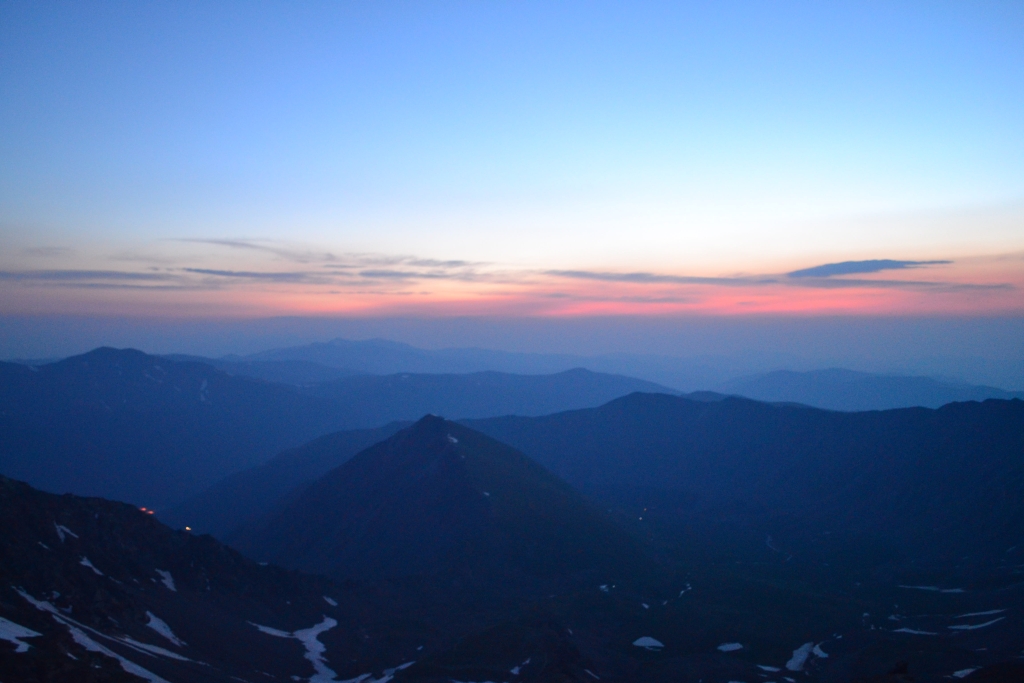
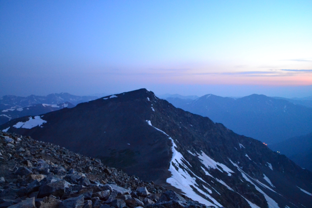
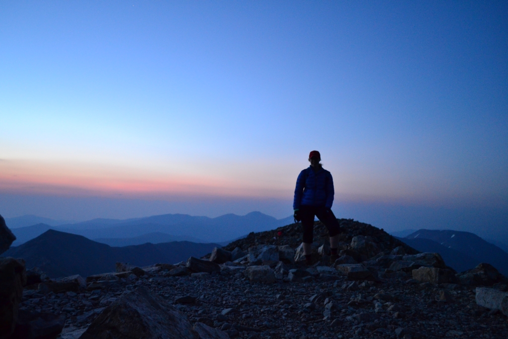
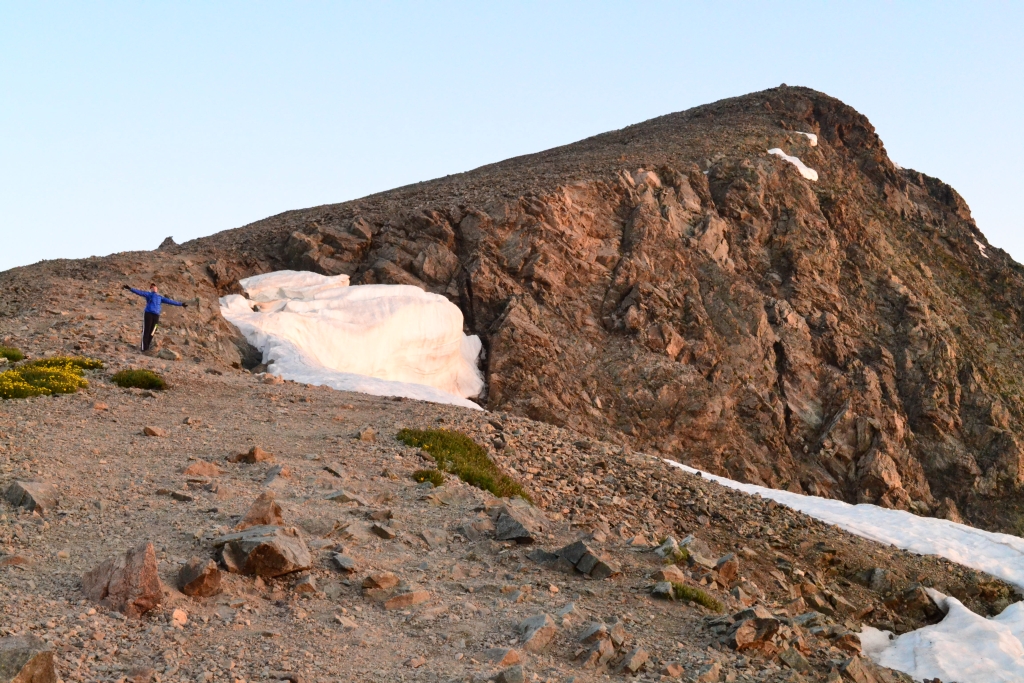
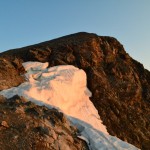
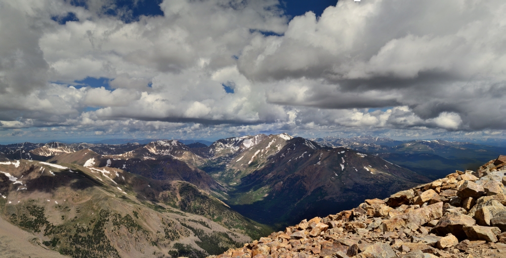
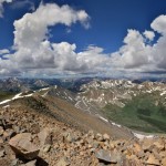
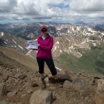
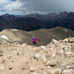
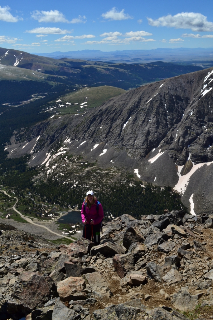
When we arrived on Grays’ summit it was roughly 5:10 am. There was a faint glow of light to the east as the sun hinted that it was ready to rise. We cuddled on the peak for warmth and to hide from the wind as we waited for Sol to make his appearance. Sadly, it was a little chilly and we decided we’d seen enough of the sunrise for now — we needed to move. We began the 600 foot down climb into the saddle and towards Torreys. Below are a few images from the predawn Grays summit.

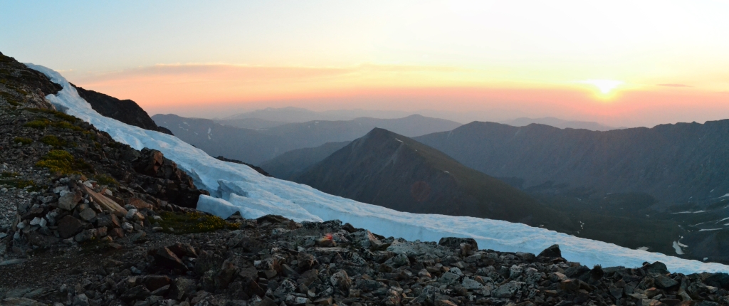
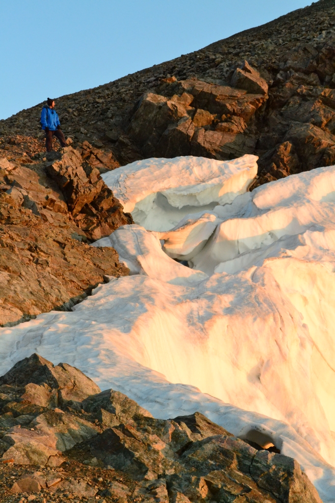
As we headed down the saddle between Grays and Torreys we excitedly remembered throwing some hand warmers in the packs. The wind wasn’t horrible, but it was enough when combined with the temps in the mid-30s, to chill our fingers even with light gloves. Towards the trough of the saddle we looked to our right and saw the sun for the first time. It looked like a ball of fire glowing in the dawn. Here are a couple images of that scene.

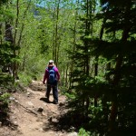
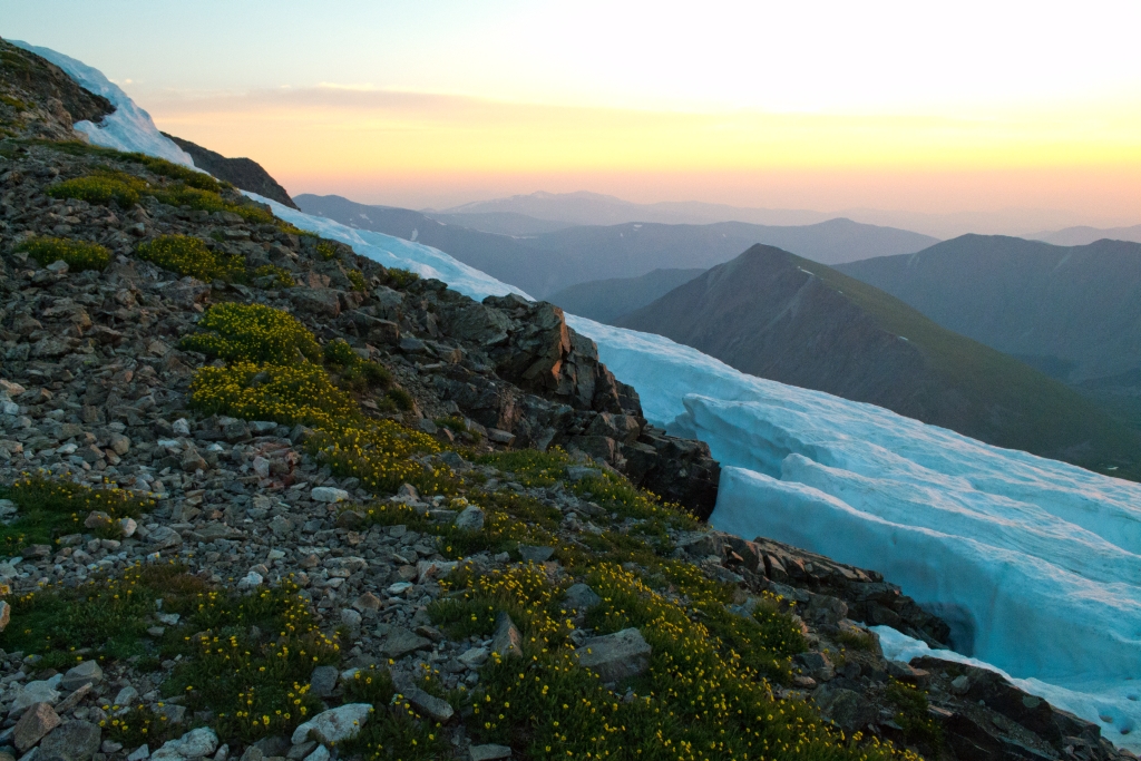
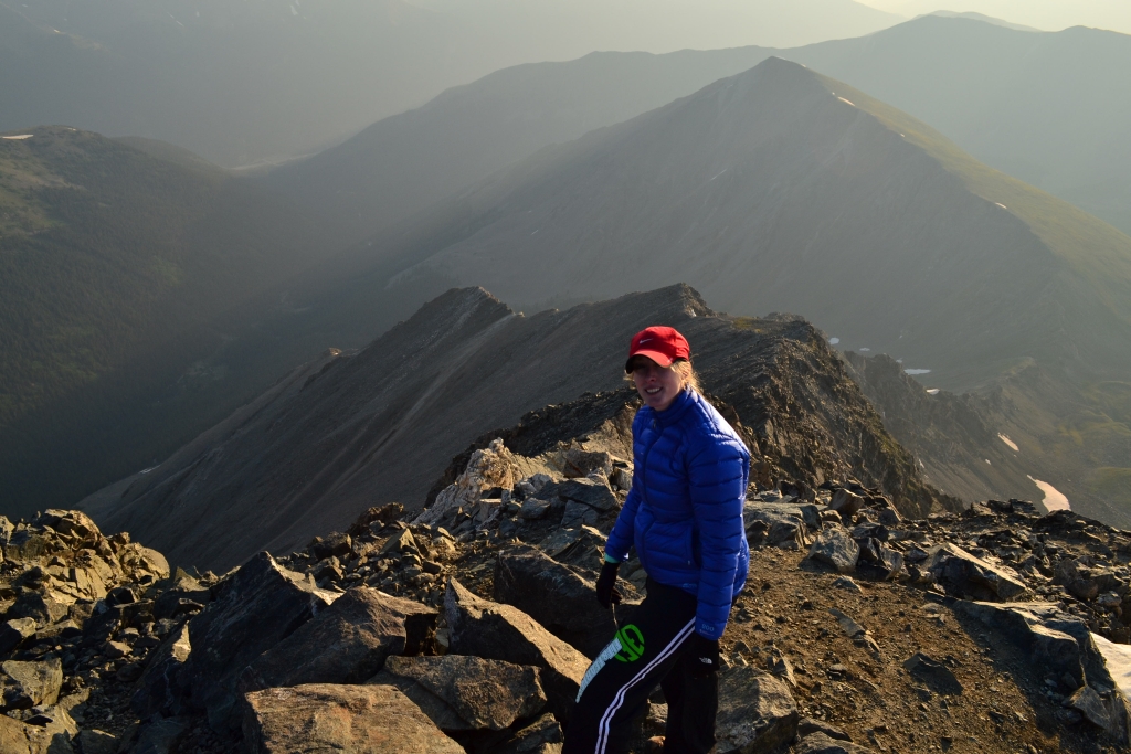
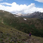
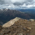
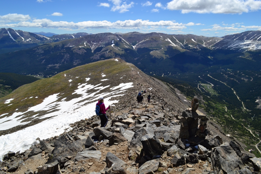
As we crossed the saddle the light was amazing. The pink glow from the sunrise reflected off the snow, the rock, and even the plants to make all of nature appear at once similar and different than we’d ever seen it before. We stopped frequently on our way up Torreys to admire the beauty all around us. Below are a few pictures from that hike up Torreys.
As we continued to head up Torreys we were just having too much fun not to take a few more pictures of the splendid scenery around us. Here are a few more pictures from about midway up Torreys.

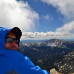
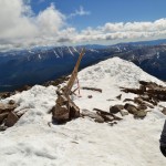
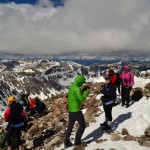
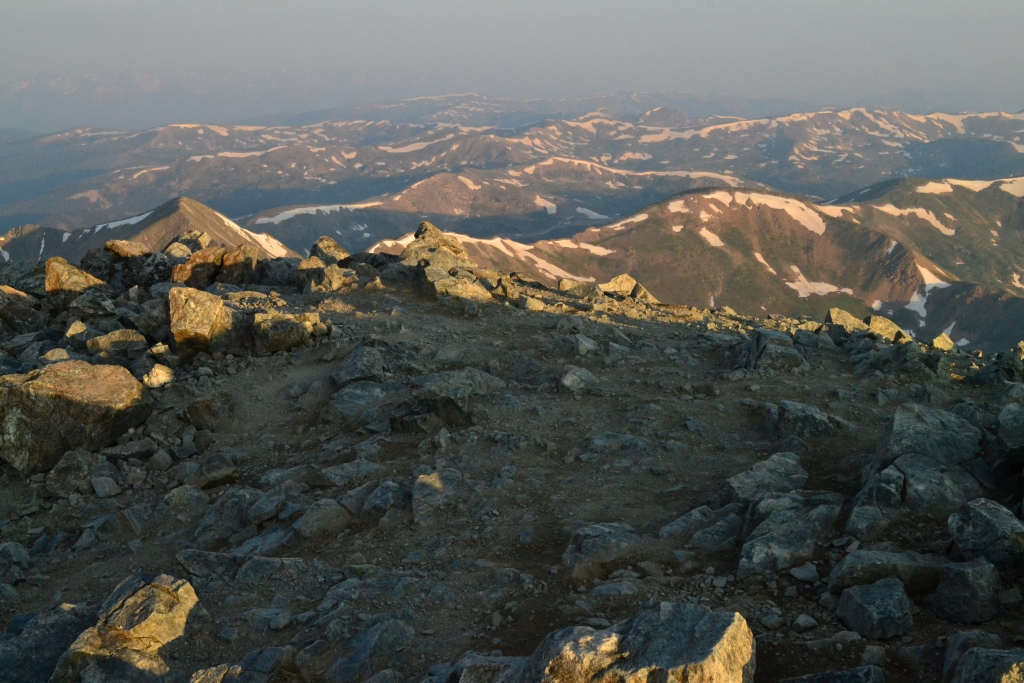
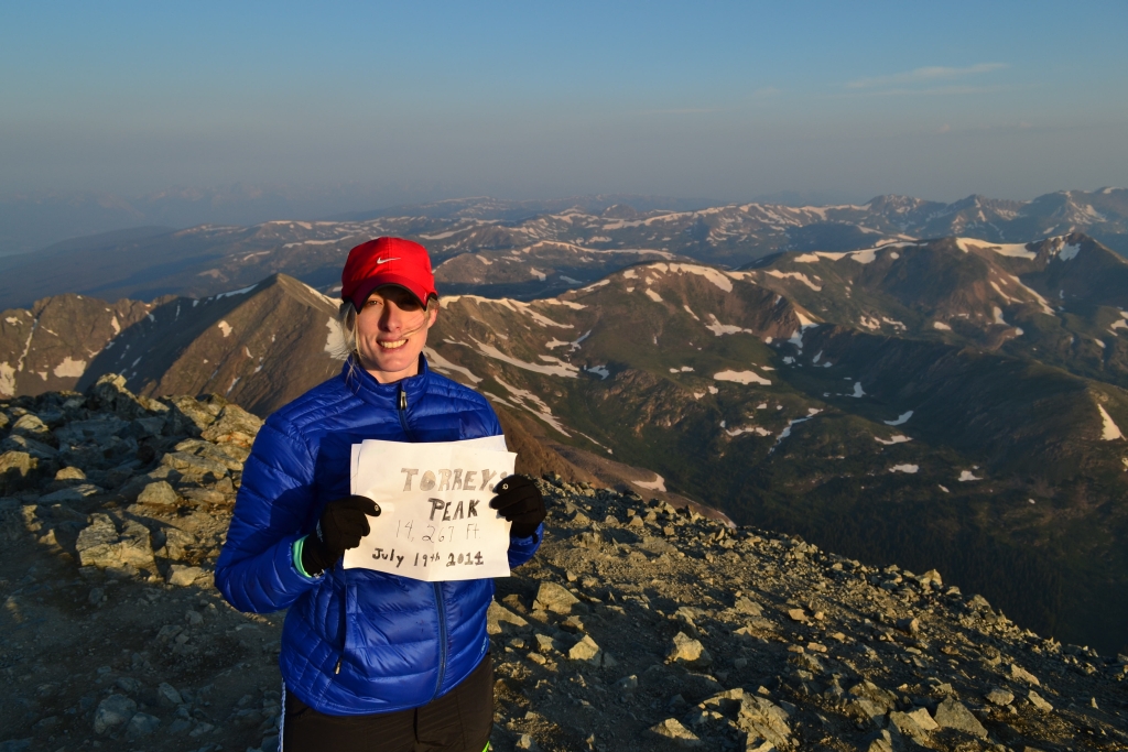
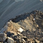
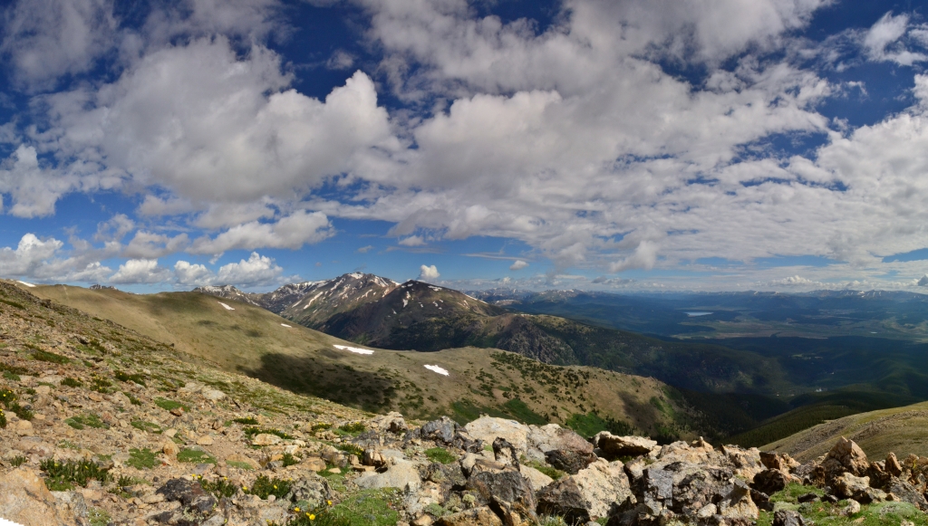
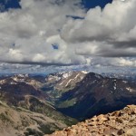
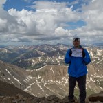
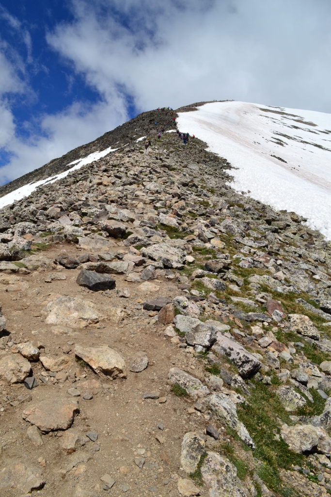
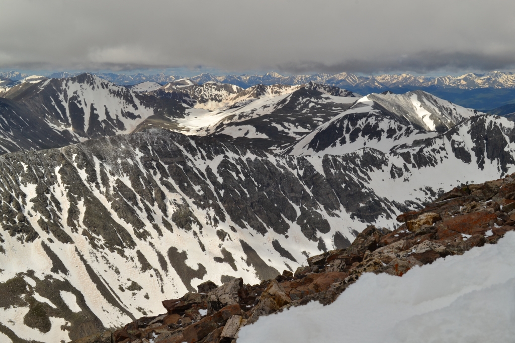
And there we stood on the summit of Torreys. We had officially completed our first double summit. It was very different from the Grays summit as it was much smaller. When on Grays gazing north, Torreys blocks some of the view of the Front Range, but on Torreys there is nothing north to block the view. It was quite amazing, and we were alone and had the summit to ourselves. Well, almost to ourselves. As we ate our peanut butter and jelly sandwiches a small ground squirrel kept running out at us and squeaking. We interpreted this squeaking as, “Give me food.” We replied that we were sorry, but it is illegal to feed wild animals. He or she was very disappointed.
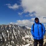
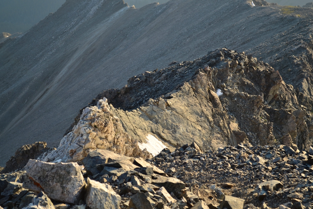
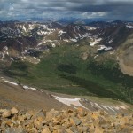
We walked around the summit of Torreys for a while and even went over to look at Kelso Ridge, a class 3 climb to the summit of Torreys which is on our list of goals for the summer. And we also shot a video on the summit. Below are some images and the video from Torreys.

Below are images of Kelso Ridge. The White Wall and Knife Edge are easily visible.
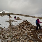
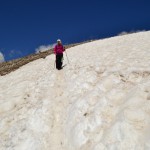
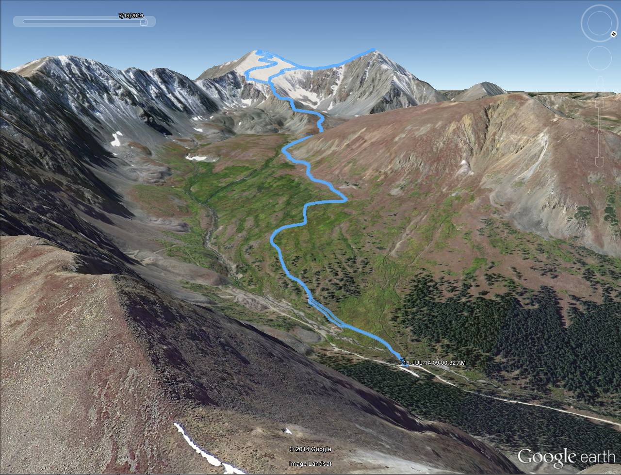
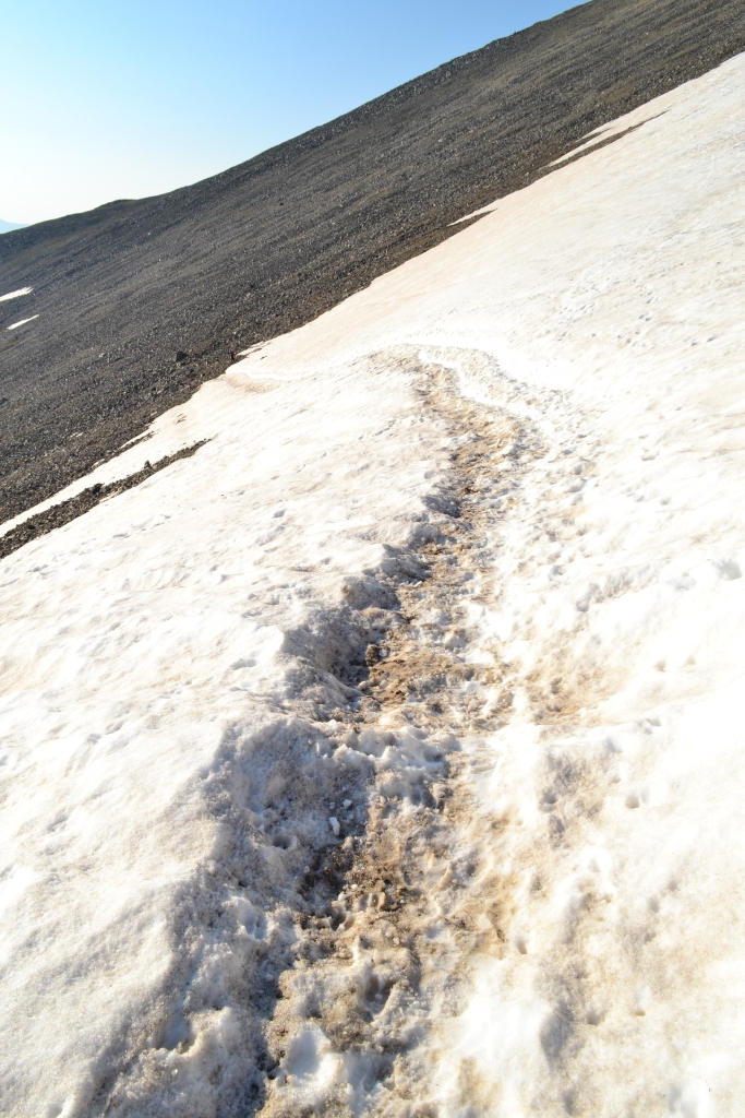
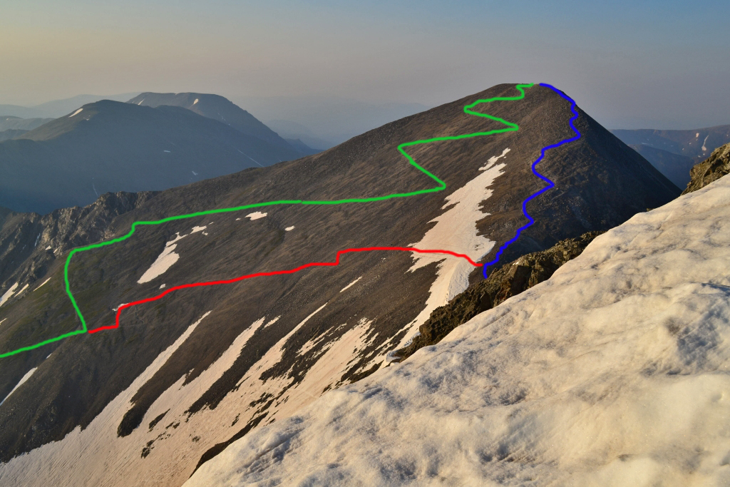
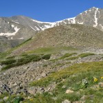
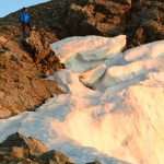
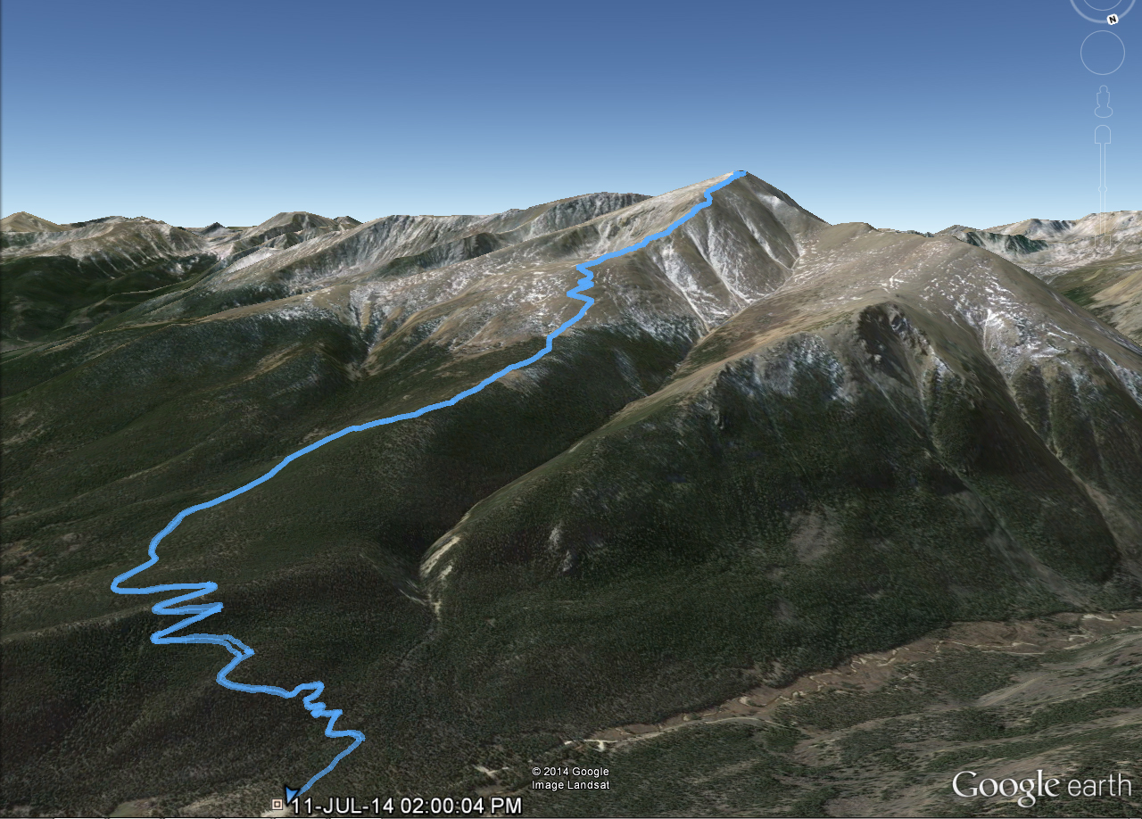
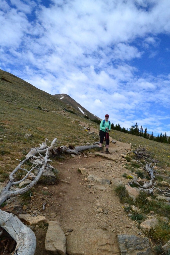
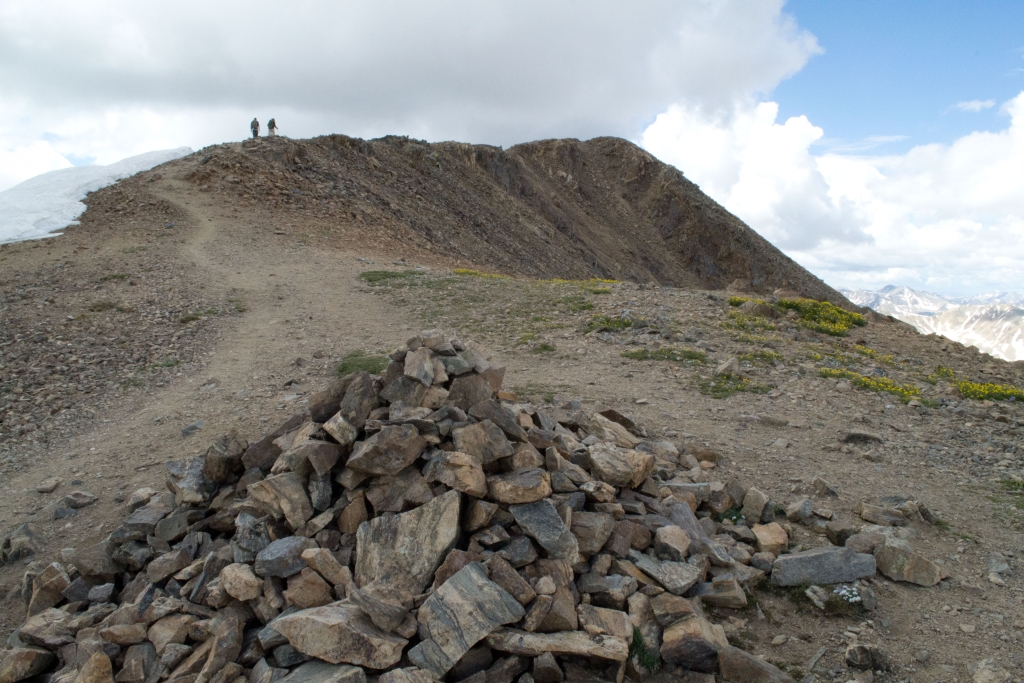
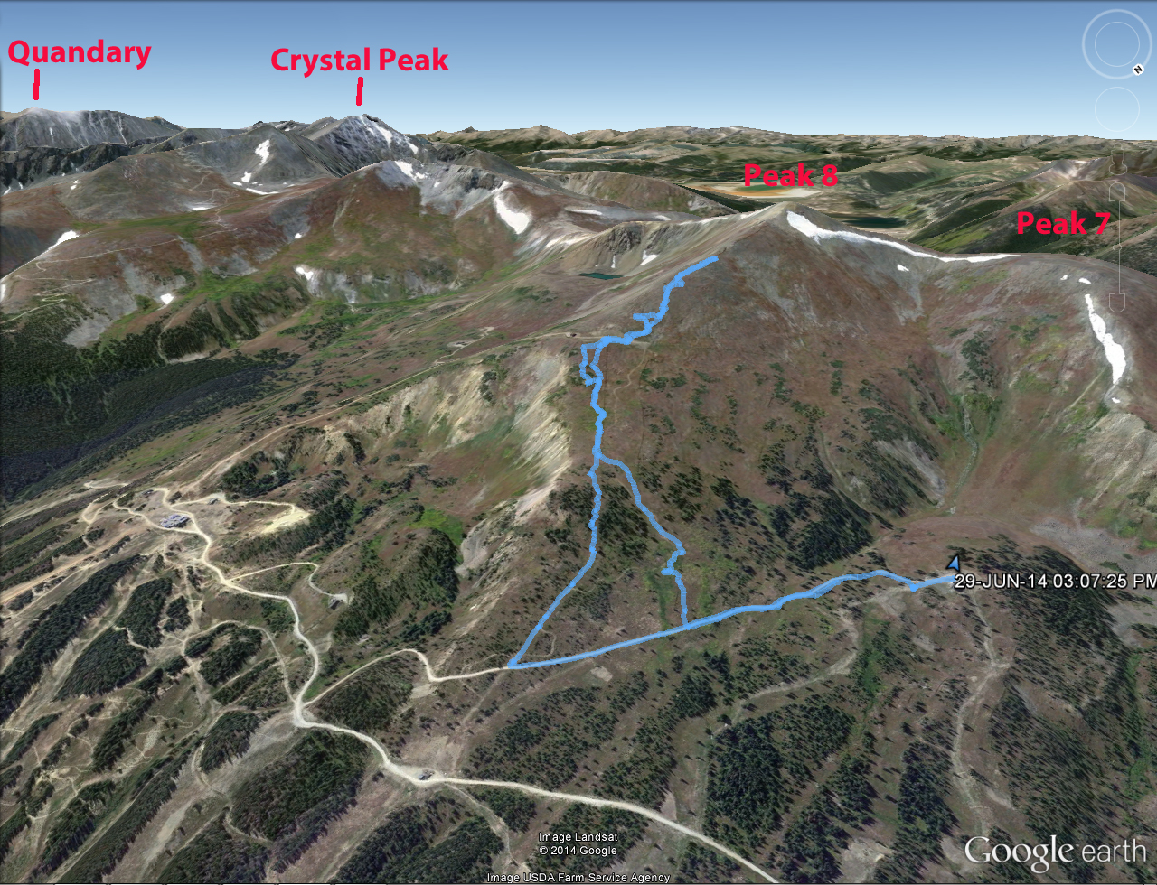
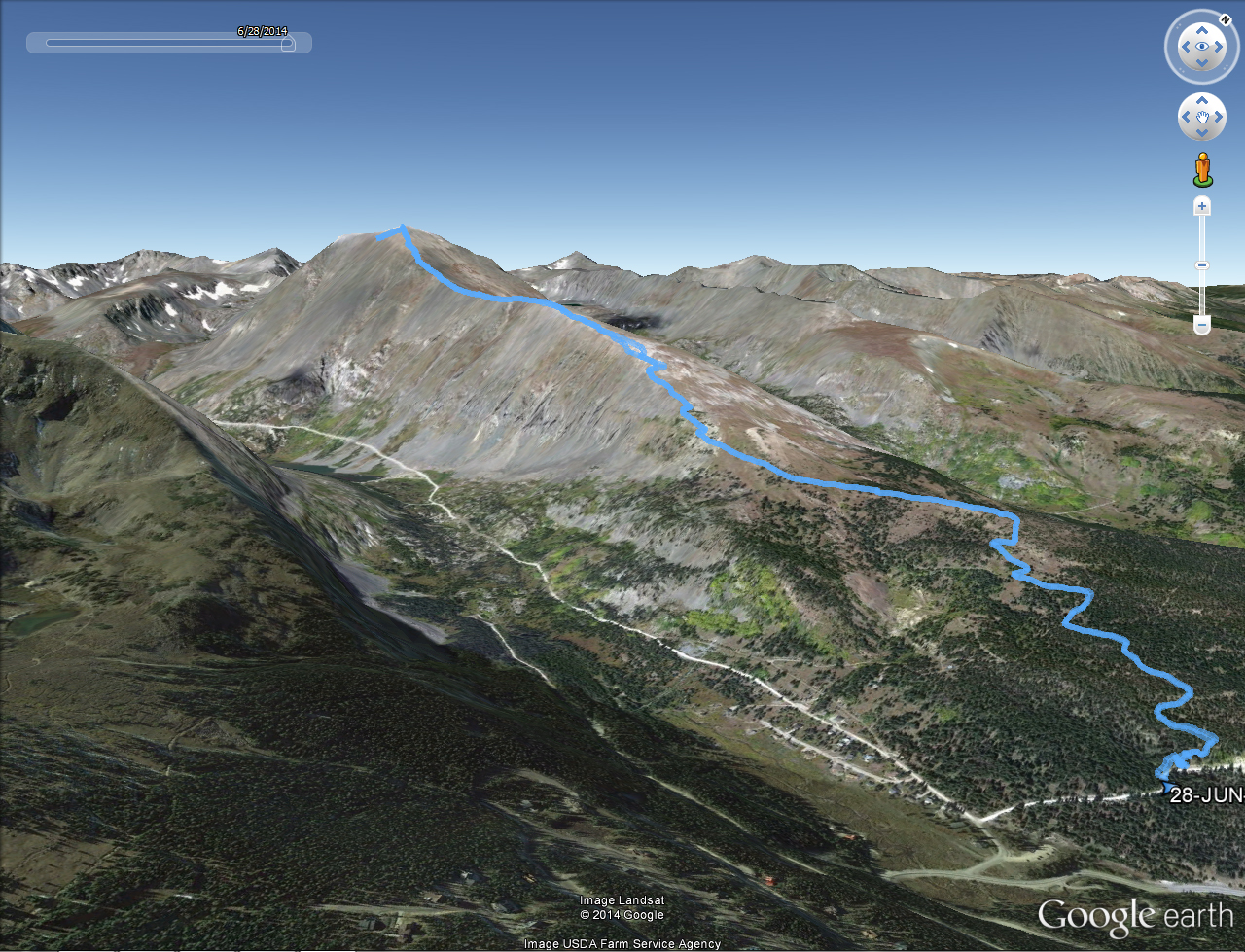
After hanging out on Torreys for about 30 minutes we decided to start climbing back down towards the car. The route to get back down cuts from the middle of the saddle back across the northeast face of Grays and meets back up with the main trail. There is a patch of snow and ice on the traverse, but it is very doable in hiking boots or even good grippy trail running shoes. Below is a picture of the traverse and an image (taken from Torreys) showing the main trail up to Grays (green), the traverse across from the saddle (red), and the route across the saddle (blue).
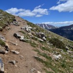
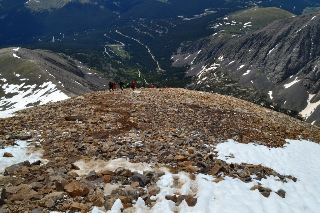
Once across and back on the main trail we noticed that there were quite a few climbers coming up. In fact, we played a game on who could guess the number of climbers we’d pass on the way down. Allyson won with a guess of 800. We counted 710 climbers on the way down, and we started counting pretty late! That must have been a busy summit later in the day. It was crazy to think we were the only ones up there and by the time we came down there were over 700 people vying for space up there.
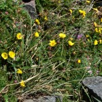
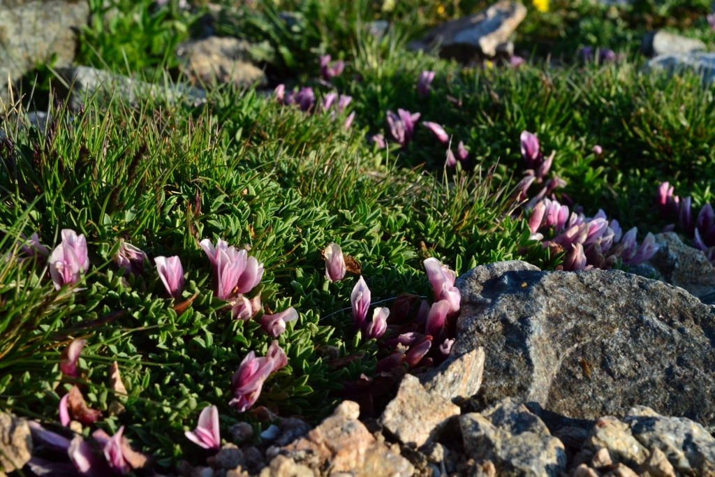
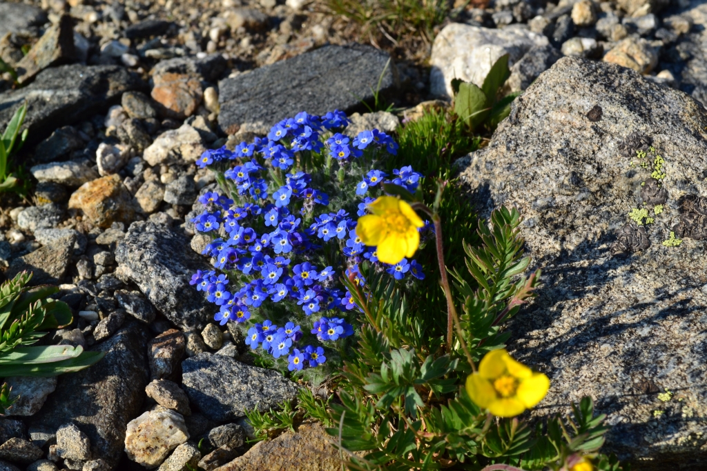
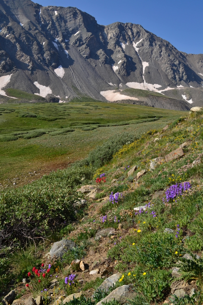
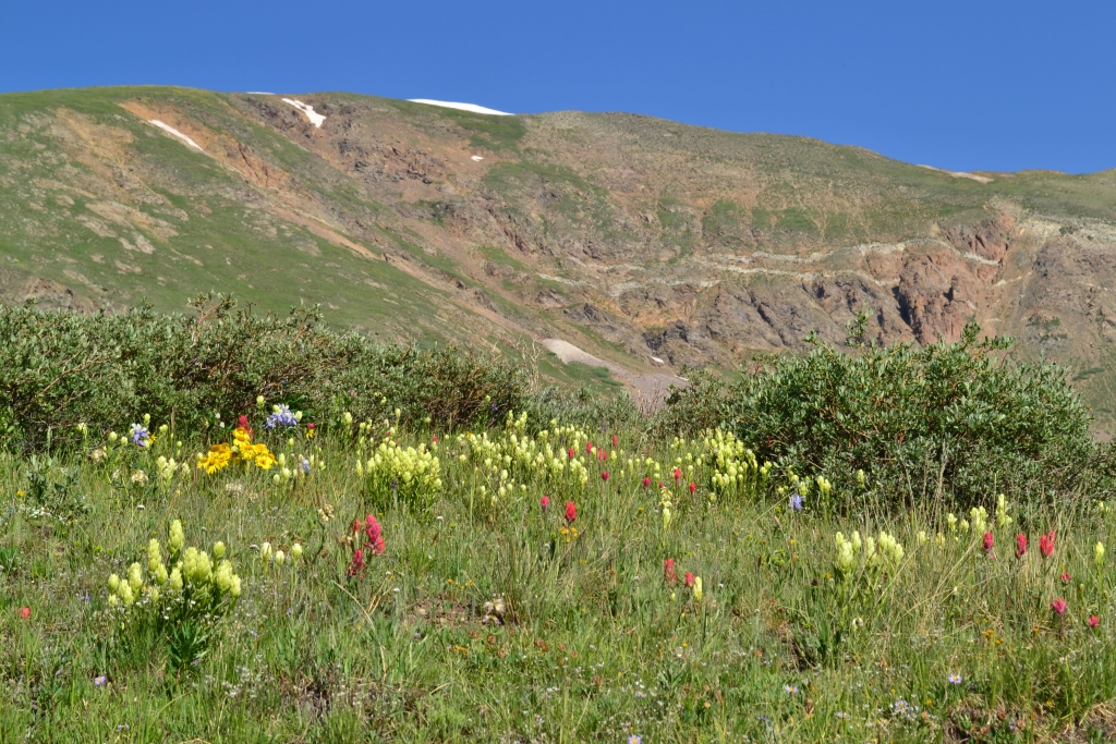
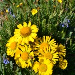
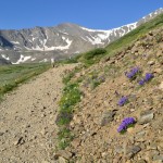
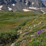
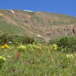
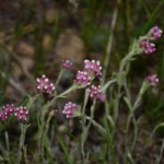
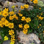
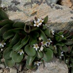
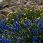
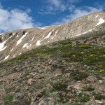
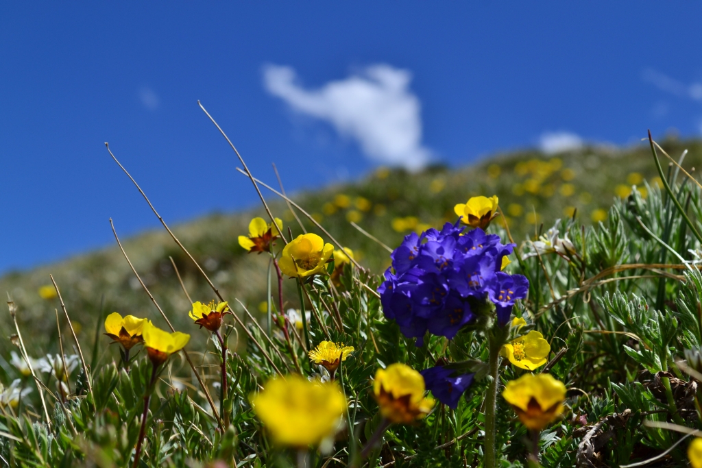
As we continued to go down we noticed something that was impossible to see in the dark of night, flowers! They were everywhere. The heavy rains we have been getting has made this a great year for wild flowers and the basin of Grays and Torreys is no exception. Pretty much every type of flower we have ever seen in Colorado and beyond was represented. It was quite lovely. Below are a few images of flowers for your viewing pleasure.
And after dodging 710+ people climbing up, as we tried to climb down, we were finally back at the parking lot. It was a beautiful day and still morning! We planned on heading back towards Denver and stopping to get breakfast. All in all a great start to the day. And even if we were pretty tired, it was well worth it!
Just a couple notes on this hike.
First, actually getting to the Grays trail-head isn’t as easy as some people make it sound. We climbed Grays last year and the dirt road up to the trail-head was rough at one point, but this year after all the rain it is pretty gnarly. The X-terra was definitely using that 4-wheel drive and the clearance was just barely enough to get over some of those ruts. Coming down later we saw a Subaru stuck and trying to reverse out of this rough area. If you plan to drive up make sure you have a good vehicle with 4-wheel drive and decent clearance.
Second, many people seem nervous about where the trail splits, one path going to Torreys the other to Grays. This occurs once you are well into the hike and there is a post in the ground saying “Stay on the Trail.” But if you look at the post a little closer there is a note written in permanent marker that says “Grays” with an arrow pointing to the left. This is where you want to turn left unless you want to go to Torreys first.


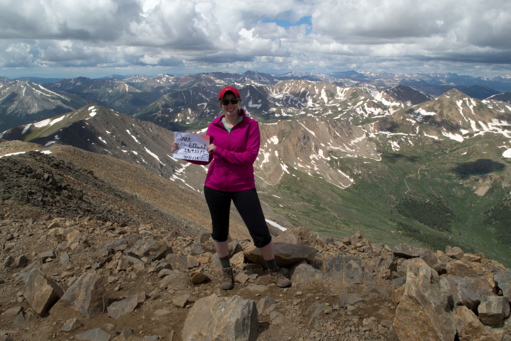
Mt. Elbert Summit: 14,433 ft
Distance: 9.62 miles (out and back) Elevation Gain: 4,408 ft (total) 4,377 ft (net)
Max Elevation: 14,433 ft Min. Elevation: 10,056 ft
All week long we constantly monitored Mountain Forecast for conditions atop Colorado’s highest peak, Mount Elbert, hoping for an opportunity to summit this spectacular mountain. Nestled about 115 miles southwest of Denver in the Sawatch Range, this gentle giant rests majestically in the San Isabel National Forest. In addition to laying claim to Colorado’s highest point, Elbert also ranks 2nd in the race to the sky in the contiguous US falling only slightly behind California’s Mt. Whitney which sits at 14,505, a mere 72 higher. Interestingly, Elbert hasn’t even been able to peacefully claim its record here in Colorado through the years. Just north of the peak sits Mt. Massive. Massive is essentially a row of peaks, all leading up to a pinnacle of one high point on the central peak which measures 14,428 ft. Through the years, there have been collective groups arguing for Massive to be named the highest peak in Colorado. Hikers/wilderness enthusiasts that got a a little too excited about this race took to building cairns on the summits of either peak hoping to gain a few feet of mountain height and with it a title. This battle resulted in Team Elbert or Team Massive simply tearing down each other’s work. Eventually, these futile efforts ceased leaving Elbert rightfully dubbed the highest Coloradoan Peak.
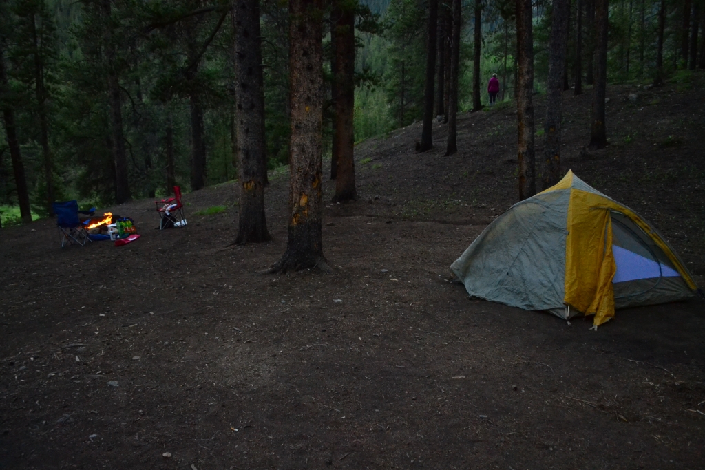
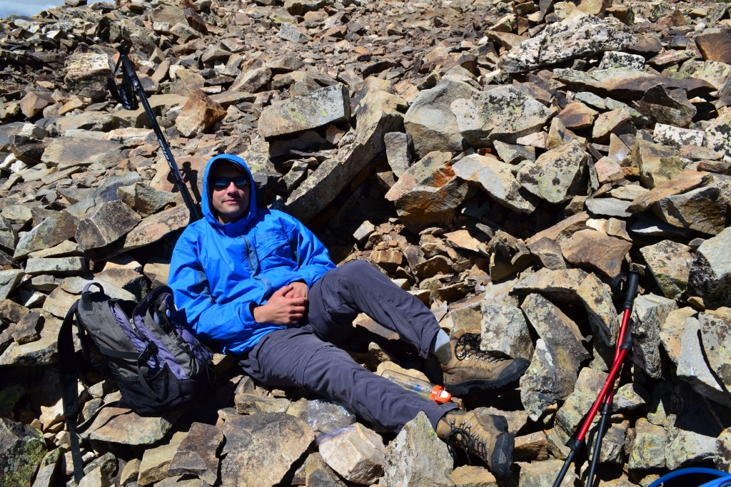
We used vacations days for a summit attempt on Friday, in order to avoid large hiking parties that often descend upon the 14ers on a July Sat. or Sunday morning. Since the trailhead is relatively far from our house, we opted for a Thursday night campout near the TH. Luckily, Mt. Elbert and Mt. Massive rise above perfect campgrounds. There are multiple fabulous spots located at Halfmoon east and west campgrounds as well as the Elbert Creek Campground just across the dirt road from the Elbert Northeast Ridge Trailhead. We were really hoping to get one of these campsites, but to our surprise they were already full at 6:00 pm on Thursday. We kept going north until the road turns into a 4WD only road and followed it past the pay campsites. We stumbled upon an amazing primitive site that overlooks the Elbert creek. It was perfect. We set up camp and roasted marshmallows. The peaceful sound of the river calmed us after a long trek into the mountains. Seen below are photos of our campsite.
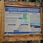
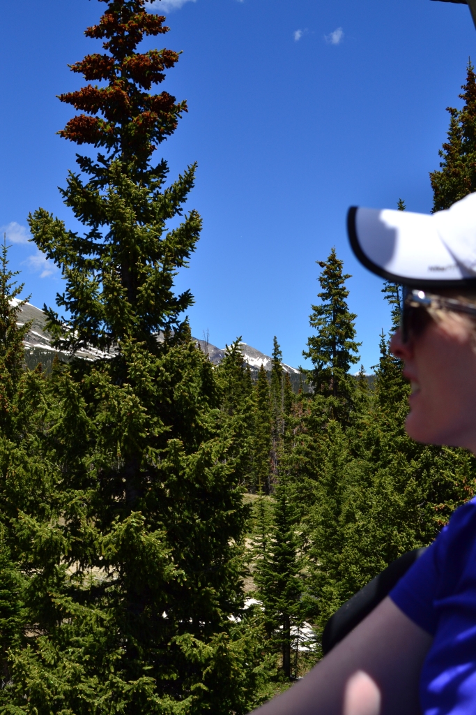
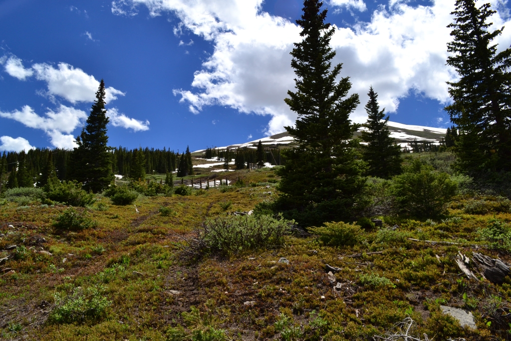
At dusk it began to rain. We crawled into the tent for an early slumber that didn’t come easily. The night was a bit of a rough one, with our cheap sleeping bag pads not cutting it. We finally fell asleep and when first light came through, we weren’t quite ready to rise. But the mountain we were planning on climbing is tall and steep and long to the summit so we threw on our boots and made the short drive to the trailhead. After eating a a snack and prepping, we were on the trail at 7:15 am. The Northeast trailhead quickly connects hikers to the Colorado Trail. We followed the Colorado Trail through a dense lodgepole pine forest for 1.1 miles where it intersected with the trail that leads to the Elbert Summit. The signage is very clear here, and we had no trouble route finding. Since, we began this hike around 10,000 feet, our trek below treeline seemed to take forever. There were also very steep sections through the trees that allowed us to shed layers pretty early on in the trek. As we reached treeline, the canopy opened up to beautiful views of the valley below as well as our first view of one of Elbert’s two false summits. Seen below are photos from the trees, and treeline, and the first of the false summits.
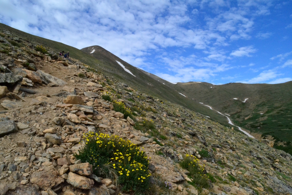
Mosquitoes began to attack ferociously right before we left treeline. We had to keep moving or we would be swarmed. This was quite surprising to us considering we were over 12,000 feet in elevation at this point. We were about 2.3 miles into the hike now and realized we still had over 2,000 feet to climb in about 2.2 miles. The first false summit loomed in front of us, teasing us with hope. We steadily climbed until just below this first summit. The trail turned very very steep here and was comprised of loose scree and dirt. Trekking poles came in handy for balance for this portion of the ascent. It was mentally a very challenging portion of the hike because we had reached 13,000 feet, air was thin, and the trail was visually daunting. Once we got past this point, we saw our next false summit, but thanks to our handy GPS we knew we had only about 800 feet left to climb. We were almost there! Seen below is the final 200 foot pitch and ridge line to the real summit.
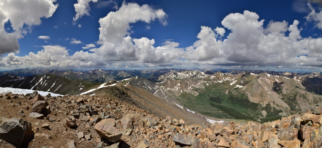
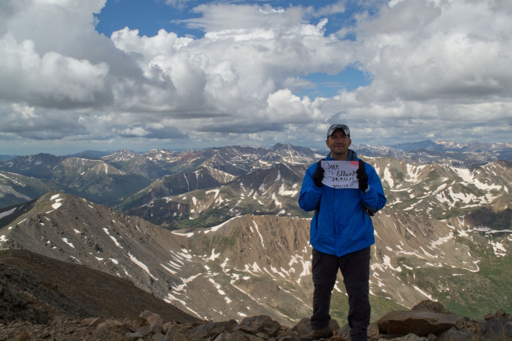
A few more feet up, and we were there. We had reached our goal in about 3 hr 45 min. which wasn’t too bad considering we paused for some photos and sunscreen along the way. The conditions were perfect on top with minimal wind and adequate sunshine to keep the temperatures reasonable. We sat and enjoyed PB&J bagels and water to refuel. Seen below are 360 views from 14,433 feet.
Seen below is a video on top of the summit and ridge right before we headed down.
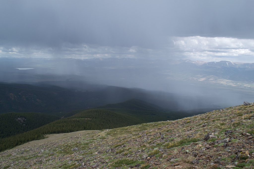
The weather report said pm rain showers were very likely, so we headed down after lunch. We were surprised to see so many people heading up the mountain as rain clouds filled the sky behind us. The trek down was hard in a different way than going up. It may have been easier cardiovascularly speaking, but was much more difficult on the quads. The thought of the storm cloud getting closer kept us moving very very quickly despite the build up of lactic acid in our legs. The saying “going up is optional, going down is mandatory” echoed in our heads.
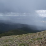
As we neared treeline it began to storm and we realized that the raindrops were in fact hail drops. We knew that light showers were a possibility in the pm, but we didn’t expect hail and lightning. The thunder was ferocious and instilled quite a bit of fear in our hearts. We wanted to jog down, and did at some points, but the steepness and loose nature of the climb down prevented us from descending too quickly. Even as we saw ground-to-air lightning strikes and heard mean sounding thunder we still continued to see hikers climbing up out of treeline. We want to take this time to warn hikers that the danger of lightning is real. On Friday, the day of our hike, in probably the same storm, a woman was killed and seven were injured by a lightning strike on the Ute Crossing Trail in Rocky Mountain National Park. We were deeply saddened to learn about this and then shocked to learn of a second fatality on Saturday when four individuals were struck on Trail Ridge Road in Rocky Mountain National Park.
We know how tempting it is to keep climbing. And we know how much effort goes into planning trips to the mountains, especially when you are from out of town. But trust us, the summit is not worth your life, and you can’t outrun a storm. Please stay safe and if you see storm clouds in the mountain get down as quickly as you safely can. Our condolences and thoughts are with the families of those who lost their lives this weekend. Below is a picture of the storm as it passed by us.
After reaching treeline it was a long hike back through the forest to the car. The scenery is relatively monothematic in the trees and we were happy when we arrived back at the car. When we reached the car the second wave of the storm hit and it began to rain very hard. We threw our gear in the back and headed over to Leadville for some grub.
If you make it up to Leadville and the Sawatch Range make sure to stop by the Silver Dollar Saloon. Opening in 1883 this famous bar served the likes of Doc Holliday (who had his last gunfight in front of the bar), Wyatt Earp, Oscar Wilde, and many others who passed through the doors of this majestic bar. The town is extremely friendly and they have many outdoor events such as the Leadville 50 and 100 mile mountain bike races.
It had been a hard day, and even scary at times, and we were thankful for another day in the mountains.


Breckenridge Peak 8 Fox Sighting and More
Distance: 2.8 miles (loop;out and back) Elevation Gain: 1,587 ft. (total) 1,467 ft. (net)
Max Elevation: 12,615 ft. Min. Elevation: 11,148 ft.
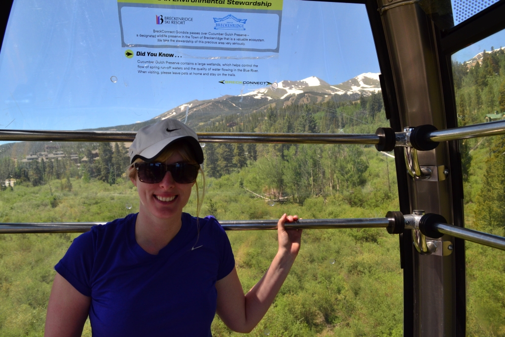
We decided to explore Breckenridge a little bit more after our Quandary expedition and headed over towards the base of Peak 8. On the way we found that the gondola was free (at least in the summer) and parked (again at a free lot). The gondola was nice, but the plexi-glass windows were really scratched up, presumably from skis and poles, which made it slightly difficult to see outside; but it was still very fun to ride up in the gondola on what was a gorgeous day. Below are two pictures from our gondola experience.
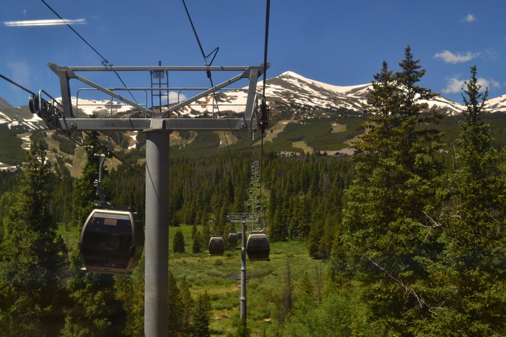
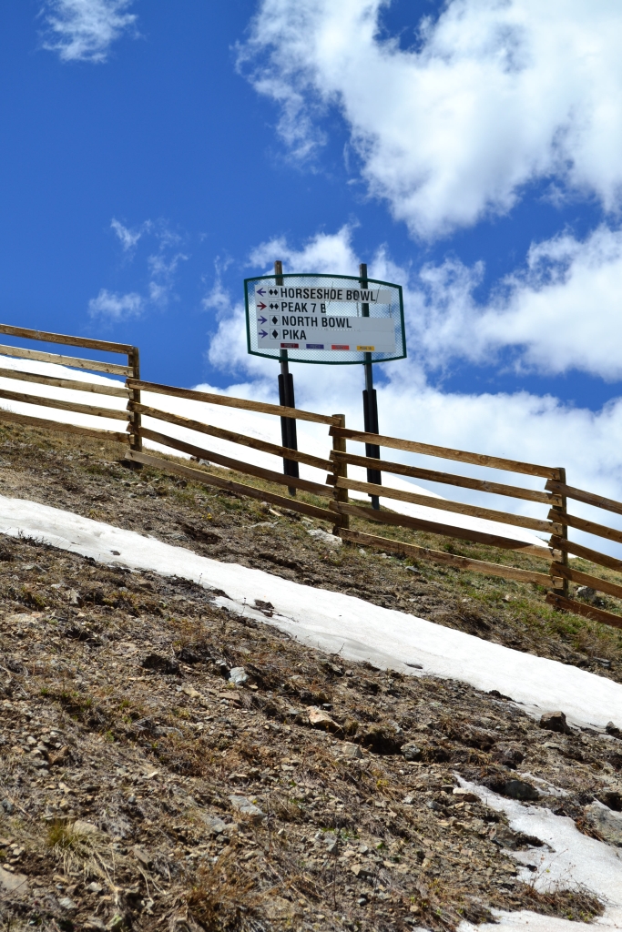
The gondola drops you off just off the base of Peak 8, so we walked past a little lodge and on to the lifts. We found out that you could rent mountain bikes at the base and then get a full-day lift ticket to go up the mountain and then back down on your bike. It sounds and looked like a lot of fun, and we plan to go back with our own mountain bikes to ride. We opted to buy a one-time scenic lift pass to ride the Independence Superchair up to the bottom of the Whale’s Tail (the structure that connects Peak 7 and 8 and forms a beautiful bowl).
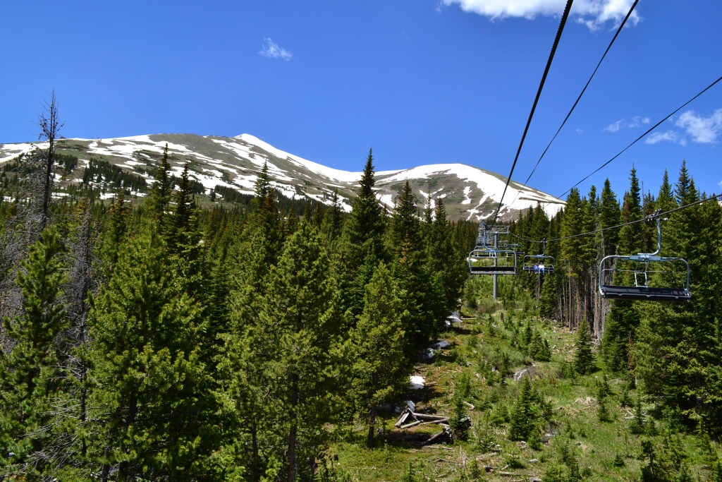
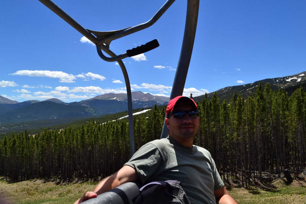
The ride cost $10 each and was well worth it. Neither of us had ridden a ski lift in the summer and it was a very different experience. For one thing, you are much higher up, since there is roughly 6-8 ft. of base snow missing below you! It was a perfectly clear day and looking around we could see Gray’s and Torrey’s Peaks off in the distance behind us, Peaks 9 and 10 to our left, and Peaks 7 and 8 in front of us. Above are some of the images from the ride.
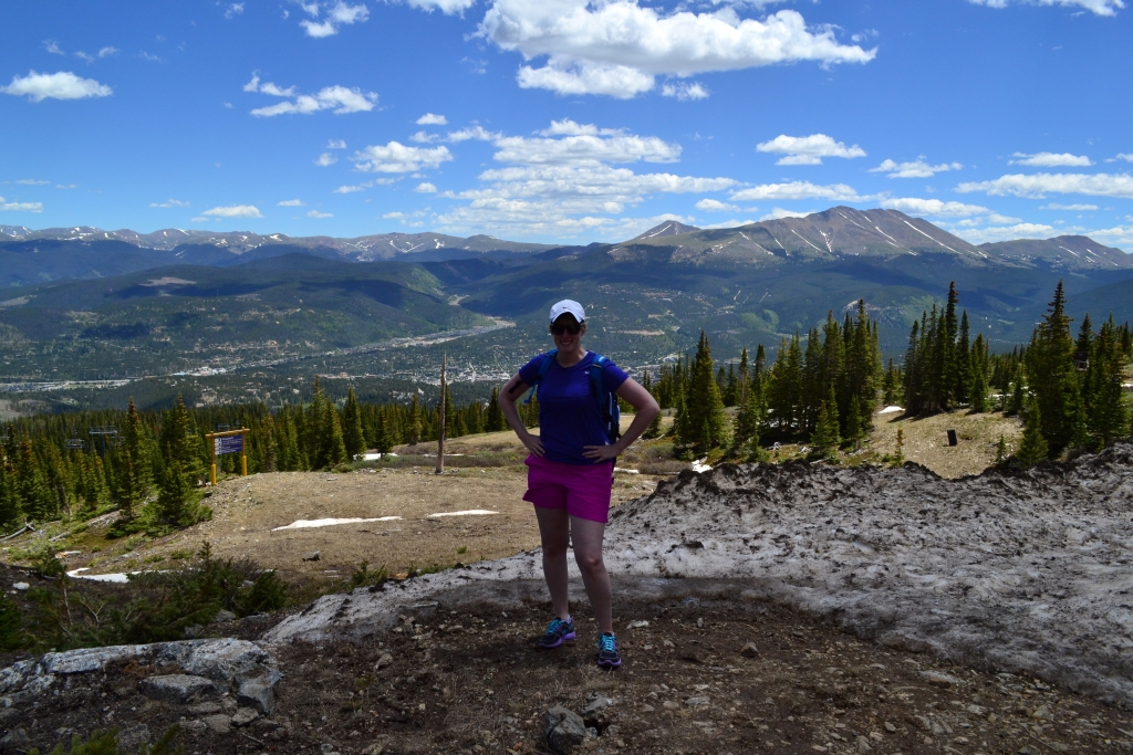
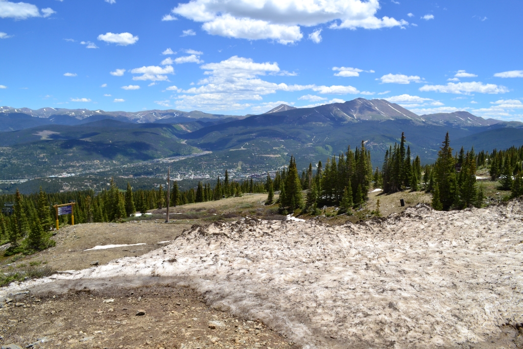
As we neared the top of the lift we prepared to unload for the first time wearing shoes. It was easy as pie. Now at the top we had to decide what to do. Our first decision was to head over to what appeared to be a rugged scenic overlook just off to the left of the lift. Once there we looked out at where we had come from and then on to the mountains beyond. It was quite a sight. There are a couple photos below from our photo op.
We took a look around and decided that we’d head up towards Peak 8, following the T-Bar lift. It was very steep and we almost turned back at first, since this was supposed to just be a relaxing day. But we kept telling ourselves that we’d just go up to the next ridge to see the view, and then the next ridge, and then the next ridge. Eventually we had a mission to go until T-Bar ended. The last portion of the T-Bar route was very steep indeed. Using our GPS and Mapsource we calculate that the last couple hundred feet of the climb is at a 42.4 degree angle (or a 45% grade). Whew! Below are some pictures from the climb up.
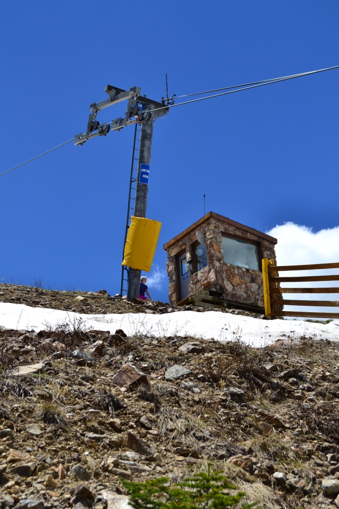
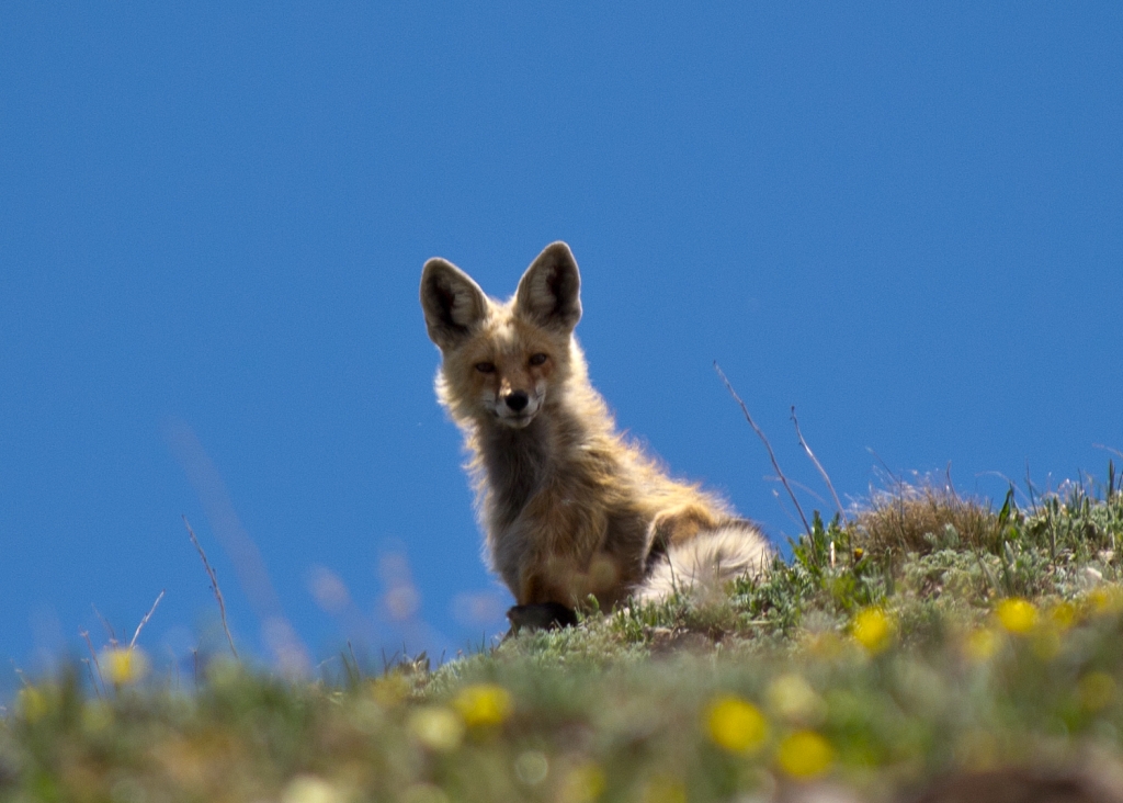
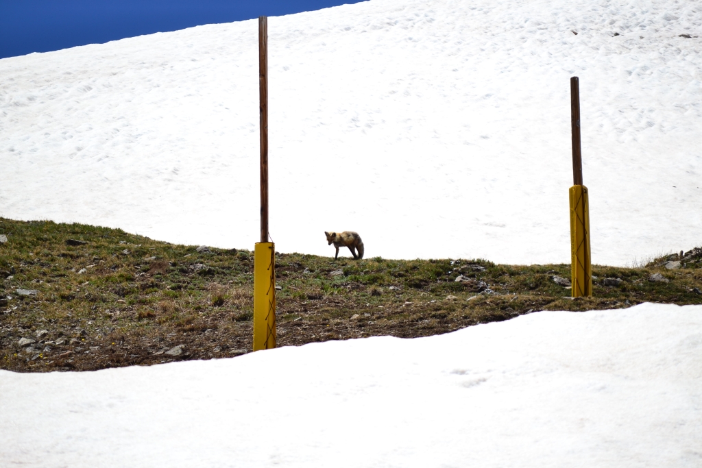
At the top of the lift we took a seat on the steps of the T-Bar operations cabin, and suddenly Allyson spotted an animal up the ridge. We took out the telephoto lens for the camera and tried to spy what it was. Zooming in on one of our pictures we could tell immediately it was a red fox. We decided to try and get just a little bit closer, and as quietly as we could we walked up and away from the fox. Very abruptly after coming over a little ridge the fox was in plain sight, sitting down and just hanging out. We snapped as many pictures as we could and then the fox decided it was time to move on. Below are the best pictures we took of our fox sighting at 12,200 ft.
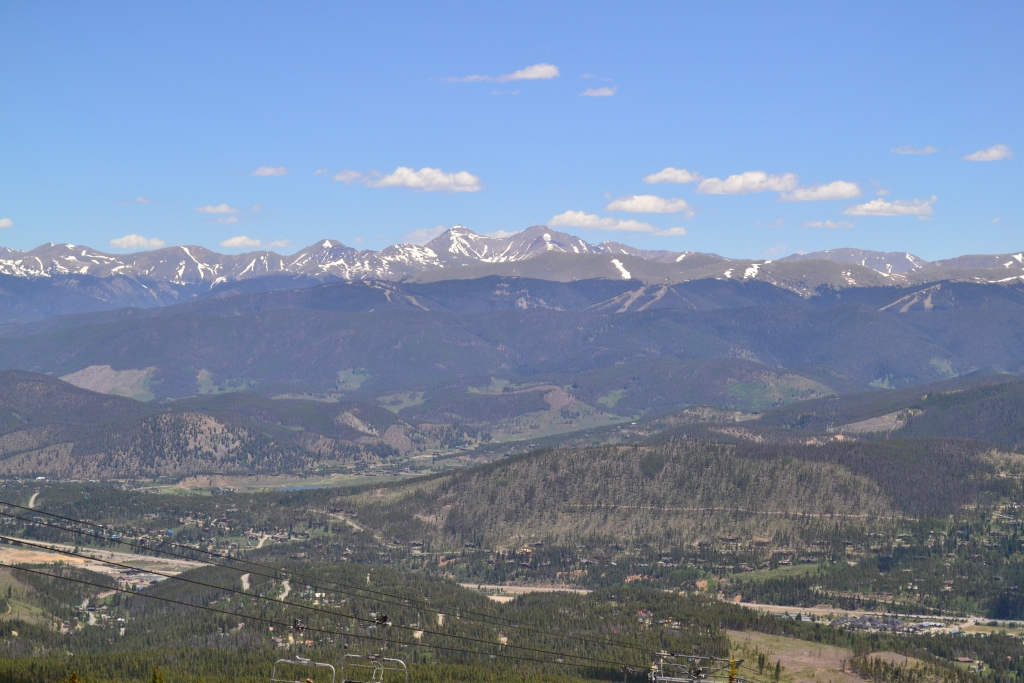
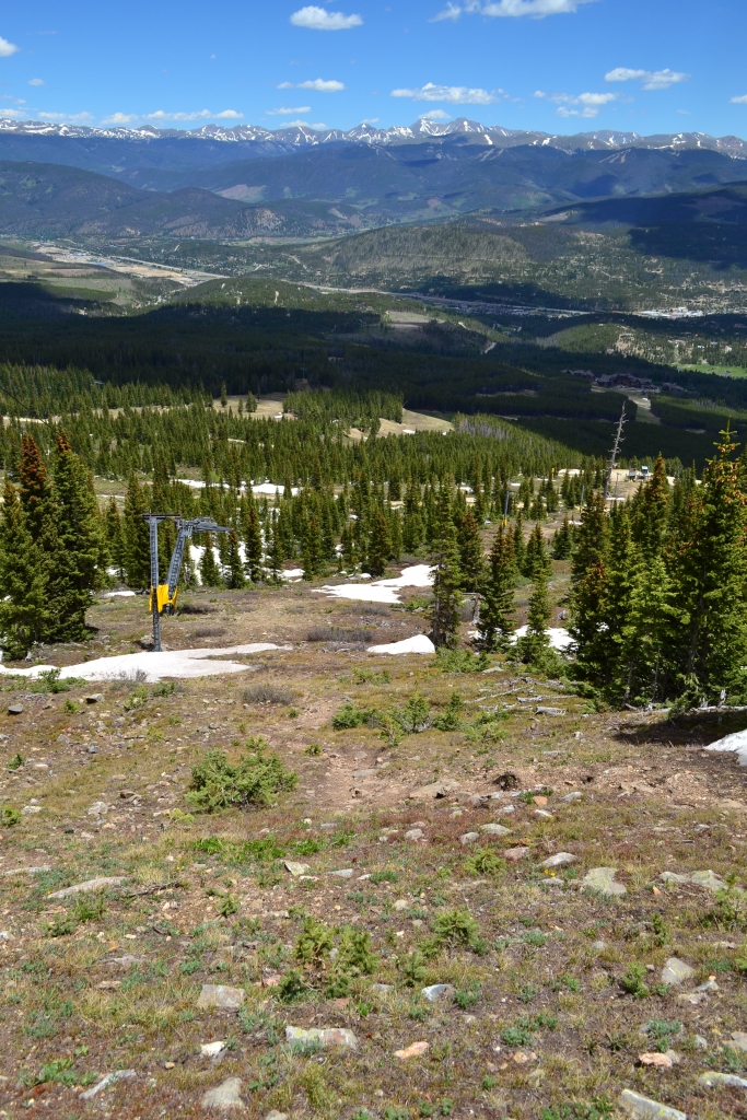
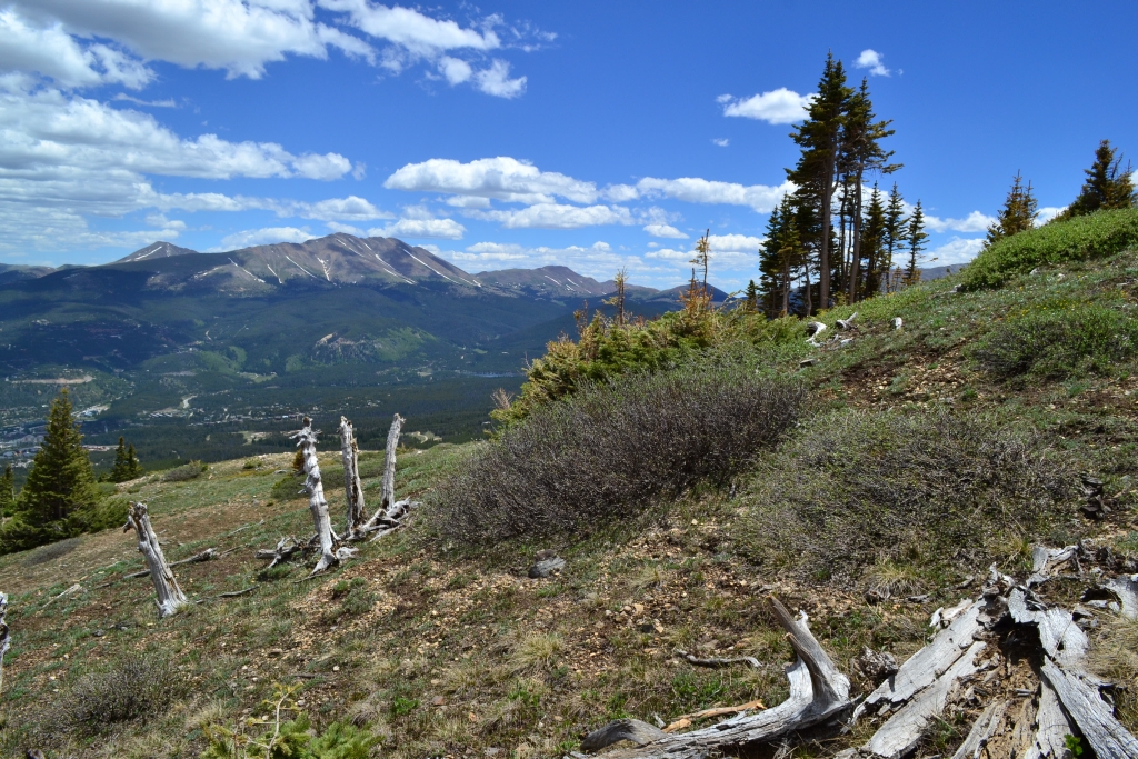
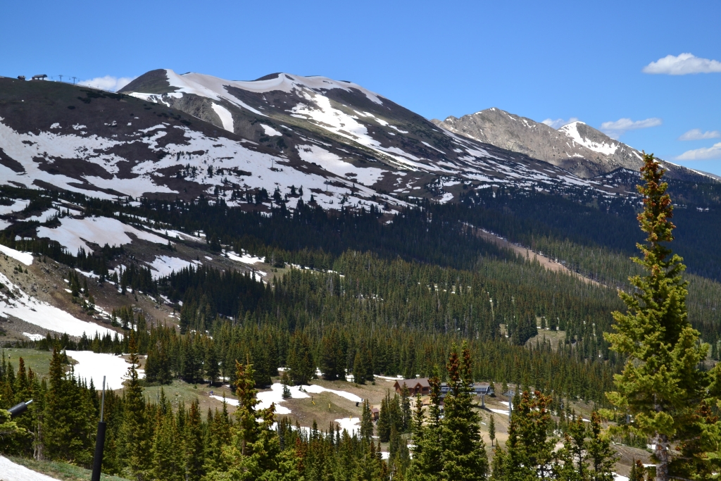
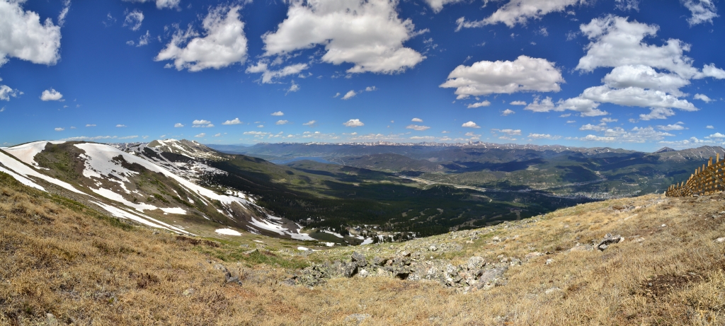
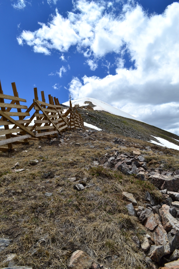
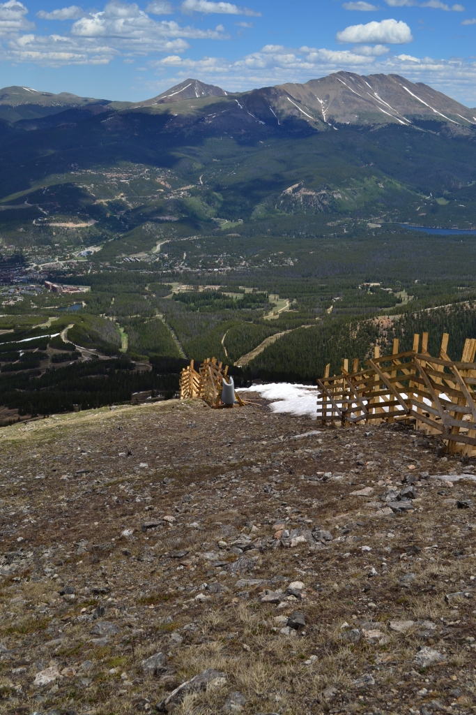
We attempted to follow our fox friend, but he was long gone. However, we did see the false summit for Peak 8 and decided we’d keep going until we reached it. On our way up we began to encounter the first large patches of snow, and since we hadn’t planned a real hiking day our sneakers didn’t enjoy that very much thus definitively ending our trek. Once at the false summit we looked around at the Dillon Reservoir, the Ten Mile Range, the Front Range, and Breckenridge below us. It was quite a sight. Up above us loomed Peak 8 and just off in the distance Peak 7. Below is a small panorama and a few pictures from the false summit at 12,615 ft.

We began our descent and realized for the first time just how steep the climb really had been. The terrain was loose rock and gravel for much of the climb down and some mud towards the top, it was definitely slippery going in sneakers. We decided to try another route at a crossroads and instead of following T-Bar down the rest of the way climbed down Pika and Ptarmigan. We thought this alternate route might be less steep and offered us more opportunities to explore. This route had quite a bit more terrain to navigate including bushes, streams, mud, etc., but allowed more ease in the descent since we were no longer on a double black diamond. We were very excited to reach the bottom of the run and head back over to the chair lift for our ride down! Below are a couple pictures from the descent.
Back at the chair lift we got in the non-existent line and hopped aboard. It was really exciting riding the chair lift down and was probably the first time we’d ever ridden a chair lift down the mountain. Back at the base we headed to the restaurant Seven for some burgers and refreshments. It was a day very well spent and we were very excited about our unexpected wildlife success. We’ll be back soon with mountain bikes and with our hiking boots to finish what we started! Until next time, stay classy Take a Walk readers and vote for this picture so we can continue to share with you our Colorado photography and enhance your viewing experience.
Quandary Peak Summit: 14,265 ft
Distance: 6.84 miles (out and back) Elevation Gain: 3,364 ft (total) 3,371ft (net)
Max Elevation: 14,265 ft Min. Elevation: 10,901 ft
It felt as though we had only just closed our eyes when we were gently roused by the sounds of The Head and the Heart streaming out of the phone at 3:45 am on Saturday morning. To be honest, we were so excited about our third 14er summit attempt that sleep was light, and soft music was the only motivation needed to throw on our clothes and boots and hit the road for Quandary Peak. This majestic peak looms to the south of the quaint but vibrant town of Breckenridge, CO. It is the 13th highest peak in Colorado. Year-round it tempts hikers, skiers, climbers, and wildlife enthusiasts to its summit.
We reached Breckenridge at about 5:50 am and were greeted by a somnolent little town with closed signs in all the windows. We waited at a gas station a few minutes until six to fuel up on snacks and then continued on. We reached the trailhead at about 6:15 am and were able to park in the second parking lot at the base of the trailhead. There is another lot further down closer to Hwy 9 with additional parking and restrooms (port-o-pots). There were a few cars and eager hikers already there, and we joined with similar enthusiasm.
The trail immediately begins to climb among the trees which wasn’t too surprising when we realized the distance to the summit was only 3.4 miles. The sun wasn’t out at the start of the climb, and a nice chill settled on the forest floor. A bridge we crossed still had ice on it, though the trail was free of snow until about half a mile past treeline. The first mile and half was simple trekking through a lodgepole pine forest. Eventually it opened up to views of Tenmile range and finally thinned out at treeline. Seen below are photos from the start of the hike.
We were then greeted with a series of steep switchbacks and loose scree, but our goal was now in sight. We could see Quandary in the distance. It looked quite far away and much higher than us. We focused on moving and breathing. At this point in the hike, we caught up to a youth group that had started about 20 min ahead of us. Interestingly, the group was in shorts and t-shirts. It was a bit frustrating once the trail flattened out to a traverse, because the group now sped up and passed us. They would then stop again a few hundred feet ahead of us, and we’d have to play the passing game again. We tried to keep a positive attitude, and quietly laughed as the leader sang out “the redeemed shall not fall” as the group tried not to stumble on the miles of talus. It was cool to see a group high schoolers out enjoying nature and being active. Seen below are photos as we crossed the traverse and looked up to the summit as well as some photos looking back down after we were a few hundred feet higher. Notice how steep it appears…
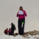
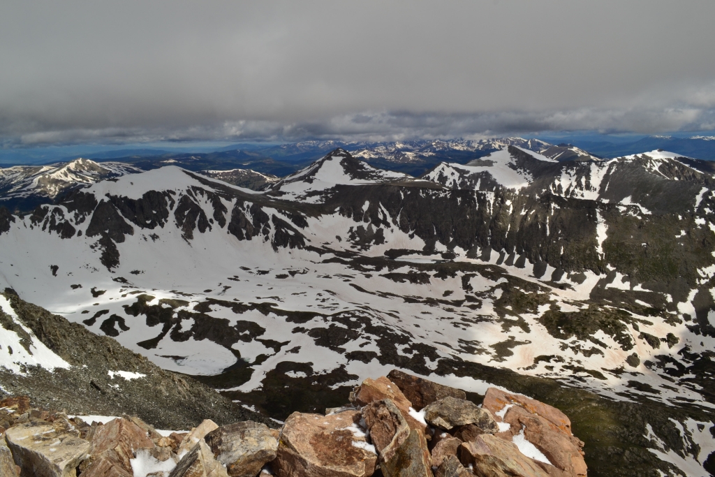
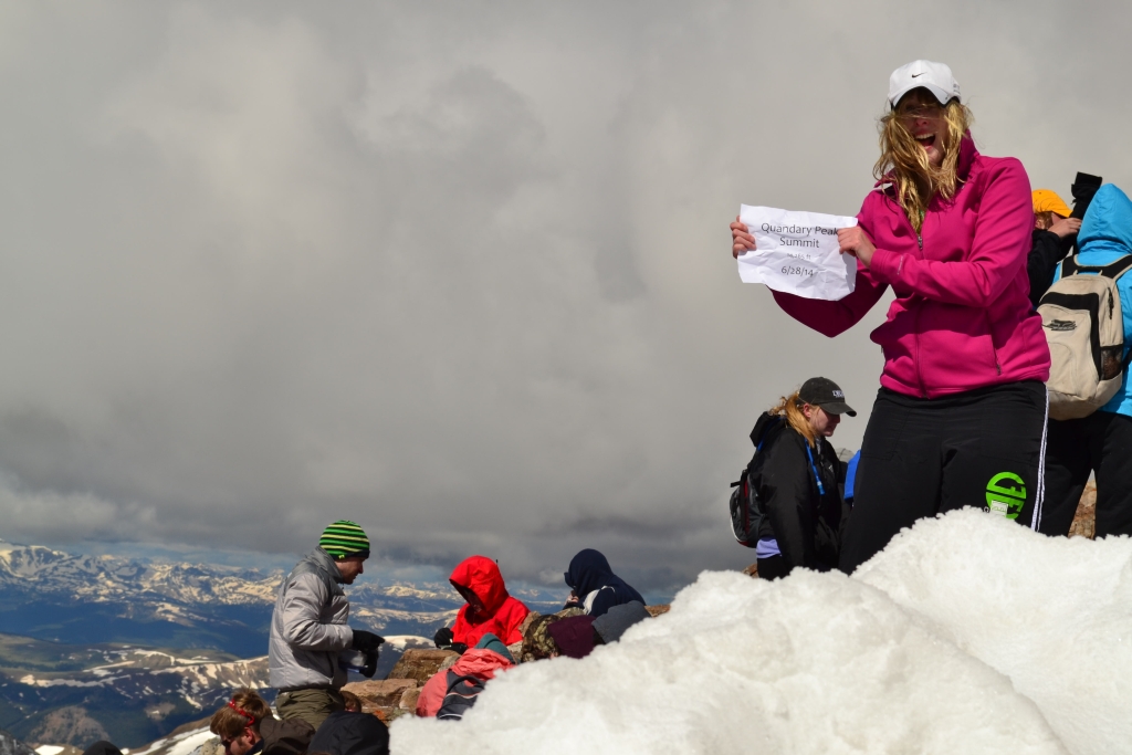
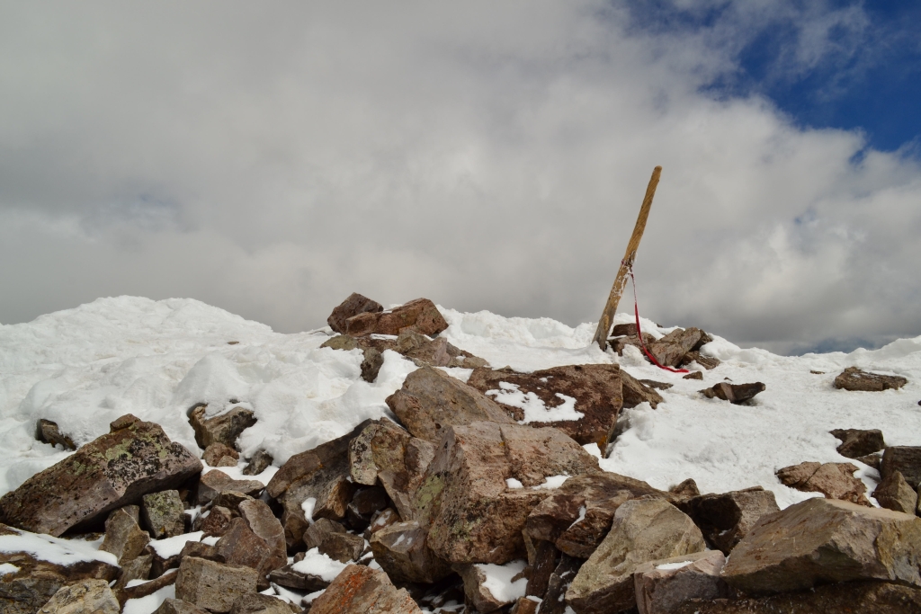
As we got closer and closer to the summit, the temperature dropped sharply and the wind picked up. The final push to the summit was still covered in snow. We carried hiking poles with us for stability but nothing could protect us from the 60 mph winds that were whipping across the top of this mountain. When we reached the summit we dove for a wind shelter, but it helped very little. We were so cold that we huddled together for warmth. Getting the summit sign out proved very difficult as the wind kept trying to steal it away. The clouds gave way to sweeping views of multiple ranges in all directions. We tried our best to get a few nice photos and the mandatory summit shot. Seen below are pictures from 14,265 ft above the world.
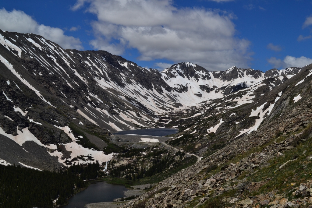
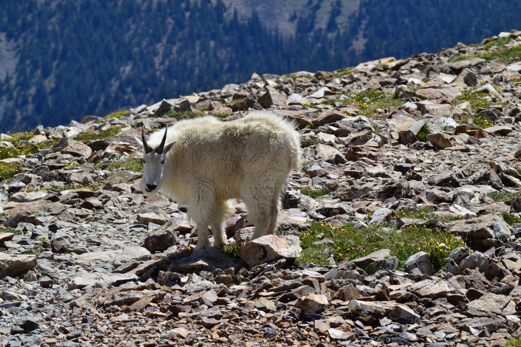
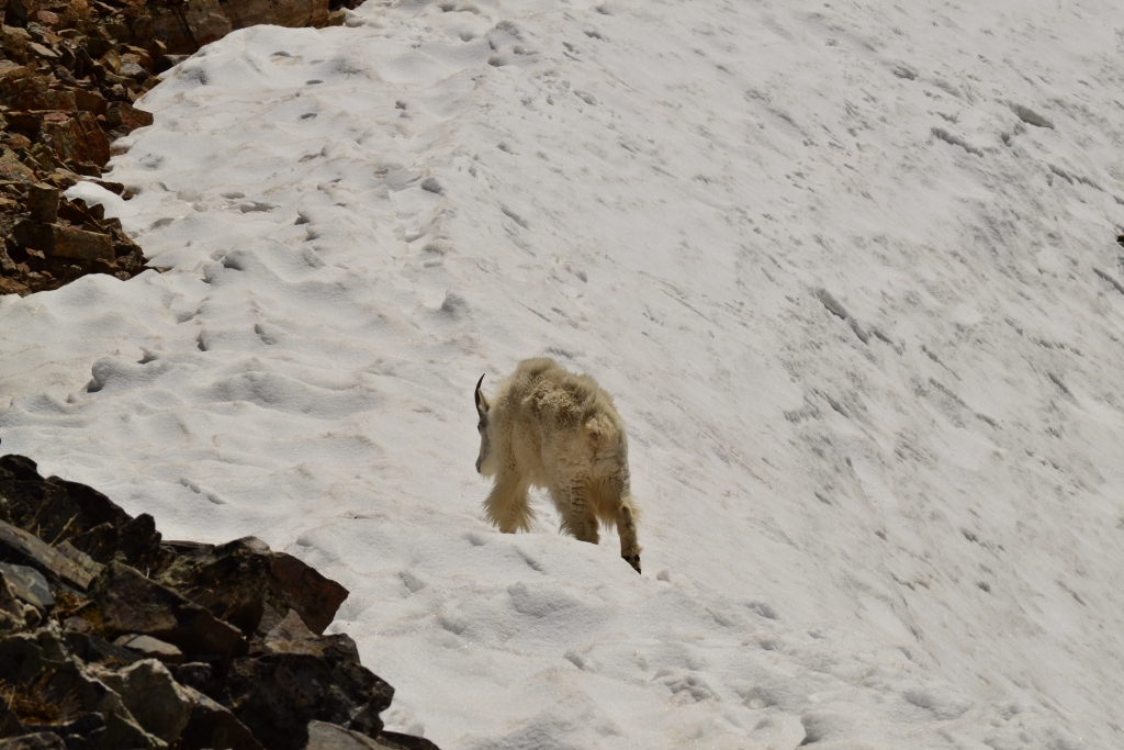
A group of guys at the summit took their shirts off for a goofy photo. They were screaming. The wind was too much, and another gust reminded us that 14,000 feet in the air is not supposed to be an inviting inhabitable place. We quickly gathered our stuff and began the descent. This may have been the most difficult part of the entire journey. The wind was blowing so hard it was difficult to maintain stability in the snow to traverse across the top and head back down the snow drift. The temperature was so low that our hands became completely numb. Numb as in they felt like large bricks that didn’t want to move. It was not fun, and another reminder to always pack extra gloves and warmer clothes even if it’s a late June summer day. As we dropped back down a few hundred feet, things began to look more positive again. Feeling came back in our fingertips and hands, and we realized we beat the crowd in summiting. There were many people heading up huffing and puffing and cursing the incline. It felt good to head down. It should be noted that going down is not easy. There is a lot of loose scree on this route, and careful footing is essential. As we returned to the traverse we spotted a mountain goat. He came a little too close for comfort for a while, and then proceeded to just run off the side of the mountain, leaping through the snow. It was incredible to watch. We envied his agility in the snow. We got a few cool photos, and then hid in this nook to have some delicious PB&Js, gatorade, and bananas. Many hikers were envious of our little cave. Seen below are the blue lakes, our friend, and our shelter.

After lunch, we headed back down. It was a perfect clear blue day now, and the temperatures at lower elevations were comfortable. More hikers were coming up in shorts and t-shirts ready to summit. We hoped for their sake the summit was tamer now. We took our time descending as we snapped photos, searched for wildlife, and enjoyed each other’s company. We had climbed our third 14er and completed a work-out that is quite a challenge and rewarding. We highly recommend Quandary. It may be one of the “easier” 14ers, but that doesn’t make it easy. It was a tough work-out, and if you are coming from out of town, get acclimated first and be in shape to get the most enjoyable experience.
We headed back into town to get lunch and shop around Main street. We then checked into our hotel at The Village which is located at the base of Peak 9. After soaking in the hot-tubs and relaxing we had dinner. Getting up at 3:45 am made sleep come easy. Coming soon: Day 2 of Breck weekend! Oh and please remember to vote for Thomas’s photo, 2 weeks left.