A Quest into the Wild
Golden Bear Peak and Hagar Mountain
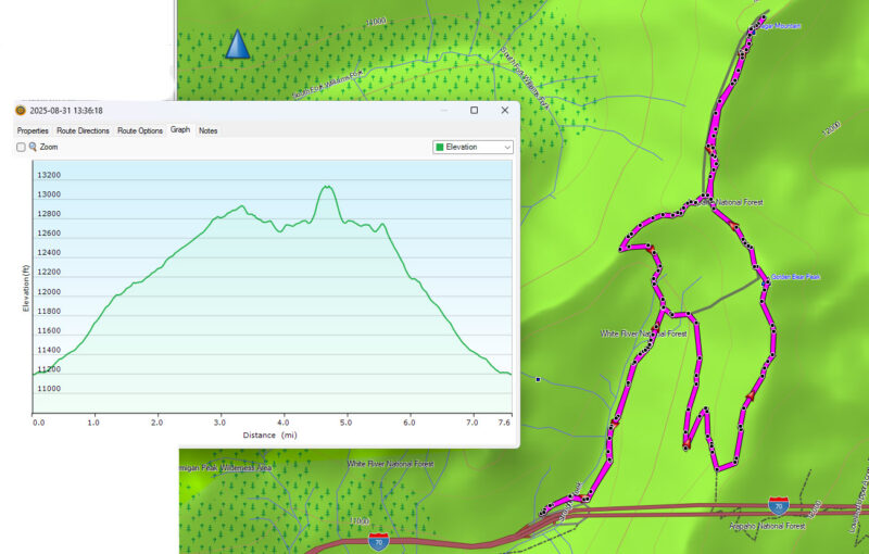
Round Trip: 8.1 mi with 3,271 ft of elevation gain
Golden Bear Peak Fast Facts (13,005 ft.)
Trip Type: Hike, YDS Class 1 with some easy 2
Distance to Peak: 3.4 mi
Hagar Mountain Fast Facts (13,246 ft.)
Trip Type: Climb, YDS Class 2 mostly with a short section of 3/3+ at the summit block
Distance to Peak: 5.0 mi
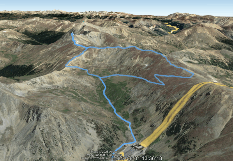
We decided to go explore a less well known entry point to climb Hagar Mountain as well as explore the area around the Eisenhower Tunnel. That is correct, if you look at the Google Earth image above, you will see we started just outside and off the road from the Eisenhower Tunnel and worked our way into the mountains from there. There isn’t a ton of parking, but it was less full than Herman Gulch. Our targets were Golden Bear and Hagar and to take a look at the Citadel.
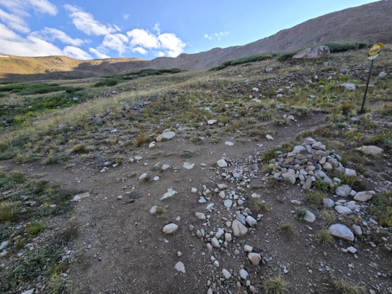
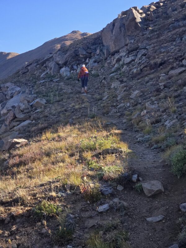
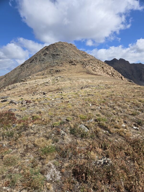
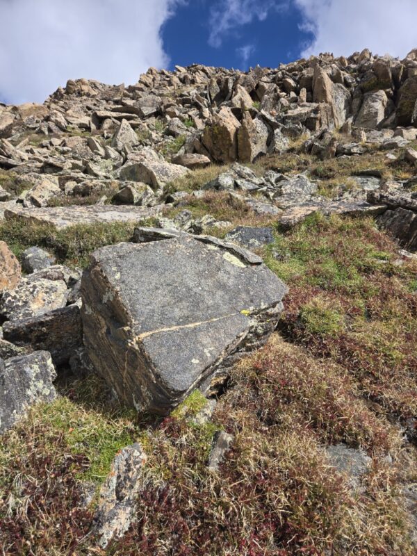
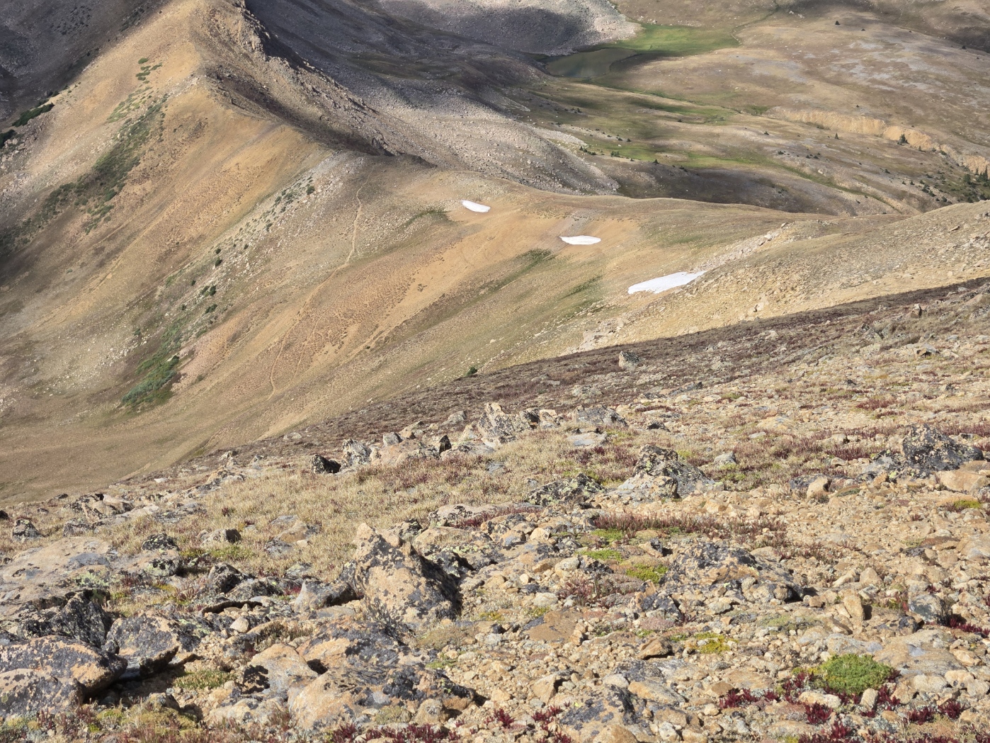
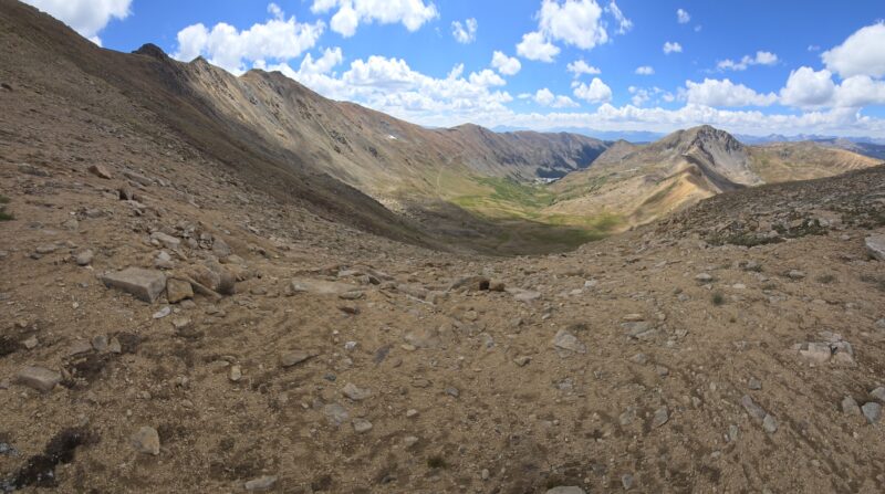
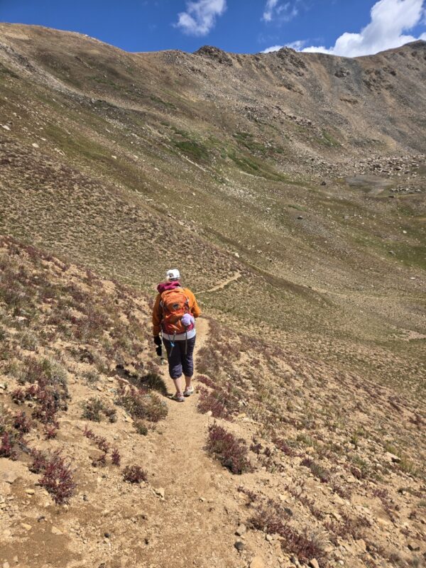
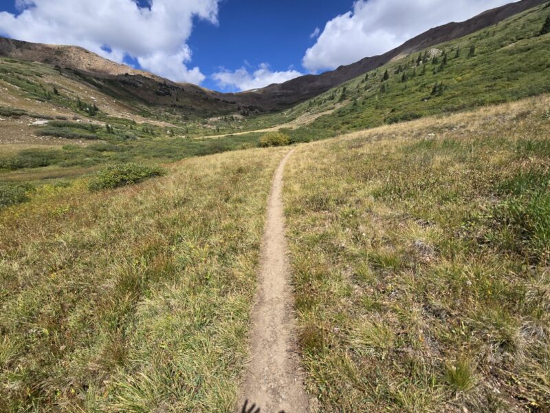
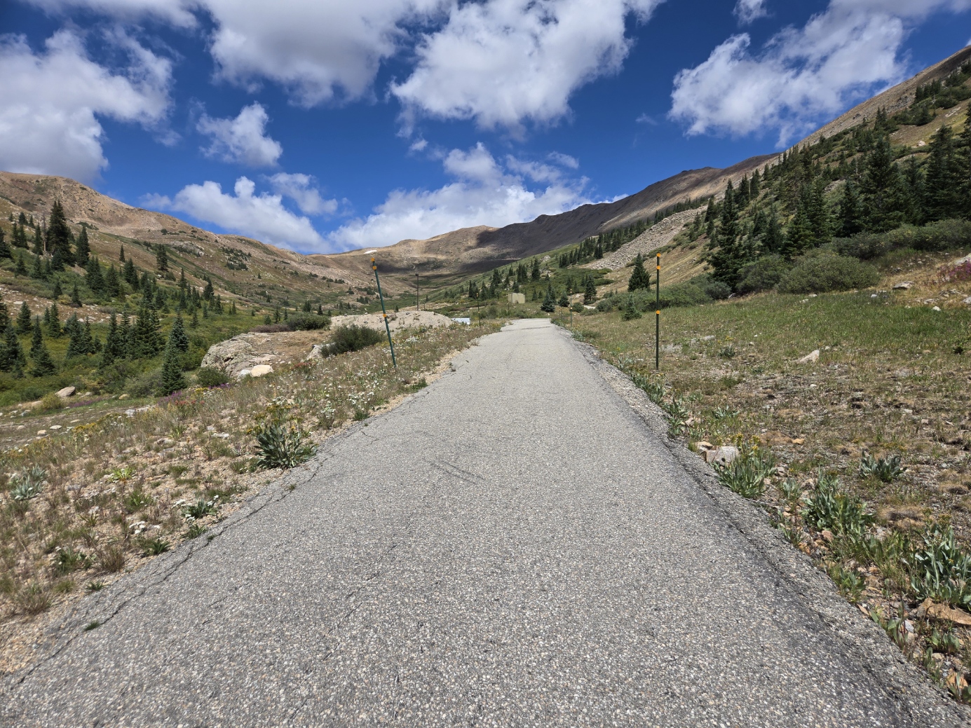
The first part of the trek to Golden Bear Peak, which is a cool name for a peak, is on a road, which isn’t tons of fun, until you realized you are hiking next to the amazing engineering feat. But it quickly turns into an ATV road and then singletrack. There are numerous options to get to Golden Bear, and we opted to take the trail that winds back across the face Golden Bears west face and then switchbacks up to the ridge (see basecamp screenshot). There is a fork in the path at about 1.3 miles and to take the route we chose you go right. See below.
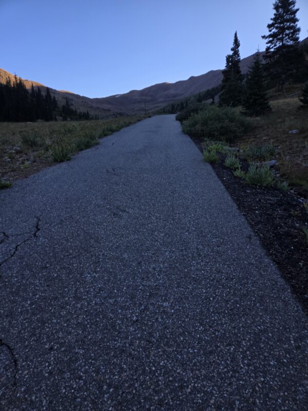
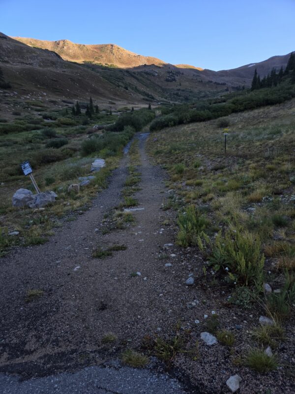
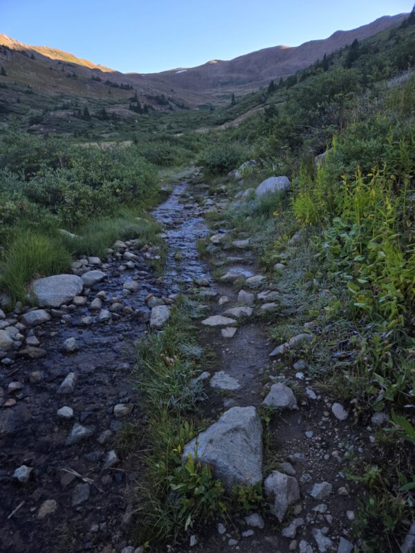

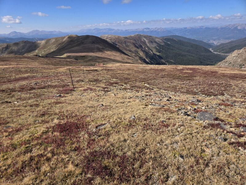
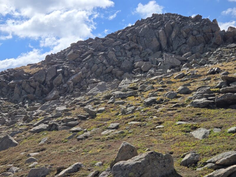
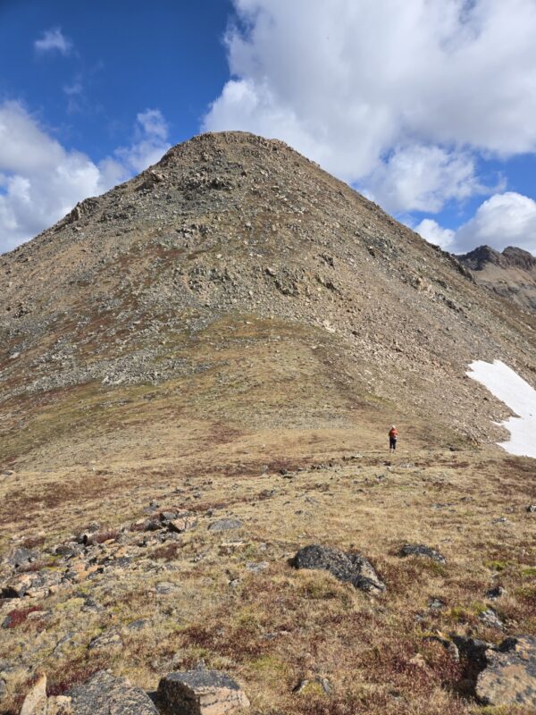
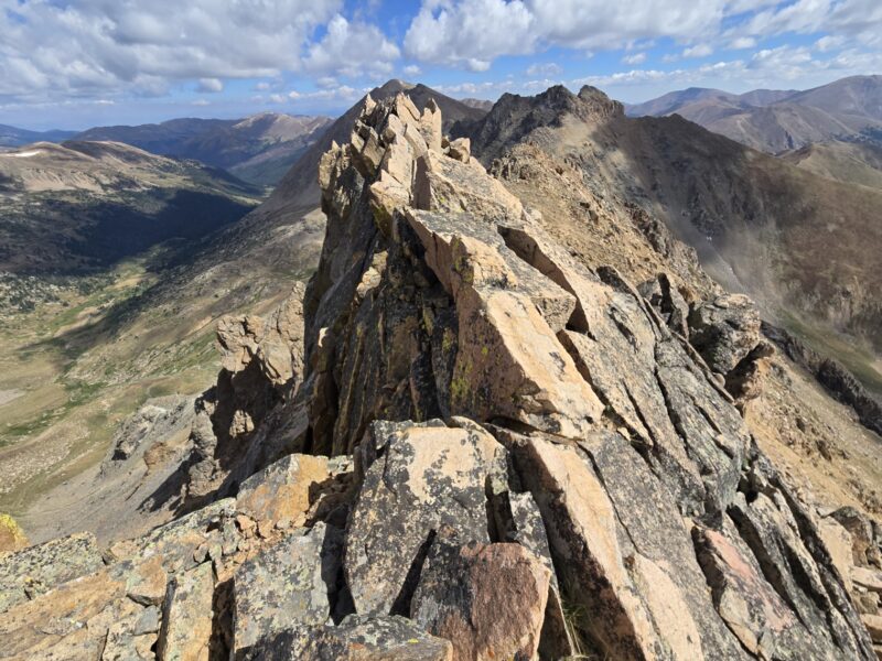
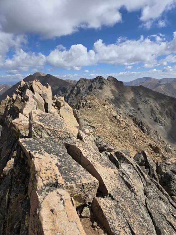
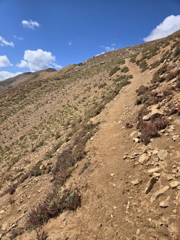
Now, this does take you quite a ways out of your way if you have no interest in Golden Bear; but who wouldn’t want to snag this cute 13er? Keep in mind that you add almost 2 miles by not staying straight at the fork above. But anyhoo, the trail is very nice up the side of the ridge. Honestly, I barely felt we were gaining elevation. You cut across the face for quite some time, and have pretty unique views of Summit County and the tunnel, not to mention the Front Range and Mosquito Range. Below are some shots of the path from the morning, and also from later in the afternoon shot from the ridge across from it.
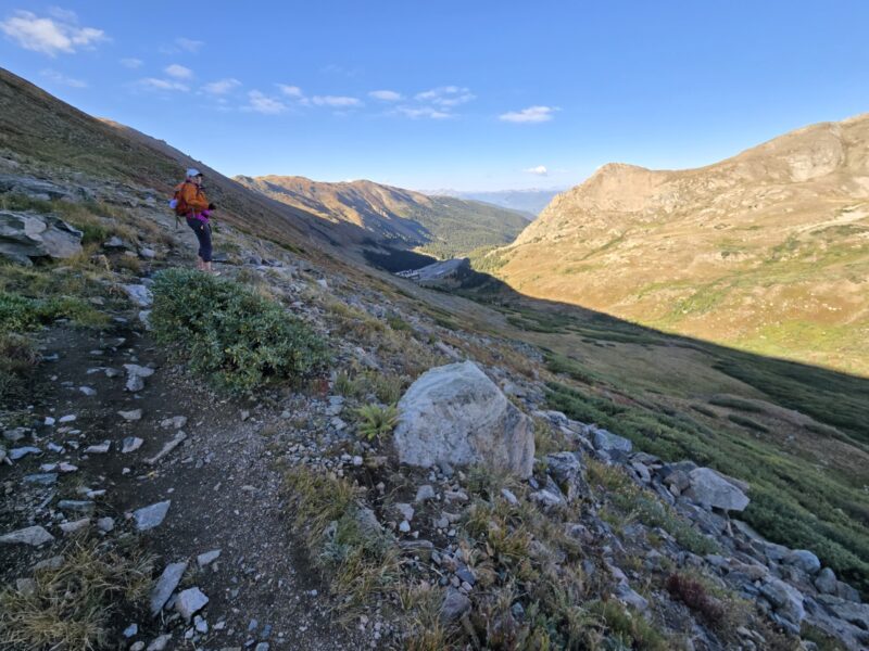
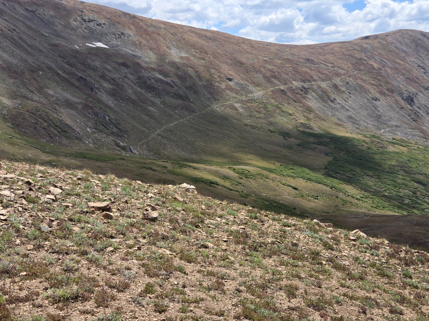
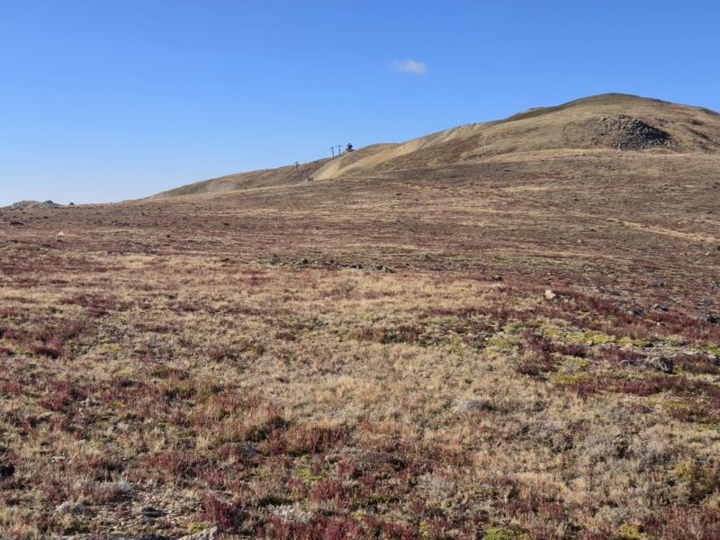
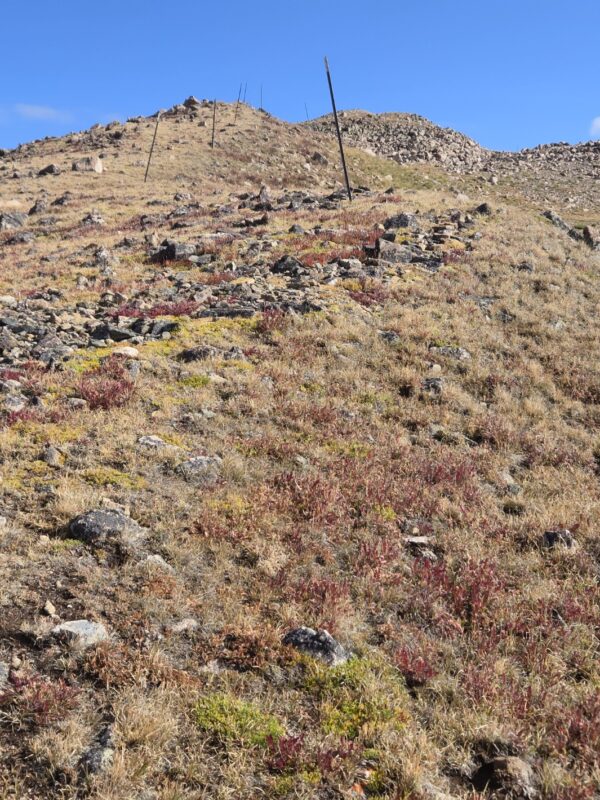
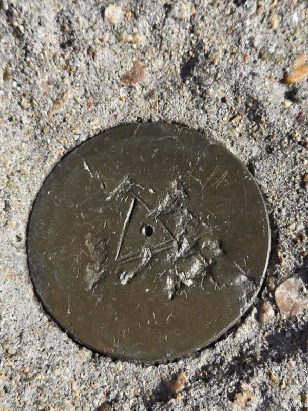
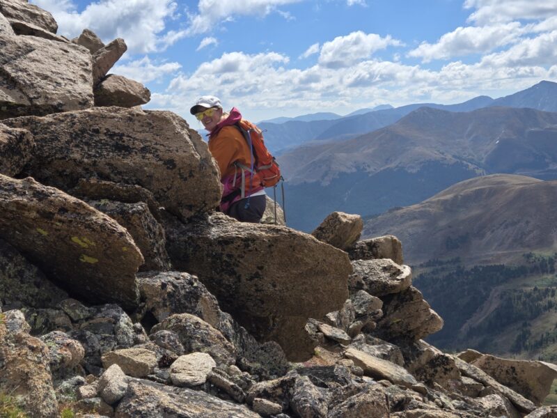
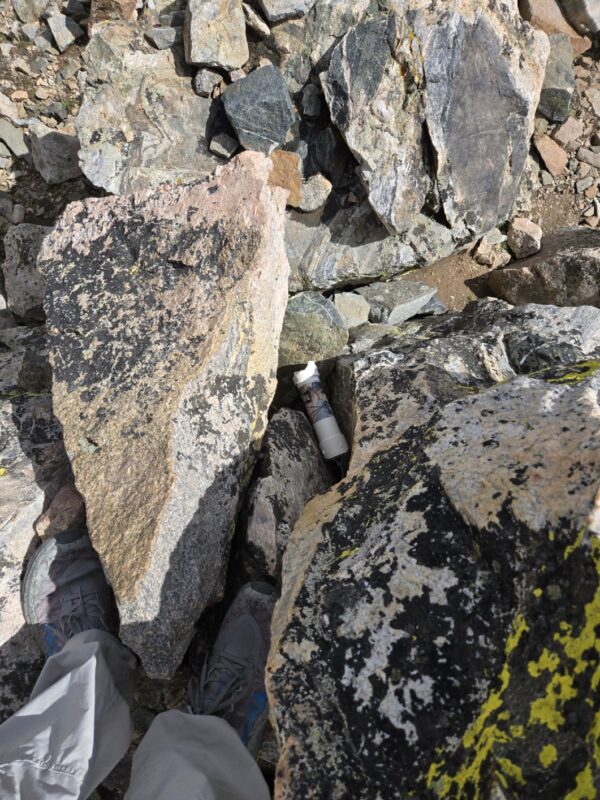
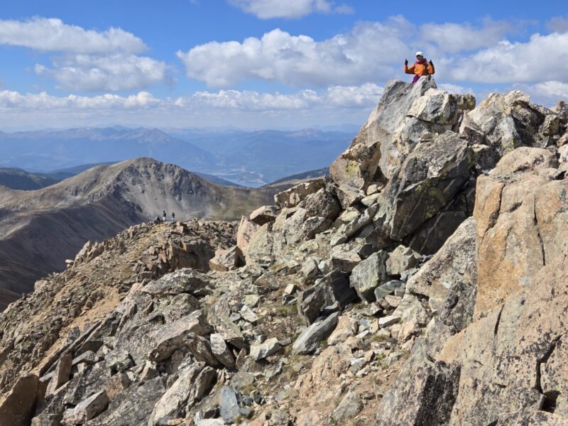
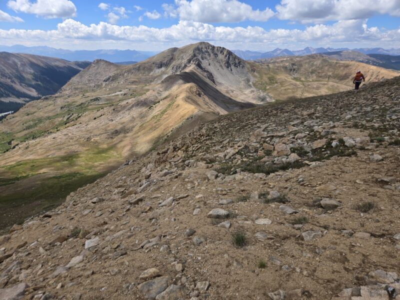
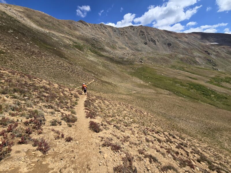
That shot above really shows you what you’re doing really well. Alright then, so you pop out on the ridge and you can see Loveland Ski area and all the fun lifts. Well, you can see quite a bit up there including Dry Gulch (which is not dry). The ridge is gorgeous and you can follow the poles stuck in the ground by ski patrol which I am guessing set the boundary for Loveland Ski Area (maybe?). After a short and relatively uneventful jaunt you arrive at the summit of Golden Bear. Actually, it’s about a mile along the ridge with a little over 500 ft of gain, but it felt brief. Below are some pictures including a very worn geological marker.

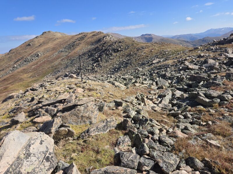
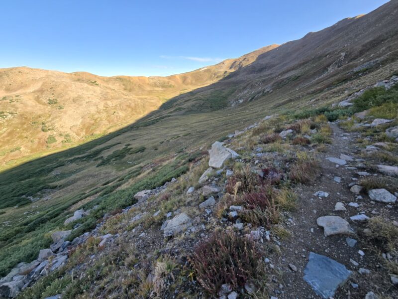
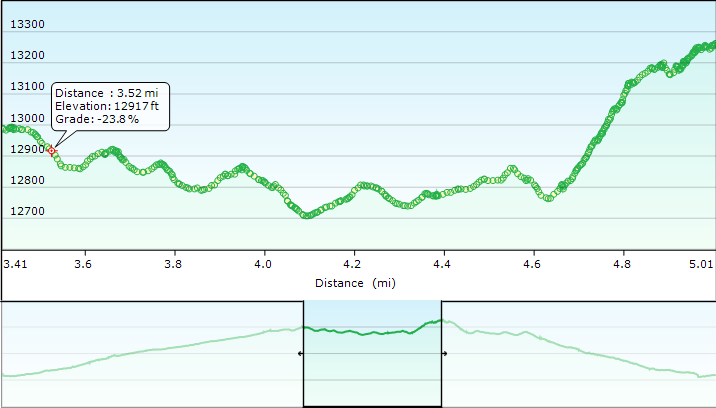
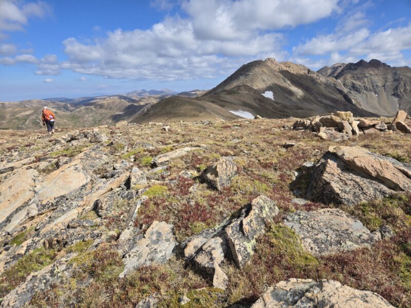
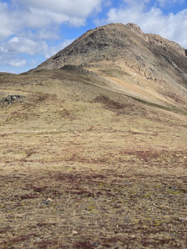
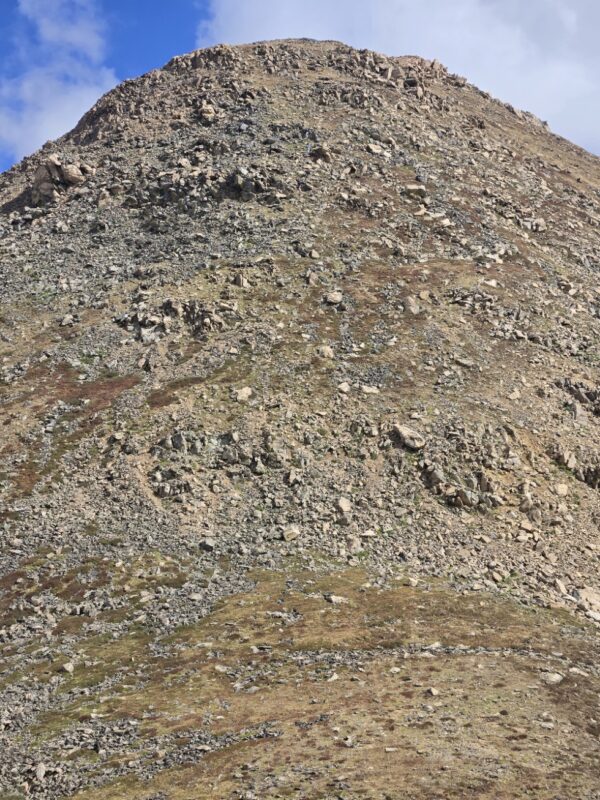
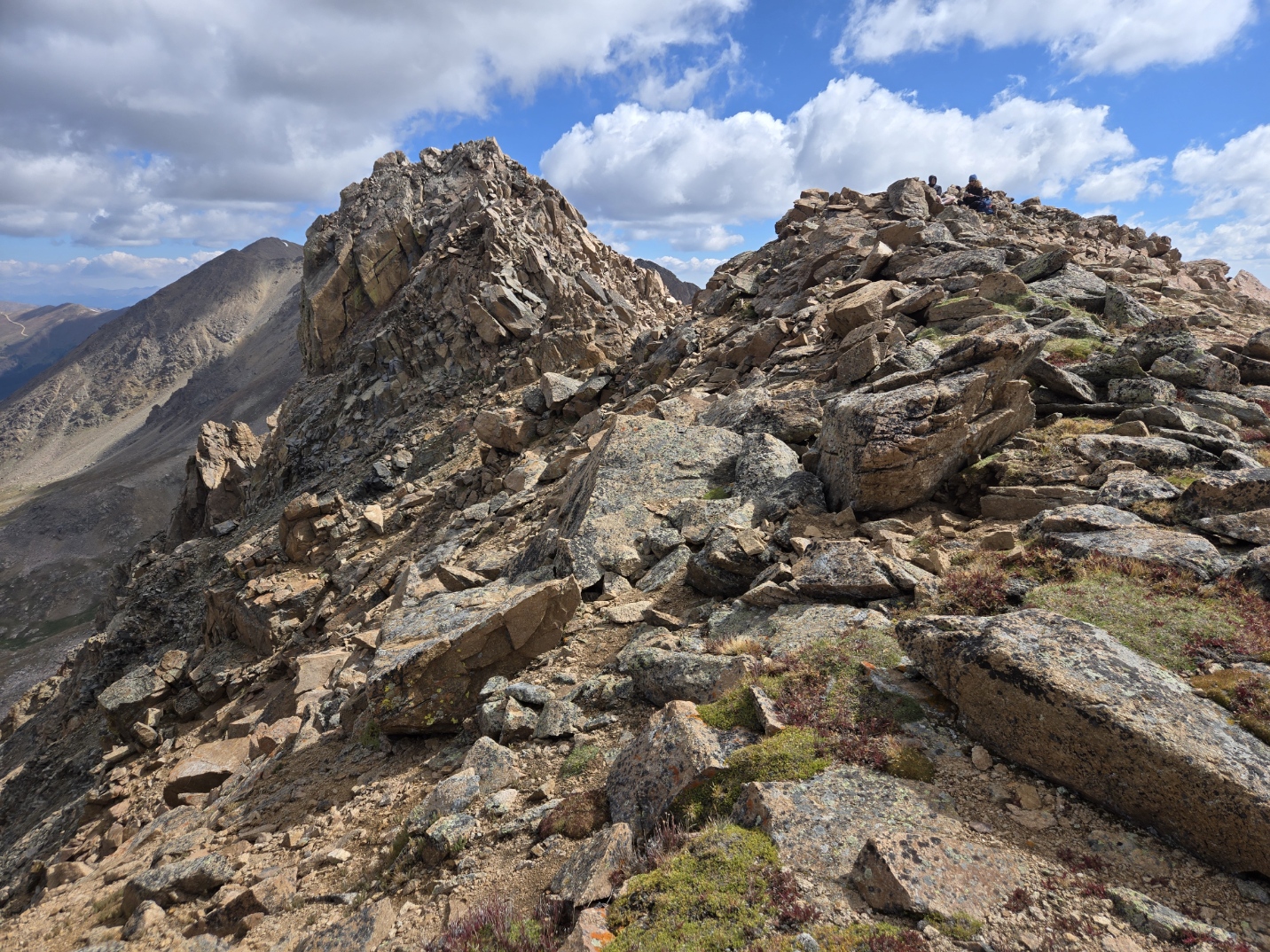
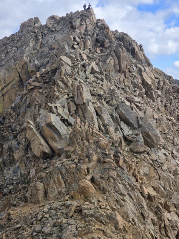
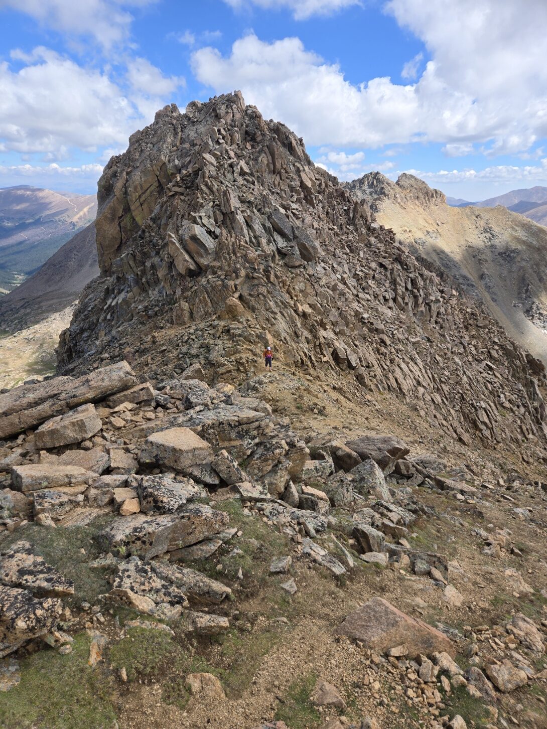
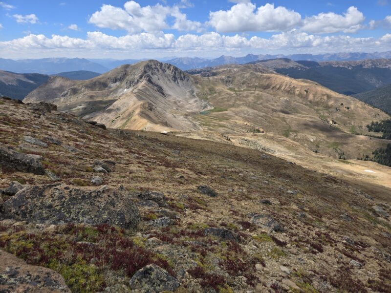
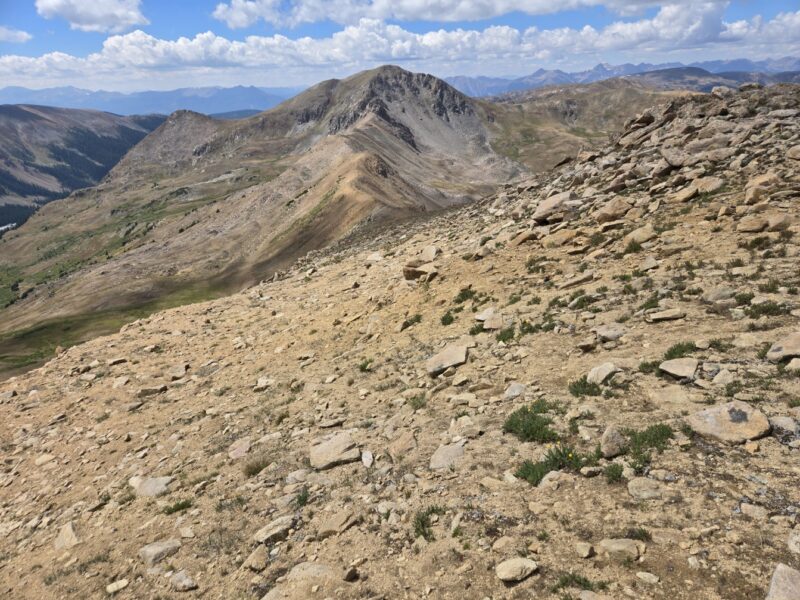
So onwards toward Hagar! It is 1.7 miles and almost a 1,000 feet of gain from here to get to Hagar, so, not nothing. You have to go up and down 6 very distinct times to get to Hagar from here, which you can see below. Pretty much all the little summits are rocky, but one of them in particular tricked us, and we just went straight over it and didn’t notice we were supposed to skirt around to the right. So, we ended up getting a little bonus class 3 on this section. You will also notice that at almost the end it gets quite steep. That is the worst section with an average grade of around 45% according to the Garmin, but that was with some traversing around.
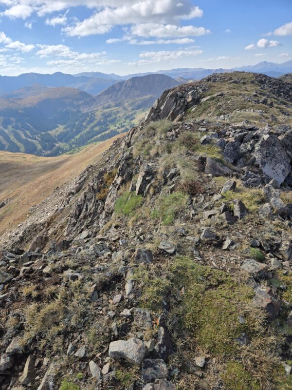
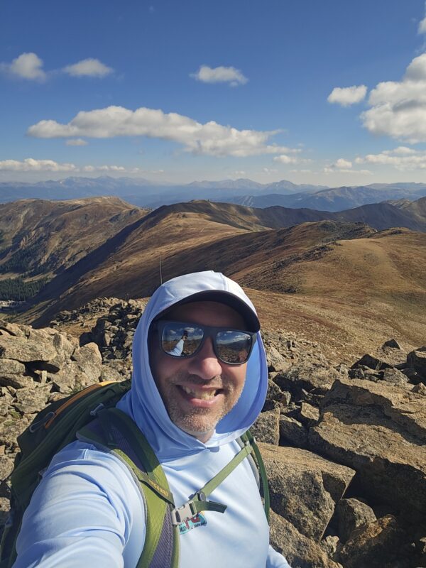
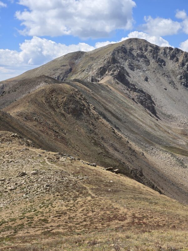
I have some pictures below of the ridgeline and of that final push to the top just before you drop down for the final push up the summit block of Hagar.
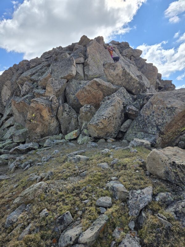
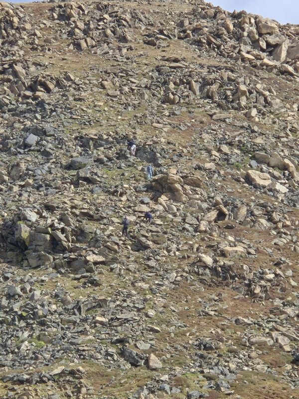

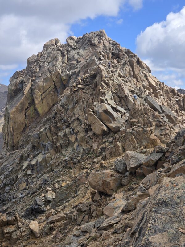
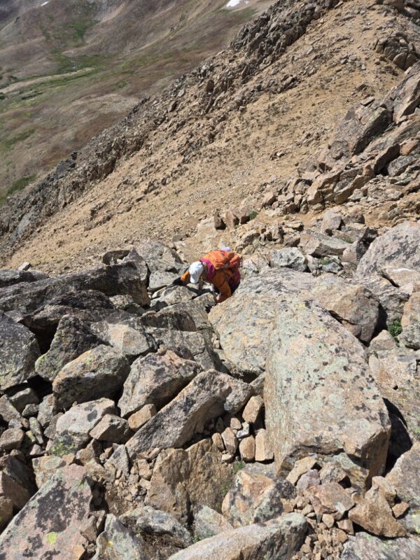
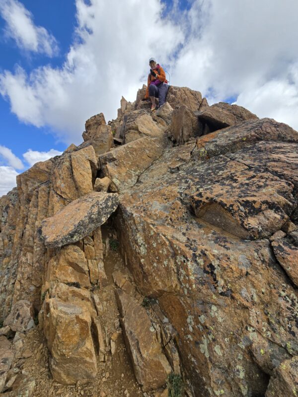
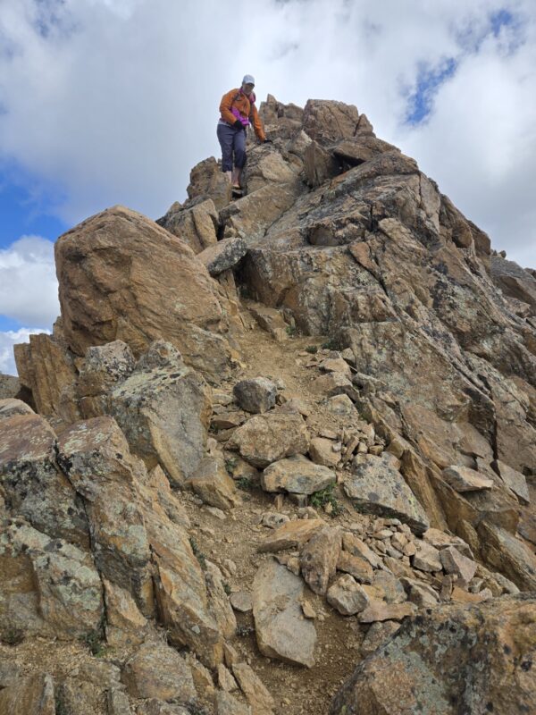
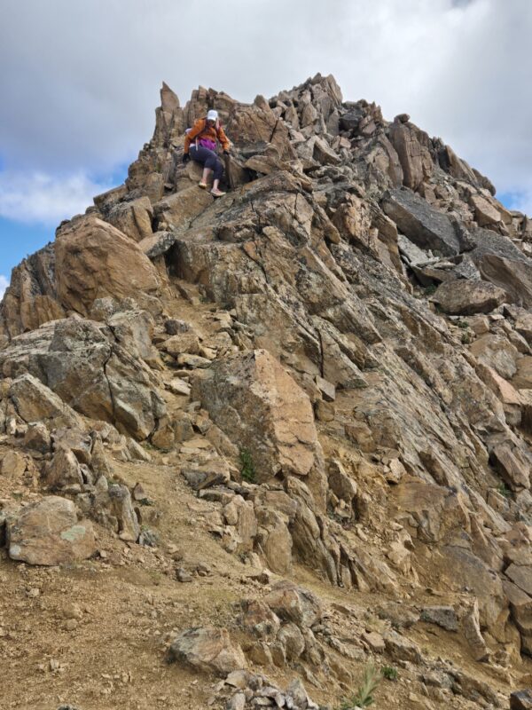
Okay, so you have made it to the last up before dropping down to the base of Hagar’s summit block (above). You have lots of options. You can choose to just observe the summit as some folks did, you can also choose to try and make it as hard as possible, which some other did as well. Regardless of your decision, it’s a neat spot. There are some class 3 routes up and it’s only about 50 ft. of climbing. So, choices.
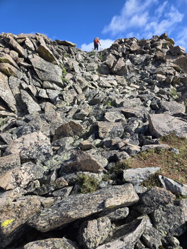
1. There is an immediate obstacle once you drop down right in front of you. You have to either go over the block of around it. If you go over it there may be a couple different options, but one obvious one. It is class 3 to go straight over it and the rock is solid. The path around looks loose and didn’t look “fun.”
2. Next, you have to make a decision as to how you want to take the line up the main block. We decided to try and keep the as much to the ridge as we could and honestly stayed pretty close to the line the couple in the first photo took. There are a few decisions to make here still, but for the most part the rock is good and just take your time.
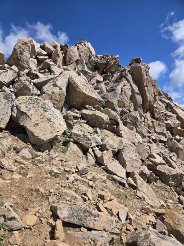
3. Near the summit block if you go right you can end up in a situation where you have to make a class 4 move, but if you keep to the left and on the ridgeline you avoid this (although the exposure can feel intense).
Now, I’ve read of folks doing the Citadel and Hagar together, and so I wanted to go a little further and see the ridge a bit. But, I ran into a knife edge pretty quickly and decided that was the turning around point for today since Allyson was still waiting for me on the summit. After thinking about it, this isn’t likely the best way to combo Hagar and the Citadel since you’d have to do both of them twice. Most folks do it from Dry Gulch as a loop. Perhaps we’ll do the Citadel from Herman Gulch next year.
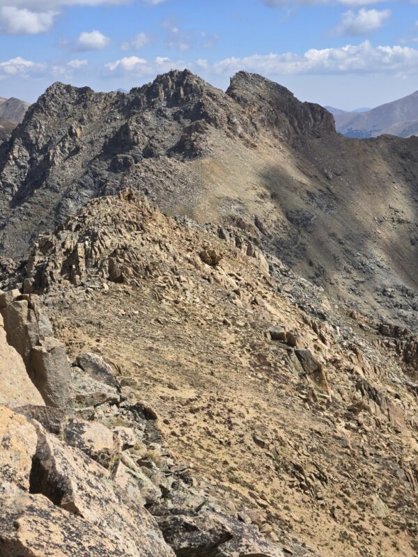
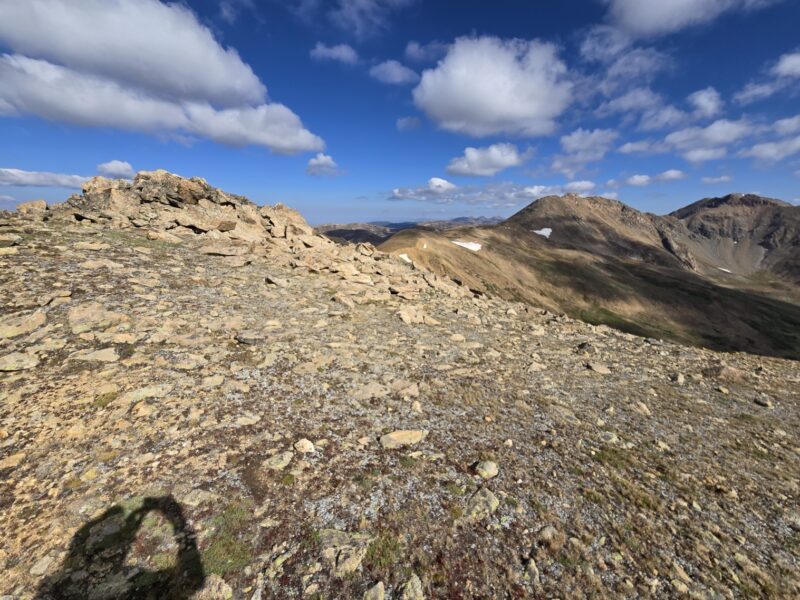
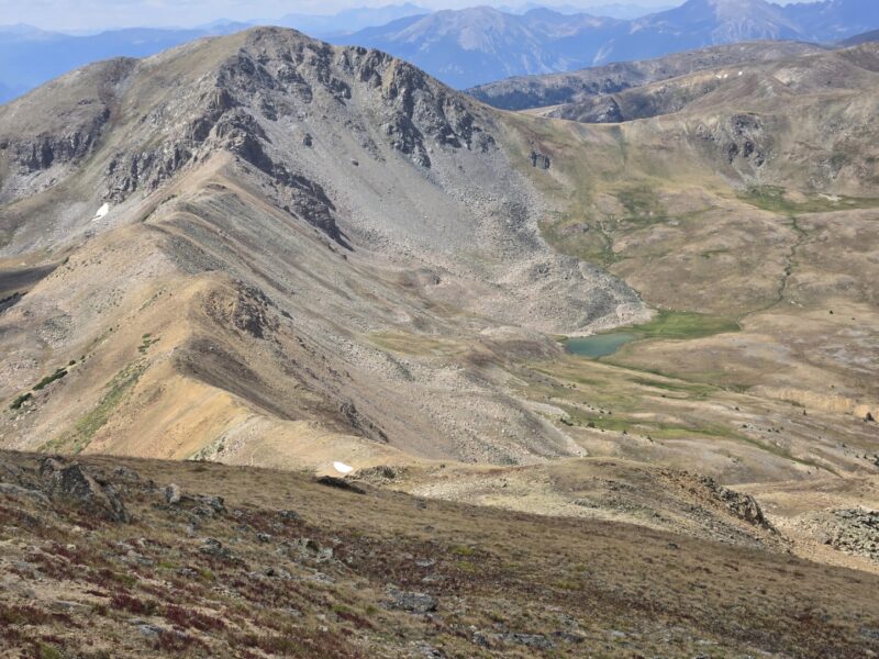
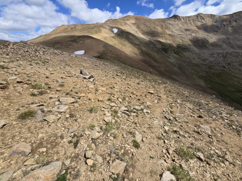
And then it was time to head back. But wait, we weren’t going to go all the way back to Golden Bear, so how are we going to get down? As you are hiking over to Hagar, you will notice on the ridge across from Golden Bear a trail going down that looks accessible from the ridge between Hagar and Golden Bear, and it is. You can see it below.
So what you do is this. You head back over and do some ups and downs again, but, once you get to a point where you can see a nice route down to that ridge, you start working your way down. There is actually a nice little trail you can find that leads over to that ridge. This is the path you’d have taken if you’d stayed straight at the fork at 1.3 miles. From there it is just a pleasant class 1 walk back to the car. Just don’t miss that trail on the ridge as it can be easy to miss.
Thanks for reading, hope it was helpful or at least interesting 🙂