Take a Walk
A Quest into the Wild
Humboldt Peak, East Ridge, 14,064 ft
Distance: 8.7 miles (out and back) Average Slope: 20% Max Slope: 42-45% Fourteener #15
Elevation Gain: 4,337 ft. (net) Max Elevation: 14,064 ft. Min. Elevation: 9,727 ft. Average Elevation: 11,755 ft.

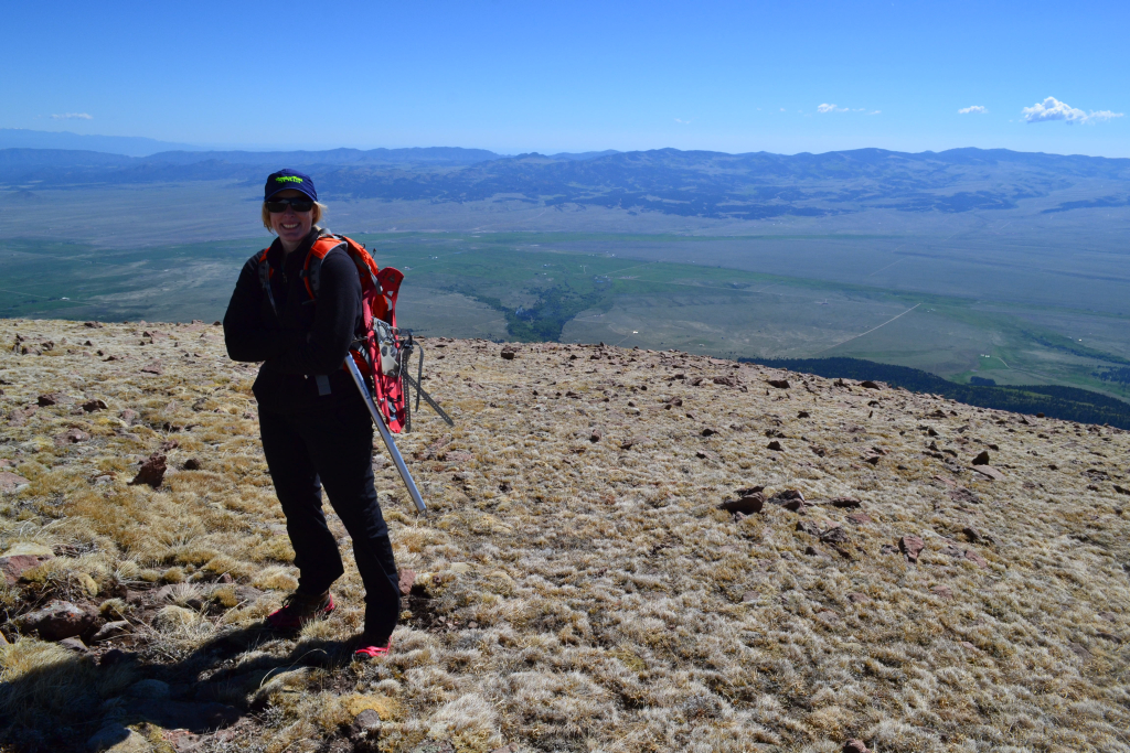
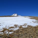
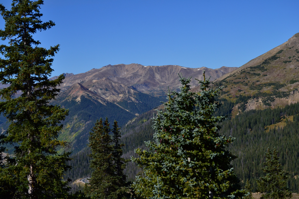
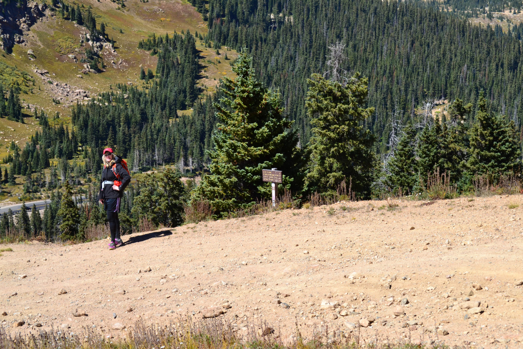
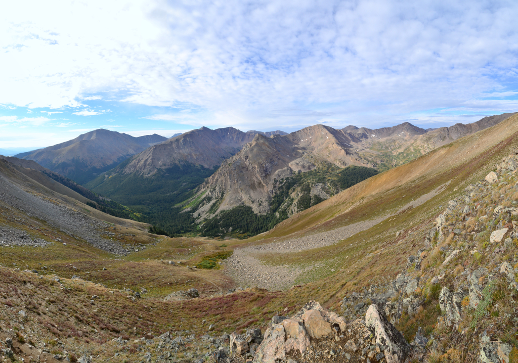
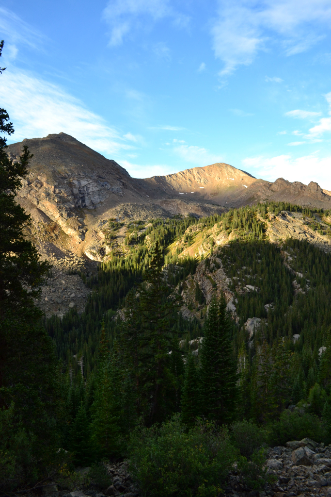
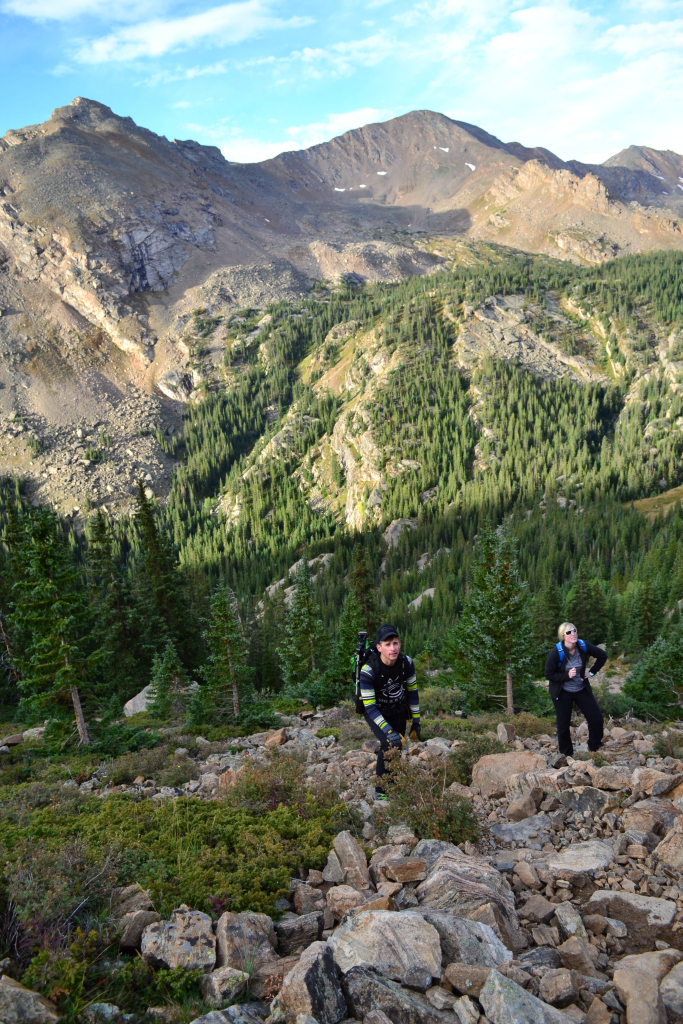
We chose Humboldt Peak as our first 14er of the season as it is often deemed a great introduction to the Sangre de Cristo range and because of the spring mountain conditions with lots of remaining snow and ice. Humboldt peak reaches 14,064 feet into the sky and offers amazing views of its famous neighbors, the Crestone Needle and Peak. We began our hike on Sunday June 5th at 6:00 am sharp at the Rainbow Trail Trailhead which is a located off of the 4WD road that ends at the South Colony Lakes upper TH. The road was relatively easy to ascend with our stock 4WD X-terra, and not nearly as bad as we have heard it described. The few parking spots were empty as we arrived at the trailhead, and the only sign of human life was a small tent in one of the spots. 50 feet beyond the TH sign we veered right and proceeded via the East Ridge route up Humboldt.
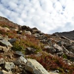
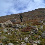
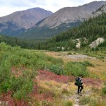
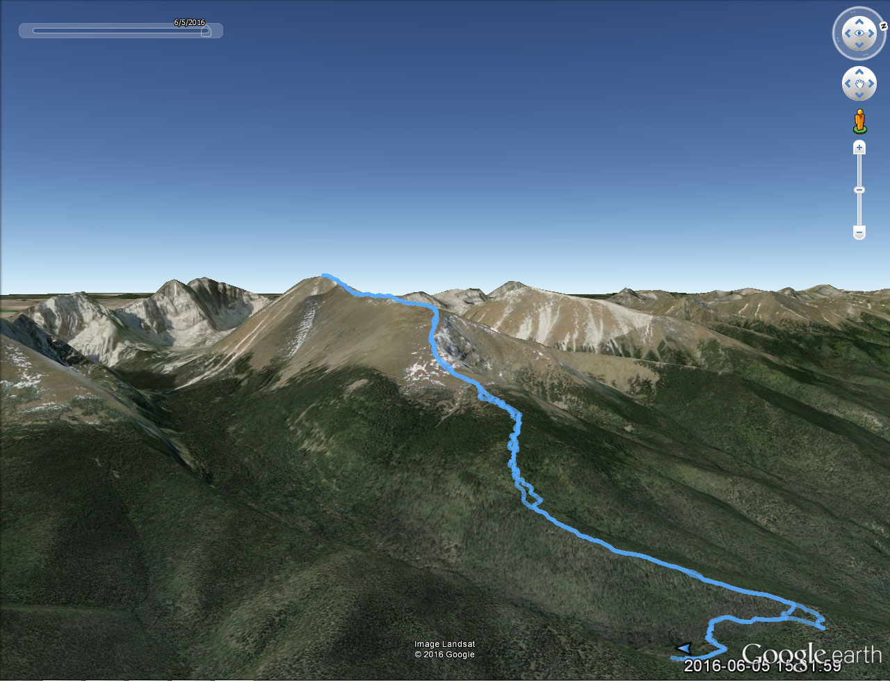
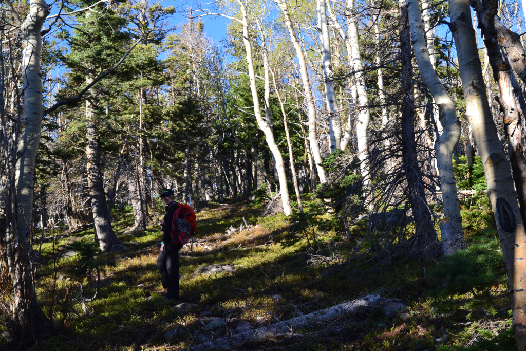
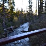
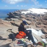
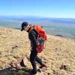
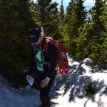
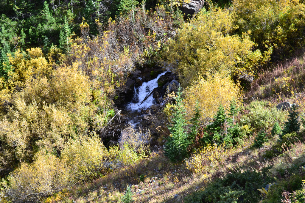
The East Ridge route is deemed a safer and shorter winter ascent of Humboldt, and with rumors and reports of remaining snow, we opted for this route. It should be noted that this route doesn’t have a defined trail in summer, and requires quite a bit of route-finding. We veered off of the lovely stable Rainbow Trail after about 0.2 miles and bridge crossing of South Colony Creek, and proceeded to bush-wack through steep woods to gain a small ridge. So far there was no snow, and temperatures were quite warm for just after 6 in the morning. Our packs were full of snowshoes, ice axes, and tons of water and energy weighing close to 45 pounds. As we trudged through the woods, we soon began to feel the burden of our excessively heavy packs this early in the season. Seen below are photos of the South Colony Creek bridge crossing and early ascent to the ridgeline.


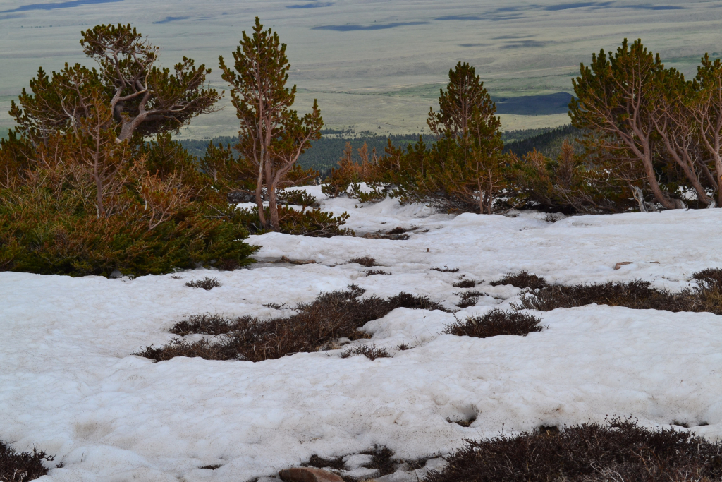
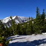
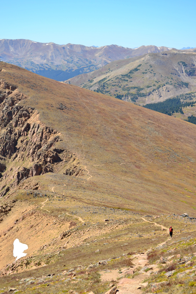
We hiked southwest along the narrow wooded ridgeline, following GPS waypoints of the route to help us stay on track. At around 10,500 feet, we turned strictly west and the forest thickened, and the terrain became significantly steeper. It reminded us of hiking up a sheer black ski run in the summer only with many more obstacles. We continued to navigate through the maze of snag and deadfall focusing primarily on gaining elevation. Though we had only been a little over 2 miles, the route through the trees felt long. We felt that tree-line was never going to come within reach. The sweat inducing off-trail adventure continued without ease until around 11,100 feet in which the elevation gain lightened up ever so slightly. Around this point, we eyed our first stashes of wet snow. We were somewhat able to weave in and out of the snow drifts for a while with minimal post-holing. As we gained elevation, the trees finally began to thin and more and more unvoidable snow began to appear. We had to post-hole a bit through this section as the snow was not continous and unworthy of snapping on the snowshoes this early.
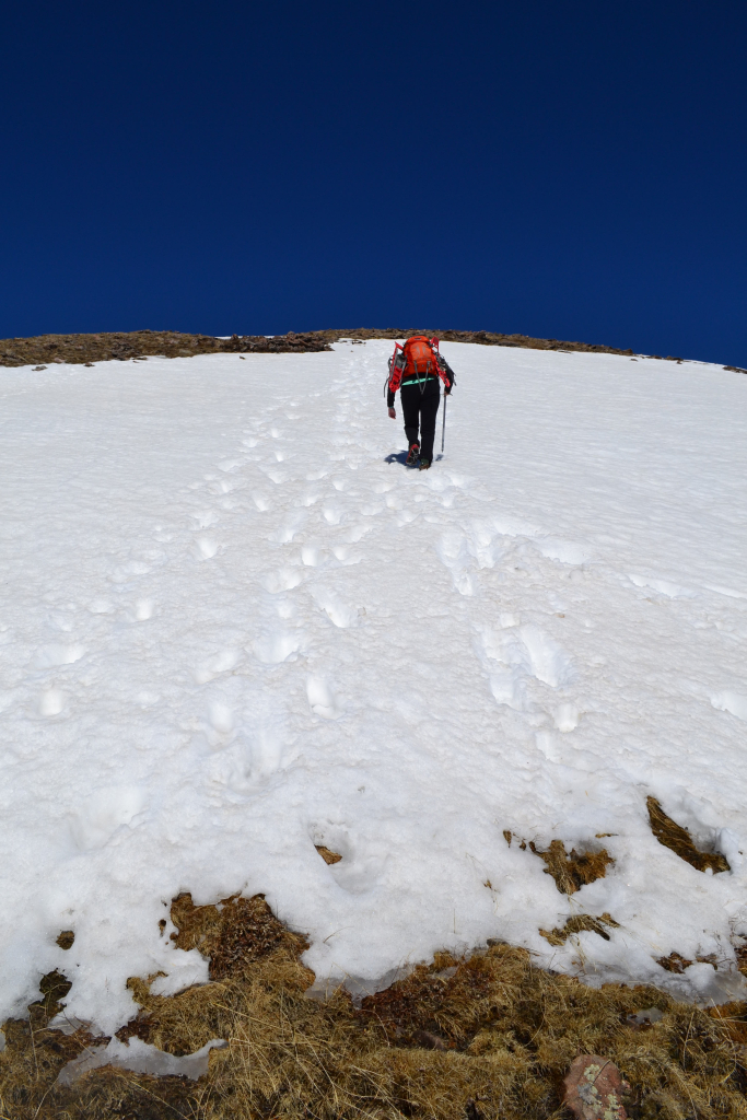
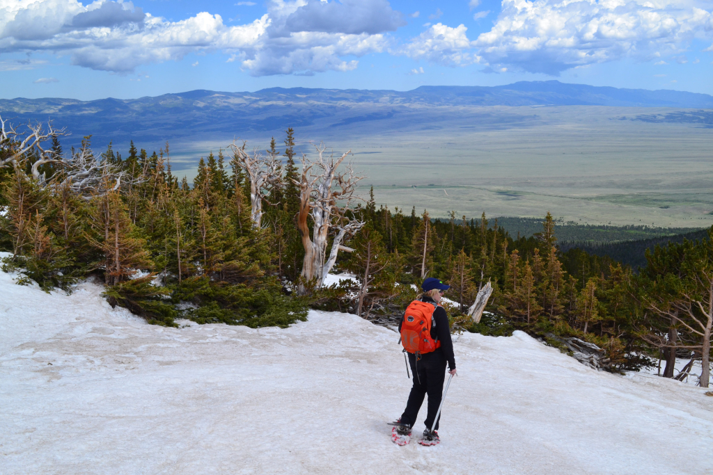
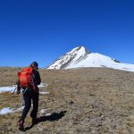
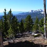
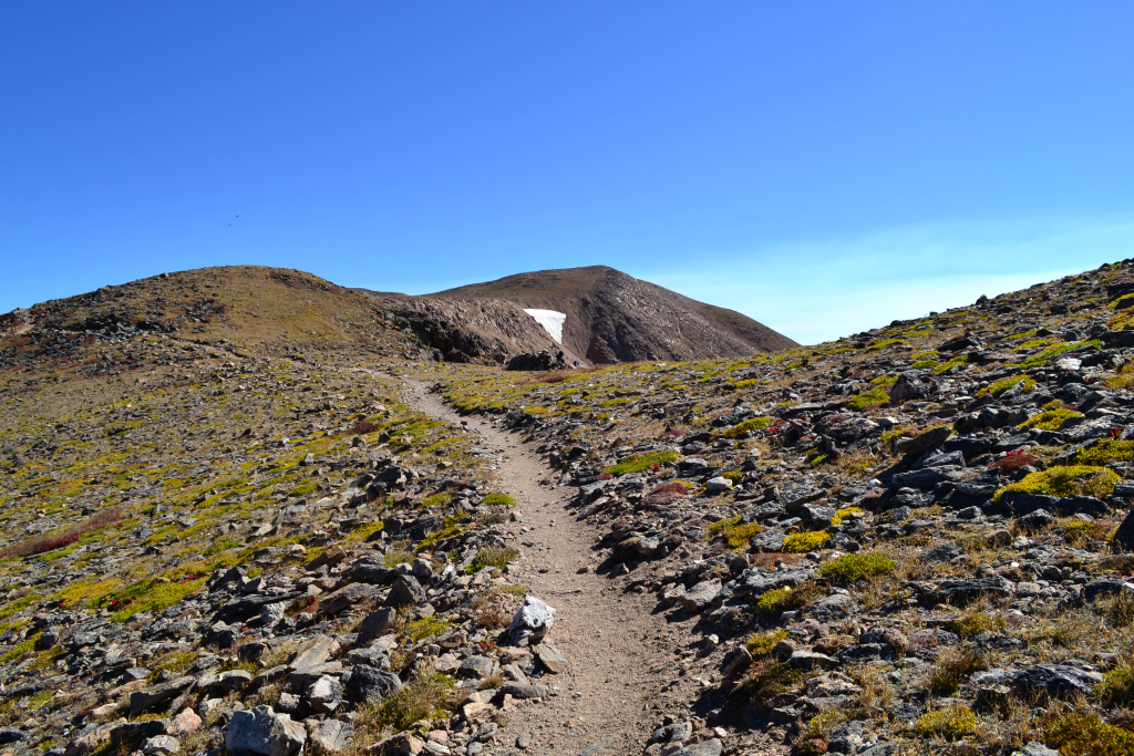
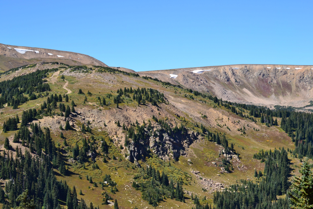
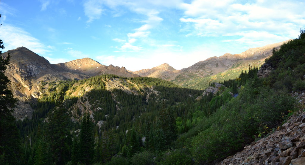
As the trees gave way to the alpine tundra, there was a signifcant stretch of snow, and we finally snapped on the snowshoes. We now had glimpses of the false summit but could not yet make out our 14,000 plus foot goal. This early in the day, the snow was still somewhat sturdy enough to support our weight. Through the steepness we trudged along. As we gained elevation, the powerful winds and bright sun left long breaks in the snow. We were now in a cycle of switching between boots, snoeshows, and microspikes with the variable conditions. As there was no trail to follow, we headed the only obvious direction…up. The lack of a designated path also meant a lack of switchbacks. While we have cursed the switchbacks on many a day in the mountains, at those times we neglected to appreciate the ease in elevation gain they provide. On this particular summit day, we headed straight up wasting no time traversing across the tundra to ease our pain. While to our west, our eyes were met with a vast rise in the earth that would not end, the east provided sweeping views of the small town of Westcliffe in which we were staying and the surrounding Wet Mountain Valley.


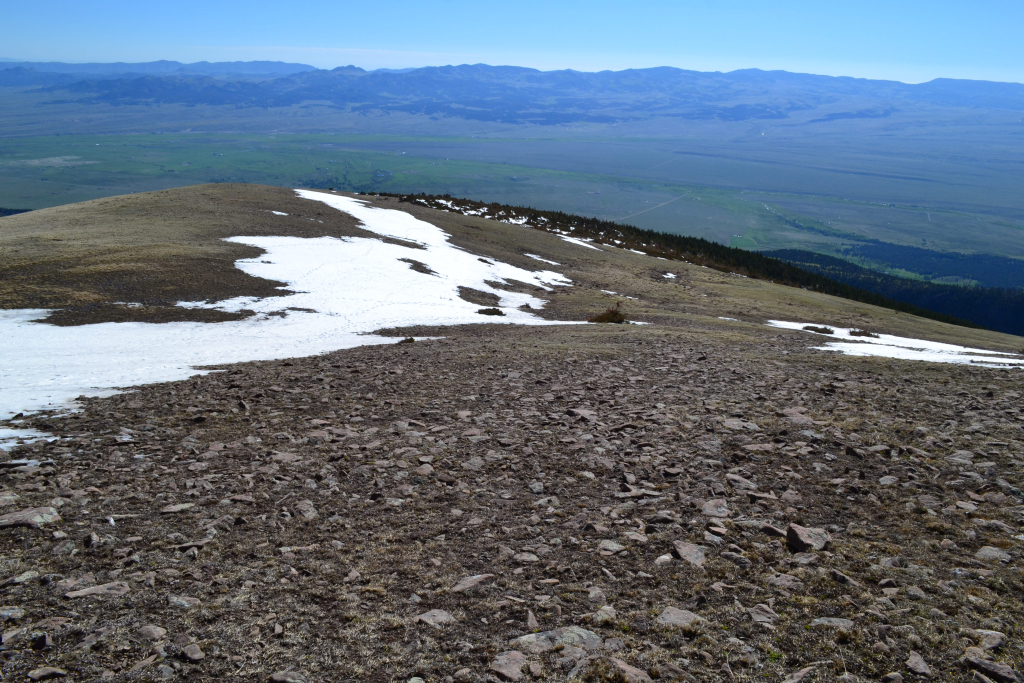
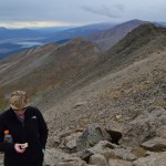
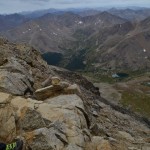
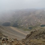
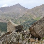
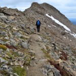
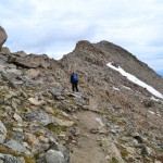
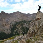
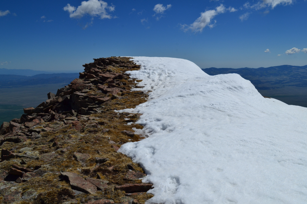
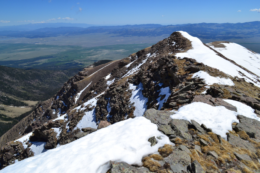
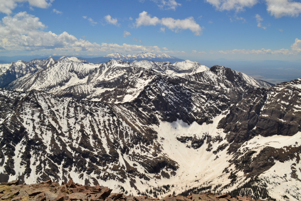
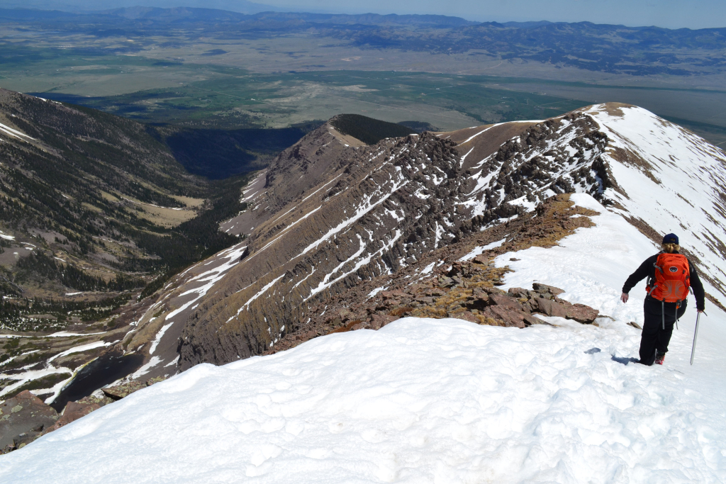
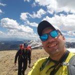
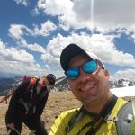
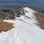
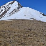
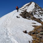
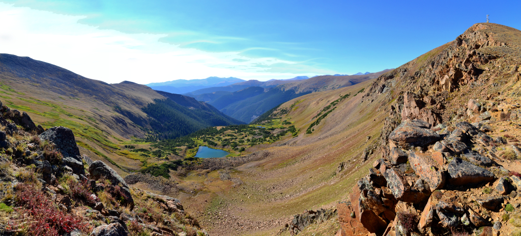
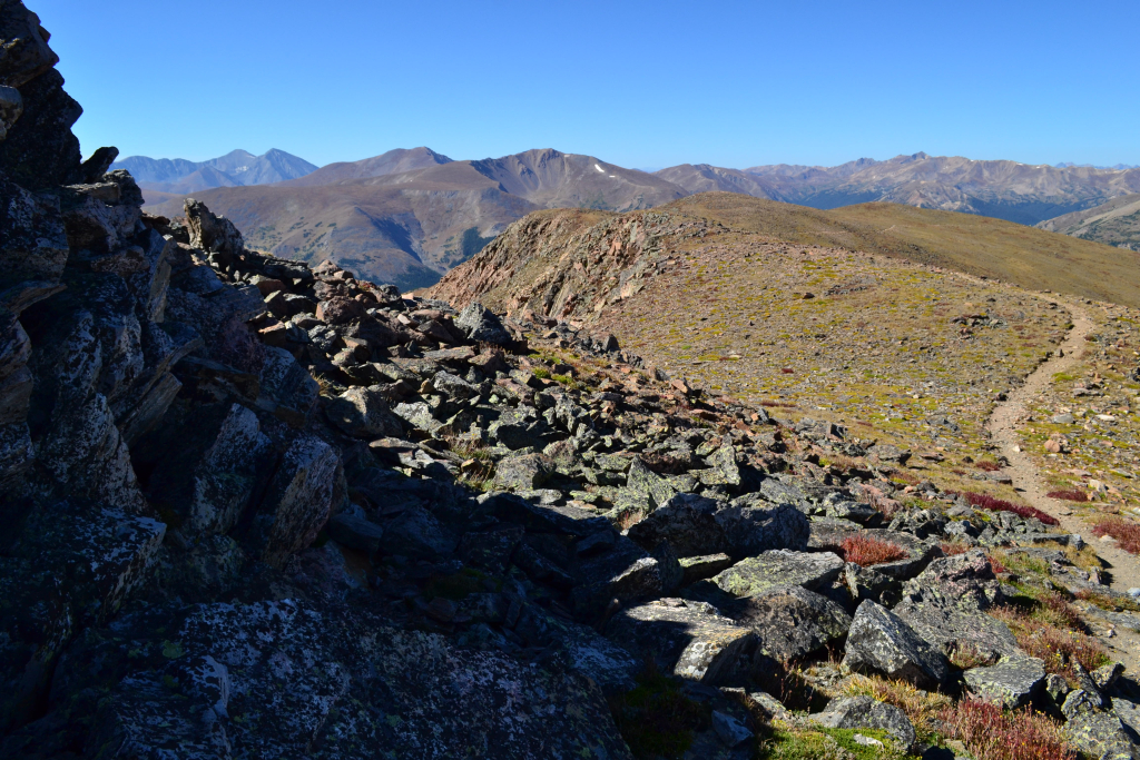
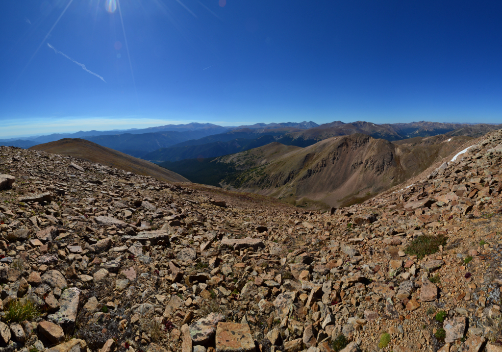
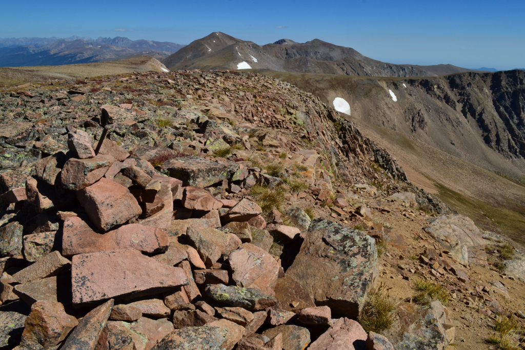
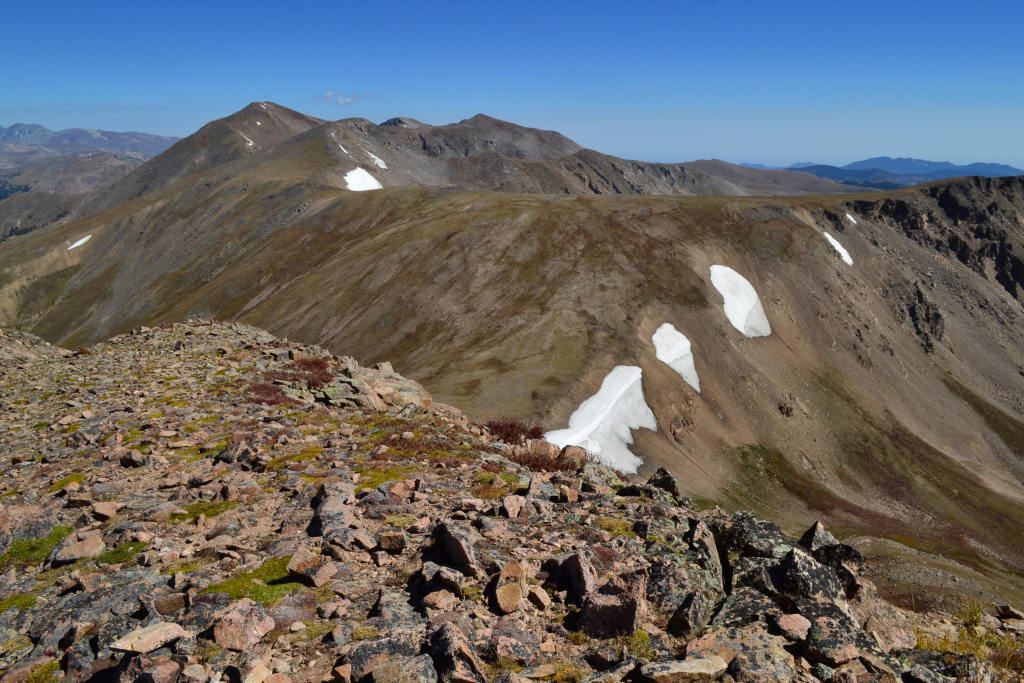
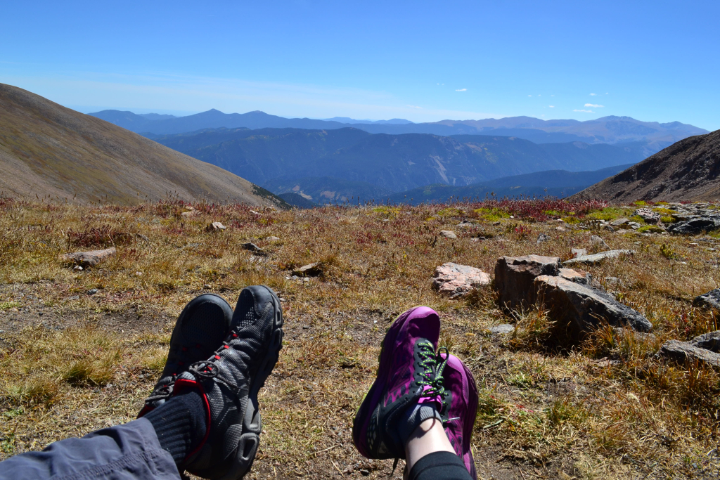
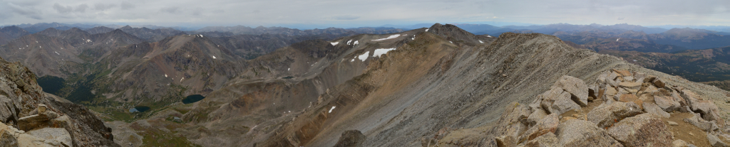
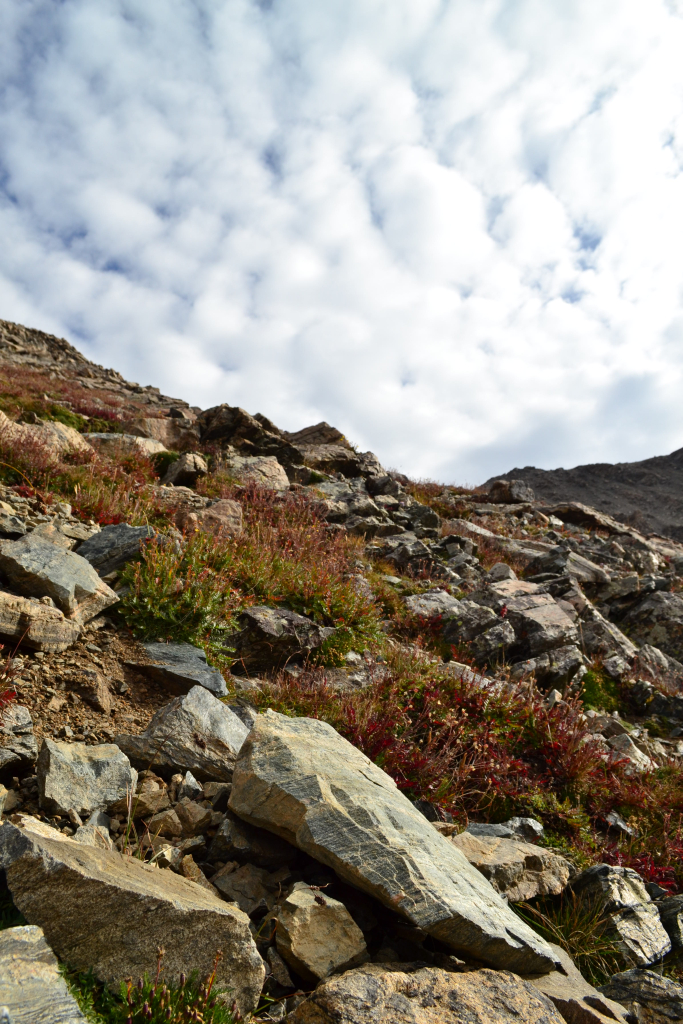
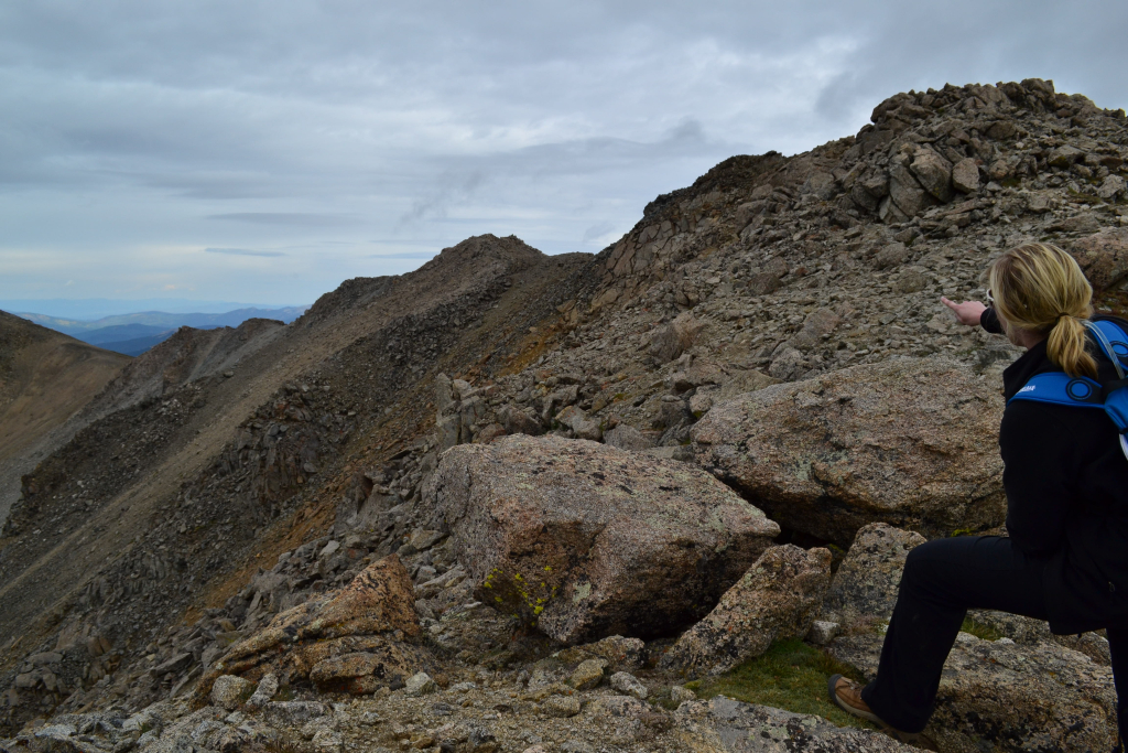
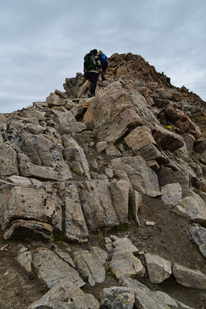
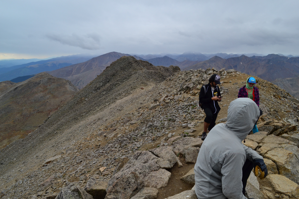
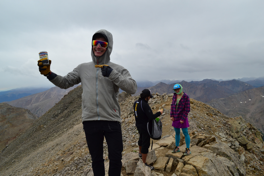
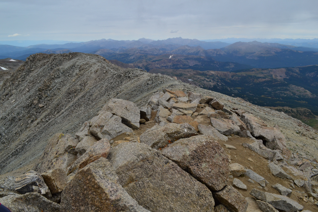
After slowly making our way up the false summit we got our first glimpses of Humboldt peak at just a little over 13,000 feet. However, we still had 1,000 feet of elevation to climb and the East Ridge still appeared to be a long and arduous journey for our early season conditioning. It is precisely one mile from this point to be more accurate. As we cleared the false summit, the route flattened a bit providing a brief reprieve. We could now see the East Ridge and our remaining route. At this point, the terrain became more dramatic with a bit of exposure. Snow covered the way to the top. Precipitous cliffs were a few feet to the right of our path (north), and steep icy chutes lined our left (south). We stashed our snoeshows shortly after beginning the ridge and proceeded carefully with microspikes. Seen below are photos of our trip across the ridge.
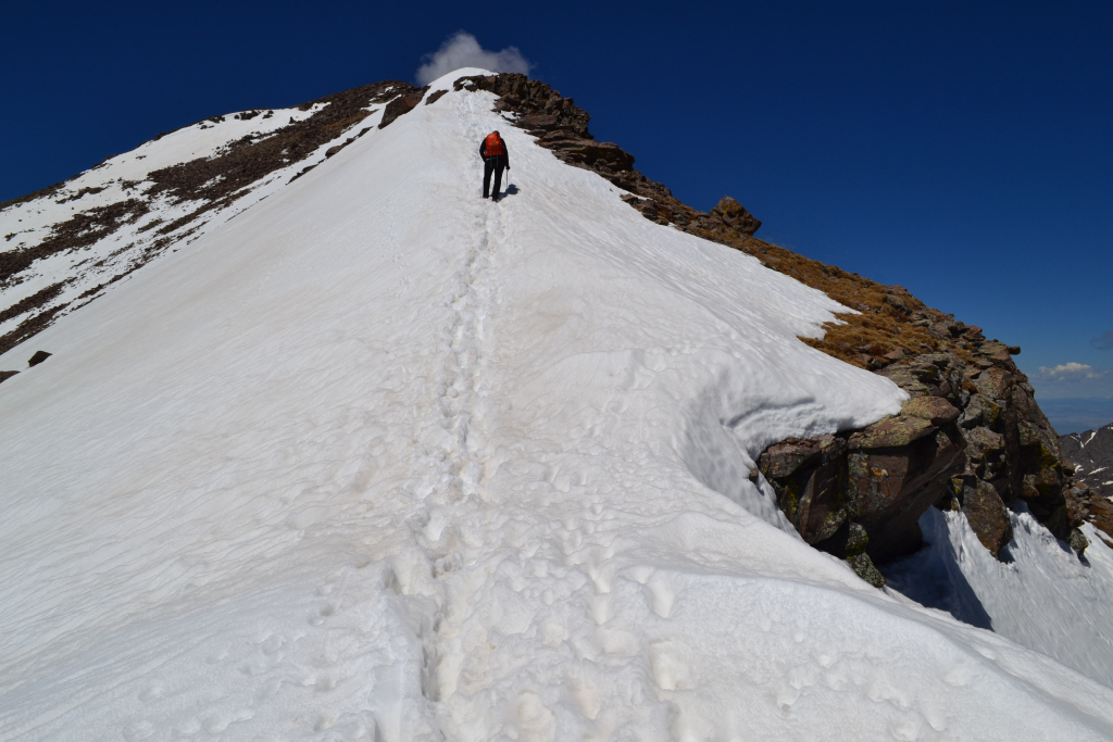
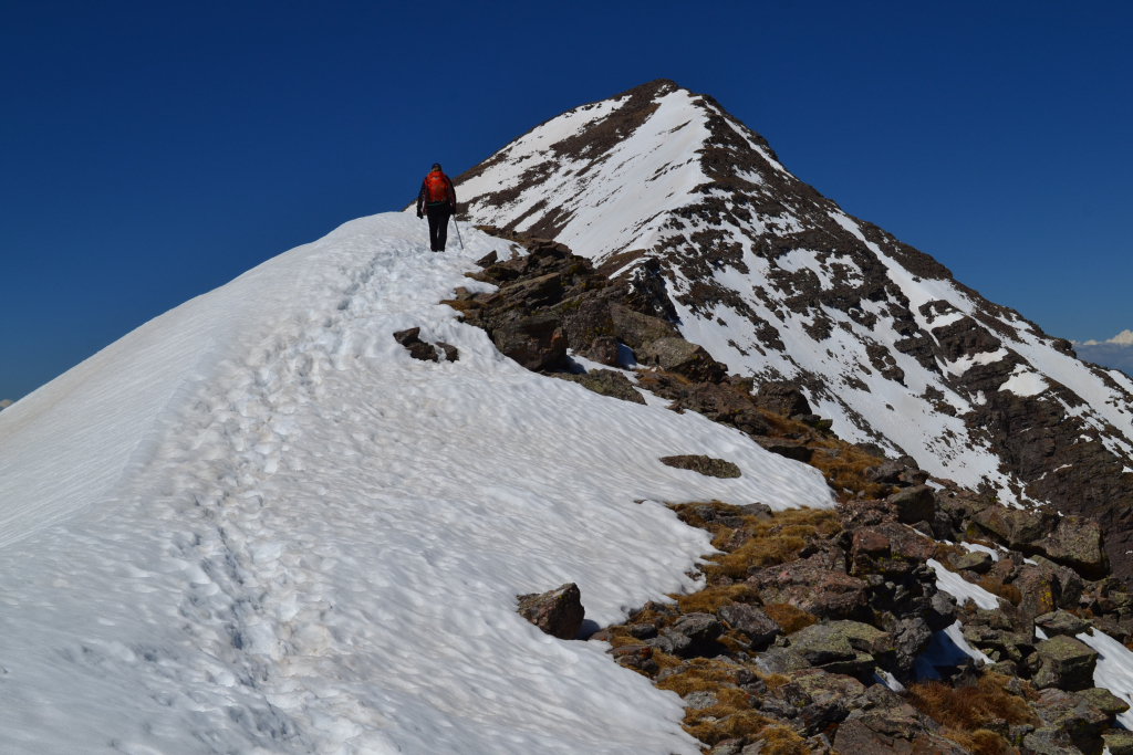
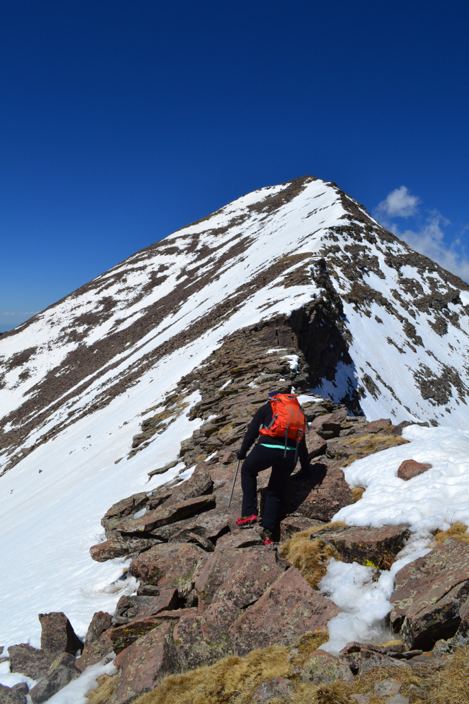
The exposure was exhilarating and a little unnerving at the same time. We had our ice axes in hand to ensure we could self-arrest if we slipped to the left. Slipping to the right was not an option. The remaining 400 feet seemed quite steep but with the summit so close, we employed a reserve stash of energy and continued strongly onward. A final quick class 2 scramble on dry rocks led us to 14,064 feet.
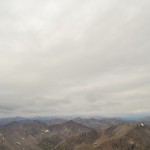
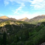
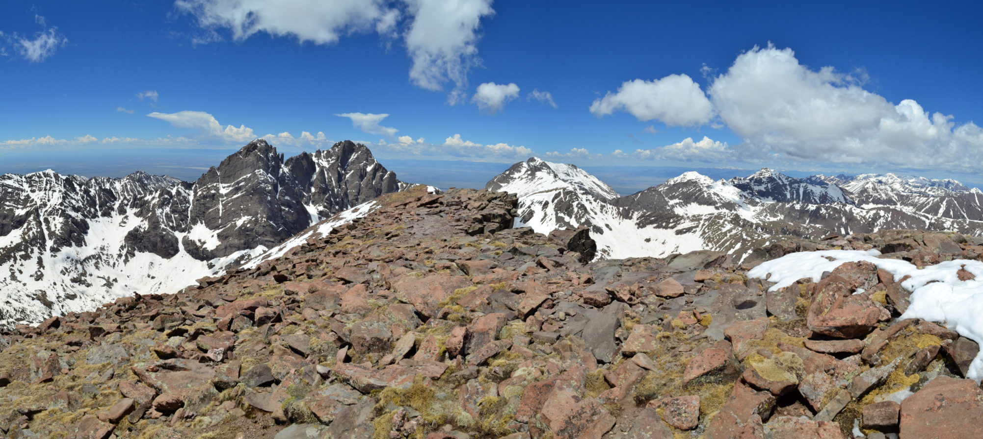
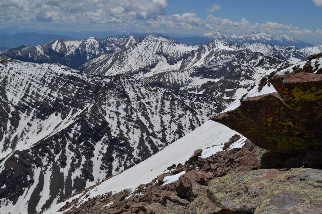
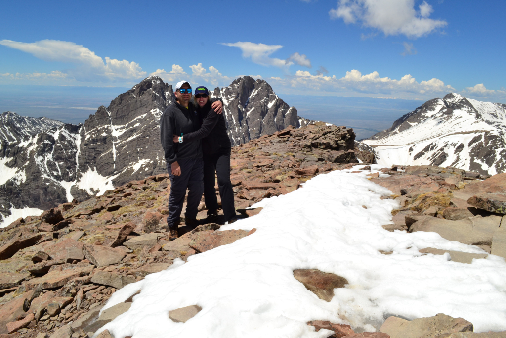
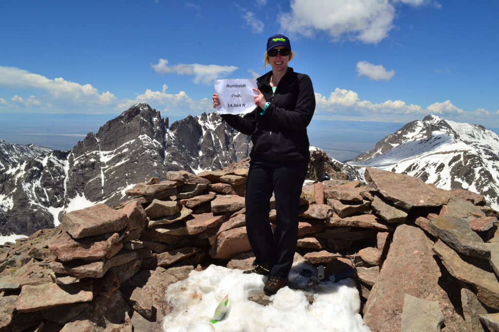
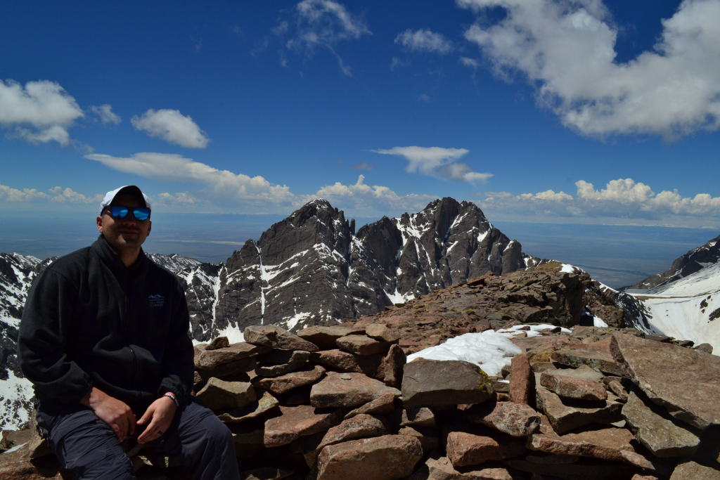
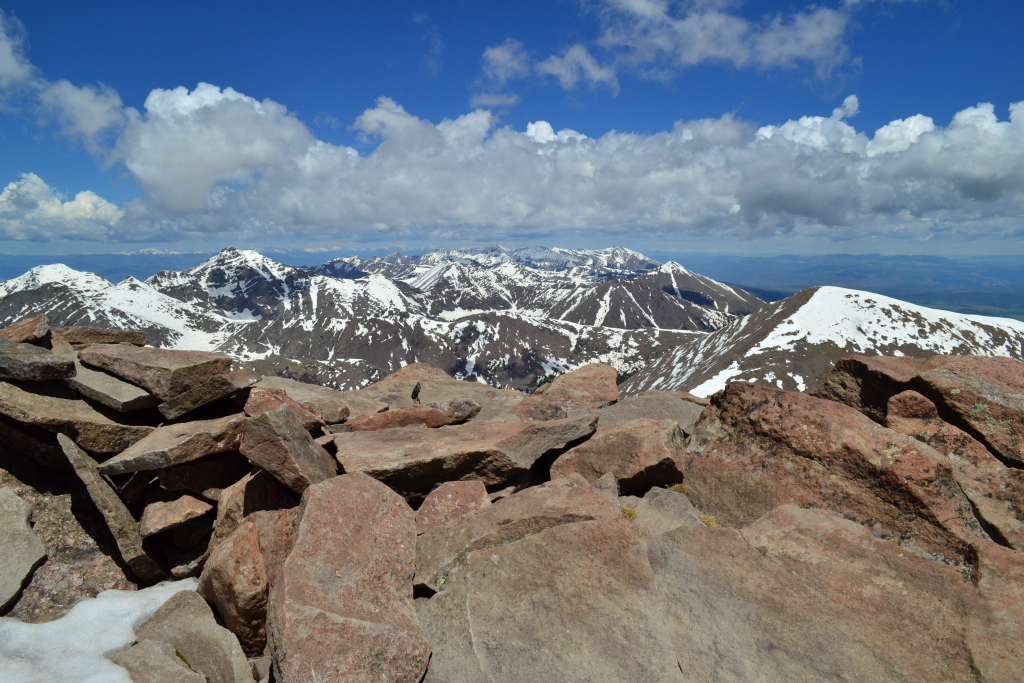
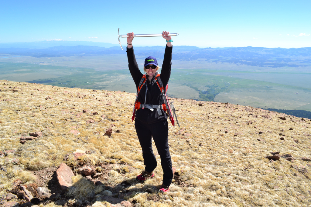
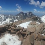
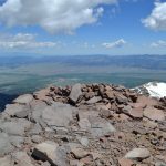
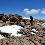
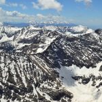
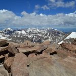
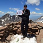
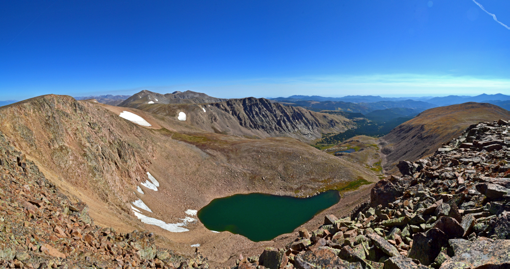
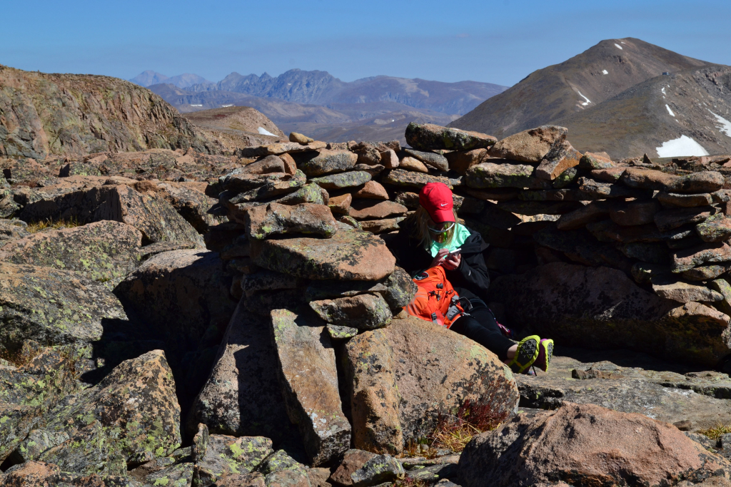
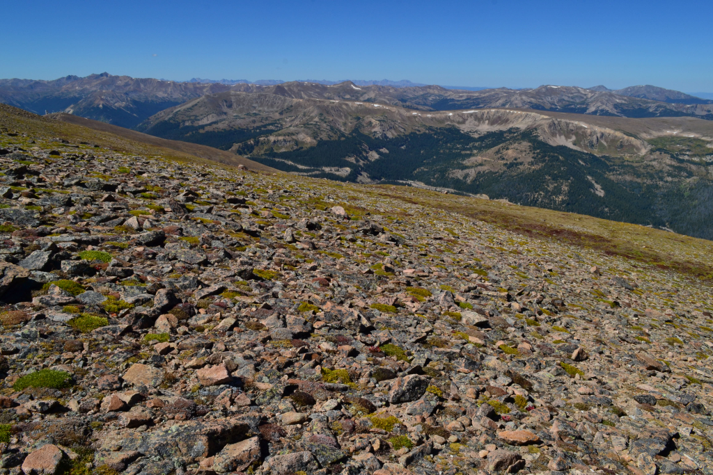
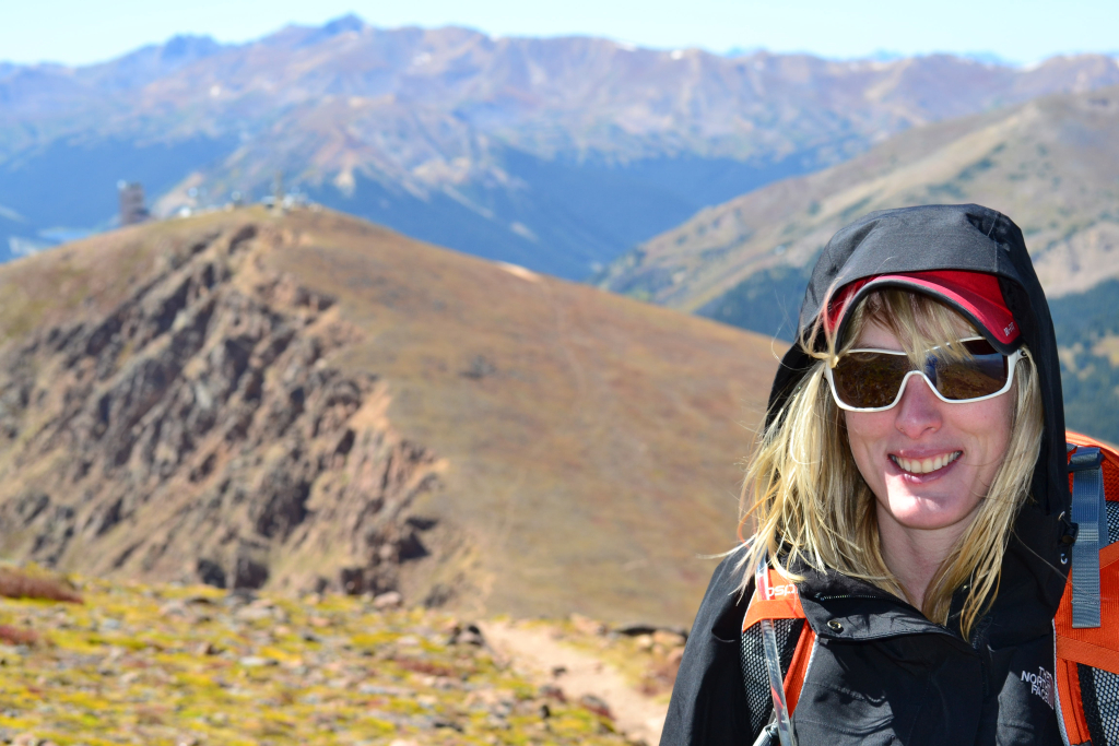
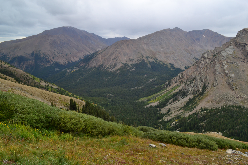
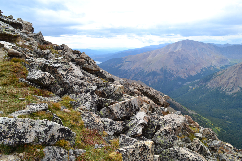
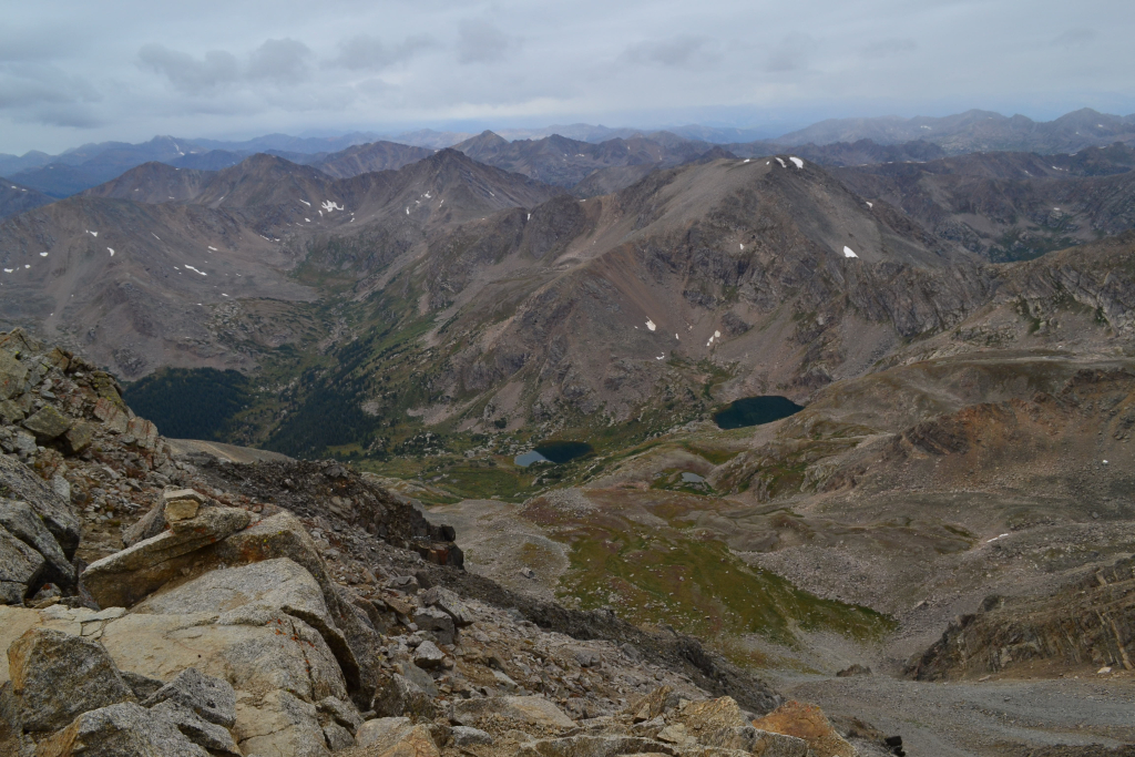
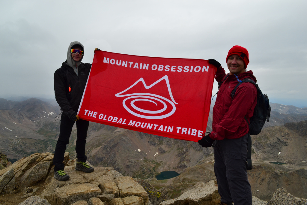
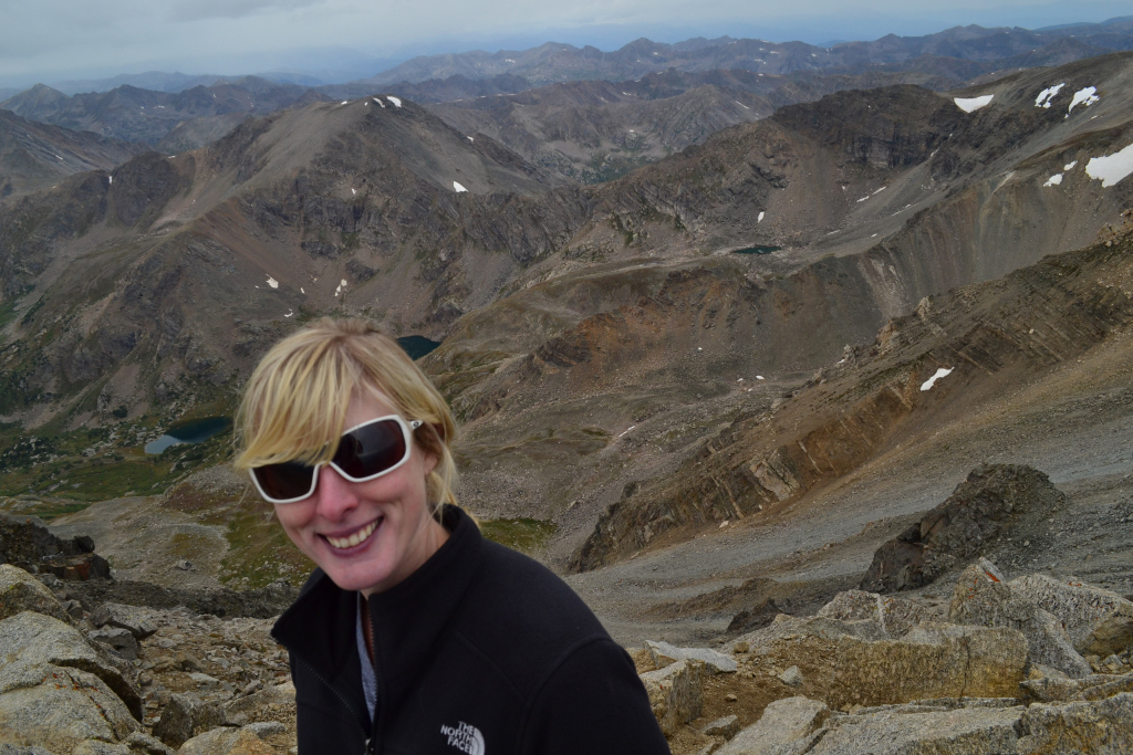
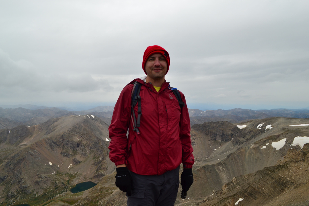
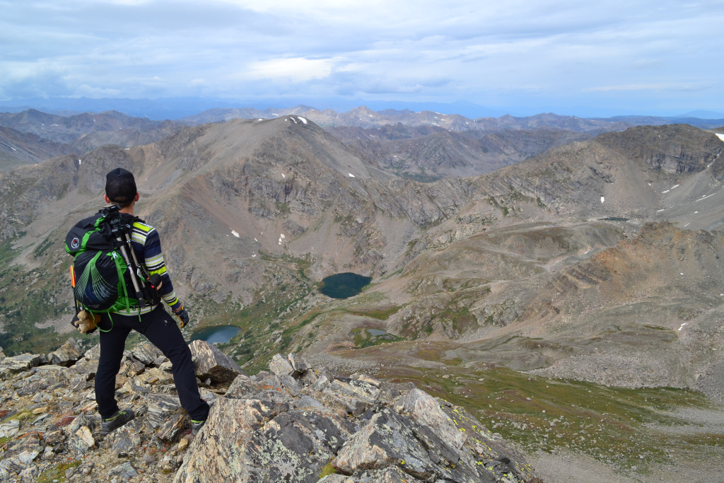
The summit provided sensational views of the Crestones (Crestone Needle and Peak) to our west and sweeping views of the rest of the southern Sangre de Cristo range. We also had the summit completely to ourselves. The weather was perfectly calm and bluebird skies remained. We signed the summit registry and noted we were the only signature for the day. There was also a peak sign in the canister which was a neat find since we hadn’t made our traditional sign for this climb. Perhaps it was because we weren’t truly sure of a successful ascent this trip with our recent limited high altitude exposure and spring mountain conditions. We stayed on the summit longer than usual (30 min) due to the relaxing solitude and spectacular views. Seen below are photos from the summit.
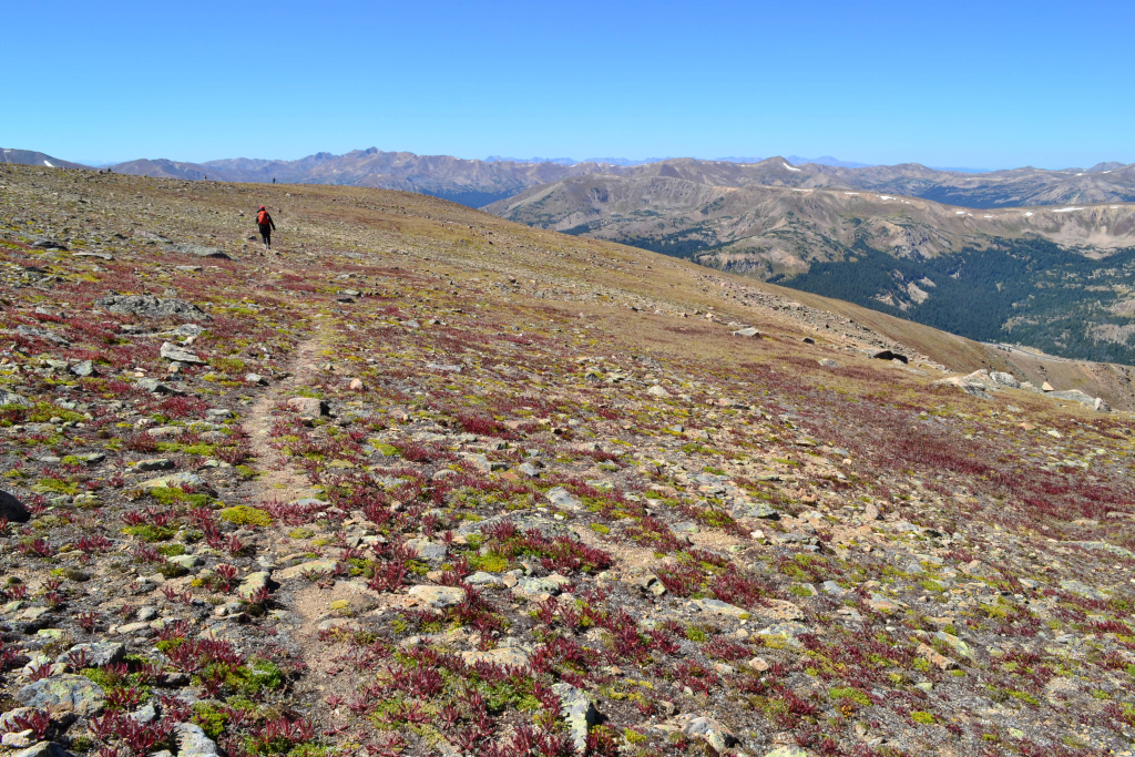
What goes up, must come down. As morning began to shift to afternoon, we knew we needed to begin our journey back down. The trip down the narrow steep ridge was not one we were looking forward to. We carefully proceeded down the steep snow packed path, following our tracks from the ascent. The declivitous route wasn’t nearly as nerve-wracking this time around, but we traveled slowly and carefully nonetheless.
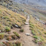
The descent of the ridge took a while, but our speed increased greatly once on the flats and false summit. The ice was now slushy and wet (noon) as we made our way to treeline. We rested briefly just before treeline and donned our snowshoes one last time. We had absolutely no traction this time around and might as well have been skiing down this brief sectional. Seen below are photos of this portion of our descent.
We prodded through the maze of forest once again and felt the first trickles of an afternoon rain shower. It continued for the duration of our descent and turned into hail once we reached the Rainbow Trail. Thankfully we were about a half mile from the truck, so our suffering was limited. The sight of the X-terra brought smiles of joy and relief. While we had an amazing summit our feet were soaked and tired. The tent from earlier was gone, but a truck was in one of the other pull outs. Still, no sight of people anywhere. Overall, we highly recommend Humboldt Peak. It was a great introduction to this challenging mountain range, and the East Ridge route was an exciting off-trail, remote experience. Once the snow completely melts, the West Ridge would probably be a more ideal choice and is deemed the standard route of the summer. We hope to try this route out in the future.
Stay tuned for more highlights and hikes from our visit to the Sangre de Cristos and Great Sand Dunes.


Cathedral Lake and Ashcroft Ghost Town: Aspen, CO
6 miles out and back ( Elevation Gain: 2,135 ft. (total)
Max Elevation: 9,945 ft. Min. Elevation: 11,907 ft.
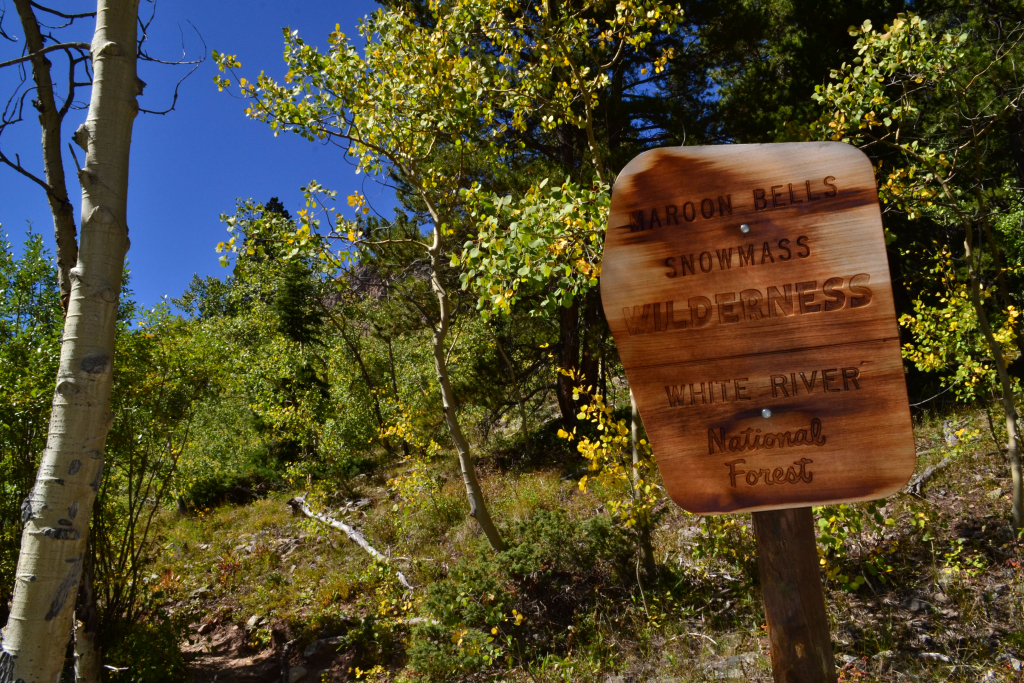
The leaves were already beginning to change the week before as we made our way to Mt. Flora and visited Rocky Mountain National Park. We felt the sense of urgency in the air as the cooler temperatures were settling into the mountains. It was time for our annual trek to Aspen to bask in the abundance of color and enjoy the great outdoors in luxury and style. Instead of staying in downtown Aspen, we chose the Westin in Snowmass Village to be close to all the exciting balloon festival activities that happened to fall on our weekend of travel. While our weekend was filled with great food, beautiful balloons, and a failed summit of Castle Peak this post will detail our trek to Cathedral Lake, a highlight of the weekend.
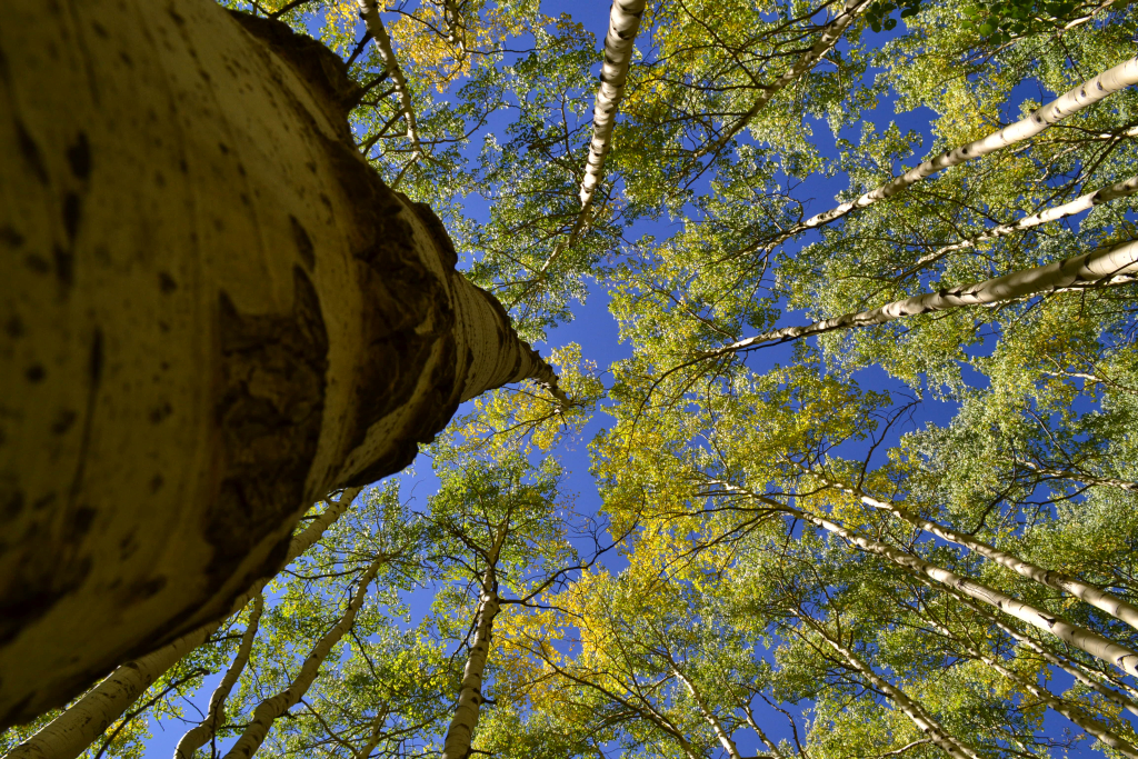
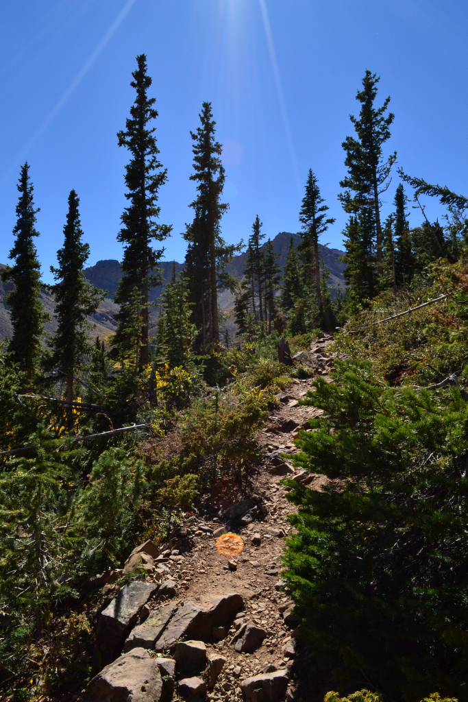
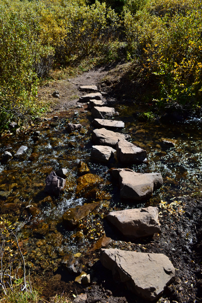
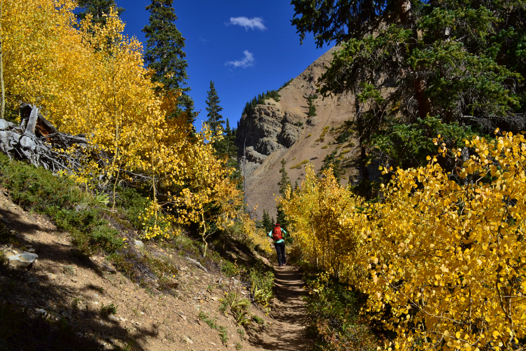
The trail to Cathedral lake can be found about 12 miles down Castle Creek Rd. from the roundabout in Aspen. There is a post signaling the turn-off on the right side of the road. After turning right, follow the dirt road for about 3/4 of a mile to the actual trail head. The road is rough, but a 2WD passenger car can make it all the way. Since it was a fall Saturday, the trail head was quite crowded with cars and people when we arrived at 2:00 pm. However, due to our later start on another gorgeous bluebird day most people were returning to their cars instead of starting the trek. The trailhead was well marked with clear signage. The signage estimated our trip to be about 2.8 miles to the lake. We mapped GPS along the way and ended up tracking about 3 miles to the lake. Immediately upon stepping foot onto the trail, we were immersed in the orange and yellow foliage of an aspen grove. Seen below are photographs of the start of our hike.
 .
. 
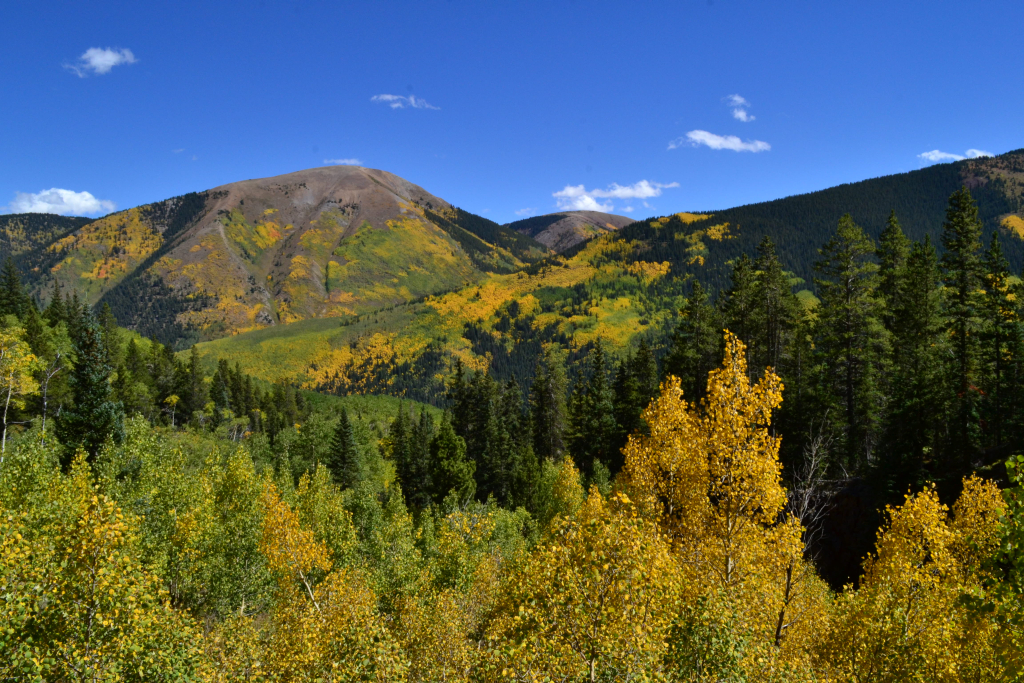
The first 3/4 of a mile led us through forests of aspens and Lodgepole pine. It snaked up along the Pine Creek offering glimpses of the river and waterfalls as it gained elevation on the way into the upper valley. At about this point, we noted a sign indicating we were entering the Maroon Bells Aspen Wilderness. The trail now led us away from the dense forests and into the Pine Creek Gorge. Sweeping views of the valley surrounded us. Color change was variable among aspen groves. Some had already changed and others were still hued a light green offering us a colorful landscape of green, blue, yellow, and orange.

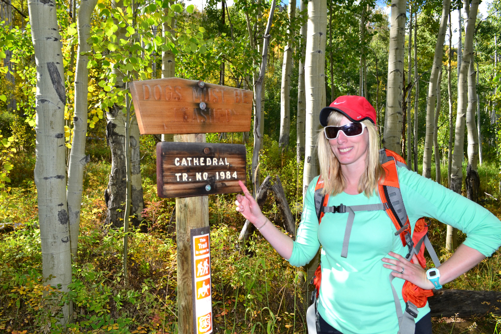
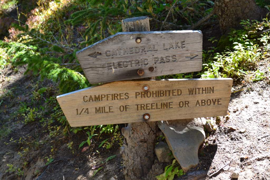
We gained over 800 feet in the first mile of the hike before the trail leveled off a bit through the valley. We eventually came to a large boulder field at mile 2. Passing through was easy enough in trail runners and proved to be no real challenge. After passing through the scree, we were presented with the only real challenge on the hike. A set of switchbacks awaited us. The switchbacks were very short, loose and steep. One gentlemen slipped on his way down as we were heading to the top. We got our heart rates up and quickly made it to the top where the trail splits for Electric Pass. Make sure and head left at the sign unless planning a longer high altitude hike to the pass. (It’s another two miles up).

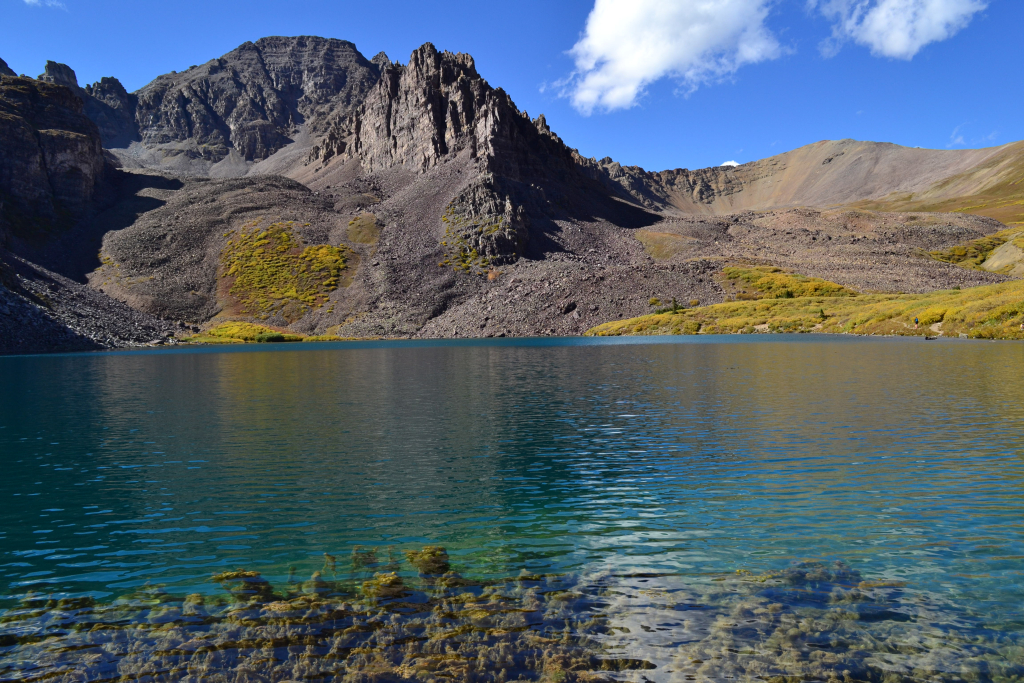
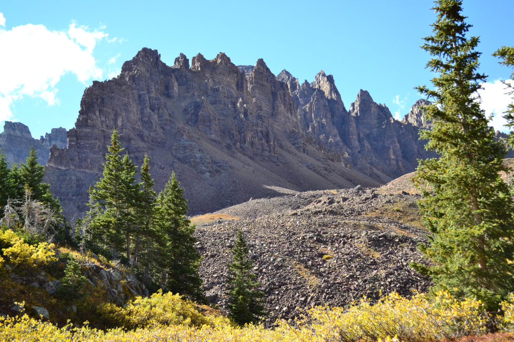
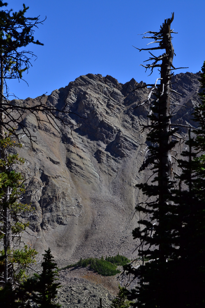
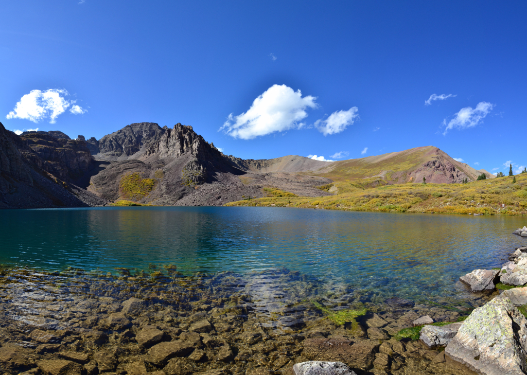
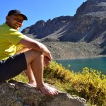
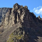
We followed the trail another quarter mile through willow patches and tip toed across perfectly aligned rock steps to cross a creek. The trail lost a little bit of elevation through the final approach. It sloped down among reeds, and several social trails led different ways to the east bank of the waters. To our right we could see Cathedral Peak (a centennial peak) to our right which is shown below. The east ridge of Cathedral Peak looked jagged and daunting, but we heard that the difficulty level to her summit shouldn’t exceed class 3.

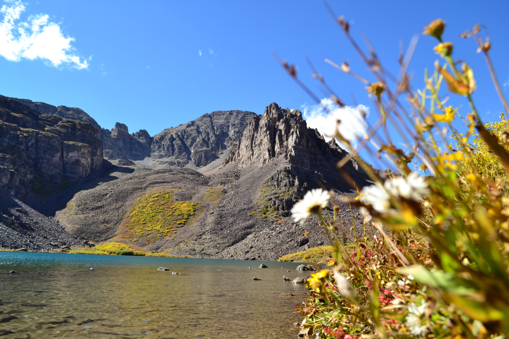
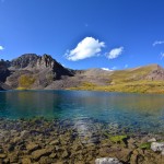
The brilliant deep turquoise of the lake startled us as we emerged from the thick willows. It was
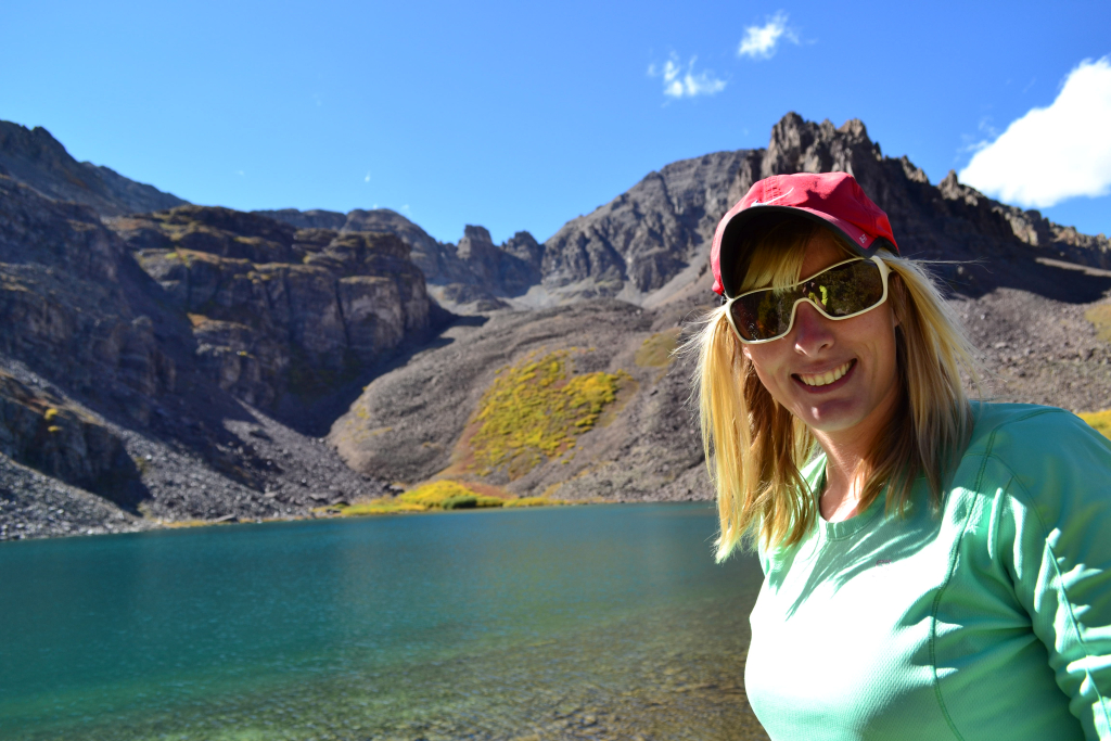
exquisite in nature, a huge bowl of deep alpine water situated below surrounding 13ers. We drank in the views and immersed our feet in the cold waters. We had excellent views of Malemute and Cathedral Peaks. The sky remained a brilliantly clear blue as it had the day before, and we relaxed in the mountain air.


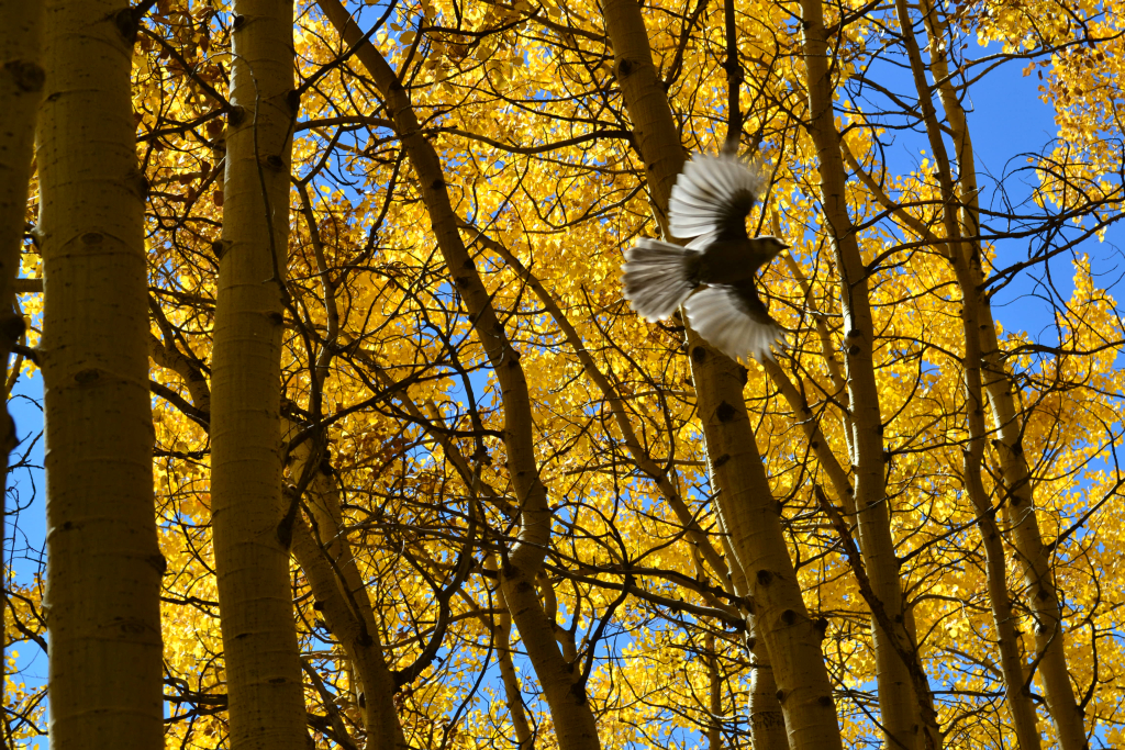
We stayed on the banks of Cathedral Lake for about 30-40 minutes soaking in the sun and views before hunger invaded our thoughts. We also planned to get ready for the evening balloon glow at Snowmass Village. The views through the aspen grove were even more beautiful in the late afternoon sunset as they had been on our journey earlier in the day. The orange and gold leaves glowed as we walked through thick forests. We glanced up to see a beautiful bird skirting across the top of the forest canopy. In no time at all, we were back at the car and thankfully so. We had just run out of our water supply. It’s surprising how much water we really need and want at high altitude in the Colorado sun. Another reminder on the importance of a well considered packing effort even if it’s only a day hike.


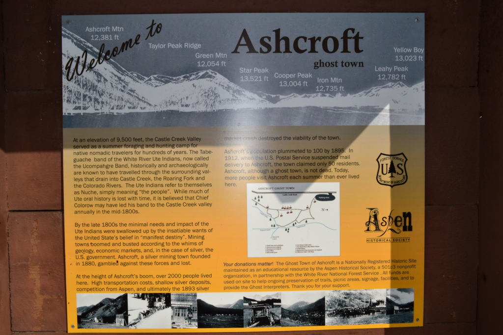
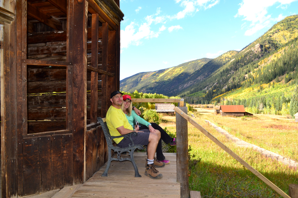
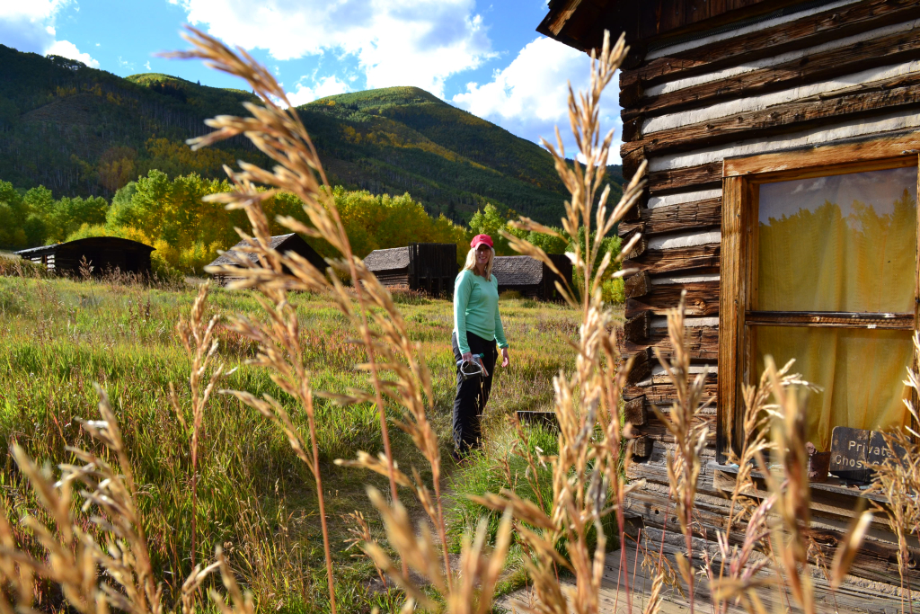
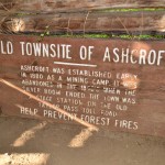
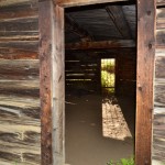
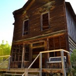
We followed the dirt road back out to Castle Creek road and took a quick right for a stop at the Ashcroft Ghost Town before heading back for dinner. Ashcroft was an old silver mining town that came to fruition in 1883. In the initial few months, the down reaped the benefits of the mine bringing in about 14,000 ounces of silver to the ton. The deposits were shallow though and two years later the town barely had anyone left. More detailed information can be found at the Aspen Historical Society’s Webpage for the history buff. There is a nice path that weaves through town buildings, some of which are original. Most of the buildings are simply reproductions of the past through complete restoration. Too many years of harsh Colorado weather removed the original construction efforts. Our favorite stop on the Ashcroft tour was the Hotel. We sat on the porch and relaxed for a moment, just as those tough Colorado folks must have done years ago.

The sun was beginning to sink behind the mountains, and we drove back to Aspen for a delicious dinner at Hickory House Ribs. The day was perfect, and our adventures weren’t even over. We still had the balloon glow on the ski run to look forward to attending. We highly recommend a hike to Cathedral Lake, a stop at Ashcroft, and of course, a fabulous dinner in town when it’s all over.


Mount Flora and Colorado Mines Peak Exploration
8.7 miles ( Elevation Gain: 2,356 ft. (total)
Max Elevation: 13,146 ft. Min. Elevation: 11,334 ft.
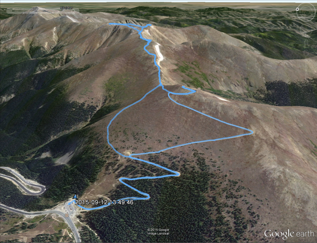
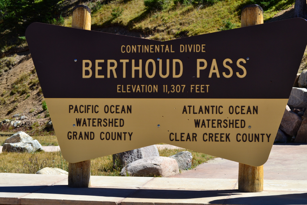
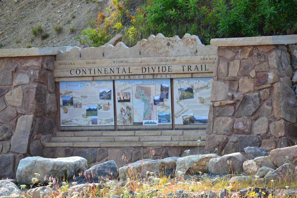
About two week ago on (September 12th) we drove up the long winding Hwy 40 towards Winter Park, CO. Instead of continuing on to the snow covered slopes as we were accustomed to in the cold winter months, we stopped at Berthoud Pass. The pass sits at an elevation of 11,307 feet and provides access to the famous Continental Divide Trail and a plethora of peaks to tag. We spent our last two weekends high alpine camping and climbing long, high elevation gain 14ers and thus sought 13er Mt. Flora for a relaxing change of pace.
A warm Starbucks latte, pumpkin bread, and the slight hues of orange and yellow popping in and out of view on the drive up led to excitement and anticipation of the coming of fall, our favorite time of year in Colorado. The brevity of fall in the mountains makes this time of year even more special. In such a fleeting fashion, the Aspen leaves produce brilliant colors of yellow and orange and then fall as the cold air settles and the first snow of the season blankets the landscape. In addition to the profound scenic beauty this time of year brings, another perk of the season is the stable weather. A blue-bird day greeted us as we began the climb up Mt. Flora. It was a nice change of pace from the intense thunderstorms that raged through the mountains on most afternoons during June, July and early August this year that made all day high alpine hikes and climbs impossible.
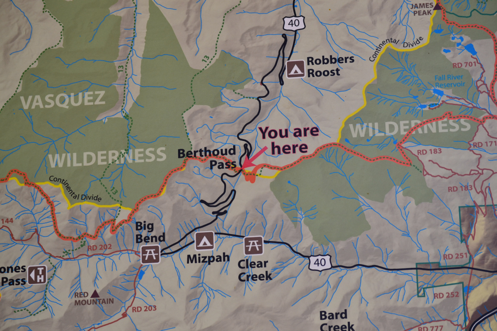
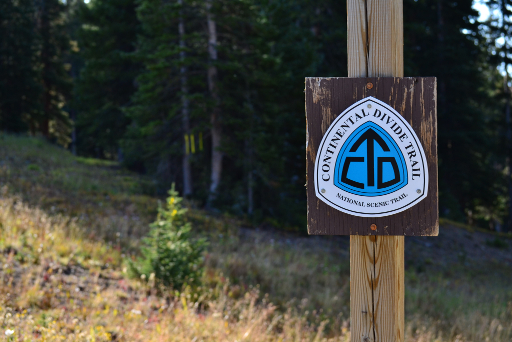
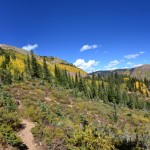
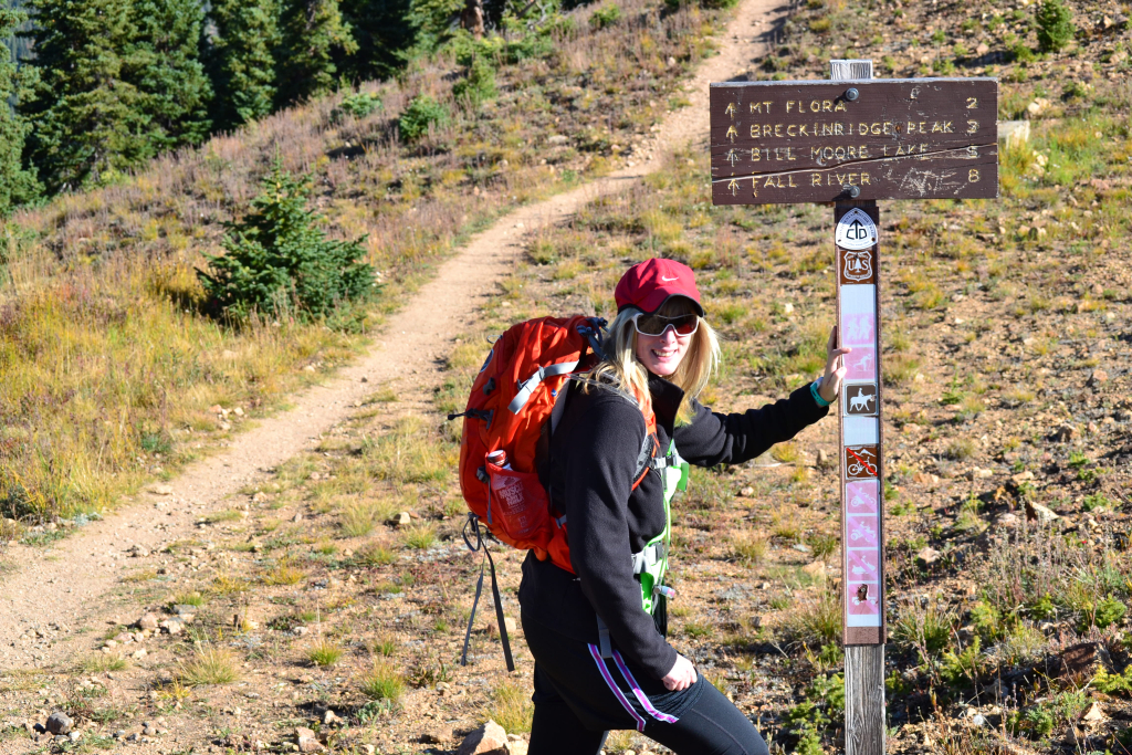
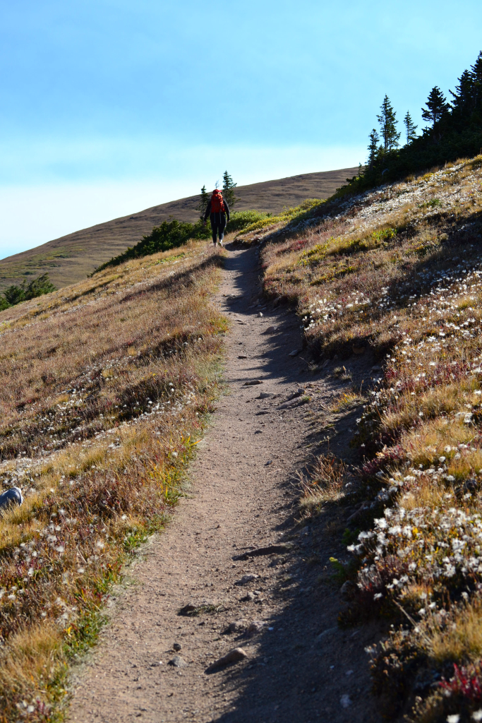
We began the hike around 9:30 am. The temperatures at the pass were in the upper 50s (fahrenheit), and the sky was a perfect blue with not a cloud in sight. For almost a mile we walked up a series of mild switchbacks on the gravel road that leads to Colorado Mines Peak before veering off to the north (left) and connecting with the Continental Divide Trail . There is a clear sign at the junction depicting mile distances to various destinations including Mt. Flora and Breckenridge Peak along the route. The trail begins as a lovely smooth single track dirt path that gently gains elevation. We were immediately greeted with a wide open alpine landscape. The parking lot and cars could now be seen as treeline dissolved.The parking lot already looked far below us as we gained elevation rather quickly on the road portion of the hike.
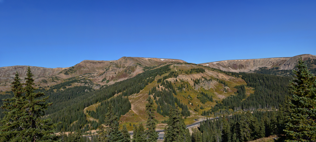

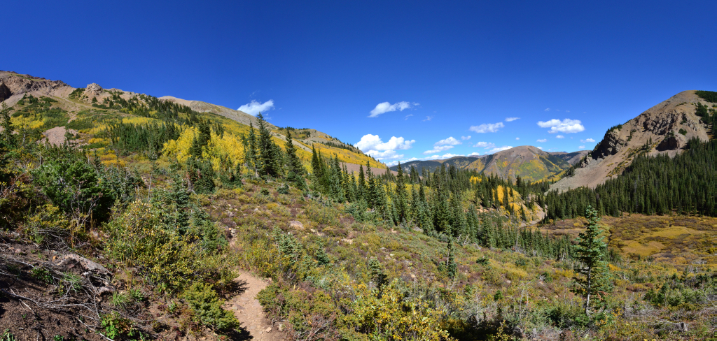
We followed the trail to the Colorado Mines Peak Junction around 12,000 ft and continued along the saddle between this peak and Mt. Flora. The beautiful Blue Lake drainage was visible to our right as was a verdant valley. There is a nice rocky outcrop overlooking the valley to stand on for excellent views and photographs. The airy gusts of wind were intense on this section of the trail, so we tried to keep moving to keep our hats from blowing away.
After our brief reprieve from gaining elevation, we began to climb again. This time we gained about 700 feet of elevation as we reached the top of a false summit. The trail begins to get rockier from this point forward, but we were comfortable in trail runners instead of traditional hiking boots. We started to see a few people coming down the mountain at this point. Prior to this our hike had been in solitude. While this is an extremely popular trail, but most people tend to hike it earlier in the summer.
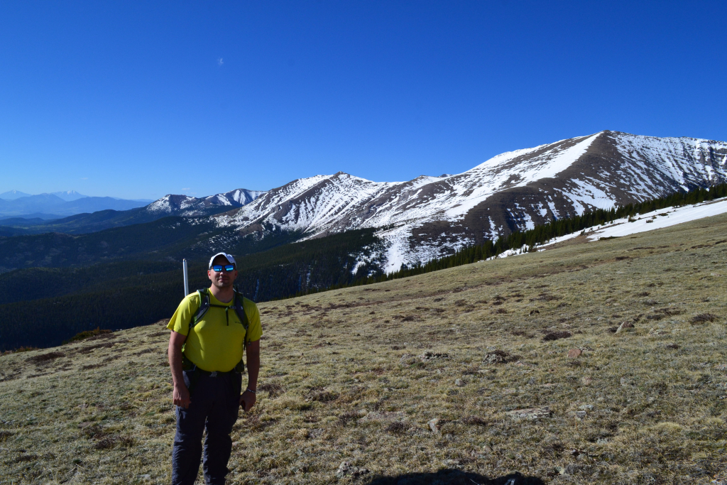
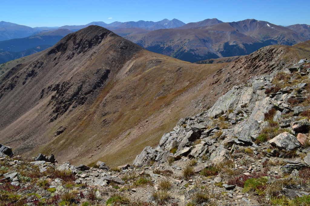
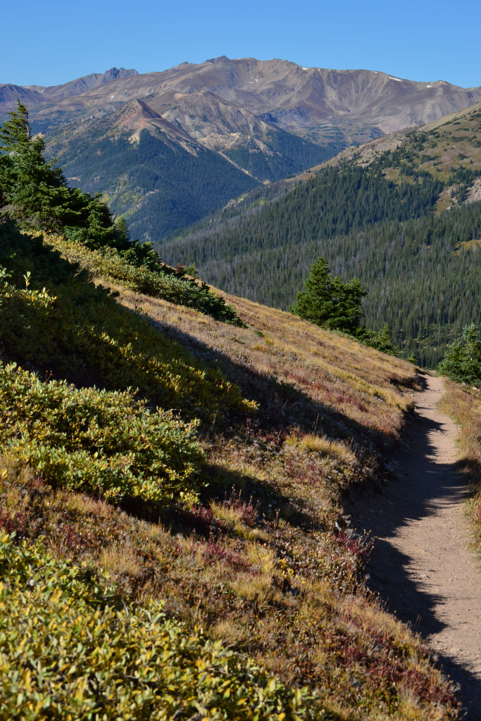
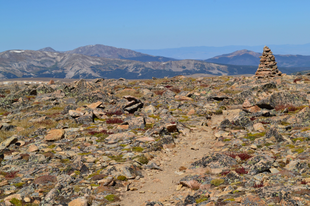
We reached the summit of Mt. Flora after hiking about 3.3 miles. The approach was very easy (compared to recent adventures). The summit is marked by a large cairn and the presence of several wind shelters. It is a very wide summit and difficult to distinguish the point of highest elevation. We did stumble upon a summit marker while on top and made a little rest spot in an unoccupied wind shelter. The views from Mt. Flora are spectacular. We felt like we were on top of the world with 360 degree sweeping views of the rocky mountains. To the northeast we could see turquoise Lake Ethel and as well as Mt. Eva, another 13er in the far distance.
We spent about 30 minutes taking pictures and playing around on the summit before attempting to continue on towards Mt. Eva. The sky was still a perfect clear blue, so we felt pretty comfortable staying above treeline. We proceeded off the summit the way we came and attempted to find the trail again. We managed to find small bits of trail here and there but nothing too defined. We bushwhacked past Mt. Flora about another mile soaking in all the scenery. We could see the town of Winter Park, CO to the west as well as the curvy blacktop hwy 40 weaving in and out of the voluminous mountains. If we kept our sights to the north and east, we were greeted with nothing but a vast expanse of wilderness and peaks. Even James Peak could be seen in the far distance which we have tagged several times. Eventually we came to the point in which we must descend into the saddle to get to Mt. Eva. We had additional plans for the rest of the day and opted to turn back.
On the way back, we stopped for a break at a wind shelter found off the east side of the trail. We leaned back on our packs and relaxed in the mountain bliss. The mountains have a way of letting the worries and stress of the everyday world dissipate. Even when the trail is tough and our legs and lungs are very tired, there is some relaxation in the fact that we only have one goal for the moment. One step, one breath, and repeat. The focus that comes from climbing and hiking is a form of meditation.
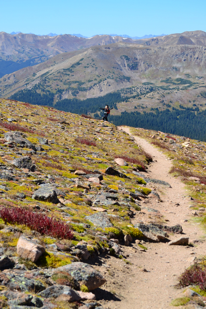
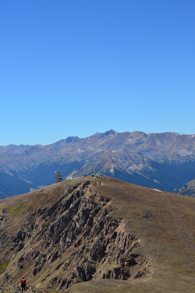
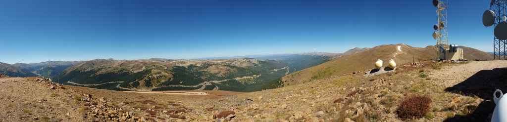
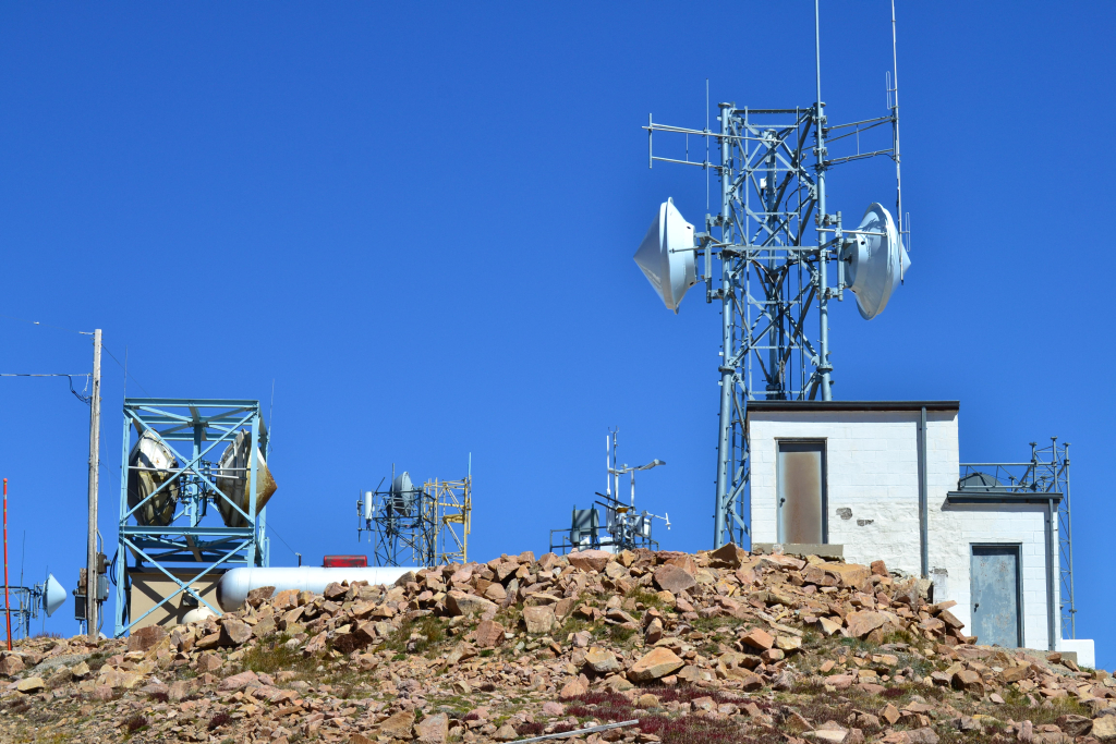
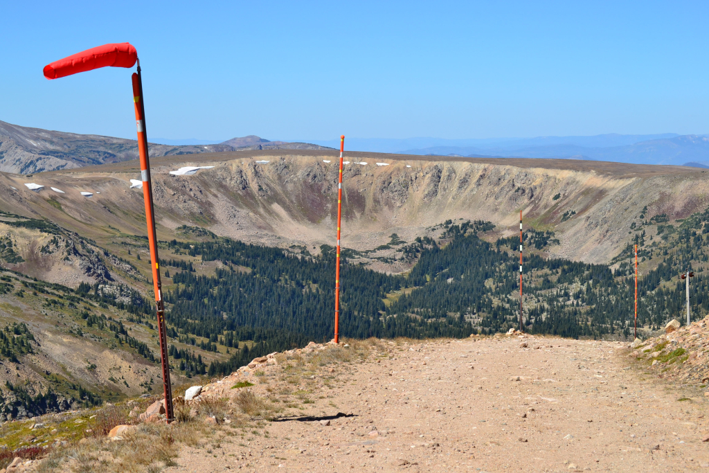
We continued back the way we came and frolicked in the alpine splendor along the way. As we approached the Colorado Peaks Mine Trail Junction we chose to climb a little bit more elevation and tag her summit as well. The trail was well defined and short but very steep. After about 10 minutes of trail hiking, we reconnected with the service road that comes from the Berthoud Pass parking lot. We saw a few Colorado Mines School students hiking to the top. They said they took the service road the whole time. We followed the road to the top of the peak and found all sorts of strange equipment and buildings. While not exactly aesthetically pleasing, the summit was quite interesting. The structures are actually part of an automated weather station to aid in aviation navigation through the critical mountain passes. This link provides more information. Note: Don’t plan on driving up the service road to see the peak. It’s closed in summer and only open for snow mobiles in winter.
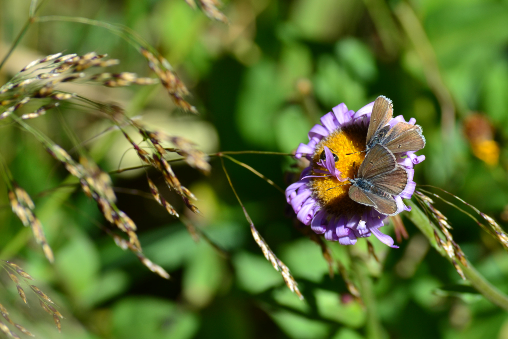
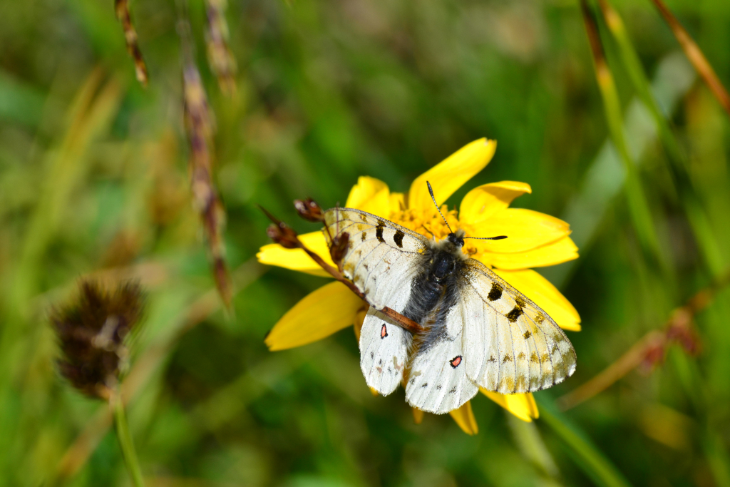
Instead of returning the way we came, we decided to walk back via the service road the rest of the way. We thought this might save time, but the road had several very long switchbacks and actually took quite a while to get back to the car. Nonetheless, there were beautiful trees and flowers along the way. Butterflies were everywhere, floating and fluttering among us and landing on the exquisite flowers.
The high alpine experience that a trip on the Continental Divide trail to Mt. Flora is a phenomenal hike that will have you singing Julie Andrews and holding your hands up in joy shortly into the trek. In short, it’s like getting the reward of a 14er for about half the effort. Instead of battling the crowds in late July or early August, give it a go in September when everyone is back in school or worried about the cold. You’ll be glad you did.
Mount Massive via Southwest Slopes: 14,421 ft
Distance: 8.06 miles (out and back) Elevation Gain: 4,037 ft. (net)
Max Elevation: 14,421 ft. Min. Elevation: 10,384 ft.
14er # 13
We drove once again into the land of the gentle giants a mere 6 days later to tackle our next objective in the Sawatch Range, Mount Massive. Massive stands majestically southwest of the little town of Leadville beckoning visitors and locals alike to touch her summit and rest a few moments in the third highest spot in the contiguous United States. Only Mt. Elbert next door and Mt. Whitney in California exceed her reach in the sky.
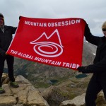
We began the trek with a Thursday evening drive into Leadville and fueled up at High Mountain Pies, a unique little pizza joint at 10,200 feet. We are constantly amazed that delicious food can ever be constructed at this elevation, but they have succeeded. After dinner, we were ready for the 30 min drive to our campsite near the trailhead after meeting up with our new hiking partner. This was a unique trip for us in the fact that we finally got to meet up with Spencer, founder of Mountain Obsession to tag a summit. Spence is on an over year long adventure trip living out of his car to explore and promote getting outdoors, being healthy and living a full life. We were pretty excited to get to share some of our backyard with him.
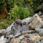
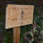
We set up camp near Halfmoon Creek about 2 miles from the North Halfmoon Creek TH which provides access to Mt. Massive via the Southwest slopes. We say set-up loosely as we car camped this time and forgot wood and chairs for a fire. Before it got dark, we wandered around near the creek and spotted a deer. Most of the time these guys are very skittish. Not this time. The deer followed us a bit and got a little too close for comfort.

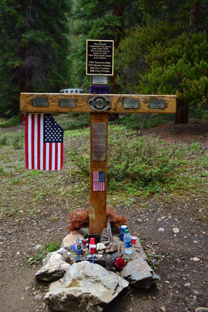
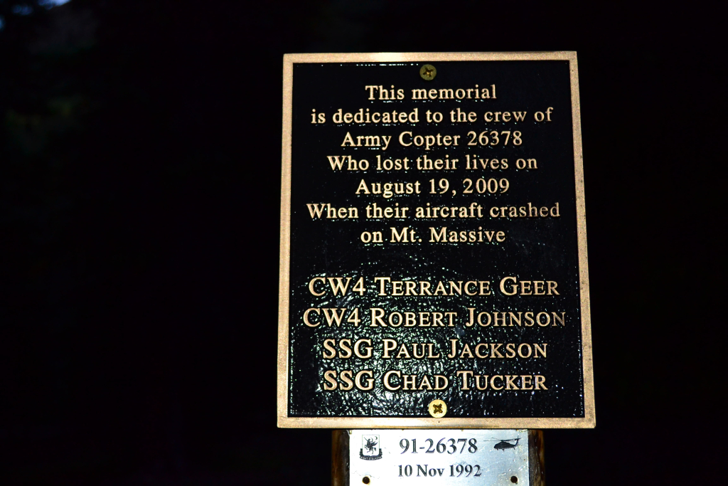
Sleeping in the X-terra was cramped and cold. The night felt long until 5:00 am came around, and we wished we had some more sleep time. Mountaineering is always more difficult than it should be due to the lack of quality sleep most summit attempts afford. As the year progresses into fall, we are left with dark cold mornings in the mountains. We used flashlights and car lamps to prep in the inky early hours. We had 2 miles of tough 4WD road to clear to reach the trail. It took us about 20 minutes to get there. We advise not to take a 2WD or low clearance vehicle up this path. There are a couple of gnarly spots in the last 0.5 miles that were tough even with a 4WD decent clearance vehicle (2012 Nissan X-terra stock). We reached the trail just as the first glimmer of morning light began to appear. A memorial to the fallen soldiers in the Black Hawk Helicopter 2009 crash into Mt. Massive solemnly stood at the start of the trek.
The trek to Mt. Massive via the Southwest slopes begins very gently, passing through dense forest and lush vegetation for the first mile and a quarter. Several rains in the area during the proceeding days made the trail moist and muddy in a few places. During the first mile or so we gained very little elevation, probably only around 300 feet. There is a trail junction right after exiting the forest that leads into a meadow. Continue on the trail veering right (north), not left into the meadow. Heading left continues on to the North Halfmoon Lakes. The way leading up on these trails is almost always correct. Alpenglow was abundant as we edged the meadow and began to gain elevation.
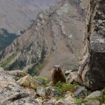
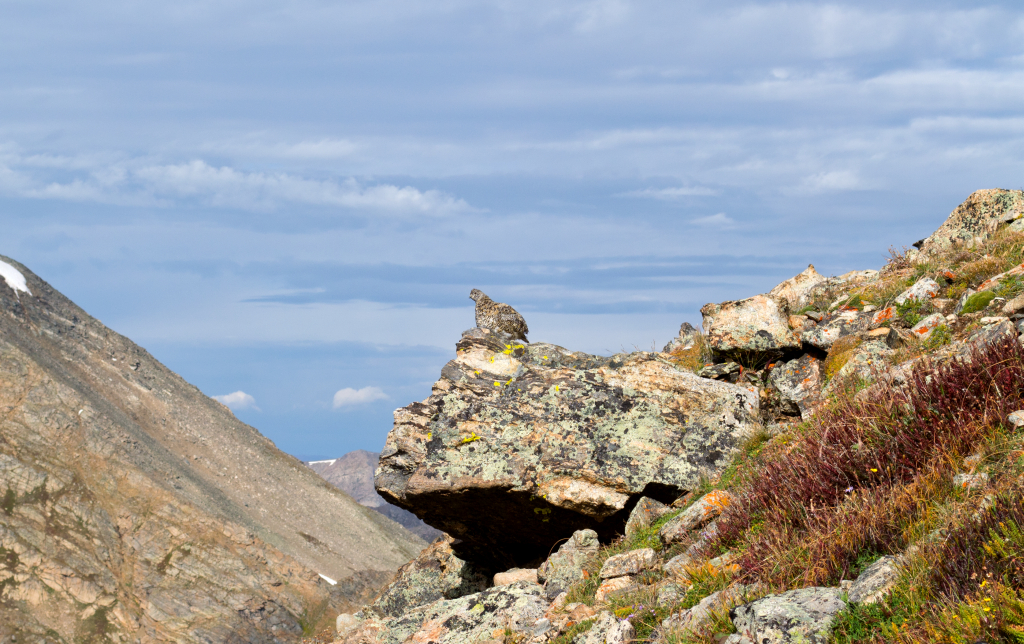
Elevation gain began to get serious after the passing the meadow. We hiked vertically through a boulder field most of which provided decent stone steps. Although there were short bursts of loose scree in between the sturdy rock. The trail is a bit less apparent through here, but we had no real difficulty finding our way. Boulder fields continued until about 11,800 feet. We then proceeded up even steeper grades of trail in a grassy open area. The gain was brutal, but we had amazing views of the creek and surrounding valley below. A ptarmigan posed for us on a ledge. These guys are really difficult to catch a glimpse of due to their amazing camouflage.

We approached our first false summit at close to 14,000 ft. We were thrilled to be close to the summit ridge. Even though we were above 14,00 feet we were still not on Mt. Massive’s true summit. Massive is large and deceiving. There are many false summits on this large mountain which cloak her true summit. We continued up and around a corner before the summit ridge came into view.
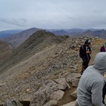
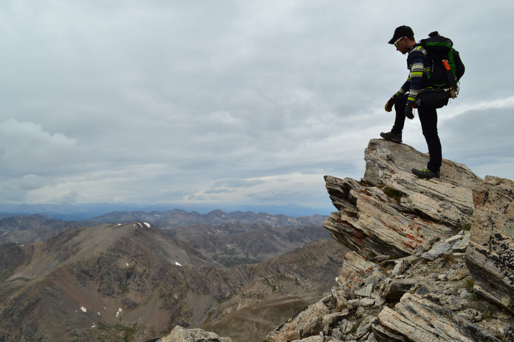
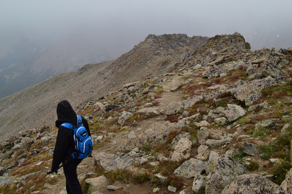
On the ridge the solid trail turns into some fun class 2 scrambling. It was very easy but really fun and more interesting than the long slog we had just endured. We climbed up a false summit that we originally thought was the highest point. We stood with two other hikers pondering this for a moment. Our GPS read 14,412 feet so we knew we needed to keep moving and tag the next point over. The final push seen below.
A few minutes later we tagged the summit. A lone hiker was resting on the summit with an Ohio University banner. She said she meant to climb Mt. Elbert that day but ended up at the wrong trailhead parking lot and said “oh well, I’ll climb Massive.” We were impressed since the Mt. Massive hike is a bit more strenuous and a much longer day than Mt. Elbert. There are some spontaneous and tough people in this state for sure. We enjoyed 15 minutes of relaxing, eating, and chatting before it started sleeting/snowing. The weather in Colorado is completely unpredictable. There was no rain or lightening which is an added benefit to hiking later in the summer season. We all had water proof shells and gloves and were good to go.
While frolicking across the ridge line was fun, our steep descent past the summit ridge was tough. Downclimbing 35 degree vertical scree is rough on the knees. Nonetheless, the Sawatch Range is so beautiful and impressive that it takes away from the discomfort. It is easy to inherent a powerful sense of human insignificance standing among the voluminous rock. Though surprisingly it tends to be more comforting than not.
“Mountains inspire awe in any human person who has a soul. They remind us of our frailty, our unimportance, of the briefness of our span on this earth. They touch the heavens, and sail serenely at an altitude beyond even the imaginings of a mere mortal”
Elizabeth Aston in “The Exploits & Adventures of Miss Alethea Darcy: A novel,” 2005.
As we approached the meadow and forest leading to our exit, we heard a voice call out from the reeds and willows. The voice called “hello” and “where are you?” and ask if we were heading on the proper trail to get out. Another testament to how easy it can be to become lost or disoriented on the trail if dehydrated and tired. She must have taken the junction to the North Lakes on her way down by mistake. After providing some direction, we whipped through the remaining 1.5 mile trail through the woods and made it back to our car. We after all had to get back to Denver to watch our Rockies take on the Giants.
All in all a good summit day. Here are a few parting words of advice if you plan to take the southwest slopes.
- The RT length of the trail is 8 miles on the Southwest slopes route versus 14 on the standard route. This doesn’t mean this route is easy. Most of the elevation gain is crammed into about 2.5 miles of steep uphill fun.
- To get to the North Halfmoon trailhead you must take a 4WD road for just over 2 miles. There is no way a 2WD low clearance vehicle could do certain parts of this road without damaging the vehicle. The worst part of the road is about 0.3 miles from the trailhead. It was tricky in the X-terra but we made it fine. Plan on a longer hike if you don’t have a high clearance ride.
- There are a ton of great campsites all throughout the Halfmoon Creek area. They have places to park, pitch a tent and most contain fire rings.
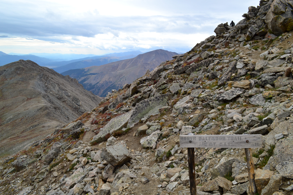
- Beware of two trail junctions on the trek to the summit. The first occurs after about 1.25 miles. Veer right (north) and head up on a less defined trail rather than left into the meadows which leads toward the N. Halfmoon lakes. The second junction is located on the summit ridge. It is where the standard route connects with the southwest ridge route. Just make sure you don’t take the standard route back down. That would lead to an extremely long hike back to your car.
Writing by Allyson Sandifer Checkley
Photography by Thomas James Checkley