Take a Walk
A Quest into the Wild
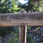
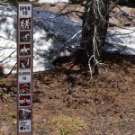
Huron Peak via the Northwest Slopes, 14,003 ft
Max Elevation: 14,003 ft. Min Elevation: 10,713 ft. Net Elevation Gain: 3,320 ft.
Distance: 7 miles (out-and-back) Difficulty: Class 2
For the 4th of July weekend, we decided to head out with Will and Moses to the Sawatch Range and camp in the San Isabel National Forest with the goal of summiting Huron Peak early in the morning of the 4th. We ventured out of Denver on Sunday morning and had decent luck with traffic on I-70, just the normal 10-15 minute delay near Idaho Springs that plagues just about every trip. Before making our way to our camp site, we stopped in the the historic town of Leadville (slogan Great living at 10,200 feet) to get some firewood and High Mountain Pies (pizza). Leadville is home to many famous and colorful sites including the Tabor Opera House and Grand Hotel, the Silver Dollar Saloon, and many historic homes.
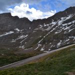
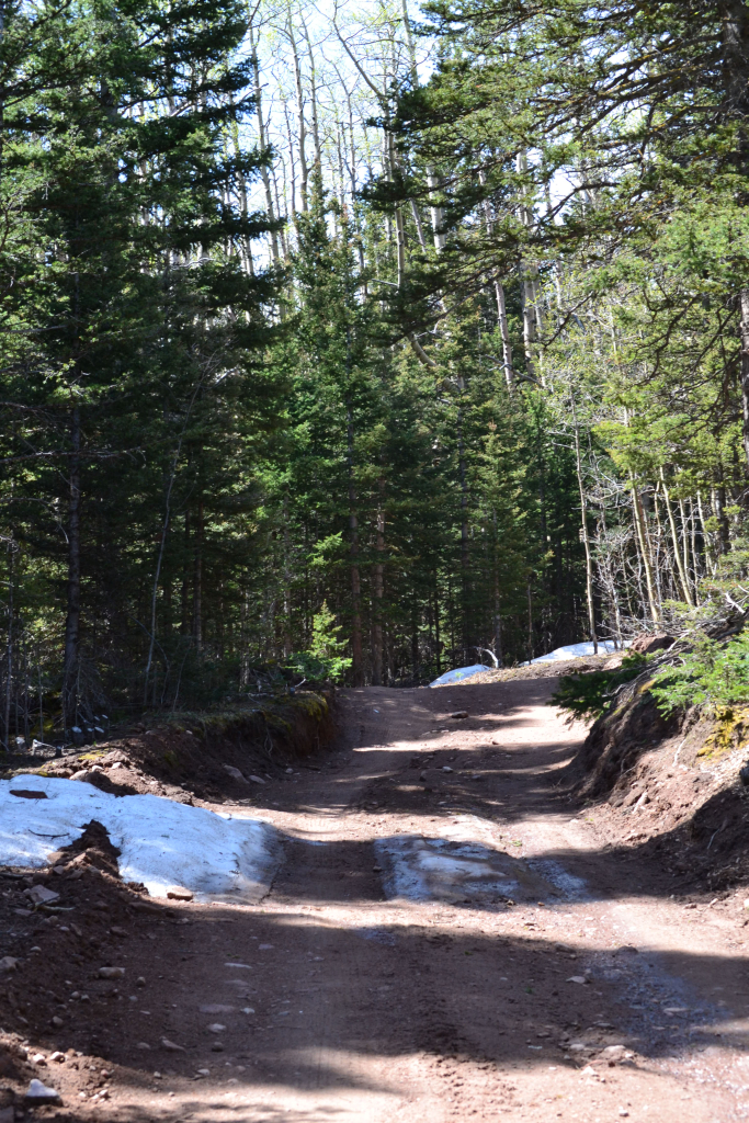
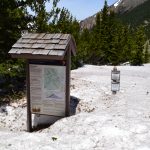
We then drove south on Hwy 24 before turning right onto a dirt road. The journey to the Huron Peak trailhead comes in two segments. The first segment consists of Hwy 390, which is a relatively nice dirt road with manageable potholes and some small bumps. After approximately 11.8 miles, this roads leads you to Winfield — an old mining ghost town — at which point you turn south on 390 and enter the 4WD road segment. Now, this segment isn’t too bad with good conditions and no snow, and we saw some 2WD vehicles make it; however, we are sure that was an exciting ride for them. It was very nice to have the 4WD and high clearance capability. If you don’t feel comfortable taking your vehicle up the 4WD, there is a large 2WD parking area and many lower campsites available.
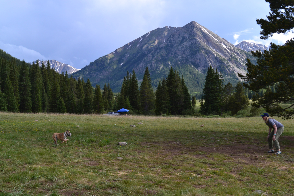
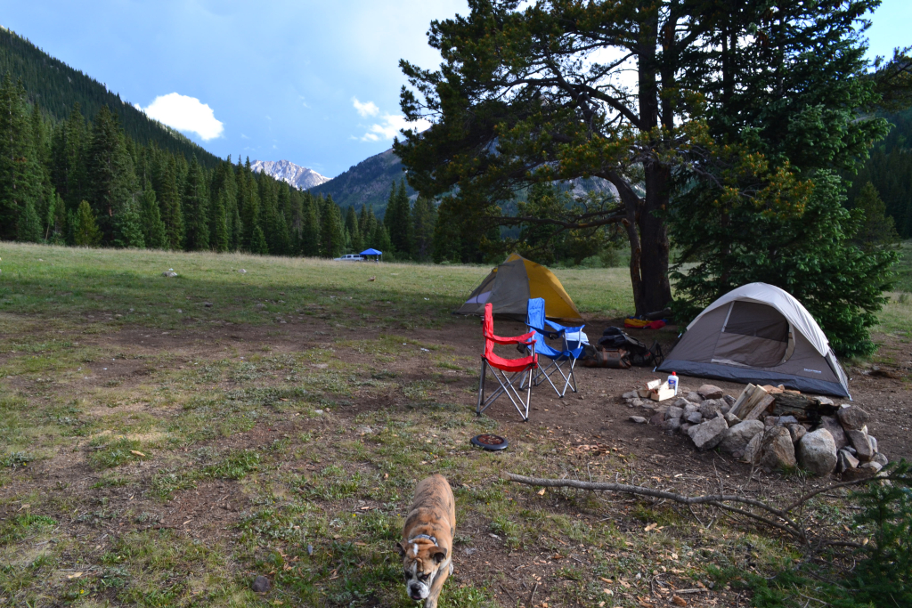
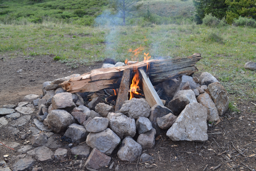
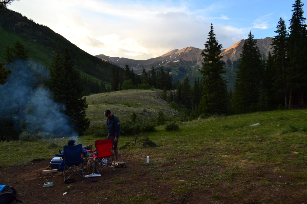
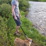
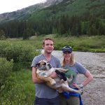
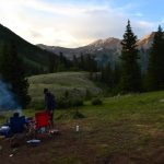
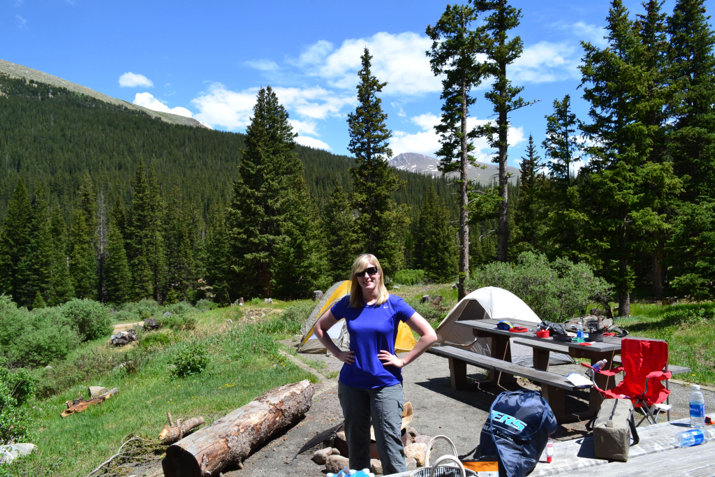
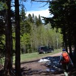
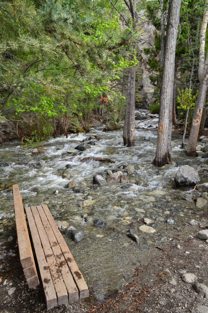
We continued up the 4WD road carefully looking for the perfect campsite. We traveled on the road approximately 1.7 miles before we spotted the perfect camp site. We found a large field near the South Fork Clear Creek with two nice smooth areas for tents and a fire pit. Camping is free here, but there are no restrooms and no filtered water. However, there is an abundance of quickly moving water in the nearby creek. The site was spectacular and offered beautiful views of the Sawatch range. It was peaceful. Baby moses enjoyed the freedom to run around the open alpine meadow and soak his feet in the the cool stream. Some pictures from our campsite are seen above.
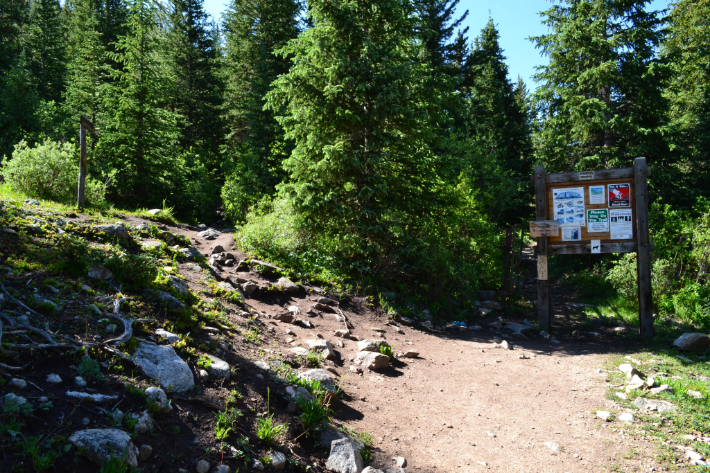
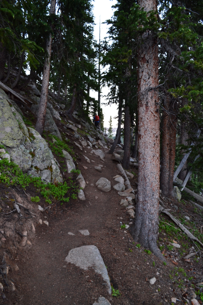
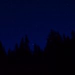
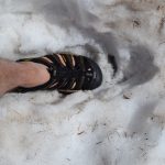
Even in the summer, the temperatures above 10,000 ft. still plunge in the evening as the warmth from the sun dissipates. The average low in the summer is in the upper 30s, and Sunday night was no different with a low of around 38 degrees. After attempting a decent night’s sleep, we awoke at 4 am to head out to the trailhead. There was still about 0.7 miles of 4WD road to manage in the dark to get to the start, but it was the easiest part of the road. Once there, we strapped on our packs and ventured out into darkness of the woods, our headlamps in place guiding us along. The inky sky reminded us we still had a bit of time before daybreak. Our bodies began to warm up as we gained elevation, but we kept our jackets on as we could still see puffs of our breathe hover in the air as we exhaled.
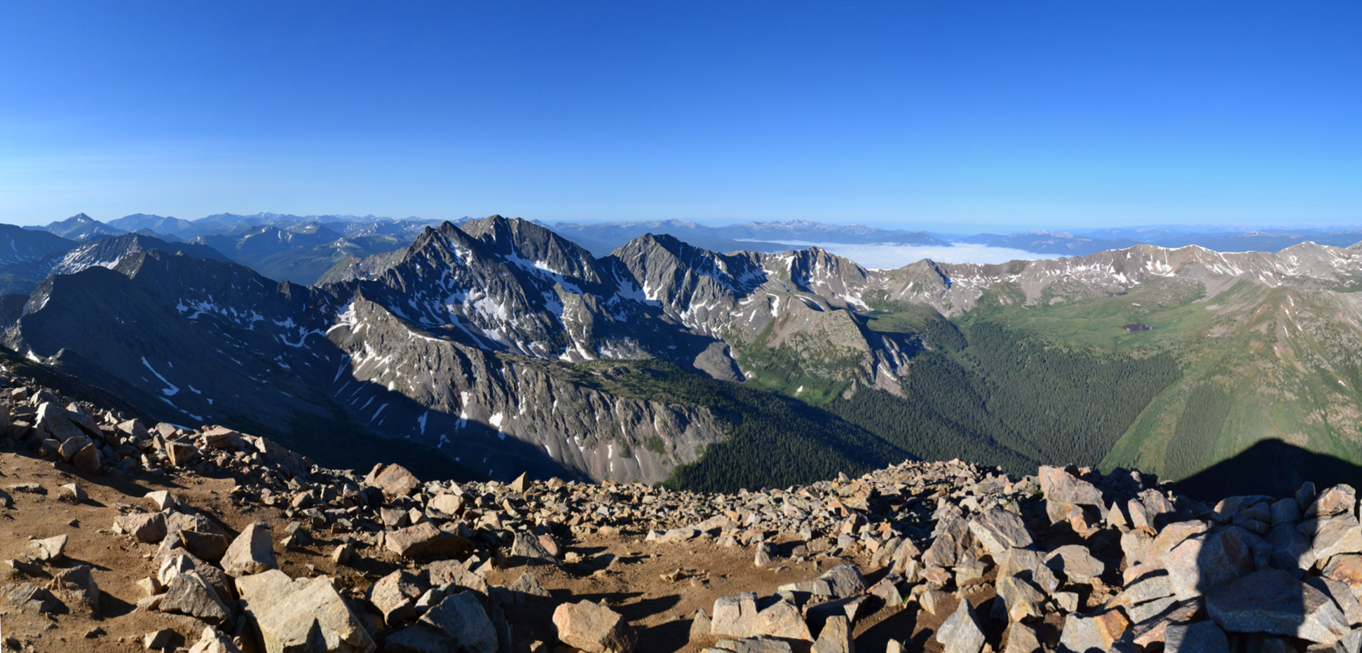
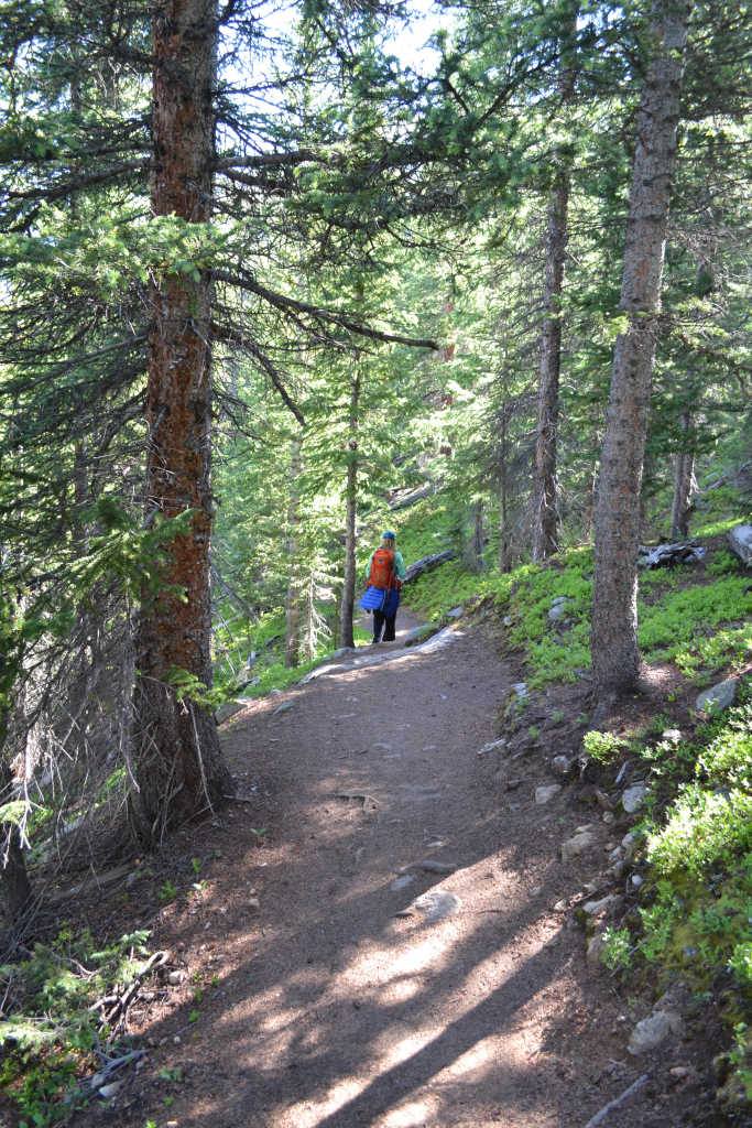
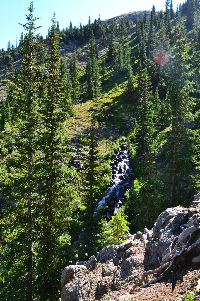
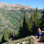
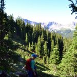
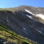
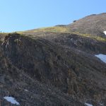
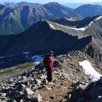
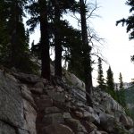
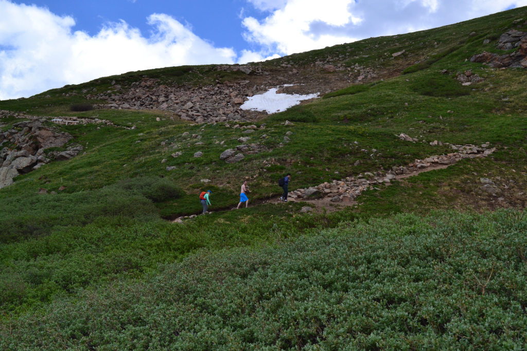
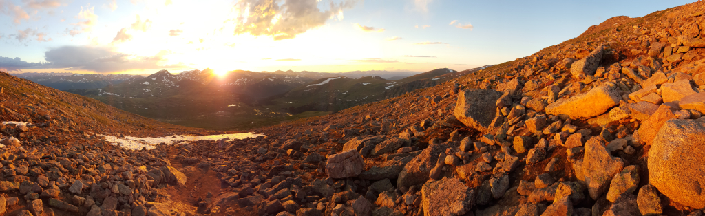
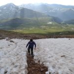
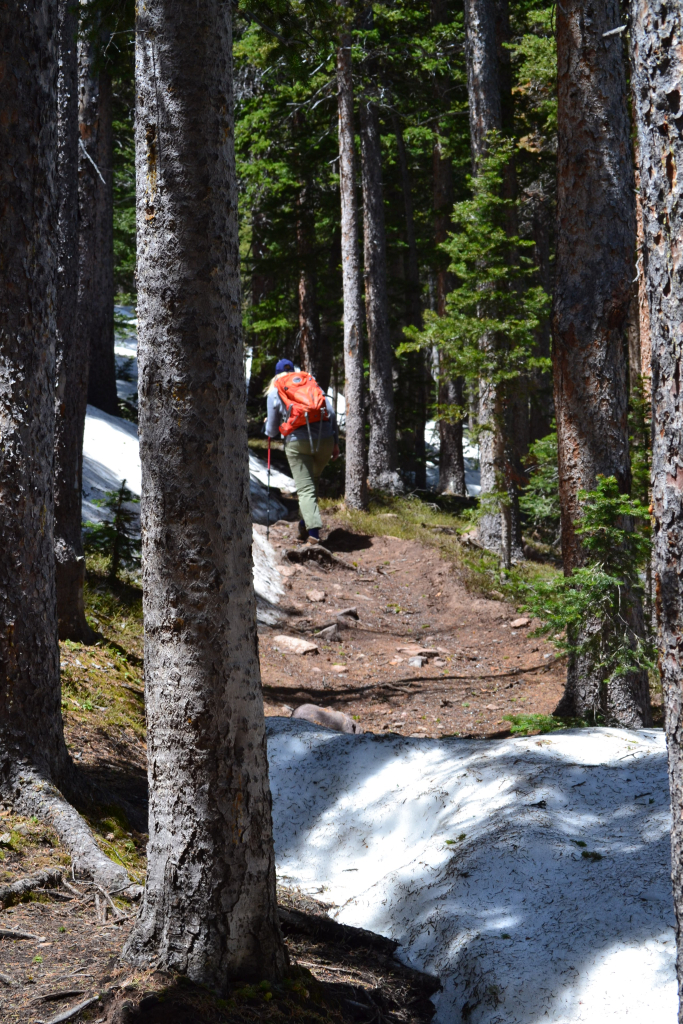
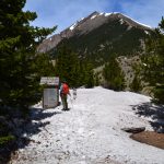
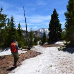
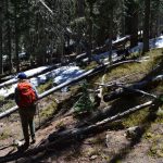
The trail led us through dense forests, canopied from the sun. Due to the heavy rains earlier in the week, there were several puddles of mud to cross. After about 0.4 miles, we reached a waterfall crossing and carefully maneuvered across. The blackness of the sky began to change to a soft blue gray. Day had arrived when we began the seemingly endless switchbacks to treeline. Seen below are photos from the trail below treeline and our first glimpses of the three apostles (North Apostle, West Apostle, and Ice Mountain) at 11,700 feet. Because the sun was barely up when we ascended this portion of the hike, the photos below show these sections of the trail on our descent.
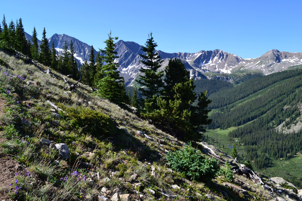
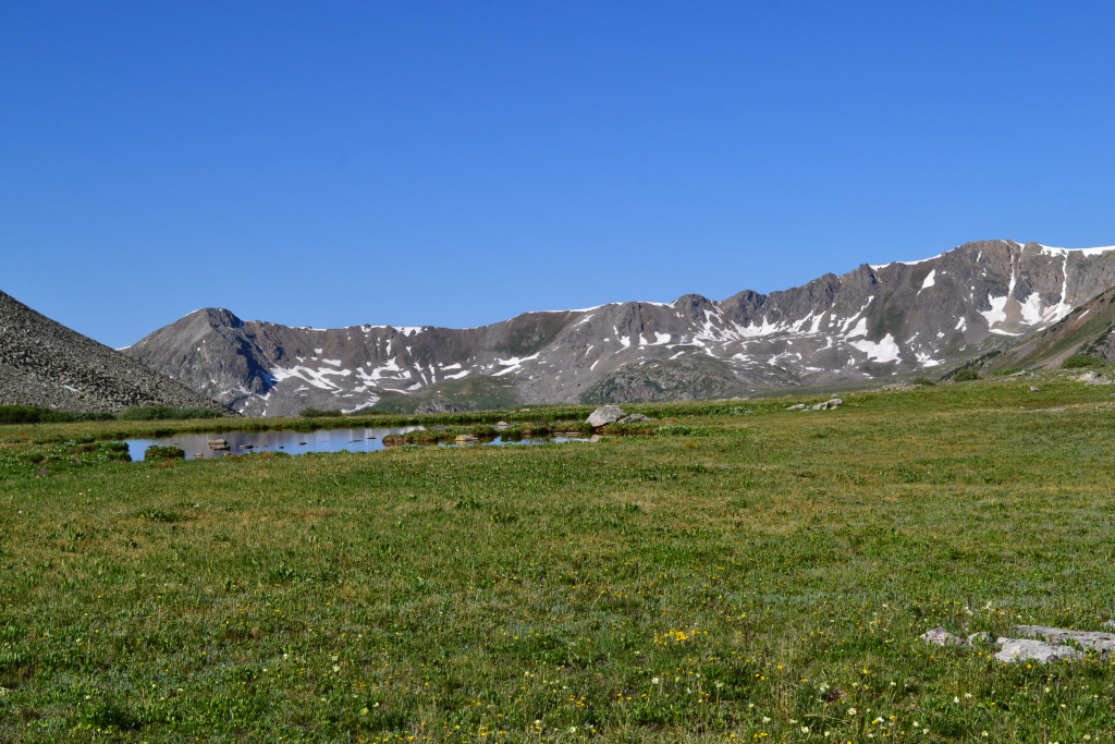
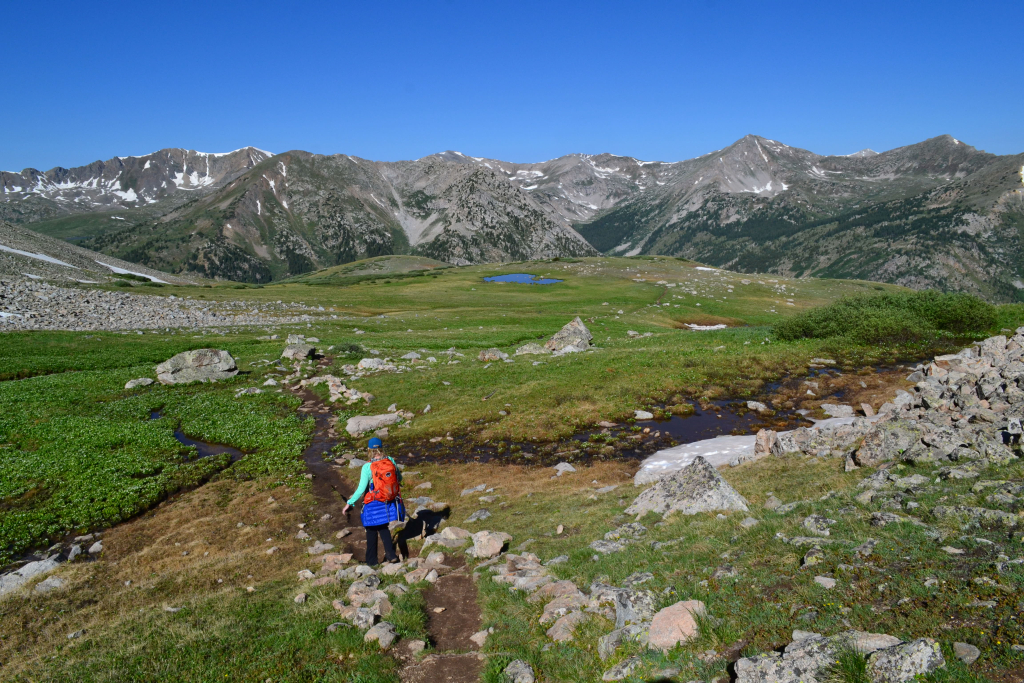
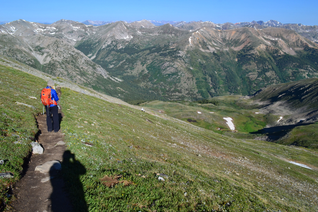
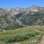
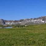
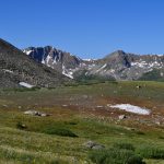
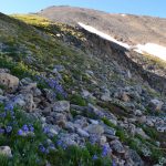
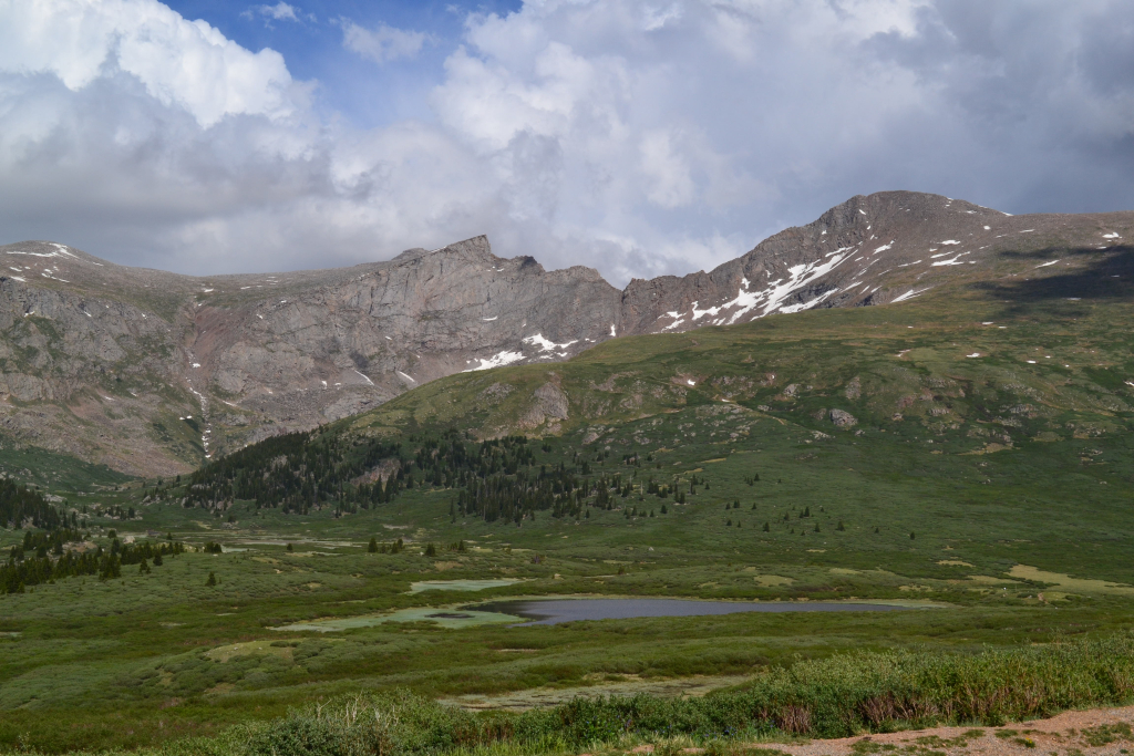
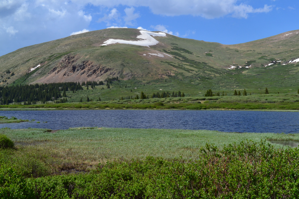
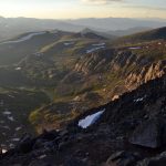
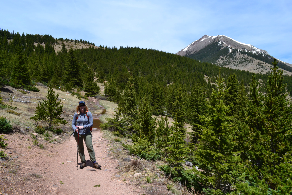
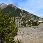
At treeline, the sun was finally upon us, and we began to shed layers. We were now in the beautiful high basin, and the trail eased up on elevation gain for a spell here. We could see Huron Peak to our northwest. We were at approximately 12,300 ft and had quite a bit of elevation gain left to go. So far we had passed one family of three on the way up the mountain and a trail runner who quickly frolicked up the mountain past us. Otherwise we had the trail to ourselves thus far, a benefit to starting a shorter 14er route before 5 am. Seen below are photos of the high basin.
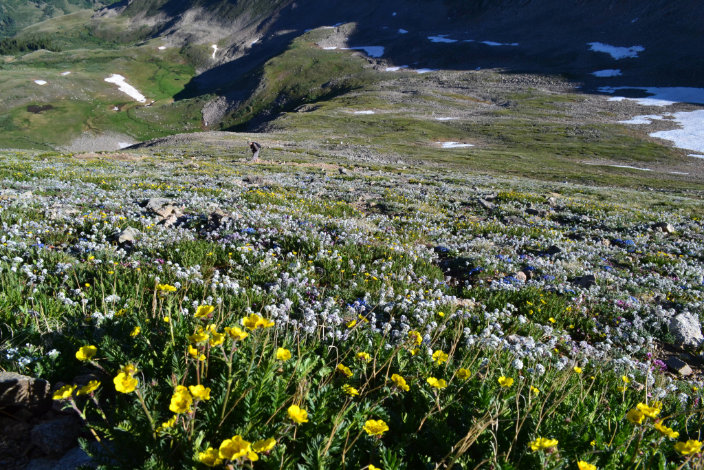
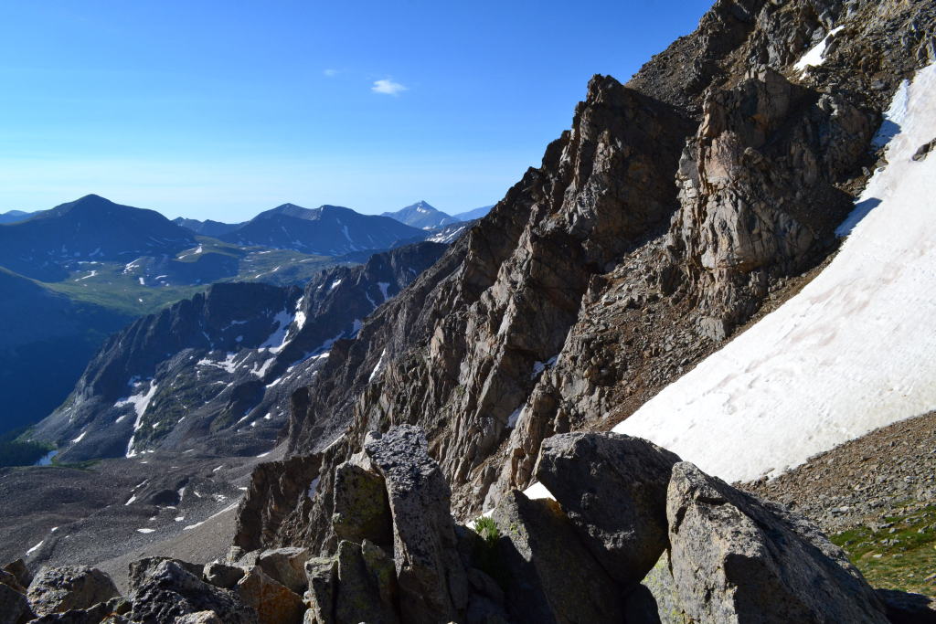
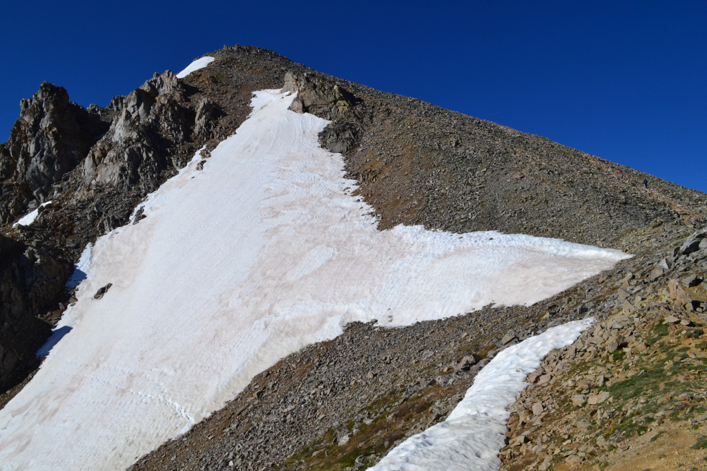
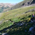
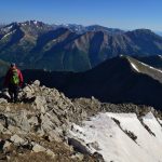
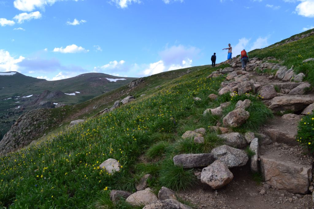
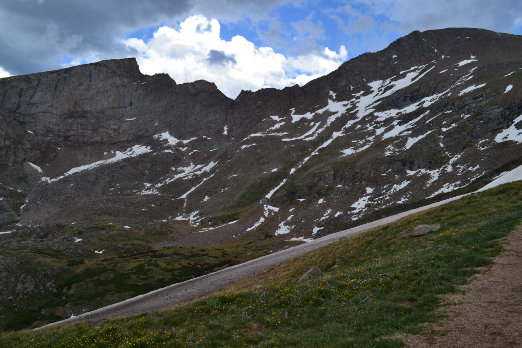
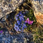
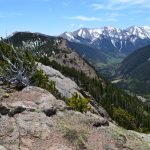
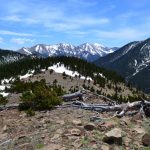
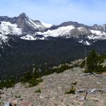
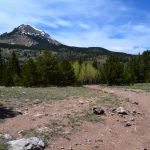
As we left the high basin, we ascended steeply up a series of rock steps and began to gain some serious elevation. Our pace slowed considerably through here, but we kept moving steadily. We continued on the upper slopes to reach the crest of the north ridge. The wildflowers were blooming in abundance, and the grass was a rich green. The views were absolutely spectacular. Seen below are photos of the upper slopes.
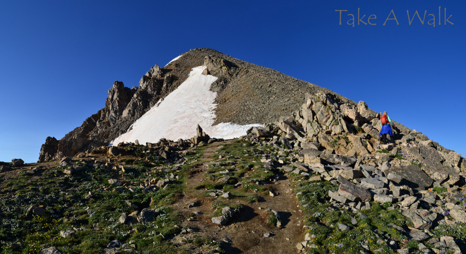
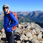
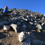
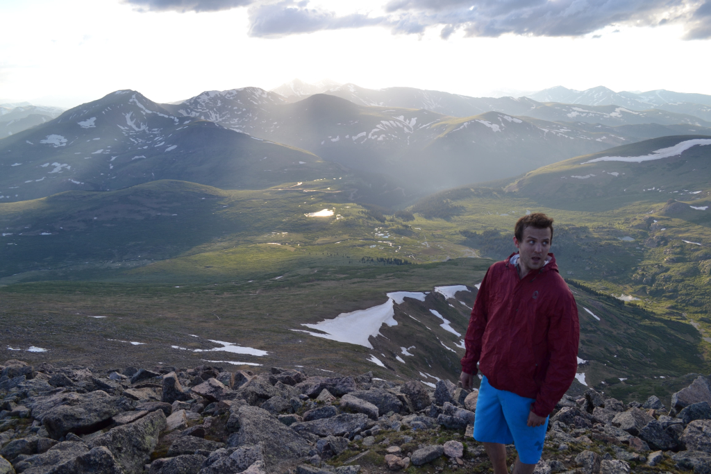
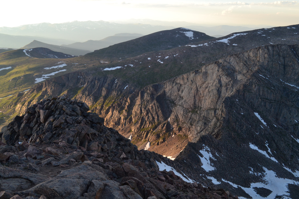
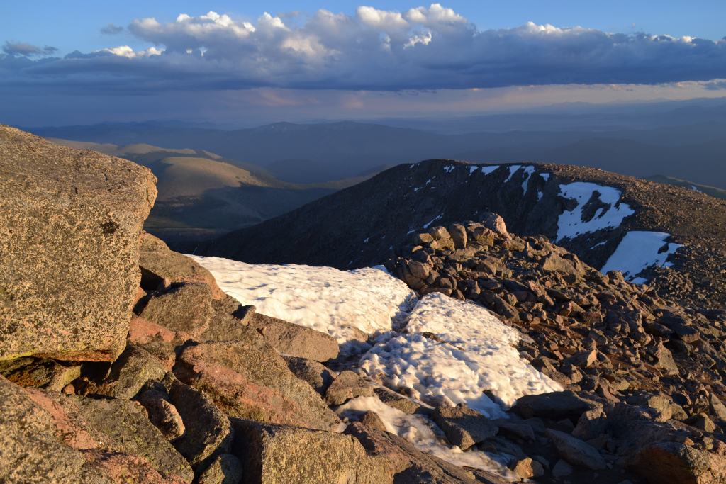
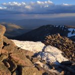
We began to encounter some of the only class 2 sections of the hike and some mild (emphasis mild) exposure. There are multiple segments of trails that all lead upward through here. We each picked a path and headed upward. We reached the final rocky pitch around 13,800 feet and saw a clear path to the summit. No one was in sight. It looked like we were once again going to have the summit to ourselves. Seen below are photos of the last portion to the summit of Huron Peak.
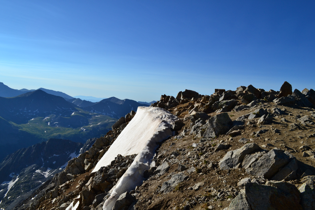
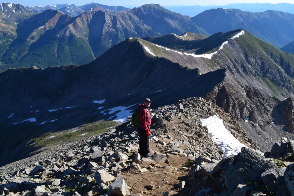
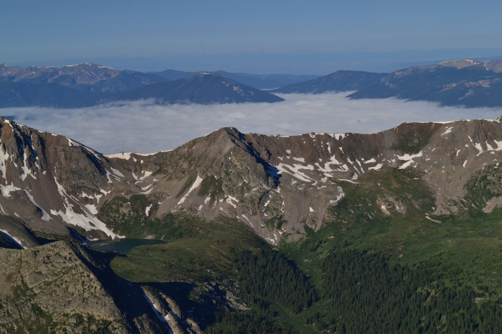
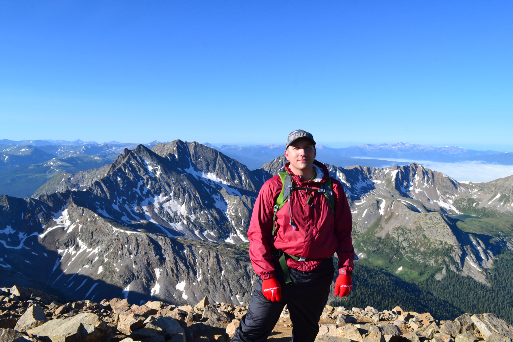
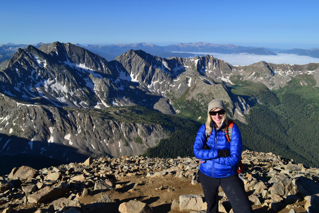
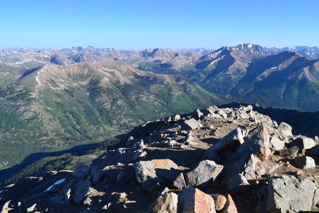
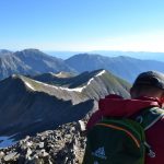
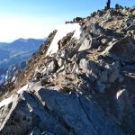
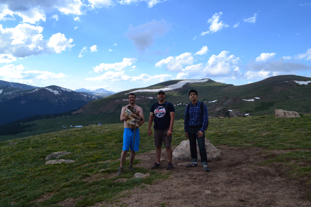
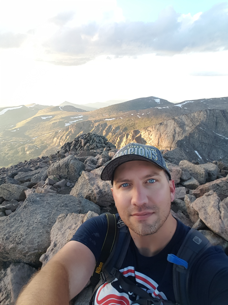
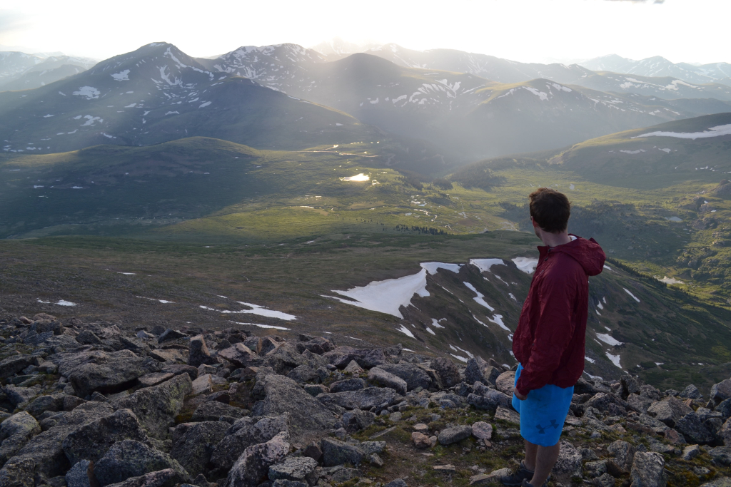
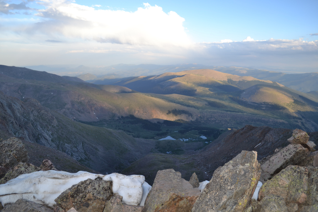
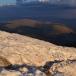
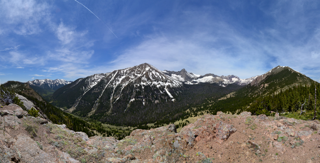
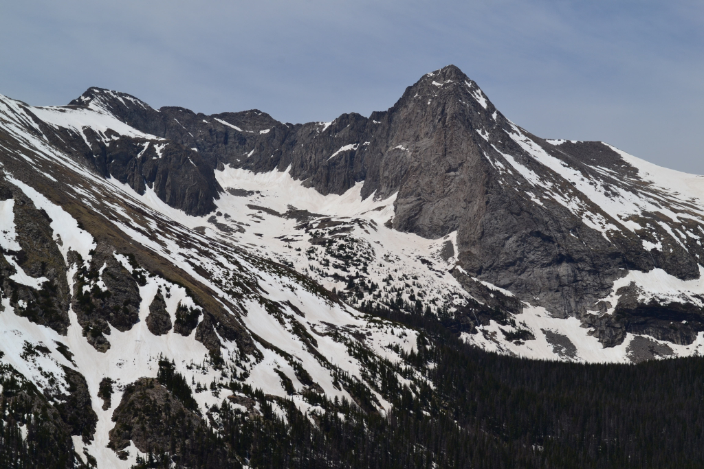
The final pitch was quite fun, and before we knew it we were standing atop Huron Peak before 8:00 in the morning. The views from Huron are some of the most magnificent we have experienced. We ranked this summit in the top three of all the 14ers we have done (we are at number 16 right now). Views from Mount of the Holy Cross and Humboldt Peak were quite amazing. Much to our delight, we saw a unique low-lying cloud formation while we were on the summit. The cloud snaked through the valley below us and reminded us very much of the “Maloja Snake” formation that was featured in the 2014 movie “Clouds of Sils Maria”. The snake “slithers” its way through the Engadin valley in the Swiss Alps on cold mornings. We stayed on the virtually windless, calm summit for about 20 minutes before heading back down to greet Will and Moses at camp. Seen below are photos of our “snake” and time spent on this impressive summit.
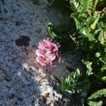
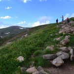
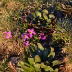
As we returned back to camp, we began to encounter many more people on their way to the top. We estimated we saw about 25-30 people heading up, and were very thankful we started early to enjoy the quiet and solitude of this beautiful peak. We took a little more time on the descent to enjoy the brilliant display of wildflowers that covered the upper basin. Seen below are photos of the hundreds of alpine flowers we encountered. Though their season is short-lived in the harsh alpine environment, they make up for it in immense beauty and color.


The temperatures had warmed up considerably for our descent, and we once again removed layers. We told Will we would be back at camp by 10:00 am, so after the basin we began to hustle. Excellent time was made through the forest, though the switchbacks on the way down seemed even longer. It was interesting to see our route from the early morning darkness now in full display amid the daylight. It was almost as if we were hiking fresh terrain. We reached the trailhead at approximately 9:50 am, and made it back to camp in the X-terra at exactly 10. Moses and Will were relaxing by the fire. We had a great Independence day, celebrating the best way we know how….hiking and camping in America’s great wilderness. We stayed in camp a little while longer to relax and then headed back to Leadville for cheeseburgers. The drive back to Denver on the evening of the 4th was completely free of traffic, and we made it home in time to enjoy watermelon and relax. Enjoy the gallery below of additional photos from the route as well as our camping spot.
Mount Bierstadt – Sunset Hike June 25th 2016
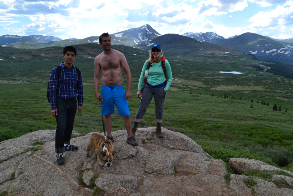
Will’s friend Julian came up from New Jersey and was excited about the prospect of getting into the Rockies. After talking about possibilities, Will and Julian decided they wanted to go camping on Guanella Pass and possibly climb Mount Bierstadt. We are always up for some camping and/or hiking, so we all packed our gear up and headed out to Guanella Pass on a late June Saturday afternoon.
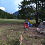
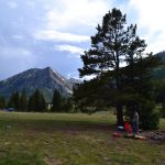
We found a superb camp site and set up our sleeping arrangements.The Guanella Pass campgrounds are very nice, but do have a moderate overnight fee of 17 dollars plus 6 dollars per extra vehicle. Our site had two picnic tables, a charcoal grill, and a fire pit. For great information on nearby campgrounds as well as availability visit the main website here. Below is a picture from our camp. Mt. Bierstadt is slightly visible in the background.
The forecast predicted possible afternoon showers, but the skies remained only partly cloudy for us. After some talk we decided a sunset hike was in order, and we gathered our hiking supplies and headed out to the mountain around for a 5 pm start time. Once there, we easily found parking in the main lot, and geared up. The hike is between 7 and 7.5 miles round-trip, and we planned to be on the summit just before sunset. Typically during summer, hikers should be off the summit before noon (thunderstorms are common between 12 and 4 pm). However, the evenings routinely provide another window of calm weather for an alpine ascent, and you are likely to have the area to yourself!
The first segment of the hike through the willows was nice, but muddy in some sections. Scott Gomer Creek was high, and we opted to walk north along the creek to an easier section to cross. We took off our shoes and socks to cross in order to avoid an uncomfortable rest of the hike. After the willows, we began to gain elevation and reached a nice overlook. Our friend Moses enjoyed part of the hike as well.
After the rocky outcrop, the elevation gain continued steadily for the remainder of the hike. It was still quite warm around 11,000 feet as the sun had not yet set. The weather continued to look mild and welcoming so we continued onward. We enjoyed the views and relative isolation that can so rarely be achieved on the popular Mt. Bierstadt (we only saw a handful of people descending). Seen below are photos as we left the willows.

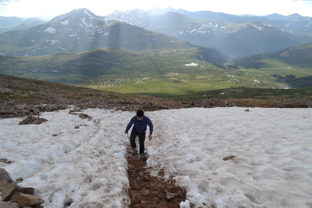
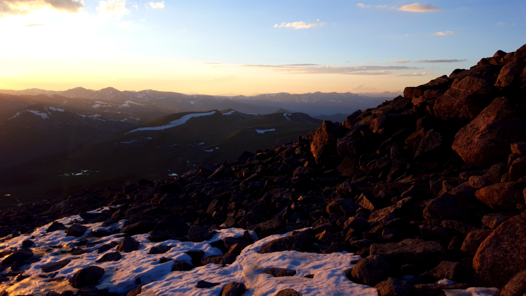
When we reached 13,000 feet, there were some remaining sections of snow and ice that we carefully maneuvered. The temperatures were beginning to drop as the sun dipped lower on the horizon, and it felt a little less like summer than earlier in the afternoon. Climbing in the evening after a full day of activities felt a bit more tiring than a morning summit attempt, too! But the views were well worth it.

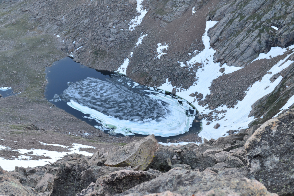
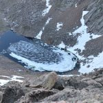
The summit was windy and chilly. With the light rapidly disappearing, we quickly took some pictures and began the descent. Below are some photos from the top. Frozen Lake was still, appropriately, frozen!


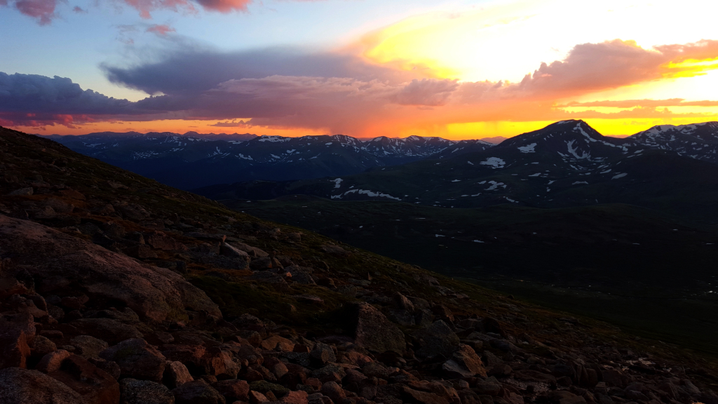
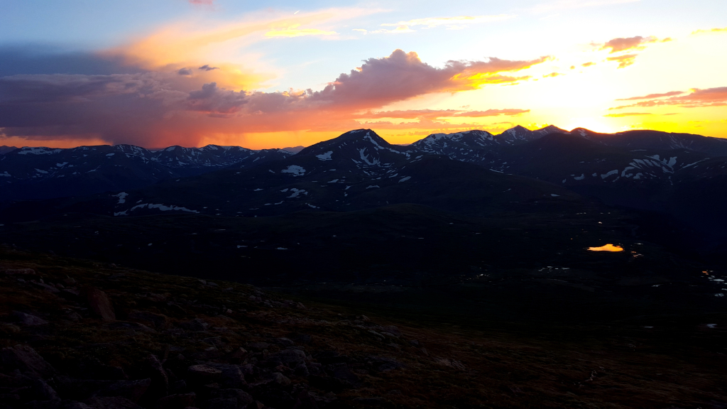
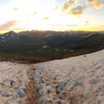
At 14,000 feet the sun began to set, leaving a hot, red orange glow on the alpine landscape below. It was truly breathtaking. Most peaks we climb are summited in the early morning, and we commonly catch sunrises. (For our favorite sunrise hike check out our Grays and Torreys Sunrise post.) A sunset was a unique experience for us on a 14er and truly breathtaking. Seen below are images captured as we descended in the alpine dusk.
It was dark as we reached the willows, and things began to get interesting. Unfortunately, we only had one headlamp as the others were mistakenly transferred out of our packs. We carefully weaved our way through the dark trying to avoid stumbling on massive boulders and/or mud pits. The trail through the willows twists and curves, and one never knows if someone or something might be around the corner. While we ascended, the willows hike felt short. Descending through them felt endless. In addition to the lack of light, we alternated carrying Moses through the brush to avoid him overworking himself. Bulldog pups never know when enough is enough when it comes to playing.
When we approached the river crossing, we discovered that the water had risen significantly compared to when we forded it earlier in the evening. It was too dark now to bushwhack our way to a better crossing through the gnarly willows. We made a decision to cross then and there. This time we kept shoes and socks on to maintain better stability and to avoid cutting our feet. We each took turns wading through the chilly water while someone else held the light source for guidance. The crossing was only 10-12 feet wide, but the water was extremely cold. The water came up to the tops of knees in most spots. We all made it safely across and proceeded the last half mile or so back to the parking lot.
A sharp bark from the blackness of the willows gave us one last adrenaline rush before reaching our car. We couldn’t see anything in the dark away from the trail, but we assumed someone was hiding out in the willows with their dog as we also got strong whiffs of weed in the frigid air. There are strange things in the Colorado backcountry. The temperature had dipped into the low 40s now. It was almost 10:00 pm. We were all utterly exhausted by the time we reached the parking lot.
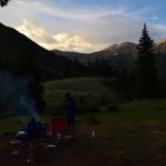
We drove the few miles down the pass to our campsite. At 10:15 pm we were ready for dinner..except for Julian who crawled in the tent to pass out. We enjoyed one of the tastiest, most satisfying chargrilled cheeseburgers of our lives that evening and then retired to our tents. It was a cold, tiring adventure and our fourth time on Mt. Bierstadt. Nonetheless, each trip up has given us a unique experience.
For more information and details on the route of Bierstadt enjoy our original Bierstadt post and our Bierstadt-Sawtooth-Evans post.


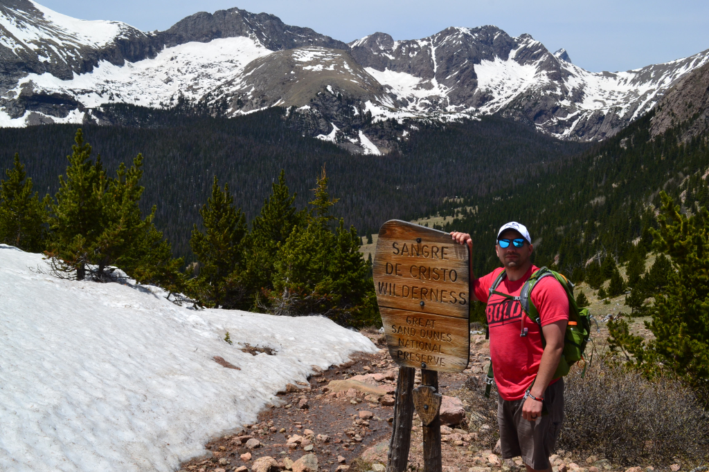
Music Pass-Sangre de Cristo Wilderness Area
Min Elevation: 10,240 ft. Max Elevation: 11,465 ft. Net Elevation Gain: 1,225 ft.
On day three, sadly the last day of our trip into the Sangre de Cristos, we finished out our adventure with a quick hike up to Music Pass. Music pass is a beautiful alpine pass on the east side of the range right next to Westcliffe, CO where we were staying. The trail and pass were named for the musical sounds that supposedly can be heard when the wind blows. Whether this is a just description or not, the surrounding beauty of the three 13,000 foot peaks and Sand Creek Valley below nonetheless bring great joy.
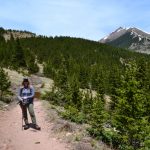
We began the journey heading down Colfax Lane, the same road that took us to the TH for Humboldt peak a few days earlier. Instead of turning right at the dead end, we veered left and followed the CR 119 to the Grape Creek TH. Up until this point, the road was quite lovely. But, we were now ready to continue on the 4WD road up to the Music Pass TH. The road began mild but quickly turned into a narrow, rocky, mess. In fact, we considered it in much worse conditions than the South Colony Lakes Rd that seems to get so much negative attention. While there were several pullouts for trucks along the way, an encounter with any oncoming traffic would have been rather unpleasant, requiring a skilled navigation by a least one party. A little misinformation on the internet led us to believe that we had only 1.5 miles to travel on this rough road. As we approached two miles in, our frustration began to build. After 2.2 miles, we opted to pull-off of the road into a nice field as the rest of the route up was covered in snow. Hiking an additional 0.4 miles led us to the music pass TH. This is a trail that supposedly receives lots of traffic, however, we saw no other cars or people the entire time. Perhaps too much snow and the fact we were hiking on a Tuesday kept the crowds away. It was splendid.
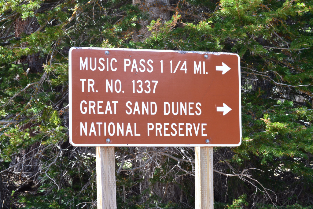
The sign said 1 and 1/4 miles to Music Pass. We began our hike in thick forest. After about a quarter of a mile into the hike, we found the trail registry and signed in to aid the forest service in estimating trail usage. Through the forest, the trail moderately gained elevation. As we climbed higher, large drifts of snow began to appear. In several spots, we had to post-hole to remain on the trail. This was not surprising as it was still only June 7th. As we approached 1 mile, the trees began to open up. We crossed over a delightful little creek with a waterfall to our left. It was a bluebird day, and the unbridled bright sun reflected upon the gurgling water brilliantly.


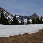
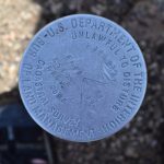
The trail disappeared in a sea of deep snow as we got closer to the pass. We wandered around a bit, and found a spectacular look out. It was a rocky outcropping with a geological marker and surrounded by steep cliffs. Seen below are photos taken from our unique perch.

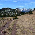
We then bushwhacked to the general direction of the pass. The snow was thigh high at times but mellowed out as we reached the official Music Pass sign. We had amazing view of Music Mountain, Milwaukee Mountain, and Tijeras Peak, all of which reach higher than 13,000 feet into the sky. To our east, we once again had sweeping views of the town of Westcliffe and Wet Mountain Valley. We enjoyed the rare solitude of Music Pass. We ate lunch, took pictures, and frolicked about in pure joy. Because of the long drive ahead to return to Denver, we opted not to continue on to the Sand Creek Lakes this time.
Take a walk to Music Pass if you have the chance. It is an easy/moderate hike with amazing views for less mileage and effort. However, to reach the upper TH make sure to have a high clearance 4WD vehicle. The road was quite difficult. If not, there is plenty of parking at Grape Creek TH, but plan on adding another 5 or so miles to the hike.


Great Sand Dunes National Park
On day 2 of our exploration of the Sangre de Cristos, we made the journey from Westcliffe, CO to the Great Sand Dunes National Park. As the crow flies, the journey is a brief cross over the narrow portion of the range. However, no easily passable road exists to get to the East entrance of the park and a bit of travel around the southern tip of the range is required. For those that have a jeep or modified high clearance 4WD vehicle, check conditions for the Medano Pass Primitive road. While it won’t save much time due to the extreme nature of the road (9 creek crossings), it will make for a memorable, exciting trip. The day of our trip, June 7th, the road was only open to the fourth creek crossing due to the high level of water from the rapid winter melt. Check conditions here before planning your visit.
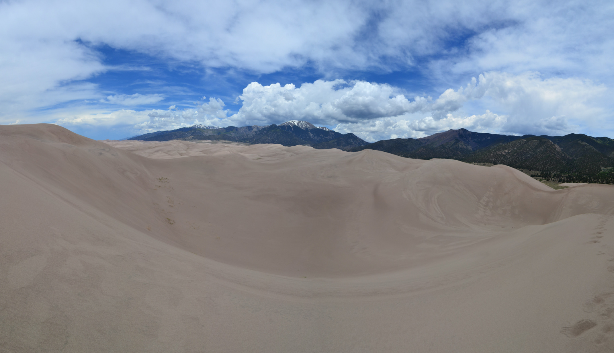
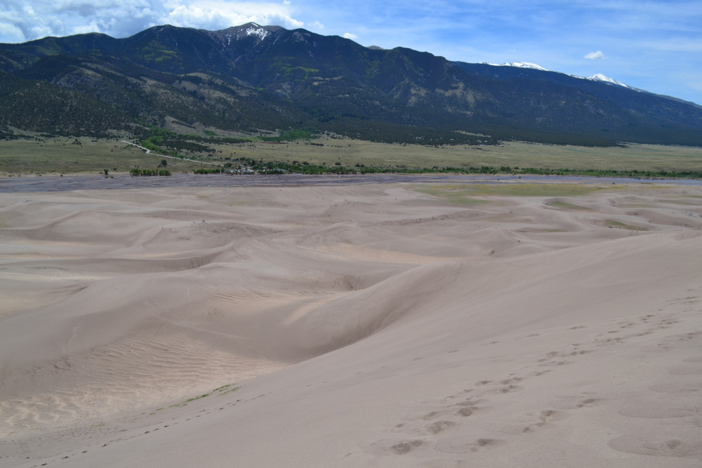
After about 90 miles and a 12 mile jaunt on a dirt road to shorten the journey, we finally saw our first glimpses of the tallest dunes in North America. The contrast of the snow-covered mountain peaks against the smooth yellow piles of sand was incredible and strange. We had landed on the centerpiece of an extremely diverse landscape. The park boasts seven life zones including the alpine tundra, subalpine, and montane forests of which we experienced on our Humboldt Ascent, as well as wetlands, salt-encrusted plains, grasslands, and of course the famous dunefield. The dunefields comprise approximately 11 percent of a 330 square mile deposit of sand in North America. We were fascinated by the rich landscape and tried to come up with scenarios responsible for the deposition of sand in front of us. A stop by the visitor’s center at the park entrance revealed that the dunes formed over thousands of years in which the predominant southwest winds deposited sands from the mountain streams and lakes of the San Luis valley in a low curve in the Sangre de Cristo range. There are excellent resources available including the national park webpage that provide a more in detail description of the fascinating geology of these dunes.
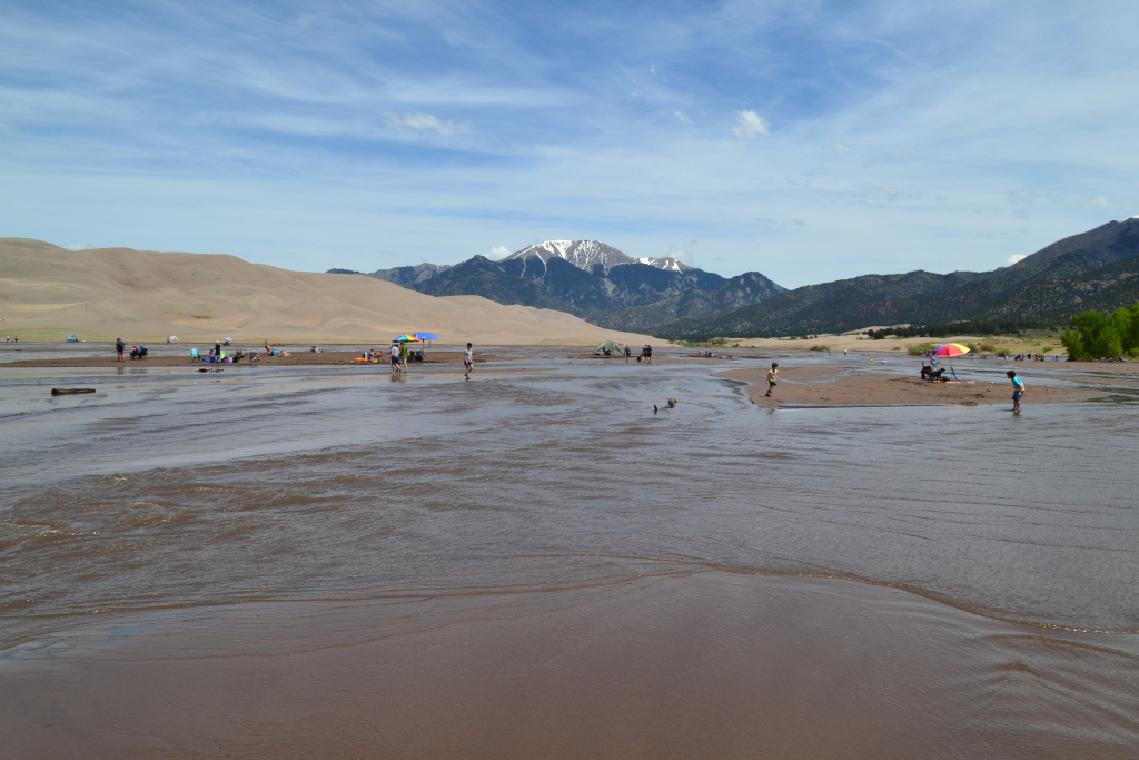
Before we entered the park, we stopped off at this shop called Oasis and rented some sand sleds. (They are 20 bucks each plus tax for one day) One of the exciting features of the park is the ability to sand surf or sled down the large dunes. With boards and snacks ready, we proceeded to the parking lot by the Medano Creek. The parking lot was almost full around lunchtime on a Monday. We’ve heard holiday weekends and most summer weekends are impossibly crowded but were a little surprised at how many people were there on a weekday. We changed into sandals to wade across the wonderfully cool water to reach the sand dunes. This creek is seasonal, and luckily we arrived at a time when there was some decent water flow. The creek typically flows from April to June, generally peaking the end of May. But, this varies depending on snow melt for the season.

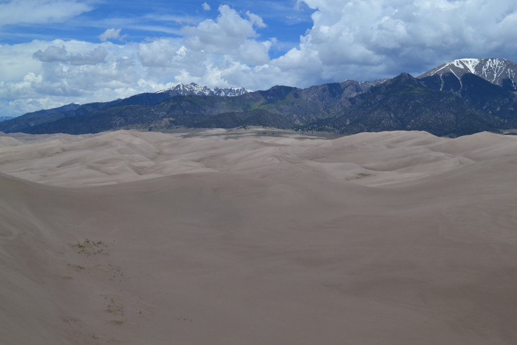
After crossing the creek and entering the sand dunes, we realized that perhaps sandals weren’t the best choice of shoes. The sand was a bit warm as we reached one of the higher dunes called High Dune which stands 699 feet from base to top. Though not the highest dune in the park, it appears that way from the creek bed and provides complete views of the entire dunefield. It was about 1.5 miles from the parking lot to this high point. While 700 feet or so doesn’t sound like much compared to climbing over 4,000 feet, it is quite tough in sand. It felt like every two feet forward we fell one foot back. The physical and mental strain of climbing to the dune top was intensified by the mid day sun reflecting off of the sand.


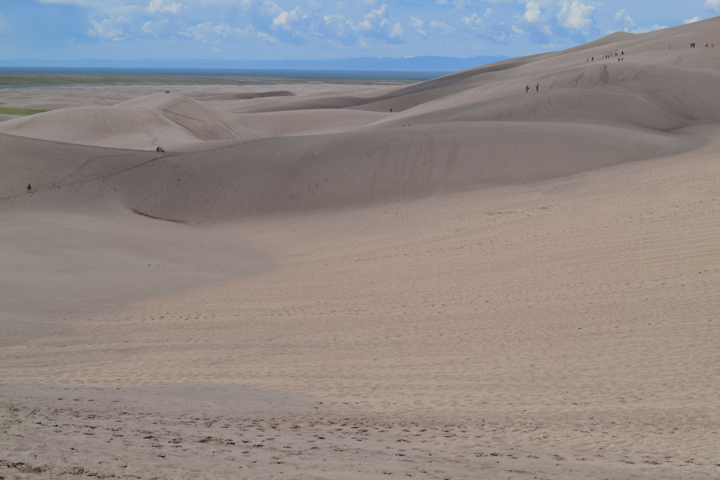
After gaining higher ground in the dunes, we started to play around on our sand sleds. In order to gain decent speed, you must apply a generous amount of wax to the board bottom. We found that with the right grade of incline, sand pack, and wax fast speeds were easy to achieve. Sometimes we also found out that it could be easy to lose control with using our feet as breaks to slow down. This equaled massive amounts of sand in our clothes, hair, eyes, and ears. Make sure to view the video at approximately 3 minutes to see what exactly we mean by this.
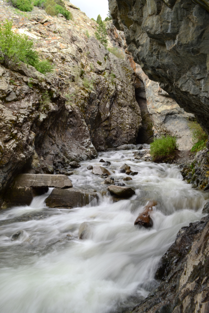
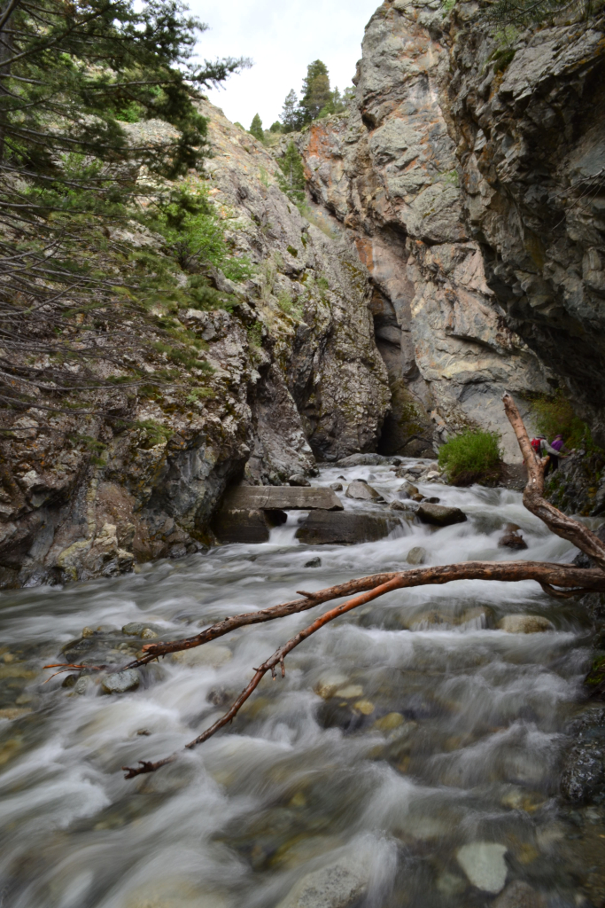
After a couple of hours of playing in the sand, we opted to head back to the car for a sack lunch and another soak in the Medano. It was wonderfully relaxing. Mid-afternoon we tore ourselves away from this playground to allow time to travel to Zapata Falls. To reach the falls, we left the park and drove about 8 miles before turning left onto the rough 3 mile road to the TH. This was a terribly bumpy, uncomfortable road that seemed to take forever to travel. Once at the top of the road and TH, we were greeted with sweeping views of the entire sand dunes as well as the San Luis Valley. The hike to the falls was really, really short (just under 0.5 miles). However, as we reached the river and the crevasses where the falls are hidden, we realized the water level and flow were still too high to safely reach the waterfall. That being said, a few people did brave the slippery rocks and swift, ice cold water to see the waterfall. We just didn’t feel it was worth the risk. Nonetheless, we still enjoyed the view of the river and rocks and relaxed in the cool breeze from the swift water.
Overall, this was a good first trip to the Great Sand Dunes. We also happened to visit during the year of the Centennial National Parks Celebration. On August 25th, 2016 the national parks service turns 100! So get outside this year and celebrate, and help advocate the preservation of these protected places for generations to come.