Take a Walk
A Quest into the Wild
Homestead Meadows Hike
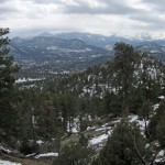
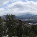
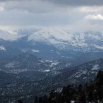
Our hike this weekend took us back into Rocky Mountain National Park, this time to the trails traversing the peaceful remains of the long ago inhabited farms and ranches of Homestead Meadows. The hike seemed appropriate for Memorial Day Weekend, as its miles of trails explore Civil War era relics as well as early 1900s images of homesteading of the western territories. In 1862, Congress passed The Homestead Act of 1862, to promote crop growing, ranching and building in many areas of the undeveloped west. Settlers were permitted to claim up to 160 acres of surveyed public land if they agreed to live on the land for at least 6 months out of the year for 5 years making improvements to the land. Today, the meadows are very quite, peaceful and full of wildlife and beauty. When we began the hike, we each tried to pretend what it would be like to be back here in time, without the modern conveniences of electricity, cars and indoor plumbing in the wild foothills of the Rockies.
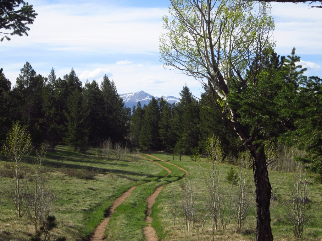
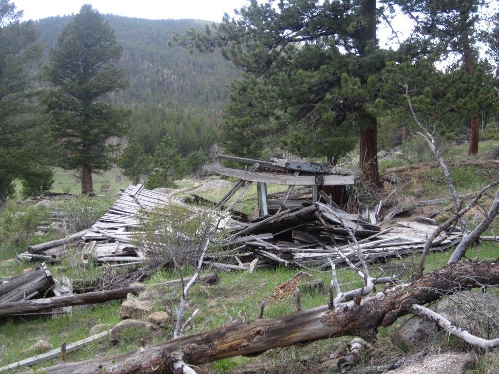
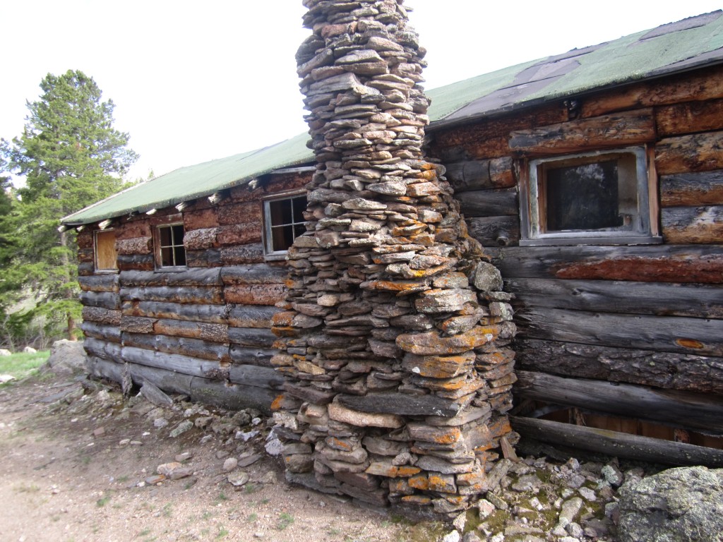
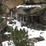
We began the hike from Hermit Park at the Homestead Meadows Connector Trailhead. The route first led us about half a mile down a dirt road before crossing a small creek that led to a single track trail going up hill for a bit. The trail slowly worked its way up and down until leading us to another dirt road (which I believe park rangers can access by truck). After another mile uphill climb, we finally reached a gate that closed off all motorized vehicles and was accessible by those on foot only. (Homestead Meadows Trail 971). Shortly after reaching the main trail, we discovered our first glimpse into the past at the Brown Homestead. This homestead was actually from a bit later (1917 and 1919). Brothers Harry and Cloyd Brown claimed adjacent 160 acres and used the land for timber and cattle ranching. What remains of their beloved homes can be seen in the pictures top left and right. Bottom left photo depicts entrance to the Homestead Meadows 971 Trail. Brown Homestead was approximately 2 miles from the trailhead; elevation 8,320 feet.
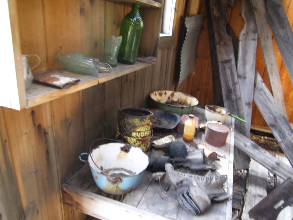
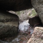
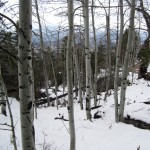
We then proceeded further down the trail which briefly entered a forest area full of Ponderosa pines and a few patches of Aspens here and there. After emerging through the timber, the trail opened up to an amazing meadow with the Rockies as a splendid backdrop. As we passed through the meadows, we came upon an area that appeared to be wetlands. This made this part of the trail a bit difficult to get through. We emerged (with feet a bit wet) from this section and once again entered another bit through the forest. We proceeded another mile or so south (could have been further) to reach Griffith Homestead. It appeared that there were only two building remains here but in much worse shape than the Brown Homestead. However, we did find some neat antique tools and food canisters on site here as well as what looked like an old radio. Unfortunately, we read that Griffith died while working on fence at his homestead. They say he felt dizzy and went in for a soda to feel better. He then returned to work but never returned that evening. His body was found the next day. Pictured below left are tools found on site. Pictured left are the remains of the Griffith homes.

We kept moving south to reach the Walker home next. Sarah Walker was the only women who participated in the Homestead Act. She survived her husband and two children and decided to start a new life in the rolling foothills and meadows. They say she walked 15 miles a few times every week to sell eggs and milk to the locals in Lyons because she owned no horse. We were all very impressed by this strong women, who braved the wilderness alone and succeeded. It made us complain just a little less about the blisters starting to develop on our own feet from the long hike. There was very little left of the Walker Homestead, but we did stumble upon her old bedframe as well as a herding corral.
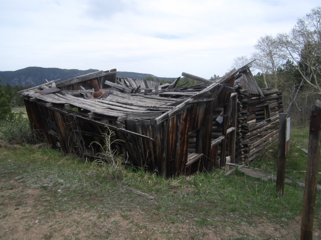
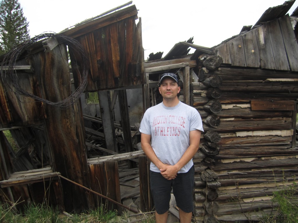
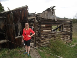
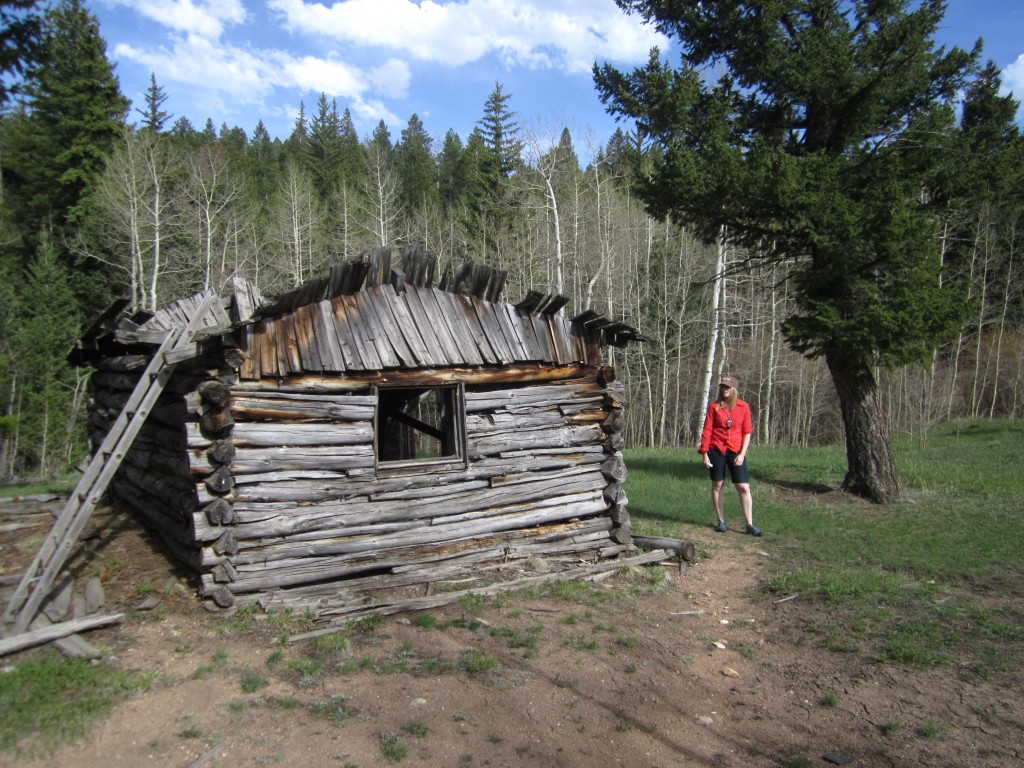
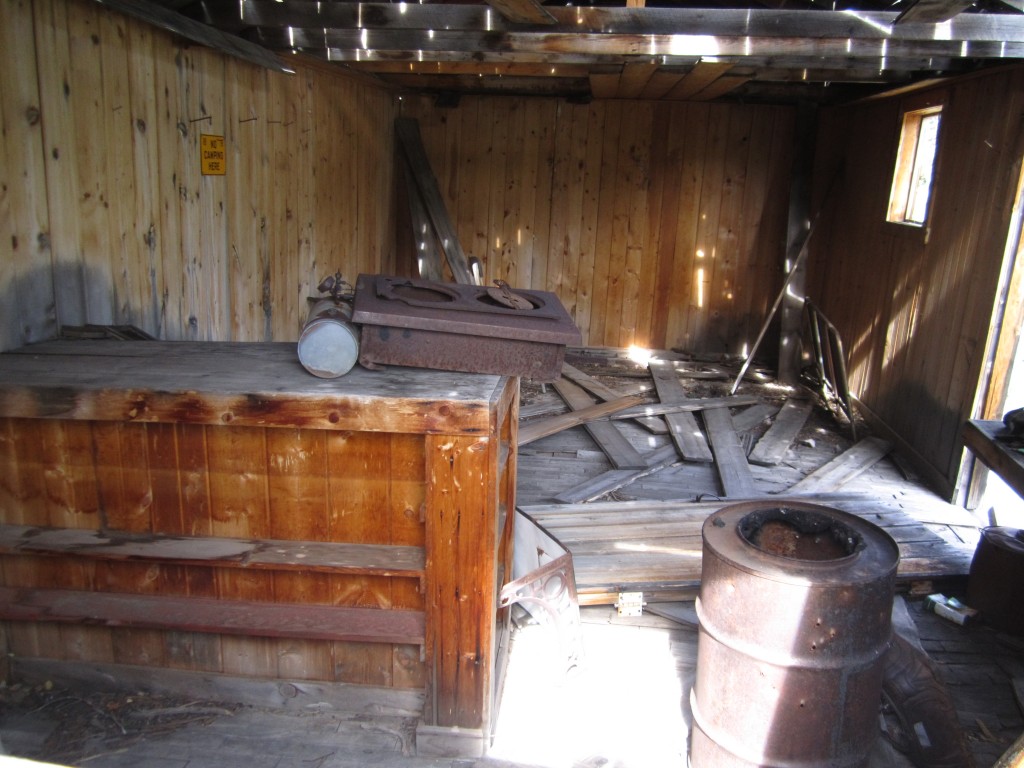
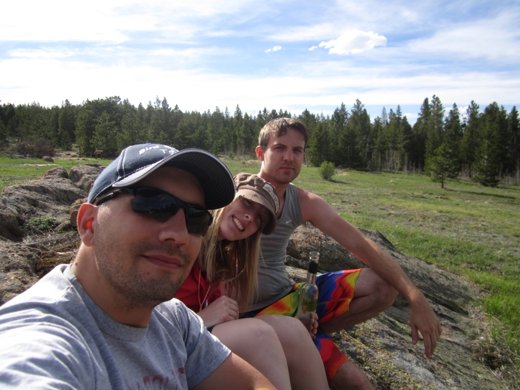
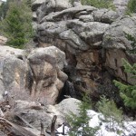
We saved the best preserved Irving homestead for last. To reach this site, we turned around an headed north on the trail. After a mile, the trail diverged and we followed an eastern path that led to the homestead about 3/4 mile away. The Irving homestead was amazing. There was a main house with a bathhouse in the rear with a sunken bathtub. In addition, further down the hill was an additional cabin and smaller bunkhouse. There also looked to be some sort of stable nearby. Though we didn’t travel to it, the Irving Homestead did a lot of timbering and a sawmill was just down the road. Pictured below are images of the well preserved remains of the Irving place. If you have a chance to hike this trail, make sure and make time to reach this site. It was the most interesting of the day.
After spending adequate time exploring the Irving Homestead, we stopped to enjoy a snack and a Moscato and took in the scenery. We then hiked the 3/4 miles back to the main trail and headed back home the way we came. This was the hardest part of the hike. We were close to about 7 miles at this point and were feeling quite tired with two more to go. Overall, this was a very great hike, with lots of exciting exploration potential. Plus, it was not very crowded. If you enjoy historic settings, with the anticipation of an exciting find at each mile covered, then this is the hike for you. Though there were some slight elevation gains (rolling hills and a few climbs) scattered throughout the hike, most of the trail was just moderately strenuous due to the sheer length of the hike. We only covered a fraction of this trail complex as well. Further out, there are many more homesteads and miles of trail. The easiest way to access the trail is through Hermit Park. A daily park fee of 6 dollars is required upon check in at the visitors center. The hike may also be accessed from the Lions Gulch Trail 949 which is all on national forest lands and requires no fee. However, the trail is more difficult and has substantial gains in elevation and more distance to reach the meadows.
Pictured Below: Our group at the Irving Homestead
Garden of the Gods Hike
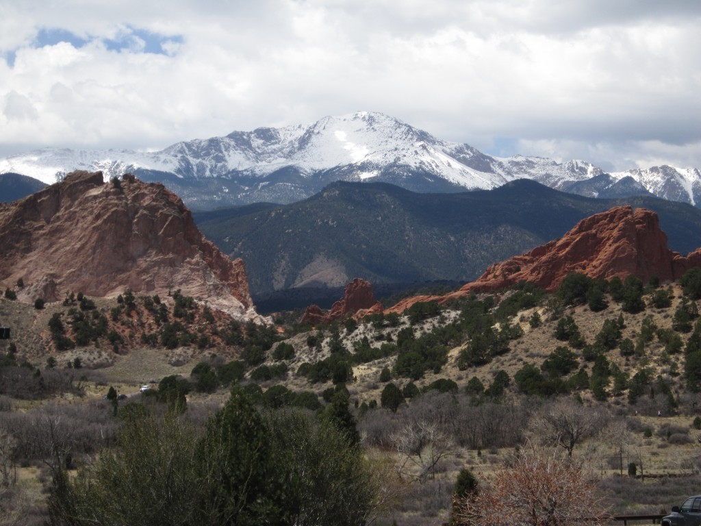
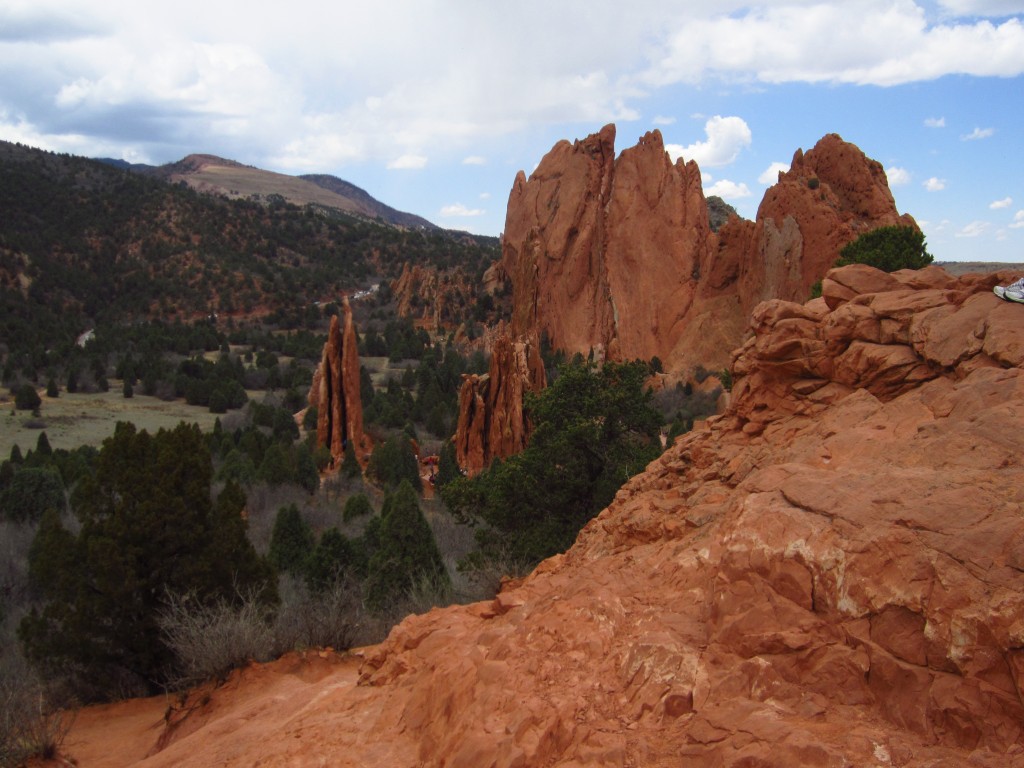
Our trek today led us to splendid geological wonder, as we were greeted with sheer cliffs of bright red sandstone protruding like jagged knifes out of the ground as we entered the Garden of the Gods National Park in Colorado Springs, CO. While not a traditional “quest into the wild” as we are going for with these hikes, the park’s striking contrasts of grassy plains and rocky mountains piqued our interest. We started the venture into the park with a stop at the Visitor’s Center which gave us a preview of what we were in for with crowds for the afternoon. Dodging children, grandparents, mothers and American summer (spring) vacationers, we managed to make it to the overlook at the visitor’s center which allowed for an amazing view of the park. Pictured below are scenes from the overlook before we began our hike. The large snow covered mountain in the background is Pikes Peak, another very popular attraction. While we didn’t partake in these activities, the park does offer a brief movie describing how the rock formations were created, a cafe to grab a quick snack and a gift shop. Plus, entry into the park is free.

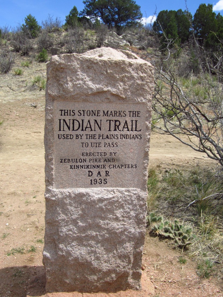
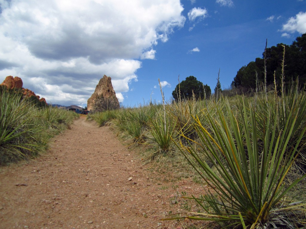
We then proceeded to drive into Garden of the Gods, and parked in the south parking lot, and then entered on the Ute Trail. The Ute Trail was named because it was a common trail for the Ute people to use and is marked today by a large stone right next to the parking lot. A picture of this marker is seen in the bottom left image. The trail had numerous yucca plants and provided an opportunity for a great picture of the plains contrasted with the mountains seen below on the right. The trail runs next to Juniper Way Loop until it meets up with the main Garden Trail.
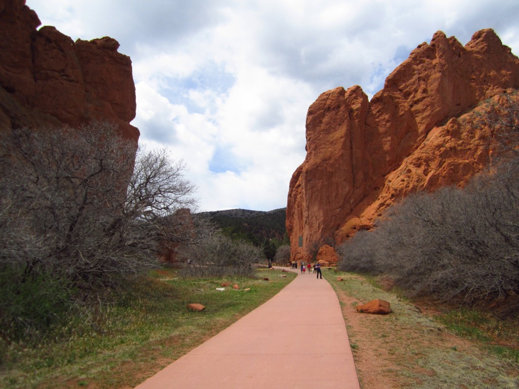
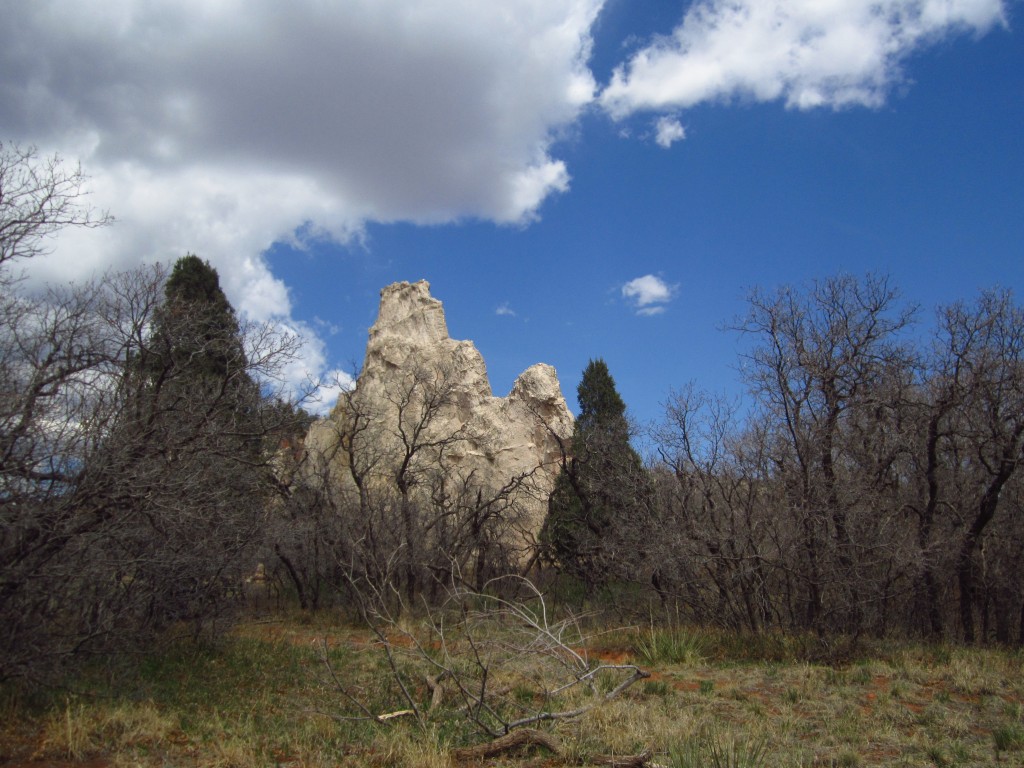
Once on the main Gateway trail and we made our way along a paved pathway with the throngs of other visitors. During this part of the hike (walk) we were completely surrounded by the magnificent rock formations. The picture on the bottom left depicts the sheer size of the Signature Rock in the park. In the bottom right is a view of the Gateway trail with the South gateway Rock and Signature Rock.

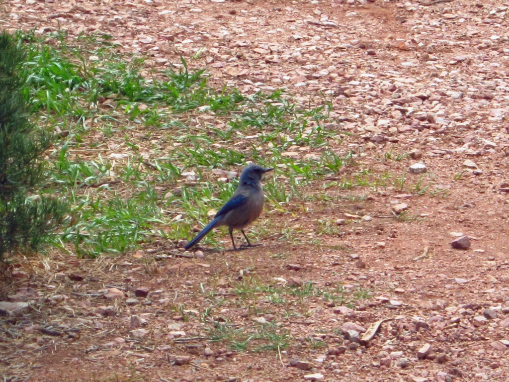
The rocks had worn down in many areas, and in fact there were signs warning of falling rocks. These worn out spaces provided homes for numerous bird species. We saw numerous ravens and pidgeons; and also saw many very brave black-billed Magpies and western shrub Jays. There appeared to be some raptors in the air, but they were too far off to identify. The Magpie is said to be the mascot of the Gardens and looks beautiful in flight. Pictured below on the left is a Magpie and on the right a Jay.

Other than birds we didn’t see much wildlife. The park is very active and the human activity probably keeps most wildlife away. The plant life, however, was extremely diverse. Some parts of the Garden feel very much like a semi-arid desert with yucca, cacti, and Junipers; and then others feel more lush with pine and fir trees. In fact, the Garden is what is known as an ecotome, which is a blending — or melting pot — of different ecosystems. There are at least 5 ecosystems which converge on the Garden and give its extreme contrast. Examining the image below taken from the Ute Trail you can see the short-grass prairie front-and-center, which is devoid of trees, and then pinyon and juniper trees in a foothills transition zone towards the back-center and back-right of the picture.
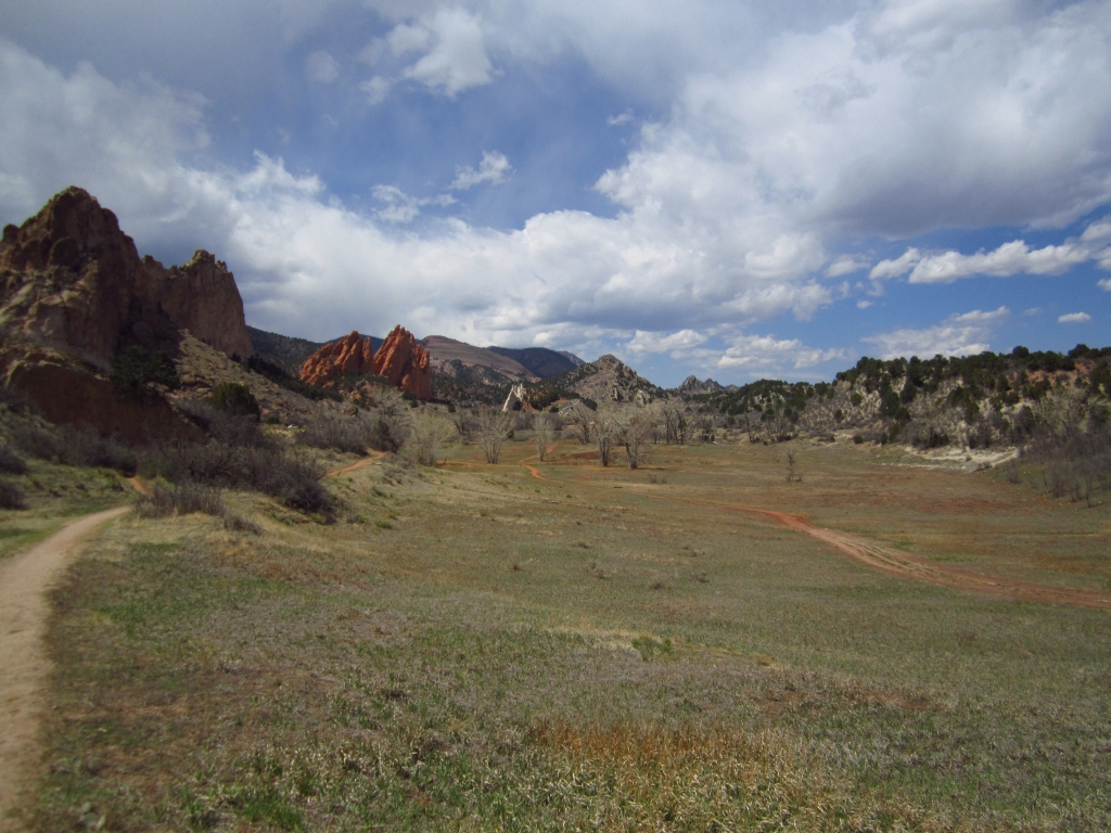
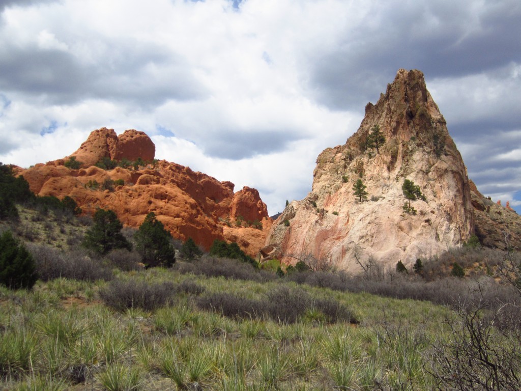
The major attractions at this stunning site are still the rock formations. There are at least nineteen named rock formations with names ranging from Keyhole Window to Sleeping Giant to Kissing Camels. The rocks vary in color from the brilliant red to dazzling white sandstone. Many different types of rock are present, and due to the vast amount of sedimentary rock many fossils are visible along the hike. Below are a few of the formations we saw.

In addition to hiking at Garden of the Gods there are many other activities offered. Horseback riding, various tour options including Segway tours, exhibits, mountain biking, rock climbing (permit required), and other events are all offered activities. Some trails are designated for mountain biking or equestrian use, however, hikers are allowed on those trails as well. We did notice that the bulk of the visitors were on the main Garden Trail, and it was relatively quiet for us on the mountain biking trails. The hike has very little elevation gain and has very well maintained gravel or paved trails. For the casual hiker you will remain at an elevation of roughly 6,400ft for the entire hike. The highest peak at Garden of the Gods is a trifling 6,640ft when compared to Pikes Peak looming in the background at an elevation of 14,114ft.
All in all, the Garden of the Gods lives up to its reputation as being one of the 20 best public spaces and offers a dizzying range of activities for visitors. It is a great starter hike for those wishing to get into hiking. If you want to learn about geology and wildlife there are classes and tours galore, and when you’re ready you can even drive over to Pikes Peak and get into the Front Range. This is also a great place to take those who aren’t quite fit enough yet to hike some of the more strenuous journeys out there. The low elevation, relatively speaking, is also helpful for those not used to the mountain air and is great for visiting friends and family. However, this is not the hike to take if you wish to “get away from it all.” As a very popular attraction it is crowded, cars and vans are often visible along the hike taking driving tours, and it is not a very long hike with loops as short as 1/2 a mile. If you are looking for something more challenging this isn’t your hike, but if you are looking for natural beauty and easy access this is your place.
Gem Lake Trail Hike Estes Park
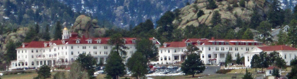
Curiosity about the inaugural Stanley Film Festival led us to our next hike in Estes Park a little bit earlier than anticipated. We embarked on our journey around 11:00 am, this time with siblings and friends in tow and first made our way to the famous hotel (the location where the The Shining was set written by Stephen King and later adapted for film by Stanley Kubrick) to get our tickets for our evening haunted movies and activities. The hotel is quite exquisite, with its bright white paint and red roof standing out brightly against the backdrop of Rocky Mountain National Forest at an elevation of 7,800 feet.
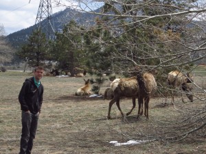
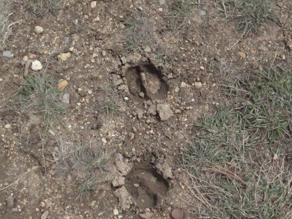
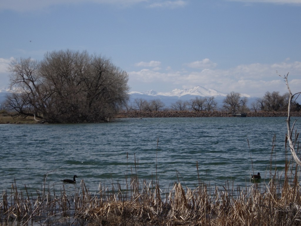
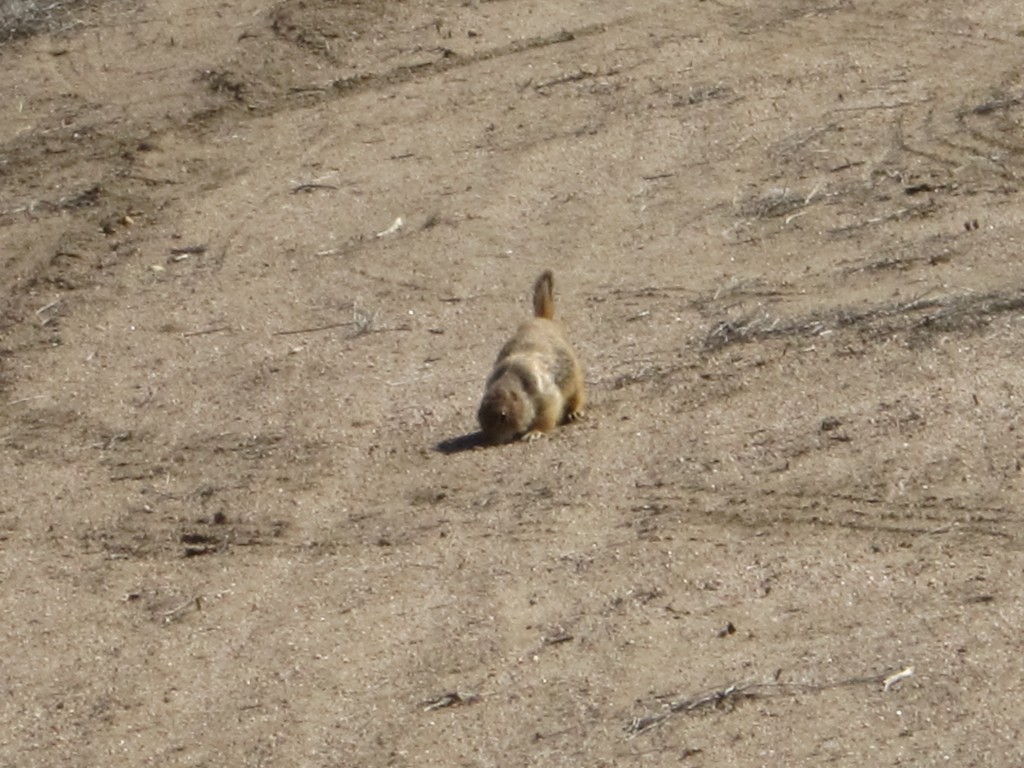
On our way into the National Park to find the trailhead we also stopped at Estes Lake and found Elk tracks and then a large heard of elk. You can see the tracks in the bottom right and the herd with Will in the bottom left. The elk were very docile and right next to a hike and bike path around the lake. We also saw some prairie dogs around the lake as well. The lake also has a nice view of the Stanley Hotel. You can see the Stanley hotel in the background of the top right picture and a view of Estes Lake in the top left.


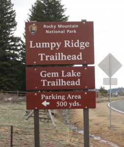
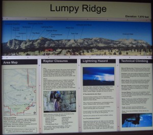
We then headed to the Lumpy Ridge trailhead, which is just off the Devil’s Gulch Road. Although Rocky Mountain National Forest offers numerous hikes, access to these particular trailheads and parking are free. Below are the signs for the trailheads, and the park showing that the Gem Lake hike is an offshoot of the larger Lumpy Ridge trail. The Gem Lake Trail is an out and back hike approximately 3.6 miles in distance with a gain in elevation of about 1080 feet.
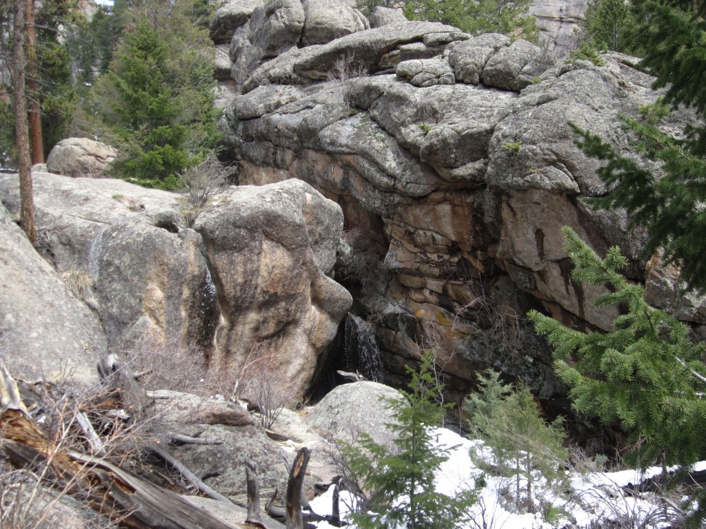
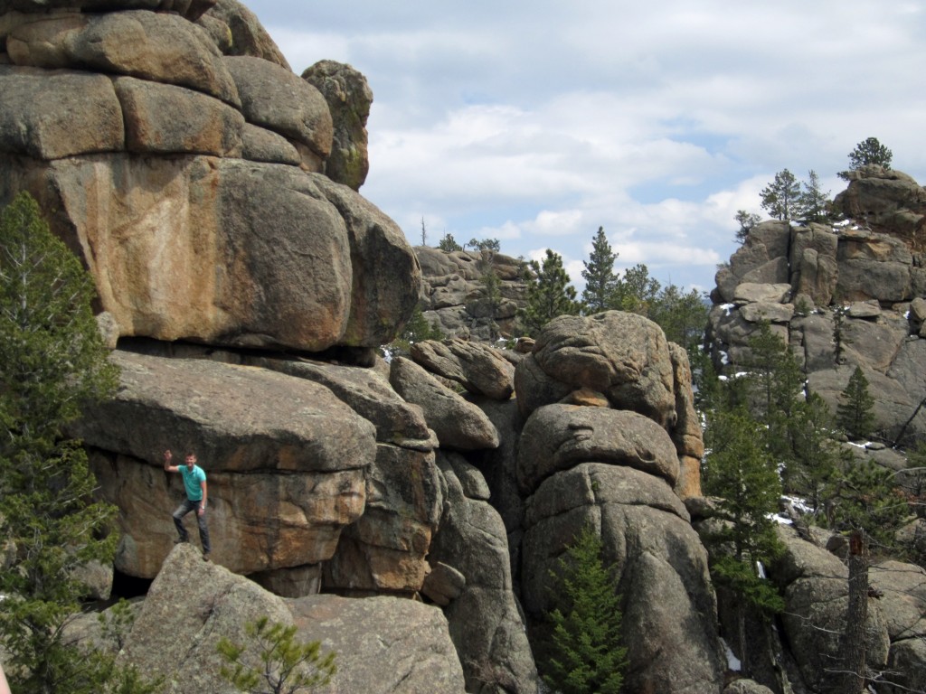
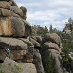
The first mile or so of the hike took us up a steady incline through ponderosa pines, spruces and firs. Though the trees were green and most of the snow gone on this part of the hike, it was still a bit early in the season for wild flowers. This part of the hike had a constant steady incline, but the magnificent views of Estes Park after the first mile where well worth it. The landscape was very unique in this area as well. There were numerous boulders surrounding the trail, some of which, if you look closely enough resemble faces. We both thought that the rocks in the photo below on the left resemble faces with long noses. I’m sure if you go there and look closely, you too will be able to find pictures and stories in the rocks as well. Adventurous Will, felt it necessary to take a closer look at this cluster of boulders as you can see in the bottom right photo.
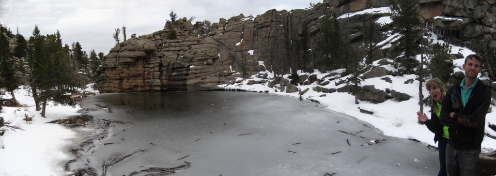
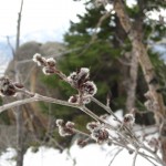
As we ascended higher and got closer to Gem Lake, we reached areas in which the snow had not yet melted. Temperatures dropped at this area, and to be honest, it was a little tough going at this point. The trail was very steep and covered in ice and snow. Despite the cold temperatures, Spring was still trying to give rise to life as you can see in the bottom left picture green shoots sprouting up, surrounded by snow. The last quarter mile to Gem Lake was the slowest portion of the hike, and it was a very exciting site to crest the final set of steps and see the glistening ice/water mix. Since it was early May, the lake was still partially frozen, but very beautiful. The lake is unique because it has no true inlet or outlets for incoming water. The surrounding boulders and sheer rocks, channel and collect rain water into the shallow basin. The lake can be seen below.


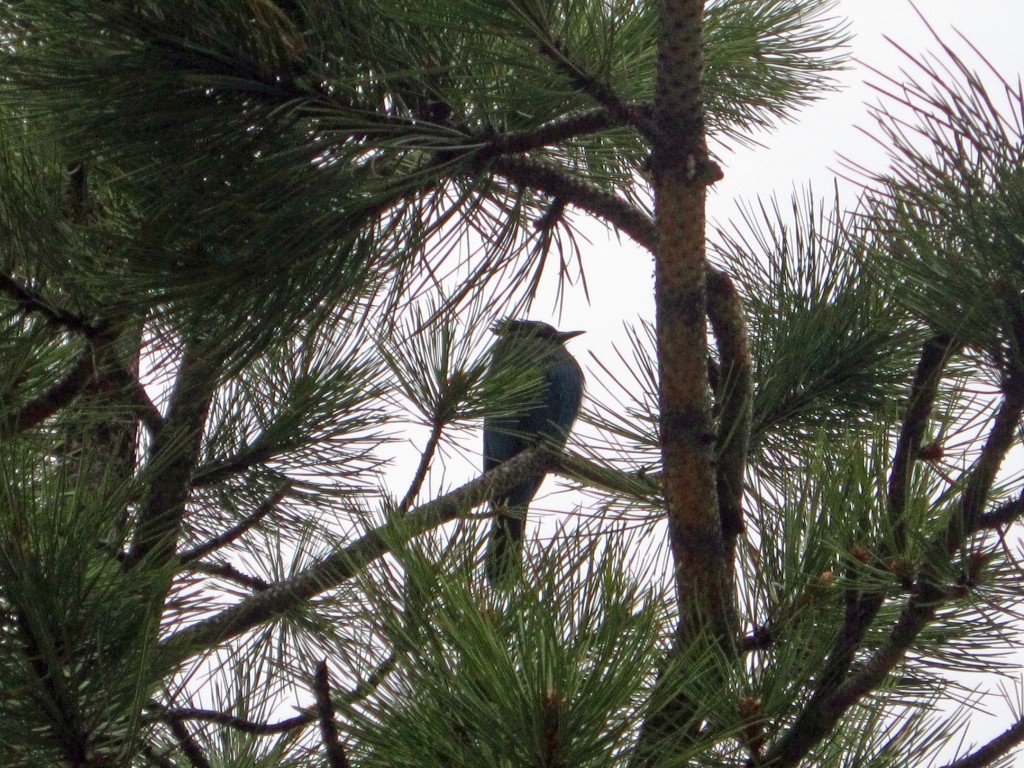
The wildlife on the trail was less exciting than at Estes Lake, but there were some neat sights. Once we had hiked for about 75 minutes and had begun the final ascent to the lake, we started to see numerous chipmunks, one of which I captured in the below left picture. They were very skittish but highly inquisitive and very cute. On our way off the trail towards the end of our hike, we spotted a Steller’s Jay, also known as a Crested Jay or Mountain Jay. They are related to Blue Jays but are black from the mantle up to the head and also have a large black crest atop their head. They are very pretty birds, but stick to high up in the trees and can be tough to get a good picture of. This Steller’s Jay was high up in a pine and very intent to wait us out. He or she had a partner and a nest in the pine just across from where I took this picture. We could see raptors flying high above ,and the area is protected for these birds of prey, including Bald Eagles and many other falcons, eagles, and hawks.

Overall, this was a spectacular hike, and we highly recommend it. At times it is a bit strenuous, with high elevation gains, but the views are spectacular and well worth it. While most of the hike was still very nice in early season, it might be an easier ascent as you get closer to the lake once all of the snow has melted. Though we saw some wildlife, the trail does get heavy traffic, so it might not be your best bet for bird watching or seeking out other wildlife.
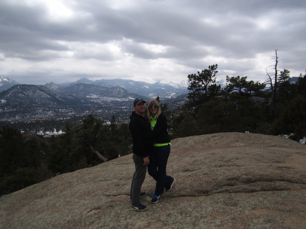
Photo Gallery of Gem Lake Hike
Hike #1 Rocky Mountain Arsenal Wildlife Refuge
“I take a walk..take a walk… take a walk…take a walk …ohhh…ohhhh” In accordance with the lyrics of Passion Pit’s latest catch, sometimes that’s all we really need to do. And so I begin in this inaugural post our quest to walk…..the plains in the rain shadow of the Rockies, the meadows with wildflower in the foothills, and to the crystal clear lakes and streams of the mountains. We wish to share our on foot journey to some of the proclaimed “best hikes” in and around the Denver and Boulder area.
Being new to the Colorado scape, we have been counting the days until the sun melts the snow and warms the ground bringing out flora and fauna. With the official day of Spring here and gone, snows have continued to come down sporadically this April, thus we chose our first adventure to visit the plains at Rocky Mountain Arsenal Wildlife Refuge for milder temperatures and no snow. And, with the refuge being located only 15 miles from downtown Denver, the hike could be started in early afternoon.
RMAWRC is quite an intriguing bit of land with an interesting story behind it. Apparently, after the bombing of Pearl Harbor, the US Army used the land for a chemical weapons plant. After threats ceased after victory in World War II, the Army leased the land to companys for the generation of agricultural pesticides. In the early 1980’s, after a cleanup effort was started on the land, a group of bald eagles was found living in the area. This prompted Congress to designate the area as a national wildlife refuge. Though this park is said to be a “work in progress” , it is now home to over 330 species and offers a range of ecosystems to explore.
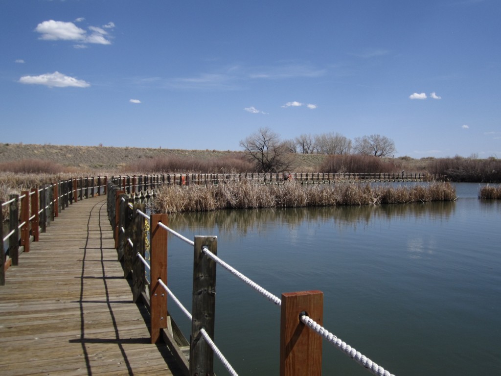
We began our day by checking in at the visitor’s center near the entrance to the refuge. The center offers a neat museum providing history of the site as well as an overview of wildlife that can be seen on the 15,000 acre refuge. After that, we hopped in the car and headed over to the Lake Mary Trail head. Lake Mary is a small man-made lake stocked with fish. It was said that the lake was originally built to allow for fishing for officers and their children. Even today, the refuge allows for fishing with a catch and release program. We began by walking down a hill to the lake. After reaching the lake, the trail turns into a floating boardwalk. This was a really neat beginning for our hike. The set of up of the trail allowed us to see a wide variety of organisms native to the wetlands.
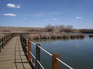
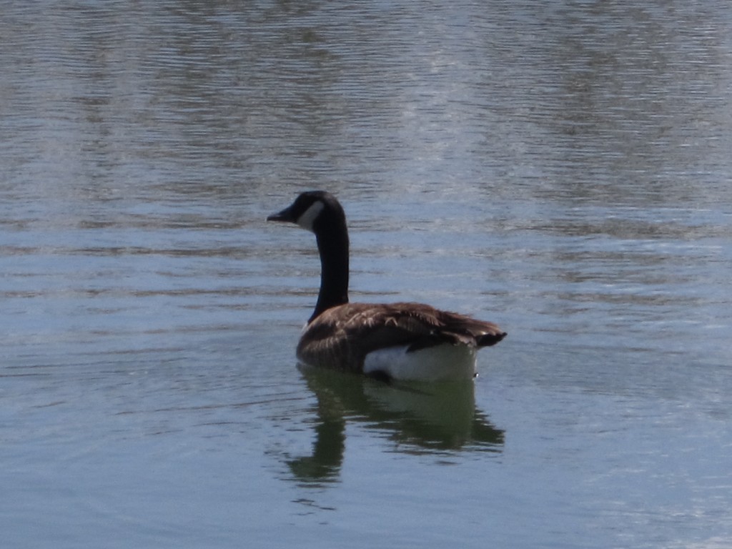
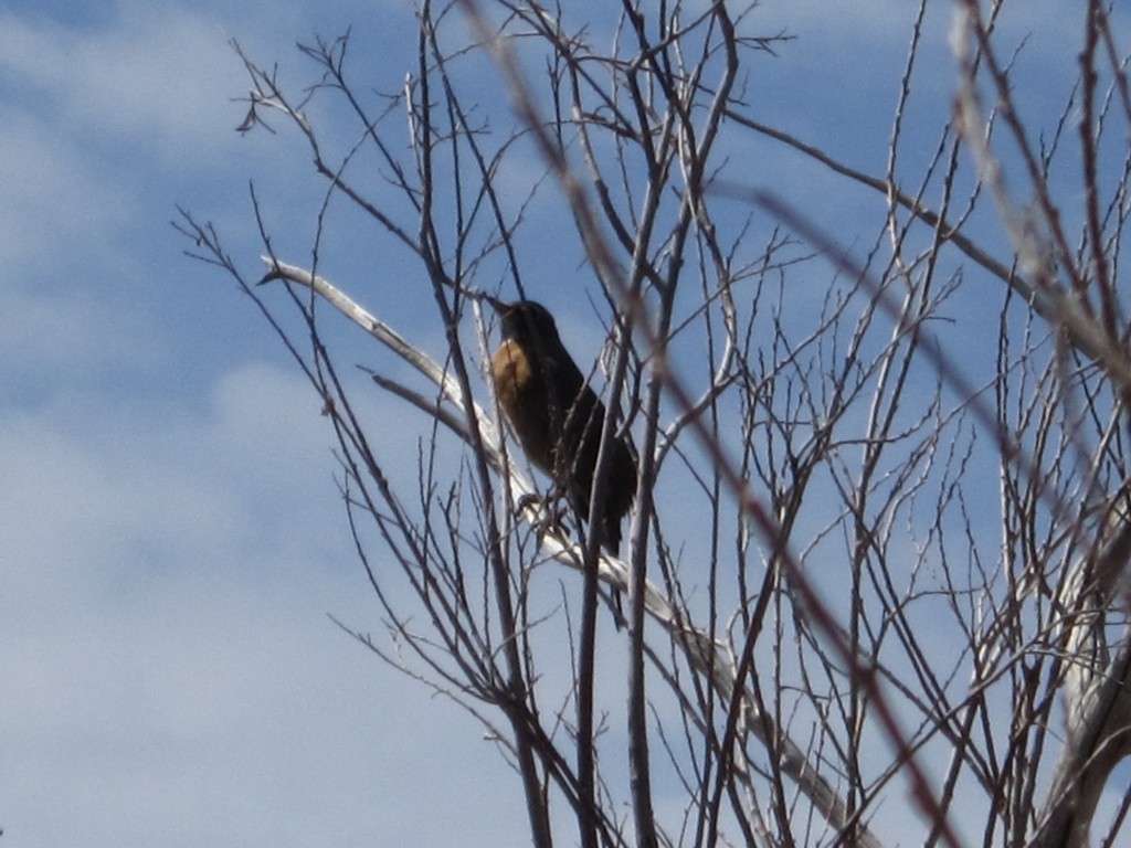
The top left picture shows the floating boardwalk and the bottom left is a shot of a Canadian goose, which were very prevalent on Lake Mary and Lake Ladora. The bottom right is an American robin, which we spotted at Lake Mary. We also saw Mallard ducks, many Red-winged black birds, and numerous Meadow larks. The larks and black birds were singing the whole while we walked and kept us company. We also spotted a Red Tailed hawk while on the Wilderness Drive. We plan to go back with a better telephoto lens for the camera and try and get some shots of American Bald eagles which are common the refuge.

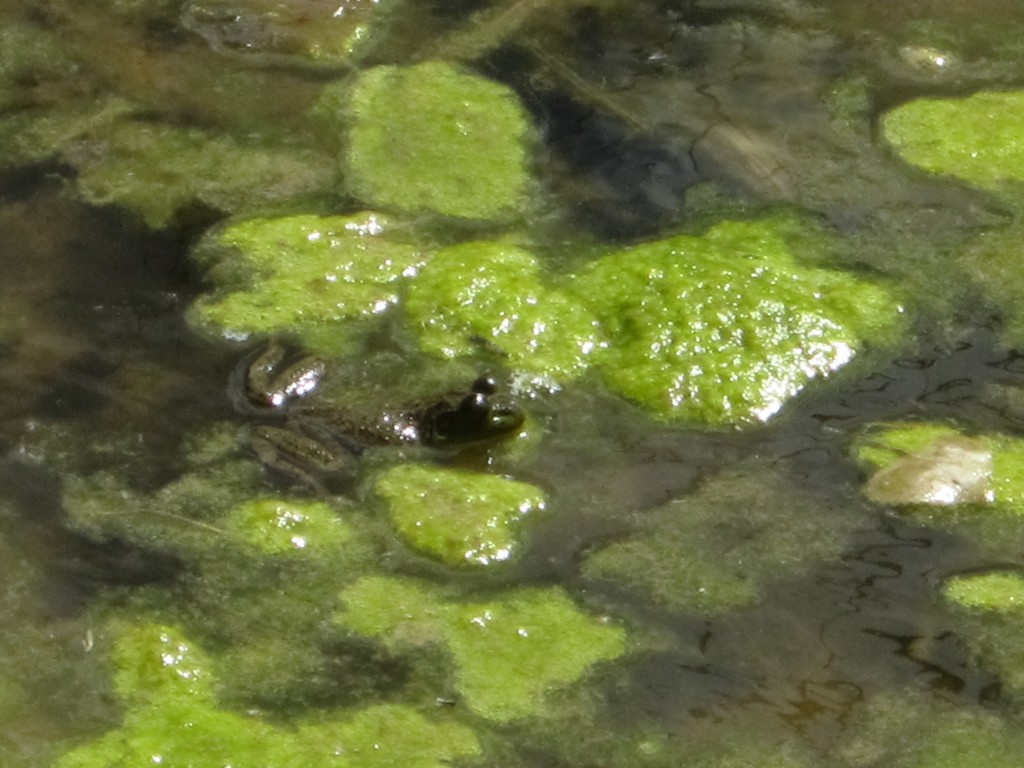
Our walk led us around Lake Ladora, which is a large lake. On the hike we found signs of animal activity as seen in the top left photo. There are no dogs allowed at the refuge, and those are coyote tracks above the Mule deer tracks. Amphibians are common as well, and we found a large Bull frog in a small pond with numerous tadpoles. The view was amazing with the lake and the Rocky Mountains as a backdrop, as you can see in the bottom left picture. After we were done hiking we drove around the park on Wildlife Drive and saw a couple large Black-tailed prairie dog towns. In the bottom right picture you can see one curious prairie dog along the side of the road. The drive leads you into the Bison enclosure; however, we could only see the bison with a spotting scope and couldn’t get a good picture (maybe next time).
All in all it was a very pleasant hike and we plan to return. There is no water on the trail so if you decide to visit make sure to bring a backpack with water. Since the area is high plains there isn’t much cover from the sun, so bring sunscreen. The morning is supposed to be very active with wildlife and in the evenings you can hear the coyotes, but even in the afternoon there is still quite a bit of activity. Check out the link below to visit the very nicely maintained website for the refuge!