Take a Walk
A Quest into the Wild
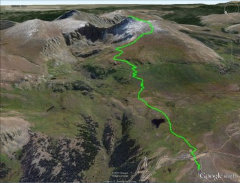
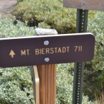
Mt. Bierstadt Summit
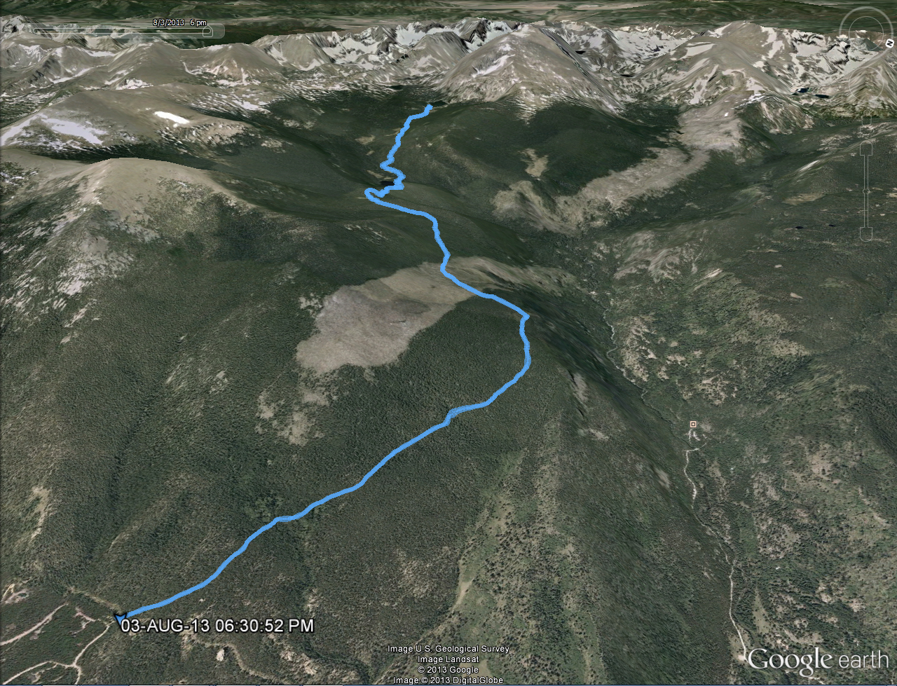
Distance: 7.55 miles (out and back) Elevation Gain: 2,950 ft (total) 2,585 ft (net)
Max Elevation: 14,057 ft Min. Elevation: 11,472 ft
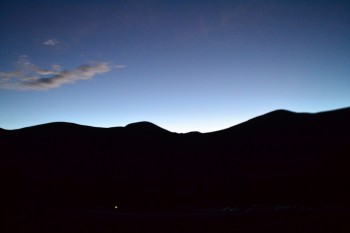
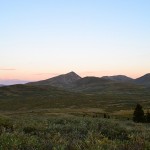
At 3:30am on September 8, 2013 we got out of bed, grabbed a quick breakfast and our gear, and headed out for our first 14er — Mt. Bierstadt. It was Allyson’s birthday and this was about as exciting an adventure as we could think of for celebrating her special day. Driving up through the mountains the city lights faded away and we were left with darkness and the stars. There were thousands of them twinkling down at us, telling Allyson Happy Birthday.
To get to Mt. Bierstadt we passed through the town of Georgetown and noticed how nice it looked and resolved we’d stop by on our way out and get some brunch. After Georgetown we were on the famous Guanella Pass. This is a high mountain road that leads from I-70 to US Highway 285 (which we became intimate with on our trip to Durango and Silverton). The pass was almost pitch black and we were afraid we might miss the trailhead. Luckily, we had an idea of about how far we needed to drive on Guanella Pass (about 10-12 miles) and around mile 10.5 we saw headlamps of hikers in a parking lot to the left (east). We pulled in, found other hikers ready to climb Bierstadt, and we knew we were in the right place.
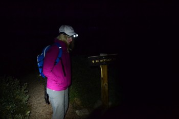
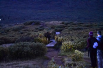
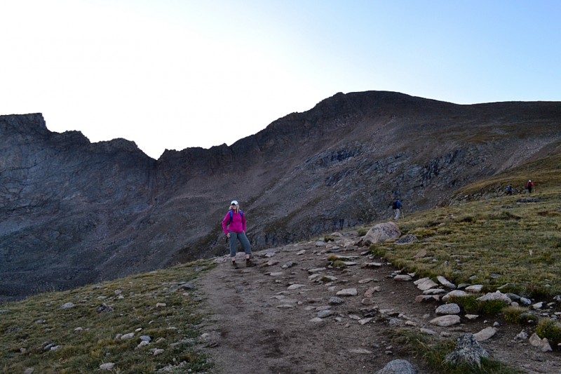
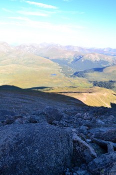
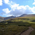
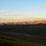
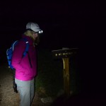
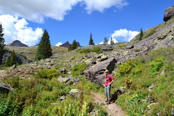
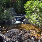
We began our hike at roughly 5:45am. The sun had not risen yet and it was cold, around 40° degrees. We donned our jackets and our headlamps and began our hike into the darkness ahead. You can see some photos from the start of our hike above.
The first part of the hike is through a dense marsh. In this riparian ecosystem we had heard that moose have become common, but we never expected the following scene when we set out that morning. We were hiking more or less alone when we saw a group of hikers stopped ahead of us. Assuming they had just seen something interesting or were trying to find something in their packs we just walked right up. As we approached we heard loud grunting sounds coming from what appeared to be a huge black shadow blocking the trail ahead of us. Adjusting our eyes we could see this large black object was moving and had huge antlers. It was a massive shiras bull moose — and it appeared to be mad.
We looked at the other hikers around us, who didn’t appear as concerned as we did, and we backed off. Turning off our headlamps we sat in the background as we watched a couple of hikers beat their ski poles at the moose trying to “scare it off.” They were told this wasn’t a bear and that they were just agitating it, to which they responded, “That’s what you’re supposed to do!” Well, after their approach with beating sticks the bull started to grunt more, lower his head, and grind his antlers into the shrubs around him, causing the branches to break loudly. We backed up some more, however, the hipster looking young hikers decided they were going to circumvent the moose by going off trail and around him. This is where it got interesting.
In the area was a cow and a large calf, which we had all seen. So we weren’t going to ‘invade’ the bulls area with the mama and baby around. But the hikers ventured out into the marsh, with its at times knee high water and thick mud. After a minute or two of them walking out at an angle to the bull he bolted out toward the hikers. They were startled by this and began plodding back towards the trail as best they could. Luckily for everyone involved the bull only feigned an attack. Once the hikers were heading back towards the trail and away from his area the bull stopped his charge. Also lucky for us, after the end of the feigned charge the bull kept walking out into the marsh away from the trail, which meant we could continue on our way — having witnessed something pretty awesome.
Sadly, given the fact that the sun wasn’t out and the danger of approaching an agitated bull moose we didn’t get a picture of this majestic creature. The image below is handheld with a multisecond exposure, so it’s pretty blurry. But you can make out the shape of the moose with his antlers. The hikers to the right were the ones beating their trekking poles at the moose.
Continuing on our way we crossed a series of small bridges (very well maintained) that crossed over the wetter parts of the marsh. Looking down with our headlamps we noticed that when the light hit the bridge it sparkled back at us. At first we thought that perhaps this was some sort of grip that had been placed on the bridge so hikers would be less prone to slip. However, this was very far from the truth. Upon further inspection it was clear that the sparkling was ice, and we realized we needed to watch our step. It was cold indeed this morning.
After a few of these bridges we were on a nice path, and the sun was starting to come out. There were already a few groups of hikers about, as witnessed by the moose, and after a very short jaunt from the end of the bridges we saw our next group of hikers staring at something of interest. This time it was a fast moving stream that everyone was concerned with. There is no good way to cross the stream and one couple was not able to get their dog to cross the stream. In fact, when they tried to pull him across by the leash he just laid down. They let us go in front of them.
We were wearing waterproof boots so the stream was not a problem for us. But others weren’t so lucky. If you plan on hiking Bierstadt we strongly recommend bringing an extra pair of socks and good hiking boots for this crossing. Once across we moseyed on through the trail and took some shots of the sun rising, which you can see below.
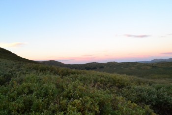
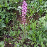
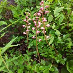
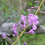
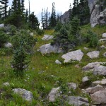
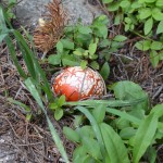
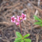
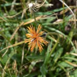
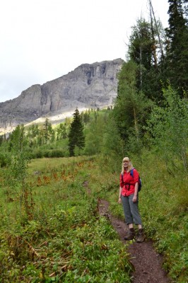
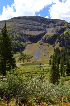
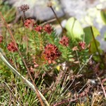
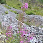
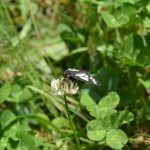
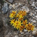
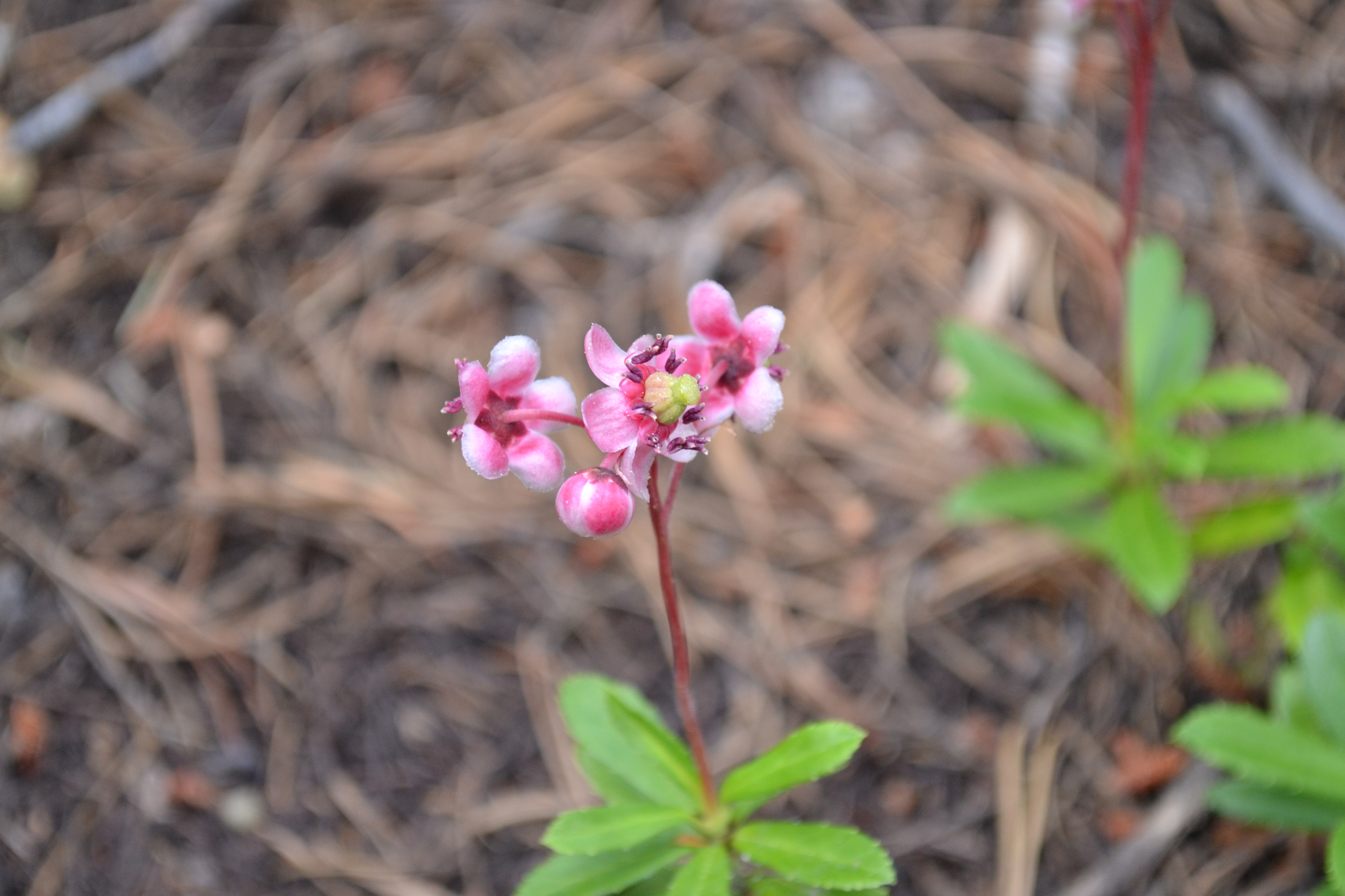
The trail actually starts to go up at this point. If you take a look at the elevation profile of this hike it starts out at 11,734 ft and then dips to 11,497 ft. Thus, the first mile is all downhill. It’s only after that first mile that you actually begin the 2,558 ft ascent. This second part of the hike is still a very nice trail and not very rocky at all. There were still some wildflowers about, mostly paintbrushes, alpine avens, and some members of the stonecrop family. It was very pretty, but chilly, as we were still climbing in the shade.
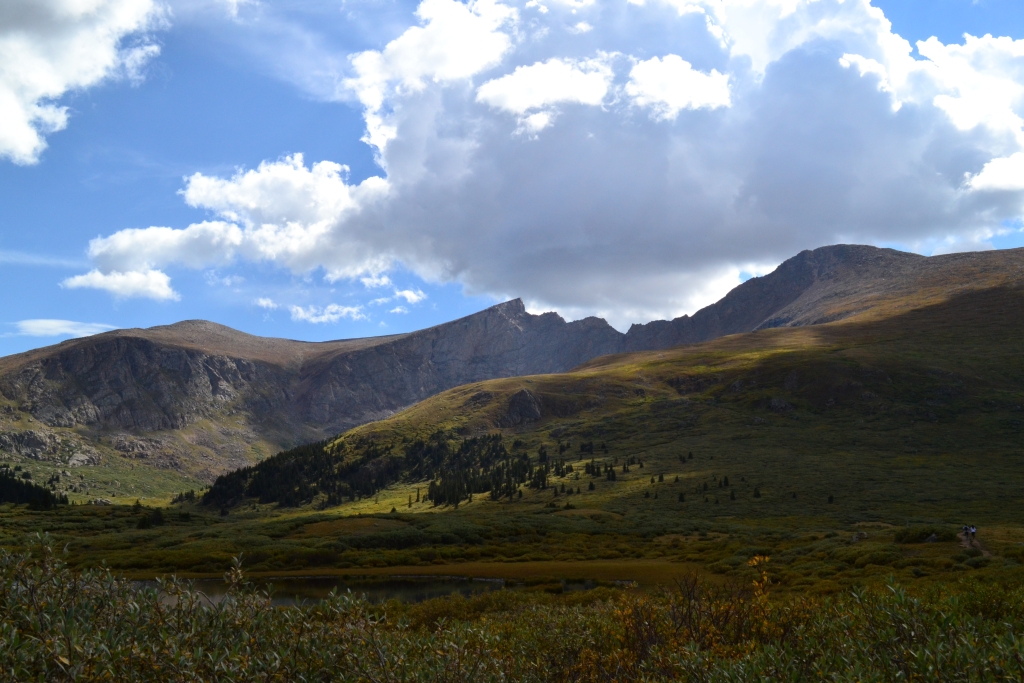
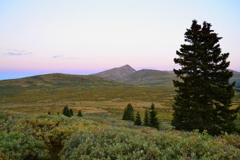
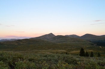
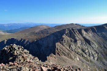
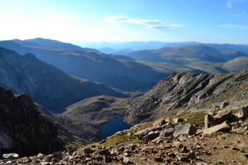
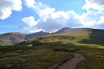
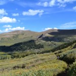
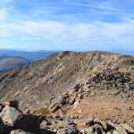
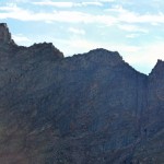
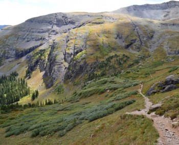
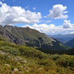
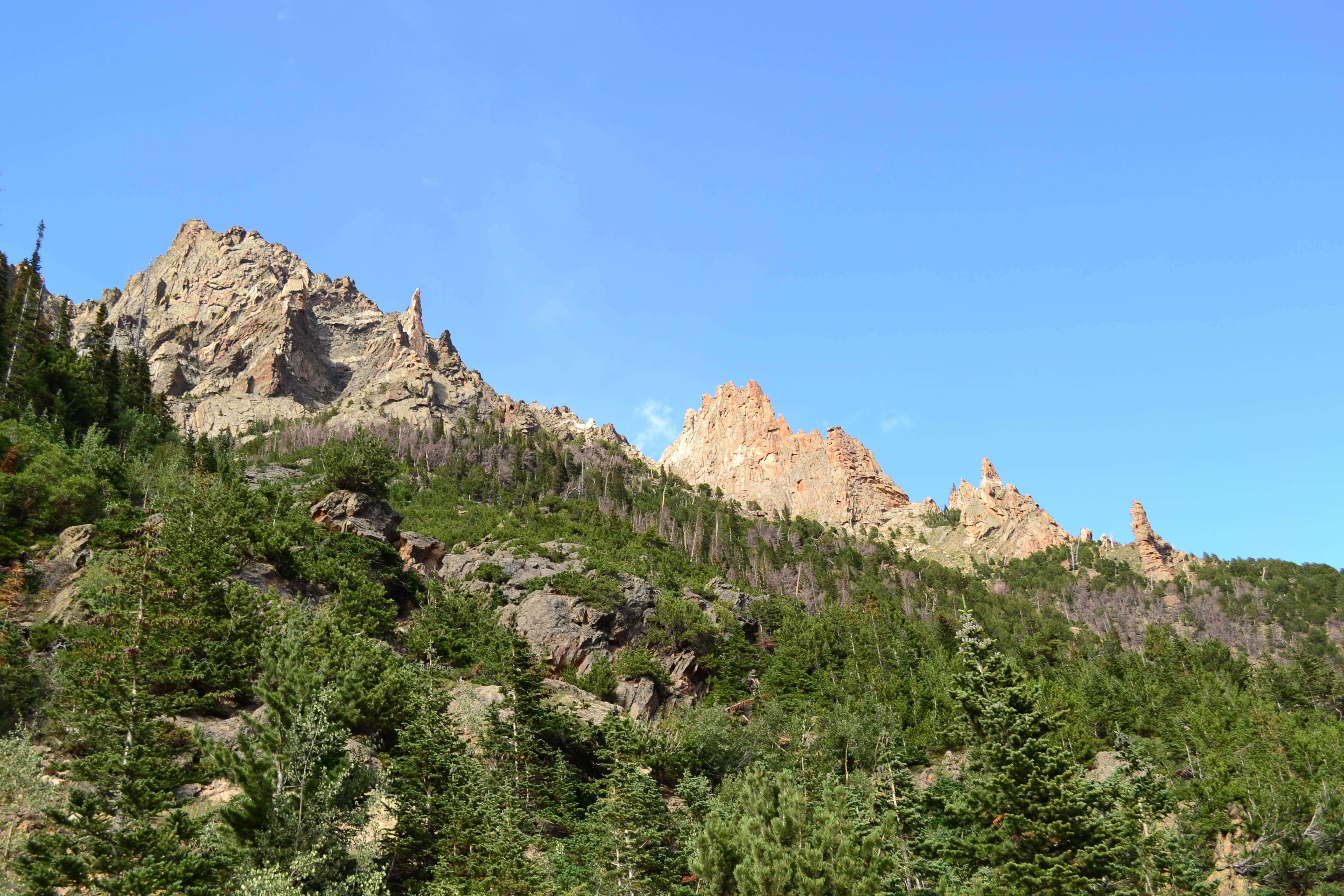
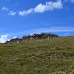
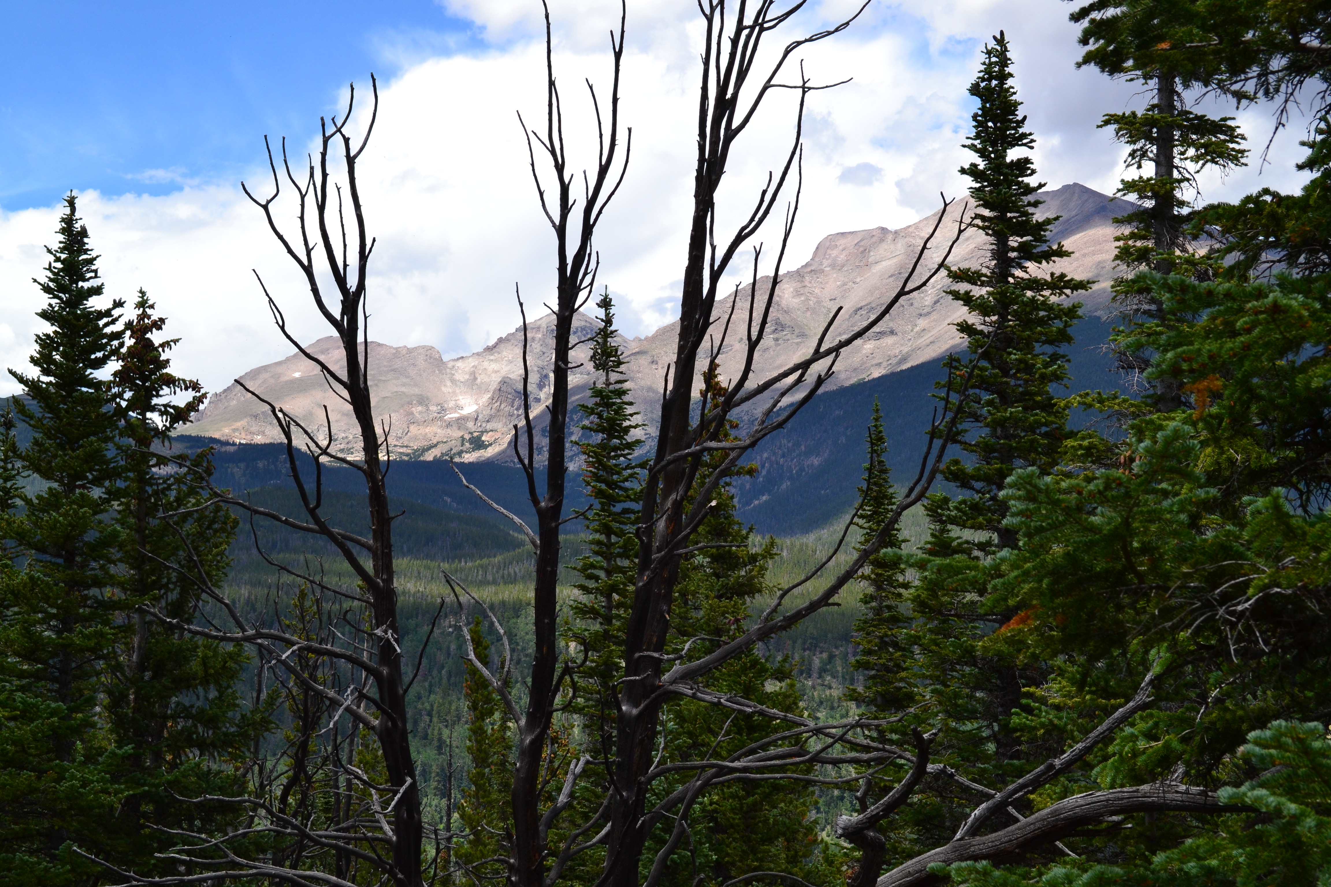
After a bit of hiking we could see the crest of the hill we had been climbing and Mt. Bierstadt and the Sawtooth came into view again. We were very excited to see it and stopped to take some pictures. In the image below you can see the Sawtooth’s jagged crest and the summit of Bierstadt to the right.
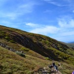
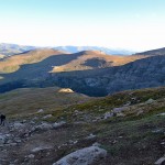
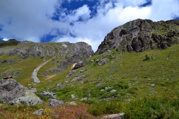
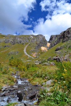
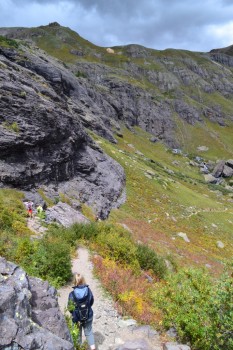
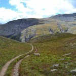
The trail continues to be friendly for a ways further, but then abruptly shifts to a less friendly rocky trail. It begins to be steep at this point, with some parts of the climb approaching a 70% grade. The footing can be slippery as well with little streams of water flowing down from unseen sources. It is a section to take at a nice comfortable pace, and again we recommend good boots for this. Below you can see two images of the trail at this point. In the image on the right you can just make out a cairn on the top of the hill, in the center.
As we neared the summit we started talking about how the name of the mountain literally meant Beer Town (bier = beer, Stadt = town/city). Our hope was that there was a super secret and exclusive little bar on top of the mountain with a few good beers on tap. We knew this had an infinitesimally small chance of being true, but it was fun to think about and this was Colorado. But this got both of us thinking about where the name actually came from, since there was no town in Colorado nearby with the name Bierstadt. As it turns out, Mount Bierstadt is named after the famous painter Albert Bierstadt. His beautiful paintings of Colorado can be found here: Gallery of Albert Bierstadt’s Works.
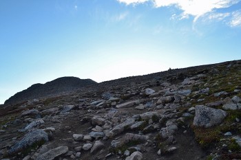
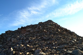
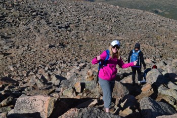
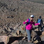
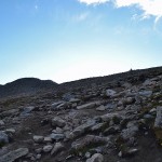
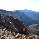
After hiking through that rocky section you crest a small ridge and it becomes very clear what you have to do next. The summit is clearly visible and unless you are very early indeed you will see people standing on the summit. There are roughly 300 ft. left to climb at this point, and it does involve a little scrambling. Below is a picture of the 300 ft. tall mass of rocks that you must climb to get to the true summit.
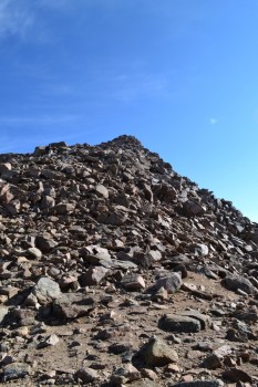
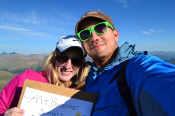
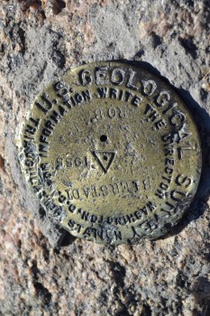
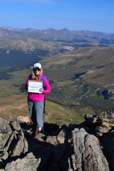
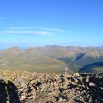
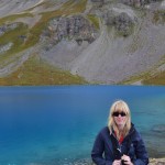
Well, we decided to try and follow the cairns up to the top, and quickly realized that this was silly. There are cairns set up all over the place and there don’t really lead through any one course up. After a while we just said, alright, let’s just go straight up — and we did. Once on the top we had a great view of our surroundings and quickly found the summit registry. We signed it, took a seat, and got out the birthday cake! Here are some of the pictures from the top of the mountain. Notice the cake and balloons in Allyson’s sign!
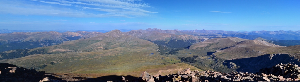
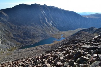
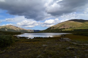
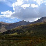
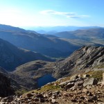
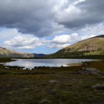
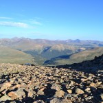
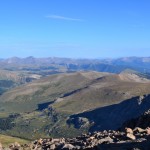
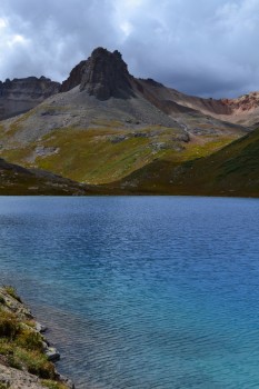
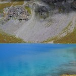
There are two large lakes visible from the top of the mountain. Abyss Lake (which has a pretty cool name) and Frozen Lake. Frozen Lake is visible from just before you ascend the rock pile to the south-east and Abyss Lake is only visible from the summit to the north-east. Abyss Lake is rather large and directly between Mount Bierstadt and Mount Evans. They are both shown below (Abyss on the left and Frozen on the right).
It is possible to cross the Sawtooth (13,440 ft.) from Mt. Bierstadt and then Mt. Evans (14,265 ft.) and Mt. Spalding (13,842 ft.) become accessible. However, the trek over the Sawtooth is an intense scramble which can take 2 hours to complete. We knew the weather forecast predicted thunderstorms in the afternoon, hence our early start, so we opted not to follow some of the other hikers who were intent on crossing over. But this gave us something to look forward to and we plan to return one day.
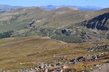
After taking our photos, signing the registry, and looking around we decided to head back down. We didn’t follow any path this time, we just headed straight down the rock pile and ignored the confusing and sporadic cairns. It was getting very busy and we could see lines of people trekking up the mountain. We were very happy we had started early and had avoided the throngs of summit hopefuls. Below is a shot of Allyson down-climbing the rock pile and a shot of the hordes ascending the mountain — arrive early!
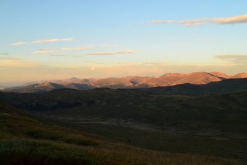
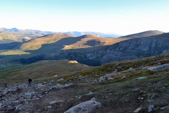
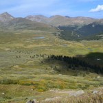
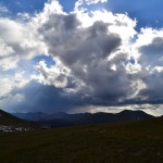
We quickly made our way down and the path was large enough that passing the crowd wasn’t a big deal. It was a gorgeous day and the sun was out in full force. We were now able to see everything that had been obscured in the dark and the shadows. Toward the bottom of the mountain we began to notice thunder clouds forming and we were again glad of our early start. Below are some of the shots we got on the way down and on our way out.
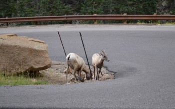
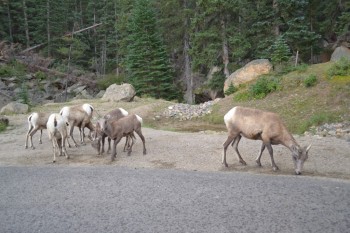
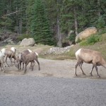
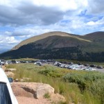
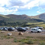
Back at our trusty truck we looked at the parking lot and couldn’t believe how many cars, trucks, and RVs were parked in the lots and on the road. And then we saw a group of young bighorn sheep rams. We didn’t see the mature rams or ewes, but we’re guessing they were probably around. They were very cute, but we just took pictures from the truck.
It had been a very eventful day, and it was barely 11am! We headed down the mountain and enjoyed a brunch at The Happy Cooker as it started to rain. Perfect timing.


Ice Lake: San Juan National Forest: Silverton, CO

Distance: 7.44 miles (out and back) Elevation Gain: 3,148 ft (total) 2,431 ft (net)
Max Elevation: 12,276 ft Min. Elevation: 9,845 ft
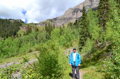
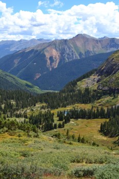
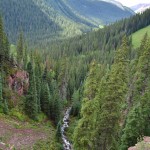
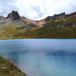
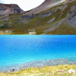
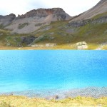
This labor day weekend we ventured out of the Front Range to explore the rugged and wild San Juan Mountains of southwestern Colorado. This area of the state still maintains a sense of old time tradition and reflects the mining days of past. In fact, its hard to find a hike or scenic drive through the area that’s not littered with abandoned mine structures or ghost towns. With hundreds of miles of beautiful trail to explore, including the famous Colorado Trail, it was challenging to pick just one hike. Ice lake lured us in with the promise of pristine, caribbean blue waters amid throngs of 13ers.
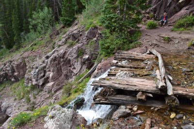
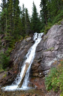
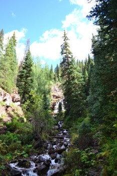
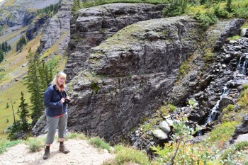
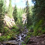
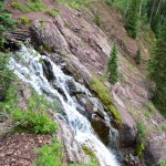
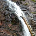
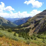
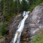
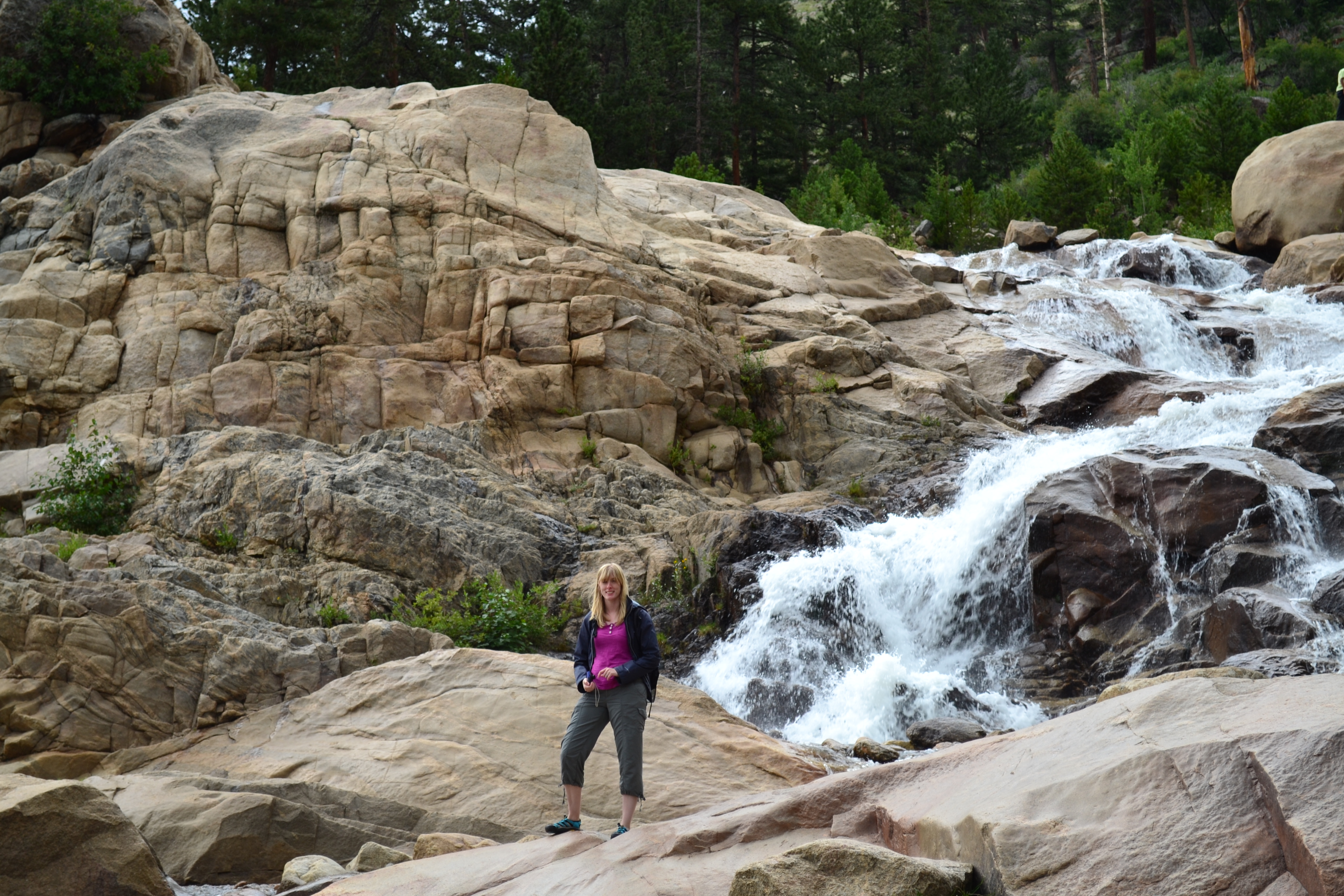
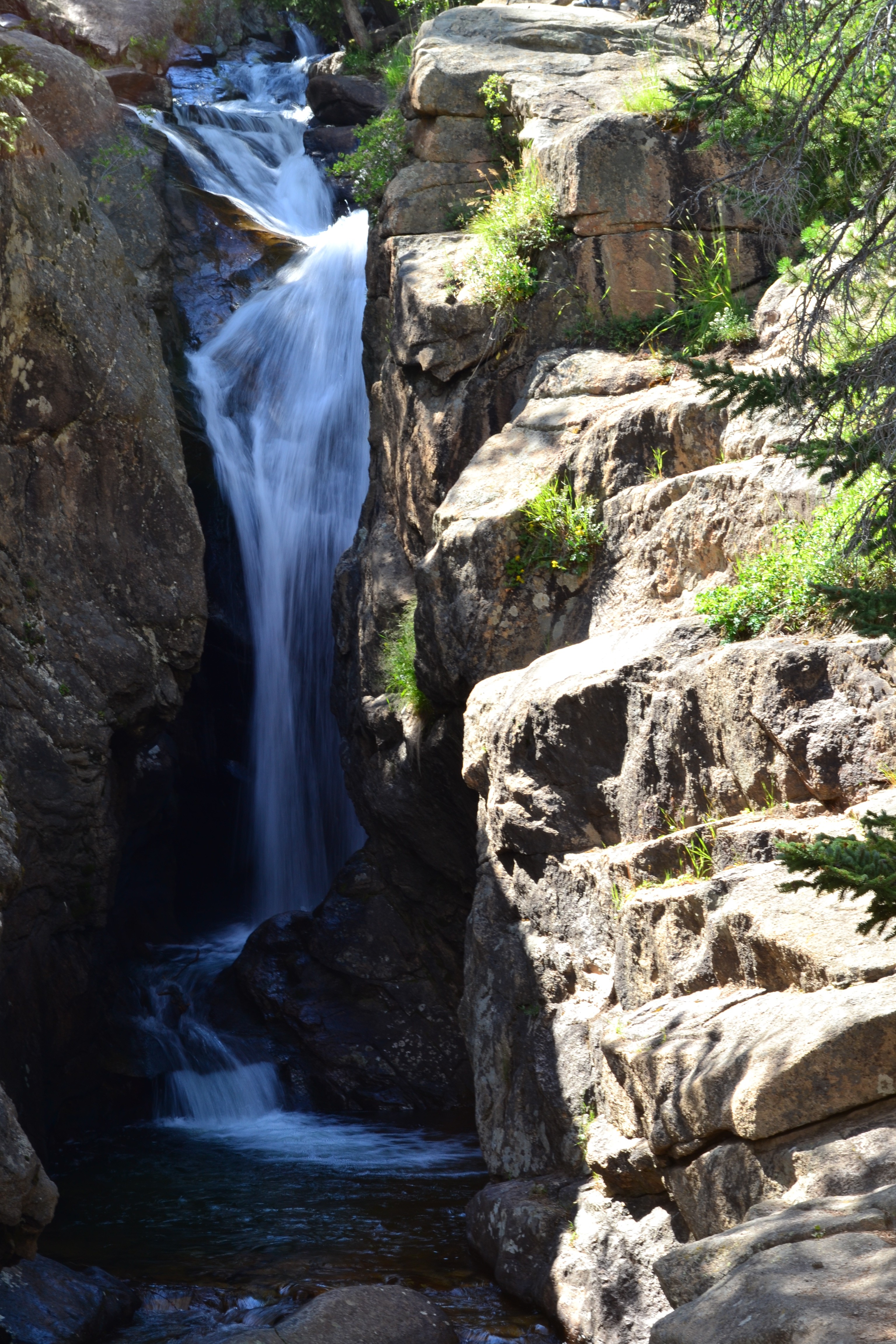
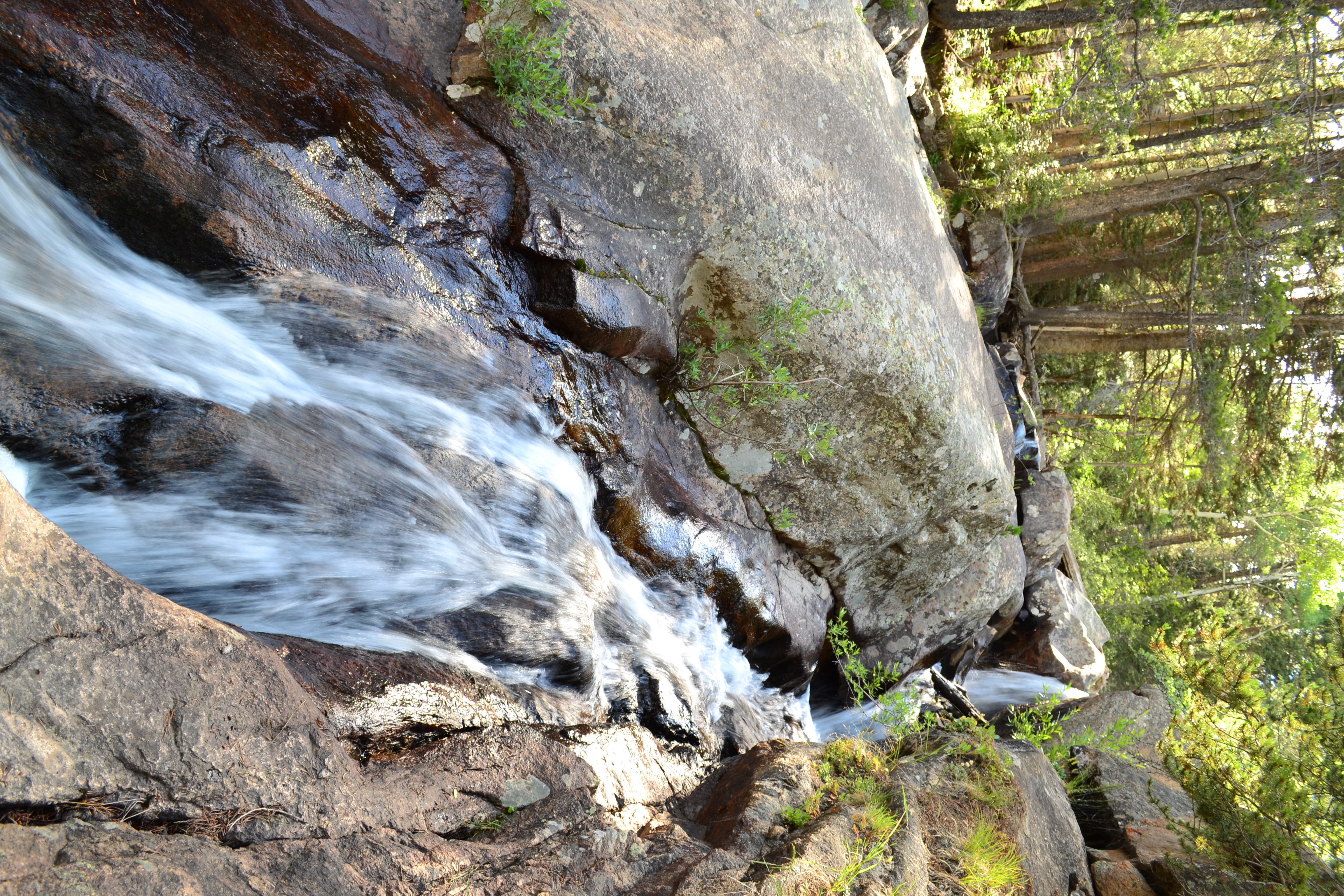
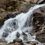
To reach the Ice lake Trailhead, we followed 550 north out of Silverton for about 2 miles. We then turned left on County Road 7 into the mineral lakes campground and trails area. We followed the dusty dirt road for about 5 miles to a small parking lot. Just north of the lot, is a tiny sign reading “Ice Lake Trail”. No mileage signs were present which contrasted with RMNP and the Front Range where they are very common. In fact, this was the only sign for the remainder of the hike. At times, it added to the remoteness of our hiking experience. At other times, we kept wondering “how much further…it feels like we have been climbing forever.” Almost immediately, the trail begins to gain elevation. In fact, the first 2 miles we gained over 1,600 feet in elevation while passing in and out of a dense forest followed by a brief stroll through a meadow and finally to the lower ice lake basin. Despite the intense climb, we were frequently rewarded with waterfalls along this portion of the hike and majestic views of Mt. Vermillion and Fuller Peak once we reached the basin. There is an option before reaching the open meadow to take a brief side trip to view an amazing waterfall. We were able to carefully cross the fall. However, extreme caution should be executed. It is slippery on the rocks and logs in the water and one wrong step could be fatal. Seen below are photos of this waterfall and “bridge” and views from the meadow.
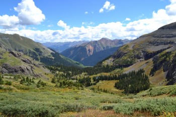
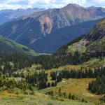
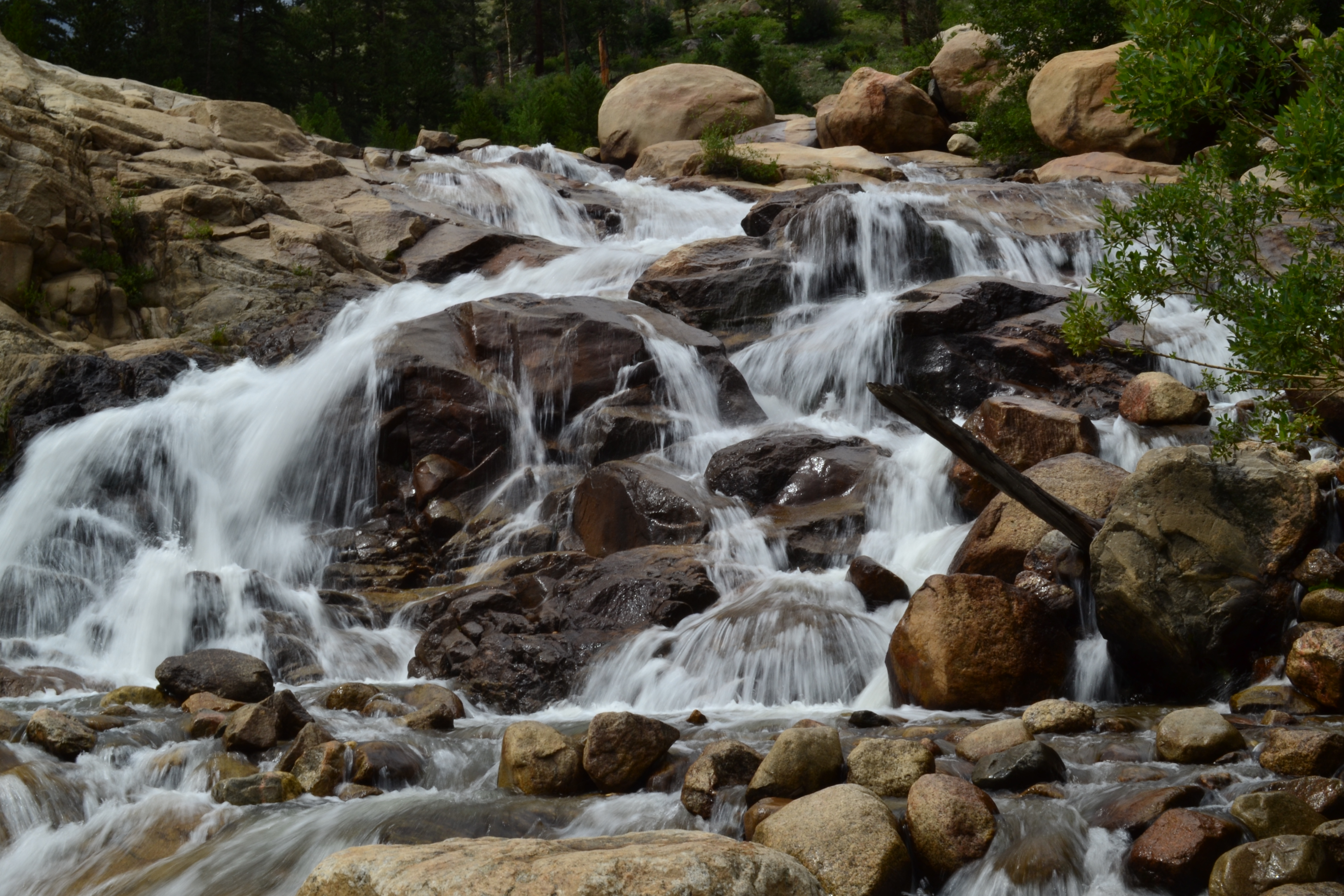
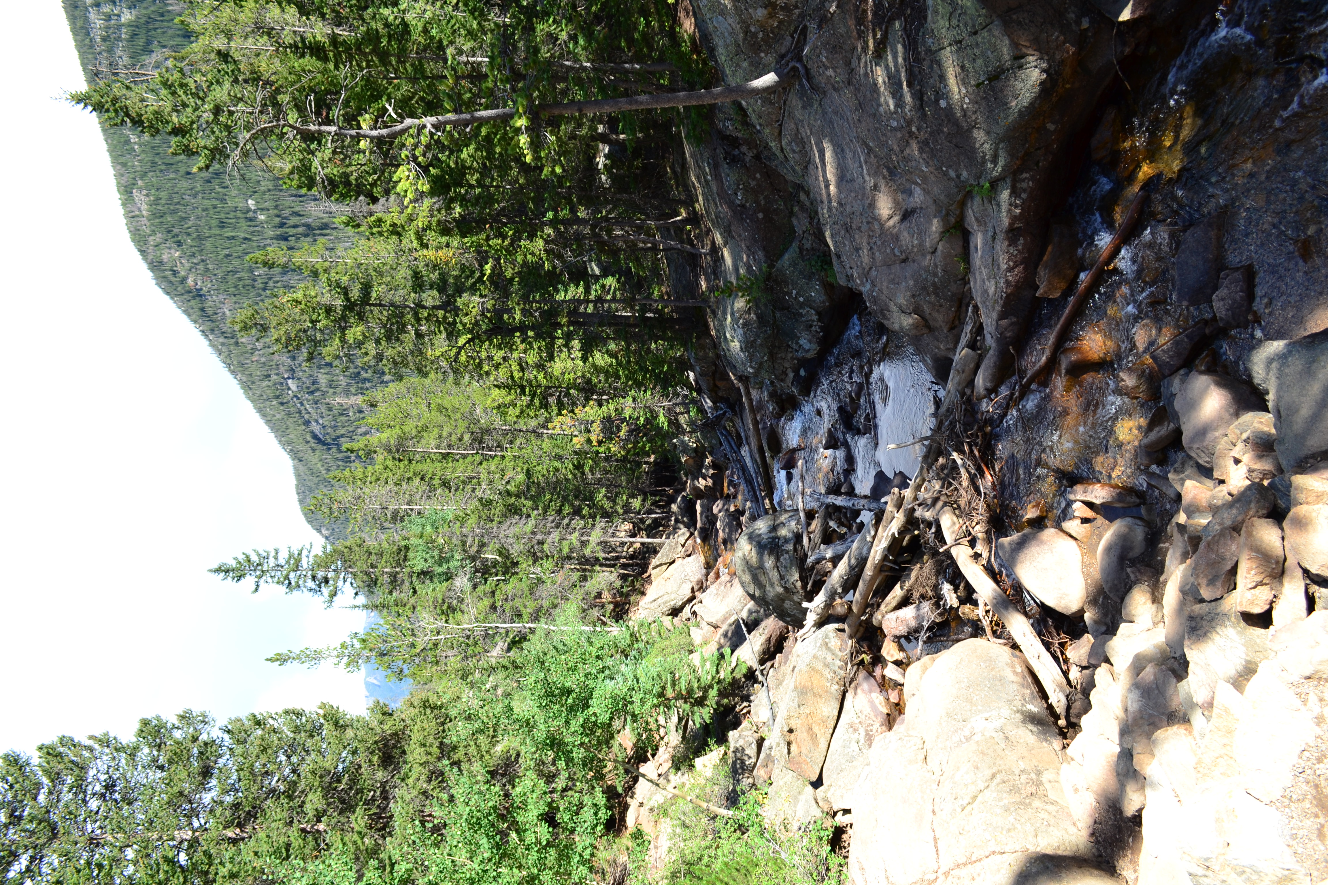
After passing through the first meadow, we continued to climb up steep switchbacks. While intensely vertical, the trail was a smoothly packed red clay surface which was a bit helpful. After a little over 2 miles, the trail opened up to Lower Ice lake Basin. Even though it was early September, the landscape was still mostly green, and wildflowers still dotted the trail and hillsides. The trail levels off for a little while here and gave our hearts a much needed rest. It should be noted that this is a very high elevation hike. At the starting point, we were already about 9,800 feet. As we arrived at the lower basin we were over 11,000 feet. Simply standing in the basin was mesmerizing. In all directions we were surrounded by enormous peaks. Emanating from the sides of the mountains were powerful waterfalls, fueled by unseen alpine lakes from the terrain above. These waterfalls formed gorgeous streams which drained into the lower Ice Lake. We were in an alpine wonderland. Seen below are photos from the basin before we began our the remaining ascent to Ice Lake.
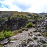
After our all too brief break in the Lower Ice Lake Basin we began our ascent to Ice Lake. This was a steep climb and at times very rocky with loose gravel. It should be noted here that according to our GPS the average percent grade on this portion of the hike was around 21% and at times was above 80% on the hike (40 degree incline). This made for a challenging hike and we were really hoping for a great reward at the top, which we found.
One of the best parts of this portion of the hike was looking back at where we had come from. On this part of the trail we were surrounded by peaks in almost every direction save the direction we came from. The geology formed what almost looked like a large theater where the area we were climbing up was the stage and the peaks around us were the stadium seating. Towards the beginning on this portion was a large waterfall fed by a stream from Ice Lake. On one part of this section you must hike harrowingly close to a cliff that drops down into a crevice the waterfall has created over the millions of years it has been eroding the rock away. Below are some of the pictures we got of the waterfall and looking back towards the Lower Ice Lake Basin.
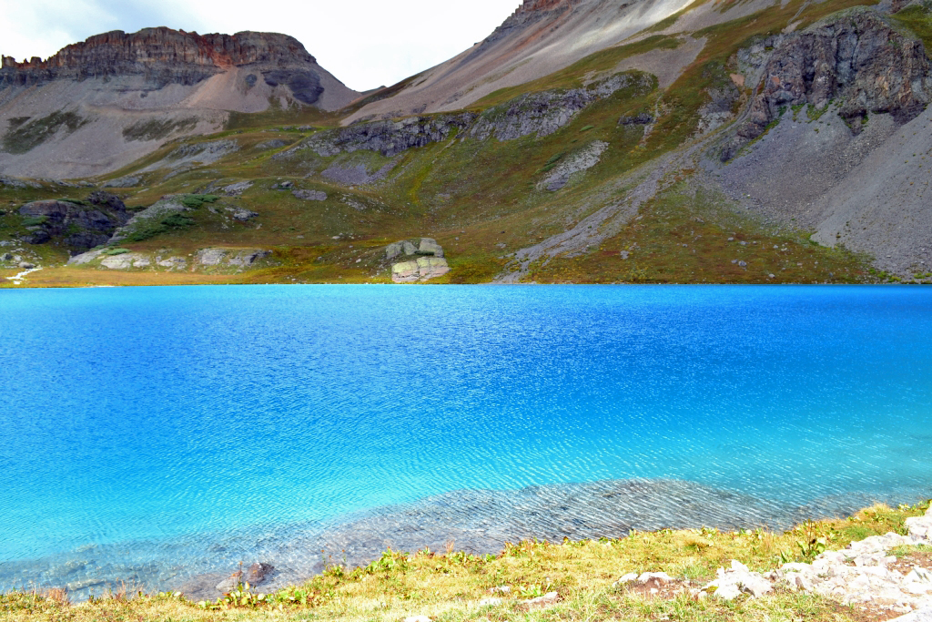
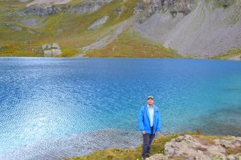
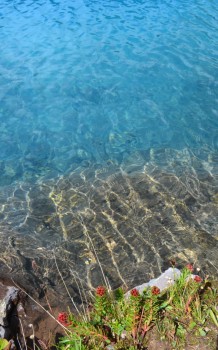
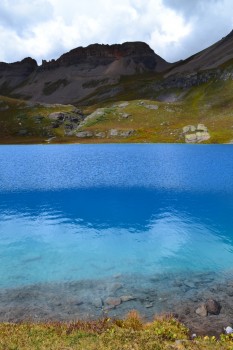
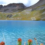
After what felt like forever we finally saw what appeared to be four-wheel drive tracks that led to what we could only imagine was the lake. We walked up those tracks for a few hundred feet and were greeted by the most beautiful azure alpine lake we have ever seen — Ice Lake. The sun was out and made the lake almost glow a turquoise blue usually reserved for post-cards and expensive coffee table books. We strolled up to the lake and savored the scenery. Vermillion Peak, Golden Horn and Pilot Knob, all 13ers provided a powerful backdrop to the bright blue lake. Below are some of the pictures we took at the lake.
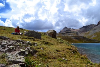
After enjoying the lake for about 20 minutes, as if on cue, a large crack of thunder erupted overhead. For a moment we thought perhaps someone had set off some dynamite at a nearby mine; but then we saw the dark clouds crest over Pilot Knob and Golden Horn. We took a few last looks at Ice Lake, regretted not being able to continue to nearby Island Lake and headed back down, quickly.
The climb down was much easier than going up; however, the loose gravel and steep grades did force us to be careful and watch our step. Every now and then we’d hear a huge crack of thunder and be reminded of the urgency to get back to the tree line. We did manage to get a few good pictures of our early descent which really put into perspective the immensity of the area — they are below. In both pictures if you follow the trail you will notice small dots on it, which are people.
We made it quickly back to tree line, across the Lower Ice Lake Basin, and into the last part of the descent. Once there we realized that we might have lucked out and stayed ahead of the rain; and that we might end up staying dry. By the time we were below 10,000 feet we knew we had dodged the rain and were very excited to be back at the truck, dry, and with plenty of daylight left. Leaving our hike we knew that we had really only sampled what the San Juan Mountains had to offer and we have already decided we will have to come back in the future to explore the plethora of 13ers, 14ers, lakes, mines and ghost towns which seem ubiquitous in this area.
RMNP: Mummy Range and Old Fall River Road
As we attempted to turn a hairpin and ascend up yet another switchback on the dusty dirt road, the car lurched into a deep rut, tilting the car and placing the passenger side closer to the ground than comfortable. We all cried out briefly before Thomas quickly regained control. And again, we asked ourselves “Why on earth did we bring the Altima instead of the X-terra!?” Our day had evolved from a quiet, peaceful visit to nature into a full out adventure. Without exactly meaning to, we ventured deep into the heart of Rocky Mountain National Park. We were excited to have Jim and Beverly join us from Austin on this trip and wanted to show them our favorite part of Colorado. We initially opted to drive into the park for a brief trip and visit a few different landmarks via short hikes instead of a long day on foot. But, as always, our days turn out longer and we see more than we ever bargained for.
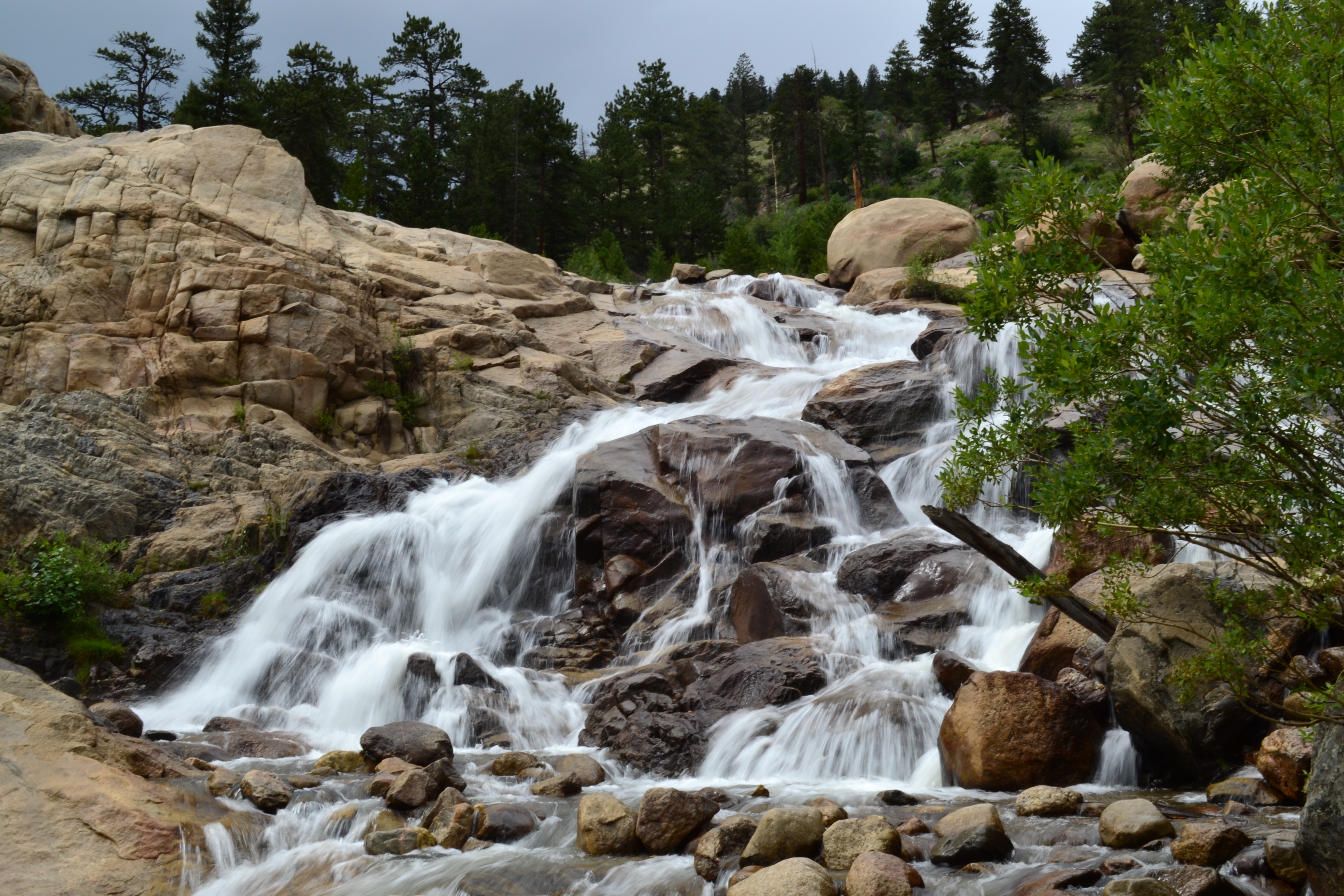
We began our trip by entering the park via the Fall River Entrance station off of Hwy 34 and continued into the park along this road before turning right onto Fall River Road. Briefly down this nicely paved road we found the East Alluvial Fan parking lot and trailhead and made our first stop to see the alluvial fan and Horseshoe Falls. In 1982, the terminal moraine holding back Lawn Lake broke through releasing nearly 30 million gallons of water. The water swept trees, boulders, sand and sediment 4 miles down into the valley. Hikers were killed, and the town of Estes Park was soon 6 feet underwater. The alluvial fan and falls are easily accessible via a short (0.25 miles one way) paved trail. With camera gear in hand, we made the short climb to the magnificent falls. While the trail only ventures to the base of the falls, hikers have the option to climb as high as they want via some mild scrambling up some large boulders that litter the area. To gain a better view, we hiked part way up the falls. Seen below are photos of Horseshoe Falls and the boulder-bed left behind from the powerful flood waters.


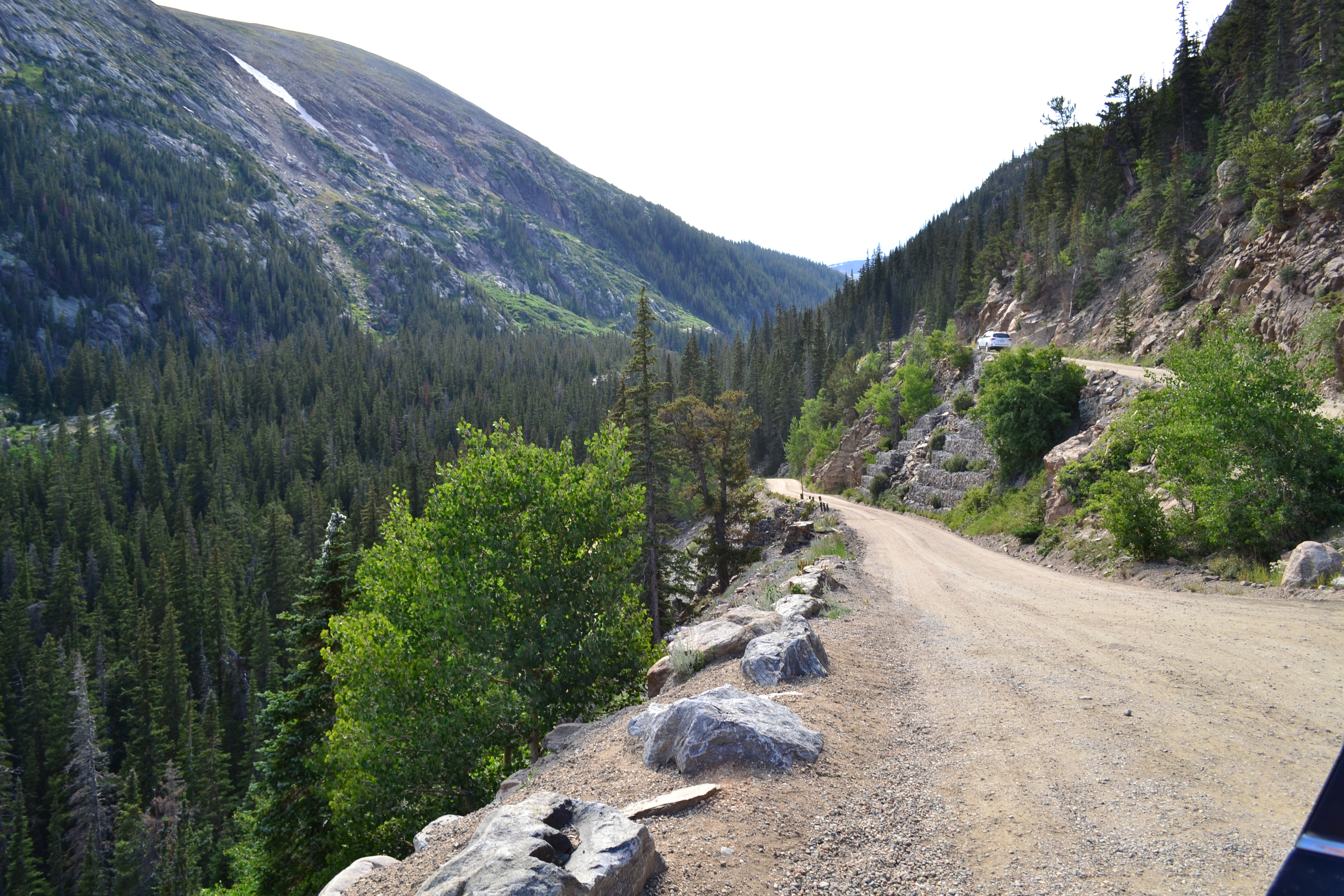
After a little exploring we then hiked back to the car and proceeded further west on Fall River Road. Along the roadside in nearby meadows we saw many mule deer relaxing in groups and under the shade of nearby trees. Our next destination was Chasm Falls. According to our guide book, the falls can be accessed right off of Old Fall River Road (Fall River Road dead ends and turns into this). The word “old” in Old Fall River Road should have clued us in to what we were in for when we ventured into the northern Mummy Range. Once a car enters this old dirt road, there is no turning back. Literally, this narrow dirt pass is a one way road…for nine long miles. So when you want to see Chasm Falls via car, you will also get to see another 7.6 miles of scenery along the rest of the route, plus another exciting 14 on the way back via the famous Trail Ridge Road. About 1.4 miles up the road a nice parking area emerges to the left with a trail entrance to Chasm Falls. The trail is very short but descends sharply to the base of the falls. At the bottom there is a nice railed-in spot to enjoy great views from the bottom of the waterfall. Seen below are photos captured at Chasm Falls.
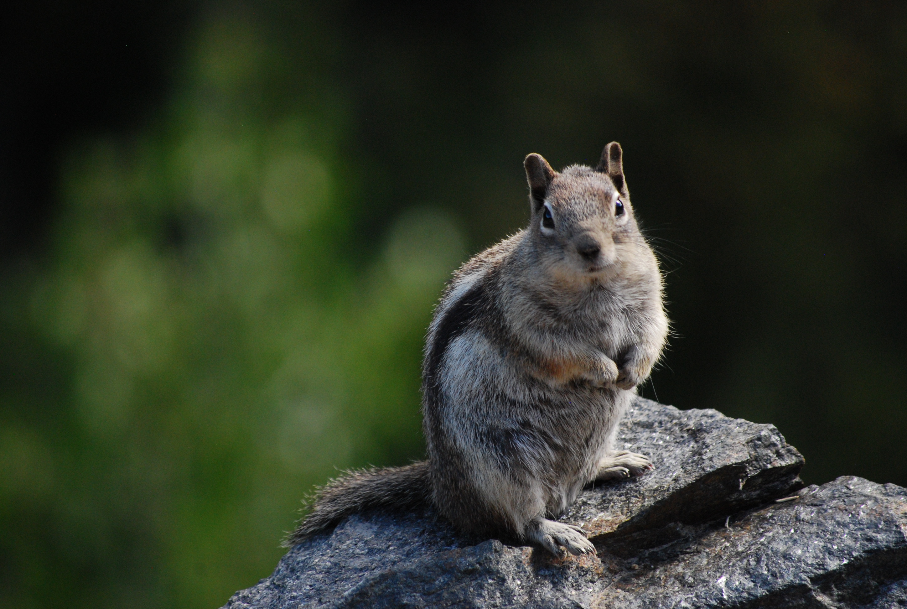
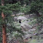
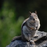
After exploring Chasm Falls we got back into the car and made our start on the remaining 7.6 miles that lay ahead of us. The road is one long continual climb and gains about 3,000 ft before reaching Fall River Pass and the Alpine Visitor’s Center which resides at approximately 11,796 feet. There are no guardrails. At times, it was a bit nerve racking looking out of the passenger window to a drop-off of about 2,000 feet. This is not a drive for the impatient or heights sensitive person. However, the views and experience were well worth the effort. Seen below are photos taken on Old Fall River Rd. while still in the subalpine forests. The chipmunk photo is courtesy of Beverly Robertson.
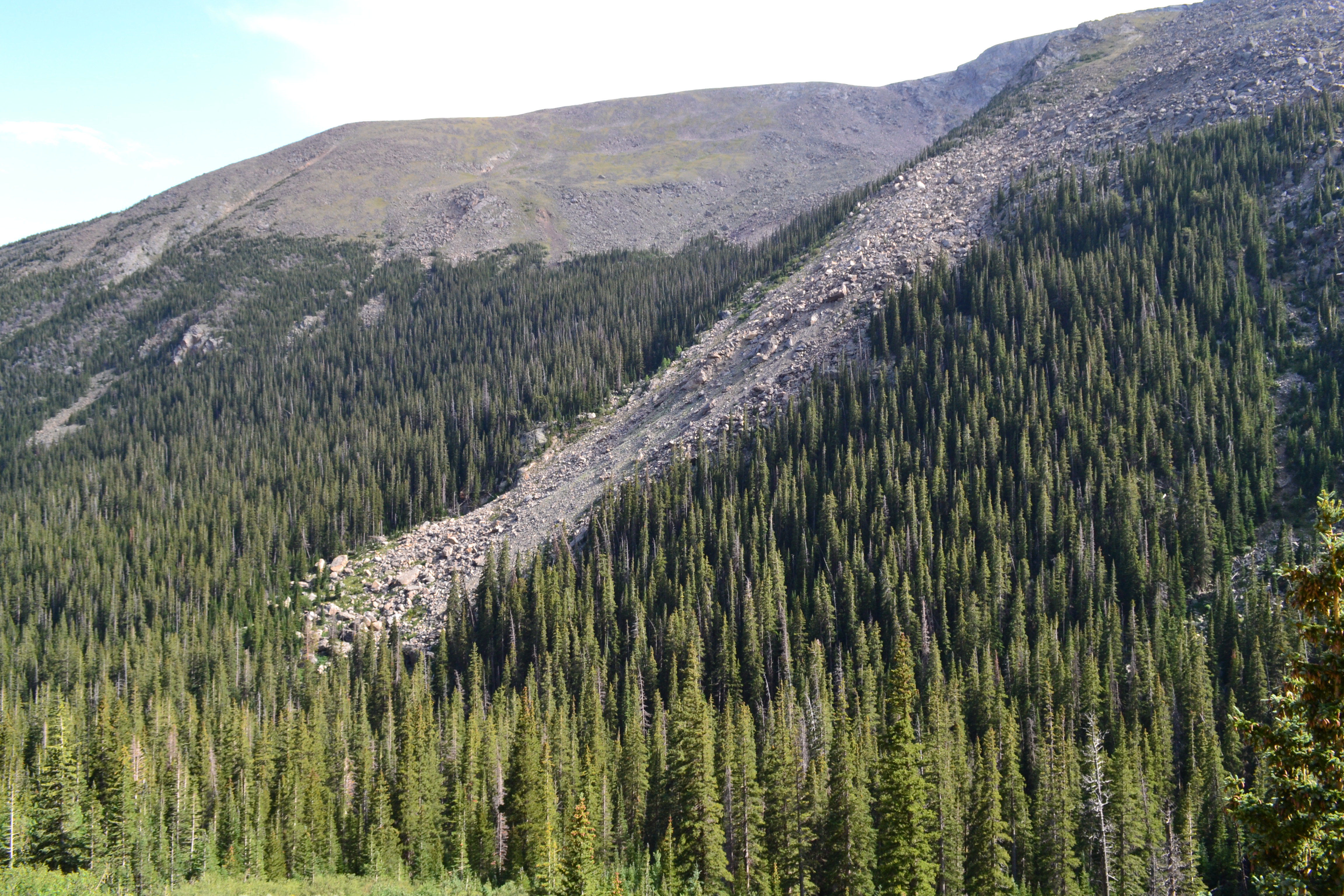
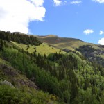
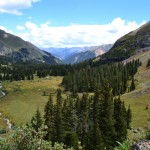
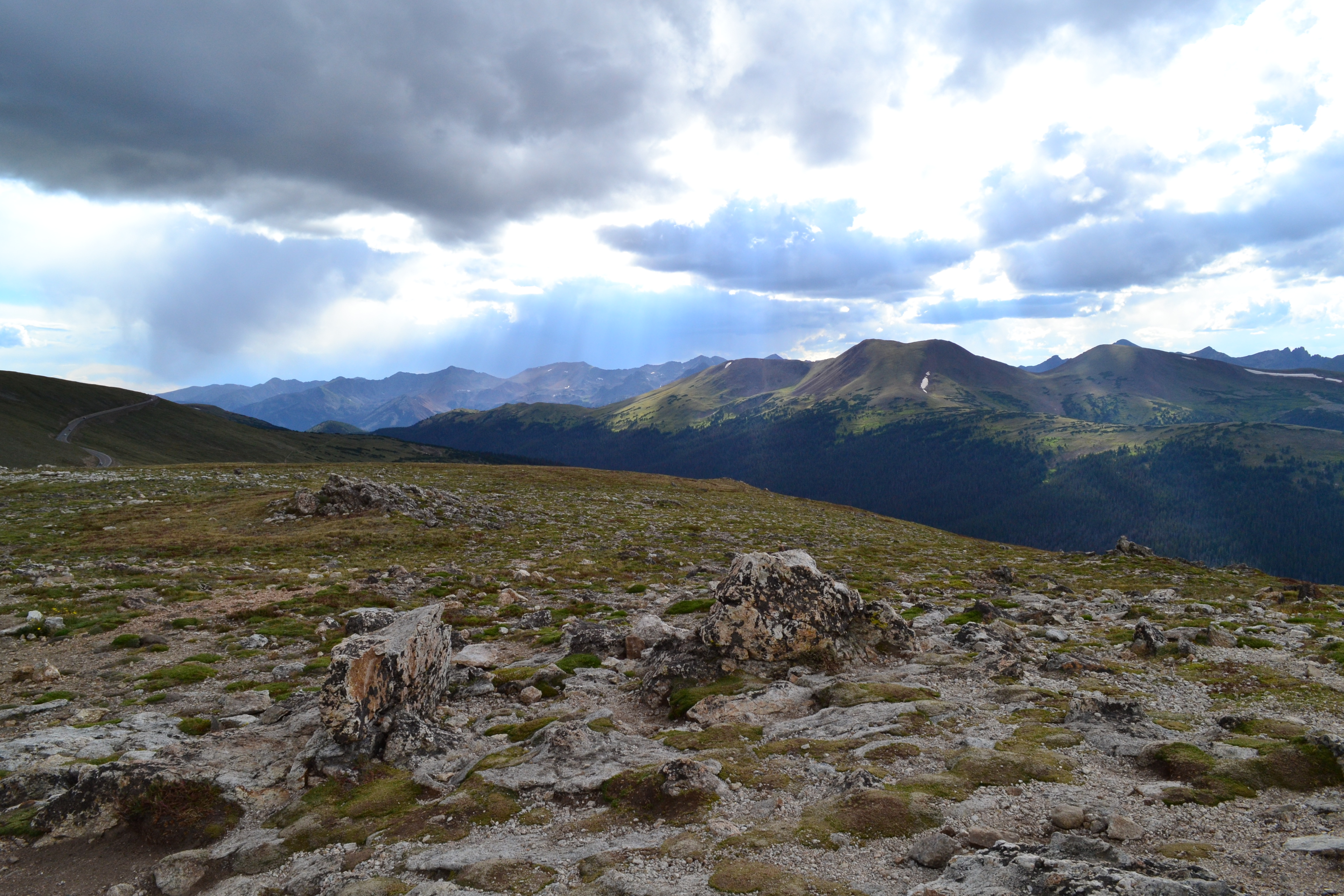
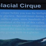
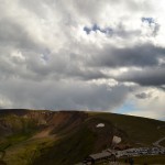
The last few miles of the old road propelled us into the pristine alpine, and the montane and subalpine forests slowly disappeared in our rear view mirror. The immensity of the surrounding mountain ranges and glacial cirques were outstanding! We were awarded excellent views of the Fall River Glacial Cirque. It appeared as though someone took a giant ice cream scoop and carved out a section of the ground. A cirque is actually a unique land formation found in mountain landscapes formed by alpine glaciers. Seen below is the cirque from the Old Fall River Road.

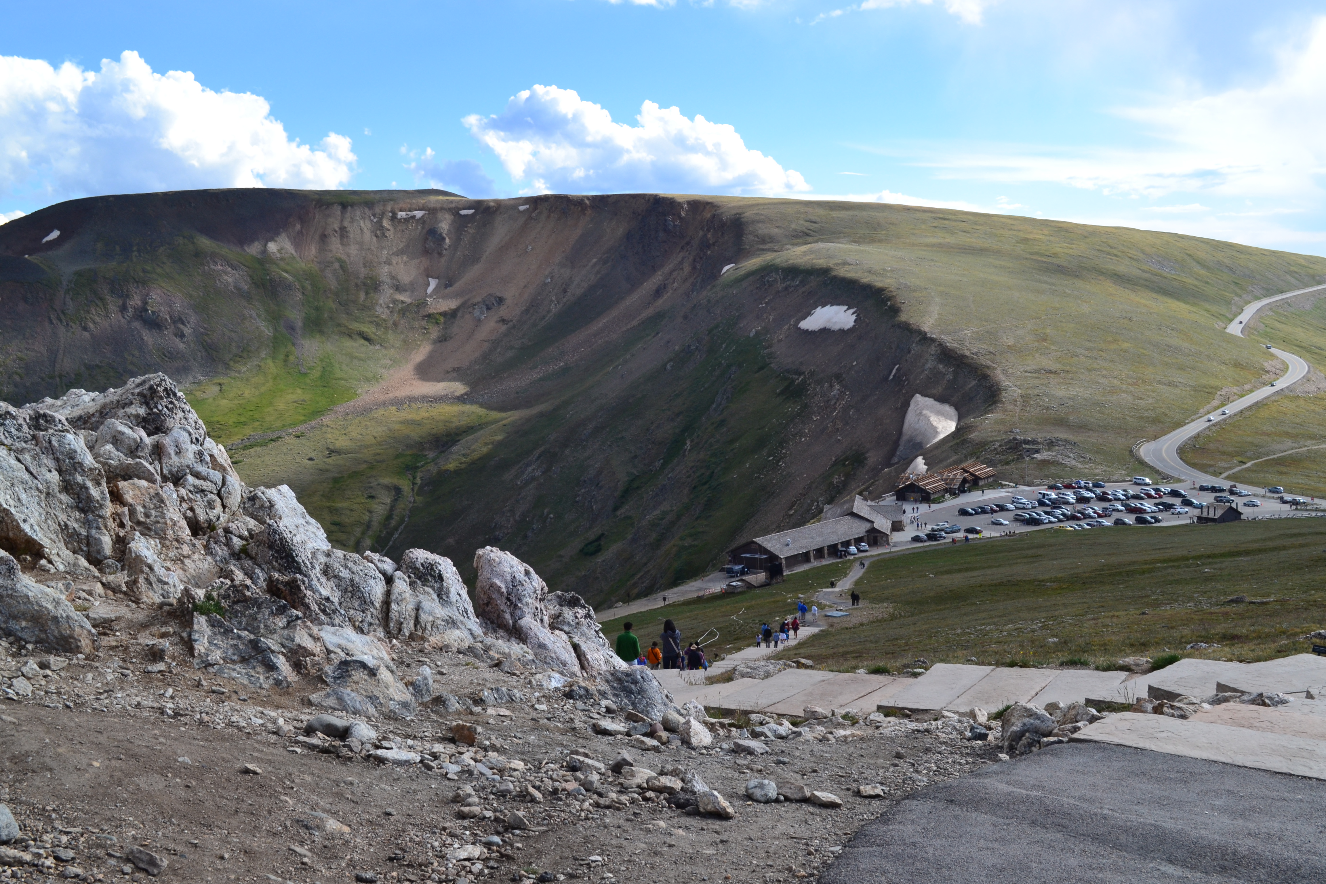
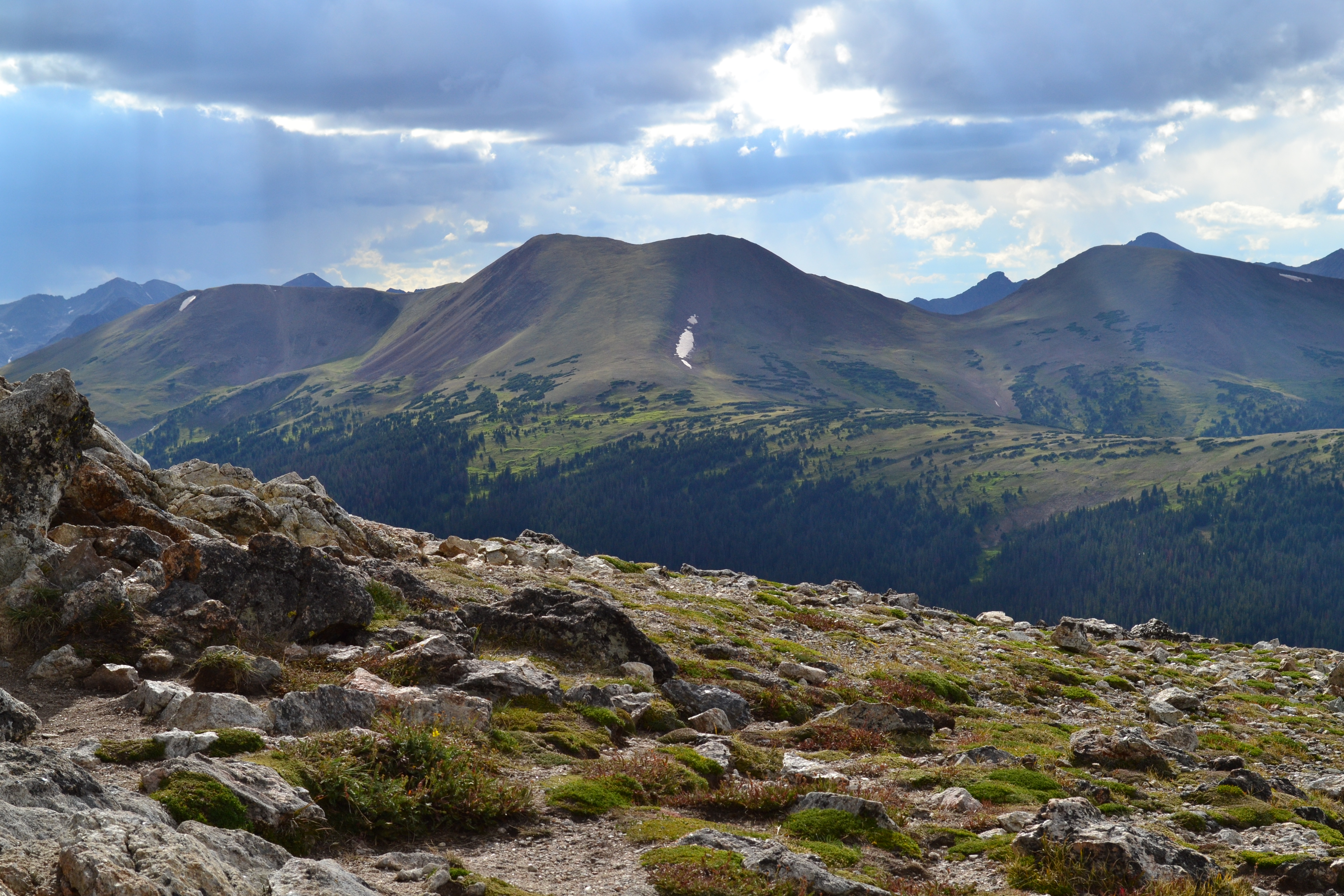
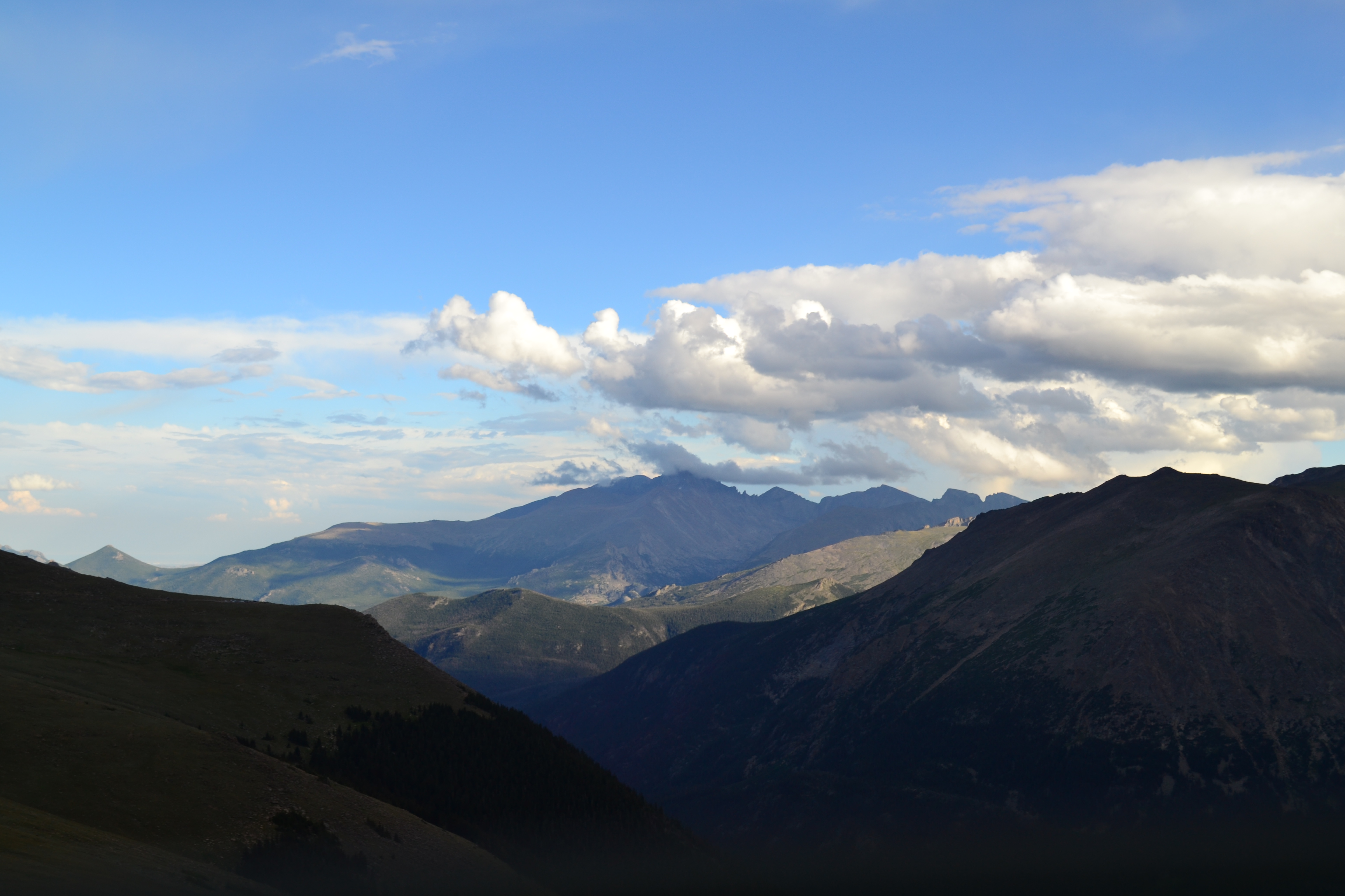
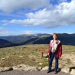
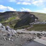
Once we reached Fall River Pass, we parked the car and proceeded to the trail that leads upward to Fall River Pass Mountain. This is a short 0.3 mile trail that climbs 220 vertical feet to a rocky outcrop that provides excellent views of the Mummy Range to the northeast and the Medicine Bow Mountain to the north. The steepness of the hike (about a 15% grade) and its high elevation have caused problems for many visitors pushing themselves to the top. Locals have apparently nicknamed it “Heart Attack Hill.” We pushed ourselves to the top pretty easily and were happy that all our previous hikes and climbs in altitude made this trek nice for us. Seen below are photos from the rock outcrop and surrounding mountain ranges.
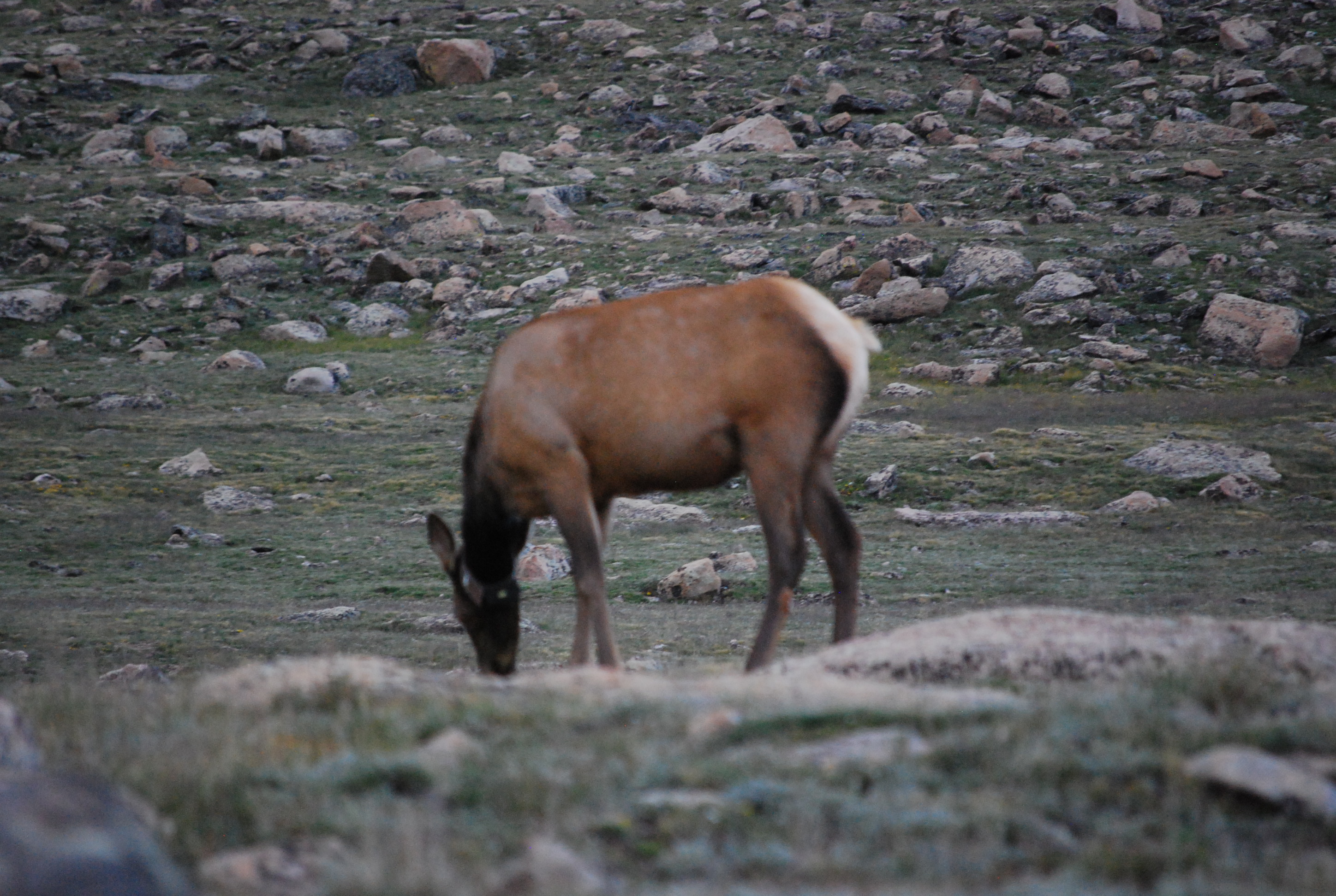
After spending a bit of time exploring and taking in the breathtaking scenery we reluctantly hopped back in the car. It was getting late and we were still in the middle of the wilderness. Since Old Fall River Road is one way, we followed the famous Trail Ridge Road back to the eastern side of the park. Where the old road had led us on a trip to the past and auto days gone by, the Trail Ridge Road transported us back to modern days. It was smooth, paved and the speed limit about 4 times faster. Trail Ridge Road is known as “the Highway to the Sky” and rightfully so. Over 11 miles of the trail are above 11,500 feet, and at its high point the road gives visitors access to 12,183 feet. This is the highest point accessible by car (mostly by car) in the entire park. Along this road we were thrilled to see a group of Elk grazing in the alpine. They will reside up here for a few more weeks before migrating back down to lower elevations as the fall approaches for mating season. Seen below are photos of the Elk and various landmarks along Trail Ridge Road. Elk photo is courtesy of Beverly Robertson.
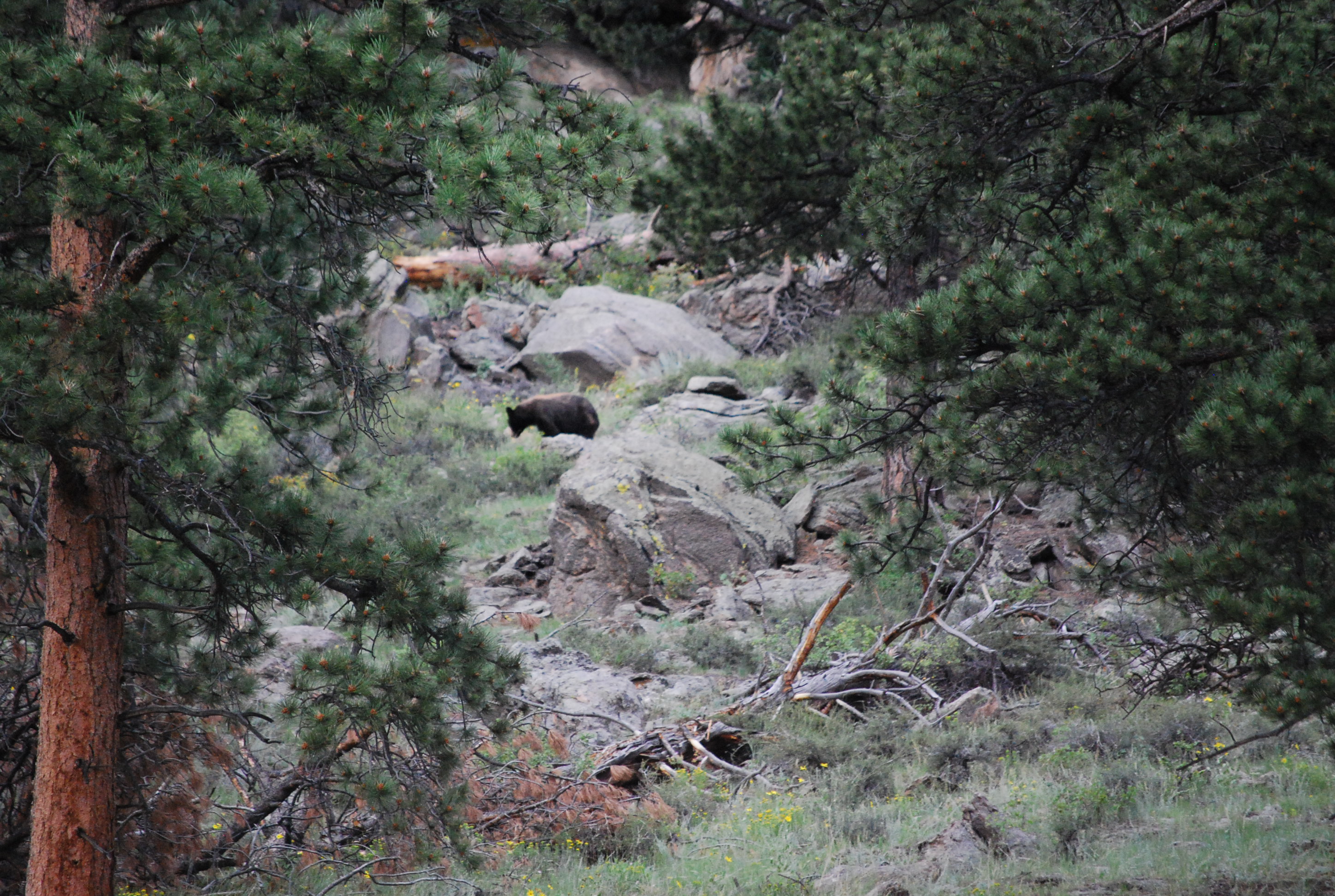
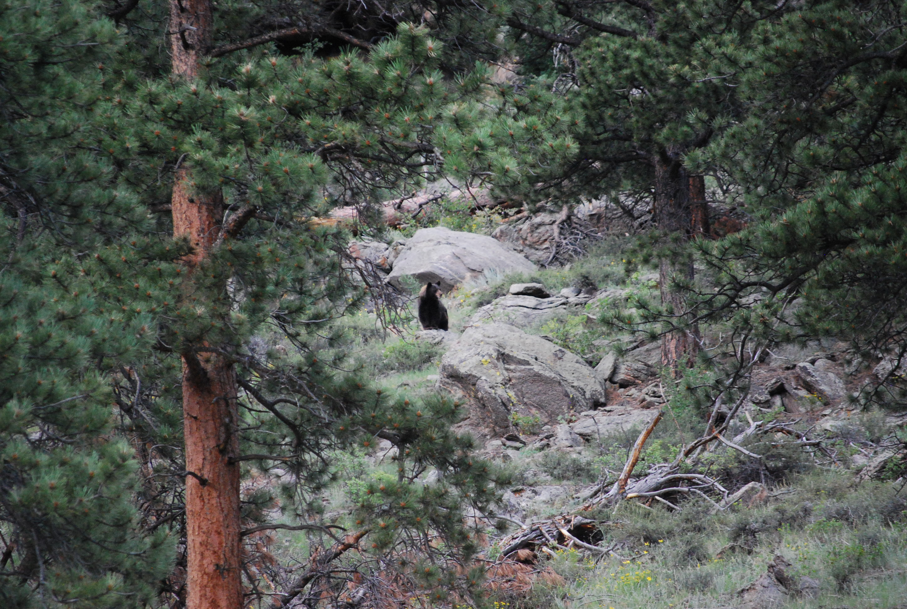
We ended the day with an exciting bear sighting. As we drove toward the exit of the park, we noticed photographers by the road staring up into the brush. Curious, we pulled over and were greeted (at a very safe distance) by a beautiful black bear. It was almost as if she were up there posing for us. Seen below are photos of this RMNP native courtesy of Beverly Robertson.
Overall, this driving trip was a great way too see lots of RMNP’s enormous Mummy Range in a short amount of time. However, we got the hiking “itch” and it simply made us excited to come back to this expanse of the park and explore much more on foot. There is just too much to see in this amazing park!. We have enough hikes planned now to fill up a year. But, unfortunately not enough snow free days to do everything we want remaining this year. We highly recommend taking this tour… in an SUV, or 4 wheel drive vehicle if possible!

Finch and Pear Lakes via Allenspark Trailhead: Wild Basin RMNP
Distance: 11.54 miles (out-and-back) Elevation Gain: 2,618 ft (total) 1,695 ft (net)
Max Elevation: 10,598 ft Min. Elevation: 8,903 ft
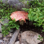
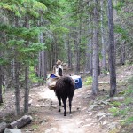
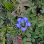
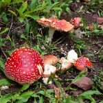
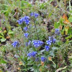
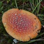
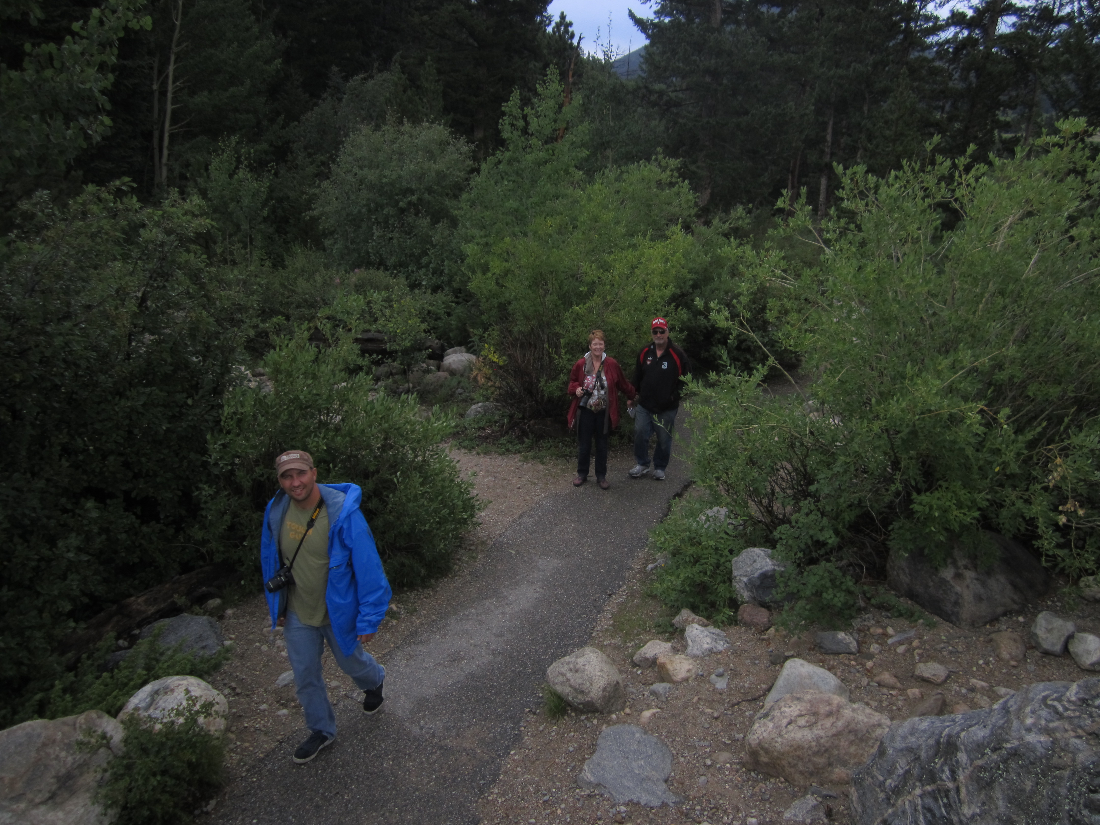
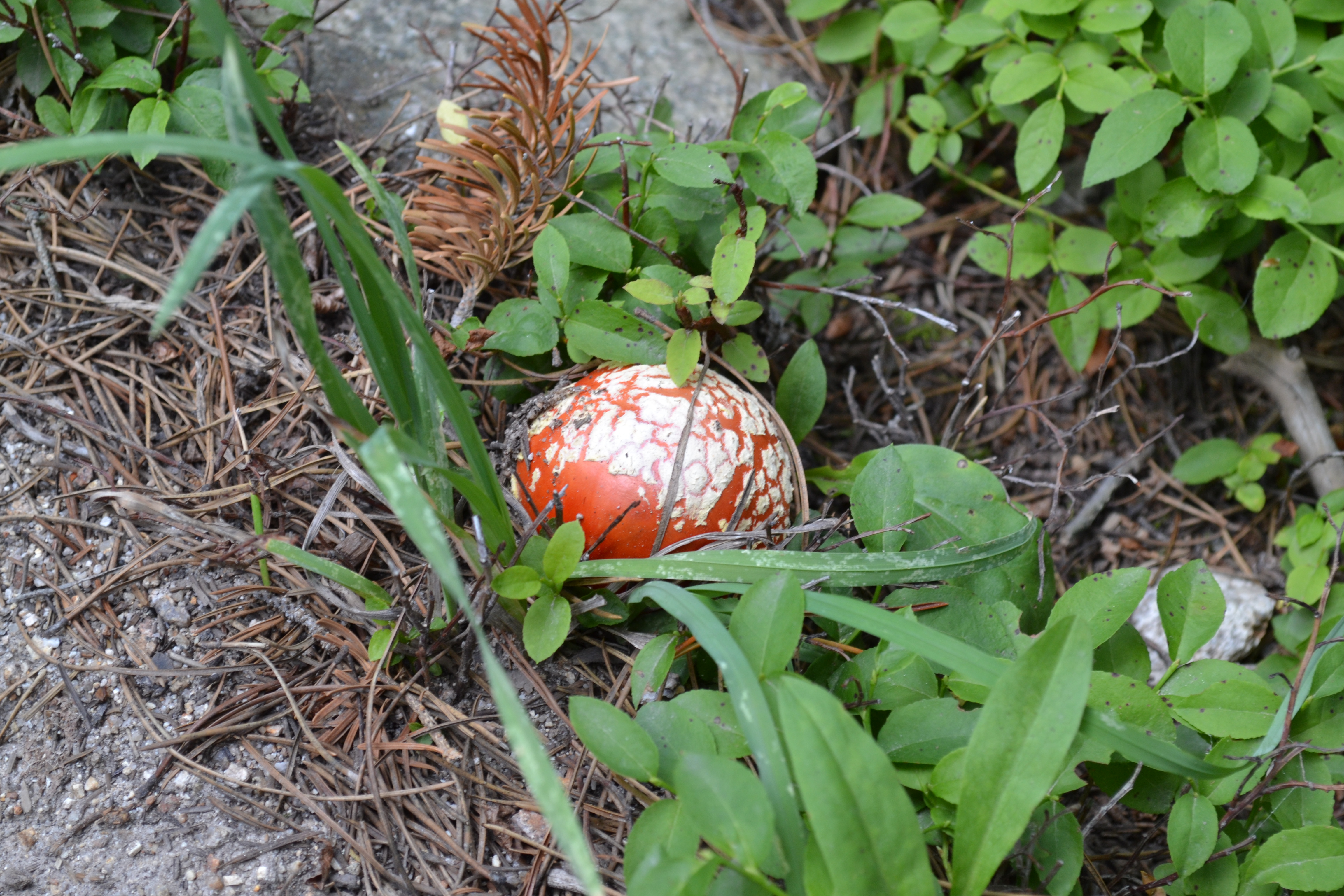
While torrential downpour flooded plains and mountains alike and funnel clouds were spotted sporadically above Boulder and Denver on Saturday, we somehow found a refuge from all of the terrible weather during a hike through Wild Basin of Rocky Mountain National Park. While we had planned for a car camp on Friday night and a summit attempt of Bierstadt early Saturday morning, weather predictions of isolated thunderstorms thwarted our well laid plans. A last minute visit to weather.com, showed us clear skies for most of the afternoon in Allenspark, CO near Wild Basin so we packed our day bags and headed up to our favorite piece of Colorado. Instead of entering Wild Basin through the Main Entrance right off of 7, we opted to give the Allenspark Trailhead a go to avoid the crowds. The trail entrance can be found in Allenspark right off of Hwy 90 via business route 7. The tiny trailhead offered room for only 7 or 8 cars and was nice to have 4 wheel drive to access (very deep ruts). The well maintained trail began with a gradual climb through a dense forest full of firs and lodgepole pine. For the first 0.8 miles, the mountains were hidden by the dense forest. However, we saw quite a few beautiful vegetation and interesting fungi, some of which included the deadly fly amanita mushroom. We also ran into a park ranger leading llamas down the trail. Seen below are photos of this odd first part of our trek.
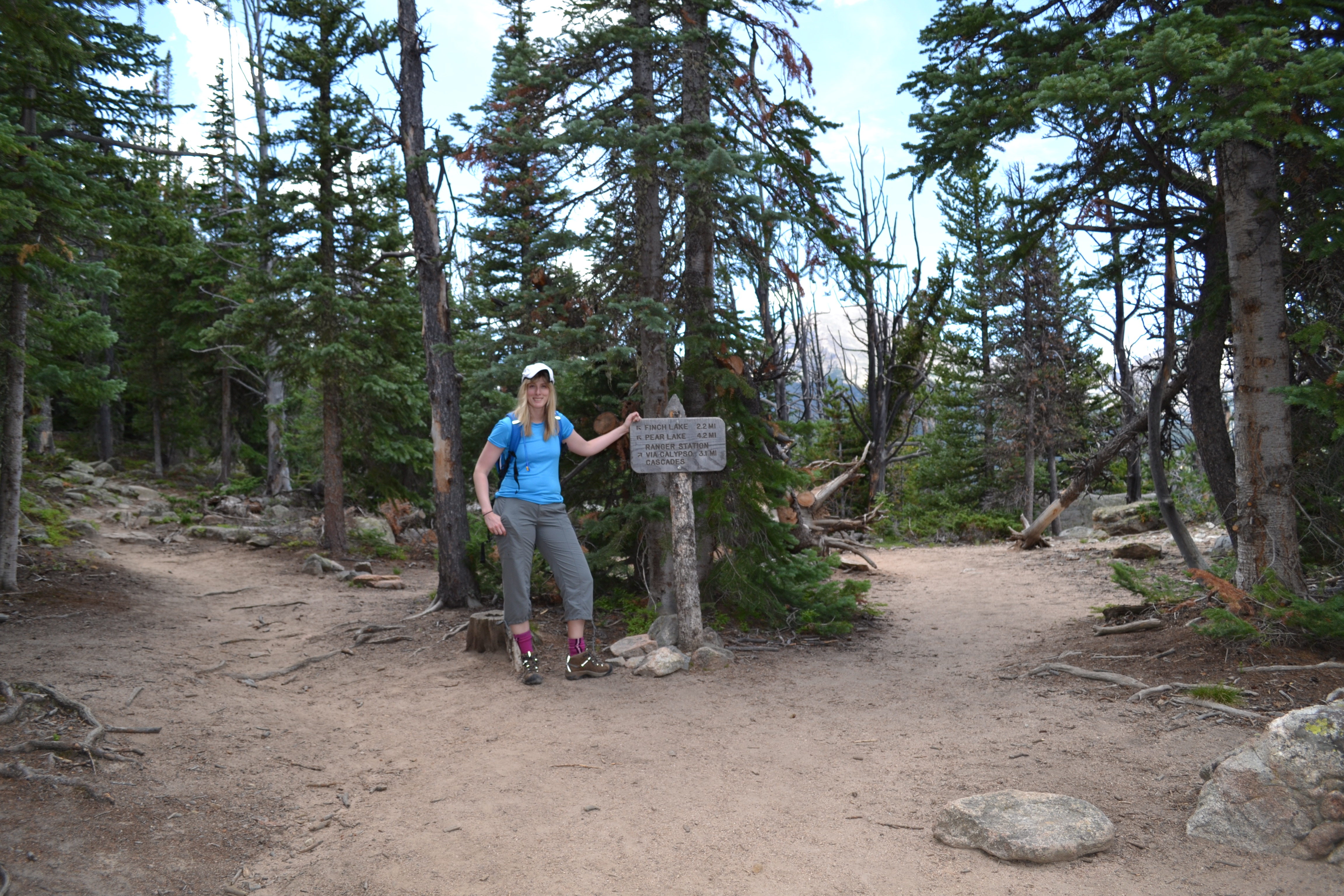

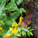
We then quickly reached the trail Junction which gives the option of continuing west to Finch and Pear lakes or north toward Calypso Cascades. We were in the mood for a less crowded hike and headed for the more isolated lakes. The next 2.2 miles or so led us through more dense forest and continued to climb. Eventually the forest thinned out a bit from a fire back in 1978 giving ways to exquisite views of the mountainous terrain. Wildflowers of many different shades and colors also lined the trail providing a beautiful array of colors with a blue bird sky as the perfect backdrop. Seen below are photos from the Finch Lake Trail.
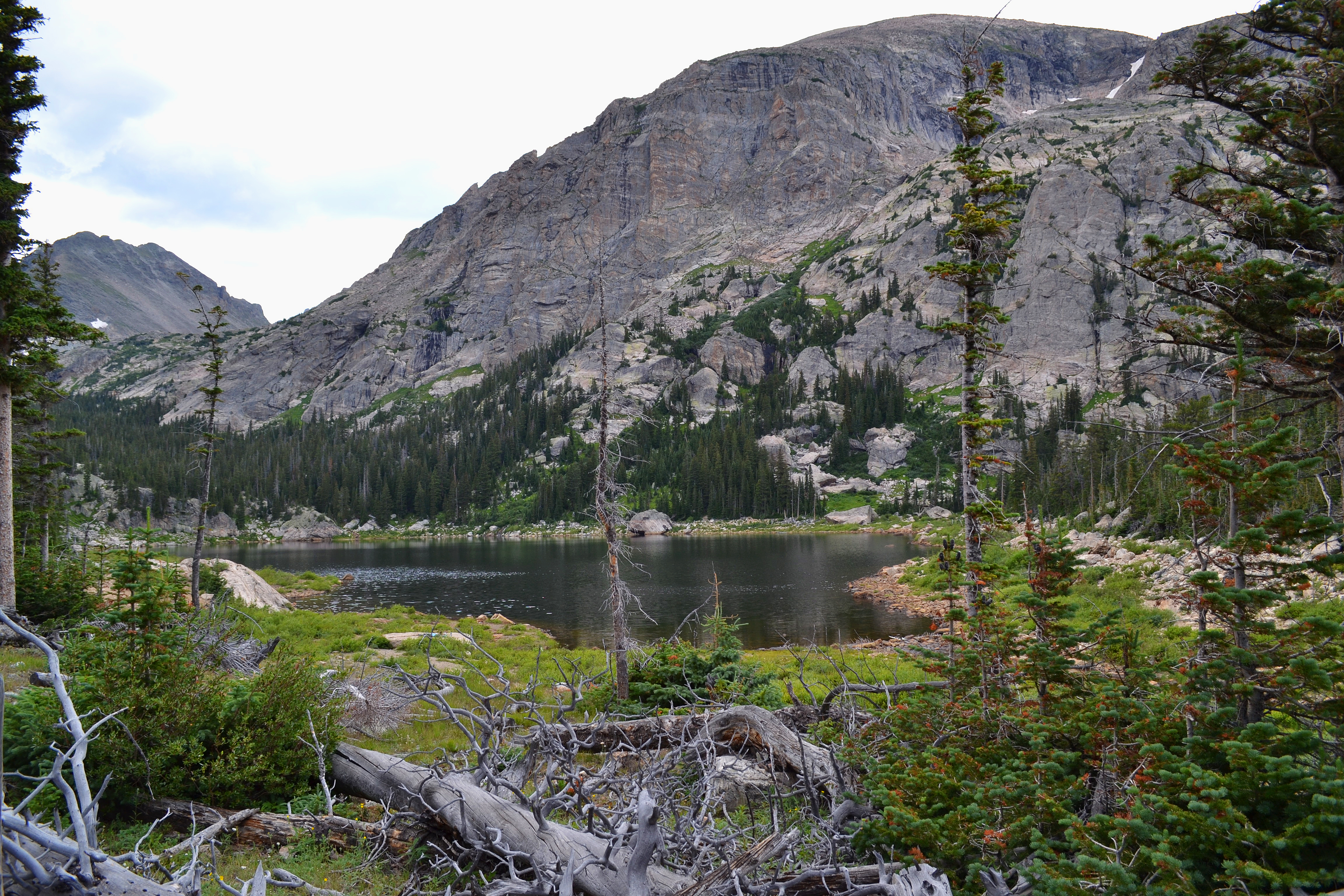
The last 0.25 miles of the Finch Lake Trail drops sharply downward via a series of switchbacks. While the descent provided relief from all the climbing we had been doing so far, we couldn’t help but think how tough it was going to be on our return trip. When the trail finally flattened out, we were greeted with the lovely east shore of Finch Lake. We paused for a few minutes on a submerged boulder on the banks of the lake enjoying the scenery and solitude. The water was crystal clear enabling us to see all the rocks and boulders on the bottom. The lake was lined with bright green vegetation on its eastern shore mixed in among all the rocks and boulders. Much of the land surrounding the lake was marsh. Seen below are photos of Finch Lake.
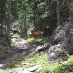
We didn’t spend too much time here as the day was quickly moving along, and we still wanted to see Pear Lake. We debated a few minutes to see if we had the energy to keep going. Pear Lake is an additional 2.2 miles from Finch Lake, which would make our entire trip close to 12 miles. But, we weren’t tired yet and wanted to see more. We picked up our pace and followed the trail as it skirted around the north side of Finch Lake and the nearby back country campgrounds. We soon discovered that this portion of the hike was quite difficult. It climbed steeply for the almost the entire next 2.2 miles. Our legs burned and our breathing was heavy as we climbed up the north side of a wide valley. At one point we crossed the quaint Coney Creek via a log bridge. Occasionally, the trail opened up to views of bright lush meadows and small, cool ponds. While gazing at these sites we almost ran into a beautiful mule deer that crossed the trail just in front of us. We were careful not to disturb her and quietly snapped a photo and watched her ease back into the forest toward the meadows. The trail from Finch to Pear lake gets very few foot traffic due to the distance of the hike making it an excellent place to see wildlife. Apparently Moose and Elk sightings are common here as well. Seen below is a photo from the Pear Lake Trail and our wildlife sighting.
Finally we crossed Pear Creek and saw a change in landscape ahead. We could sense we were close and made one final little climb through an amazing array of wildflowers amid rock and boulder. As we crested the last ridge, we were greeted with the deep dark blue water of Pear Lake and the powerful Copeland Mountain behind it. While we saw another hiker at the lake, we had not encountered a single hiker on our 2.2 mile trek to get there. Pear lake truly felt like we were in the back country. We sat on a large boulder overlooking the water and enjoyed our reward for the long journey. The pizza from the previous night we had packed along tasted amazing. We laid on the rocks and didn’t want to move. But, very suddenly a rain dark cloud engulfed the backside of the mountain sharply dropping the temperature. We were unfortunately only able to spend about 20 min at Pear Lake before the weather forced us to begin our 6 miles back. Seen below are some photos taken at Pear Lake.

On our way back down to Finch Lake it began to rain slightly and we dutifully donned our rain gear. We noticed that the rain was hitting us pretty hard and thought that perhaps the rain drops were just really big; but we looked down and noticed little white things bouncing off the ground. To our surprise the little white things were pieces of hail. The hail was extremely small, half the size of a pea, and it was gone in a matter of minutes. But it reminded us that the weather was iffy and we made good time.
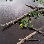
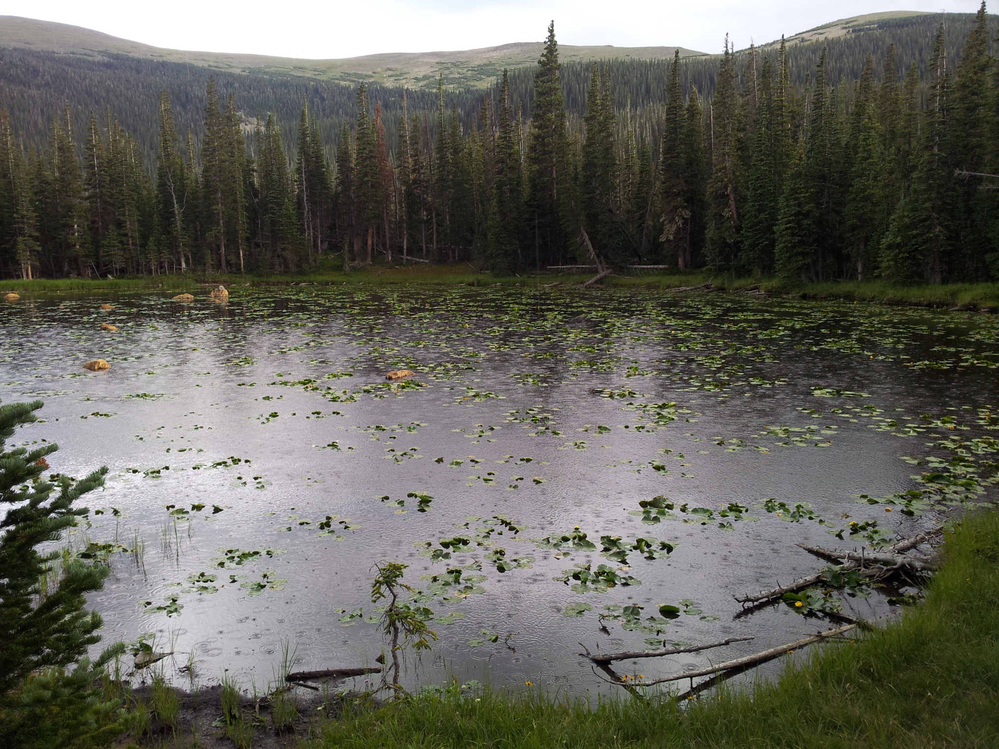
Almost back to Finch Lake we saw an unnamed lake (we can’t find a name for it anywhere) and since the rain seemed to have passed right over us, we stopped to look at it. The lake was gorgeous, with numerous yellow pond lilies in full bloom. We took a few pictures of the lake and then moved on. Below are a couple of those images with the yellow pond lilies.

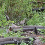
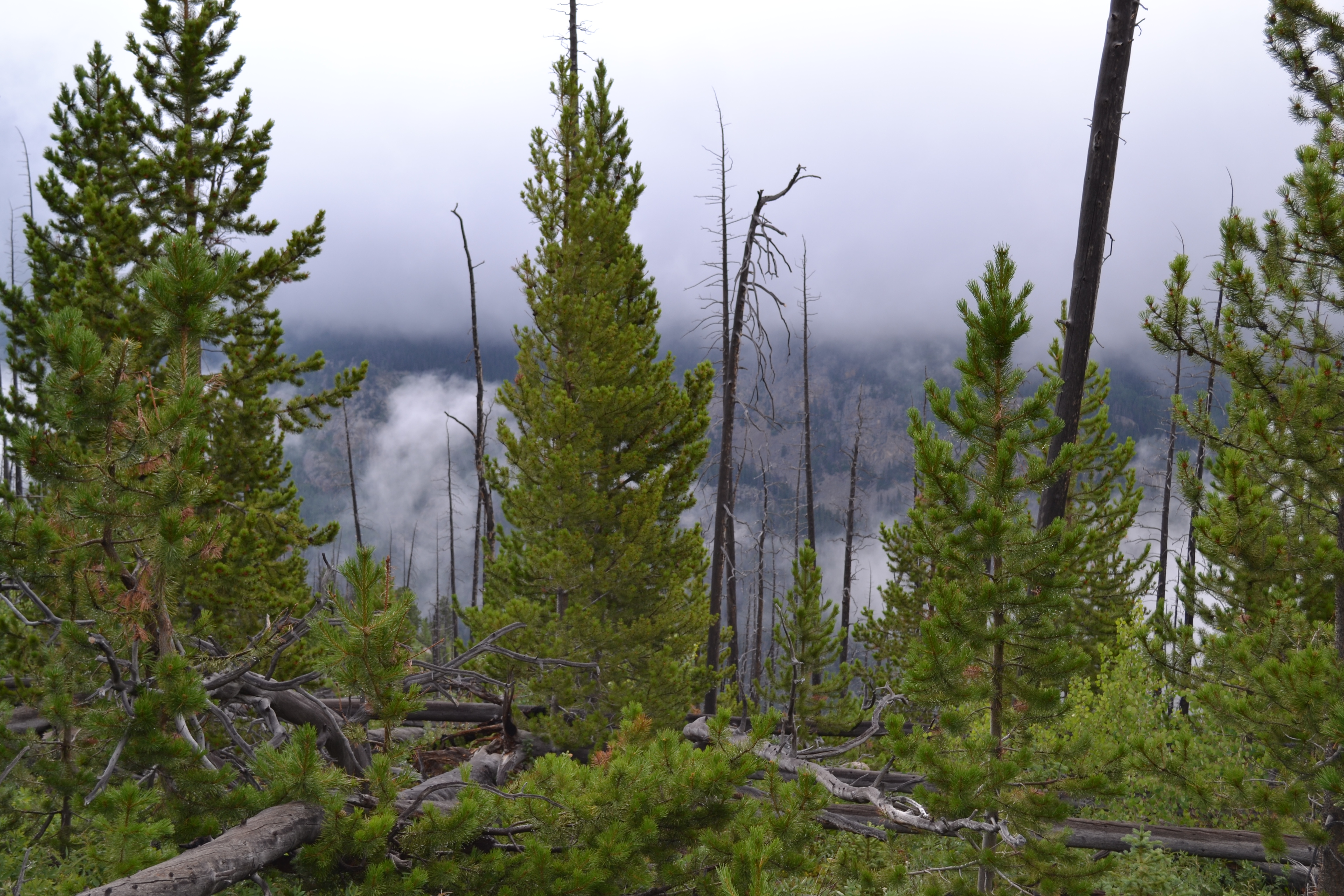
We were back to Finch Lake in no time at all and didn’t stop since the clouds were threatening again. We kept moving steadily back towards the trailhead, still another 4 miles away. It was a very peaceful hike and very isolated. We didn’t see another hiker the entire hike back from Pear Lake (6 miles). Similar to our Bear Lake Hike, fog rolled in and made the hike feel almost mystical. Suddenly, Allyson stopped us when she spotted a female Dusky Grouse in its summer feathers. We watched her for a few minutes as she hopped around on fallen trees. Below is a shot of the fog and of our grouse.

We were pretty close to the trailhead after our grouse sighting and made it back in very good time. Back at the truck we felt very tired but very happy with our hike. We had seen some very interesting fungi including multiple fly amanita and brain fungus, a mule deer, a female dusky grouse, and three amazing lakes, the whole time surrounded by the rocky mountains. It was a good day!