A Quest into the Wild
Mt. Blue Sky from Summit Lake
Stats: RT distance 5.75 — Elevation Gain: 2,159 ft — Summit Lake Parking Lot — Hiked: July 13, 2024
We started out our 14er season this year with Mt. Blue Sky from Summit Lake. It now requires a permit to park and it is a timed entry. But it is pretty easy to get a permit (not like the lottery systems for peaks like Mt. Whitney). The link is here: https://www.recreation.gov/timed-entry/10087438. One issue is that the first timed entry is 8 am and you may want to get an earlier start; what you can do is enter and park and put your permit that you printed at home in the window. Make sure to get the correct permit.
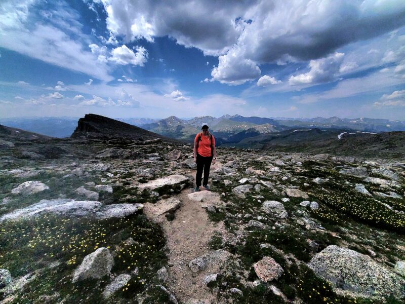
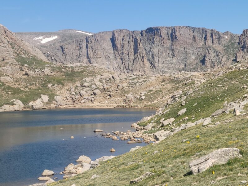
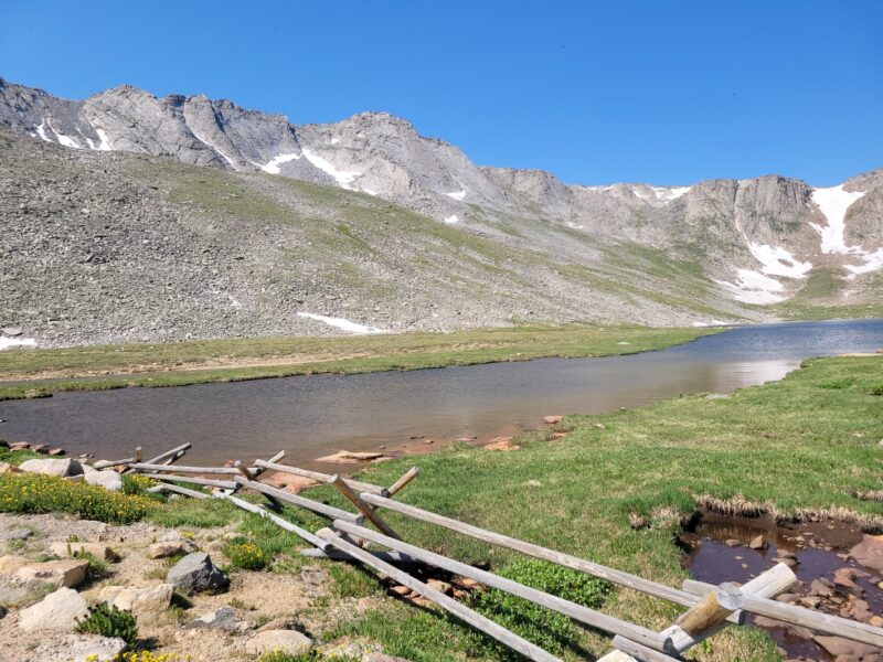
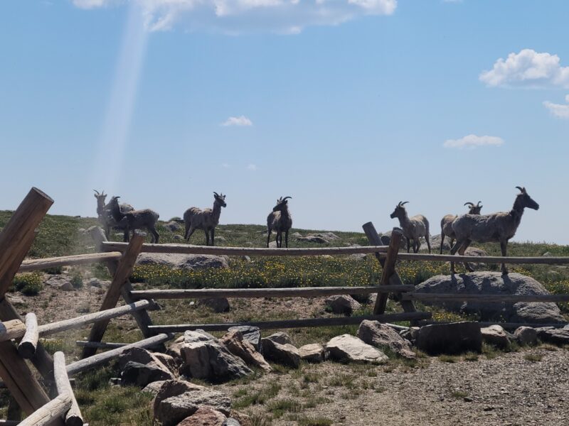
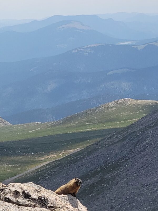
This was not our first time hiking Mt. Blue Sky, but it was our first time hiking it from Summit Lake. The area is really pretty and there were some goats hanging around and park rangers giving educational lessons on the area at a table. It was very busy and many many tourists around. The trail begins just north of the parking lot and is obvious and very nice. There are bathrooms and some side trails to go to the lake. I want to post a few shots below and one in particular from Google Earth that I marked up.
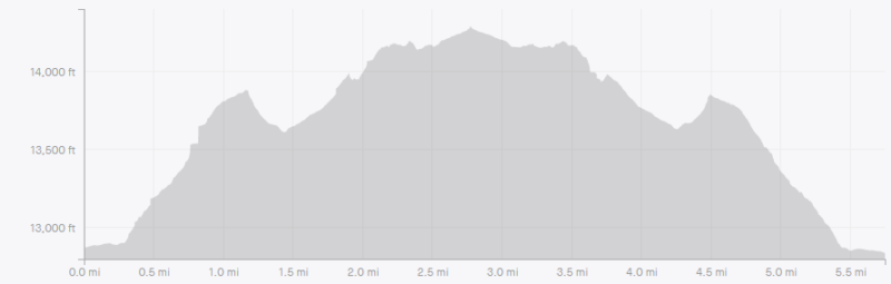
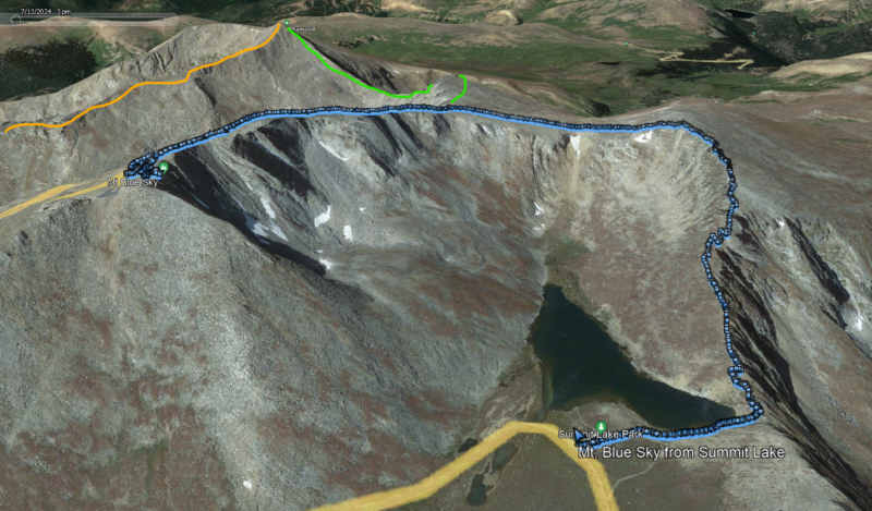
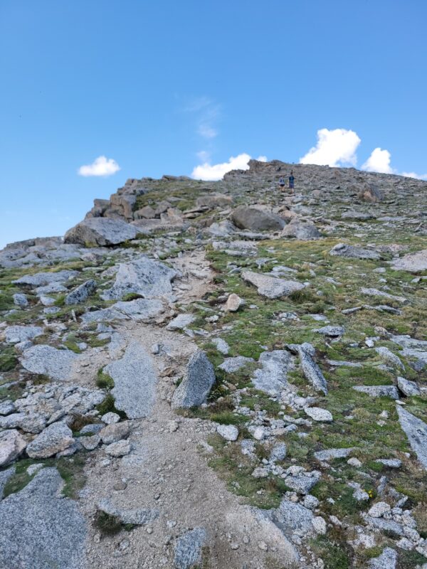
The first image is the elevation profile, and you’ll likely have to open it to see the full profile. But generally you have a nice little walk over to the actual trail, and then start a steep hike up to Mt. Spalding (a 13er at 13,863′). From there you lose about 200 ft. of elevation before hiking up to a little spot where you make a left hand turn onto the southwest face of Mt. Blue Sky. The last section is what throws people off and I’ll provide some tips down below. I marked up the middle image to shows some other popular routes. The green is the Sawtooth route and the orange is the Bierstadt’s East Ridge route. We plan on hiking the East Ridge soon as part of the Tour de Abyss (named for Abyss Lake which you can see in some pictures below). Let me post a few pictures of the first section up to Mt. Spalding.
I want to make a brief-ish plug about hiking this trail. We saw multiple groups of hikers who really weren’t prepared for the hike. While it is a “short” hike and you can do it one way and have a car meet you at the top (making the entire journey a little over 2.5 miles), it is not easy. We ran into a few people who said they weren’t prepared for the “scrambling” on the first section of the hike and who had very little water (they were going to run out). First, there is no scrambling on the standard route up to Mt. Spalding from Summit Lake. If you’re actually scrambling, you’re off route. Second, unless you are accustomed to hiking across mountain terrain, hiking a mile here is not hiking a mile at your local hike and bike trail in the city. I sincerely hope the individuals we ran into made it safely to the summit, since they did not want to turn around. But this is part of the issue with having a summit you can drive to. Short version, be prepared.
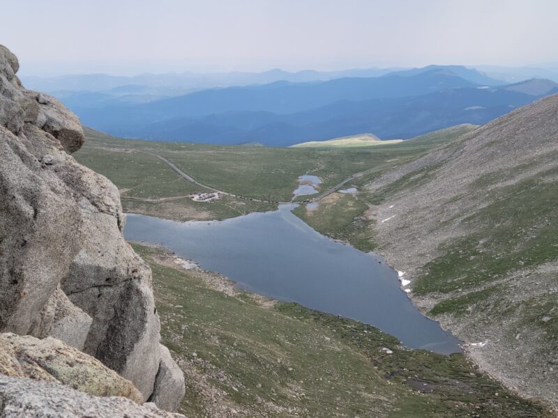
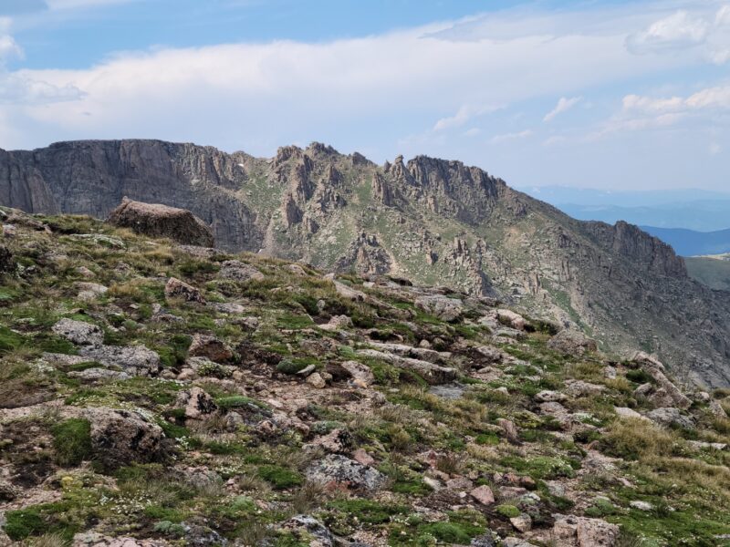
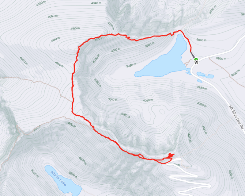
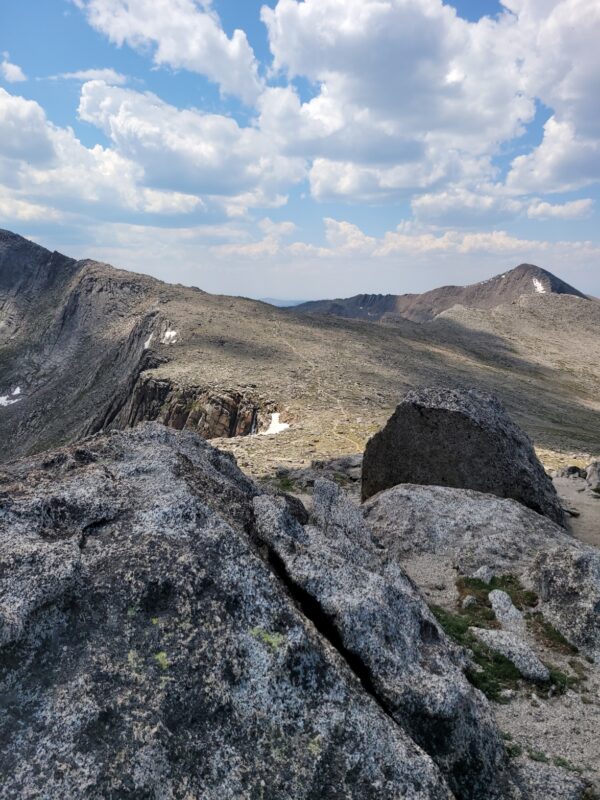
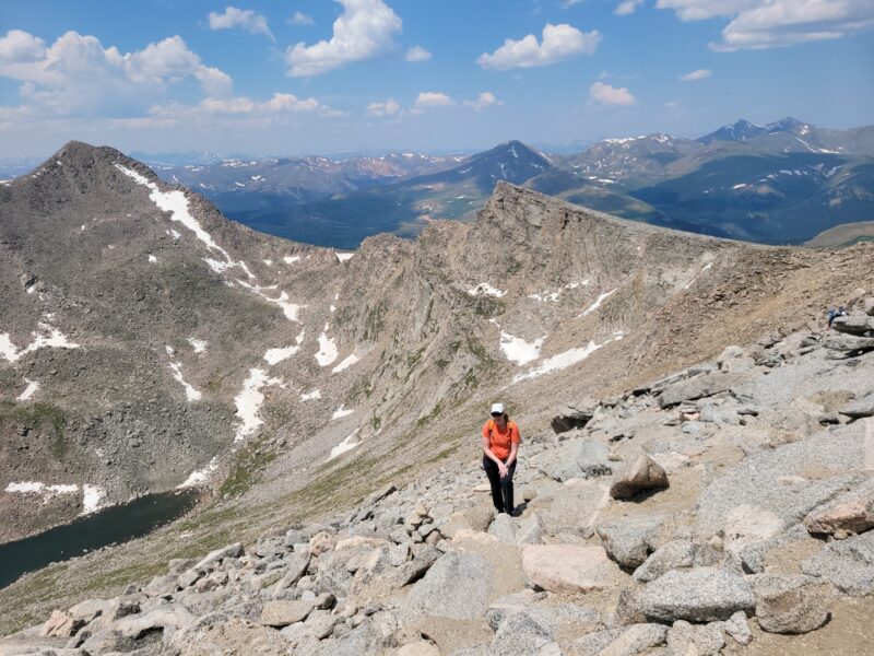
Anyways, once you are to Mt. Spalding and drop down those 200 feet you get to that left hand turn I mentioned and the class 2 climbing begins. Up until this point it should have been class 1. You can almost see where I’m talking about in the second to last picture above (you can follow the trail up and see where it kind of vanishes behind the face. Let me put some pictures of this area below (you can see Abyss Lake in the first picture below Mt. Bierstadt).
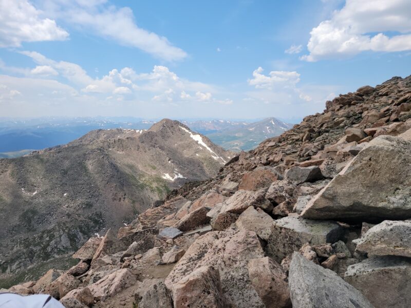
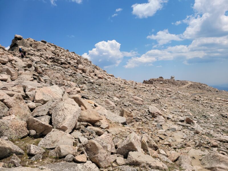
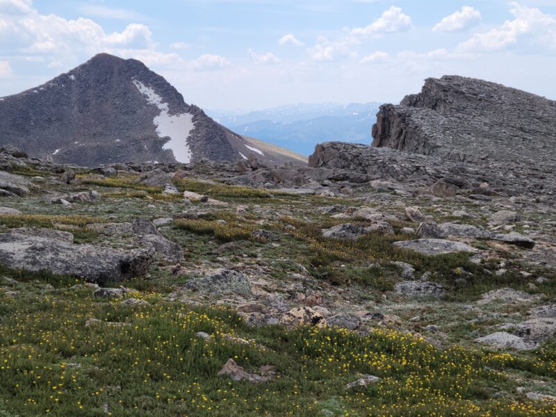
Alright, so here’s my biggest tip and I offered to groups who requested it. The easiest trail and the one that will keep it to class 2 stays low pretty much the entire time. You may be temped to climb up to the ridge, but don’t unless you want class 3 climbing or, and this is a big or, you want to tag West Mt. Blue Sky. Yup, that’s right, there is a second, unranked peak at about 14,250 ft. There are cairns that lead to this second peak, and if you follow them up, you’ll be led to class 3 scrambling and have to downclimb to avoid being cliffed out. This can tire you out quickly, as I learned when I did it myself when I did the Bierstadt-Sawtooth-WestBlueSky-BlueSky route. So, stay low and the trail should stay pretty nice. Don’t worry about missing the peak, look at the last picture, it shows that as you hike you eventually will see the observatory while on the trail. Not having good route finding skills in this area can lead to an extra 30 minutes to over an hour of extra hiking (depending on various factors).
Keep hiking towards that observatory and you’ll see the the parking lot and the mass of humans all milling about. Hike up the last few switchbacks to join the gong show at the top. Luckily, it is a big trail and a large rather accommodating summit. I didn’t actually take any pictures at the top of Mt. Blue Sky this time, but I have more images in the Bierstadt-Sawtooth-Evans post (the name hadn’t changed yet when we hiked it last). Some people catch a ride down from here, but the return hike is the same as going up but in reverse. Take some pictures and mosey on back down to the trail to find some solitude.
I will say that this really actually is a lovely hike. You have Abyss Lake on the west side and Summit Lake on the east side of the hike, many wildflowers, critters running around, and generally speaking people are friendly. You get great views of Mt. Bierstadt as well as the Sawtooth and the East Ridge. I’ll post a few more pics I did snap along the way in a gallery below. But I hope this helps a little bit on navigating the route.